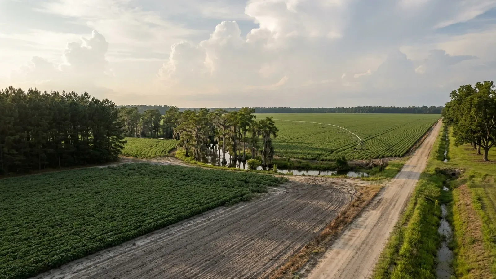
A very large flat South Carolina row-crop field with centre-pivot irrigation tracks, a sharp-edged pine plantation block, a cypress swamp along the creek and a straight dirt road.
Bamberg County One statewide code, county design maps

Barndominium Builders in Bamberg County, SC

Bamberg County has 12,796 people, 102,313 acres in farms and one of the more unusual zoning ordinances in South Carolina. The county is zoned countywide, but its RUD Rural District says in its own words that "Use regulations are not applicable to this district" — the ordinance sets setbacks and almost nothing else out there, with no minimum lot size, no height ceiling and no rule sizing an accessory building against the house. That is a real and checkable difference from every neighbour on this side of the state, and it is the reason a shop-first or shop-larger design that fails in Calhoun can work here. Two other things belong on any Bamberg drawing set. The county publishes a filled-in Table R301.2(1) inside its own building codes ordinance, and its seismic and wind entries do not read the same as the Building Codes Council's approved sheet for the county — a genuine conflict between two published sources, and one worth settling in writing at plan review rather than at inspection. And the River and Streamside Management overlay puts a 100-foot buffer along the Edisto and Salkehatchie Rivers and 50 feet along the perennial streams feeding them, to be left in a natural state with no clearing or grading, which decides where a pad can go on a great many of the county's better tracts.

Bamberg County at a glance

County
Bamberg County
Population
12,796

Building conditions in Bamberg County

The building code is the same in every South Carolina county: S.C. Code § 6-9-10(A) requires each municipality and county to enforce the Building Codes Council's codes and to enforce only those, and SC Regulation 8-236(C) bars a local jurisdiction from writing one of its own. The design numbers are not local either, but they are not one number for the state — Regulations 8-1202 and 8-1203 send wind and seismic to the Council's own map for this county, and those maps are drawn as contours, so the figure is read at your address rather than off a county name. What is genuinely local is who issues the permit and inspects the work, what that office charges, the permit procedure it adopted by ordinance, whether your parcel is zoned at all, and the rest of Table R301.2 — frost depth, termite probability and flood — which the jurisdiction fills in for itself.

Build conditions for Bamberg County , South Carolina : design wind speed The Building Codes Council's approved Bamberg County sheet, Bamberg 15(Mays).pdf, carries a single blue wind contour labelled 120 MPH at both ends and no seismic design category label at all; the county's own building codes ordinance separately publishes a Table R301.2(1) giving Wind Speed 94 to 100 mph and Seismic Design Category C-Do. BUILD CONDITIONS BAMBERG COUNTY, SCBamberg CountyONE STATEWIDE CODEDESIGN WIND SPEEDThe Building Codes…Regs 8-1202 and 8-1203 replace IRC R301.2.1 and R301.2.2.1 with the South Carolina Building CodesCouncil's own county maps, and Bamberg is one of the 33 counties with an approved sheet. The…ZONING · RUD (RURAL DISTRICT)Zoning is countywide — § 2-100 establishes the districts "in theunincorporated portions of Bamberg County" — but the rural district…NEW CONSTRUCTION BUILDING PERMIT$480 for the first $100,000 of valua…That is the fourth of five bands on the county's published feeschedule for the 2025-2026 budget. The others: $1,000 or less, no…WHO ISSUES THE PERMITBamberg County Building & Planning D…(803) 245-3111. One department covers building inspection, planningand zoning, code enforcement and litter control, and mosquito…
Build conditions for Bamberg County, drawn from the sourced facts on this page. Every figure above is cited in the quick-facts panel below, with its source and vintage.
The Council's Bamberg sheet carries one 120 MPH contour and no seismic category at all
South Carolina does not use the national maps for houses. Modification IRC 2021-04 rewrites Section R301.2.1 so the ultimate design wind speed comes from "the previously published maps by the South Carolina Building Codes Council" rather than Figure R301.2(2), and IRC 2021-05 does the same for the seismic design category at R301.2.2.1. Bamberg is one of the 33 counties with an approved sheet. That sheet was downloaded and read three separate ways — its text layer extracted in reading order, extracted again in layout mode, and its page content stream decompressed and enumerated operator by operator — and all three agree. It carries the Council's standard interpolation note and the words 120 MPH twice, once at each end of a single blue contour, and no seismic letter of any kind. There is no red ink anywhere in the drawing; the only annotation colours are the blue of the wind contour and the green of the county outline. That absence is real rather than an extraction failure: the Council's Clarendon County sheet, in the same file format, returns C, D0 and D1 in red from the same three readings without difficulty. The sheet's own note reads: "Wind speed, shown in miles per hour, applies at all points along the length of its corresponding (blue) line. Interpolation between wind speed lines is determined by the AHJ as permitted by Figure R301.2(4)(A) of the 2015 International Residential Code." So the Council publishes a wind figure for Bamberg County and publishes no seismic category for it — which makes the county's own published criteria, in the next fact, the thing to read next.

SC Building Codes Council, "Wind/Seismic Maps", https://llr.sc.gov/bcc/maps.aspx ; the Council's Bamberg County sheet, https://llr.sc.gov/bcc/PDFfiles/WSMaps/Bamberg%2015(Mays).pdf (HTTP 200, application/pdf, 3,647,387 bytes, downloaded 8 September 2026 and read as extracted text in both pdftotext -raw and pdftotext -layout, and independently by inflating the page content stream); modifications IRC 2021-04 and IRC 2021-05, SCBCC 2021 Modification Index, https://llr.sc.gov/bcc/PDFfiles/2021-Modification-index.pdf (HTTP 200, application/pdf, 2,546,668 bytes, downloaded and read 8 September 2026); Regs 8-1202 and 8-1203, https://llr.sc.gov/bcc/PDFfiles/2021-Code-Modifications.pdf

Bamberg publishes design criteria of its own — and they do not read the same as the Council's sheet
This is the first thing to settle before anyone orders a frame for a Bamberg County build, and it is a genuine conflict between two published sources rather than a technicality. The Building Codes Ordinance of Bamberg County, the adopting ordinance posted on the county's own building inspection page, prints a completed Table R301.2(1) under the heading "Section R301.2: Table R301.2(1) Climatic and Geographic Design Criteria". Its entries, verbatim: Ground Snow Load 10 pounds; Wind Speed 94 to 100 mph; Seismic Design Category C-Do; Weathering Moderate; Frost Line Depth 12 inches; Termite Very heavy; Winter Design Temperature 0 degrees F; Flood Hazards September 29, 2010. Set that against the Council's Bamberg sheet, which carries a single 120 MPH contour and no seismic label at all. On wind the two are reconcilable and it is worth showing the arithmetic, because it explains what looks at first like a large gap. Under the standard IRC conversion the nominal speed is the ultimate speed multiplied by the square root of 0.6, so 120 mph ultimate is 92.9 mph nominal — the county appears to be stating the same order of magnitude in the older nominal convention, with its range running a little above it. On seismic they are not reconcilable in the same way, because the Council sheet says nothing at all and the county says C-Do. That matters concretely: under IRC Section R301.2.2 a detached one- or two-family dwelling picks up the residential code's seismic provisions at Seismic Design Category D0, so the county's own criteria reach a threshold the Council's sheet is silent about. The county is the authority having jurisdiction and its building official makes the determination. Do not have this argument at the inspection. Take the Council sheet and the county's ordinance to plan review together, agree in writing which wind speed and which seismic design category the drawings are to carry, and have the engineer state the source on the drawings before the building is bought.

Building Codes Ordinance of Bamberg County (2014; the ordinance number is left blank on the posted copy), Section II and the Section R301.2 Table R301.2(1) criteria, https://www.bambergcounty.sc.gov/sites/default/files/uploads/departments/building-and-planning/building-permit-ordinance-03-17-14.pdf (HTTP 200, application/pdf, 207,065 bytes, downloaded 8 September 2026 and read as extracted text in both pdftotext -raw and pdftotext -layout, which agree line for line on the table), linked as "Building Code Ordinance & Fee Schedule" from https://www.bambergcounty.sc.gov/building-planning/building-inspection ; the Council's Bamberg County sheet for comparison at https://llr.sc.gov/bcc/PDFfiles/WSMaps/Bamberg%2015(Mays).pdf ; Regs 8-1202 and 8-1203 at https://llr.sc.gov/bcc/PDFfiles/2021-Code-Modifications.pdf

In the Rural District the zoning ordinance regulates setbacks and almost nothing else
Bamberg County is zoned countywide, and then its rural district does something few South Carolina ordinances do. Section 4-101(b) of the Zoning Ordinance, for the RUD Rural District, reads in full: "Permitted uses. Use regulations are not applicable to this district, except as made applicable by the provisions of Article V, section 5-126 and the provisions of section 4-121 of this chapter." Section 5-126 is a short list of intensive uses that carry supplemental standards everywhere in the county — sanitary and inert landfills, hazardous and nuclear waste disposal, certain public service uses, sexually oriented businesses, body piercing establishments and tattoo parlours, large scale projects, automotive wrecking and junkyards, resource recovery and waste transfer facilities, and vehicle race and testing tracks — and section 4-121 is the effect of a Special Public Interest district designation. None of that reaches a house or a workshop. What the district does regulate is Section 4-101(c): a minimum setback of thirty feet from any road right-of-way line, a minimum side setback of ten feet, a minimum rear setback of twenty feet, a ten-foot sign setback, and a sight-triangle rule at intersections. Industrial and warehousing buildings in RUD take the setbacks from Table I instead. The front setback can even come down — where the majority of the frontage within two hundred feet on each side of a lot is developed at less than the required setback, the requirement becomes the average of existing setbacks, but never less than fifteen feet. Read all of that together and the district publishes no minimum lot size, no maximum building height, no lot coverage ratio and no rule measuring an accessory building against the dwelling. There is one more RUD-specific carve-out worth knowing: Section 5-106 requires a developer to tie into an existing public or private community water or sewer system within one thousand feet of a proposed development, and it exempts "buildings, structures and development in the RUD District" from that requirement by name. Confirm the district for your tax map number with the Building and Planning Department before relying on any of this, because these are the RUD rules and the county has ten other districts.

Bamberg County Zoning Ordinance (prepared by the Lower Savannah Council of Governments for the Bamberg County Planning Commission, August 2007; posted copy dated 4/1/2011), §§ 2-100, 4-100, 4-101, 5-106 and 5-126, https://www.bambergcounty.sc.gov/sites/default/files/uploads/departments/building-and-planning/zoning-ordinance.pdf (HTTP 200, application/pdf, 604,251 bytes, downloaded 8 September 2026 and read as extracted text in both pdftotext -raw and pdftotext -layout); department page at https://www.bambergcounty.sc.gov/building-planning/planning-zoning-functions

A 100-foot natural buffer on the Edisto and the Salkehatchie, and 50 feet on the streams that feed them
This is the constraint that decides where the pad goes on many of Bamberg County's better tracts, and it is drawn much wider than the buffers most South Carolina counties use. Section 4-127 of the Zoning Ordinance creates the River and Streamside Management overlay. Its boundaries clause: "The minimum horizontal width of the primary streamside management area along the Edisto and Salkehatchie Rivers shall be one hundred (100) feet and shall apply to the banks of these rivers within the jurisdiction of Bamberg County. A primary buffer is defined as the area between the average top edge of the stream channel of the river and a parallel line located 100 feet away. In addition to the primary streamside management areas along these rivers, a secondary fifty (50) foot streamside management area is established along the main channel of each bank of the perennial streams which flow directly into the Edisto and Salkehatchie Rivers." What that buffer means in practice is stricter than a setback. The development regulations state that within the streamside management areas "it is prohibited to remove the natural vegetation for the purposes of subdivision, land development, timber harvest, or the clearing of land for structures, uses or activities other than those specifically exempt," that the areas "shall be left in a natural state and no clearing or grading shall be allowed," and that "Natural leaf litter, humus and soil should remain." Existing non-buffer land uses may continue as non-conforming provided they do not become more non-conforming. Two exemptions matter to a rural buyer: utility lines, where removed vegetation is re-established or the buffer width is made up, and timber harvest on land currently managed for silviculture using the South Carolina Forestry Commission's Best Management Practices as part of a recommended regeneration plan. Shoreline contiguous with the spillway elevation of an impoundment existing when the ordinance took effect is outside Section 4-127, but land along perennial streams both above and below such impoundments is inside it. The overlay is an overlay: permitted uses still come from the underlying district, and the section notes that all wetland areas must additionally be permitted through the U.S. Army Corps of Engineers.

Bamberg County Zoning Ordinance, § 4-127 (River and Streamside Management Areas), https://www.bambergcounty.sc.gov/sites/default/files/uploads/departments/building-and-planning/zoning-ordinance.pdf (read 8 September 2026 in both pdftotext -raw and pdftotext -layout)

Bamberg is one of only two South Carolina counties where SSURGO returns a high shrink-swell rating for Meggett soil
Most shrink-swell warnings aimed at South Carolina buyers are written for the Piedmont, where mafic-derived clays such as Iredell measure a linear extensibility of 17 percent. Bamberg is Coastal Plain and does not have that problem. It does have a narrower one worth knowing about, and it is checkable rather than generic. A query of the NRCS Soil Data Access tabular service for every major South Carolina soil component with a maximum horizon linear extensibility of 6 percent or more returns MEGGETT at LEP 7.5 — inside the NRCS high shrink-swell band of 6 to 8.9 percent — in exactly two survey areas in the state, Bamberg and Horry. Meggett is a fine, mixed, active, thermic Typic Albaqualf: a poorly drained clayey soil whose clay fraction is mixed rather than purely low-activity kaolinite. And then the honest correction, which is the interesting half. The Official Series Description for Meggett carries this in its own REMARKS: "Concept of the series revised from high shrink-swell subsoil to moderate shrink-swell." NRCS looked again and downgraded it, while the mapped SSURGO data still carries the older high value. That is the right calibration for a Bamberg site. The ground on a Meggett map unit moves, it is poorly drained, and a wide slab-on-grade building on it wants a real geotechnical look rather than a table value — but it is not the Piedmont problem, and no Coastal Plain series here carries a Vertic subgroup. The practical instruction is the same one that applies to every wide building on Coastal Plain ground: pull the Web Soil Survey report for the actual footprint, look at the depth-to-water-table figures as well as the shrink-swell, and get borings before the foundation is designed rather than after.

NRCS Soil Data Access tabular service query of maximum horizon linear extensibility (lep_r) by major soil component across South Carolina survey areas, https://SDMDataAccess.sc.egov.usda.gov/Tabular/post.rest (query run for this build and recorded in research/statewide/soils-and-geology.md); Meggett Official Series Description, including the REMARKS revision note, https://soilseries.sc.egov.usda.gov/OSD_Docs/M/MEGGETT.html ; NRCS Web Soil Survey, https://websoilsurvey.nrcs.usda.gov/

102,313 acres in farms, cotton on top, and the farm count down 27 percent while the acreage held flat
The 2022 Census of Agriculture counts 260 farms in Bamberg County working 102,313 acres at an average of 394 acres each — 40.6 percent of a county of roughly 252,000 land acres. The land breaks down as 54,370 acres of cropland, 4,229 of pastureland, 39,382 of woodland and 4,332 of other, four figures that sum exactly to the total, which is the check worth doing before quoting any of them. Irrigation covers 10,165 acres, 10 percent of the land in farms. The change since 2017 is the part that matters to a homesite buyer, and it is a different shape from most of the Midlands: the number of farms fell 27 percent while the land in farms was essentially unchanged at minus zero percent, so the average operation grew 36 percent. Fewer operators farming the same ground — consolidation rather than land leaving agriculture — which means the tracts that do come to market tend to be pieces off larger holdings rather than whole farms. The size distribution shows where the small parcels are: 7 farms are 1 to 9 acres, 51 are 10 to 49, and 87 are 50 to 179, so 145 of the 260 operations are under 180 acres. Bamberg's crop is cotton — 12,454 acres, the top crop by area, with 8,776 acres of corn for grain, 5,845 of soybeans and 3,746 of peanuts behind it — and the county ranks fourth in South Carolina for vegetables, melons, potatoes and sweet potatoes at $12,605,000 of sales and seventh for cotton and cottonseed at $10,247,000. Livestock is cattle rather than the poultry concentration found east of here: 6,891 head of cattle and calves at the end of 2022. The county's population was 12,796 in 2025, down 515 since the 2020 census, so land here is patient inventory rather than a contested market.

USDA National Agricultural Statistics Service, 2022 Census of Agriculture County Profile, Bamberg County, South Carolina, https://www.nass.usda.gov/Publications/AgCensus/2022/Online_Resources/County_Profiles/South_Carolina/cp45009.pdf (HTTP 200, application/pdf, 879,139 bytes, downloaded 8 September 2026 and read with pdftotext -raw; the percentage-change column was checked against the pdftotext -layout render, which pairs it with the wrong row labels, and the -raw pairing was confirmed by recomputing the average-size change from the farm-count and acreage changes); population from Census Bureau Vintage 2025 county population estimates

Also worth knowing before you build in Bamberg County

The published permit fee bands, and the valuation that drives them
Bamberg County's fee schedule for the 2025-2026 budget sets new construction permit fees in five bands. Work valued at $1,000 or less carries no fee "unless inspection required, then $30". From $1,000 to $50,000 the fee is $35 for the first thousand plus $5 for each additional thousand or fraction thereof. From $50,001 to $100,000 it is $280 for the first fifty thousand plus $4 each additional thousand. From $100,001 to $500,000 it is $480 for the first hundred thousand plus $3 each additional thousand. At $500,001 and up it is $1,695 of the first five hundred thousand plus $2 each additional thousand. Plan review is one half of the permit fee. Other lines a rural project touches: a moving permit for a building other than a manufactured home $100.00, demolition $30.00, swimming pool $40.00, electric meter box inspection or upgrade $35.00, gas meter inspection $35.00, both together $45.00, a stop work order $200 penalty, and a manufactured home permit $65.00 for a single-wide. Two sentences printed above the bands do more work than the bands themselves. "Permit fees will be calculated based on the value of construction (using current International Code Council (ICC) Building Validation Data & Total Square feet of project)" — so the valuation is the ICC's published cost per square foot for the occupancy and construction type multiplied by the area, not the price on your contract, which for a large shop bay can move the fee substantially in either direction. And "Permit fees shall be doubled if any work commences before obtaining permit."

Bamberg County, South Carolina Fees Schedule, 2025-2026 Budget, Building department pages, https://www.bambergcounty.sc.gov/sites/default/files/uploads/copy-of-bamberg-county-fee-schedule-fy2026_.pdf (HTTP 200, application/pdf, 68,962 bytes, downloaded 8 September 2026 and read as extracted text in both pdftotext -raw and pdftotext -layout; the building bands agree in both renders, while other sections of the schedule are misaligned in the layout render and were taken from the reading-order render); linked from https://www.bambergcounty.sc.gov/building-planning/planning-zoning-functions

In the flood hazard area the county ordinance sets the floor at base flood elevation, with no freeboard added
Bamberg County runs its own Flood Damage Prevention Ordinance, number 19-09-01, and the Zoning Ordinance's Flood Hazard District at Section 4-125 is an overlay that routes all development in the mapped area to it. What that ordinance requires is worth stating precisely, because it is not what the neighbouring counties require. Article 5, Section B(1): "New construction or substantial improvement of any residential building (or manufactured home) shall have the lowest floor, including basement elevated no lower than the base flood elevation." Non-residential construction under Section B(2) gets the same standard, with a dry-floodproofing alternative available in A zones where a registered professional engineer or architect certifies that the walls are substantially impermeable and the structure resists hydrostatic and hydrodynamic loads and buoyancy. Where solid foundation perimeter walls are used to elevate a structure, openings sufficient to allow the unimpeded movement of flood waters are required. Elevated buildings with fully enclosed areas below the flood level may use them only for parking, building access or limited storage, must preclude finished space, and must be designed to equalise hydrostatic pressure automatically through flood openings. So the county ordinance's own benchmark is the base flood elevation itself rather than a foot above it — several South Carolina counties add freeboard and this one, as written, does not. That is a floor, not a ceiling: confirm the required elevation with the building official for your parcel, get the flood determination before the pad is designed, and note that the county's own building codes ordinance records a flood hazard map date of September 29, 2010.

Bamberg County Flood Damage Prevention Ordinance #19-09-01 (Revision 1), Article 5 Section B(1), (2) and (3), https://www.bambergcounty.sc.gov/sites/default/files/uploads/departments/building-and-planning/fporev1-19-09-01.pdf (HTTP 200, application/pdf, 102,761 bytes, downloaded 8 September 2026 and read as extracted text in both pdftotext -raw and pdftotext -layout); Bamberg County Zoning Ordinance § 4-125, https://www.bambergcounty.sc.gov/sites/default/files/uploads/departments/building-and-planning/zoning-ordinance.pdf ; flood hazard map date from the Building Codes Ordinance of Bamberg County, https://www.bambergcounty.sc.gov/sites/default/files/uploads/departments/building-and-planning/building-permit-ordinance-03-17-14.pdf

What the county wants at the counter, and the two-year rule on building your own house
Bamberg County's Building and Planning Department publishes its answers to the questions people actually ask, and three of them shape a barndominium project. On the submittal: "You must submit two complete sets of foundation, floor, typical wall section and electrical plans; a letter from the town stating they will supply water and sewage or a DHEC septic tank system." On acting as your own contractor: "Yes, if you or your immediate family members are performing the work and you will live in your home for two years after the work is completed" — which is a real condition attached to an owner-builder permit and not a formality, and it is separate from the trades, because the department also states that a general contractor may not perform electrical, plumbing or mechanical work since "There are different qualification requirements for each trade." And on small work: "Generally no. Permits are not required for minor, non-structural repairs" for a project under $1,000.00, which lines up with the fee schedule's own first band. Inspections are scheduled by calling the Building Department on (803) 245-3111 and are usually carried out within 24 hours. One overlay applies to height regardless of district: every district is subject to the Bamberg County Airport Zoning Ordinance, Ordinance No. 23-82-7, which reviews and limits the height of structures and natural growth in the vicinity of the Bamberg County Airport. If the site is anywhere near the airport, ask about that before designing a tall shop bay.

Bamberg County Building & Planning FAQs, https://www.bambergcounty.sc.gov/building-planning/faqs (served page read 8 September 2026); Building Inspection department page and forms index, https://www.bambergcounty.sc.gov/building-planning/building-inspection ; Bamberg County Zoning Ordinance § 4-126 and Table I note on the Airport Zoning Ordinance No. 23-82-7, https://www.bambergcounty.sc.gov/sites/default/files/uploads/departments/building-and-planning/zoning-ordinance.pdf

Bamberg is not in the coastal zone, however Lowcountry the rivers feel
The Edisto and the Salkehatchie run through this county toward tidewater, and buyers sometimes arrive expecting a state coastal permit on top of the county's. Bamberg County is not in the coastal zone, and the answer comes from a definition clause rather than from a map or a river. S.C. Code Section 48-39-10(B) of the Coastal Tidelands and Wetlands Act defines the coastal zone as "all coastal waters and submerged lands seaward to the state's jurisdictional limits and all lands and waters in the counties of the State which contain any one or more of the critical areas. These counties are Beaufort, Berkeley, Charleston, Colleton, Dorchester, Horry, Jasper, and Georgetown." That is a closed list of eight named counties. Bamberg is not on it, so there is no Critical Area permit and no coastal zone consistency certification for a build here — even on a parcel fronting a river that eventually reaches the sea. A county touching a river that is tidal further downstream does not become a coastal-zone county; the General Assembly answered the question by naming the eight. What does apply on and near the water in Bamberg is different in kind: the county's own 100-foot and 50-foot streamside management buffers under Zoning Ordinance Section 4-127, U.S. Army Corps of Engineers permitting where wetlands are involved, which Section 4-127 states expressly, and the county's flood damage prevention ordinance in the mapped hazard area. Onsite wastewater is a state permit under S.C. Regulation 61-56 rather than a county one, and because Bamberg sits below the Fall Line the mandatory backhoe-pit soil evaluation that applies in the Piedmont does not apply here.

S.C. Code § 48-39-10(B), Coastal Tidelands and Wetlands Act, https://www.scstatehouse.gov/code/t48c039.php ; Bamberg County Zoning Ordinance § 4-127, https://www.bambergcounty.sc.gov/sites/default/files/uploads/departments/building-and-planning/zoning-ordinance.pdf ; S.C. Regulation 61-56, Onsite Wastewater Systems, § 104.1(5), SCDES copy at https://des.sc.gov/sites/des/files/Library/Regulations/R.61-56.pdf

One code statewide, no local modification here, and an ordinance that says so itself
The construction standard in Bamberg County is the State's. S.C. Code Section 6-9-10(A) requires every municipality and county in the State to enforce the Building Codes Council's codes and to "enforce only" them, and SC Regulation 8-236(C) adds that "Local jurisdictions are prohibited from writing or publishing any other building codes in part or in whole." The county's own adopting ordinance is unusually explicit about being downstream of the Council: it recites that its adoption "is concurrent with the findings and directives of the South Carolina Building Codes Council," and it sets its own update mechanism — "Once new or revised or successor building codes for each, respectively, are published and adopted by the South Carolina Building Code Council, such building codes shall be immediately adopted as part of the County Code, but shall be implemented and enforced one-year from the date of adoption by the South Carolina Building Code Council." In force now are the 2021 International codes with South Carolina modifications, implemented 1 January 2023, together with the 2020 National Electrical Code and, by statute rather than by the Council, the 2009 International Energy Conservation Code. The 2024 codes take effect 1 January 2027, and Section 6-9-130(A) fixes the edition that governs a project at the date the original building permit was issued. Under the 2021 codes the Council has granted exactly one local residential modification anywhere in South Carolina, and it belongs to Greenville County. Bamberg has none — which is the point worth holding on to when reading the county's own Table R301.2(1): a locality may publish the criteria it will design to, and it may not write a different code.

S.C. Code §§ 6-9-10(A) and 6-9-130(A), https://www.scstatehouse.gov/code/t06c009.php ; SC Reg 8-236, https://www.scstatehouse.gov/coderegs/Chapter%208.pdf ; SC Building Codes Council, Building Code Adoption, https://llr.sc.gov/bcc/BCAdoption.aspx ; Building Codes Ordinance of Bamberg County, Sections I and II, https://www.bambergcounty.sc.gov/sites/default/files/uploads/departments/building-and-planning/building-permit-ordinance-03-17-14.pdf

A barndominium is never a farm structure, and the statute closes it in the definition
On 102,313 acres of farmland this is the question every buyer asks, and South Carolina answers it in the definition rather than leaving it to argument. S.C. Code Section 6-9-65(A) defines a farm structure as one built on a farm "other than a residence or a structure attached to it," and excludes any structure "originally qualifying as a 'farm structure' but later converted to another use." A barndominium is a residence, so it is outside the exemption in every case; the shop half of a shouse under one continuous roof is attached to a residence, so it is outside too. There is no square-footage test and no percentage-of-use test to work with, and the build-a-barn-and-finish-it-out-later plan is closed by the conversion clause on its own terms — after the footings are buried, the frame is closed in and nothing has been inspected. Three more points from the same section. The exemption is not automatic: Section 6-9-65(C) says it does not apply unless the owner files an affidavit with the local building official before construction stating that the structure is being built as a farm structure. It never reaches flood: Section 6-9-65(B) preserves the National Flood Insurance Program standards regardless, which in Bamberg means the county's own flood damage prevention ordinance still applies in the mapped hazard area. And Section 6-9-65(D) leaves the county free to require a building permit anyway. A genuinely detached barn or equipment shed on the same land can qualify. The building anyone sleeps in cannot.

S.C. Code § 6-9-65, Title 6 Chapter 9 (Building Codes), https://www.scstatehouse.gov/code/t06c009.php

An excavator grading a compacted building pad on a cleared lot, with orange clay in the cut face, survey stakes and a drainage swale.
Below the slab

The expensive surprises are in the ground, not the building

What moves a South Carolina budget is usually below grade, and more often than not it is the drainfield rather than the foundation. R.61-56 § 200.1 settles whether a parcel can take an onsite system from soil morphology — texture, structure, depth to a restrictive horizon and depth to the zone of saturation — and § 200.2 then rules out two conditions outright: soils exhibiting massive or platy structure, and soils with substantial amounts of expansible layer clay minerals or smectites. That second clause is the one that bites on the mafic Piedmont, where the shrink-swell series sit in quantity under York, Fairfield, Chester, Laurens, Union, Newberry, Greenwood, McCormick, Lancaster, Saluda, Abbeville and Edgefield. A foundation problem has a price and an answer; an unbuildable septic parcel has neither, which is why we look at it first. Bedroom count is the number to settle early, because § 61-56.501 drives design flow from bedrooms, design flow drives trench length, and trench length plus a repair area decides how much good soil the parcel has to have — shop square footage adds nothing to it. Above the Fall Line the evaluation is done in backhoe pits rather than borings alone, so the answer comes from a dug hole and not a form. The site work, the foundation and the drainfield therefore get resolved together rather than one at a time. We price the dirt before we price the building.

What a build looks like

Three stages every Bamberg County project passes through, from a raw parcel to a finished home. Site work first, because that is where the budget is decided.

Aerial view of an undeveloped rural lot with cleared rough grass, planted pine along one boundary, and a red dirt access track cut through orange clay.
Stage one

The parcel

Zoning, setbacks, flood zone and utility access get checked before anything is drawn.

An excavator grading a compacted building pad on a cleared lot, with orange clay in the cut face, survey stakes and a drainage swale.
Stage two

Pad and permit

Clearing, grading and a compacted pad, while the submittal works through whichever office issues the permit where you are building.

A finished barndominium at dusk with warm interior lighting glowing through its large windows.
Stage three

Frame to finish

Shell erected and dried in, then systems, insulation and interior finish through to CO.

Those are the rules where you are building in Bamberg County. Tell us what you want to build and we will draw it to them.

Nearby areas we build in

Others we cover nearby. One may be a county and another a municipality inside one — and a South Carolina municipality can sit in two counties at once — so the office that issues the permit, the fees it charges, whether the land is zoned at all, and which design map covers it can all differ from one card to the next.

Building in Bamberg County: common questions

7 questions we get asked most often about building in Bamberg County. If yours is not on the list, ask it directly.

What design wind speed and seismic design category should my engineer use in Bamberg County?
Two published sources answer that question and they do not say the same thing, so the honest answer is that you settle it at plan review rather than take it off a page. The Building Codes Council's approved sheet for Bamberg County carries a single blue wind contour labelled 120 MPH at both of its ends and no seismic design category label at all. That absence was checked rather than assumed — the sheet was read as extracted text in reading order, again in layout mode, and a third time by decompressing the page content stream and listing every drawing operator — and there is no red ink anywhere in the file, while the Clarendon sheet in the same format returns C, D0 and D1 in red from the same three readings. Separately, Bamberg County's own Building Codes Ordinance prints a filled-in Table R301.2(1) with Wind Speed 94 to 100 mph and Seismic Design Category C-Do, alongside a 10-pound ground snow load, moderate weathering, a 12-inch frost line, a very heavy termite rating, a 0 degrees F winter design temperature and a September 29, 2010 flood hazard date. On wind the two are the same order of magnitude once the convention is matched: under the standard IRC conversion the nominal speed is the ultimate speed multiplied by the square root of 0.6, so the Council's 120 mph ultimate is 92.9 mph nominal, just below the county's stated range. On seismic they do not reconcile, because one source says nothing and the other says C-Do — and that matters, because under IRC Section R301.2.2 a detached one- or two-family dwelling picks up the residential code's seismic provisions at Seismic Design Category D0. The county is the authority having jurisdiction; its building official makes the determination. Take both documents to plan review, agree in writing which wind speed and which seismic category the drawings will carry, and have the engineer state the source on the drawings before the building is bought.
Can the shop be bigger and taller than the house in Bamberg County?
In the RUD Rural District, the county's zoning ordinance does not set a rule that would stop you — and that is a genuinely unusual answer in South Carolina. Section 4-101(b) states that "Use regulations are not applicable to this district, except as made applicable by the provisions of Article V, section 5-126 and the provisions of section 4-121," and neither of those exceptions reaches a house or a workshop: section 5-126 lists intensive uses such as landfills, junkyards, hazardous waste disposal and race tracks, and section 4-121 concerns Special Public Interest overlay districts. What the district does regulate, in section 4-101(c), is setbacks — thirty feet from any road right-of-way line, ten feet from a side property line and twenty feet from a rear property line. There is no minimum lot size published for RUD, no maximum building height, no lot coverage ratio, and no provision measuring an accessory building against the dwelling in floor area or in height. Compare that with the county immediately to the north-west, where an accessory structure must be subordinate in area and size to the principal building by ordinance, and the difference is real. Three cautions before anyone designs on that basis. First, confirm the district for your tax map number with Building and Planning, because Bamberg has ten other districts and Table I sets height and coverage limits in the UD, RD, IND, LD and OR districts. Second, height is constrained county-wide by something other than zoning: section 4-126 applies the Bamberg County Airport Zoning Ordinance, Ordinance No. 23-82-7, which reviews and limits the height of structures in the vicinity of the airport. Third, the building code applies in full regardless — the setbacks are the zoning question and the structure is the code question, and the county's own Table R301.2(1) is where the design criteria for the second one start.
My land is on the Edisto. What can I clear?
Not the first hundred feet, and that is the constraint to design around rather than discover. Section 4-127 of the Bamberg County Zoning Ordinance establishes the River and Streamside Management overlay. Along the Edisto and Salkehatchie Rivers the primary streamside management area is one hundred feet wide, measured from the average top edge of the stream channel to a parallel line a hundred feet away, and it applies to the banks of both rivers within the county. A secondary fifty-foot management area runs along the main channel of each bank of the perennial streams that flow directly into those two rivers. Inside those areas the ordinance is strict: removing natural vegetation "for the purposes of subdivision, land development, timber harvest, or the clearing of land for structures, uses or activities other than those specifically exempt" is prohibited, the areas "shall be left in a natural state and no clearing or grading shall be allowed," and natural leaf litter, humus and soil should remain. Existing uses that already encroach may continue as non-conforming so long as they do not become more non-conforming. Two exemptions are worth knowing. Utility lines are exempt provided the removed vegetation is re-established or the buffer widened to compensate. And timber harvest is exempt on land currently managed for silviculture that uses the South Carolina Forestry Commission's Best Management Practices as part of a recommended regeneration plan — which is not the same as clearing to build. Shoreline contiguous with the spillway elevation of an impoundment that existed when the ordinance took effect falls outside section 4-127, but perennial-stream frontage above and below such impoundments is inside it. And the section notes separately that all wetland areas need additional permitting through the U.S. Army Corps of Engineers. Practically: get the buffer line surveyed before you site the pad, because a hundred feet off a river bank on a narrow tract can move a whole building.
Who permits the build in Bamberg County, and what will it cost?
One county department, on (803) 245-3111. Bamberg County Building & Planning runs building inspection, planning and zoning, code enforcement and floodplain administration from the same office, and inspections are usually carried out within 24 hours of being called in. The submittal the department asks for is two complete sets of foundation, floor, typical wall section and electrical plans, together with a letter from the town confirming it will supply water and sewage, or a state septic tank system. On fees, the county's published schedule for the 2025-2026 budget sets new construction bands: $1,000 or less carries no fee unless an inspection is required, then $30; $1,000 to $50,000 is $35 for the first thousand plus $5 each additional thousand or fraction; $50,001 to $100,000 is $280 for the first fifty thousand plus $4 each additional thousand; $100,001 to $500,000 is $480 for the first hundred thousand plus $3 each additional thousand; and $500,001 and up is $1,695 of the first five hundred thousand plus $2 each additional thousand. Plan review is one half of the permit fee. Demolition is $30.00, a swimming pool permit $40.00, a moving permit for a building other than a manufactured home $100.00, and a stop work order carries a $200 penalty. The line that changes the arithmetic is printed above the bands: fees are calculated on the value of construction "using current International Code Council (ICC) Building Validation Data & Total Square feet of project", so the valuation comes from a published cost per square foot times the area rather than from your contract price — which matters on a project where a large low-cost shop bay sits next to finished living space. Starting work before the permit doubles the fee. Onsite wastewater is not a county permit: the South Carolina Department of Environmental Services issues it under Regulation 61-56.
Can I build it as a farm building and finish it out later?
No, and the statute closes it in the definition rather than leaving room to argue. S.C. Code Section 6-9-65(A) defines a farm structure as one built on a farm "other than a residence or a structure attached to it." A barndominium is a residence, so it is outside the exemption in every case, and the shop half of a shouse under one continuous roof is attached to a residence, so it is outside too. The same subsection excludes any structure "originally qualifying as a 'farm structure' but later converted to another use," which takes care of the build-the-shell-now plan directly: converting it removes the exemption and the code then applies to the dwelling it has become, after the footings are buried, the frame is closed in and nothing has been inspected. Three more points from the same section. The exemption is not automatic — Section 6-9-65(C) says it does not apply unless the owner files an affidavit with the local building official before construction, stating the structure's purpose and intended use. It never reaches flood — Section 6-9-65(B) preserves the National Flood Insurance Program standards regardless, which in Bamberg means Flood Damage Prevention Ordinance #19-09-01 still governs in the mapped hazard area. And Section 6-9-65(D) leaves the county free to require a building permit anyway. A genuinely detached barn or equipment shed on the same farm can qualify. The building you sleep in cannot, and no amount of sequencing changes that. The good news in Bamberg is that you rarely need the workaround: in the RUD Rural District the zoning ordinance sets setbacks and does not apply use regulations, so a permitted shop building on the same tract is a straightforward proposition on its own terms.
Will the ground take a slab and a septic system?
Usually, and the two questions to ask are about water and about one particular soil. Bamberg is Coastal Plain: the sediments are hundreds of feet deep and there is no rock to hit, so the controlling feature is not bearing on bedrock but the restrictive horizon nearer the surface — a clay-increase subsoil, plinthite, or a seasonal high water table. The county-specific item worth knowing is Meggett. A query of the NRCS Soil Data Access service for every major South Carolina soil component with a maximum horizon linear extensibility of 6 percent or above returns Meggett at 7.5 percent — the NRCS high shrink-swell band — in exactly two survey areas in the state, and Bamberg is one of them, alongside Horry. Then the correction that keeps it in proportion: the Official Series Description for Meggett records in its own remarks that the "Concept of the series revised from high shrink-swell subsoil to moderate shrink-swell," so NRCS itself has downgraded the rating while the mapped data still carries the older value. Meggett is poorly drained and clayey and it moves; it is not the Piedmont mafic-clay problem, and none of the Coastal Plain series here is Vertic. Practically: pull the Web Soil Survey report for your actual footprint, look at depth to water table as well as shrink-swell, and if the report puts a wet or clayey unit under a wide slab, get borings before the foundation is designed rather than after. On septic, the permit is a state one under S.C. Regulation 61-56 rather than a county one, and because Bamberg sits below the Fall Line the mandatory backhoe-pit evaluation that applies in the Piedmont does not. Section 200.7(1) of that regulation requires a usable repair area of at least half the size of the original system, kept clear, so lay out the drainfield and its replacement before the pad rather than after.
Is Bamberg County in the coastal zone? Do I need a state coastal permit?
No, and the reason is a closed statutory list rather than geography. S.C. Code Section 48-39-10(B) of the Coastal Tidelands and Wetlands Act defines the coastal zone as "all coastal waters and submerged lands seaward to the state's jurisdictional limits and all lands and waters in the counties of the State which contain any one or more of the critical areas," and then names them: "These counties are Beaufort, Berkeley, Charleston, Colleton, Dorchester, Horry, Jasper, and Georgetown." Eight counties, named in the statute. Bamberg is not one of them, so there is no Critical Area permit and no coastal zone consistency certification for a build in this county — and that stays true on a parcel fronting the Edisto or the Salkehatchie, because a river that is tidal a long way downstream does not make the county it rises in a coastal-zone county. Three things do apply on and near the water here and they come from different bodies, which is why it pays to be precise about who is asking for what. The county's own River and Streamside Management overlay, Zoning Ordinance Section 4-127, sets a 100-foot natural buffer on the Edisto and Salkehatchie and 50 feet on the perennial streams feeding them. The U.S. Army Corps of Engineers permits work in wetlands, which Section 4-127 states expressly. And the county's Flood Damage Prevention Ordinance #19-09-01 governs in the mapped special flood hazard area, requiring the lowest floor of a new residential building to be elevated no lower than the base flood elevation. Get the flood determination and the buffer line before the pad is designed, and treat the coastal question as answered.

Building in Bamberg County?

Start with the plan. Tell us what you want to build and we will draw it, then confirm which office issues the permit for your parcel, what it will let you put there, and what wind load it has to meet. That conversation costs nothing.