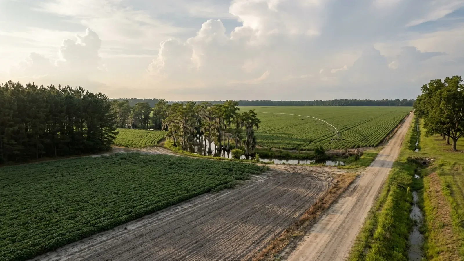
A very large flat South Carolina row-crop field with centre-pivot irrigation tracks, a sharp-edged pine plantation block, a cypress swamp along the creek and a straight dirt road.
Orangeburg County One statewide code, county design maps

Barndominium Builders in Orangeburg County, SC

Orangeburg County has 230,111 acres in farms — more than any other county in South Carolina — and it touches nine of them, including Dorchester and Berkeley on the Charleston side and Lexington and Calhoun on the Columbia side. That geography is the whole point of the page: this is where the land is when the job is in one metro and the acreage is not. Zoning is countywide here, adopted as Appendix A of the county code by Ordinance 2008-01-07-01, and the district that carries the farmland is FA, Forest Agricultural. Three things about building here are genuinely local. The Building Codes Council's approved map for this county carries two wind contours and three seismic design categories, and the higher seismic bands change how a foundation has to be built. The zoning ordinance caps an accessory building's height but says nothing at all about its size, so the shop half of a barndominium is not measured against the house. And the western edge of Lake Marion is the one place in South Carolina with real cave karst — a narrow, checkable fact rather than a statewide worry.

Orangeburg County at a glance

County
Orangeburg County
Population
83,177

Building conditions in Orangeburg County

The building code is the same in every South Carolina county: S.C. Code § 6-9-10(A) requires each municipality and county to enforce the Building Codes Council's codes and to enforce only those, and SC Regulation 8-236(C) bars a local jurisdiction from writing one of its own. The design numbers are not local either, but they are not one number for the state — Regulations 8-1202 and 8-1203 send wind and seismic to the Council's own map for this county, and those maps are drawn as contours, so the figure is read at your address rather than off a county name. What is genuinely local is who issues the permit and inspects the work, what that office charges, the permit procedure it adopted by ordinance, whether your parcel is zoned at all, and the rest of Table R301.2 — frost depth, termite probability and flood — which the jurisdiction fills in for itself.

Build conditions for Orangeburg County , South Carolina : design wind speed The Building Codes Council's approved Orangeburg County map carries 120 MPH and 130 MPH wind contour lines. BUILD CONDITIONS ORANGEBURG COUNTY…Orangeburg CountyONE STATEWIDE CODEDESIGN WIND SPEEDThe Building Codes…Reg 8-1202 replaces IRC R301.2.1 with the Council's own county maps. This is a contour map, not asingle value: the map's printed note says the speed "applies at all points along the length of it…ZONING · FA (FOREST AGRICULTURAL), RC (RURAL…One acre in FA; in RC the minimum lo…The Zoning Ordinance of Orangeburg County (Code Appendix A, Ord. No.2008-01-07-01, adopted 7 January 2008) applies throughout the…IMPACT AND PERMIT FEESPlanning and zoning feesOrangeburg County levies no impact fee. Its Planning Departmentpublishes a fee schedule effective 1 January 2026 under Zoning…WHO ISSUES THE PERMITOrangeburg County Permitting and Ins…Permits and inspections at 803-533-6173, Monday to Friday 8:30 am to5:00 pm; the department's own page links the Building Codes…
Build conditions for Orangeburg County, drawn from the sourced facts on this page. Every figure above is cited in the quick-facts panel below, with its source and vintage.
The Council's Orangeburg County map carries 120 MPH and 130 MPH contours and seismic labels C, D0 and D1
South Carolina does not use the national wind map for houses. Regulation 8-1202 replaces IRC Section R301.2.1 with "the previously published maps by the South Carolina Building Codes Council," and Regulation 8-1203 does the same for the seismic design category at R301.2.2.1. The Council's approved map for Orangeburg County was downloaded and its text layer read: it carries wind contour lines labelled 120 MPH and 130 MPH, seismic design category labels C, D0 and D1, and this note printed on its face — "Wind speed, shown in miles per hour, applies at all points along the length of its corresponding (blue) line. Interpolation between wind speed lines is determined by the AHJ as permitted by Figure R301.2(4)(A) of the 2015 International Residential Code." In the order the labels come off the sheet the C label sits alongside the 120 MPH line and the D0 and D1 labels alongside the 130 MPH line, but the value that governs is the one read at your parcel, and the map is a raster drawing whose contour positions cannot be transcribed into text. There is no single Orangeburg County number, and anybody who quotes you one has not looked at the map. The county's own Permitting and Inspections page links the Council's seismic and wind zone map rather than publishing figures of its own.

SC Building Codes Council, "Wind/Seismic Maps", https://llr.sc.gov/bcc/maps.aspx (served HTML enumerated 5 Sep 2026; Orangeburg is one of the 35 counties listed), and the Council's Orangeburg County map, https://llr.sc.gov/bcc/PDFfiles/WSMaps/Orangeburg%2015(Mays).pdf (HTTP 200, application/pdf, 15,123,375 bytes, downloaded 5 Sep 2026 and read as text extracted with pdftotext -layout); Regs 8-1202 and 8-1203, 2021 Code Modifications, SC State Register Vol. 46 Issue 5, https://llr.sc.gov/bcc/PDFfiles/2021-Code-Modifications.pdf ; Orangeburg County Permits / Inspections, https://www.orangeburgcounty.org/223/Permits-Inspections

A D0 or D1 label is not trivia — it changes the footing under a post-frame building
This is where the Orangeburg map earns its keep. Under IRC Section R301.2.2 the residential code's seismic provisions do not reach a detached one- or two-family dwelling until Seismic Design Category D0, and Orangeburg's map carries D0 and D1 as well as C. Cross that line and three things follow. R403.1.2 requires exterior walls in SDC D0, D1 and D2 to sit on continuous solid or fully grouted masonry or concrete footings — which is the provision that bites a post-frame building hardest, because isolated pier pads under the exterior wall line stop being a prescriptive option and become an engineered alternative. R403.1.3 requires footings and stem walls to be reinforced. R403.1.6.1 tightens sill anchorage with plate washers and closer anchor-bolt spacing. And R301.2.2.6 lists eight irregularity conditions — out-of-plane braced-wall offsets, missing lateral support at roof and floor edges, floor or roof openings over 50 percent of the least dimension, and others — that push a building out of the prescriptive method entirely in SDC C and above. On a wide-open barndominium with a long clear-span shop bay and a tall door wall, several of those are live questions. Settle the category in writing with the building official before the frame is quoted, not after.

2021 South Carolina Residential Code Sections R301.2.2, R301.2.2.6, R403.1.2, R403.1.3 and R403.1.6.1 (IRC 2021 with South Carolina modifications); seismic category source at SC Reg 8-1203, https://llr.sc.gov/bcc/PDFfiles/2021-Code-Modifications.pdf ; category labels read off the Council's Orangeburg County map, https://llr.sc.gov/bcc/PDFfiles/WSMaps/Orangeburg%2015(Mays).pdf (read 5 Sep 2026)

Nothing in Orangeburg's zoning caps how big a detached shop may be
This is the single most useful sentence on the page, and it is unusual. Section 7.5 of the Zoning Ordinance is the whole of what the county says about accessory buildings: no mobile or manufactured home or shipping container may be used as one; "If located within the buildable area, accessory buildings shall observe the height limits for the district within which they are located. If located in a required setback area, said buildings shall not exceed 12 feet in height"; and no accessory use may occupy any part of a bufferyard. There is no floor-area cap, no percentage-of-the-dwelling test, and no rear-yard coverage limit — the three devices South Carolina counties usually use to stop a shop from outgrowing the house. Table 6 then lets an "Auxiliary Shed, Workshop, Storage Building, etc." and a detached garage sit as close as three feet to the rear line. Read those two together and the design decision becomes clear: keep the shop inside the buildable area and it gets the district's full 35-foot height in FA; push it back to three feet off the rear line and it is in a required setback area, where 12 feet is the ceiling and a 14-foot overhead door is gone.

Zoning Ordinance of Orangeburg County (Code Appendix A, Ord. No. 2008-01-07-01, adopted 7 January 2008), Secs. 7.2(5) and Table 6, and Sec. 7.5, read 5 Sep 2026 from the Municode publication API for Orangeburg County (client 7155, product 14706, job 476041, "Codified through Ordinance No. 2025-12-01-47, enacted December 1, 2025"); browsable at https://library.municode.com/sc/orangeburg_county/codes/code_of_ordinances?nodeId=COOR_APXAZO

In FA the binding numbers are a 50-foot rear setback, 35 feet of height and 15 percent impervious cover
Table 2 of the zoning ordinance sets the dimensional standards, and the FA Forest Agricultural district is the one that carries the farmland. Minimum residential lot: one acre, with the note that only small subdivisions of five or fewer lots are permitted and none may be enlarged without rezoning. Minimum lot width 150 feet. Front setback 50 feet on a multi-lane major street, 30 on a two-lane major street, 20 on a minor street. Side setback 15 feet residential, 25 feet non-residential. Rear setback 50 feet residential, 75 feet non-residential. Maximum height 35 feet. Maximum residential density one unit per gross acre. And the one most people miss: maximum impervious surface ratio 15 percent of the lot in FA, against 25 percent in RC Rural Community. On a one-acre FA lot that is 6,534 square feet of roof, slab, apron and drive combined — a 60 by 80 shop is 4,800 of it before the house, the turning apron or the driveway. Table note (G) adds a riparian buffer of not less than 40 feet, or one-third the depth of the lot, whichever is less, along the banks of all lakes, streams and rivers, to be left undeveloped except for piers, docks and pervious paths. Size the pad against the impervious ratio at the same time you size it against the septic field.

Zoning Ordinance of Orangeburg County, Sec. 2.4, Table 2 (Schedule of Lot Area, Yard, Setback, Height, Density, and Impervious Surface Ratios, by District), including table references (D), (G) and (H) (Ord. No. 2014-5-5-7, § I, 5-5-2014), read 5 Sep 2026 via the Municode publication API for Orangeburg County client 7155; browsable at https://library.municode.com/sc/orangeburg_county/codes/code_of_ordinances?nodeId=COOR_APXAZO

The western edge of Lake Marion is the only cave karst in South Carolina — and it is in this county
Almost every karst warning aimed at a South Carolina buyer is imported from the Appalachian limestone belts and is simply wrong here: the Blue Ridge and Piedmont are crystalline rock and do not dissolve. Orangeburg is the exception worth knowing about. The South Carolina Encyclopedia's Coastal Plain entry states that "The coastal plain also contains a unique area of karst topography along the western edge of Lake Marion in Orangeburg County," formed as acidic groundwater reacted with the Santee limestone. The University of South Carolina's SCMAPS teaching manual puts it on the ground: caves lie under Santee State Park on the southern shore of Lake Marion, dissolved out of the limestone that underlies the park, and "the majority of the state's limestone is quarried from the Santee Limestone Formation in Bamberg, Berkeley, Dorchester, and Orangeburg counties." SCDNR's own hazard map, GGMS-5, draws two different things: a large "potentially karstic rocks" area taken from a USGS report which lies inland of the liquefaction zone and "consists almost entirely of the middle Coastal Plain" — which is Orangeburg — and a handful of discrete known-sinkhole areas, whose nearest is described as east of Lake Moultrie along the Santee River, downstream of this county. Two honest caveats belong with all of it. GGMS-5 is drawn at 1:600,000 and says on its face that it "should not be used for land-use zoning, building-code requirements, or defining insurance rate zones" and that "Hazard potential should be evaluated through site-specific geotechnical investigation by qualified practitioners." And this is a belt near the lake, not a countywide condition — most of Orangeburg's farmland is ordinary Coastal Plain sand and clay.

South Carolina Encyclopedia, "Coastal Plain", https://www.scencyclopedia.org/sce/entries/coastal-plain/ (loaded 5 Sep 2026); University of South Carolina Center for Excellence in Geographic Education, SCMAPS teaching manual, Section 7, "Coastal Plain Region / Karst Topography", http://artsandsciences.sc.edu/cege/resources/scmaps/manual/chap7.pdf (HTTP 200, application/pdf, 144,737 bytes, downloaded and read 5 Sep 2026); SCDNR Geological Survey, Geologic Hazards of the South Carolina Coastal Plain, GGMS-5 (2012, 1:600,000), map discussion and disclaimer, https://www.dnr.sc.gov/geology/pdfs/GGMS5.pdf (HTTP 200, application/pdf, 32,578,931 bytes, downloaded and read as extracted text 5 Sep 2026)

230,111 acres in farms — the largest farmland base of any county in the state
The 2022 Census of Agriculture counts 764 farms in Orangeburg County working 230,111 acres at an average of 301 acres, 32.5 percent of the county's 708,083 land acres. No other South Carolina county has more land in farms. Inside that acreage sit 142,257 acres of cropland and 30,191 irrigated acres — 13 percent of the land in farms, an unusually high share for South Carolina and a sign of how much of this is genuinely worked ground rather than idle timber. The size distribution matters more than the total to somebody buying a homesite: 55 farms are 1 to 9 acres, 203 are 10 to 49, and 241 are 50 to 179, so 499 of the 764 operations are under 180 acres and the market has real small-tract supply. Land in farms fell 22 percent since 2017 while the number of farms held flat, which is land coming out of production — the supply side of a rural homesite market. The county's population was 83,177 in 2025, down 1,046 since the 2020 census, so this is a seller's inventory rather than a bidding war. Orangeburg borders nine counties, including Dorchester and Berkeley on the Charleston side and Lexington and Calhoun on the Columbia side, which is why it answers the land question for two metros at once.

USDA National Agricultural Statistics Service, 2022 Census of Agriculture County Profile, Orangeburg County, South Carolina, https://www.nass.usda.gov/Publications/AgCensus/2022/Online_Resources/County_Profiles/South_Carolina/cp45075.pdf (HTTP 200, application/pdf, 878,751 bytes, downloaded and read 5 Sep 2026); population from Census Bureau Vintage 2025 county population estimates

Also worth knowing before you build in Orangeburg County

Five dwellings may share one FA or RC lot without subdividing
Section 7.4 of the zoning ordinance sets out how many principal buildings a lot may carry, and the rural districts get a specific and generous answer: "As many as five residential uses may be permitted on a lot in the FA and RC Zones; provided all applicable lot area and setback requirements are met for each principal use (dwelling), as if it were established on a single lot and so arranged to ensure public access in the event the property is subsequently subdivided for sale or transfer." The ordinance even tells owners how to show it — "Property owners may sketch dwelling location(s) on an existing plat or tax map copy to demonstrate setback compliance at the time of application." For a family buying a larger tract together, or for anyone who wants the main house now and a second dwelling later, that is a real planning tool and it avoids a subdivision plat. The conditions are not decorative: each dwelling has to clear FA's one-acre lot area, 150-foot width and 50-foot rear setback as though it stood on its own lot, and the arrangement has to leave public access if the land is ever split.

Zoning Ordinance of Orangeburg County, Sec. 7.4 (Number of Principal Buildings/Uses on a Lot), read 5 Sep 2026 via the Municode publication API for Orangeburg County client 7155, product 14706, job 476041; browsable at https://library.municode.com/sc/orangeburg_county/codes/code_of_ordinances?nodeId=COOR_APXAZO

Zoning is countywide here, and the ordinance says so in its own preamble
There is no unzoned remainder in unincorporated Orangeburg County. The Zoning Ordinance's preamble ends by ordaining the articles that follow "WHICH SHALL COMPRISE AND BE KNOWN AS THE ZONING ORDINANCE OF ORANGEBURG COUNTY, AND SHALL BE APPLICABLE THROUGHOUT THE UNINCORPORATED AREA OF SAID COUNTY," adopted under Title 6, Chapter 29 of the Comprehensive Planning Enabling Act of 1994. Section 1.1 establishes eight primary districts — RS, RG, RO, CN, CG, BI, FA and RC — plus three special purpose districts, PUD Planned Use, FH Flood Hazard and AC Airport Compatibility. That is worth knowing because several of Orangeburg's neighbours and much of the Upstate are not like this: the answer to "is my parcel zoned?" is yes everywhere outside a municipal boundary in this county, and the answer to "which district?" comes from the county's Zoning Department, which also issues a Zoning Verification Letter. Inside an incorporated town line, that municipality's own ordinance governs instead, so confirm which side of the line a tax map number falls on before relying on any of these figures.

Zoning Ordinance of Orangeburg County, Preamble and Sec. 1.1 (Establishment of Districts), Ord. No. 2008-01-07-01, read 5 Sep 2026 via the Municode publication API (Municode client 7155 verified as Orangeburg County, South Carolina, PO Drawer 9000 / 1437 Amelia St. Room 200A, Orangeburg SC 29116, website orangeburgcounty.org); county Zoning Department page at https://www.orangeburgcounty.org/199/Zoning

In a flood zone the floor goes a foot above base flood, and a $3,000 shed has to go up with it
Section 2.6 of the zoning ordinance runs the Flood Hazard District, and it applies where FEMA's maps for Orangeburg County put the parcel. New residential construction and substantial improvements must have "the lowest floor elevated no lower than one foot above the base flood elevation," with a pre-construction and a post-construction elevation certificate, and "No basements are permitted." Non-residential gets the same one foot, with a dry-floodproofing alternative in A zones certified by a registered engineer or architect. The provision that catches barndominium buyers is Section 2.6-2(4): "An accessory structure, the cost of which is greater than $3,000.00, must comply with the elevated structure requirements of this section." Three thousand dollars is not a shop building — it is barely a garden shed — so in practice any detached shop in the mapped hazard area is elevated too. Where a stream has no established base flood elevation, no fill, new construction or substantial improvement is permitted within 40 feet of the stream bank without an engineer's certification that flood levels will not rise. The county runs Floodplain Development as its own function and charges a published $50.00 floodplain development fee.

Zoning Ordinance of Orangeburg County, Secs. 2.6, 2.6-1 and 2.6-2, read 5 Sep 2026 via the Municode publication API for client 7155; Orangeburg County Floodplain Development, https://www.orangeburgcounty.org/173/Floodplain-Development ; fee from the county Planning fee schedule, https://www.orangeburgcounty.org/DocumentCenter/View/3407/Fee-Schedule-Effective-010126 (application/pdf, 130,704 bytes, read 5 Sep 2026)

The county publishes its planning fees, and they are per-review, not per-square-foot
Orangeburg County's Planning Department publishes a fee schedule effective 1 January 2026, keyed to Section 9.9 of the zoning ordinance. The ones a rural homesite touches: a simple plat review, for a lot of record or fewer than five splits, $50.00; preliminary and final plat review $200 plus $20.00 per lot each; a residential zoning verification letter $50.00 (commercial $100.00); a floodplain development fee $50.00; a grading permit $50 per acre with a $250 minimum; a Zoning Board of Appeals application for an appeal, special exception or variance $300.00; a Planning Commission application for a rezoning or subdivision approval $300.00. Re-reviews escalate — the first is inside the original fee, a second costs 25 percent of it, a third 50 percent and a fourth 100 percent — which is a real argument for getting the submittal right the first time. Building permit and inspection fees are separate and come from Permitting and Inspections, at 803-533-6173, not from Planning.

Orangeburg County Planning Department, "Fee Schedule Effective 01.01.26" (Zoning Ordinance Sec. 9.9, Types of Required Permits/Certificates and Fees), https://www.orangeburgcounty.org/DocumentCenter/View/3407/Fee-Schedule-Effective-010126 (HTTP 200, application/pdf, 130,704 bytes, downloaded and read 5 Sep 2026); department pages at https://www.orangeburgcounty.org/239/Planning and https://www.orangeburgcounty.org/223/Permits-Inspections

A barndominium is never a farm structure, and the statute is unusually blunt about it
This is the question every buyer on Orangeburg farmland asks, and South Carolina answers it in the definition rather than leaving it to argument. S.C. Code Section 6-9-65(A) defines a farm structure as one built on a farm "other than a residence or a structure attached to it," and excludes any structure "originally qualifying as a 'farm structure' but later converted to another use." A barndominium is a residence, so it is outside the exemption in every case; the shop half under the same continuous roof is attached to a residence, so it is outside too. There is no square-footage test and no percentage-of-use test to work with. Section 6-9-65(C) adds that the exemption "do[es] not apply unless" the owner files an affidavit with the local building official before construction stating the structure is being built as a farm structure, and Section 6-9-65(B) preserves FEMA's National Flood Insurance Program standards regardless — so the exemption never reaches flood. Section 6-9-65(D) leaves the county free to require a building permit anyway. A genuinely detached barn or equipment shed on the same land can qualify. The building anyone sleeps in cannot, and putting up a shell as a barn and finishing it out later takes it back out of the exemption by the definition's own terms.

S.C. Code § 6-9-65, Title 6 Chapter 9 (Building Codes), https://www.scstatehouse.gov/code/t06c009.php (served HTML read 5 Sep 2026)

Septic is a state permit, and below the Fall Line the evaluation is different from the Upstate's
Orangeburg County does not permit onsite wastewater; the South Carolina Department of Environmental Services does, under Regulation 61-56. Two things are worth knowing before an offer. First, the Fall Line rule cuts the other way here than it does in the Upstate: R.61-56 § 104.1(5) provides that "Backhoe pits shall be required above the Fall Line that separates the Piedmont area from the Coastal Plain as defined by the South Carolina Geological Survey," and Orangeburg sits below that line, so the evaluation does not carry the mandatory machine-pit requirement that a Greenville or Oconee parcel does. Second, the site has to be ready before the evaluator arrives: § 104.1(6) requires the applicant to clear and mark the boundary lines and corners, post an identification marker at the front centre of the lot, stake the corners of the proposed building, mark the stub-out, tank and drainfield area, and locate the well. Space is the real constraint on a wide building — § 200.6 keeps no part of the system within five feet of a building or a property line, 75 feet of a private well or 25 feet of a drainage ditch, and § 200.7(1) requires a usable repair area "equivalent to at least fifty (50) percent of the size of the original system." On an FA lot already capped at 15 percent impervious cover, the drainfield and its replacement area get sited before the pad, not after.

S.C. Regulation 61-56, Onsite Wastewater Systems, §§ 104.1(5), 104.1(6), 200.6 and 200.7(1), SCDES copy at https://des.sc.gov/sites/des/files/Library/Regulations/R.61-56.pdf (HTTP 200, application/pdf, 4,282,530 bytes, downloaded and read as text extracted with pdftotext -layout, 5 Sep 2026)

The county enforces the state's code, and it is the state's code in all 46 counties
The Orangeburg County Permitting and Inspections Department describes its mission as safeguarding the public "through enforcement of the Adopted Building Codes," and that is exactly the right framing, because the codes are not the county's. S.C. Code § 6-9-10(A) requires every municipality and county in the State to enforce the Building Codes Council's codes and to "enforce only" them, and SC Regulation 8-236(C) adds that "Local jurisdictions are prohibited from writing or publishing any other building codes in part or in whole." In force now: the 2021 I-codes with South Carolina modifications, implemented 1 January 2023, together with the 2020 National Electrical Code and — by statute rather than by the Council — the 2009 International Energy Conservation Code. The 2024 codes take effect 1 January 2027, and § 6-9-130(A) fixes the edition that governs a project at the date the original building permit was issued. Under the 2021 codes the Council has granted exactly one local residential modification anywhere in South Carolina, and it belongs to Greenville County. Orangeburg has none, which means the construction standard here is the state's, unmodified — what varies locally is the map, the zoning and the paperwork.

Orangeburg County Permits / Inspections, https://www.orangeburgcounty.org/223/Permits-Inspections ; S.C. Code §§ 6-9-10(A) and 6-9-130(A), https://www.scstatehouse.gov/code/t06c009.php ; SC Reg 8-236, https://www.scstatehouse.gov/coderegs/Chapter%208.pdf ; SC Building Codes Council, Building Code Adoption, https://llr.sc.gov/bcc/BCAdoption.aspx (served HTML read 5 Sep 2026)

An excavator grading a compacted building pad on a cleared lot, with orange clay in the cut face, survey stakes and a drainage swale.
Below the slab

The expensive surprises are in the ground, not the building

What moves a South Carolina budget is usually below grade, and more often than not it is the drainfield rather than the foundation. R.61-56 § 200.1 settles whether a parcel can take an onsite system from soil morphology — texture, structure, depth to a restrictive horizon and depth to the zone of saturation — and § 200.2 then rules out two conditions outright: soils exhibiting massive or platy structure, and soils with substantial amounts of expansible layer clay minerals or smectites. That second clause is the one that bites on the mafic Piedmont, where the shrink-swell series sit in quantity under York, Fairfield, Chester, Laurens, Union, Newberry, Greenwood, McCormick, Lancaster, Saluda, Abbeville and Edgefield. A foundation problem has a price and an answer; an unbuildable septic parcel has neither, which is why we look at it first. Bedroom count is the number to settle early, because § 61-56.501 drives design flow from bedrooms, design flow drives trench length, and trench length plus a repair area decides how much good soil the parcel has to have — shop square footage adds nothing to it. Above the Fall Line the evaluation is done in backhoe pits rather than borings alone, so the answer comes from a dug hole and not a form. The site work, the foundation and the drainfield therefore get resolved together rather than one at a time. We price the dirt before we price the building.

What a build looks like

Three stages every Orangeburg County project passes through, from a raw parcel to a finished home. Site work first, because that is where the budget is decided.

Aerial view of an undeveloped rural lot with cleared rough grass, planted pine along one boundary, and a red dirt access track cut through orange clay.
Stage one

The parcel

Zoning, setbacks, flood zone and utility access get checked before anything is drawn.

An excavator grading a compacted building pad on a cleared lot, with orange clay in the cut face, survey stakes and a drainage swale.
Stage two

Pad and permit

Clearing, grading and a compacted pad, while the submittal works through whichever office issues the permit where you are building.

A finished barndominium at dusk with warm interior lighting glowing through its large windows.
Stage three

Frame to finish

Shell erected and dried in, then systems, insulation and interior finish through to CO.

Those are the rules where you are building in Orangeburg County. Tell us what you want to build and we will draw it to them.

Nearby areas we build in

Others we cover nearby. One may be a county and another a municipality inside one — and a South Carolina municipality can sit in two counties at once — so the office that issues the permit, the fees it charges, whether the land is zoned at all, and which design map covers it can all differ from one card to the next.

Building in Orangeburg County: common questions

8 questions we get asked most often about building in Orangeburg County. If yours is not on the list, ask it directly.

What wind speed and seismic category apply to my Orangeburg parcel?
The wind speed comes off a state map, not a county chart, and it is a contour, not a number. Regulation 8-1202 replaced IRC section R301.2.1 with "the previously published maps by the South Carolina Building Codes Council," and Regulation 8-1203 did the same for the seismic design category. The Council's approved map for Orangeburg County carries wind contour lines labelled 120 MPH and 130 MPH and seismic design category labels C, D0 and D1. The map says on its own face that a wind speed "applies at all points along the length of its corresponding (blue) line" and that "Interpolation between wind speed lines is determined by the AHJ as permitted by Figure R301.2(4)(A) of the 2015 International Residential Code." So there is no one Orangeburg figure: there is a map, a value read at your parcel, and a building official who interpolates between lines. Be wary of any builder who quotes a single number for the whole county. The seismic half deserves more attention than it usually gets here, because Orangeburg's map carries D0 and D1 as well as C, and the residential code's seismic provisions do not touch a detached one- or two-family dwelling until D0. Get the category confirmed in writing by the county building official for your tax map number before the frame is ordered, and note that the mechanism changes on 1 January 2027, when the 2024 modifications move wind and seismic to the ASCE Hazard Tool.
Can the shop be bigger and taller than the house?
As far as Orangeburg County zoning is concerned, yes on size, and the height depends entirely on where you put it. Section 7.5 is the whole of what the ordinance says about accessory buildings, and it contains no floor-area cap, no percentage-of-the-dwelling test and no rear-yard coverage limit — the three devices other South Carolina counties use to keep a shop smaller than the house. What it does say is that an accessory building inside the buildable area observes the height limit of its district, which is 35 feet in FA and RC, and that one placed in a required setback area "shall not exceed 12 feet in height." Table 6 allows an auxiliary shed, workshop or storage building to sit three feet off the rear line — but three feet off the rear line in FA is well inside the 50-foot required rear yard, so that building is capped at 12 feet, which will not take a 14-foot overhead door. Keep the shop inside the buildable area and you get the full 35 feet. Two more limits bind regardless: the FA district's 15 percent maximum impervious surface ratio, which counts roof, slab, apron and drive together, and the fact that a shouse with the shop and the living space under one continuous roof is not an accessory building at all — it is the principal dwelling, and only the district's own setbacks and 35-foot height apply to it.
Is my land zoned, and which district is it in?
Yes, if it is outside a town line. The Zoning Ordinance of Orangeburg County was adopted by Ordinance 2008-01-07-01 on 7 January 2008 and its preamble ordains that it "shall be applicable throughout the unincorporated area of said county." There is no unzoned remainder here, which is different from several counties in the Upstate and from a couple of Orangeburg's own neighbours. Eight primary districts exist — RS, RG, RO, CN, CG, BI, FA Forest Agricultural and RC Rural Community — plus PUD, FH Flood Hazard and AC Airport Compatibility as special purpose districts. Farmland is almost always FA; crossroads settlements are often RC. The practical step is to take the tax map number to the county's Zoning Department, which issues a written Zoning Verification Letter for a published $50.00 residential fee, and to do it before you make an offer rather than after. If the parcel sits inside any incorporated town line in the county, that municipality's ordinance governs instead and this page's numbers do not apply.
Can I build it as a farm building and finish it out later?
No, and South Carolina closes this one in the definition itself rather than leaving room to argue. S.C. Code § 6-9-65(A) defines a farm structure as one built on a farm "other than a residence or a structure attached to it." A barndominium is a residence, so it is outside the exemption in every case, and the shop half of a shouse is attached to a residence, so it is outside too. The same subsection excludes any structure "originally qualifying as a 'farm structure' but later converted to another use," which takes care of the build-a-barn-and-finish-it-later plan directly: converting it removes it from the exemption and the code then applies to it as the dwelling it has become — after the footings are buried, the frame is closed in and nothing has been inspected. Three more points from the same section. The exemption is not automatic: § 6-9-65(C) says it "do[es] not apply unless" the owner files an affidavit with the county building official before construction, stating the structure's purpose and intended use. It never reaches flood: § 6-9-65(B) preserves FEMA's National Flood Insurance Program standards regardless. And § 6-9-65(D) leaves the county free to require a building permit anyway. A genuinely detached barn or equipment shed on the same farm can qualify. The building you sleep in cannot.
I keep hearing about sinkholes near Lake Marion. Is that real?
It is real, it is narrow, and Orangeburg is the one county in South Carolina where the question is worth asking at all. The South Carolina Encyclopedia records that the coastal plain "contains a unique area of karst topography along the western edge of Lake Marion in Orangeburg County," formed as acidic groundwater dissolved the Eocene Santee limestone; the University of South Carolina's SCMAPS manual puts caves under Santee State Park on the lake's southern shore and notes that most of the state's limestone is quarried from the Santee Limestone Formation in Bamberg, Berkeley, Dorchester and Orangeburg counties. SCDNR's hazard map GGMS-5 shows a broad potentially-karstic-rocks area covering essentially the whole middle Coastal Plain, and separately maps a few discrete known-sinkhole areas — north of Myrtle Beach, around Beaufort, east of Lake Moultrie along the Santee River and at Georgetown — none of which is drawn on the Orangeburg farmland away from the lake. Three things follow. First, this is a lake-edge belt, not a countywide condition; most of the county's 230,111 farm acres are ordinary Coastal Plain sand and clay. Second, GGMS-5 is a 1:600,000 planning map and states on its face that it "should not be used for land-use zoning, building-code requirements, or defining insurance rate zones" and that hazard potential "should be evaluated through site-specific geotechnical investigation by qualified practitioners" — so it tells you whether to ask the question, not what the answer is. Third, if you are buying near the lake and putting a wide slab-on-grade building on it, that geotechnical investigation is money well spent, and it is the same investigation that will tell you your bearing capacity anyway. And to be clear about what this is not: there is no Piedmont or Blue Ridge karst in South Carolina at all, so karst warnings written for the Appalachian limestone belts buyers do not transfer.
How much of the lot can I actually cover?
In FA, 15 percent of it, and this catches more barndominium plans than the setbacks do. Table 2 of the zoning ordinance sets a maximum impervious surface ratio of 15 percent in the FA Forest Agricultural district and 25 percent in RC Rural Community. Impervious means roof, slab, apron, driveway and any other surface water cannot pass through — not just the building footprint. On a one-acre FA lot, 15 percent is 6,534 square feet in total. A 60 by 80 shop is 4,800 of that on its own, before the dwelling, before a turning apron wide enough for a trailer, and before the drive out to the road. That is not a reason to avoid FA land; it is a reason to buy more than the one-acre minimum if the building programme is large, and it is one of the two numbers to size the site plan against from the first sketch. The other is the septic layout: S.C. Reg 61-56 § 200.7(1) requires a usable repair area equal to at least half the size of the original system, kept free of buildings and improvements, so the drainfield and its replacement get located before the pad. Also worth pricing in early: FA's rear setback is 50 feet for a residential building and 75 feet for a non-residential one, its side setbacks are 15 and 25 feet, and minimum lot width is 150 feet.
Who permits the build, and what does the county charge?
Two county offices and one state agency. Orangeburg County Permitting and Inspections, on 803-533-6173, enforces the adopted building codes and runs inspections for the unincorporated county — its own page links the Building Codes Council's seismic and wind zone map rather than publishing figures of its own, which tells you where the design criteria come from. Planning and Zoning administers the Zoning Ordinance, the Flood Hazard District, subdivision and plat review, the Zoning Board of Appeals and the Planning Commission, and issues the Zoning Verification Letter you should have in hand before closing. Onsite wastewater is not a county permit at all: the South Carolina Department of Environmental Services permits it under Regulation 61-56. On money, the county publishes its planning fees and they are modest and per-review: a simple plat review for a lot of record or fewer than five splits is $50.00, preliminary and final plat review are $200 plus $20.00 per lot each, a residential zoning verification letter is $50.00, floodplain development is $50.00, a grading permit is $50 per acre with a $250 minimum, and a Zoning Board of Appeals or Planning Commission application is $300.00. Re-reviews cost 25 percent of the original fee for the second, 50 for the third and 100 for the fourth, so a complete first submittal is worth real money. Building permit and inspection fees are set separately by Permitting and Inspections.
My land is in a flood zone. What changes?
The floor goes up a foot above base flood elevation, the basement is off the table, and the shop goes up with the house. Section 2.6-2 of the zoning ordinance requires new residential construction and substantial improvements in the mapped hazard area to have "the lowest floor elevated no lower than one foot above the base flood elevation," with a pre-construction and a post-construction elevation certificate, and states flatly that "No basements are permitted." Non-residential construction gets the same one foot, with a dry-floodproofing alternative available in A zones if a registered engineer or architect certifies it. The provision people miss is Section 2.6-2(4): an accessory structure costing more than $3,000.00 must meet the elevated-structure requirements too, and only structures at or under $3,000.00 get the lighter treatment, which also bars them from human habitation and requires low flood-damage potential and firm anchoring. Three thousand dollars does not buy a shop, so in practice the detached building is elevated as well. In a floodway, no fill, new construction or substantial improvement is permitted unless a hydraulic analysis shows no rise in flood level. Along a stream with no established base flood elevation, nothing may encroach within 40 feet of the bank without a professional engineer's certification. On a wide slab-on-grade building, a foot of freeboard is a fill, retaining and driveway-grade decision, so get the flood determination from the county before the pad is designed, not after.

Building in Orangeburg County?

Start with the plan. Tell us what you want to build and we will draw it, then confirm which office issues the permit for your parcel, what it will let you put there, and what wind load it has to meet. That conversation costs nothing.