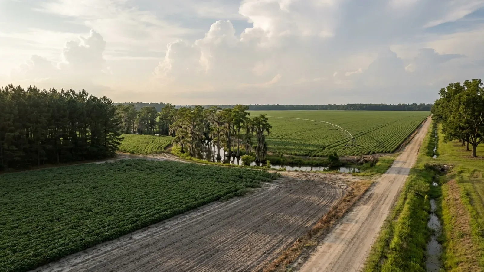
A very large flat South Carolina row-crop field with centre-pivot irrigation tracks, a sharp-edged pine plantation block, a cypress swamp along the creek and a straight dirt road.
Hampton County One statewide code, county design maps

Barndominium Builders in Hampton County, SC

Hampton County is the land answer for money that lives forty-five minutes east of it. Bluffton and Hilton Head have the incomes and none of the acreage; Hampton has 96,359 acres in farms across a 358,384-acre county — 26.9 percent — worked at an average of 521 acres, the third-largest average operation in South Carolina. Estill, Varnville, Brunson, Yemassee, Furman, Gifford, Luray and Hampton town sit on that ground, and 37 of the county's 185 farms run over a thousand acres. The county has run a countywide Unified Land Development Ordinance since 1994, most recently updated in July 2024, and it is an unusually plain document to build under. There is no maximum building height in it outside the airport protection district. There is no rule sizing an accessory building against the dwelling. What it does have is a setback note that quietly reshapes a barndominium plan — any accessory building over fifteen feet tall or six hundred square feet has to meet the principal building's setbacks, not the accessory ones — and a soils article that names thirteen specific soil series and requires a report explaining how you intend to overcome them before the Building Inspector will issue a permit. Two more things are worth knowing before you look. The Building Codes Council's Hampton sheet carries a single 130 MPH wind contour, and the county's own residential submittal requires plans signed and sealed by a South Carolina architect or structural engineer to meet the wind load of the location. And Hampton is not in South Carolina's coastal zone, however Lowcountry it feels — that is a closed statutory list of eight counties and this is not one of them.

Hampton County at a glance

County
Hampton County
Population
18,174

Building conditions in Hampton County

The building code is the same in every South Carolina county: S.C. Code § 6-9-10(A) requires each municipality and county to enforce the Building Codes Council's codes and to enforce only those, and SC Regulation 8-236(C) bars a local jurisdiction from writing one of its own. The design numbers are not local either, but they are not one number for the state — Regulations 8-1202 and 8-1203 send wind and seismic to the Council's own map for this county, and those maps are drawn as contours, so the figure is read at your address rather than off a county name. What is genuinely local is who issues the permit and inspects the work, what that office charges, the permit procedure it adopted by ordinance, whether your parcel is zoned at all, and the rest of Table R301.2 — frost depth, termite probability and flood — which the jurisdiction fills in for itself.

Build conditions for Hampton County , South Carolina : design wind speed The Building Codes Council's Hampton County sheet, Hampton 15(Mays).pdf, carries a single blue wind contour labelled 130 MPH at both ends. Those two labels are the entire text content of the sheet: no seismic design category letters and no note box appear in its text layer, and the seismic category for Hampton County is therefore not established from this map. BUILD CONDITIONS HAMPTON COUNTY, SCHampton CountyONE STATEWIDE CODEDESIGN WIND SPEEDThe Building Codes…Modifications IRC 2021-04 and IRC 2021-05 replace IRC R301.2.1 and R301.2.2.1 with the SouthCarolina Building Codes Council's own previously published county maps, and Hampton is one of the…ZONING · RR (RURAL RESOURCE DISTRICT)10,000 sq ft for a single-family det…The Unified Land Development Ordinance was adopted 6 June 1994 andthe published copy is headed "Last updated July 25, 2024". § 1.2…RESIDENTIAL BUILDING PERMIT$733.00 for the first $100,000 of va…That is the fourth of five bands on the county's published schedule,effective 1 July 2024. The others: $3,000 or less, $55.00; $3,001 t…WHO ISSUES THE PERMITHampton County Building & Planning D…B.T. Deloach Building, 201 Jackson Avenue West, Hampton SC 29924;803-914-2127, fax 803-914-2130, permits@hamptoncountysc.org. The…
Build conditions for Hampton County, drawn from the sourced facts on this page. Every figure above is cited in the quick-facts panel below, with its source and vintage.
The Council's Hampton sheet: a single 130 MPH contour, and what its silence does and does not mean
South Carolina takes the design wind speed and the seismic design category away from the locality and away from the national code maps. Modifications IRC 2021-04 and IRC 2021-05 replace IRC Sections R301.2.1 and R301.2.2.1 with "the previously published maps by the South Carolina Building Codes Council," and those maps exist for thirty-five of the state's forty-six counties. Hampton is one of the thirty-five, so the absence that defines the Upstate counties does not apply here — but the sheet itself is unusually spare and it is worth describing exactly. Hampton 15(Mays).pdf was downloaded from the Council's own map library and its content stream examined directly. The entire text on the sheet is four show operations spelling "130 " and "MPH" twice: one blue wind contour, labelled at both ends, and nothing else. There is no seismic category lettering and no note box in the sheet's text layer, and unlike most of the coastal-county sheets there is no scanned base image at all — the whole thing is vector line work in grey with blue and green annotation. That matters for how you read it. A blank text layer is not the same as a silent map, and the correct position is that Hampton's wind figure is published and its seismic category is not established from this sheet. Do not fill that gap from Jasper's sheet, from Colleton's, from Beaufort's, or from a national hazard tool — go and get the building official's written determination for your tax map number. The practical consequence is smaller than it sounds. The residential code applies its seismic provisions to a detached one- or two-family dwelling only at Seismic Design Category D0 and above, so on most Inner Coastal Plain ground the seismic chapter never reaches the house at all and the engineering argument on a Hampton build is made on wind and on the county's own submittal rules instead. One thing not to infer from the 130 figure: IRC R301.2.1.1's threshold limb is 140 mph and is qualified by the words "in a special wind region," and 130 is below it either way.

SC Building Codes Council, "Wind/Seismic Maps", https://llr.sc.gov/bcc/maps.aspx ; the Hampton County sheet at https://llr.sc.gov/bcc/PDFfiles/WSMaps/Hampton%2015(Mays).pdf (application/pdf, 6,492,897 bytes, downloaded 8 September 2026; the two "130 MPH" labels were read from the sheet's text layer in both layout and reading-order extraction modes, and the sheet's twenty-four compressed content streams were decompressed and searched directly, returning exactly four text-show operations and no raster image object); the substituting modifications at SC Building Codes Council, 2021 Modification Index, https://llr.sc.gov/bcc/PDFfiles/2021-Modification-index.pdf ; the eleven-county no-map list and the code chain from research/statewide/design-criteria-and-climate.md

A shop over 15 feet or 600 square feet loses the accessory setback — and there is no height limit at all
This is the ordinance line that reshapes a barndominium plan in Hampton County, and it is a footnote to a table. The Unified Land Development Ordinance's setback schedule at Section 3.4.2 gives residential accessory structures a five-foot side and five-foot rear yard, against ten feet and twenty-five feet for a single-family dwelling, with a front yard of thirty feet on a minor road, forty on a collector and fifty on an arterial. Then note (8) takes the concession straight back for anything of a useful size: "Accessory building or structures in excess of 15 feet in height or 600 square feet in gross floor area, satellite dishes, ham radio towers and domestic kennels and pens shall observe the minimum setback requirements for the principal building or use to which they are accessory." Six hundred square feet is a two-car garage. Any real shop bay is over it, and any shop with a fourteen-foot door is over the fifteen-foot line too, so in practice a barndominium's shop half sits on the dwelling's setbacks: ten feet from the side line, twenty-five from the rear, and thirty to fifty from the road depending on its classification. Note (9) adds a separate and much larger number for a different building: "Barns and structures housing livestock and the keeping of swine or fowl regardless of type enclosure shall be located no closer than 100 feet to the nearest property line." Now the good news, and it is genuinely unusual. There is no maximum building height anywhere in this ordinance outside the Airport Protection District — no district height cap, no accessory-structure height cap, and no rule anywhere sizing an accessory building against the dwelling by floor area or by height. A shop taller and larger than the house is not something the Hampton County zoning ordinance prohibits. What it regulates instead is where the building sits, how much of the lot is hard surface — residential development is limited to a 55 percent impervious surface ratio — and, under Section 9.4, that no more than one principal building may stand on a lot of record, with a narrow exception for single-family dwellings on heirs property where use of the property is permitted by legacy.

Hampton County Unified Land Development Ordinance, adopted by action of Hampton County Council 6 June 1994, last updated 25 July 2024, §§ 3.2.2, 3.3.2, 3.4.2 (including notes 8 and 9), 3.4.6 and 9.4, https://www.hamptoncountysc.org/DocumentCenter/View/57/Unified-Land-Development-Ordinance (application/pdf, 2,014,271 bytes, downloaded 8 September 2026 and read in both layout and reading-order extraction modes; the setback table and the area-standards table agree in both renders, and the impervious-surface table was read from the reading-order render because the layout render detaches its labels from its values); linked from Hampton County Building & Planning Department, https://www.hamptoncountysc.org/9/Building-Planning-Department

This county's ordinance names the soils it will not let you ignore — thirteen of them, by series
Almost no county land-development ordinance in South Carolina does this, and it is the single most useful page in Hampton's. Article II of the Unified Land Development Ordinance requires a natural features analysis before development, and Section 2.3 is a soils article that opens with an unusually candid sentence: "Soils may and often do pose significant constraints to development. However, these constraints often may be over come by sound engineering solutions, making use of such soils possible if proper steps are taken. Such steps might include the removal of these soils from construction areas, use of additional fill dirt, used of extra thick sub-base, pilings, elevated first floor, or other such measures." It then names the soils, as identified by the USDA Soil Conservation Service, that present severe limitations to development in this county: Argent, Coxville, Lynchburg, Osier, Pelham, Plummer, Wahee, Chipley, Leon, Ocilla, Rains, Pickney and the Osier-Pickney complex. Where such soils are known to exist on a site proposed for development, "a soils analysis report shall be submitted together with the preliminary plat or site plan," describing the extent of the soil and how its limitations are to be overcome, and "the proposed method of dealing with the soils shall be approved by the Building Inspector prior to the issuance of a building permit." That list is not abstract. The soil survey measures 18,552 acres of Lynchburg in Hampton County — a wet flatwoods series with a seasonal high water table sitting close to the surface — alongside 19,059 acres of Norfolk, which is the well-behaved end of the same landscape. So on a great many Hampton tracts the pad height, the fill volume and the drainage away from the pad are not a detail the builder sorts out later; they are a document the county wants before it will issue a permit. Article II also requires an applicant to contact the U.S. Army Corps of Engineers where the analysis identifies wetlands, to determine whether they are jurisdictional and secure the necessary permits or clearance, before the county will issue a building or use permit.

Hampton County Unified Land Development Ordinance, §§ 2.1, 2.3 and 2.4, https://www.hamptoncountysc.org/DocumentCenter/View/57/Unified-Land-Development-Ordinance (read 8 September 2026); the Lynchburg and Norfolk component acreages for Hampton County from research/statewide/soils-and-geology.md, built on USDA-NRCS Soil Data Access component acreage by survey area; the Lynchburg series description at https://soilseries.sc.egov.usda.gov/OSD_Docs/L/LYNCHBURG.html

The Rural Resource District, and what it lets you do on acreage
Hampton County zones its whole unincorporated area, but it does so with six districts rather than thirty, and the one that carries the acreage is RR, the Rural Resource District. Its stated intent is to "protect and preserve areas of the county which are rural or agricultural in character and use and are uniquely suited for such purposes," permitting development "compatible with the preservation of the rural lifestyle, character and agricultural use of these areas" and preventing "speculative, premature intrusions of urban uses and lifestyles." Twenty-five uses are permitted outright in RR, and the two that matter to a barndominium sit next to each other on the list: "Dwelling, single-family detached," and "Agricultural uses, including commercial greenhouses and nurseries, general farming operations, keeping and raising of animals and livestock, and structures for housing products raised on the premises." Equestrian uses including stables and fields are permitted, so are home occupations, and so are outdoor recreation facilities including hunt clubs. Uses accessory to any of those are permitted. What RR does not carry is a district minimum acreage — the ordinance sets its area standards centrally instead, at Section 3.2.2, where a single-family detached dwelling requires a minimum of 10,000 square feet, and where the ordinance is explicit that a building not on a public sewerage system "shall meet the minimum area requirements of the County Health Department" and in no case less than that floor. On a rural tract that means the state's onsite-wastewater evaluation, not the zoning ordinance, sets how small a workable parcel can be. The other three residential-capable districts are worth telling apart: RCD, the Residential Conservation and Development District, is for stabilising existing neighbourhoods and permits single-family dwellings while excluding mobile homes, and new RCD districts require twenty acres and ten units or a platted subdivision of twenty lots. GD is the general development district for the urbanising areas. LD is low intensity. APD is the airport overlay and is the one place in the ordinance where a height limitation appears.

Hampton County Unified Land Development Ordinance, §§ 3.2.2, 4.0, 4.1, 4.4, 4.5 (4.5.1 and 4.5.2) and 4.6, https://www.hamptoncountysc.org/DocumentCenter/View/57/Unified-Land-Development-Ordinance (read 8 September 2026); Hampton County Building & Planning Department, https://www.hamptoncountysc.org/9/Building-Planning-Department

Hampton County publishes two affidavits, and a barndominium can sign neither of them
Hampton County's Building Department publishes an Agricultural Building Affidavit and an Accessory Structure Letter of Use, and both are worth reading precisely, because between them they close the two doors people most often try. The Agricultural Building Affidavit states that agricultural buildings newly constructed in Hampton County "are exempt from plan review and inspection by the County Building Department" if the building will be built on the agricultural land for which it will be used, will be used for agricultural purposes only, and the owner signs before a notary public and two witnesses and records the affidavit with the Hampton County Clerk of Court. That is a real exemption and it is stricter procedurally than most counties' — recording at the Clerk of Court is not a formality. But S.C. Code § 6-9-65(A) defines a farm structure as a structure built on a farm "other than a residence or a structure attached to it," and expressly excludes a structure that originally qualified but was "later converted to another use." A barndominium is a residence, so it is outside the exemption from the first day, and the shop half of a shouse is outside it too because it is attached to a residence. There is no square-footage test and no percentage-of-use test to argue about. Signing that affidavit for a building you intend to live in is a false statement of intended use, sworn before a notary and recorded in the public record. The Accessory Structure Letter of Use closes the other door in the county's own words. The owner acknowledges that the structure "WILL NOT be used for any commercial activity or as living quarters (temporarily or permanently) and no alterations or modification will be made after the Final Inspection without a permit," that "only family members living in the principal residence located at the above address can use this structure," and that the county "reserves the right to randomly inspect the accessory building." If the use does not match, the county's listed remedies include a summons before a judge, a per-day fine, and a request that power be disconnected to the structure. Permit the building as a dwelling from the start, with the shop bay in the drawings.

Hampton County Building Department, "Agricultural Building Affidavit" (rev. 10/31/2024), https://www.hamptoncountysc.org/DocumentCenter/View/2860/09Agriculture-Affidavit-10022024 ; "Accessory Structure Letter of Use — Acknowledgement" (rev. 03.04.26), https://www.hamptoncountysc.org/DocumentCenter/View/2861/10Accessory-Structure-Use-030426 (both downloaded 8 September 2026 and read as extracted text); both listed on Hampton County Building & Planning Department, https://www.hamptoncountysc.org/9/Building-Planning-Department ; S.C. Code § 6-9-65, https://www.scstatehouse.gov/code/t06c009.php

The permit fee runs on square feet under roof, not on your contract price
Hampton County moved to a new fee schedule on 1 July 2024, and it publishes the whole thing on one page. The sentence that matters most to a barndominium is the basis of assessment: "Permit fees for all new construction will be calculated based on square feet under roof using the most current ICC Building Validation Data." So the number the county runs through its bands is not what you are paying your builder — it is a valuation derived from your area under roof against a published national table, which means a large shop bay drives the permit fee whether or not it is finished space. On top of the permit fee, "For new construction, a Plan Fee will be charged based on 50% of the Permit Fee for Residential and 75% of the Permit Fee for Commercial," so the residential permit line is effectively one and a half times the band figure. The bands themselves: $55.00 for a total valuation of $3,000 or less; $55.00 for the first $3,000 plus $7.50 for each additional thousand or fraction thereof to $50,000; $408.00 for the first $50,000 plus $6.50 per additional thousand to $100,000; $733.00 for the first $100,000 plus $5.50 per additional thousand to $500,000; and $2,933.00 for the first $500,000 plus $4.50 per additional thousand above that. Those bands reconcile against one another — $55 plus 47 times $7.50 is $407.50, $408 plus 50 times $6.50 is $733, $733 plus 400 times $5.50 is $2,933 — which is the check worth running on any published fee sheet before budgeting from it. Elsewhere on the sheet: re-inspection where a routine inspection reveals deficiencies is $100.00 and must be paid before the re-inspection; moving a house or building is $200.00 and a building permit is still required for the foundation, repairs, electrical and plumbing; residential demolition is $50.00; a zoning verification letter is $30.00, plat review $25.00, a minor subdivision $50.00 plus $10 per lot and a major subdivision $300.00 plus $10 per lot; and a rezoning or variance application is $200.00 each. No impact fee appears anywhere on the schedule. Septic is a separate state permit and is not part of any of this.

Hampton County, Schedule of Permit Fees, https://www.hamptoncountysc.org/396/Schedule-of-Permit-Fees (served page retrieved 8 September 2026 and read from the served HTML rather than from a summary; the five valuation bands were reconciled arithmetically against one another before being quoted); Hampton County Building & Planning Department, https://www.hamptoncountysc.org/9/Building-Planning-Department

Also worth knowing before you build in Hampton County

Hampton is NOT in the coastal zone, however Lowcountry it feels
It borders Beaufort and Jasper, the town of Yemassee straddles the Beaufort County line, and its Council wind sheet carries the same 130 mph contour as Jasper's. None of that puts Hampton County in South Carolina's coastal zone, and the distinction is worth a paragraph because getting it wrong costs a permit cycle. The coastal zone is a closed statutory list. S.C. Code § 48-39-10(B) defines it and then names the counties: "These counties are Beaufort, Berkeley, Charleston, Colleton, Dorchester, Horry, Jasper, and Georgetown." Eight, and Hampton is not among them, although two of its neighbours are. So there is no OCRM Critical Area line on a Hampton tract, no critical area permit under § 48-39-130, and no coastal zone consistency certification on a house build here. The test in the statute is whether a county contains a critical area — coastal waters, tidelands, beaches or the beach/dune system — and the General Assembly has already answered that question by naming the eight. A county touching a tidal or brackish river does not join the list by inference. What does apply on the water side in Hampton is ordinary and still worth doing properly: the county's floodplain provisions and its separate Floodplain Ordinance; federal wetlands jurisdiction, which the county's own ordinance routes you to the Corps of Engineers to settle before it will issue a permit; the state construction stormwater rules once land disturbance reaches an acre; and the septic evaluation. Do not buy a coastal permit you do not need — and do not treat not needing one as a reason to skip the wetland determination.

S.C. Code § 48-39-10(B), (G) and (J), Coastal Tidelands and Wetlands Act, served text read 8 September 2026 at https://www.scstatehouse.gov/code/t48c039.php ; SCDES Bureau of Coastal Management, https://des.sc.gov/programs/bureau-coastal-management ; SCDES Coastal Zone Consistency Certification, https://des.sc.gov/programs/bureau-coastal-management/coastal-zone-consistency-certification ; the wetlands referral at Hampton County Unified Land Development Ordinance § 2.4, https://www.hamptoncountysc.org/DocumentCenter/View/57/Unified-Land-Development-Ordinance

96,359 acres in farms at a 521-acre average — and the county is losing people
Hampton County works 96,359 acres in farms across a 358,384-acre county, 26.9 percent of the land area, at an average operation of 521 acres. That average is the third-largest in South Carolina, behind only Jasper's 678 and Dillon's 555, and it tells you what kind of county this is: not many owners, holding a lot each. The 2022 Census of Agriculture counts 185 farms, and 37 of them — one in five — run over a thousand acres. The five-year direction is consolidation with contraction: between 2017 and 2022 the number of farms fell 24 percent, land in farms fell 10 percent, and the average size rose 18 percent. Fewer operators, slightly less ground, each holding more. Inside the base the land use is 36,794 acres of cropland, 929 of pasture, 50,177 of woodland and 8,459 of other uses, four figures that sum exactly to the 96,359-acre total. Two features of that split are worth pausing on. First, cropland is 38 percent of the base here against Georgetown's 20 percent and Colleton's 19 percent — this is genuinely worked ground, not timber with a farm number on it. Second, 8,046 acres are irrigated, 8 percent of land in farms, which is a real number for South Carolina and means centre-pivot infrastructure and water access on some of these tracts. Crops are 99 percent of the value sold; cotton and cottonseed alone are $11.435 million and rank sixth in the state, and other crops and hay rank fourth. The size distribution still leaves room for a homesite buyer: 38 operations of 10 to 49 acres and 68 of 50 to 179, so 106 of the 185 farms are under 180 acres. Meanwhile the population is falling — 18,174 estimated for 2025 against 18,561 at the 2020 census, down 2.1 percent. A working farm base, a falling population and a forty-five-minute drive from the fastest-growing incomes in the Lowcountry is a specific and unusual combination, and it is the whole commercial case for this county.

USDA National Agricultural Statistics Service, 2022 Census of Agriculture County Profile — Hampton County, South Carolina, https://www.nass.usda.gov/Publications/AgCensus/2022/Online_Resources/County_Profiles/South_Carolina/cp45049.pdf (application/pdf, 878,861 bytes, downloaded 8 September 2026 and read in both reading-order and layout extraction modes; the three percentage-change figures are quoted from the reading-order render, where label, value and percent print on one line, and the layout render was confirmed to be shifted against its labels on exactly those three rows; the four land-use figures and the six farm-size counts were each checked to sum exactly to their totals); land area and the statewide comparisons from research/statewide/geography-and-population.md, built on the same census joined to the 2025 Census Gazetteer county file, https://www2.census.gov/geo/docs/maps-data/data/gazetteer/2025_Gazetteer/2025_gaz_counties_45.txt ; population from U.S. Census Bureau Vintage 2025 county population estimates, https://www2.census.gov/programs-surveys/popest/datasets/2020-2025/counties/totals/co-est2025-alldata.csv

The ordinance covers the whole unincorporated county, with exactly one carve-out
Some South Carolina counties zone only part of their unincorporated area and some have no county zoning at all, so it is worth being definite about Hampton: it zones all of it, and the ordinance says so in nine lines. Section 1.2 of the Unified Land Development Ordinance reads: "This ordinance shall apply to all unincorporated portions of Hampton County, except the following, which is exempt from these regulations. All that land included in the Lowcountry Regional Industrial Park, recorded in Plat Cab A Slide 55 in the office of the Clerk of Court for Hampton County, South Carolina, for which deed covenants, conditions and restrictions have been promulgated to run with the land." One named industrial park, identified by its recorded plat, and nothing else. The ordinance was adopted by action of Hampton County Council on 6 June 1994 following an advertised public hearing, and the copy the county publishes is headed "Last updated July 25, 2024," so it is maintained rather than dormant. Section 4.0 adds one overlay that a rural buyer can genuinely be caught by: where a district overlaps the Airport Protection District or the 100-year flood boundaries shown on the Flood Insurance Rate Maps for Hampton County, "the regulations shall be altered to accommodate the special needs of such areas as prescribed by this Ordinance and in accord with the County's Flood Damage Prevention Ordinance." The Airport Protection District is the one part of this ordinance that limits building height, and it does so by reference to imaginary surfaces around the Hampton County Airport rather than by a flat number. Inside the county's incorporated municipalities the town rather than the county is the permitting authority, so confirm which side of a town line your tract sits on before you assume the county ordinance is the one that governs it.

Hampton County Unified Land Development Ordinance, title page and §§ 1.2, 4.0 and 4.6, https://www.hamptoncountysc.org/DocumentCenter/View/57/Unified-Land-Development-Ordinance (read 8 September 2026); the countywide-zoning determination cross-checked against research/statewide/county-zoning-survey.md ; Hampton County Building & Planning Department, https://www.hamptoncountysc.org/9/Building-Planning-Department

Where you permit, what the county wants sealed, and when it inspects
Permits for unincorporated Hampton County come from the Hampton County Building & Planning Department in the B.T. Deloach Building at 201 Jackson Avenue West in Hampton, on 803-914-2127, open Monday to Friday 8am to 5pm. The department's own description of its function is compliance with the applicable residential and commercial building codes "and other regulations including fire, plumbing, HVAC, electrical, gas, and flood zones," plus review of pre-construction plans, issuing building, renovation, electrical, mechanical, sign and house-moving permits, registering mobile homes, and enforcing the Unified Land Development Ordinance, the Public Nuisances Ordinance and the Unfit Dwelling Ordinance. Its Residential Permit Submittal Requirements are worth reading before a plan set is bought, because item 2 is a real gate: "One digital copy of plans, signed and sealed by either an SC Architect or SC Structural Engineer to meet Wind Load of location and include Floor Plan, Wall Section, and Elevation." Note the state named in that sentence, and note that a manufacturer's stock drawing is that engineer's starting material rather than a substitute for one. The rest of the list is a RESCheck to meet the 2009 IECC energy code — which is South Carolina's residential energy standard by statute, because IRC Chapter 11 is deleted from the state's residential code outright — Manual J and D for the HVAC, a scaled site plan showing the house and any other structures with setbacks, driveways and parking, the truss package (which may be deferred), proof of water and sewer tap fees or a Septic Tank Permit to Construct from SCDES, E-911 address verification (the county cannot permit against a PO box), zoning approval, and the contractor's licence plus a subcontractor list with SCLLR licences that has to be updated before the final or CO inspection. Inspections run in a published fourteen-step sequence from temporary power through underground plumbing, footing and foundation, rough plumbing, electrical and HVAC, nailing and strapping, framing, insulation, the three finals, permanent power and the certificate of occupancy — and they are carried out on Tuesdays and Thursdays only, scheduled by 4pm the day before. Before the certificate of occupancy issues, the county requires a termiticide report, final SCDES approval and the final subcontractor list.

Hampton County Building & Planning Department, https://www.hamptoncountysc.org/9/Building-Planning-Department and https://www.hamptoncountysc.org/1858/Building-Department ; Residential Permit Submittal Requirements (rev. 03.04.26), https://www.hamptoncountysc.org/DocumentCenter/View/2865/14Residential-Submittal-030426 ; "What Inspections Should I Request? Building a New Home" (03/17/25), https://www.hamptoncountysc.org/DocumentCenter/View/2776/New-Home-Construction-03_17_25 ; New Home Construction, https://www.hamptoncountysc.org/1891/New-Home-Construction (all read 8 September 2026); the deletion of IRC Chapter 11 by modification IRC 2021-41 and the statutory adoption of the 2009 IECC at S.C. Code § 6-10-30, https://llr.sc.gov/bcc/PDFfiles/2021-Modification-index.pdf and https://www.scstatehouse.gov/code/t06c009.php

In a flood area the lowest floor goes at or above the base flood elevation — and the enclosure rules bite a shop
Hampton County carries its flood standards in two places, and both reach a barndominium. Section 2.2 of the Unified Land Development Ordinance applies where the natural features analysis identifies floodplain, and for residential uses it is unambiguous: "All new construction or substantial improvement of any residential structure shall have the lowest floor, including basement no lower than the base flood elevation." All new construction and substantial improvements in a flood hazard area must also be anchored to prevent flotation, collapse or lateral movement, built with flood-damage-resistant materials, and have electrical, heating, ventilation, plumbing and air conditioning equipment located or designed to keep water out. Non-residential structures may be dry flood-proofed instead of elevated, but only where a registered professional engineer or architect certifies the walls are substantially impermeable and the structural components can resist hydrostatic and hydrodynamic loads and buoyancy. The provision that catches a shop is the one about elevated buildings. Where a new or substantially improved elevated building includes fully enclosed area below the base flood elevation, that area "shall be designed to preclude finished living space" and to let floodwater in and out automatically — a minimum of two openings totalling not less than one square inch for every square foot of enclosed area, with the bottom of each opening no higher than one foot above grade. Electrical, plumbing and other utility connections are prohibited below the base flood elevation, access to the enclosed area is limited to the minimum necessary for parking a vehicle or storing maintenance equipment or reaching the living area, and "the interior portion of such enclosed area shall not be partitioned or finished into separate rooms." That is a description of exactly what most people want a ground-floor shop to be, so if any part of your tract is in a mapped flood area, resolve the elevation before the building is designed rather than after. The county also administers a separate Floodplain Ordinance through the Building & Planning Department.

Hampton County Unified Land Development Ordinance, § 2.2.0 items (1) through (7), https://www.hamptoncountysc.org/DocumentCenter/View/57/Unified-Land-Development-Ordinance (read 8 September 2026); Hampton County Floodplain Ordinance, https://www.hamptoncountysc.org/DocumentCenter/View/2805/Flood-plain-ordinance ; both listed at Hampton County Building & Planning Department, https://www.hamptoncountysc.org/9/Building-Planning-Department

Septic is the gate, and it is a state permit rather than a county one
Hampton County's own area standards defer to it in terms — a building not on a public sewerage system "shall meet the minimum area requirements of the County Health Department" and in no case less than 10,000 square feet — so on a rural tract the onsite wastewater evaluation, not the zoning ordinance, decides how small a workable parcel can be. The permit comes from the South Carolina Department of Environmental Services under Regulation 61-56, not from the county, and the county will not issue a building permit without a Septic Tank Permit to Construct in the folder for a new system, or a licensed installer's confirmation that an existing tank is operational. South Carolina reads soil morphology rather than running a percolation test: suitability comes from texture, restrictive horizons and depth to the zone of saturation, and below the Fall Line the evaluation is done with hand borings rather than backhoe pits. The failure mode on Inner and Outer Coastal Plain ground is almost always the seasonal high water table or a restrictive horizon sitting too close to the trench bottom, and it is invisible from the surface in August — which is precisely the condition Hampton's own soils article at Section 2.3 is written about. Section 200.6 keeps no part of the system within five feet of a building or a property line, 75 feet of a private well, 100 feet of a public well or 25 feet of a drainage ditch, and § 200.7(1) requires a usable repair area equal to at least half the original system on soil proven suitable. On a wide barndominium footprint with a shop bay and a turnaround, that arithmetic rather than any setback line is usually what fixes where the pad goes. You can wait for the Department to do the evaluation or hire a licensed Professional Soil Classifier and file the soil report with the application. Make the offer contingent on the soil evaluation, not on the closing, and walk the tract in a wet month if you get the chance.

S.C. Regulation 61-56, Onsite Wastewater Systems, §§ 200.2, 200.5, 200.6 and 200.7(1), https://des.sc.gov/sites/des/files/Library/Regulations/R.61-56.pdf ; SCDES Professional Soil Classifiers, https://des.sc.gov/permits-regulations/septic-tanks/professional-soil-classifiers ; the county's sequencing requirement at Hampton County Building Department, Residential Permit Submittal Requirements, https://www.hamptoncountysc.org/DocumentCenter/View/2865/14Residential-Submittal-030426 ; the deference to the health department's minimum area at Hampton County Unified Land Development Ordinance § 3.2.2, https://www.hamptoncountysc.org/DocumentCenter/View/57/Unified-Land-Development-Ordinance

An excavator grading a compacted building pad on a cleared lot, with orange clay in the cut face, survey stakes and a drainage swale.
Below the slab

The expensive surprises are in the ground, not the building

What moves a South Carolina budget is usually below grade, and more often than not it is the drainfield rather than the foundation. R.61-56 § 200.1 settles whether a parcel can take an onsite system from soil morphology — texture, structure, depth to a restrictive horizon and depth to the zone of saturation — and § 200.2 then rules out two conditions outright: soils exhibiting massive or platy structure, and soils with substantial amounts of expansible layer clay minerals or smectites. That second clause is the one that bites on the mafic Piedmont, where the shrink-swell series sit in quantity under York, Fairfield, Chester, Laurens, Union, Newberry, Greenwood, McCormick, Lancaster, Saluda, Abbeville and Edgefield. A foundation problem has a price and an answer; an unbuildable septic parcel has neither, which is why we look at it first. Bedroom count is the number to settle early, because § 61-56.501 drives design flow from bedrooms, design flow drives trench length, and trench length plus a repair area decides how much good soil the parcel has to have — shop square footage adds nothing to it. Above the Fall Line the evaluation is done in backhoe pits rather than borings alone, so the answer comes from a dug hole and not a form. The site work, the foundation and the drainfield therefore get resolved together rather than one at a time. We price the dirt before we price the building.

What a build looks like

Three stages every Hampton County project passes through, from a raw parcel to a finished home. Site work first, because that is where the budget is decided.

Aerial view of an undeveloped rural lot with cleared rough grass, planted pine along one boundary, and a red dirt access track cut through orange clay.
Stage one

The parcel

Zoning, setbacks, flood zone and utility access get checked before anything is drawn.

An excavator grading a compacted building pad on a cleared lot, with orange clay in the cut face, survey stakes and a drainage swale.
Stage two

Pad and permit

Clearing, grading and a compacted pad, while the submittal works through whichever office issues the permit where you are building.

A finished barndominium at dusk with warm interior lighting glowing through its large windows.
Stage three

Frame to finish

Shell erected and dried in, then systems, insulation and interior finish through to CO.

Those are the rules where you are building in Hampton County. Tell us what you want to build and we will draw it to them.

Nearby areas we build in

Others we cover nearby. One may be a county and another a municipality inside one — and a South Carolina municipality can sit in two counties at once — so the office that issues the permit, the fees it charges, whether the land is zoned at all, and which design map covers it can all differ from one card to the next.

Building in Hampton County: common questions

8 questions we get asked most often about building in Hampton County. If yours is not on the list, ask it directly.

Can the shop be bigger and taller than the house in Hampton County?
Yes on both counts, and Hampton is unusually clear about it. There is no maximum building height anywhere in the Unified Land Development Ordinance outside the Airport Protection District — no district height cap and no accessory-structure height cap — and there is no rule anywhere in the ordinance sizing an accessory building against the dwelling by floor area or by height. That is not true of most South Carolina counties, several of which cap a detached accessory structure at the height of the principal building or at a fraction of its floor area. What the ordinance regulates instead is where the building sits, and one footnote does the work. Note 8 to the setback table at Section 3.4.2 provides that accessory buildings or structures "in excess of 15 feet in height or 600 square feet in gross floor area" must observe the minimum setback requirements for the principal building. Six hundred square feet is a two-car garage, so any real shop is over the line and has to sit on the dwelling's yards — ten feet from the side property line, twenty-five from the rear, and thirty, forty or fifty from the road depending on whether it is a minor, collector or arterial route. Two more numbers to plan around. Residential development is limited to a 55 percent impervious surface ratio, so the house, the shop, the drive and the parking together have a ceiling relative to the site. And note 9 puts barns and structures housing livestock, swine or fowl no closer than 100 feet to the nearest property line, regardless of the type of enclosure — which matters if the plan is a shop on one side of the tract and a real barn on the other. As everywhere, the tidiest design is a single continuous building: put the shop and the living space under one roof and it is simply the dwelling, permitted as a dwelling in the Rural Resource District.
What design wind speed should my engineer use, and what about seismic?
The wind figure is published and the seismic category is not, and it is worth being precise about both. South Carolina does not use the residential code's national maps for houses: modifications IRC 2021-04 and IRC 2021-05 replaced the code's own wind and seismic sections with "the previously published maps by the South Carolina Building Codes Council," and those maps exist for thirty-five of the forty-six counties. Hampton is one of the thirty-five, so unlike Greenville, Spartanburg or Anderson there is a Council sheet for this county. What that sheet carries is a single blue wind contour labelled 130 MPH at both ends — and those two labels are the entire text content of the map. There is no seismic category lettering on it and no note box. A blank text layer is not proof that a map is silent, so the correct position is that the county's wind figure comes from the Council and the seismic reading has to come from the building official. Do not let anyone fill that gap from a neighbouring county's sheet or from a national hazard tool. In practice the seismic side is less consequential in Hampton than on the coast: the residential code applies its seismic provisions to a detached one- or two-family dwelling only at Seismic Design Category D0 and above, so on most of this ground the seismic chapter never reaches the house at all. Where the argument for engineering does bite here is wind, and the county has already settled it — its Residential Permit Submittal Requirements demand plans "signed and sealed by either an SC Architect or SC Structural Engineer to meet Wind Load of location." Note the state named in that requirement. South Carolina's own residential code says the same thing in its definitions: design departing from the prescriptive methods must be made "by a South Carolina licensed Architect or Engineer." An out-of-state seal is not what either asks for.
Is Hampton County in the coastal zone? Do I need an OCRM permit?
No, and it is worth being definite because everything about the county invites the opposite guess. It borders Beaufort and Jasper, the town of Yemassee straddles the Beaufort County line, and its Council wind sheet carries the same 130 mph contour as Jasper's. None of that puts it in South Carolina's coastal zone. The coastal zone is a closed statutory list: S.C. Code § 48-39-10(B) defines it and then names the counties — "These counties are Beaufort, Berkeley, Charleston, Colleton, Dorchester, Horry, Jasper, and Georgetown." Eight, and Hampton is not one of them, although two of its neighbours are. The statutory test is whether a county contains a critical area, meaning coastal waters, tidelands, beaches or the beach/dune system, and the General Assembly has already answered that by naming the eight. A county touching a tidal or brackish river does not join the list by inference. So on a Hampton tract there is no OCRM Critical Area line, no critical area permit under § 48-39-130, and no coastal zone consistency certification on a house build. What does apply is ordinary and still worth doing properly. The county's own ordinance requires you to contact the U.S. Army Corps of Engineers where the natural features analysis identifies wetlands, to determine whether they are jurisdictional and secure the necessary permits or clearance, before the county will issue a building or use permit. The county's floodplain standards apply where the tract is in a mapped flood hazard area. The state construction stormwater rules apply once land disturbance reaches an acre. And the septic evaluation applies everywhere. Do not buy a coastal permit you do not need, and do not treat not needing one as licence to skip the wetland determination.
The county's ordinance mentions a soils report. What is that, and will it apply to me?
It may well, and it is one of the more useful things in the ordinance rather than a piece of red tape. Section 2.3 of the Unified Land Development Ordinance names the soils that the USDA Soil Conservation Service identified as presenting severe limitations to development in Hampton County: Argent, Coxville, Lynchburg, Osier, Pelham, Plummer, Wahee, Chipley, Leon, Ocilla, Rains, Pickney and the Osier-Pickney complex. Where such soils are known to exist on a site proposed for development, a soils analysis report must be submitted with the preliminary plat or site plan, describing the extent of the soil and how its limitations are to be overcome, and the proposed method "shall be approved by the Building Inspector prior to the issuance of a building permit." The ordinance is candid about what those methods look like — removing the soil from construction areas, additional fill dirt, an extra-thick sub-base, pilings, an elevated first floor. That list is a fair description of what a wide slab-on-grade building costs on wet flatwoods ground, and it is why the pad is the foundation decision here rather than an afterthought. The list is not theoretical either: the soil survey measures 18,552 acres of Lynchburg in this county alongside 19,059 acres of the much better-behaved Norfolk series, so which one you are standing on genuinely varies from tract to tract. Two practical consequences. First, check the USDA Web Soil Survey against the parcel before you make an offer — it is free, it takes ten minutes, and the map unit names on it are the same names the county ordinance lists. Second, the same wetness that triggers the soils report is what will decide the septic evaluation, which is a separate state permit under Regulation 61-56 and is usually the harder of the two gates. Do both before you close, not after.
Can I put up a farm building now and finish it into a house later?
No, and Hampton County has made the paperwork more serious than most counties, which makes the answer easier to give plainly. The county publishes an Agricultural Building Affidavit under which a newly constructed agricultural building is "exempt from plan review and inspection by the County Building Department" if it is built on the agricultural land for which it will be used and used for agricultural purposes only. But the owner has to sign it in the presence of a notary public and two witnesses and record it with the Hampton County Clerk of Court before any part of construction may begin. So the false statement, if you made one, would be sworn and recorded in the public record. And it would be a false statement, because the statute the exemption rests on closes the door at the definition: S.C. Code § 6-9-65(A) defines a farm structure as a structure built on a farm "other than a residence or a structure attached to it," and expressly excludes a structure that originally qualified but was later converted to another use. A barndominium is a residence. The shop half of a shouse is attached to a residence. There is no square-footage test and no percentage-of-use test to work with. The county's other form closes the second door in its own words: the Accessory Structure Letter of Use has the owner acknowledge that the structure "WILL NOT be used for any commercial activity or as living quarters (temporarily or permanently)," that only family members living in the principal residence may use it, that no alterations will be made after the final inspection without a permit, and that the county may inspect it at random — with a summons, a per-day fine and a request to have power disconnected among the listed remedies. There are also two ordinary commercial reasons not to try it. An uninspected building is a problem for a lender, for an insurer and eventually for a buyer. And the county requires a termiticide report, final SCDES approval and a final subcontractor list before it will issue a certificate of occupancy, which an unpermitted shell will never have. Permit it as a dwelling from the start, with the shop bay in the drawings.
What will the county charge me, and how is it worked out?
Hampton County moved to a new fee schedule on 1 July 2024 and publishes it in full. The basis of assessment is the part to understand first, because it is not what most people expect: "Permit fees for all new construction will be calculated based on square feet under roof using the most current ICC Building Validation Data." So the valuation the county runs through its bands comes from your area under roof against a published national table, not from your contract price — which means a large shop bay drives the permit fee whether or not it is finished space. The bands are $55.00 for a total valuation of $3,000 or less; $55.00 for the first $3,000 plus $7.50 for each additional thousand or fraction up to $50,000; $408.00 for the first $50,000 plus $6.50 per thousand up to $100,000; $733.00 for the first $100,000 plus $5.50 per thousand up to $500,000; and $2,933.00 for the first $500,000 plus $4.50 per thousand above that. Each band's base equals the previous band run to its ceiling, so the schedule reconciles against itself. Then add the plan fee, which is where budgets go wrong: for new construction it is 50 percent of the permit fee for residential work and 75 percent for commercial. Re-inspection, where a routine inspection finds deficiencies, is $100.00 and has to be paid before the re-inspection happens. Moving a house or building is $200.00 and a building permit is still required for the foundation, repairs, electrical and plumbing. Residential demolition is $50.00. On the planning side a zoning verification letter is $30.00, plat review $25.00, a minor subdivision $50.00 plus $10 per lot, a major subdivision $300.00 plus $10 per lot, and a rezoning or a variance application $200.00 each. No impact fee appears anywhere on the schedule — which is a real saving against some coastal counties. Septic is a separate state permit and is not part of this at all.
Why Hampton County rather than somewhere closer to Bluffton or Beaufort?
Because the acreage exists here and it does not exist there, and the numbers are not close. Hampton County holds 96,359 acres in farms across a 358,384-acre county — 26.9 percent — at an average operation of 521 acres, the third-largest average in South Carolina. Beaufort County, forty-five minutes east, is 9.8 percent farmland and its buildable land is platted subdivision priced by proximity to the water. Bluffton is fast-growing, high-income and has essentially no acreage at all. So the pattern that works is the one people already use for land in this part of the state: the income is east, the ground is west, and the drive is the trade. What you are buying here is genuinely worked farmland rather than timber with a farm number on it — 36,794 acres of cropland against 50,177 of woodland and 929 of pasture, with 8,046 acres irrigated, 8 percent of land in farms. Cotton and cottonseed rank sixth in the state by value sold. The size distribution still leaves room for a homesite: 38 operations of 10 to 49 acres and 68 of 50 to 179, so 106 of the county's 185 farms are under 180 acres, while 37 run over a thousand. Two things to be realistic about. The county is losing population — 18,174 estimated for 2025 against 18,561 in 2020, down 2.1 percent — and the farm count fell 24 percent between 2017 and 2022 while land in farms fell 10 percent and the average size rose 18 percent, which is consolidation. That means fewer, larger owners and fewer small tracts casually on the market than the acreage total suggests. And the ground is wet in places the county has already named in its own ordinance. Check the soil survey and get the septic evaluation before you close. Jasper County immediately south and Colleton immediately north-east are the two obvious alternatives, and both are on the coastal-zone list where Hampton is not.
How many houses can I put on one tract?
One principal building per lot of record, with a specific exception that matters on family land. Section 9.4 of the Unified Land Development Ordinance provides that no more than one principal building may be located upon a lot of record, except for a listed set of uses — institutional, industrial and commercial buildings, multi-family dwellings, mobile home parks, mobile homes where permitted in the Rural Resource District, and "Single-family dwellings and/or mobile homes on 'heirs' property, where use of the property is permitted by legacy" — each of which requires a minimum lot area of one acre. Where more than one principal building is located on a lot, the required setbacks have to be maintained along all property lines. Two things follow. If the plan is a main house now and a second dwelling for a parent or a grown child later, on ordinary titled land, the route is a subdivision rather than a second building — which brings in the ordinance's Article VIII subdivision standards and the plat review fee, and means the new lot has to carry its own 10,000-square-foot minimum area, its own setbacks and, critically, its own septic system with its own proven repair area. If the land is heirs property, the ordinance already contemplates more than one single-family dwelling on it. Separately, the Rural Resource District permits a mobile home as a second residence on a lot with a single-family dwelling, which is a real answer for temporary accommodation during a build but is not a route to a permanent second house. And in every case the accessory structures still follow the setback rules: over fifteen feet or six hundred square feet, they take the principal building's yards, not the accessory five-foot ones.

Building in Hampton County?

Start with the plan. Tell us what you want to build and we will draw it, then confirm which office issues the permit for your parcel, what it will let you put there, and what wind load it has to meet. That conversation costs nothing.