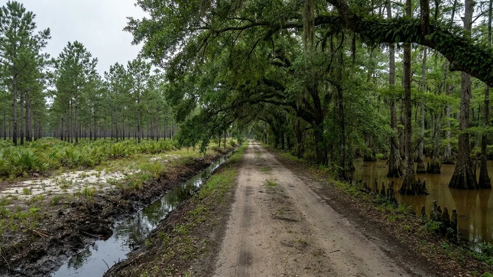
Flat South Carolina pine flatwoods with a loblolly plantation in straight rows, a blackwater cypress swamp margin, a water-filled roadside ditch and a shallow Carolina bay depression.
Colleton County One statewide code, county design maps

Barndominium Builders in Colleton County, SC

This is the page for the person who has spent a year looking for land near Charleston and keeps finding subdivisions. Colleton County holds 167,546 acres in farms inside a 676,166-acre county — 24.8 percent — and 106,404 of those farm acres are woodland, which is what an ACE Basin timber and hunting tract looks like in the agricultural statistics. Walterboro sits on I-95 at the county's centre, under an hour from downtown Charleston, and the parcels are real: 187 operations between 10 and 49 acres and 178 between 50 and 179. Two things shape a build here more than anything else. First, the Building Codes Council's own Colleton County sheet carries 130 and 140 mph wind contours and seismic design category labels C, D0 and D1 — so part of this county sits in the band where the residential code's seismic chapter switches on for a detached house and part does not, and the county's own construction drawing requirements say a site above 110 mph "must be Engineered." Second, the ground is wet. Of the 587,786 acres the soil survey classifies here by drainage, 6,772 — one and two-tenths percent — are rated well drained. The septic evaluation is the gate on a Colleton parcel, and it comes before everything else.

Colleton County at a glance

County
Colleton County
Population
39,382

Building conditions in Colleton County

The building code is the same in every South Carolina county: S.C. Code § 6-9-10(A) requires each municipality and county to enforce the Building Codes Council's codes and to enforce only those, and SC Regulation 8-236(C) bars a local jurisdiction from writing one of its own. The design numbers are not local either, but they are not one number for the state — Regulations 8-1202 and 8-1203 send wind and seismic to the Council's own map for this county, and those maps are drawn as contours, so the figure is read at your address rather than off a county name. What is genuinely local is who issues the permit and inspects the work, what that office charges, the permit procedure it adopted by ordinance, whether your parcel is zoned at all, and the rest of Table R301.2 — frost depth, termite probability and flood — which the jurisdiction fills in for itself.

Build conditions for Colleton County , South Carolina : design wind speed The Building Codes Council's Colleton County sheet, Colleton 15(Mays).pdf, carries wind contours labelled 130 MPH and 140 MPH and seismic design category labels C, D0 and D1 across the county. BUILD CONDITIONS COLLETON COUNTY…Colleton CountyONE STATEWIDE CODEDESIGN WIND SPEEDThe Building Codes…Reg 8-1202 and 8-1203 (modifications IRC 2021-04 and IRC 2021-05) replace the IRC's own wind andseismic figures with the Council's previously published county maps. Colleton is one of the 35…ZONING · RD-1 (RURAL DEVELOPMENT-1)1 acre (43,560 sq ft), one dwelling…Nine base districts adopted May 2022 under Ord. No. 22-O-05 provideland use regulation throughout the county. RD-1 sets 100 ft minimum…WHO ISSUES THE PERMITColleton County Planning and Develop…31 Klein Street, third floor, Harrelson Building, P.O. Box 98,Walterboro SC 29488; 843-549-1709, inspection line 843-549-1844. Th…
Build conditions for Colleton County, drawn from the sourced facts on this page. Every figure above is cited in the quick-facts panel below, with its source and vintage.
The Council's Colleton County map: 130 and 140 MPH contours, seismic C, D0 and D1
South Carolina is the only state where the State itself publishes per-county design criteria. Regulations 8-1202 and 8-1203 replace IRC sections R301.2.1 and R301.2.2.1 with "the previously published maps by the South Carolina Building Codes Council," and Colleton is one of 35 counties with a map — eleven have none. Its sheet, Colleton 15(Mays).pdf, carries wind contours labelled 130 MPH and 140 MPH and seismic design category labels C, D0 and D1 repeated across the county. Colleton County links that sheet from its own Building Code Administration page as the "Wind & Seismic Map for Colleton County," so this is not an outside document imposed on the county — it is the map the county's Chief Building Official points the public at. The sheet's note says how to read it: "Wind speed, shown in miles per hour, applies at all points along the length of its corresponding (blue) line. Interpolation between wind speed lines is determined by the AHJ as permitted by Figure R301.2(4)(A) of the 2015 International Residential Code." So Colleton County does not have a wind number and does not have a seismic category. It has contours, and the value at your parcel is the one read off the map at your parcel.

SC Building Codes Council, Wind/Seismic Maps, https://llr.sc.gov/bcc/maps.aspx, and the Colleton County sheet at https://llr.sc.gov/bcc/PDFfiles/WSMaps/Colleton%2015(Mays).pdf (3,917,212-byte application/pdf, text layer extracted with pdftotext -layout and read 5 Sep 2026); the county's own link to the map is on Colleton County Planning & Development, Building Code Administration, https://www.colletoncounty.org/planning-development/building-code-administration ; Regulations 8-1202 and 8-1203, 2021 Code Modifications, S.C. State Register Vol. 46 Issue 5, 27 May 2022, https://llr.sc.gov/bcc/PDFfiles/2021-Code-Modifications.pdf

The county's own drawing requirements: above 110 MPH it "must be Engineered"
Colleton County publishes a three-page Construction Drawing Requirements sheet for a new residence, and its general requirements list four items: "All plans must be site specific," "No reverse plans," "Wind Load (If site exceeds 110 MPH must be Engineered)," and "Seismic Zone." Put that beside the Council's map for this county — 130 and 140 mph contours — and the arithmetic is not close: there is no part of Colleton County below 110 mph, so on the county's own form every new residence here is an engineered building. The same sheet adds a second trigger that catches post-frame and pier construction directly: "Piers, columns, and wood piles must be Engineered design." It also asks the drawings to show anchor bolt size, length, depth of embedment and spacing, hold-down anchors at all openings, shear walls on all four elevations, girder connection to the foundation walls, and lumber species, grade, size and spacing throughout. This is not a county that accepts a supplier's brochure drawing. And it lines up with what the county has adopted: its Building Code Administration page lists the 2021 I-codes with South Carolina modifications, the 2020 NEC, the 2009 IECC, NFPA 101 and — unusually explicit for a South Carolina county — the "Standard for Residential Construction in High-Wind Regions ICC 600—2008 Edition," which is one of the four alternatives SC Residential Code R301.2.1.1 names where wind design is required.

Colleton County Planning & Development, "Construction Drawing Requirements," https://www.colletoncounty.org/sites/default/files/uploads/images/PlanningDev/bc_construction-drawing-reqmts.pdf ; adopted code list and staff from Colleton County Building Code Administration, https://www.colletoncounty.org/planning-development/building-code-administration ; Residential Construction Checklist (effective version 11/01/2022), https://www.colletoncounty.org/sites/default/files/uploads/planning_dev/Checklists/2023-residential-construction-checklist.pdf (all read 5 Sep 2026); SC Residential Code § R301.2.1.1 as rendered at https://up.codes/viewer/south_carolina/irc-2021/chapter/3/building-planning

In part of this county the seismic chapter switches on, and it starts at the footing
SC Residential Code R301.2.2 applies the code's seismic provisions to detached one- and two-family dwellings in Seismic Design Categories D0, D1 and D2. Most of South Carolina — the Midlands, the Pee Dee, the Upstate — sits at B or C and never picks the chapter up. Colleton's map carries all three of C, D0 and D1, which is precisely why the contour matters rather than a county-wide label: a parcel that reads C is outside the chapter and a parcel that reads D0 or D1 is inside it. Inside it, R403.1.2 requires exterior walls to be "supported by continuous solid or fully grouted masonry or concrete footings," with other footing systems "designed in accordance with accepted engineering practice," and extends that requirement to required interior braced wall panels in buildings "with plan dimensions greater than 50 feet" — which is most barndominiums. R403.1.3 adds minimum footing and stem-wall reinforcement in the same categories, and R403.1.6.1 adds plate washers on anchor bolts along every required braced wall line. Then R301.2.2.6 lists eight irregularity conditions that put a structure outside the prescriptive provisions altogether in C, D0, D1 and D2, and four of them describe the barndominium form: a floor or roof section not laterally supported on all edges, an opening exceeding the lesser of 12 feet or half the least dimension, vertically offset floor portions, and braced wall lines that do not occur in two perpendicular directions. South Carolina then defines the escape hatch: modification IRC 2021-01 added "accepted engineering practice" to R202 as design "made with accepted design standards by a South Carolina licensed Architect or Engineer as permitted by existing state law." Note the State named in that sentence.

2021 South Carolina Residential Code §§ R301.2.2, R301.2.2.6, R403.1.2, R403.1.3, R403.1.6.1, read at https://up.codes/viewer/south_carolina/irc-2021/chapter/3/building-planning and https://up.codes/viewer/south_carolina/irc-2021/chapter/4/foundations, 5 Sep 2026 — a third-party rendering of the adopted South Carolina code; SCBCC 2021 Modification Index, modification IRC 2021-01, https://llr.sc.gov/bcc/PDFfiles/2021-Modification-index.pdf

A detached shop here may never be taller than the house
This is the rule that decides the shape of a Colleton barndominium, and it is one line of the zoning ordinance: "Accessory structures shall be located within the buildable area on the same lot as the principal structure and observe the height limits for the district where they are located, but in no instance exceed the height of the principal structure." A 40-foot district ceiling is generous; the height of your own house is not, and a 16-foot eave shop beside a single-storey dwelling is the case that fails. There is no square-footage cap in the ordinance to worry about, but there are three placement rules that reward acreage. Farm structures up to 5,000 square feet on parcels of two acres or more in RC-1, RC-2, RD-1 and RD-2 may sit as close as 150 feet to the front property line; "otherwise, no accessory structure may be located in a front yard." In RD-1 and RD-2 only, accessory structures of any size on agricultural properties of five acres or more may go in the front yard between the dwelling and the road, no closer than 50 feet to the front line, if screened by a natural landscaped buffer with the opacity of a solid wall, concealing the structure from the right-of-way and from any dwelling within 300 feet on abutting land. Accessory buildings must stand at least five feet from the principal or any other accessory structure, and — except on land used for agriculture — an accessory structure may not be placed on the lot before the principal structure. The clean way round all of it is the same as everywhere: if the shop and the living space are one continuous building, it is the dwelling, not an accessory structure, and single-family detached residential is a permitted use by right in RD-1.

Colleton County Code Title 14 (Land Management), Chapter 14.08 (Zoning) §§ 14.08-2.010(D)(2)(f), 14.08-2.050(B)(1)(v), 14.08-3.020(A)(4)–(A)(9) (Ord. No. 22-O-05, § 2, 3 May 2022), as published by the county in "Zoning District Regulations Update," https://www.colletoncounty.org/sites/default/files/uploads/planning_dev/2023%20Ordinance%20Update/zoning-district-regs-update-current-final.pdf (2,890,878-byte PDF, text extracted and read 5 Sep 2026; document header "Colleton County, South Carolina, Code of Ordinances … (Supp. No. 8)"), linked from https://www.colletoncounty.org/planning-development/zoning-administration

Colleton's farm-structure affidavit says the power gets disconnected if you live in it
Every state in this series has a farm-building myth attached to it. Colleton County is the only jurisdiction in this research where the county has printed the consequence on the form you sign. Its "Farm & Accessory Use Structure Non-Conversion Affidavit" has the owner affirm the structure is built as an accessory structure — garage, shed, barn, storage, greenhouse, shop, carport, boat house, pool house or farm structure — and then states: "Should this structure be used for any purpose other than a simple accessory structure to support a farm or home as defined above, and where it is found instead to be used as a principal use, such as: residential dwelling; commercial use; industrial use; place of assembly; or any other non-approved accessory structure use, the electric power to the structure shall be disconnected, and the property owner could be fined up to $500.00 and serve up to 30 days in jail in accordance with Colleton County Codes, Chapter 13.04 — Buildings and Construction, Section 13.04.010 (H), and, Section 13.04.010 (I), where each day's violation of any provision of the construction code shall constitute a separate offense." The affidavit is signed "pursuant the provisions of SC Code of Laws, Section 6-9-65." The county's Farm Structure checklist sets out the two tiers behind it: a farm structure under 5,000 square feet needs only a hand-drawn sketch with dimensions, a site plan and the signed affidavit, and "No inspections will be performed on the structure"; a farm structure greater than 5,000 square feet, "or with bathroom regardless of size," needs building plans stamped by an engineer, a septic permit if applicable, and all inspections. Read those two tiers together and the design of the rule is obvious — the moment a building has plumbing in it, the county stops treating it as a barn.

Colleton County Planning and Development, "Farm & Accessory Use Structure Non-Conversion Affidavit," https://www.colletoncounty.org/sites/default/files/uploads/planning_dev/Affidavits/2023-farm-accessory-structures-affidavit.pdf ; "Farm Structure Requirements and Checklist" (last updated 4/20/2022), which reprints S.C. Code § 6-9-65 in full, https://www.colletoncounty.org/sites/default/files/uploads/planning_dev/Checklists/2022-colleton-county-farm-structure-checklist.pdf (both read 5 Sep 2026); S.C. Code § 6-9-65, https://www.scstatehouse.gov/code/t06c009.php

167,546 acres in farms, 106,404 of them woodland — and 1.2 percent of the county rated well drained
USDA's 2022 Census of Agriculture records 575 farms on 167,546 acres in Colleton County, averaging 291 acres and covering 24.8 percent of a 676,166-acre county — the number of farms up 25 percent since 2017 while the acreage held flat and the average holding fell 20 percent — land being split rather than lost, which is the opposite direction from most of the state. The composition is the tell: 106,404 acres of that is woodland against 31,450 acres of cropland and 5,405 of pasture. This is timber and hunting ground in the ACE Basin, not row-crop country, and the parcels come up in buyable sizes — 187 operations of 10 to 49 acres and 178 of 50 to 179, so 63 percent of the county's farms are under 180 acres. Now the constraint. A query of the USDA soil survey for Colleton County returns, across the 587,786 acres it classifies by drainage, 188,149 acres poorly drained (32.0 percent), 133,869 somewhat poorly drained (22.8 percent) and 130,813 very poorly drained (22.3 percent) — and 6,772 acres, one and two-tenths percent of the county, rated well drained. The dominant components are Lynchburg at 49,583 acres, Rains at 47,375, Goldsboro at 39,368, Pelham at 32,722 and Argent at 30,529. On ground like that the seasonal high water table, not the acreage and not the price, is what decides whether a tract will take a house.

USDA NASS 2022 Census of Agriculture County Profile, Colleton County, South Carolina, https://www.nass.usda.gov/Publications/AgCensus/2022/Online_Resources/County_Profiles/South_Carolina/cp45029.pdf ; U.S. Census Bureau, Vintage 2025 county population estimates, https://www2.census.gov/programs-surveys/popest/datasets/2020-2025/counties/totals/co-est2025-alldata.csv ; drainage-class and component acreage from USDA-NRCS Soil Data Access, survey area SC029 (Colleton County, South Carolina), tabular query posted to https://SDMDataAccess.sc.egov.usda.gov/Tabular/post.rest 5 Sep 2026 (all read 5 Sep 2026)

Also worth knowing before you build in Colleton County

The districts: RD-1 at an acre, RC-1 at five, and what each is for
Colleton adopted a new set of zoning regulations in May 2022, and the ordinance establishes nine base districts "to provide comprehensive land use regulations throughout the county." Four of them carry rural land, and they are not interchangeable. Rural Development-1 (RD-1) was established "to conserve, sustain, and protect rural areas and resources, particularly agricultural/farm lands and areas of high flood potential": minimum lot one acre (43,560 sq ft), one dwelling per acre, 100 feet of lot width, 25-foot front, 10-foot side, 20-foot rear, 40-foot maximum height, with single-family detached residential a permitted use and accessory structures a conditional use approved administratively. RD-2 is the same envelope on a half acre (21,780 sq ft) at two dwellings per acre with 80 feet of width. Resource Conservation-2 (RC-2) takes an acre but pushes the yards out to 35/20/50 with 100 feet of width. Resource Conservation-1 (RC-1) is the restrictive one, and its stated purpose names the reason: it "was established to protect fragile wetlands, marshes, beaches, sand dunes, rivers, creeks, islands, and other natural resources critical to the ecosystems within the ACE Basin. This is the most restrictive zoning district in the county and requires large lot development." RC-1 is five acres minimum, one dwelling per five acres, 150 feet of width and 35/20/50 yards. A general provision worth knowing before you plan: any combination of not more than two single-family detached or manufactured dwellings and their customary accessory structures may be erected on one lot, provided the lot area and setbacks are met for both.

Colleton County Code Title 14, Chapter 14.08 §§ 14.08-2.010(D)(1)(d), 14.08-2.020, 14.08-2.030, 14.08-2.040, 14.08-2.050, 14.08-2.060 (Ord. No. 22-O-05, § 2, 3 May 2022), https://www.colletoncounty.org/sites/default/files/uploads/planning_dev/2023%20Ordinance%20Update/zoning-district-regs-update-current-final.pdf ; Colleton County Zoning Administration, https://www.colletoncounty.org/planning-development/zoning-administration (both read 5 Sep 2026)

Colleton is on the coastal-zone list by statute, and its own ordinance already draws the Critical Line
S.C. Code § 48-39-10(B) defines the coastal zone and names it: "These counties are Beaufort, Berkeley, Charleston, Colleton, Dorchester, Horry, Jasper, and Georgetown." A closed list of eight, Colleton on it, settled by statute rather than by looking at a map. What the listing triggers is Coastal Zone Consistency review — SCDES's Bureau of Coastal Management reviews within the eight coastal counties, and SCDES states that a construction stormwater permit for one to two disturbed acres in one of the eight must be accompanied by a Coastal Zone Consistency determination, which a house pad, a shop pad, a drive and a septic field will reach on a rural build sooner than people expect. The Critical Area permit is different: § 48-39-10(J) defines the critical area as coastal waters, tidelands, beaches, and the beach/dune system "which is the area from the mean high-water mark to the setback line as determined in Section 48-39-280." Colleton's ocean frontage is the Town of Edisto Beach, an incorporated municipality with its own permitting at the county's southeastern tip; SCDES groups Edisto Beach and Edingsville Beach in the "Greater Edisto Area" for the 2024–2028 beachfront jurisdictional line review, whose Phase II lines had not been proposed when this page was written. Everywhere else in the county the critical area arrives as tidelands and coastal waters — the tidal Ashepoo, Combahee and Edisto — not as beach and dune. Colleton's own zoning ordinance already carries that distinction: it sets accessory-structure rules for "Waterfront properties with or without an OCRM Critical Line," requiring 30 feet from the Critical Line or the rear property line, and separately imposes a riparian buffer of not less than 30 feet or one-third the depth of the parcel, whichever is less, along all streams, rivers and shorelines, measured from the mean high tide line on tidal water. Inland acreage at Smoaks, Islandton, Ruffin or Lodge does not become critical area because the county is on the statutory list.

S.C. Code § 48-39-10(B) and (J), served text read at https://www.scstatehouse.gov/code/t48c039.php 5 Sep 2026; SCDES Coastal Zone Consistency Certification, https://des.sc.gov/programs/bureau-coastal-management/coastal-zone-consistency-certification ; SCDES stormwater, 1 to 2 Acres of Land Disturbance, https://des.sc.gov/programs/bureau-water/stormwater/stormwater-construction-activities/1-2-acres-land-disturbance ; SCDES State Beachfront Jurisdictional Lines, https://des.sc.gov/programs/bureau-coastal-management/beachfront-management/state-beachfront-jurisdictional-lines ; Colleton County Code §§ 14.08-3.020(A)(7) and 14.08-4.040(A), https://www.colletoncounty.org/sites/default/files/uploads/planning_dev/2023%20Ordinance%20Update/zoning-district-regs-update-current-final.pdf ; municipal status of Edisto Beach from U.S. Census Bureau, 2020 place-by-county file for South Carolina, https://www2.census.gov/geo/docs/reference/codes2020/place_by_cou/st45_sc_place_by_county2020.txt

Flood: base flood elevation plus one foot, a Class 7 CRS rating, and no exemption for the shop
Colleton County administers Chapter 13.12 of its code as the Flood Damage Prevention Ordinance and provides services inside the Special Flood Hazard Areas — Zones A, AE and VE — mapped by FEMA. Three things from the county's own floodplain page bear directly on a barndominium. First, the elevation: asked what regulations apply to construction in a flood hazard area, the county answers that "generally, residences or mobile homes will have to be elevated from the ground to a minimum height, known as the Base Flood Elevation plus one foot." Second, the scope: "Accessory buildings or sheds are not exempt from flood regulations," so the shop is in the same regime as the house, and permits are required for "all types of development in the floodplain, not just for the construction of buildings" — including placing fill. Third, the insurance: the county participates in FEMA's Community Rating System and "is currently rated as a Class 7 community; therefore, residents receive a 15% premium reduction," which is a real number on a thirty-year cost of ownership in a county where flood zones are common. An Elevation Certificate completed by a South Carolina registered surveyor, engineer or architect is the key document, and the county keeps them on file. On the substantial-damage side, a structure damaged to 50 percent or more of its pre-damage market value "must be repaired to meet the same construction requirements as a new building, including elevation requirements" — and that includes damage of any origin, fire and wind as well as flood.

Colleton County Planning & Development, Floodplain Management, https://www.colletoncounty.org/planning-development/floodplain-management (read 5 Sep 2026); Ordinance 22-O-04 amending Title 13 — Buildings and Construction, Chapter 13.04 Construction Codes Adopted, Chapter 13.12 Flood Damage Prevention, Chapter 13.16 Manufactured Homes and Chapter 13.20 Uniform Ordinance Summons, listed at https://www.colletoncounty.org/alert/2022-planning-and-development-code-updates

What the county wants in the folder, and the order it wants it in
Colleton County runs a two-step sequence and doing it out of order costs weeks. Step one on the Residential Checklist is the zoning permit and, if applicable, the floodplain development permit, together with the Restrictive Covenants form and the wetlands notification. Step two is the building permit application and the residential checklist itself. The county requires a zoning permit for new construction and also "for construction of accessory structures like sheds, fences, barns, etc." With the building application it wants two sets of detailed plans referencing ICC 600-2008, a copy of the permit to construct or the final septic tank permit from the state, a copy of the recorded plat (or a deed where no plat exists), a scaled site or plot plan, an elevation certificate for anything in a FEMA flood zone, the tax map number, a REScheck compliance certificate, the heated and unheated square footage with the seismic and wind requirements, and the 911 address posted on site in four-inch reflective numbers before work begins. Accessory structures are split at a threshold that is lower than most people expect: 225 square feet or less needs a zoning permit, the restrictive covenants form and the non-conversion affidavit; 226 square feet or more adds a building permit application and two sets of detailed plans. Final septic approval and a termite certificate are required before permanent power. Planning and Development is at 31 Klein Street, third floor of the Harrelson Building, Walterboro.

Colleton County Planning and Development, Residential Construction Checklist, effective version 11/01/2022, https://www.colletoncounty.org/sites/default/files/uploads/planning_dev/Checklists/2023-residential-construction-checklist.pdf ; Construction Drawing Requirements, https://www.colletoncounty.org/sites/default/files/uploads/images/PlanningDev/bc_construction-drawing-reqmts.pdf ; Building Permit Application, https://www.colletoncounty.org/sites/default/files/uploads/planning_dev/2019-current-building-permit-application.pdf ; "When do I need a zoning permit?", https://www.colletoncounty.org/faq/when-do-i-need-zoning-permit ; office address from https://www.colletoncounty.org/planning-development/building-code-administration (all read 5 Sep 2026)

Six houses for the family on one lot, if the density and the setbacks close
Family land moves differently here than in a county that only offers a subdivision plat. Colleton's zoning ordinance provides for a family group development: up to six dwelling units occupied by family members "related by blood, marriage, or adoption on a single lot of record," without subdividing at all. The conditions are arithmetic rather than discretionary. The six-unit maximum applies only if the dwelling-units-per-acre density and the setbacks for every unit comply with the district — which in RD-1, at one dwelling per acre, means six acres and six full setback envelopes. Each unit must stand at least 15 feet from any other and be reached by a driveway at least 15 feet wide for emergency vehicles. A notarised family group development declaration has to be recorded at the register of deeds stating that all residents on the lot are related by blood, marriage or adoption and that the land will not be subdivided in future unless the zoning and land development chapters are satisfied. Anything beyond six units needs a special exception, and it can only be requested if the lot has the acreage for all six to comply anyway. Separately, every new lot in the county must front a public road, private road or private access easement with at least 30 feet of frontage on it.

Colleton County Code §§ 14.08-3.020(N) and 14.08-2.010(D)(1)(c) (Ord. No. 22-O-05, § 2, 3 May 2022), https://www.colletoncounty.org/sites/default/files/uploads/planning_dev/2023%20Ordinance%20Update/zoning-district-regs-update-current-final.pdf (read 5 Sep 2026)

Septic in Colleton is a soil question, and the state answers it
The county's checklist asks for a state septic permit before it issues a building permit, and the permit itself is SCDES's, not the county's. South Carolina reads soil morphology rather than running a percolation test: R.61-56 sets site suitability from texture, restrictive horizons and depth to the zone of saturation, and § 61-56.200.2 states that soils "exhibiting massive or platy structure, and soils which have been identified as having substantial amounts of expansible layer clay minerals or smectites, are unsuitable for onsite wastewater systems" — unsuitable outright, not merely expensive. On Colleton's ground the binding factor is usually water rather than clay: with only 1.2 percent of the classified acreage rated well drained and 54 percent poorly or very poorly drained, the seasonal high water table is what the evaluator is looking for. § 61-56.200.7 then requires a usable repair area of at least 50 percent of the original system, on soil proven suitable — so a parcel has to hold the system, its whole setback envelope and a proven reserve, none of it under the drive, the shop or the pool. You can wait for the Department to do the evaluation or hire a licensed Professional Soil Classifier privately and file the soil report with the application. Two more constraints: SCDES will not issue an onsite wastewater permit where public sewer is accessible, which catches edge-of-Walterboro acreage; and the geometry has to close on a private well, at 75 feet from the septic system and 50 feet from any barn or stable.

S.C. Regulation 61-56, Onsite Wastewater Systems, §§ 61-56.102, 61-56.200.2, 61-56.200.7, https://des.sc.gov/sites/des/files/Library/Regulations/R.61-56.pdf (4,282,530-byte PDF, text extracted and read 5 Sep 2026); SCDES Professional Soil Classifiers, https://des.sc.gov/permits-regulations/septic-tanks/professional-soil-classifiers ; the county's own sequencing requirement is on its Residential Construction Checklist, https://www.colletoncounty.org/sites/default/files/uploads/planning_dev/Checklists/2023-residential-construction-checklist.pdf

An excavator grading a compacted building pad on a cleared lot, with orange clay in the cut face, survey stakes and a drainage swale.
Below the slab

The expensive surprises are in the ground, not the building

What moves a South Carolina budget is usually below grade, and more often than not it is the drainfield rather than the foundation. R.61-56 § 200.1 settles whether a parcel can take an onsite system from soil morphology — texture, structure, depth to a restrictive horizon and depth to the zone of saturation — and § 200.2 then rules out two conditions outright: soils exhibiting massive or platy structure, and soils with substantial amounts of expansible layer clay minerals or smectites. That second clause is the one that bites on the mafic Piedmont, where the shrink-swell series sit in quantity under York, Fairfield, Chester, Laurens, Union, Newberry, Greenwood, McCormick, Lancaster, Saluda, Abbeville and Edgefield. A foundation problem has a price and an answer; an unbuildable septic parcel has neither, which is why we look at it first. Bedroom count is the number to settle early, because § 61-56.501 drives design flow from bedrooms, design flow drives trench length, and trench length plus a repair area decides how much good soil the parcel has to have — shop square footage adds nothing to it. Above the Fall Line the evaluation is done in backhoe pits rather than borings alone, so the answer comes from a dug hole and not a form. The site work, the foundation and the drainfield therefore get resolved together rather than one at a time. We price the dirt before we price the building.

What a build looks like

Three stages every Colleton County project passes through, from a raw parcel to a finished home. Site work first, because that is where the budget is decided.

Aerial view of an undeveloped rural lot with cleared rough grass, planted pine along one boundary, and a red dirt access track cut through orange clay.
Stage one

The parcel

Zoning, setbacks, flood zone and utility access get checked before anything is drawn.

An excavator grading a compacted building pad on a cleared lot, with orange clay in the cut face, survey stakes and a drainage swale.
Stage two

Pad and permit

Clearing, grading and a compacted pad, while the submittal works through whichever office issues the permit where you are building.

A finished barndominium at dusk with warm interior lighting glowing through its large windows.
Stage three

Frame to finish

Shell erected and dried in, then systems, insulation and interior finish through to CO.

Those are the rules where you are building in Colleton County. Tell us what you want to build and we will draw it to them.

Nearby areas we build in

Others we cover nearby. One may be a county and another a municipality inside one — and a South Carolina municipality can sit in two counties at once — so the office that issues the permit, the fees it charges, whether the land is zoned at all, and which design map covers it can all differ from one card to the next.

Building in Colleton County: common questions

9 questions we get asked most often about building in Colleton County. If yours is not on the list, ask it directly.

I want to build near Charleston but there is no land left. Is Colleton really the answer?
It is the closest county to Charleston that still has open ground in quantity, and the figures are unambiguous. Charleston County is 6.6 percent farmland and took 175 net domestic migrants in the year to July 2025; the demand has physically moved to Berkeley and Dorchester, and the open land is one county further out. Colleton holds 167,546 acres in farms across a 676,166-acre county — 24.8 percent — and the number of farms here is up 25 percent since 2017 while the acreage itself held flat and the average holding fell 20 percent — subdivision rather than loss, against the statewide trend. The character of it matters as much as the quantity: 106,404 of those farm acres are woodland, which is the ACE Basin timber and hunting tract, not a cleared field. Walterboro sits on I-95 at the middle of the county, roughly fifty minutes from downtown Charleston, with Cottageville, Ruffin, Smoaks, Islandton, Lodge and Williams around it. Parcel sizes are workable — 187 operations of 10 to 49 acres and 178 of 50 to 179 acres, so 63 percent of the county's farms sit under 180 acres. What you are trading for the price is drainage and distance, and the drainage is the part to take seriously before you make an offer.
What wind speed and seismic category apply on my parcel?
Both come from a map the South Carolina Building Codes Council publishes for this county, and both are contours rather than county-wide labels. Regulations 8-1202 and 8-1203 replace the residential code's own wind and seismic sections with the Council's previously published county maps; those exist for 35 of the 46 counties and Colleton is one of them. The Colleton sheet carries wind contours labelled 130 MPH and 140 MPH, and seismic design category labels C, D0 and D1. The county links that same sheet from its own Building Code Administration page, so it is not an outside document — it is the map the Chief Building Official points people at. How to read it is printed on the map: a wind speed "applies at all points along the length of its corresponding (blue) line," and "Interpolation between wind speed lines is determined by the AHJ as permitted by Figure R301.2(4)(A) of the 2015 International Residential Code." The seismic spread is the more consequential half, because the residential code applies its seismic provisions to a detached dwelling only at D0, D1 and D2 — so one Colleton parcel can be outside that chapter and another inside it. Get both readings from the Colleton County building official in writing, for your tax map number, before anyone orders steel or trusses.
Do I really need an engineer, or can I build from a plan set the building supplier sends?
In Colleton County you need the engineer, and the county says so on its own form rather than leaving it to interpretation. Its Construction Drawing Requirements sheet for a new residence lists among the general requirements: "All plans must be site specific," "No reverse plans," and "Wind Load (If site exceeds 110 MPH must be Engineered)." The Council's map for this county carries 130 and 140 mph contours, so no part of Colleton sits below that threshold. The same sheet also says "Piers, columns, and wood piles must be Engineered design," which reaches straight into how most post-frame and elevated coastal buildings are founded. And where the map reads D0 or D1 rather than C, the residential code's seismic chapter comes in on top: continuous footings under exterior walls and under required interior braced wall panels on buildings over 50 feet in plan dimension, footing and stem-wall reinforcement, plate washers along every braced wall line, and R301.2.2.6's eight irregularity conditions that push most open-plan shop-plus-house layouts out of the prescriptive provisions altogether. South Carolina then defines the way out narrowly: "accepted engineering practice" means design by a South Carolina licensed architect or engineer. An out-of-state seal is not what the definition asks for, and a manufacturer's stock drawing is a starting point for that engineer rather than a substitute.
Can the shop be bigger than the house? Taller?
Bigger, generally yes. Taller, no — and that is the rule that reshapes barndominium plans in this county. Colleton's zoning ordinance provides that an accessory structure must sit within the buildable area on the same lot as the principal structure and observe the district height limits, "but in no instance exceed the height of the principal structure." The RD-1 and RC districts allow 40 feet, which sounds generous until you notice that your own single-storey house, not the district, becomes the ceiling. There is no square-footage cap in the ordinance to fight, but placement rules apply: except on agricultural land an accessory structure may not go up before the principal structure; accessory buildings must stand at least five feet from the dwelling and from each other; and no accessory structure may sit in a front yard, with two exceptions that reward acreage — a farm structure up to 5,000 square feet on two acres or more in RC-1, RC-2, RD-1 or RD-2 may come as close as 150 feet to the front line, and in RD-1 and RD-2 an accessory structure of any size on agricultural land of five acres or more may go between the house and the road at 50 feet if it is screened by a natural landscaped buffer with the opacity of a solid wall. The design that avoids all of this is the obvious one: make the shop and the living space a single continuous building. Then it is not accessory to anything. It is the dwelling, single-family detached residential is permitted by right in RD-1, and the height rule has nothing to bite on.
Can I put up a farm building now and finish it into a house later?
Colleton County has printed the answer on the form you would have to sign. Its Farm & Accessory Use Structure Non-Conversion Affidavit, signed "pursuant the provisions of SC Code of Laws, Section 6-9-65," states that if the structure is found to be used as a principal use such as a residential dwelling, "the electric power to the structure shall be disconnected, and the property owner could be fined up to $500.00 and serve up to 30 days in jail" under County Code § 13.04.010(H) and (I), with each day a separate offence. The statute behind it closes the door at the definition: § 6-9-65(A) defines a farm structure as one built on a farm "other than a residence or a structure attached to it," and excludes any structure that originally qualified "but later converted to another use." So a barndominium is never a farm structure, the shop half of a shouse is not one either, and conversion pulls the whole building back under the code. The county's own checklist shows where it draws the practical line: a farm structure under 5,000 square feet needs a hand sketch, a site plan and the affidavit, with no inspections performed at all; a farm structure over 5,000 square feet "or with bathroom regardless of size" needs engineer-stamped plans, a septic permit and every inspection. Plumbing is the tell, and the county knows it. Build it as a dwelling and permit it as a dwelling.
Will the land perc? What actually decides whether I can put a house on a Colleton tract?
The septic evaluation, and it is not close. A query of the USDA soil survey for Colleton County returns 188,149 acres poorly drained, 133,869 somewhat poorly drained and 130,813 very poorly drained out of the 587,786 acres it classifies — and 6,772 acres, one and two-tenths percent, rated well drained. Lynchburg alone maps 49,583 acres here, Rains 47,375. That is flatwoods ground with a seasonal high water table close to the surface, and it is why a beautiful, cheap, wooded 20 acres can be unbuildable. South Carolina does not run a percolation test; R.61-56 reads soil morphology — texture, restrictive horizons and depth to the zone of saturation — either through SCDES staff or through a licensed Professional Soil Classifier you hire, whose report you file with the application. The regulation sets no acreage minimum, but § 61-56.200.7 requires a usable repair area of at least 50 percent of the original system, on soil proven suitable, so the parcel must carry the system, its full setback envelope and a proven reserve, none of it under the drive, the shop or a pool. Two traps: SCDES will not issue an onsite wastewater permit where public sewer is accessible, however rural the tract feels; and the county will not issue a building permit until the state septic permit is in the folder. Make the offer contingent on the soil evaluation, not on the closing.
Colleton is on the coastal-county list. Does that mean OCRM has to permit my build?
Not usually, but the listing is real and it does show up in one specific place. S.C. Code § 48-39-10(B) names the eight counties in the coastal zone and Colleton is one of them, settled by statute rather than by looking at a map. What that triggers is Coastal Zone Consistency review: SCDES's Bureau of Coastal Management reviews within the eight coastal counties, and SCDES states that a construction stormwater permit covering one to two disturbed acres in one of the eight must be accompanied by a Coastal Zone Consistency submittal. On a rural build, a house pad, a shop pad, a turnaround, a long drive and a septic field will pass an acre of disturbance sooner than most people plan for. The Critical Area permit is the other instrument and it follows a feature. § 48-39-10(J) defines the critical area as coastal waters, tidelands, beaches, and the beach/dune system, measured "from the mean high-water mark to the setback line as determined in Section 48-39-280." That last category is a beachfront thing, and Colleton's ocean frontage is the Town of Edisto Beach — an incorporated municipality with its own permitting at the far southeastern corner of the county, forty-odd miles from Walterboro. Elsewhere in Colleton the critical area arrives as tidelands and coastal waters on the Ashepoo, Combahee and Edisto. The county's own zoning ordinance already builds that in: it sets accessory-structure rules for waterfront properties "with or without an OCRM Critical Line" and requires 30 feet from that line, and it imposes a riparian buffer of not less than 30 feet or one-third of the lot depth along all streams, rivers and shorelines, measured from mean high tide on tidal water. A tract at Smoaks or Islandton is not critical area because the county is on the list.
How high does the floor have to be, and what does the flood zone cost me?
Colleton County's own answer is base flood elevation plus one foot. Its floodplain page states that under the county's flood ordinance, "generally, residences or mobile homes will have to be elevated from the ground to a minimum height, known as the Base Flood Elevation plus one foot," with non-residential buildings either elevated or flood-proofed, and significant development limits inside a floodway. Three things follow for a barndominium. First, this is a pad-and-fill decision, not a detail — on a slab-on-grade building the elevation requirement is decided before the slab is designed, and on flatwoods soil the fill volume is already the biggest earthwork number on the job. Second, the shop is not exempt: the county states plainly that "Accessory buildings or sheds are not exempt from flood regulations," and that permits are required for all development in the floodplain including placing fill. Third, the paperwork: an Elevation Certificate completed by a South Carolina registered surveyor, engineer or architect is the key document, and the county keeps them on file. On the cost side there is good news — Colleton participates in FEMA's Community Rating System and is "currently rated as a Class 7 community; therefore, residents receive a 15% premium reduction" on flood insurance. And know the 50 percent rule before you buy an existing structure to renovate: substantial damage or substantial improvement at half the market value pulls the whole building up to current standards, and substantial damage counts damage of any origin, fire and wind included.
We want to put several family houses on the land. What does Colleton allow?
More than most counties, and without subdividing. The zoning ordinance provides for a family group development of up to six dwelling units occupied by people "related by blood, marriage, or adoption on a single lot of record." The conditions are arithmetic: the six-unit maximum applies only where the density in dwelling units per acre and the setbacks for every unit comply with the district, so in RD-1 at one dwelling per acre that means six acres and six complete setback envelopes; each unit must stand at least 15 feet from every other; and each must be reached by a driveway at least 15 feet wide so emergency vehicles can get in. A notarised family group development declaration is recorded at the register of deeds stating that all residents are related and that the land will not be subdivided in future unless the zoning and land development chapters are met. Beyond six units you need a special exception, and it can only be requested if the lot could have carried all six compliantly anyway. Separately, the general provisions allow any combination of not more than two single-family detached or manufactured dwellings and their customary accessory structures on one lot where the area and setbacks are met for both — which is the simpler route for a main house plus one. And every new lot must front a public road, private road or private access easement with at least 30 feet of frontage.

Building in Colleton County?

Start with the plan. Tell us what you want to build and we will draw it, then confirm which office issues the permit for your parcel, what it will let you put there, and what wind load it has to meet. That conversation costs nothing.