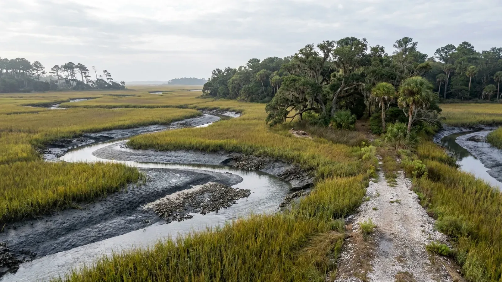
A South Carolina salt marsh at low tide with a winding tidal creek and exposed pluff mud banks, backed by live oaks hung with Spanish moss and cabbage palmetto.
Charleston County One statewide code, county design maps

Barndominium Builders in Charleston County, SC

This page exists to route you somewhere else, and the county's own numbers are the reason. Charleston County is 6.6 percent farmland, the lowest share of any county in South Carolina, and in the year to July 2025 it took 175 net domestic migrants while Berkeley took 6,830 and Dorchester 2,906. The market has physically moved inland. What is still worth knowing before you buy anywhere in the Lowcountry is what unincorporated Charleston County does to this building type, because the rules here are the strictest version of what you will meet one county over. The county's zoning ordinance puts a 50-foot setback and a 35-foot vegetated buffer against the OCRM critical line in every rural district, measured from that line even when it falls on somebody else's land. Its rural density ladder starts at one dwelling per 25 acres. Its accessory-structure rule turns on a four-foot connector at a four-to-one length-to-width ratio, which is the sentence that decides whether a shop and a house are one building or two. And the Building Codes Council's map for this county is a contour sheet carrying two wind lines and four seismic categories, so there is no single Charleston County number for anyone to quote at you. If what you want is acreage, the honest answer is Berkeley, Dorchester and Colleton, and the pages for all three are a click away.

Charleston County at a glance

County
Charleston County
Population
436,200

Building conditions in Charleston County

The building code is the same in every South Carolina county: S.C. Code § 6-9-10(A) requires each municipality and county to enforce the Building Codes Council's codes and to enforce only those, and SC Regulation 8-236(C) bars a local jurisdiction from writing one of its own. The design numbers are not local either, but they are not one number for the state — Regulations 8-1202 and 8-1203 send wind and seismic to the Council's own map for this county, and those maps are drawn as contours, so the figure is read at your address rather than off a county name. What is genuinely local is who issues the permit and inspects the work, what that office charges, the permit procedure it adopted by ordinance, whether your parcel is zoned at all, and the rest of Table R301.2 — frost depth, termite probability and flood — which the jurisdiction fills in for itself.

Build conditions for Charleston County , South Carolina : design wind speed The Building Codes Council's approved sheet for Charleston County, Charleston 15(Mays).pdf, is a contour map. Its labels are 140 MPH and 150 MPH for wind and C, D0, D1 and D2 for seismic design category — the widest span on any single county sheet in the state. There is therefore no such thing as "the Charleston County wind speed": the figure at a parcel is the figure read off the map at that parcel.. BUILD CONDITIONS CHARLESTON COUNTY…Charleston CountyONE STATEWIDE CODEDESIGN WIND SPEEDThe Building Codes…Regulation 8-1202 replaces IRC Section R301.2.1 with construction "in accordance with thepreviously published maps by the South Carolina Building Codes Council", and 8-1203 does the same…ZONING · RM, AG-15, AG-10, AG-8, AGR AND RR-3…1 acre in RM, AG-10 and AG-8; 3 acre…The Zoning and Land Development Regulations apply "to alldevelopment, public and private, within the unincorporated areas of…BUILDING PERMIT FEE, NEW RESIDENTIAL CONSTRUC…$655.25 for the first $100,000 of va…From the county's published permit fee schedule, given as Ordinance2386. The bands run: no fee at $1,000 or less unless an inspection…WHO ISSUES THE PERMITCharleston County Building Inspectio…Both departments are at 4045 Bridge View Drive, North Charleston, SC29405 — Building Inspection Services on 843-202-6930, Zoning and…
Build conditions for Charleston County, drawn from the sourced facts on this page. Every figure above is cited in the quick-facts panel below, with its source and vintage.
There is no "Charleston County number" — the Council's sheet is contours, and it spans four seismic categories
This is the correction to make before any other conversation about design here, because the wrong version of it is everywhere. The South Carolina Building Codes Council publishes per-county wind and seismic sheets and Regulation 8-1202 and 8-1203 substitute them for the residential code's own wind and seismic sources. The Charleston County sheet was opened and read for this page. It is a drawn contour map, and its labels are 140 MPH and 150 MPH for wind and C, D0, D1 and D2 for seismic design category — four categories and two wind lines on one county. That is the widest span on any single county sheet in South Carolina; the neighbouring Berkeley sheet carries one wind line and two categories, Colleton's carries two lines and three categories. The map answers the question itself in a note printed on its face: "Wind speed, shown in miles per hour, applies at all points along the length of its corresponding (blue) line. Interpolation between wind speed lines is determined by the AHJ as permitted by Figure R301.2(4) of the International Residential Code." So the correct sentence is never "Charleston County is 150 mph and D2" — it is "read the map at the parcel, and where the parcel falls between lines the building official interpolates." Get that reading in writing from Building Inspection Services with the address on it, because on this county's sheet the answer genuinely changes across a few miles. Ask for the wind-borne debris determination in the same letter, and be careful what you accept as an answer to it: South Carolina did not amend Section R301.2.1.2, so that boundary is a determination each jurisdiction makes in its own copy of Table R301.2 under the table's own footnote, not a state line and not a county line. Only two published South Carolina answers are on file, and neither of them belongs to this county — the City of Charleston records a Wind-borne Debris Zone of "2", which is an ASTM E1996 wind zone number rather than a yes or no, and York County records "No".

SC Building Codes Council, Charleston County wind/seismic map, https://llr.sc.gov/bcc/PDFfiles/WSMaps/Charleston%2015(Mays).pdf (41,242,594-byte PDF, downloaded and text layer extracted 6 Sep 2026); Wind/Seismic Maps index, https://llr.sc.gov/bcc/maps.aspx; 2021 Code Modifications, Regulations 8-1202 and 8-1203, https://llr.sc.gov/bcc/PDFfiles/2021-Code-Modifications.pdf; comparison sheets Berkeley 15(Mays).pdf, https://llr.sc.gov/bcc/PDFfiles/WSMaps/Berkeley%2015(Mays).pdf, and Colleton 15(Mays).pdf, https://llr.sc.gov/bcc/PDFfiles/WSMaps/Colleton%2015(Mays).pdf

Fifty feet back from the OCRM critical line — and 35 feet of untouched vegetation in front of that
This is the single most expensive line on a Lowcountry parcel and it is the county's own rule, not the state's. Article 9.7 of the Zoning and Land Development Regulations sets a table of buffers and setbacks against saltwater wetlands, waterways and the OCRM critical line. In RM, AG-15, AG-10, AG-8, AGR and RR-3 — every rural district the county has — the OCRM Critical Line Buffer is 35 feet and the setback from the critical line is 50 feet. Read the measurement clause, because it is the part that surprises people: required buffers and setbacks "shall be measured from the OCRM critical line, whether the critical line or wetland/waterway is located on, adjacent to, or near the subject parcel." A neighbour's marsh edge can therefore push your building envelope. Inside the buffer the ordinance specifically prohibits removal, excavation or disturbance of the soil beyond minimal planting, grassed lawns needing regular mowing and chemicals, and gardens, fences or structures except permitted crossings — so it is not usable yard, it is a no-go strip. The Planning Director may reduce the setback to no less than the buffer depth where necessary to accommodate reasonable development, and may relieve a parcel created before 21 April 1999 that the rules would otherwise render unbuildable; anything beyond that is a Board of Zoning Appeals matter. On a marsh-front tract, establish where the critical line actually runs before you make an offer, not after.

Charleston County Zoning and Land Development Regulations, Article 9.7 (Wetlands, Waterways and OCRM Critical Line) and Table 9.7.1.B.1, read from the ordinance published by the county at its code vendor, https://online.encodeplus.com/regs/charlestoncounty-zldr/export2doc.aspx?pdf=1&tocid=001 (full-ordinance PDF export, 34,026,694 bytes, downloaded and read 6 Sep 2026); ordinance home reached from the county's Zoning and Planning page, https://www.charlestoncounty.gov/departments/zoning-planning/index.php and https://online.encodeplus.com/regs/charlestoncounty-sc/doc-viewer.aspx

Four feet wide at a four-to-one ratio — the connector that decides whether the shop is part of the house
Every barndominium question in a zoning office comes down to whether the building is one thing or two, and unincorporated Charleston County answers it with a measurement rather than a judgment call. Article 6.5.1.B of the Zoning and Land Development Regulations defines an accessory structure as one detached from the principal structure, lists detached accessory buildings including dwellings, barns, garages, sheds and gazebos, and then provides: "If any accessory building is attached to a principal building with a roof supported by columns or walls, it shall be deemed part of the principal building provided the attachment is a minimum of 4 feet in width with a minimum length to width ratio of 4:1. In such cases, the structure shall comply with the setback requirements of the applicable zoning district." Read that as a design instruction. A breezeway four feet wide and sixteen feet long makes the shop half of a shouse part of the dwelling, judged against the district's own 50/15/30 setbacks and its 35-foot height limit — not against accessory rules. Two related provisions matter on acreage. Article 6.5.2 bars an accessory structure from going up before the permits and approvals for the principal use are in hand, so the build-the-shop-first plan does not work by default. But Article 6.5.3.K and 6.5.4 allow barns and farm-related structures on all parcels in agricultural zoning districts even where the parcel has no primary structure, with a 250-square-foot cap only on parcels of an acre or less in R-4, M-8 and M-12. That is a zoning permission about land use; it is not a building-code exemption, and the two are decided by different offices.

Charleston County Zoning and Land Development Regulations, Article 6.5 (Accessory Uses and Structures), §§ 6.5.1, 6.5.2, 6.5.3 and 6.5.4, https://online.encodeplus.com/regs/charlestoncounty-zldr/export2doc.aspx?pdf=1&tocid=001 (read 6 Sep 2026); district dimensional standards from Chapter 4, Tables 4.3.3 through 4.8.3 in the same document

The rural density ladder starts at one dwelling per 25 acres
Charleston County zones its whole unincorporated area and the rural end of that map is deliberately thin. Six base districts carry the county's rural land, and their maximum densities read as a ladder: RM, Resource Management, at one dwelling unit per 25 acres; AG-15 at one per 15; AG-10 at one per 10; AG-8 at one per 8; RR-3, Rural Residential, at one per 3; and AGR, Agricultural/Residential, at one per acre. The minimum lot areas are much smaller than those densities — 1 acre in RM, AG-10 and AG-8, 3 acres in AG-15, 30,000 square feet in AGR and RR-3 — which means the binding constraint on a big tract is the density cap, not the lot size, and a 40-acre RM parcel is a one-house parcel. RM adds a bonus of one dwelling on the residual area where lots of one to three acres are carved out of a tract of 100 acres or more. The dimensional standards are identical across all six: 50-foot front and street-side setback, 15-foot interior side, 30-foot rear, 50 feet off the OCRM critical line, building cover capped at 30 percent of the lot and height capped at 35 feet. Thirty-five feet is generous for this building type — it is the density and the buffers, not the height, that decide what fits.

Charleston County Zoning and Land Development Regulations, Chapter 4 Base Zoning Districts, Articles 4.3 (RM), 4.4 (AG-15), 4.5 (AG-10), 4.6 (AG-8), 4.7 (AGR) and 4.8 (RR-3), with Tables 4.3.3, 4.4.3, 4.5.3, 4.6.3, 4.7.3 and 4.8.3, and Article 1.4.1 on applicability, https://online.encodeplus.com/regs/charlestoncounty-zldr/export2doc.aspx?pdf=1&tocid=001 (read 6 Sep 2026)

Fifty-nine thousand people live in unincorporated Charleston County — and 175 moved into the whole county last year
Two measurements decide whether this county is a land market, and both say no. The first is jurisdictional. The Census Bureau's Vintage 2025 sub-county estimates split Charleston County's 436,200 residents across sixteen municipalities and a remainder the Bureau labels "Balance of Charleston County" — and that balance holds 59,579 people, under 14 percent of the county. North Charleston's Charleston-County portion alone is 97,111 and Mount Pleasant is 95,469. So the county's own zoning ordinance and its own building department reach roughly one resident in seven; everywhere else, a different council writes the rules. The second measurement is the market. The 2022 Census of Agriculture records 370 farms in Charleston County on 38,727 acres at an average of 105 acres, against 918.1 square miles of land — about 6.6 percent farmland, the lowest share of any county in South Carolina. And in the year to 1 July 2025 the county's net domestic migration was 175 people. Berkeley County's was 6,830 and Dorchester County's 2,906 — thirty-nine times and seventeen times over. Charleston County still grew, on births and international migration, but it is not where people moving in from elsewhere are landing, and it is not where the acreage they are buying is.

U.S. Census Bureau Population Estimates, Vintage 2025, sub-est2025_45.csv, SUMLEV 157 records for Charleston County (45019) including "Balance of Charleston County", https://www2.census.gov/programs-surveys/popest/datasets/2020-2025/cities/totals/sub-est2025_45.csv, and co-est2025-alldata.csv for POPESTIMATE2025 and DOMESTICMIG2025, https://www2.census.gov/programs-surveys/popest/datasets/2020-2025/counties/totals/co-est2025-alldata.csv (both downloaded and parsed 6 Sep 2026); USDA NASS 2022 Census of Agriculture County Profile, Charleston County, https://www.nass.usda.gov/Publications/AgCensus/2022/Online_Resources/County_Profiles/South_Carolina/cp45019.pdf; county land area from research/statewide/geography-and-population.md §1

This county fronts the Atlantic, and the state's beachfront lines here are mid-review right now
Charleston County is one of the eight counties named in the definition clause of the Coastal Tidelands and Wetlands Act, and unlike Berkeley or Dorchester it fronts the ocean — so the beachfront jurisdiction lines are live here in a way they are not one county inland. Those lines come from S.C. Code § 48-39-280: SCDES establishes a baseline for each erosion zone, normally at the crest of the primary oceanfront sand dune, and then a setback line landward of it at "forty times the average annual erosion rate or not less than twenty feet". SCDES describes the setback line as the landward extent of the state's direct permitting authority in the beach/dune system critical area. The statute requires the lines to be re-established on cycles of not less than seven and not more than ten years — and the current cycle has not reached this county yet. As at 6 September 2026 the 2024–2028 jurisdictional lines review had Phase I established and in effect from 24 July 2026 for the Beaufort-area islands, with Phase II covering the Greater Charleston area — Seabrook Island, Kiawah Island, Folly Beach, Morris Island, Sullivan's Island, Isle of Palms and Dewees Island — still without published proposed lines and without a scheduled hearing or comment period. If a parcel of yours is anywhere near the ocean side of this county, the line that governs it is going to move within the next couple of years, and § 48-39-280 gives an adversely affected landowner a review that has to be initiated by certified mail within one year of a line being established. On top of that, the county requires a V-Zone Design Certificate in V-Zones and Coastal A Zones, signed and sealed by a registered professional engineer or architect, certifying among other things that the bottom of the lowest horizontal structural member of the lowest floor sits at least two feet above the base flood elevation and that scour and erosion at the foundation have been anticipated for base flood conditions including wave action.

SCDES Bureau of Coastal Management, State Beachfront Jurisdictional Lines, https://des.sc.gov/programs/bureau-coastal-management/beachfront-management/state-beachfront-jurisdictional-lines, and the shoreline line viewer, https://gis.des.sc.gov/shoreline/, with cycle status as recorded in research/statewide/land-water-and-septic.md §3.4; S.C. Code §§ 48-39-10(B), 48-39-280(A), (B), (C) and (F), https://www.scstatehouse.gov/code/t48c039.php; Charleston County V-Zone Design Certificate for V-Zones and Coastal A Zones, https://www.charlestoncounty.gov/departments/building-inspection-services/forms/VZone-Design-Cert.pdf (PDF loaded and text extracted 6 Sep 2026)

Also worth knowing before you build in Charleston County

A Class 2 flood rating, a 40 percent insurance discount, and two feet of freeboard on the finished floor
The flood regime in the unincorporated county is stricter than the federal minimum and it pays for itself. Charleston County states on its own department page that the Federal Emergency Management Agency has rated it Class 2 in the Community Rating System under the National Flood Insurance Program, which "allows Unincorporated Charleston County residents in the Special Flood Hazard Area (SFHA) and those outside the SFHA to receive 40% discount on flood insurance premiums", and that the private insurance industry's Building Code Effectiveness Grading program has also rated the department Class 2. What earns that is the rulebook. The county's floodplain page states that "the finished floor of all new and substantially improved residential structures must be elevated to a minimum of two feet above the base flood elevation indicated on the applicable flood insurance rate map", with a flood elevation certificate on the latest form required before any inspection other than the foundation inspection. Only non-residential structures may be dry-floodproofed instead, and then only with pre-construction and as-built certificates and sealed plans from a South Carolina registered architect or professional engineer. There may be no electrical wiring, plumbing, mechanical fixtures, appliances or ductwork below two feet above base flood elevation, with a single GFCI outlet and switch excepted. Enclosed areas below base flood elevation — garages, sheds, crawl spaces — need flood control vents to FEMA's specification, at least two openings on different walls within 12 inches of grade at one square inch per square foot of enclosed area, or a written certification from a South Carolina registered architect or engineer instead. For a slab-on-grade building this is a fill-and-pad decision made before the foundation is designed, not a detail settled later.

Charleston County Building Inspection Services, https://www.charlestoncounty.gov/departments/building-inspection-services/index.php, and its Floodplain / Flood Management page, https://www.charlestoncounty.gov/departments/building-inspection-services/floodplain.php (both read 6 Sep 2026); Charleston County Flood Damage Prevention Ordinance No. 2306, adopted 13 August 2024, https://www.charlestoncounty.gov/ordinances/archived/2300-2399/2306.pdf

The coastal zone is a closed statutory list; the critical area is a feature, and the two are different questions
People conflate these constantly, and the difference decides whether you need a state permit at all. S.C. Code § 48-39-10(B) defines the coastal zone as "all coastal waters and submerged lands seaward to the state's jurisdictional limits and all lands and waters in the counties of the State which contain any one or more of the critical areas. These counties are Beaufort, Berkeley, Charleston, Colleton, Dorchester, Horry, Jasper, and Georgetown." That is a closed list of eight written into the statute — it is not something to work out from a map, and Charleston County is on it. What being on the list mainly triggers is Coastal Zone Consistency review of other state and federal permits. The critical area is a narrower and more literal thing: § 48-39-10(J) defines it as coastal waters, tidelands, beaches, and the beach/dune system from the mean high-water mark to the setback line set under § 48-39-280. It follows a physical feature, so the tidal creek at the back of a parcel can put you in it while an inland tract in the same county is nowhere near it. Under § 48-39-130 nobody may fill, remove, dredge, drain or erect any structure on, or in any way alter, a critical area without a permit from the department, and the statutory exemptions at § 48-39-130(D) do not include building a house. The practical first move on a marsh-front parcel is a Critical Area Line Request to SCDES's Bureau of Coastal Management, because the county's own 50-foot setback and 35-foot buffer are both measured from that line and neither can be located until the line is.

S.C. Code §§ 48-39-10(B), 48-39-10(J), 48-39-130 and 48-39-280, https://www.scstatehouse.gov/code/t48c039.php (served text read 6 Sep 2026); SCDES Bureau of Coastal Management, South Carolina Critical Areas, https://des.sc.gov/programs/bureau-coastal-management/south-carolina-critical-areas; Charleston County Zoning and Land Development Regulations Article 9.7, https://online.encodeplus.com/regs/charlestoncounty-zldr/export2doc.aspx?pdf=1&tocid=001

Sixteen municipalities, one county department — and a Charleston address usually means neither
Charleston County is an unusually municipal county and it changes who you talk to. The Census Bureau's Vintage 2025 sub-county file lists, inside this county, Awendaw, the Charleston County part of the City of Charleston, Folly Beach, Hollywood, Isle of Palms, James Island, Kiawah Island, part of Lincolnville, McClellanville, Meggett, Mount Pleasant, the Charleston County part of North Charleston, Ravenel, Rockville, Seabrook Island, Sullivan's Island and part of Summerville — plus the unincorporated balance. Each municipality permits inside its own limits under its own zoning ordinance; the county's Zoning and Land Development Regulations apply only "within the unincorporated areas of Charleston County". Notice which names those are: Folly Beach, Isle of Palms, Sullivan's Island, Kiawah and Seabrook are the county's beaches, and they are all incorporated, so the county's own zoning ordinance carries no beachfront overlay — that layer belongs to the towns and to SCDES, not to the county. The practical rules follow. A postal address that says Charleston, Mount Pleasant or Johns Island tells you almost nothing about jurisdiction. Check the parcel against the municipal boundaries before you assume a fee schedule, a setback or a review body. And if a listing agent quotes you a county rule for a parcel inside a town, or a town rule for a parcel outside one, both are wrong in the same way.

U.S. Census Bureau Population Estimates, Vintage 2025, sub-est2025_45.csv, SUMLEV 157 records for county FIPS 019, https://www2.census.gov/programs-surveys/popest/datasets/2020-2025/cities/totals/sub-est2025_45.csv (downloaded and parsed 6 Sep 2026); Charleston County Zoning and Land Development Regulations Article 1.4.1, https://online.encodeplus.com/regs/charlestoncounty-zldr/export2doc.aspx?pdf=1&tocid=001; Charleston County Zoning and Planning Department, https://www.charlestoncounty.gov/departments/zoning-planning/index.php

A barndominium is never a farm structure here, and the statute closes the door in the definition
The hopeful version of this plan — put up a farm building, finish it into a house later, skip the code — is closed in South Carolina by wording rather than by a test, and it is worth reading the wording. S.C. Code § 6-9-65(A) defines a farm structure as "a structure which is constructed on a farm, other than a residence or a structure attached to it, for use on the farm including, but not limited to, barns, sheds, and poultry houses". A building anyone lives in is a residence, so it is outside the exemption with no square-footage or percentage-of-use test to argue about; and because the definition also excludes "a structure attached to it", the shop half of a shouse under one continuous roof is outside it too. The same definition excludes a structure "originally qualifying as a 'farm structure' but later converted to another use", which is the finish-it-later plan named and killed. Three more limbs matter: § 6-9-65(B) preserves the Federal Emergency Management Agency's National Flood Insurance Program standards regardless, which in this county is not a small carve-out; § 6-9-65(C) makes the exemption conditional on the owner filing an affidavit with the local building official before construction, stating the structure is being built as a farm structure and giving a statement of purpose or intended use; and § 6-9-65(D) leaves the county's authority to require a building permit intact. Charleston County's zoning ordinance does permit barns and farm-related structures on all parcels in its agricultural districts even without a primary structure — but that is a land-use permission from the Zoning and Planning Department, not a code exemption from Building Inspection Services, and the two are separate questions answered by separate offices.

S.C. Code § 6-9-65, https://www.scstatehouse.gov/code/t06c009.php (served HTML of Title 6 Chapter 9, read 6 Sep 2026); Charleston County Zoning and Land Development Regulations §§ 6.5.3.K and 6.5.4, https://online.encodeplus.com/regs/charlestoncounty-zldr/export2doc.aspx?pdf=1&tocid=001; research/statewide/code-regime.md §1.7

What the permit actually costs, and which counter charges it
Two departments, two fee schedules, and they do not overlap. Building Inspection Services prices the building permit off the cost of construction under Ordinance 2386: no fee at $1,000 or less unless an inspection is required, then $75.00 to $2,000, "$75.00 for the first $2,000 + $6.00 per $1,000" to $50,000, "$363.00 for the first $50,000 + $5.63 per $1,000" to $100,000, "$655.25 for the first $100,000 + $5.25 per $1,000" to $300,000, "$1,694.25 for the first $300,000 + $5.03 per $1,000" to $500,000, and "$2,699.25 for the first $500,000 + $4.50 per $1,000" beyond. Plan review for a single-family residence is $100.00, and residential land disturbance is $150.00 for the first disturbed acre plus $50.00 per additional acre on the parcel — which on a long drive, a house pad and a septic field arrives sooner than people expect. Zoning and Planning bills separately on the fee schedule adopted 26 October 2021: $25.00 for a residential zoning permit, $25.00 for residential land disturbance, $10.00 for a zoning verification, $50.00 for a one-lot or exempt plat, $100.00 plus $10.00 a lot for a minor subdivision plat, and $150.00 plus $10.00 an acre for a rezoning. The department also publishes a set of forms that tell you what a Lowcountry job actually involves: V-Zone design and breakaway-wall certifications, a typical order for inspections in the floodplain, a roof underlayment form for the 2021 code, and an IECC prescriptive compliance form.

Charleston County Building Inspection Services, Forms, Fees, and Permits, https://www.charlestoncounty.gov/departments/building-inspection-services/permit-fees.php (read 6 Sep 2026), with the underlying Ordinance 2386, https://www.charlestoncounty.gov/ordinances/archived/2375-/2386.pdf; Charleston County Zoning and Planning Department Fee Schedule adopted 26 October 2021, https://www.charlestoncounty.gov/departments/zoning-planning/files/fees.pdf (PDF loaded and text extracted 6 Sep 2026)

One code statewide, and the county has no amendment to it
The adopted edition is not a local fact in South Carolina, and saying so plainly is more useful than dressing it up. S.C. Code § 6-9-10(A) requires all municipalities and counties to enforce the Building Codes Council's codes and to "enforce only" them; Regulation 8-236(C) provides that local jurisdictions are prohibited from writing or publishing any other building codes in part or in whole; and § 6-9-30(A) names unincorporated county land specifically as territory that must sit under a building official's jurisdiction. A locality may petition for a variation under § 6-9-105, but only on local physical or climatological grounds, only after its own governing body approves, and only on a two-thirds vote of the Council — and under the 2021 codes exactly one local residential modification has been granted anywhere in the state, to Greenville County, for a radon appendix. There is none for Charleston County. So the 2021 South Carolina codes apply here on the same terms as everywhere else, they have applied since 1 January 2023, and the 2024 editions take effect on 1 January 2027 — at which point the Council's county map mechanism is replaced by the ASCE hazard tool. Under § 6-9-130(A) a building is inspected under the codes in effect on the date the original permit was issued. What genuinely varies from county to county is everything downstream: the Council's map, the zoning, the flood ordinance, the coastal overlay and the permit procedure — the last because § 6-9-50(A) leaves the codes' administrative chapter out of the statewide adoption unless the local governing body adopts it by ordinance.

S.C. Code §§ 6-9-10(A), 6-9-30(A), 6-9-50(A), 6-9-65, 6-9-105 and 6-9-130(A), https://www.scstatehouse.gov/code/t06c009.php; SC Building Codes Council Building Code Adoption page, https://llr.sc.gov/bcc/BCAdoption.aspx; SCBCC 2021 Modification Index, https://llr.sc.gov/bcc/PDFfiles/2021-Modification-index.pdf; 2024 Combined Continued Modifications with Index, https://llr.sc.gov/bcc/Forms/2024%20Combined%20Continued%20Modifications%20with%20Index.pdf; research/statewide/code-regime.md §1 and §2

The engineering is decided by the seismic trigger, not by the wind headline
It is worth being precise about why a barndominium in this county is an engineered building, because the popular explanation is the wrong one. The wind route is narrower than the map's 150 MPH line suggests: Section R301.2.1.1 requires wind design where Figure R301.2.1.1 requires it, or where the ultimate design wind speed reaches 140 mph in a special wind region — and both of the only two South Carolina jurisdictions publishing a completed Table R301.2 record "No" in the special wind region cell. So do not lean on a claim that the prescriptive tables run out at 140 mph; that qualifier is part of the sentence. The seismic route needs no such caveat. Section R301.2.2 applies the residential code's seismic provisions to a detached one- or two-family dwelling from Seismic Design Category D0 upward, and the Council's Charleston County sheet carries D0, D1 and D2 across most of the county. Section R301.2.2.6 then lists eight irregularity conditions that put a building in Category C through D2 outside the prescriptive provisions — among them a floor or roof section not laterally supported by braced wall lines on all edges, an opening exceeding the lesser of 12 feet or 50 percent of the least dimension, and shear walls not occurring in two perpendicular directions. That is a description of a clear-span shop bay beside a two-storey living end. An irregular structure must be designed "in accordance with accepted engineering practice", and South Carolina defined that phrase for itself: modification IRC 2021-01 added to R202 that such design "shall be made with accepted design standards by a South Carolina licensed Architect or Engineer as permitted by existing state law." S.C. Code § 40-22-270(8) turns that into a permit gate, requiring the building official to refuse a permit for work whose plans would need an engineer's seal unless the applicant furnishes satisfactory evidence the documents were prepared by an engineer licensed under that chapter. Budget the design at the front of the job.

2021 South Carolina Residential Code §§ R301.2.1.1, R301.2.2, R301.2.2.6, R403.1.2 and R403.1.3; SCBCC 2021 Modification Index, modifications IRC 2021-01, IRC 2021-04 and IRC 2021-05, https://llr.sc.gov/bcc/PDFfiles/2021-Modification-index.pdf; 2021 Code Modifications, Regulations 8-1202 and 8-1203, https://llr.sc.gov/bcc/PDFfiles/2021-Code-Modifications.pdf; S.C. Code § 40-22-270(8), https://www.scstatehouse.gov/code/t40c022.php; research/statewide/design-criteria-and-climate.md §2b and §4d

An excavator grading a compacted building pad on a cleared lot, with orange clay in the cut face, survey stakes and a drainage swale.
Below the slab

The expensive surprises are in the ground, not the building

What moves a South Carolina budget is usually below grade, and more often than not it is the drainfield rather than the foundation. R.61-56 § 200.1 settles whether a parcel can take an onsite system from soil morphology — texture, structure, depth to a restrictive horizon and depth to the zone of saturation — and § 200.2 then rules out two conditions outright: soils exhibiting massive or platy structure, and soils with substantial amounts of expansible layer clay minerals or smectites. That second clause is the one that bites on the mafic Piedmont, where the shrink-swell series sit in quantity under York, Fairfield, Chester, Laurens, Union, Newberry, Greenwood, McCormick, Lancaster, Saluda, Abbeville and Edgefield. A foundation problem has a price and an answer; an unbuildable septic parcel has neither, which is why we look at it first. Bedroom count is the number to settle early, because § 61-56.501 drives design flow from bedrooms, design flow drives trench length, and trench length plus a repair area decides how much good soil the parcel has to have — shop square footage adds nothing to it. Above the Fall Line the evaluation is done in backhoe pits rather than borings alone, so the answer comes from a dug hole and not a form. The site work, the foundation and the drainfield therefore get resolved together rather than one at a time. We price the dirt before we price the building.

What a build looks like

Three stages every Charleston County project passes through, from a raw parcel to a finished home. Site work first, because that is where the budget is decided.

Aerial view of an undeveloped rural lot with cleared rough grass, planted pine along one boundary, and a red dirt access track cut through orange clay.
Stage one

The parcel

Zoning, setbacks, flood zone and utility access get checked before anything is drawn.

An excavator grading a compacted building pad on a cleared lot, with orange clay in the cut face, survey stakes and a drainage swale.
Stage two

Pad and permit

Clearing, grading and a compacted pad, while the submittal works through whichever office issues the permit where you are building.

A finished barndominium at dusk with warm interior lighting glowing through its large windows.
Stage three

Frame to finish

Shell erected and dried in, then systems, insulation and interior finish through to CO.

Those are the rules where you are building in Charleston County. Tell us what you want to build and we will draw it to them.

Nearby areas we build in

Others we cover nearby. One may be a county and another a municipality inside one — and a South Carolina municipality can sit in two counties at once — so the office that issues the permit, the fees it charges, whether the land is zoned at all, and which design map covers it can all differ from one card to the next.

Building in Charleston County: common questions

10 questions we get asked most often about building in Charleston County. If yours is not on the list, ask it directly.

Can I actually build a barndominium in Charleston County?
In the unincorporated county, yes — but the honest answer is that there is not much unincorporated county to build in, and there is even less land in it. Start with the jurisdiction. The Census Bureau's Vintage 2025 estimates put 436,200 people in Charleston County and 59,579 of them in the unincorporated balance; sixteen municipalities hold the rest, and each of those permits inside its own limits under its own ordinance. Then the land. The 2022 Census of Agriculture records 370 farms here on 38,727 acres averaging 105 acres, in a county of 918.1 square miles — about 6.6 percent farmland, the lowest share of any county in South Carolina. Then the density. The county's six rural districts cap dwellings at one per 25 acres in RM, one per 15 in AG-15, one per 10 in AG-10, one per 8 in AG-8, one per 3 in RR-3 and one per acre in AGR. Then the buffers: 50 feet off the OCRM critical line and a 35-foot no-disturbance buffer in front of it, in every one of those districts, measured from that line even when it is on a neighbour's parcel. None of that makes the building impossible. What it makes it is scarce and expensive, and the next question says where the same money goes further.
So where should I be looking instead?
North and west, and the migration numbers say most people already are. In the year to 1 July 2025 Charleston County's net domestic migration was 175 people. Berkeley County's was 6,830 — third among South Carolina's 46 counties — and Dorchester County's was 2,906. Berkeley is the first stop: Moncks Corner, Bonneau, Cross and St. Stephen, on the same statewide code, but with the Council's Berkeley sheet carrying a single 140 MPH wind line and seismic D1 and D2 rather than Charleston's two lines and four categories, and with a zoning ordinance whose accessory-size cap simply does not apply on a parcel of one acre or more in its Flex1 agricultural district. Dorchester is the second: Summerville itself is built out, but St. George, Ridgeville and Harleyville up US-78 are not. Colleton is where the ground actually is — 575 farms on 167,546 acres averaging 291 acres, roughly a quarter of the county, straddling I-95 with Walterboro as the seat, and a Council sheet carrying 130 and 140 MPH contours and seismic C through D1. All three are still among the eight counties named in the coastal-zone statute, so the coastal question does not vanish when you cross the line — but the acreage, the density caps and the accessory-building rules all change, and none of the three fronts the ocean, which removes the beachfront jurisdiction lines from the conversation entirely.
What wind speed and seismic category apply in Charleston County?
There is no single answer, and anyone who gives you one has not read the map. The South Carolina Building Codes Council publishes a wind and seismic sheet for this county and Regulations 8-1202 and 8-1203 substitute it for the residential code's own wind and seismic sources. That sheet is a drawn contour map, and it carries wind labels at 140 MPH and 150 MPH and seismic labels C, D0, D1 and D2 — four seismic categories in one county, which is the widest span of any county sheet in the state. The map says what to do about it on its own face: wind speed applies at all points along the length of its corresponding line, and interpolation between wind speed lines is determined by the authority having jurisdiction. The regulations add that the local building official may delineate within the jurisdiction provided the result does not exceed the Applied Technology Council's figures. So the sequence is: locate the parcel, ask Building Inspection Services for the wind speed and seismic design category in writing for that address, and give both to whoever engineers the frame. Note also that the City of Charleston publishes its own completed design-criteria sheet showing 150 mph and seismic D2 — those are the city's values for the city, not the county's for the county, and reading one across to the other is the most common mistake made about this place.
Can the shop be bigger than the house?
In the unincorporated county that question has a specific answer, and it turns on how the two halves are joined. Article 6.5.1.B of the Zoning and Land Development Regulations says that where an accessory building is attached to a principal building with a roof supported by columns or walls, it is deemed part of the principal building — provided the attachment is at least 4 feet wide with a minimum length-to-width ratio of 4:1 — and that the whole structure then complies with the setback requirements of the zoning district. Build it that way and you are not dealing with accessory-structure rules at all: you are building one dwelling, judged against the district's 50-foot front and street-side setback, 15-foot interior side, 30-foot rear, 50 feet off the OCRM critical line, 35-foot maximum height and 30 percent building cover. If instead it is genuinely detached, Article 6.5.2 bars it from going up before the principal use is permitted and approved, which is why the shop-first plan usually needs re-sequencing. There is one useful exception on rural land: barns and farm-related structures are allowed on all parcels in the agricultural districts even where there is no primary structure. That is a zoning permission about land use, not a building-code exemption — and § 6-9-65 makes sure it never becomes one, because a farm structure is defined as something other than a residence or a structure attached to one. Put the question to the Zoning and Planning Department in writing before a plan is drawn.
What does the OCRM critical line do to my parcel?
More than most buyers expect, and it does it twice. First at state level: Charleston County is one of the eight counties named in S.C. Code § 48-39-10(B), and § 48-39-10(J) defines the critical area as coastal waters, tidelands, beaches and the beach/dune system to the setback line. Under § 48-39-130 nobody may fill, dredge, drain or erect a structure on, or otherwise alter, a critical area without a permit from the department, and the statutory exemptions do not cover building a house. Second at county level, and this is the part that costs money on ordinary marsh-front acreage that will never need a state permit. Article 9.7 of the county's zoning ordinance requires a 35-foot vegetated buffer off the OCRM critical line and a 50-foot setback from it in every rural district, and it requires both to be measured from that line "whether the critical line or wetland/waterway is located on, adjacent to, or near the subject parcel" — so a neighbouring marsh edge counts. Inside the buffer, soil disturbance, mown lawn, gardens, fences and structures are prohibited except for permitted crossings. The Planning Director can reduce the setback to no less than the buffer depth to accommodate reasonable development, and can relieve a parcel created before 21 April 1999 that the rules would otherwise make unbuildable; anything further goes to the Board of Zoning Appeals. The sensible first step on any parcel with water at the back of it is a Critical Area Line Request to SCDES's Bureau of Coastal Management, because until that line is located neither the buffer nor the setback can be drawn.
How high do I have to build, and is the flood insurance really cheaper here?
Two feet above the base flood elevation, and yes — the two facts are connected. The county's floodplain page states that the finished floor of all new and substantially improved residential structures must be elevated to a minimum of two feet above the base flood elevation on the applicable flood insurance rate map, with a flood elevation certificate on the current form required before any inspection except the foundation inspection. Everything electrical, plumbing, mechanical and ductwork has to sit above that same line, with one ground-fault-protected outlet and switch excepted, and any enclosed area below base flood elevation needs FEMA-compliant flood vents or a written certification from a South Carolina registered architect or professional engineer. Dry floodproofing is available only for non-residential buildings. In V-Zones and Coastal A Zones the requirement changes shape: a V-Zone Design Certificate, signed and sealed by a registered professional engineer or architect, certifies that the bottom of the lowest horizontal structural member of the lowest floor sits at least two feet above base flood elevation and that scour and erosion at the foundation were anticipated for base flood conditions including wave action. The payoff is that the county reports a FEMA Community Rating System Class 2 rating, which it says gives unincorporated Charleston County residents inside and outside the Special Flood Hazard Area a 40 percent discount on National Flood Insurance Program premiums, and a Building Code Effectiveness Grading Class 2 from the private insurance industry on top of it. Settle the elevation before the foundation is designed, because on a slab-on-grade building it decides the fill, the pad and sometimes the parcel.
Do I need an engineer, or can I build from the plan set a supplier sends?
You need the sealed set, and the reason is seismic rather than wind. The Council's sheet for this county carries seismic design categories D0, D1 and D2 across most of its area, and Section R301.2.2 of the South Carolina Residential Code applies the code's seismic provisions to a detached one- or two-family dwelling from D0 upward. Once you are there, R403.1.2 requires exterior walls to be supported on continuous solid or fully grouted masonry or concrete footings, extends that to required interior braced wall panels in buildings with plan dimensions greater than 50 feet, and R403.1.3 adds reinforcement in footings and stem walls — which is why isolated pier pads under a dwelling's exterior wall line are not the default answer on this ground. Then R301.2.2.6 lists eight irregularity conditions that take a building in Category C through D2 out of the prescriptive provisions altogether, and a big open shop bay next to a two-storey living end trips several of them by its shape. An irregular structure has to be designed in accordance with accepted engineering practice, and South Carolina wrote its own definition of that phrase into R202 by modification IRC 2021-01: design "made with accepted design standards by a South Carolina licensed Architect or Engineer as permitted by existing state law." Note the state named in that sentence. S.C. Code § 40-22-270(8) then requires the building official to refuse a permit for work whose plans would require an engineer's seal unless the applicant furnishes satisfactory evidence the documents were prepared by an engineer licensed under that chapter. A manufacturer's stock plan set is a starting point for that engineer, not a substitute for one.
My address says Charleston. Is that the county, a town, or the city?
Very often none of the three that you assume. Charleston County contains sixteen municipalities in the Census Bureau's Vintage 2025 sub-county file — Awendaw, part of the City of Charleston, Folly Beach, Hollywood, Isle of Palms, James Island, Kiawah Island, part of Lincolnville, McClellanville, Meggett, Mount Pleasant, part of North Charleston, Ravenel, Rockville, Seabrook Island, Sullivan's Island and part of Summerville — and an unincorporated balance of 59,579 people. The county's Zoning and Land Development Regulations apply only within the unincorporated areas, and Charleston County Building Inspection Services permits only there. Inside a municipality, that town or city writes the zoning, sets the fees and issues the permit. A postal address is a poor guide: plenty of property addressed Charleston, Johns Island or Mount Pleasant has never been inside any municipality, and plenty that looks rural is inside one. Check the parcel against the municipal boundary before you rely on a single rule you have been quoted. Note too that the City of Charleston itself spans the Charleston/Berkeley county line, so even inside that one municipality the county-level records and flood maps differ depending on which side you are on.
What does a permit cost in unincorporated Charleston County?
It is priced off the cost of construction, and it comes from two counters. Building Inspection Services charges under the schedule it publishes as Ordinance 2386: nothing at $1,000 of valuation or less unless an inspection is required, $75.00 from $1,001 to $2,000, then $75.00 for the first $2,000 plus $6.00 per $1,000 to $50,000; $363.00 for the first $50,000 plus $5.63 per $1,000 to $100,000; $655.25 for the first $100,000 plus $5.25 per $1,000 to $300,000; $1,694.25 for the first $300,000 plus $5.03 per $1,000 to $500,000; and $2,699.25 for the first $500,000 plus $4.50 per $1,000 above that. Plan review for a single-family residence is $100.00, and residential land disturbance is $150.00 for the first disturbed acre plus $50.00 for each additional acre on the parcel. Zoning and Planning bills separately on the schedule adopted 26 October 2021 — $25.00 for a residential zoning permit, $25.00 for residential land disturbance, $10.00 for a zoning verification, $50.00 for a one-lot or exempt plat and $150.00 plus $10.00 an acre for a rezoning. Both departments sit at 4045 Bridge View Drive in North Charleston, Building Inspection Services on 843-202-6930 and Zoning and Planning on 843-202-7200, and permits are filed through the county's self-service portal. Septic, well, stormwater coverage and any coastal permit are separate again and come from SCDES, not from the county.
Is the beachfront line going to move on me?
If your parcel is on the ocean side of this county, almost certainly, and the timing is knowable. S.C. Code § 48-39-280 requires SCDES to establish a baseline and a setback line for each erosion zone and to re-establish them in cycles of not less than seven and not more than ten years, based on the best available data. The baseline normally goes at the crest of the primary oceanfront sand dune; the setback line goes landward of it at forty times the average annual erosion rate, with a floor of twenty feet — and SCDES describes the setback line as the landward extent of the state's direct permitting authority in the beach/dune system critical area. As at 6 September 2026 the 2024–2028 review had Phase I lines established and in effect since 24 July 2026 for the Beaufort-area islands, and Phase II — the Greater Charleston area, which is Seabrook Island, Kiawah Island, Folly Beach, Morris Island, Sullivan's Island, Isle of Palms and Dewees Island — had no proposed lines published and no hearing or comment period scheduled. The statute builds in notice: a tentative schedule at least 120 days before a cycle begins, proposed locations published for public input at least 120 days before establishment with the raw data released, a public hearing in the county or municipality at least 90 days before, and data accepted up to 30 days before. It also gives a landowner who claims to be adversely affected a review, which has to be initiated by certified mail within one year of the line being established. If you are buying near the beach here, put the line cycle on your diligence list alongside the flood map.

Building in Charleston County?

Start with the plan. Tell us what you want to build and we will draw it, then confirm which office issues the permit for your parcel, what it will let you put there, and what wind load it has to meet. That conversation costs nothing.