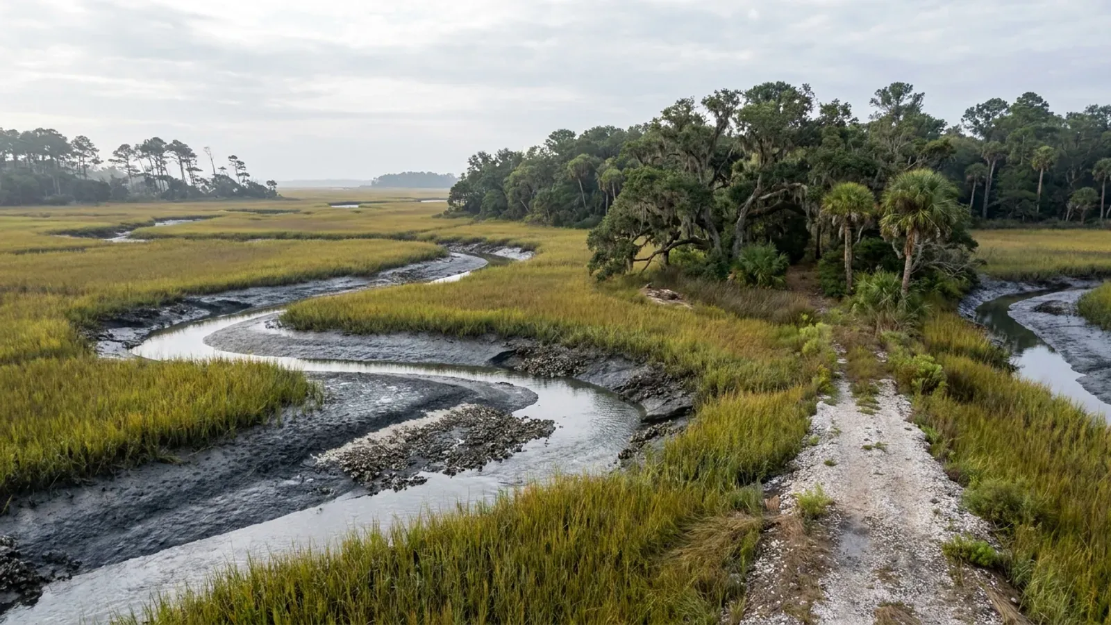
A South Carolina salt marsh at low tide with a winding tidal creek and exposed pluff mud banks, backed by live oaks hung with Spanish moss and cabbage palmetto.
Beaufort County One statewide code, county design maps

Barndominium Builders in Beaufort County, SC

This page is deliberately half a sales page. Beaufort County is 9.8 percent farmland, and USDA's 2022 Census of Agriculture records the direction of travel plainly: 101 farms on 36,074 acres, down 37 percent in operations and 36 percent in acreage since 2017. The county's own Land Preservation Department manages over 14,000 acres acquired through the Rural and Critical Lands Preservation and Green Space programs, which is land permanently off the market. Hilton Head Island, Bluffton, Port Royal, Yemassee and the City of Beaufort are incorporated and permit inside their own limits, and the nine barrier islands the county names in its own code carry a beachfront regime that the mainland does not. What is genuinely left, and genuinely workable, is the mainland — Sheldon, Dale, Lobeco and Seabrook — in the county's T2 Rural transect zone, which is one of only four zones the Development Code exempts from the building-type standards that dictate house-and-outbuilding form everywhere else in the unincorporated county. Two design facts shape any build here. The Building Codes Council's Beaufort County sheet carries wind contours at 130 and 140 MPH and seismic design category labels C and D0 — and D0 is exactly the line where the residential code's seismic chapter starts applying to a detached house, so one parcel in this county is inside that chapter and another is outside it. If the answer for your budget is more land than Beaufort County still has, the honest route is one county west or north, to Jasper and Hampton.

Beaufort County at a glance

County
Beaufort County
Population
204,433

Building conditions in Beaufort County

The building code is the same in every South Carolina county: S.C. Code § 6-9-10(A) requires each municipality and county to enforce the Building Codes Council's codes and to enforce only those, and SC Regulation 8-236(C) bars a local jurisdiction from writing one of its own. The design numbers are not local either, but they are not one number for the state — Regulations 8-1202 and 8-1203 send wind and seismic to the Council's own map for this county, and those maps are drawn as contours, so the figure is read at your address rather than off a county name. What is genuinely local is who issues the permit and inspects the work, what that office charges, the permit procedure it adopted by ordinance, whether your parcel is zoned at all, and the rest of Table R301.2 — frost depth, termite probability and flood — which the jurisdiction fills in for itself.

Build conditions for Beaufort County , South Carolina : design wind speed The Building Codes Council's Beaufort County sheet, Beaufort 15(Mays).pdf, carries wind contours labelled 130 MPH and 140 MPH and seismic design category labels C and D0 across the county. BUILD CONDITIONS BEAUFORT COUNTY…Beaufort CountyONE STATEWIDE CODEDESIGN WIND SPEEDThe Building Codes…Reg 8-1202 and 8-1203 (modifications IRC 2021-04 and IRC 2021-05) replace the IRC's own wind andseismic figures with the Council's previously published county maps. Beaufort is one of the 35…ZONING · T2R (T2 RURAL), WITH THE T2 RURAL-LO…Half acre minimum, 100 ft width; gro…The Community Development Code applies to all land in unincorporatedBeaufort County under § 1.3.10, with no unzoned remainder. T2 Rural…WHO ISSUES THE PERMITBeaufort County Community Developmen…100 Ribaut Road, P.O. Box 1228, Beaufort SC 29901; building permits843-255-2065, inspections 843-255-2078. Zoning permit first,…
Build conditions for Beaufort County, drawn from the sourced facts on this page. Every figure above is cited in the quick-facts panel below, with its source and vintage.
The Council's Beaufort County map: 130 and 140 MPH contours, seismic C and D0
South Carolina is the only state where the State itself publishes per-county design criteria. Modification IRC 2021-04 replaces the residential code's wind map so that buildings are constructed using the ultimate design wind speed in Table R301.2 as determined from "the previously published maps by the South Carolina Building Codes Council," and IRC 2021-05 does the same for the seismic design category. Beaufort is one of 35 counties with a map; eleven have none. Its sheet, Beaufort 15(Mays).pdf, carries wind contours labelled 130 MPH and 140 MPH and seismic design category labels C and D0, each appearing twice across the county — read in both layout and reading-order extraction modes, which agree. The sheet also carries its own provenance: "This map is based upon the the 2015 South Carolina Residential Code and a report to the South Carolina Building Codes Council by Dr. Timothy Mays dated 6/30/2016." These are contour sheets, not solid fills, so the value at a parcel is the value read off the map at that parcel, and under R301.2.1 and R301.2.2.1 as amended the local building official may delineate the wind and seismic categories more finely within the jurisdiction so long as they do not surpass the values on the hazard site the Council names.

SC Building Codes Council, Wind/Seismic Maps, https://llr.sc.gov/bcc/maps.aspx, and the Beaufort County sheet at https://llr.sc.gov/bcc/PDFfiles/WSMaps/Beaufort%2015(Mays).pdf (6,245,171-byte application/pdf, text layer extracted and read 6 Sep 2026); SCBCC 2021 Modification Index, modifications IRC 2021-04 and IRC 2021-05, https://llr.sc.gov/bcc/PDFfiles/2021-Modification-index.pdf

D0 is the line where the seismic chapter reaches a detached house — and Beaufort straddles it
SC Residential Code R301.2.2 applies the code's seismic provisions to detached one- and two-family dwellings in Seismic Design Categories D0, D1 and D2. Most of South Carolina sits at B or C and never picks the chapter up. Beaufort's map carries both C and D0, which is precisely why the contour matters more here than a county-wide label would: a parcel reading C is outside the chapter and a parcel reading D0 is inside it. Inside it, three things change and they start at the footing. R403.1.2 requires exterior walls to be "supported by continuous solid or fully grouted masonry or concrete footings," with other footing systems "designed in accordance with accepted engineering practice," and extends the same requirement to required interior braced wall panels in buildings "with plan dimensions greater than 50 feet" — which is most barndominiums. R403.1.3 adds minimum footing and stem-wall reinforcement. R403.1.6.1 adds plate washers on anchor bolts along every required braced wall line. Then R301.2.2.6 lists eight irregularity conditions that put a structure outside the prescriptive provisions altogether in C, D0, D1 and D2, and four of them describe the barndominium form: a floor or roof section not laterally supported by shear walls or braced wall lines on all edges; an opening exceeding the lesser of 12 feet or 50 percent of the least dimension; vertically offset floor portions; and braced wall lines that do not occur in two perpendicular directions. Note that the irregularity rule reaches C as well as D0, so it applies across the whole of this county. South Carolina then defines the way out narrowly: modification IRC 2021-01 added "accepted engineering practice" to R202 as design "made with accepted design standards by a South Carolina licensed Architect or Engineer as permitted by existing state law," and S.C. Code § 40-22-270(8) requires the building official to "refuse to issue a permit for any undertaking, the plans and specifications for which would require the seal of a professional engineer, unless the permit applicant has furnished satisfactory evidence that the documents were prepared by an engineer licensed as required by this chapter." Beaufort County's own permit checklist has a line for it: "ARQ. or ENG. Seal as Required."

2021 South Carolina Residential Code §§ R301.2.2, R301.2.2.6, R403.1.2, R403.1.3, R403.1.6.1, read at https://up.codes/viewer/south_carolina/irc-2021/chapter/3/building-planning and https://up.codes/viewer/south_carolina/irc-2021/chapter/4/foundations, 6 Sep 2026 — a third-party rendering of the adopted South Carolina code; SCBCC 2021 Modification Index, modification IRC 2021-01, https://llr.sc.gov/bcc/PDFfiles/2021-Modification-index.pdf ; S.C. Code § 40-22-270, https://www.scstatehouse.gov/code/t40c022.php ; Beaufort County Checklist for Residential/Commercial Projects, https://beaufortcountysc.gov/building-codes/documents/forms/BEAUFORT%20COUNTY%20CHECKLIST%20FOR%20RESIDENTIAL%20AND%20COMMERICAL%20PERMITS.pdf

The land is going away here, and the numbers say how fast
This is the fact that decides whether Beaufort County is the right search or the wrong one. USDA's 2022 Census of Agriculture records 101 farms in Beaufort County on 36,074 acres — the number of operations down 37 percent and the acreage down 36 percent since 2017, with the average farm at 357 acres. Of the 36,074 acres, 19,528 are woodland, 5,518 cropland, 1,701 pasture and 9,327 other; the four figures sum exactly to the total. And the size distribution shows how little of it is buyable acreage: 33 of the 101 operations are 1 to 9 acres and 36 are 10 to 49, while only 9 are 1,000 acres or more. Against a 368,654-acre county that leaves farmland at 9.8 percent, third-lowest in South Carolina. Meanwhile the county has been buying the rest: Beaufort County's Land Preservation Department states that it "manages and operates over 14,000 acres of property, including nature preserves, historic sites, an interpretive center and event facilities," acquired through the county's Rural and Critical Lands Preservation and Green Space programs. Population is still climbing — the Census Bureau's vintage 2025 estimates put the county at 204,433 on 1 July 2025 against a 2020 base of 187,093, with 1,140 net domestic migrants in the year — but the supply is not. Compare Jasper County next door, where land in farms rose 20 percent over the same 2017 to 2022 window and the average operation runs 678 acres.

USDA NASS 2022 Census of Agriculture County Profile, Beaufort County, South Carolina, https://www.nass.usda.gov/Publications/AgCensus/2022/Online_Resources/County_Profiles/South_Carolina/cp45013.pdf (read in reading-order mode and cross-checked: the four land-use figures sum exactly to land in farms and the six size classes sum exactly to the farm count); U.S. Census Bureau, Vintage 2025 county population estimates, https://www2.census.gov/programs-surveys/popest/datasets/2020-2025/counties/totals/co-est2025-alldata.csv ; Beaufort County Land Preservation Department, https://beaufortcountysc.gov/land-preservation/about.html (all read 6 Sep 2026)

A detached shop must be subordinate in area to the house, and its doors may not face the street
Two lines of the Community Development Code decide the shape of a Beaufort County barndominium. The first is § 4.2.20.B, which requires every accessory use and accessory structure to "be customarily accessory and clearly incidental and subordinate to the principal use or structure" and to "be subordinate in area, extent, and purpose to the principal use or structure." There is no percentage in the ordinance to argue over — subordinate in area is the test, so a detached shop larger than the dwelling is not what this section contemplates. The same subsection adds that an accessory structure may not "be constructed or established prior to the time the principal use or structure is constructed," may not sit on a different lot, and may not "constitute a combination use, which is the combination of two principal uses." The second line is in the T2 Rural building form standards themselves: "Loading docks, overhead doors, and other service entries may not be located on street-facing facades." A shop with its bay doors facing the road is not permitted here regardless of size. Both problems have the same solution, and it is the one that builds better anyway: make the shop and the living space a single continuous building. Then it is not accessory to anything — it is the dwelling, Dwelling: Single-Family Detached Unit is a permitted use in T2 Rural on the code's own use table, and the whole building is designed, permitted and inspected as a dwelling. The door orientation rule still applies to it, so plan the bay doors off the street.

Beaufort County Community Development Code §§ 4.2.20 (General Standards and Limitations) and 3.2.40 (T2 Rural (T2R) Standards), and the T2R allowed-use table, codified through Ordinance No. 2025/19 adopted 14 April 2025 (Supp. No. 16), https://library.municode.com/sc/beaufort_county/codes/community_development_code — read via api.municode.com client 199 (Beaufort County, South Carolina), product 15433, job 472612, 6 Sep 2026

T2 Rural is one of four zones exempt from the county's building-type standards
Beaufort County runs a form-based Development Code, and for most of the unincorporated county that means your house has to be one of a named list of building types — Estate House, Village House, Small Lot House, Carriage House and so on — each with its own caps on main-body width, secondary wing dimensions and accessory structure footprint. The Estate House type, for example, limits an accessory structure to 36 feet wide and 30 feet deep. Section 5.1.20.A then says where all of that applies: "The requirements of this Division shall apply to all proposed development within the transect zones with the exception of T1 Natural Preserve, T2 Rural, T2 Rural-Low, and T2 Rural Neighborhood." That exemption is why the rural mainland is the part of Beaufort County where a barndominium is a realistic building. What governs instead is the T2R form standards in § 3.2.40: front setback 50 feet minimum, side street 50 feet, side 18 feet for the main building and 10 feet for an ancillary building, rear 50 feet; lot size at a half-acre minimum with 100 feet of width; main building and ancillary building both two storeys maximum; maximum lot coverage n/a; and gross density of 0.34 dwelling units per acre in T2 Rural and 0.20 in the T2 Rural-Low sub-zone — roughly one dwelling per three acres and one per five. Parking must be set back 50 feet from the front and side street property lines. Ground floor finish level has no minimum, with the note that "Buildings located in a flood hazard zone will be required to be built above base flood elevation in accordance with Beaufort County Building Codes."

Beaufort County Community Development Code §§ 5.1.20 (Applicability), 5.1.50 (Estate House) and 3.2.40 (T2 Rural (T2R) Standards), https://library.municode.com/sc/beaufort_county/codes/community_development_code — read via api.municode.com product 15433, job 472612, 6 Sep 2026; Division 1.3 applicability at https://library.municode.com/sc/beaufort_county/codes/community_development_code?nodeId=ART1GEPR_DIV1.3APJU_1.3.10GEAP

Beaufort fronts the Atlantic, so the beachfront lines are live — and they landed on the islands
S.C. Code § 48-39-10(B) defines the coastal zone and names it: "These counties are Beaufort, Berkeley, Charleston, Colleton, Dorchester, Horry, Jasper, and Georgetown." A closed list of eight, Beaufort on it, settled by statute rather than by looking at a map. What that listing triggers county-wide is Coastal Zone Consistency review, which a construction stormwater permit covering one to two disturbed acres in one of the eight has to carry with it. The Critical Area is separate and follows a feature: § 48-39-10(J) defines it as coastal waters, tidelands, beaches and the beach/dune system, "which is the area from the mean high-water mark to the setback line as determined in Section 48-39-280." Unlike Berkeley, Dorchester or Jasper, Beaufort actually fronts the Atlantic, so that last limb is live here — § 48-39-280(E)(1) has the department set monumented and controlled survey points "in each county fronting the Atlantic Ocean," § 48-39-280(B) puts the setback line landward of the baseline at forty times the average annual erosion rate or not less than twenty feet, and § 48-39-280(C) requires the lines to be established anew "during establishment cycles that are not less than every seven years, but not more than every ten years." Where the machinery actually lands is the point for anyone buying land: in the current 2024–2028 review, SCDES states that baseline and setback lines for "Daufuskie Island, Hilton Head Island, Bay Point Island, St. Phillips Island, Little Capers Island, Pritchards Island, Fripp Island, Hunting Island, and Harbor Island have been established and will be in effect as of July 24th, 2026." Every one of those is an island. Beaufort County's own code draws the same distinction: § 5.11.50.B applies "on the seaward side only of the barrier islands (i.e., Bay Point, Little Capers, Daufuskie, Fripp, Harbor, Hilton Head, Hunting, Pritchards and St. Phillips Islands)," where no structure may be built within 50 feet landward of the OCRM baseline and no septic tank or tile field within 100 feet. On the mainland the critical area arrives instead as tidelands and coastal waters, and the county measures from the OCRM critical line: Table 5.11.60.A sets, in T1 and T2, a 50-foot river buffer, a 60-foot setback for a single-family dwelling, 100 feet for other residential and non-residential buildings, 100 feet for parking lots and drives, 100 feet for a septic tank or tile field, and 150 feet for agriculture. Read that table before siting a detached shop on a tidal creek: the house is at 60 feet and the outbuilding is at 100.

S.C. Code § 48-39-10(B) and (J) and § 48-39-280(B), (C) and (E), Coastal Tidelands and Wetlands Act, served text read at https://www.scstatehouse.gov/code/t48c039.php 6 Sep 2026; SCDES State Beachfront Jurisdictional Lines, 2024–2028 Jurisdictional Lines Review, https://des.sc.gov/programs/bureau-coastal-management/beachfront-management/state-beachfront-jurisdictional-lines ; Beaufort County Community Development Code §§ 5.11.50 (Beach Dune System) and 5.11.60 (River Buffer), Table 5.11.60.A, https://library.municode.com/sc/beaufort_county/codes/community_development_code — read via api.municode.com product 15433, job 472612, 6 Sep 2026; SCDES Coastal Zone Consistency Certification, https://des.sc.gov/programs/bureau-coastal-management/coastal-zone-consistency-certification ; SCDES stormwater, 1 to 2 Acres of Land Disturbance, https://des.sc.gov/programs/bureau-water/stormwater/stormwater-construction-activities/1-2-acres-land-disturbance

Also worth knowing before you build in Beaufort County

Beaufort is one of the very few places in South Carolina where sinkholes are a real question
South Carolina has no Blue Ridge or Piedmont karst at all — those provinces are crystalline rock, which does not dissolve — and the state's limited karst is a Coastal Plain limestone phenomenon confined to a handful of named places. Beaufort is one of them, and it is named by the State's own geologists. SCDNR's General Geologic Map Series 5, Geologic Hazards of the South Carolina Coastal Plain, describes two kinds of collapse-potential area. The larger one is taken from a USGS report on potentially karstic rocks and "lies inland of the zone of liquefaction and consists almost entirely of the middle Coastal Plain." The smaller ones are mapped from actual karstic features — sinkholes, caves and losing streams — and of those, GGMS-5 says: "Two areas north of Myrtle Beach are delineated from sinkhole studies by Hockensmith and Pelletier (1987). A large area is found around the town of Beaufort. The data for this area comes from geologic mapping by Doar (2003)." The map adds honestly that "there is field evidence for significantly more karstic features in the lower Coastal Plain, but because of map scale sinkhole potential is generalized." Now read the limits the map prints on itself, because they are as important as the finding: SCDNR states that the "information should not be used for land-use zoning, building-code requirements, or defining insurance rate zones," that "the relative hazard zones also are not intended to replace site-specific evaluations, such as engineering analysis or design," and that "hazard potential should be evaluated through site-specific geotechnical investigation by qualified practitioners." So GGMS-5 does not set a requirement and cannot. What it does is tell you which parcels deserve the borings before anyone designs a wide monolithic slab, and around Beaufort that is a live question rather than a theoretical one.

SCDNR Geological Survey and SC Emergency Management Division, General Geologic Map Series 5, Geologic Hazards of the South Carolina Coastal Plain, 1:600,000 — https://www.dnr.sc.gov/geology/pdfs/GGMS5.pdf (32,578,931-byte PDF, text extracted and read 6 Sep 2026); landing page https://www.dnr.sc.gov/geology/geologic-hazards.html

You may not raise the pad more than three feet in a flood hazard area
Most barndominium sites solve a flood elevation with fill. Beaufort County adopted a division of its Development Code in 2021 specifically to stop that, and it is one of the most consequential local rules on this page. Division 5.13 (Fill Standards) applies to all proposed development in the unincorporated county inside the special flood hazard areas on FEMA's Flood Insurance Rate Maps for Beaufort County, with a narrow set of exemptions — notably single-family residential development on lots existing before the division was adopted on 27 September 2021, and fill used for agriculture or property maintenance. Where it applies, § 5.13.30 provides that "the amount of allowable fill must not increase the existing natural grade of the property by more than three vertical feet"; that "the only portion of the property that may be filled is the area underneath the elevated structure, together with driveway and walkway access to the structure," tapering at a maximum slope of 1:3 from a five-foot perimeter around the outer foundation back to existing site elevation; that on a lot of 20 acres or more no more than 33.33 percent of the total lot area may be filled; and — this is the sentence that changes a design — that any required building elevation "exceeding the three-foot fill limitation … must be achieved through the use of elevation foundations, piers or similar structural elevation techniques that are in compliance with then-applicable county building code requirements as certified by a structural engineer." There is also a clean-fill rule: offsite soil placed below or within one foot above the seasonal high water table has to be tested for total petroleum hydrocarbons, for benzene, toluene, ethyl benzene and xylene, and by the full toxicity characteristic leaching procedure, and must come in under 100 ppm TPH and 10 ppm total BTEX.

Beaufort County Community Development Code Division 5.13 (Fill Standards) §§ 5.13.10, 5.13.20 and 5.13.30 (Ord. No. 2021/40, 27 Sep 2021), https://library.municode.com/sc/beaufort_county/codes/community_development_code — read via api.municode.com product 15433, job 472612, 6 Sep 2026

The Development Code applies to all unincorporated land — and five towns permit their own
Beaufort County's zoning is its Community Development Code, and § 1.3.10 settles the scope in one sentence: "The provisions of this Development Code shall apply to the development of all land within unincorporated Beaufort County unless it is expressly exempted by a specific section or subsection of this Development Code." § 1.3.20 extends it to development by the county and, to the extent allowed by law, by any city, town, state or federal government on land it owns or controls. There is no unzoned remainder. The Code is adopted under the enabling authority in S.C. Code § 6-29-710 et seq. and organises the unincorporated county into transect zones (T1 Natural Preserve through T4 Neighborhood Center), conventional zones (C3, C4, C5 and the S1 Industrial zone) and overlays — including the Cultural Protection Overlay, established "to preserve the rural character and to protect the cultural, natural, and historic resources on St. Helena Island," home to one of the largest Gullah/Geechee communities on the southeast coast. What that scope leaves out is the part a land buyer needs to know: the Town of Hilton Head Island, the Town of Bluffton, the Town of Port Royal, the Town of Yemassee and the City of Beaufort are incorporated municipalities that permit inside their own limits under their own ordinances, and the City of Hardeeville reaches into the county as well. County staff sit at 100 Ribaut Road, Beaufort.

Beaufort County Community Development Code §§ 1.1.20, 1.3.10, 1.3.20, 3.1.20 and 3.4.50, codified through Ordinance No. 2025/19 adopted 14 April 2025 (Supp. No. 16), https://library.municode.com/sc/beaufort_county/codes/community_development_code?nodeId=ART1GEPR_DIV1.3APJU_1.3.10GEAP — read via api.municode.com client 199, product 15433, job 472612, 6 Sep 2026; municipality list and county address from Beaufort County government, https://beaufortcountysc.gov/building-codes/requirements.html

Zoning permit first, building permit second, and what goes in the folder
Beaufort County runs a two-office sequence and doing it out of order costs weeks. The Zoning Department goes first, and its list is short: three site plans with the structure located and the setbacks from the property lines shown, the septic tank permit or proof of sewer, and the 911 address. Only then does the Building Codes Office take the building permit application, together with the contractor's name, address, telephone, state licence and Beaufort County business licence number; a list of subcontractors with their state and county business licence numbers; two printed 24-by-36-inch sets of building plans plus a digital copy; two approved site plans; an electrical load calculation; county stormwater and state permits; and energy code documentation. The plans have to include an HVAC plan with Manual J load calculations and duct sizing and layout, a plumbing riser diagram with water supply by fixture unit, an electrical plan with panel location and load calculations, and a RESCheck document. The building permit fee and, where applicable, impact fees are paid at submittal. The county's own project checklist adds the items that catch rural builds: a development permit, the seal, the total cost of construction by trade, an owner-builder affidavit where there is no licensed contractor, the zoning district, river overlay, Corridor Review Board approval and archaeological review. On site, the permit card must be posted and protected until the certificate of occupancy issues, the 911 address must be posted before any inspection, and "the approved set of plans reviewed and stamped by the Plans Examiner must be on site for every inspection." Inspections are requested by 3:30pm the day before.

Beaufort County Building Inspections, Inspection and Permit Requirements, https://beaufortcountysc.gov/building-codes/requirements.html ; Beaufort County Building Permit Application (2026 revision), https://beaufortcountysc.gov/building-codes/documents/forms/building-permit-application-2026%20WR.pdf ; Beaufort County Checklist for Residential/Commercial Projects, https://beaufortcountysc.gov/building-codes/documents/forms/BEAUFORT%20COUNTY%20CHECKLIST%20FOR%20RESIDENTIAL%20AND%20COMMERICAL%20PERMITS.pdf (all read 6 Sep 2026)

The family compound rule asks for fifty years of family ownership
Beaufort County has a provision for putting more than one house on family land without a conventional subdivision, and its threshold is unlike anything else in this research. Section 2.7.40 requires that "a single member of the family, multiple members of the family, or an unbroken succession of family members shall own a family compound property for no less than 50 years," that all owners of the property request the family compound, and that the people for whom the dwelling units are built or the property subdivided be related to the owner by blood, marriage or adoption. The compound may be built as units on one parcel or subdivided and conveyed to a family member to build on, and it may be laid out conventionally or as a traditional cluster — defined as at least two dwelling units on the parcel with an average distance between units of no more than 50 feet. Density comes from Table 2.7.40.A, which rewards clustering: a site of up to 1.99 acres carries two units clustered against one unclustered, and a two-acre site carries four clustered against two unclustered, with the maximum counting accessory dwelling units. Dwelling: Family Compound appears on the T2 Rural use table as a conditional use rather than a permitted one, so it is an application, not a right. That fifty-year rule is a real barrier for someone who bought recently, and it is the sort of thing worth checking against the deed history before an offer rather than after.

Beaufort County Community Development Code §§ 2.7.40 (Family Compound Standards) and 4.1.80 (Family Compound), with Table 2.7.40.A, and the T2R allowed-use table at § 3.2.40, https://library.municode.com/sc/beaufort_county/codes/community_development_code — read via api.municode.com product 15433, job 472612, 6 Sep 2026

A barndominium is never a farm structure, whatever the permit application's checkbox says
Beaufort County's building permit application has a "Nature of Work" row with a box marked "Agricultural Only," and that box causes more confusion on rural parcels than any other line on the form. South Carolina closes the question in the statutory definition rather than leaving room to argue. S.C. Code § 6-9-65(A) defines a farm structure as a structure constructed on a farm "other than a residence or a structure attached to it." A building anyone lives in is not a farm structure, and neither is a shop welded to the side of one. There is no square-footage test and no percentage-of-use test to work with. The section also excludes any structure "originally qualifying as a 'farm structure' but later converted to another use," so putting up a pole barn under the exemption and finishing it into living space later takes the whole building back out and the code applies to it as the residence it has become. § 6-9-65(C) makes the exemption conditional on filing an affidavit with the local building official before construction begins. Separately, the contractor-licensing exemption printed on Beaufort County's own permit application is often misread as the same thing: it exempts from the Contractor's Licensing Act "a wood frame farm building or portable storage building less than five thousand square feet used only for livestock or storage," which is a question about who may build, not about whether the building code applies or whether anyone may live in it.

S.C. Code § 6-9-65, https://www.scstatehouse.gov/code/t06c009.php ; Beaufort County Building Permit Application, Part I "Nature of Work" and Part II contractor exemptions, https://beaufortcountysc.gov/building-codes/documents/forms/building-permit-application-2026%20WR.pdf (both read 6 Sep 2026)

Septic is a state permit, and on this ground it decides the parcel
The zoning permit will not issue without the septic tank permit or proof of sewer, and the septic permit itself is the State's rather than the county's. South Carolina reads soil morphology rather than running a percolation test: Regulation 61-56 sets site suitability from texture, restrictive horizons and depth to the zone of saturation, and § 61-56.200.2 states that soils "exhibiting massive or platy structure, and soils which have been identified as having substantial amounts of expansible layer clay minerals or smectites, are unsuitable for onsite wastewater systems" — unsuitable outright, not merely expensive. § 61-56.200.7 then requires a usable repair area of at least 50 percent of the original system, on soil proven suitable, so a parcel has to hold the system, its whole setback envelope and a proven reserve, none of it under the drive, the shop or a pool. You can wait for the Department to do the evaluation or hire a licensed Professional Soil Classifier privately and file the soil report with the application. Three Beaufort-specific constraints stack on top. SCDES will not issue an onsite wastewater permit where public sewer is accessible, which catches a great deal of ground near the municipalities. The county's own river buffer table pushes a septic tank or tile field 100 feet back from the OCRM critical line in T1 and T2. And on the seaward side of the barrier islands the Development Code adds 100 feet landward of the OCRM baseline, or as required by the State, whichever is greater. A private well then has to close its own geometry at 75 feet from the septic system and 50 feet from any barn or stable.

S.C. Regulation 61-56, Onsite Wastewater Systems, §§ 61-56.102, 61-56.200.2, 61-56.200.7, https://des.sc.gov/sites/des/files/Library/Regulations/R.61-56.pdf ; SCDES Professional Soil Classifiers, https://des.sc.gov/permits-regulations/septic-tanks/professional-soil-classifiers ; Beaufort County Community Development Code Table 5.11.60.A and § 5.11.50.B, https://library.municode.com/sc/beaufort_county/codes/community_development_code ; the county's sequencing requirement is on Beaufort County Building Inspections, Inspection and Permit Requirements, https://beaufortcountysc.gov/building-codes/requirements.html (all read 6 Sep 2026)

An excavator grading a compacted building pad on a cleared lot, with orange clay in the cut face, survey stakes and a drainage swale.
Below the slab

The expensive surprises are in the ground, not the building

What moves a South Carolina budget is usually below grade, and more often than not it is the drainfield rather than the foundation. R.61-56 § 200.1 settles whether a parcel can take an onsite system from soil morphology — texture, structure, depth to a restrictive horizon and depth to the zone of saturation — and § 200.2 then rules out two conditions outright: soils exhibiting massive or platy structure, and soils with substantial amounts of expansible layer clay minerals or smectites. That second clause is the one that bites on the mafic Piedmont, where the shrink-swell series sit in quantity under York, Fairfield, Chester, Laurens, Union, Newberry, Greenwood, McCormick, Lancaster, Saluda, Abbeville and Edgefield. A foundation problem has a price and an answer; an unbuildable septic parcel has neither, which is why we look at it first. Bedroom count is the number to settle early, because § 61-56.501 drives design flow from bedrooms, design flow drives trench length, and trench length plus a repair area decides how much good soil the parcel has to have — shop square footage adds nothing to it. Above the Fall Line the evaluation is done in backhoe pits rather than borings alone, so the answer comes from a dug hole and not a form. The site work, the foundation and the drainfield therefore get resolved together rather than one at a time. We price the dirt before we price the building.

What a build looks like

Three stages every Beaufort County project passes through, from a raw parcel to a finished home. Site work first, because that is where the budget is decided.

Aerial view of an undeveloped rural lot with cleared rough grass, planted pine along one boundary, and a red dirt access track cut through orange clay.
Stage one

The parcel

Zoning, setbacks, flood zone and utility access get checked before anything is drawn.

An excavator grading a compacted building pad on a cleared lot, with orange clay in the cut face, survey stakes and a drainage swale.
Stage two

Pad and permit

Clearing, grading and a compacted pad, while the submittal works through whichever office issues the permit where you are building.

A finished barndominium at dusk with warm interior lighting glowing through its large windows.
Stage three

Frame to finish

Shell erected and dried in, then systems, insulation and interior finish through to CO.

Those are the rules where you are building in Beaufort County. Tell us what you want to build and we will draw it to them.

Nearby areas we build in

Others we cover nearby. One may be a county and another a municipality inside one — and a South Carolina municipality can sit in two counties at once — so the office that issues the permit, the fees it charges, whether the land is zoned at all, and which design map covers it can all differ from one card to the next.

Building in Beaufort County: common questions

9 questions we get asked most often about building in Beaufort County. If yours is not on the list, ask it directly.

Can I actually build a barndominium in Beaufort County, or should I be looking somewhere else?
Both answers are true and it depends entirely on which part of the county you mean. On the mainland — Sheldon, Dale, Lobeco, Seabrook — in the T2 Rural transect zone, yes, and the Development Code is unusually accommodating there: § 5.1.20.A exempts T1 Natural Preserve, T2 Rural, T2 Rural-Low and T2 Rural Neighborhood from the building-type standards that everywhere else in the unincorporated county force a house into a named type with capped main-body widths and capped accessory footprints. That exemption is the reason the rural mainland works. Hilton Head Island is a different proposition entirely — an incorporated town that permits under its own ordinances, on a barrier island the county's own code singles out for beachfront setbacks, with essentially no agricultural land. Bluffton is likewise its own town and its own market. And the supply picture across the whole county is the thing to be honest about: USDA counts 101 farms on 36,074 acres here, operations down 37 percent and acreage down 36 percent since 2017, leaving farmland at 9.8 percent of a 368,654-acre county, while the county's Land Preservation Department manages over 14,000 acres it has taken permanently out of the market. If what you need is thirty or a hundred buildable acres, the realistic answer is one county over: Jasper, where land in farms rose 20 percent in the same window and the average operation is 678 acres, or Hampton, which is 26.9 percent farmland.
What wind speed and seismic category apply on my parcel?
Both come from a map the South Carolina Building Codes Council publishes for this county, because modifications IRC 2021-04 and IRC 2021-05 replaced the residential code's national wind and seismic figures with the Council's own county maps. Those exist for 35 of the 46 counties and Beaufort is one of them. The Beaufort sheet carries wind contours labelled 130 MPH and 140 MPH, and seismic design category labels C and D0. Neither is a county-wide number — these are contour sheets, so the value is whatever the map reads at your parcel, and the local building official may delineate more finely within the jurisdiction so long as the result does not exceed the values on the hazard site the Council points to. The seismic half is the one that changes the building. The residential code applies its seismic provisions to a detached one- or two-family dwelling starting at D0, so a Beaufort parcel reading C is outside that chapter and one reading D0 is inside it, where continuous footings under exterior walls and under required interior braced wall panels on buildings over 50 feet in plan dimension, footing and stem-wall reinforcement, and plate washers along every braced wall line all come in. Get both readings from the Beaufort County building official in writing, against your tax map number, before anyone orders steel or trusses.
Can the shop be bigger than the house?
If it is a separate building, no. The Community Development Code requires every accessory structure to "be customarily accessory and clearly incidental and subordinate to the principal use or structure" and to "be subordinate in area, extent, and purpose to the principal use or structure." There is no percentage to argue with — subordinate in area is the test itself. The same subsection adds that an accessory structure may not be built before the principal structure, may not sit on a different lot, and may not create a combination use, meaning two principal uses on one site. And there is a second rule that catches even a modest detached shop: the T2 Rural building form standards provide that "loading docks, overhead doors, and other service entries may not be located on street-facing facades," so bay doors facing the road are not permitted regardless of size. Both problems have the same fix, and it is the one that builds better anyway. If the shop and the living space are a single continuous building, it is not an accessory structure at all — it is the dwelling, Dwelling: Single-Family Detached Unit is a permitted use in T2 Rural, and the whole thing is designed and inspected as a dwelling under the two-storey T2R height limit. Keep the bay doors off the street elevation either way.
I found land in a flood zone and I was going to build the pad up. Will that work here?
Probably not the way you are imagining, and Beaufort County is stricter about this than almost anywhere in the state. Division 5.13 of the Development Code, adopted 27 September 2021, applies to development in the unincorporated county inside the FEMA special flood hazard areas, and it provides that "the amount of allowable fill must not increase the existing natural grade of the property by more than three vertical feet." Only the area underneath the elevated structure plus driveway and walkway access may be filled, tapering at a maximum 1:3 slope from a five-foot perimeter around the outer foundation back to existing grade, and on a lot of 20 acres or more no more than 33.33 percent of the total lot area may be filled at all. Then the operative sentence for design: any required building elevation beyond that three-foot limit "must be achieved through the use of elevation foundations, piers or similar structural elevation techniques … as certified by a structural engineer." So on a slab-on-grade barndominium in a Beaufort flood zone, the elevation question is answered by a foundation system, not by a dump truck. Two more things to check: fill brought in from offsite and placed below or within one foot above the seasonal high water table must be tested for petroleum hydrocarbons and BTEX and pass a leaching procedure; and the Division exempts single-family residential development on lots that existed before it was adopted, so the vintage of the lot of record matters. Get that exemption question answered in writing before you make an offer.
Beaufort is a coastal county. Does OCRM have to permit my build?
It depends where, and Beaufort is one of the few South Carolina counties where the full beachfront machinery actually applies. S.C. Code § 48-39-10(B) names the eight counties in the coastal zone and Beaufort is one of them; that alone triggers Coastal Zone Consistency review, and a construction stormwater permit for one to two disturbed acres in any of the eight has to carry a consistency determination — which a house pad, a shop pad, a drive and a septic field reach faster than most people plan for. The Critical Area is separate: § 48-39-10(J) defines it as coastal waters, tidelands, beaches and the beach/dune system, and that last category is measured from the mean high-water mark to a setback line established under § 48-39-280. Because Beaufort County fronts the Atlantic, that section is live here — the setback line sits landward of the baseline at forty times the average annual erosion rate or at least twenty feet, and the lines are re-established on cycles of not less than seven and not more than ten years. In the current 2024–2028 review, SCDES has established the lines for Daufuskie, Hilton Head, Bay Point, St. Phillips, Little Capers, Pritchards, Fripp, Hunting and Harbor Islands, effective 24 July 2026. Every one of those is an island. On the mainland the critical area arrives as tidelands and coastal waters instead, and the county's own table measures from the OCRM critical line: in T1 and T2 that means a 50-foot river buffer, the house at 60 feet, other residential and non-residential buildings at 100 feet, parking and drives at 100 feet, a septic tank or tile field at 100 feet, and agriculture at 150 feet. Note the gap between 60 and 100 — a detached shop on a tidal creek needs 40 more feet than the house does.
Are sinkholes really a thing here, or is that a rumour?
It is real, it is documented by the State's own geologists, and Beaufort is one of only a handful of places in South Carolina where it is. SCDNR's General Geologic Map Series 5, Geologic Hazards of the South Carolina Coastal Plain, maps discrete known-sinkhole areas from actual karstic features and names them: two areas north of Myrtle Beach from Hockensmith and Pelletier's 1987 studies, and — in the map's own words — "a large area is found around the town of Beaufort. The data for this area comes from geologic mapping by Doar (2003)." There is no Blue Ridge or Piedmont karst anywhere in the state, so this is a Coastal Plain limestone phenomenon rather than a mountain one. Now the caveat, which SCDNR prints on the map itself and which matters as much as the finding: the information "should not be used for land-use zoning, building-code requirements, or defining insurance rate zones," the hazard zones "are not intended to replace site-specific evaluations, such as engineering analysis or design," and "hazard potential should be evaluated through site-specific geotechnical investigation by qualified practitioners." So nothing about the map requires anything of you. What it does is tell you which parcels justify borings before a wide monolithic slab is designed, and around the town of Beaufort that is a sensible line item rather than an abundance of caution.
Can I put it up as a farm building and finish it into a house later?
No, and the definition closes it rather than leaving room to argue. S.C. Code § 6-9-65(A) defines a farm structure as one constructed on a farm "other than a residence or a structure attached to it," so a building anyone lives in is not a farm structure and neither is a shop attached to one. There is no square-footage test and no percentage-of-use test. The same section excludes any structure "originally qualifying as a 'farm structure' but later converted to another use," which pulls the whole building back under the code as the residence it has become, and § 6-9-65(C) requires an affidavit filed with the local building official before construction to claim the exemption at all. Two things on Beaufort County's own paperwork cause confusion here. The building permit application has an "Agricultural Only" box in its Nature of Work row, which is a description of the work rather than a code exemption. And the same application prints the contractor-licensing exemption for "a wood frame farm building or portable storage building less than five thousand square feet used only for livestock or storage" — that is a rule about who may lawfully build, not about whether the residential code applies or whether anyone may live in the result. Permit it as a dwelling and build it as one.
We want to put several family houses on the land. What does Beaufort County allow?
There is a family compound provision, and its first condition is unlike anything else in South Carolina: § 2.7.40 requires that "a single member of the family, multiple members of the family, or an unbroken succession of family members shall own a family compound property for no less than 50 years," with all owners joining the request, and the people for whom the units are built related to the owner by blood, marriage or adoption. If the deed history clears that bar, the property may be developed with the units built on it or subdivided and conveyed to family members to build on. Layout may be conventional or a traditional cluster — at least two dwelling units with an average separation of no more than 50 feet — and the density table rewards clustering: up to 1.99 acres carries two units clustered against one unclustered, and two acres carries four clustered against two, counting accessory dwelling units toward the total. Dwelling: Family Compound is a conditional use in T2 Rural rather than a permitted one, so it is an application with findings, not a right. Outside that route the ordinary T2R gross density governs: 0.34 dwelling units per acre in T2 Rural and 0.20 in T2 Rural-Low, which is roughly one dwelling per three acres and one per five, computed on the base site area rather than on the deed acreage.
What order do the permits go in, and what will they ask me for?
Zoning first, building second, and the septic answer has to exist before either. The Zoning Department wants three site plans with the structure located and the setbacks to each property line shown, the septic tank permit or proof of sewer, and the 911 address. With the zoning permit in hand you go to the Building Codes Office with the building permit application, the contractor's state licence and Beaufort County business licence numbers, a list of subcontractors with theirs, two printed 24-by-36-inch plan sets plus a digital copy, two approved site plans, an electrical load calculation, county stormwater and state permits, and energy code documentation. The plans themselves must carry an HVAC plan with Manual J load calculations and duct sizing, a plumbing riser diagram with water supply by fixture unit, an electrical plan with panel location and load calculations, and a RESCheck. The county's project checklist adds a development permit, the architect's or engineer's seal as required, total cost of construction by trade, the zoning district, river overlay, Corridor Review Board approval and archaeological review — the last of which surprises people on Lowcountry acreage and is worth raising early. On site, post the permit card where it can be seen and keep it protected until the certificate of occupancy, post the 911 address before requesting any inspection, and keep the plan set stamped by the Plans Examiner on site, because the county requires it at every inspection. Inspection requests go in by 3:30pm the day before.

Building in Beaufort County?

Start with the plan. Tell us what you want to build and we will draw it, then confirm which office issues the permit for your parcel, what it will let you put there, and what wind load it has to meet. That conversation costs nothing.