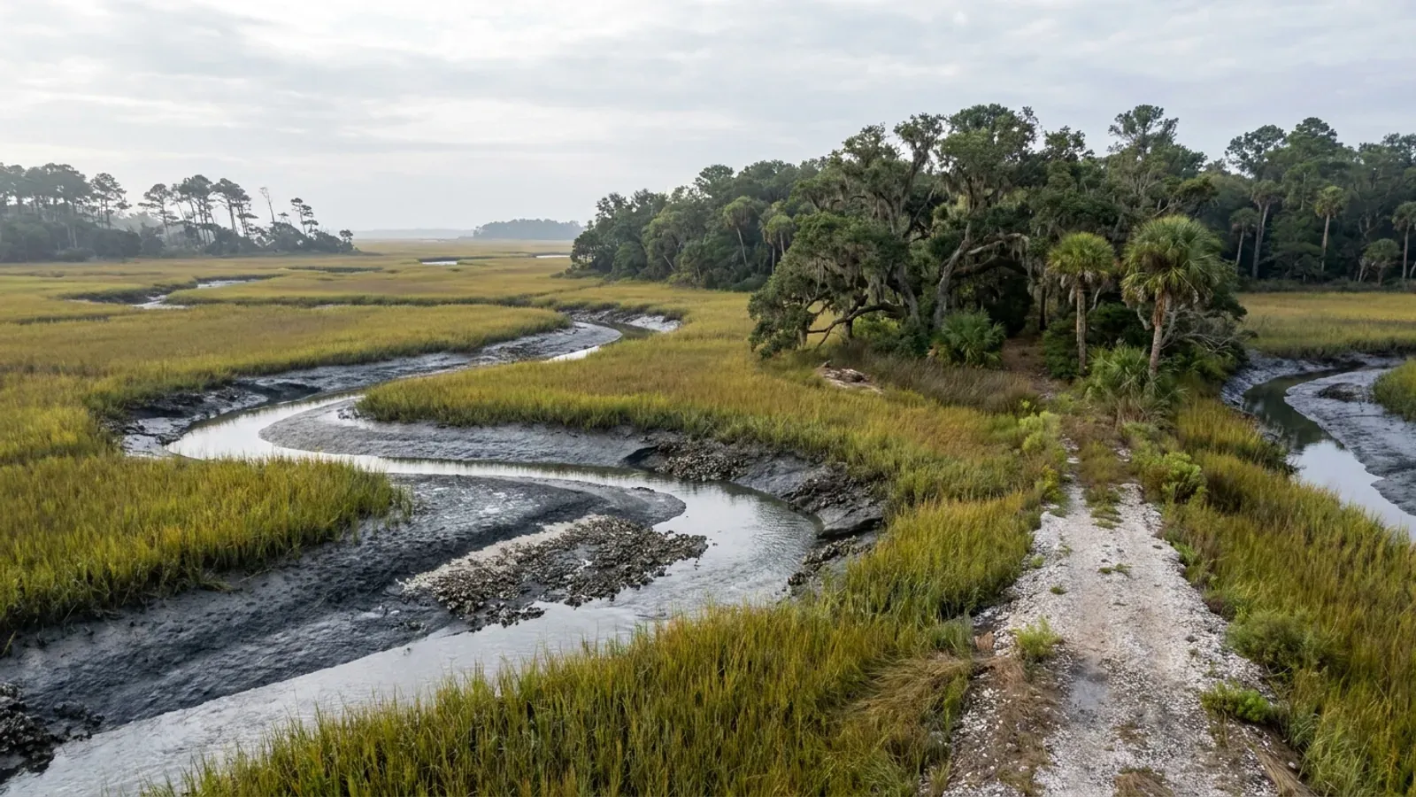
A South Carolina salt marsh at low tide with a winding tidal creek and exposed pluff mud banks, backed by live oaks hung with Spanish moss and cabbage palmetto.
Horry County One statewide code, county design maps

Barndominium Builders in Myrtle Beach, SC

This page exists to answer one question honestly, and the answer is mostly no. Myrtle Beach is the name every buyer on the South Carolina coast reaches for, and more of the people reaching for it are doing so from another state than from inside this one. So this page is written for someone who does not live here yet. So here is what a relocating buyer needs before anything else. There is no acreage inside the city limits. Myrtle Beach is a dense coastal municipality with its own permitting, its own zoning and no rural district, sitting on the barrier strip between the Intracoastal Waterway and the Atlantic, and what land remains there is priced and regulated as beachfront. The barndominium answer on the Grand Strand is real, but it is twenty to forty minutes west: Conway, Aynor and Loris, in the western half of Horry County, where the USDA still counts 629 farms on 151,691 acres. Two things worth unlearning on the way. The Building Codes Council's Horry County map puts the 150 MPH contour offshore, over the Atlantic, where it never crosses land, so the number everyone assumes for the beach is not the number on the map. And the seismic category here reads B, which means the residential code's seismic chapter never reaches a detached house at all — the opposite of the Charleston Lowcountry.

Myrtle Beach at a glance

County
Horry County
Population
40,937

Building conditions in Myrtle Beach

The building code is the same in every South Carolina county: S.C. Code § 6-9-10(A) requires each municipality and county to enforce the Building Codes Council's codes and to enforce only those, and SC Regulation 8-236(C) bars a local jurisdiction from writing one of its own. The design numbers are not local either, but they are not one number for the state — Regulations 8-1202 and 8-1203 send wind and seismic to the Council's own map for this county, and those maps are drawn as contours, so the figure is read at your address rather than off a county name. What is genuinely local is who issues the permit and inspects the work, what that office charges, the permit procedure it adopted by ordinance, whether your parcel is zoned at all, and the rest of Table R301.2 — frost depth, termite probability and flood — which the jurisdiction fills in for itself.

Build conditions for Myrtle Beach , Horry County, South Carolina : design wind speed The Building Codes Council's Horry County sheet carries a blue wind contour boxed and labelled 140 MPH running roughly north-south through the western part of the county, passing just east of Aynor, and a second boxed contour labelled 150 MPH lying offshore in the Atlantic, parallel to the Grand Strand and several miles out, where it never crosses land. Myrtle Beach, Conway, Loris and Socastee therefore all sit between the two lines. The seismic labels hand-lettered on the same sheet are B and C, with the C on the south-western side toward Georgetown County, so the Strand reads B. BUILD CONDITIONS MYRTLE BEACH, SCHorry CountyONE STATEWIDE CODEDESIGN WIND SPEEDThe Building Codes…Reg 8-1202 and 8-1203 (modifications IRC 2021-04 and IRC 2021-05) replace the IRC's own wind andseismic figures with the Council's previously published county maps, and Horry is one of the 35…ZONING · R-5, R-7, R-8, R-10 AND R-15 — SECTI…15,000 sq ft (0.34 acre) in R-15, th…This is the reason the page routes west. Maximum height is 35 ft inevery single-family district, maximum building coverage 35 percent…WHO ISSUES THE PERMITCity of Myrtle Beach Construction Se…921 North Oak Street, Myrtle Beach, SC 29577, mailing address P.O.Box 2468, Myrtle Beach, SC 29578; main number (843) 918-1111, with…
Build conditions for Myrtle Beach, drawn from the sourced facts on this page. Every figure above is cited in the quick-facts panel below, with its source and vintage.
The Council's Horry County map puts the 150 MPH contour offshore — it never crosses land
If you are planning a move to the Grand Strand from out of state, this is the first thing to unlearn, because almost everyone assumes it and the assumption is wrong. Regulations 8-1202 and 8-1203 replace IRC R301.2.1 and R301.2.2.1 with "the previously published maps by the South Carolina Building Codes Council", so the design wind speed on the coast is not read off a national map or an insurance table — it is read off the Council's own county sheet. The Horry sheet is an image-only scan with an empty text layer, which is why it is so rarely quoted; extracted and read at native resolution it carries two boxed blue contours. One is labelled 140 MPH and runs roughly north to south through the western part of the county, passing just east of Aynor near Cool Spring and Dog Bluff. The other is labelled 150 MPH, and it lies out in the Atlantic, parallel to the beach and several miles offshore. It does not touch land anywhere in the county. Myrtle Beach, North Myrtle Beach, Surfside, Socastee, Conway and Loris therefore all sit between the two lines, not on either of them. What that means practically is set by the map's own note: a wind speed "applies at all points along the length of its corresponding (blue) line", and "Interpolation between wind speed lines is determined by the AHJ as permitted by Figure R301.2(4)(A) of the 2015 International Residential Code." So there is no such thing as "the Myrtle Beach wind speed" to look up. There is a value your authority having jurisdiction determines for your address, and inside the city limits that authority is the City of Myrtle Beach, not Horry County.

SC Building Codes Council, Wind/Seismic Maps, https://llr.sc.gov/bcc/maps.aspx and the Horry County sheet at https://llr.sc.gov/bcc/PDFfiles/WSMaps/Horry%20County.pdf (10,372,422-byte PDF, one page, a single image with no text layer; raster extracted and read at native resolution); Regulations 8-1202 and 8-1203, 2021 Code Modifications, S.C. State Register Vol. 46 Issue 5, 27 May 2022, https://llr.sc.gov/bcc/PDFfiles/2021-Code-Modifications.pdf ; SCBCC 2021 Modification Index, modifications IRC 2021-04 and IRC 2021-05, https://llr.sc.gov/bcc/PDFfiles/2021-Modification-index.pdf (all read 6 Sep 2026)

The 900-square-foot ceiling: the city defines a private garage smaller than a typical barndominium shop
The City of Myrtle Beach Zoning Ordinance does not merely regulate a detached shop by setback and height — it defines the accessory building itself in a way that caps its floor area. Article 2 defines: "Accessory Use, Private Garage: An accessory building not exceeding 900 square feet in floor area designed or used for the storage of not more than four motor driven vehicles, owned and used by the occupants of the building to which it is accessory. Not more than one of the vehicles may be a commercial vehicle and that one of not more than one ton capacity." Two clauses do the damage. The 900-square-foot cap is smaller than the shop bay on nearly every barndominium plan — a modest 30x40 shop is 1,200 square feet and already exceeds it. And the vehicle clause forbids more than one commercial vehicle and bars any vehicle over one ton in capacity, which excludes the dually, the equipment trailer and the second work truck that are the entire reason many owners want a shop-house. Section 1502.B, "Uses Customarily Accessory to Single-family Dwellings," reinforces this: it lists a private garage, a "Shed or tool room for the storage of equipment used in grounds or building maintenance," a children's playhouse, private recreational facilities, a storm shelter and a greenhouse. A workshop, barn or contractor's shop appears nowhere on that list.

City of Myrtle Beach, SC, Code of Ordinances, Appendix A - Zoning, Article 2 (Definitions) and Article 15, Section 1502.B; PDF published by the City at https://cms6.revize.com/revize/myrtlebeachsc/departments/docs/City%20of%20Myrtle%20Beach%20Zoning%20Code.pdf ; also hosted at https://library.municode.com/sc/myrtle_beach/codes/code_of_ordinances?nodeId=COOR_APXAZO

There is no agricultural district in Myrtle Beach, and the largest residential lot minimum is a third of an acre
Section 1402, "Zoning Districts Named," establishes every zoning district in the city. The full list runs R5, R7, R8, R10, R15, RMM, RMH, RMH-MH, RMV, A (Amusement), AP (Airport), ART (Arts & Innovation), BP (Business Park), C7, C8, C-6 (Urban Village), CG (Campground), CS (Cabana Section), E (Entertainment), HC1, HC2, IN (Institutional), IR (Interim Redevelopment), LM (Light Manufacturing), MP (Medical/Professional), MU-M, MU-H, PUD, PRC (Parks, Recreation and Conservation), RDZ (Redevelopment District Zone) and WM (Wholesale/Manufacturing). There is no agricultural district, no rural district and no large-lot estate district anywhere in that list. The single-family minimum lot areas in Section 1603.B are measured in thousands of square feet, not acres: R-5 requires 5,000 square feet, R-7 requires 7,500, R-8 requires 8,000, R-10 requires 10,000, and R-15 — the most generous single-family district in the city — requires 15,000 square feet, which is 0.34 of an acre. The only district with a larger single-family figure is IR, Interim Redevelopment, at 30,000 square feet, still under seven-tenths of an acre. Agriculture appears in the ordinance only as a conditional use for a seasonal farm stand, and even that provision assumes the adjacent land "shall also be classified agricultural" — a classification the city's own district list does not offer.

City of Myrtle Beach, SC, Code of Ordinances, Appendix A - Zoning, Article 14, Section 1402 (Zoning Districts Named) and Article 16, Section 1603.B (Requirements for Residential Zoning Districts); https://cms6.revize.com/revize/myrtlebeachsc/departments/docs/City%20of%20Myrtle%20Beach%20Zoning%20Code.pdf ; codified text of the same Appendix A also hosted at https://library.municode.com/sc/myrtle_beach/codes/code_of_ordinances?nodeId=COOR_APXAZO

The land supply, quantified: 15,002 acres of city at 1,746 people per square mile
The U.S. Census Bureau's 2025 Gazetteer place file for South Carolina records the City of Myrtle Beach at 60,712,736 square meters of land — 23.441 square miles, or roughly 15,002 acres — plus 711,505 square meters of water. The Bureau's Vintage 2025 subcounty estimates put the city's population at 40,937 as of July 1, 2025, up from a 2020 census base of 35,694. That works out to about 1,746 residents per square mile of land. The raw density figure actually understates the shortage of buildable acreage, because a large share of those 15,002 acres is Myrtle Beach International Airport and the redeveloped former Air Force Base at Market Common, neither of which yields rural residential land. The comparison that matters runs inland. Conway is the larger municipality by land area at 27.995 square miles — about 17,917 acres, more territory than Myrtle Beach holds — with 30,627 residents, a density near 1,094 per square mile. Loris covers 4.582 square miles with 2,935 people, roughly 641 per square mile. Aynor covers 1.802 square miles with 1,068 people, roughly 593 per square mile. Aynor and Loris carry about a third of Myrtle Beach's density, and both sit inside the farm belt of western Horry County.

U.S. Census Bureau, 2025 Gazetteer Files, Places, South Carolina (2025_gaz_place_45.txt), https://www2.census.gov/geo/docs/maps-data/data/gazetteer/2025_Gazetteer/2025_gaz_place_45.txt ; U.S. Census Bureau, Vintage 2025 Subcounty Resident Population Estimates, https://www2.census.gov/programs-surveys/popest/datasets/2020-2025/cities/totals/sub-est2025_45.csv

Myrtle Beach is 40,937 people inside a metro of 427,551 — the name means far more land than the city holds
The honest way to explain why this page routes you elsewhere is to be precise about what "Myrtle Beach" means, because the word does two jobs and only one of them is a city. The Census Bureau's Vintage 2025 estimates put the City of Myrtle Beach at 40,937 residents. The Myrtle Beach-Conway-North Myrtle Beach metropolitan statistical area, which is simply the whole of Horry County, is 427,551 — up 21.8 percent since the 2020 census. So the city is under a tenth of the place its name is attached to. When someone in another state searches for a builder in Myrtle Beach, they are almost never picturing the twelve or so miles of oceanfront municipality; they are picturing the Grand Strand and its hinterland. The rest of that hinterland is where the land is, and the numbers are not close: Conway, the county seat, is 30,627 people and sits inland on the Waccamaw; Loris is 2,935 up toward the North Carolina line; Aynor is 1,068 out toward Marion County. Those three are small precisely because the land around them has not been subdivided. Being pointed from the city to Conway, Aynor or Loris is not being sent away from Myrtle Beach. It is being sent to the part of Myrtle Beach that still has ground, and the drive to the beach from any of them is twenty to forty minutes.

U.S. Census Bureau Population Estimates, Vintage 2025 subcounty estimates for South Carolina, sub-est2025_45.csv, https://www2.census.gov/programs-surveys/popest/datasets/2020-2025/cities/totals/sub-est2025_45.csv (downloaded and parsed 6 Sep 2026 — Myrtle Beach city 40,937; Conway city 30,627; Loris city 2,935; Aynor town 1,068; North Myrtle Beach city 21,346; Surfside Beach town 4,392); metropolitan statistical area figures from the Vintage 2025 county estimates, co-est2025-alldata.csv, https://www2.census.gov/programs-surveys/popest/datasets/2020-2025/counties/totals/co-est2025-alldata.csv

Where the acreage actually is: 151,691 acres of farmland in Horry County, essentially none of it in the city
The land a shop-house needs does exist in Horry County — it simply sits west of the city line. The USDA's 2022 Census of Agriculture county profile records 629 farms in Horry County working 151,691 acres of land in farms, at an average size of 241 acres. Of that, 92,254 acres are cropland, 48,253 acres woodland and 5,579 acres pastureland. To put the scale in perspective, the farmland in Horry County alone covers roughly ten times the entire land area of the City of Myrtle Beach. That farm belt is the historic bright-leaf tobacco country of the county's western half, and the towns embedded in it are precisely the routing destinations: Conway, the county seat on the Waccamaw River, at 27.995 square miles the largest of the three by area; Loris, an agricultural market town of 2,935 people in the northwest; and Aynor, a town of 1,068 on US 501 that began as a rail terminus shipping tobacco and cotton toward Conway. These are the addresses where a buyer can find a parcel measured in acres rather than in thousands of square feet, and where a detached shop is not defined out of existence at 900 square feet.

USDA National Agricultural Statistics Service, 2022 Census of Agriculture, County Profile: Horry County, South Carolina, https://www.nass.usda.gov/Publications/AgCensus/2022/Online_Resources/County_Profiles/South_Carolina/cp45051.pdf ; land-area comparison computed from U.S. Census Bureau 2025 Gazetteer place file, https://www2.census.gov/geo/docs/maps-data/data/gazetteer/2025_Gazetteer/2025_gaz_place_45.txt

Also worth knowing before you build in Myrtle Beach

Thirty-five feet of height and 35 to 40 percent lot coverage leave no room for a shop
Section 1603.B sets the same maximum height across every single-family district in Myrtle Beach: 35 feet in R-5, R-7, R-8, R-10 and R-15. Footnote (A) allows one additional foot of height for each foot and a half of additional side yard setback per side, but caps the result — "However, in no instance is the maximum height to exceed 50'" — and that bonus is written for the multifamily districts. Thirty-five feet is workable for a residential eave, but it is the ceiling, and it governs the accessory building as well as the house. The more binding constraint is coverage. Maximum building coverage is 40 percent in R-5, R-7, R-8 and R-10, and 35 percent in R-15. On a minimum R-15 lot of 15,000 square feet, 35 percent coverage yields 5,250 square feet of total footprint for the house, the garage and every other structure combined. On a minimum R-5 lot, 40 percent of 5,000 square feet is 2,000 square feet in total. Minimum lot widths compound the problem: 60 feet in R-5, R-7 and R-8, 75 feet in R-10, and 80 feet in R-15. Every single-family district also requires 50 percent minimum pervious surface. A 60-foot-wide lot, minus side setbacks, does not leave a buildable envelope a truck and trailer can turn into.

City of Myrtle Beach, SC, Code of Ordinances, Appendix A - Zoning, Article 16, Section 1603.B and footnotes (A) and (B); https://cms6.revize.com/revize/myrtlebeachsc/departments/docs/City%20of%20Myrtle%20Beach%20Zoning%20Code.pdf ; codified text of the same Appendix A also hosted at https://library.municode.com/sc/myrtle_beach/codes/code_of_ordinances?nodeId=COOR_APXAZO

Aynor has no mapped flood hazard at all — the sharpest contrast with the beach
The single cleanest illustration of what moving inland buys a builder appears on the cover of the same FEMA study that maps Myrtle Beach's AE and VE zones. Listing the communities it covers, the Horry County Flood Insurance Study flags the Town of Aynor with an asterisk defined as "NO SPECIAL FLOOD HAZARD AREAS IDENTIFIED," and states in the body of the report: "The Town of Aynor has no identified Special Flood Hazard Areas (SFHA)." Roughly thirty miles inland from the oceanfront, the same countywide study that forces three feet of freeboard onto a Myrtle Beach foundation identifies no regulatory floodplain in Aynor whatsoever. That does not mean Aynor never floods — no map promises that, and the ordinance's own disclaimer warns that larger floods can and will occur — but it does mean a builder there is not designing to a Base Flood Elevation, not buying an elevation certificate, and not paying for elevated foundation work as a condition of permit. Conway and Loris sit between the two extremes, with mapped riverine floodplain along the Waccamaw and its tributaries but nothing resembling the coastal high-hazard VE zone that governs the Myrtle Beach oceanfront. Distance from the ocean is, in this county, measurable directly in foundation cost.

Federal Emergency Management Agency, Flood Insurance Study, Horry County, South Carolina and Incorporated Areas, Volume 1 of 4, FIS No. 45051CV001B, revised December 16, 2021, cover page community listing and Section 1.1 Purpose of Study, https://www.nmb.us/DocumentCenter/View/2158/Horry-County-Flood-Insurance-Study---121621---Vol-1

Seismic B on the Strand — so the engineering argument here is made on wind, not on earthquakes
This is where the Grand Strand parts company with the part of the South Carolina coast people have usually read about. The seismic labels on the Council's Horry County sheet are hand-lettered B and C either side of a hand-drawn boundary, with the C on the south-western side toward Georgetown County — so Myrtle Beach, Conway and Aynor read B. SC Residential Code R301.2.2 applies the code's seismic provisions to a detached one- or two-family dwelling only in categories D0, D1 and D2, which is item 2 of that section. At B, a detached house never picks the chapter up at all. Everything that makes a barndominium difficult in the Charleston triangle therefore does not fire here: R403.1.2's continuous solid or fully grouted footings under exterior walls, R403.1.3's footing and stem-wall reinforcement, and above all R301.2.2.6's eight irregularity conditions, which a wide clear shop bay next to a two-storey living end trips several of by design. That is genuinely good news, and it also removes the argument most people expect to be making. The case for an engineered building on the Grand Strand has to rest on wind uplift and the continuous load path, on the water table and the pad, and on what the permitting jurisdiction demands at submittal — not on seismic. Horry County, for its part, will not accept a residential plan set without wind design summary sheets and an original South Carolina engineer's or architect's seal, which tells you where the local attention actually sits.

Seismic and wind labels from the SCBCC Horry County sheet, https://llr.sc.gov/bcc/PDFfiles/WSMaps/Horry%20County.pdf (raster extracted and read at native resolution); 2021 South Carolina Residential Code §§ R301.2.2, R301.2.2.6, R403.1.2 and R403.1.3, as recorded in research/statewide/design-criteria-and-climate.md §4a-§4c; Horry County Code Enforcement, "What you need for a Building Permit," https://www.horrycountysc.gov/departments/code-enforcement/permits/building-permit/what-you-need-for-a-building-permit/ (read 6 Sep 2026)

The city publishes no Table R301.2 design-criteria sheet — it makes the applicant supply one
Some South Carolina jurisdictions publish a filled-in IRC Table R301.2, "Climatic and Geographic Design Criteria," telling designers exactly which wind, seismic, frost, termite and decay values apply locally. Myrtle Beach does not. A review of the city's full Applications, Documents and Forms index turns up a permit fee schedule, residential and commercial submittal packets, an inspection process sheet, driveway, fence and pool requirements, floodplain requirements, solar and EV charging requirements, and a general "All South Carolina Building Codes" reference — but no local design-criteria table. Instead the city shifts that burden onto the applicant. The residential submittal sheet requires the cover sheet of every plan set to carry a "Design criteria list" including a code compliance statement, occupancy category, component importance factor, type of construction, "Wind, seismic, live loads etc.," the design pressure rating of windows and doors, and windborne debris protection by plywood panels, impact-resistant glazing, or storm shutters tested to ASTM E1996 and ASTM E1886. The city's Construction Services page notes that the South Carolina Building Codes Council adopted the current mandatory code editions in October 2021 for enforcement statewide, with an implementation date of January 1, 2023. In short, the designer must establish and state the site criteria; the city reviews the statement rather than publishing the values.

City of Myrtle Beach, Applications, Documents & Forms index, https://www.cityofmyrtlebeach.com/services/forms_and_applications.php ; "Single-Family Dwellings and Additions Submittal Requirements," https://cms6.revize.com/revize/myrtlebeachsc/RESIDENTIAL%20SUBMITTAL%20REQUIREMENTS.pdf ; Construction Services Department, https://www.cityofmyrtlebeach.com/departments/construction_services_department.php

Three feet of freeboard above Base Flood Elevation, in both AE and VE zones
Floodplain management is not a separate ordinance in Myrtle Beach; it is Article 11 of the Zoning Ordinance itself. Section 1110.A requires that "All residential structures, including prefabricated and manufactured homes, shall have the lowest floor of such structure, including basement, elevated no less than three feet above the base flood elevation." Section 1110.B applies the same three-foot standard to nonresidential structures, permitting dry floodproofing as an alternative only for those. The city's own plain-language handout states it directly: "The City of Myrtle Beach adds three feet to this number, so that the first floor of your home has to be elevated to a height that equals the BFE + 3 feet." That handout confirms there are two Special Flood Hazard Area designations inside the city, AE and VE, and that in a VE zone "the bottom of the lowest horizontal structural member must be no less than three feet above the BFE," basements are prohibited, fill is not allowed except limited beach-compatible landscaping fill, and enclosures below the first floor may only use open lattice, collapsible insect screening or breakaway walls rated between 10 and 20 pounds per square foot. Three feet of freeboard is materially more than the one or two feet many jurisdictions require, and for a slab-on-grade shop it is a foundation problem before it is a framing problem.

City of Myrtle Beach, SC, Code of Ordinances, Appendix A - Zoning, Article 11, Sections 1102 and 1110, https://cms6.revize.com/revize/myrtlebeachsc/departments/docs/City%20of%20Myrtle%20Beach%20Zoning%20Code.pdf ; City of Myrtle Beach Construction Services, "Floodplain Requirements," https://cms6.revize.com/revize/myrtlebeachsc/FLOODPLAIN%20REQUIREMENTS.pdf ; codified text of the same Appendix A also hosted at https://library.municode.com/sc/myrtle_beach/codes/code_of_ordinances?nodeId=COOR_APXAZO

The map behind the numbers: Horry County's FIRM was revised December 16, 2021, and the city is a CRS Class 5
The governing flood map for Myrtle Beach is the countywide Flood Insurance Study and Flood Insurance Rate Map for Horry County, South Carolina and Incorporated Areas, FIS number 45051CV001B, revised December 16, 2021. The study covers the Towns of Atlantic Beach, Aynor, Briarcliffe Acres and Surfside Beach, the Cities of Conway, Loris, Myrtle Beach and North Myrtle Beach, and unincorporated Horry County. The city has participated in the National Flood Insurance Program's Community Rating System since 1991 and holds a Class 5 rating, which is a strong classification — the CRS scale runs from 1 to 9 with lower numbers earning larger premium discounts, and Class 5 sits well above the national median. That rating is earned precisely by the higher regulatory standards described above, including the three-foot freeboard. The practical reading for a buyer is that the city's flood rules are not an obstacle the city is embarrassed about; they are a deliberate, points-earning program, and they are not going to be waived. Myrtle Beach's own flood protection page tells residents plainly that if you live in the city, your property is in or near the flood hazard area, with most beachfront property east of Ocean Boulevard sitting in a mapped floodplain zone.

Federal Emergency Management Agency, Flood Insurance Study, Horry County, South Carolina and Incorporated Areas, Volume 1 of 4, FIS No. 45051CV001B, revised December 16, 2021, https://www.nmb.us/DocumentCenter/View/2158/Horry-County-Flood-Insurance-Study---121621---Vol-1 ; City of Myrtle Beach, Flood Protection, https://www.cityofmyrtlebeach.com/services/flood_protection/index.php

Who permits: Construction Services on North Oak Street, and a plan review measured in business days
Building permits inside the city line are issued by the City of Myrtle Beach Construction Services Department at 921 North Oak Street, Myrtle Beach, SC 29577, mailing address P.O. Box 2468, Myrtle Beach, SC 29578. The main number is (843) 918-1111; the Permit Services Supervisor and Floodplain Coordinator is reached at (843) 918-1163. Submittal is by email rather than a self-service portal: plans go to the department's plan reviewer address and permit paperwork to its permit tech address, both published on the Construction Services page. The city's Single-Family Dwellings and Additions submittal sheet requires one email containing the applications, an HOA approval letter if applicable, a sewer elevation form, a tree statement form, driveway requirements and hold-harmless forms, the site plan, and both architectural and structural plans including the IECC coversheet, with an elevation certificate where the property is in a flood zone. The sheet instructs applicants to "allow 10 business days for review" and warns that additional approvals from SCDOT, DHEC, OCRM, the Standard Code Board, the Board of Zoning Appeals, Planning Commission or City Council may delay the permit. Oceanfront single-family construction must additionally clear the Community Appearance Board before submittal. Incomplete submittals are not accepted.

City of Myrtle Beach Construction Services Department, https://www.cityofmyrtlebeach.com/departments/construction_services_department.php ; City of Myrtle Beach, "Single-Family Dwellings and Additions Submittal Requirements," https://cms6.revize.com/revize/myrtlebeachsc/RESIDENTIAL%20SUBMITTAL%20REQUIREMENTS.pdf ; forms index at https://www.cityofmyrtlebeach.com/services/forms_and_applications.php

The beachfront overlay: state jurisdictional lines reach across the oceanfront blocks
Myrtle Beach fronts the Atlantic, so a second regulator sits on top of the city's zoning. The South Carolina Coastal Tidelands and Wetlands Act defines the coastal zone at S.C. Code Section 48-39-10(B) to include "all lands and waters in the counties of the State which contain any one or more of the critical areas," and names those counties as "Beaufort, Berkeley, Charleston, Colleton, Dorchester, Horry, Jasper, and Georgetown." Horry is on that list. Section 48-39-280 sets the geometry: "The baseline for each standard erosion zone is established at the location of the crest of the primary oceanfront sand dune in that zone," and "A setback line must be established landward of the baseline a distance which is forty times the average annual erosion rate or not less than twenty feet from the baseline for each erosion zone based upon the best historical and scientific data adopted by the department." Section 48-39-290 then provides that "No new construction or reconstruction is allowed seaward of the baseline except" a narrow list of enumerated exceptions — walkways, decks, fishing piers, landscaping, pools and groins under specified conditions. The lines are administered by SCDES's Bureau of Coastal Management and re-established on a statutory review cycle. This rarely bears on a shop-house, since the oceanfront blocks are the least likely place to find land — but it is a further layer of state permitting over the very part of the city the search term evokes.

S.C. Code of Laws Title 48, Chapter 39 (Coastal Tidelands and Wetlands), Sections 48-39-10(B), 48-39-280 and 48-39-290, https://www.scstatehouse.gov/code/t48c039.php ; SCDES Bureau of Coastal Management, State Beachfront Jurisdictional Lines, https://des.sc.gov/programs/bureau-coastal-management/beachfront-management/state-beachfront-jurisdictional-lines

A barndominium is never a farm structure in South Carolina — so the exemption people ask about is not the way in
Buyers arriving from out of state often ask whether the building can be permitted as an agricultural structure and finished out later, and South Carolina closes that in the definition rather than in a test. S.C. Code § 6-9-65(A) defines a farm structure as one constructed on a farm "other than a residence or a structure attached to it, for use on the farm including, but not limited to, barns, sheds, and poultry houses." A barndominium is a residence, so it is outside the exemption from the first day, and the shop half of a shouse under one continuous roof is outside it too because it is attached to a residence. There is no square-footage test and no percentage-of-use test to work with. The section then closes three more gaps: § 6-9-65(C) makes the exemption conditional on the owner filing an affidavit with the local building official before construction stating the purpose and intended use, so it is never automatic; the definition expressly excludes a structure "originally qualifying as a 'farm structure' but later converted to another use", which is exactly the plan of putting up a pole barn and finishing it into living space afterwards; and § 6-9-65(B) preserves FEMA National Flood Insurance Program standards regardless, which matters across most of this city. None of this is a Myrtle Beach rule — it is state law, and it travels with you to Conway, Aynor and Loris.

S.C. Code § 6-9-65, served text of Title 6 Chapter 9 read at https://www.scstatehouse.gov/code/t06c009.php 6 Sep 2026

An excavator grading a compacted building pad on a cleared lot, with orange clay in the cut face, survey stakes and a drainage swale.
Below the slab

The expensive surprises are in the ground, not the building

What moves a South Carolina budget is usually below grade, and more often than not it is the drainfield rather than the foundation. R.61-56 § 200.1 settles whether a parcel can take an onsite system from soil morphology — texture, structure, depth to a restrictive horizon and depth to the zone of saturation — and § 200.2 then rules out two conditions outright: soils exhibiting massive or platy structure, and soils with substantial amounts of expansible layer clay minerals or smectites. That second clause is the one that bites on the mafic Piedmont, where the shrink-swell series sit in quantity under York, Fairfield, Chester, Laurens, Union, Newberry, Greenwood, McCormick, Lancaster, Saluda, Abbeville and Edgefield. A foundation problem has a price and an answer; an unbuildable septic parcel has neither, which is why we look at it first. Bedroom count is the number to settle early, because § 61-56.501 drives design flow from bedrooms, design flow drives trench length, and trench length plus a repair area decides how much good soil the parcel has to have — shop square footage adds nothing to it. Above the Fall Line the evaluation is done in backhoe pits rather than borings alone, so the answer comes from a dug hole and not a form. The site work, the foundation and the drainfield therefore get resolved together rather than one at a time. We price the dirt before we price the building.

What a build looks like

Three stages every Myrtle Beach project passes through, from a raw parcel to a finished home. Site work first, because that is where the budget is decided.

Aerial view of an undeveloped rural lot with cleared rough grass, planted pine along one boundary, and a red dirt access track cut through orange clay.
Stage one

The parcel

Zoning, setbacks, flood zone and utility access get checked before anything is drawn.

An excavator grading a compacted building pad on a cleared lot, with orange clay in the cut face, survey stakes and a drainage swale.
Stage two

Pad and permit

Clearing, grading and a compacted pad, while the submittal works through whichever office issues the permit where you are building.

A finished barndominium at dusk with warm interior lighting glowing through its large windows.
Stage three

Frame to finish

Shell erected and dried in, then systems, insulation and interior finish through to CO.

Those are the rules where you are building in Myrtle Beach. Tell us what you want to build and we will draw it to them.

Nearby areas we build in

Others we cover nearby. One may be a county and another a municipality inside one — and a South Carolina municipality can sit in two counties at once — so the office that issues the permit, the fees it charges, whether the land is zoned at all, and which design map covers it can all differ from one card to the next.

Building in Myrtle Beach: common questions

9 questions we get asked most often about building in Myrtle Beach. If yours is not on the list, ask it directly.

Can I actually build a barndominium in the City of Myrtle Beach?
Honestly, no — and it is better to know why now than after you have paid for a lot. Three things in the city's own ordinance close it. First, the shop. The zoning ordinance does not merely set a setback for a detached accessory building; it caps its floor area inside the definition itself: "Accessory Use, Private Garage: An accessory building not exceeding 900 square feet in floor area designed or used for the storage of not more than four motor driven vehicles, owned and used by the occupants of the building to which it is accessory. Not more than one of the vehicles may be a commercial vehicle and that one of not more than one ton capacity." Nine hundred square feet is smaller than a 30-by-40 shop, which is 1,200. The vehicle clause is the second blade — one commercial vehicle, nothing over a ton, which excludes the dually, the equipment trailer and the second work truck that are usually the whole reason for wanting a shop. And Section 1502.B's list of uses customarily accessory to a single-family dwelling runs private garage, shed or tool room, playhouse, recreation facilities, storm shelter and greenhouse. A workshop, a barn and a contractor's shop appear nowhere on it. Second, the land. Section 1402 names every zoning district in the city and there is no agricultural district, no rural district and no large-lot estate district among them. The most generous single-family minimum lot area in the city is R-15's 15,000 square feet — 0.34 of an acre. Third, the envelope: 35 feet maximum height in every single-family district, 35 to 40 percent maximum building coverage, and lot widths of 60 to 80 feet. On a minimum R-15 lot, 35 percent coverage is 5,250 square feet of footprint for the house, the garage and everything else combined. What you can build here is a house. What you cannot build here is a house attached to a shop on land. The next question says where you can.
So where should I be looking instead?
West, into Horry County, and not very far. The three towns to search around are Conway, Aynor and Loris, all twenty to forty minutes from the beach, all inside the same county, the same building code regime and the same labour market. The land is genuinely there: USDA's 2022 Census of Agriculture counts 629 farms in Horry County working 151,691 acres — 20.9 percent of a 725,217-acre county — with 92,254 acres of cropland, 48,253 of woodland and 5,579 of pasture, and an average farm of 241 acres. That is roughly ten times the entire land area of the City of Myrtle Beach. The parcel sizes are buyable too: 248 operations of 10 to 49 acres and 178 of 50 to 179 acres, so about two thirds of the county's farms are under 180 acres. Conway is the county seat, 30,627 people on the Waccamaw River, and at 27.995 square miles it is actually larger in land area than Myrtle Beach. Loris is 2,935 people up toward the North Carolina line. Aynor is 1,068 on US 501 toward Marion County. And the rules change when you cross the city line, which is the real point. Horry County's zoning ordinance puts the inland acreage in the Forest Agriculture district, where a single-family dwelling is a permitted use, and its Section 402 governing accessory buildings contains no size cap at all — no square-footage ceiling, no percentage of the dwelling — once a principal dwelling exists on the parcel. A shop that is defined out of existence at 900 square feet inside the city is simply not capped a few miles west of it.
I'm relocating from out of state. What should I understand before I start looking?
That "Myrtle Beach" is doing two jobs in your head, and only one of them is a city. The Census Bureau's Vintage 2025 estimates put the City of Myrtle Beach at 40,937 residents. The Myrtle Beach-Conway-North Myrtle Beach metropolitan statistical area — which is simply the whole of Horry County — is 427,551, up 21.8 percent since the 2020 census. The city is under a tenth of the place its name is attached to. When you picture Myrtle Beach you are almost certainly picturing the Grand Strand and its hinterland, and the hinterland is where the ground is. Three practical consequences follow. Your permitting authority depends on which side of the city line your parcel is: inside it, the City of Myrtle Beach Construction Services Department at 921 North Oak Street; outside it, Horry County Code Enforcement in Conway, on a different fee schedule and a different submittal list. Your flood exposure changes dramatically over a short distance — the city requires three feet of freeboard above the base flood elevation and holds a Community Rating System Class 5 for exactly that kind of higher standard, while the same countywide FEMA study identifies no Special Flood Hazard Area at all in Aynor. And the design numbers are not what you would guess from the coastline; see the wind question below. One thing that does not change anywhere in the State: South Carolina requires the same Building Codes Council codes everywhere, so the code edition is not something to shop for. Zoning, flood rules and permit procedure are what actually vary, and they vary a great deal within twenty miles here.
What design wind speed applies on the Grand Strand? I've read 150 mph.
That figure is very widely repeated and the Council's own map does not support it. Regulations 8-1202 and 8-1203 replace the residential code's wind and seismic provisions with the maps the South Carolina Building Codes Council publishes for 35 of the 46 counties, so the governing instrument here is the Council's Horry County sheet rather than a national map or an insurance table. That sheet is an image-only scan with an empty text layer, which is why it is so rarely quoted. Read at native resolution it carries two boxed blue contours. One is labelled 140 MPH and runs roughly north to south through the western part of the county, passing just east of Aynor near Cool Spring and Dog Bluff. The other is labelled 150 MPH — and it lies offshore, out in the Atlantic, parallel to the beach and several miles out. It does not cross land anywhere in Horry County. Myrtle Beach, North Myrtle Beach, Surfside, Socastee, Conway and Loris therefore all sit between the two lines rather than on either. The map's own note sets out what that means: a wind speed "applies at all points along the length of its corresponding (blue) line", and "Interpolation between wind speed lines is determined by the AHJ as permitted by Figure R301.2(4)(A) of the 2015 International Residential Code." Modification IRC 2021-04 adds that the local building official "may delineate the wind design category within their jurisdiction, as long as, it does not surpass those provided on the Applied Technology Council (ATC) website." So there is no number to look up. There is a determination made by your authority having jurisdiction for your address — and inside the city limits that is the City of Myrtle Beach, not Horry County. Get it in writing before a steel package or a truss order is placed.
Does the city publish its design criteria, or do I have to work them out?
You supply them, and that is a genuine difference from a couple of other South Carolina jurisdictions. Some places publish a filled-in IRC Table R301.2, "Climatic and Geographic Design Criteria", telling designers exactly which wind, seismic, frost, termite and decay values apply — Charleston and York County are the two found doing it in this State. Myrtle Beach does not. Its full applications, documents and forms index carries a permit fee schedule, residential and commercial submittal packets, an inspection process sheet, driveway, fence and pool requirements, floodplain requirements, solar and EV charging requirements and a general South Carolina building codes reference, but no local design-criteria table. Instead the burden lands on the applicant: the city's Single-Family Dwellings and Additions submittal sheet requires the cover sheet of every plan set to carry a "Design criteria list" including a code compliance statement, occupancy category, component importance factor, type of construction, "Wind, seismic, live loads etc.", the design pressure rating of windows and doors, and windborne debris protection by plywood panels, impact-resistant glazing or storm shutters tested to ASTM E1996 and ASTM E1886. The city reviews your statement rather than publishing the values. Practically that means the wind determination has to be settled with Construction Services before the plans are drawn, not asserted on them afterwards. The rest of the submittal is by email rather than a portal — plans to the plan reviewer address, paperwork to the permit tech address — the sheet says to allow ten business days for review, incomplete submittals are not accepted, and oceanfront single-family construction must clear the Community Appearance Board first.
Does the Charleston earthquake code apply here?
No, and this is one of the real advantages of the Grand Strand over the Lowcountry. The seismic labels hand-lettered on the Council's Horry County sheet are B and C, either side of a hand-drawn boundary, with the C on the south-western side toward Georgetown County — so Myrtle Beach, Conway and Aynor read B. SC Residential Code R301.2.2 applies the code's seismic provisions to a detached one- or two-family dwelling only in Seismic Design Categories D0, D1 and D2, which is item 2 of that section. At category B a detached house never picks the chapter up at all. Everything that makes this building type difficult in the Charleston triangle therefore does not fire here: R403.1.2's requirement that exterior walls sit on continuous solid or fully grouted masonry or concrete footings, R403.1.3's footing and stem-wall reinforcement, and above all R301.2.2.6's eight irregularity conditions, which a wide clear shop bay next to a two-storey living end trips several of by design. The Council's maps put Charleston County at C through D2, Berkeley at D1 and D2 and Dorchester at D0 through D2, so the same plan really is a different building an hour and a half down the coast. What that also means is that the argument for engineering here has to be made honestly on other grounds — on wind uplift and the continuous load path, on the water table and the pad, and on what the permitting jurisdiction demands at submittal. Horry County, for its part, will not accept a residential plan set without wind design summary sheets and an original South Carolina engineer's or architect's seal.
How high will I have to build for flood, and does that change if I move inland?
Dramatically, and it is one of the clearest arguments for looking west. Inside the City of Myrtle Beach, floodplain management is not a separate ordinance — it is Article 11 of the zoning ordinance. Section 1110.A requires that "All residential structures, including prefabricated and manufactured homes, shall have the lowest floor of such structure, including basement, elevated no less than three feet above the base flood elevation", and Section 1110.B applies the same three feet to nonresidential structures. The city's own plain-language handout puts it directly: the city adds three feet to the base flood elevation so the first floor has to sit at BFE plus three. There are two Special Flood Hazard Area designations inside the city, AE and VE, and in a VE zone the bottom of the lowest horizontal structural member must be at least three feet above the BFE, basements are prohibited, fill is not allowed except limited beach-compatible landscaping fill, and enclosures below the first floor may use only open lattice, collapsible insect screening or breakaway walls rated between 10 and 20 pounds per square foot. The city tells residents plainly that if you live there your property is in or near the flood hazard area. Three feet of freeboard on a wide slab-on-grade building is a fill, retaining and driveway-grade problem long before it is a paperwork problem. Now the contrast. The governing map for all of this is the countywide Horry County Flood Insurance Study, FIS number 45051CV001B, revised 16 December 2021 — and on its own community listing that study flags the Town of Aynor with an asterisk defined as "NO SPECIAL FLOOD HAZARD AREAS IDENTIFIED", stating in the body that "The Town of Aynor has no identified Special Flood Hazard Areas (SFHA)." Thirty miles inland, the same study that forces three feet onto a Myrtle Beach foundation maps no regulatory floodplain at all. Conway and Loris sit between the two, with riverine floodplain along the Waccamaw and its tributaries but nothing like the coastal high-hazard VE zone. In this county, distance from the ocean is measurable directly in foundation cost.
If I do find an oceanfront or second-row lot, what do the state beachfront lines do?
They sit on top of the city's zoning, and they are drawn by the State rather than by Myrtle Beach. Horry County is one of eight counties named in the definition clause of the Coastal Tidelands and Wetlands Act — S.C. Code § 48-39-10(B) lists "Beaufort, Berkeley, Charleston, Colleton, Dorchester, Horry, Jasper, and Georgetown" — and that is a closed statutory list, not an inference from a coastline. Because the city fronts the Atlantic, the beach/dune system limb of the critical-area definition at § 48-39-10(J) is live here, measured "from the mean high-water mark to the setback line as determined in Section 48-39-280." Section 48-39-280 sets the geometry: "The baseline for each standard erosion zone is established at the location of the crest of the primary oceanfront sand dune in that zone", and "A setback line must be established landward of the baseline a distance which is forty times the average annual erosion rate or not less than twenty feet from the baseline for each erosion zone based upon the best historical and scientific data adopted by the department." Section 48-39-290(A) then bars new construction or reconstruction seaward of the baseline apart from a narrow list of walkways, decks, fishing piers, landscaping, pools and groins on stated conditions, and between the baseline and the setback line § 48-39-290(B)(1)(a)(i) permits a new habitable structure only where it "is no larger than five thousand square feet of heated space" and is placed as far landward as practicable. Both lines are re-established on a statutory review cycle, so the current lines have to be checked against the specific parcel. Section 48-39-330 also requires a contract of sale for property seaward of the setback line to carry a disclosure naming the lines and the local erosion rate. None of this is a barndominium problem in practice, because the oceanfront blocks are the least likely place in the county to find land — but it is a further layer of state permitting over exactly the part of the city the search term evokes.
Can I put it up as a farm building and finish it out later?
No, and South Carolina closes that in the definition rather than in a test — so it does not become available by driving inland either. S.C. Code § 6-9-65(A) defines a farm structure as one constructed on a farm "other than a residence or a structure attached to it, for use on the farm including, but not limited to, barns, sheds, and poultry houses." A barndominium is a residence, so it sits outside the exemption from the first day, and the shop half of a shouse under one continuous roof sits outside it too because it is attached to a residence. There is no square-footage test and no percentage-of-use test to work with. The section then closes the three gaps people try. It is not automatic: § 6-9-65(C) requires the owner to file an affidavit with the local building official before construction, stating the purpose and intended use. It evaporates on conversion, because the definition expressly excludes a structure "originally qualifying as a 'farm structure' but later converted to another use" — which is precisely the plan of putting up a pole barn now and finishing it into living space afterwards. And § 6-9-65(B) preserves FEMA National Flood Insurance Program standards regardless, so the exemption never reaches flood, which matters across most of this city. Horry County's own zoning ordinance draws the same line from the land-use side without pretending it is a code exemption: its Section 108 lets genuinely agricultural buildings used in connection with a bona fide agricultural use be shown on a site plan without being drawn to scale, while still meeting the district's exterior setbacks. That is a drafting concession about site plans. It is not permission to live in the building.

Building in Myrtle Beach?

Start with the plan. Tell us what you want to build and we will draw it, then confirm which office issues the permit for your parcel, what it will let you put there, and what wind load it has to meet. That conversation costs nothing.