Barndominium Builders in Georgetown County, SC
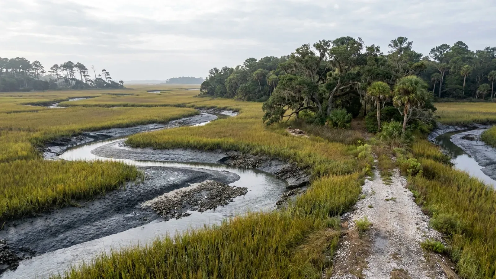
Georgetown County is two counties wearing one name, and knowing which one your parcel is in decides almost everything about the build. East of the Waccamaw River is the Waccamaw Neck — Pawleys Island, Litchfield, Murrells Inlet, DeBordieu — where the land is priced as beachfront and there is effectively none of it to farm. West and north of the river is the other Georgetown County: Andrews, Hemingway, Plantersville, Choppee, the Sampit and Black River bottoms, and the Pee Dee side that shares a line with Williamsburg and Marion. The county's own tree ordinance draws exactly that line, splitting the county into an urban Waccamaw Neck overlay and a rural overlay covering everything else. Three facts shape a barndominium here more than any others. The South Carolina Building Codes Council's Georgetown sheet is one of only two county maps in the entire state carrying a 150 MPH wind contour — Charleston's is the other — and it letters three seismic design categories across the county. The county adopted a Wetland Protection Ordinance on 23 June 2026 whose own findings put 249,336 acres of wetland inside the county, 48 percent of the land area. And Georgetown is one of the eight counties named in the statute that defines South Carolina's coastal zone, which is a legal fact rather than a geographic impression. The agricultural base is small and getting smaller — 63,303 acres in farms, 12.2 percent of the county, down 21 percent in five years — so the honest version of this page is that the land here is bought one tract at a time, on the western side, and the septic evaluation and the wetland delineation come before the offer.
Building conditions in Georgetown County
The building code is the same in every South Carolina county: S.C. Code § 6-9-10(A) requires each municipality and county to enforce the Building Codes Council's codes and to enforce only those, and SC Regulation 8-236(C) bars a local jurisdiction from writing one of its own. The design numbers are not local either, but they are not one number for the state — Regulations 8-1202 and 8-1203 send wind and seismic to the Council's own map for this county, and those maps are drawn as contours, so the figure is read at your address rather than off a county name. What is genuinely local is who issues the permit and inspects the work, what that office charges, the permit procedure it adopted by ordinance, whether your parcel is zoned at all, and the rest of Table R301.2 — frost depth, termite probability and flood — which the jurisdiction fills in for itself.
SC Building Codes Council, "Wind/Seismic Maps", https://llr.sc.gov/bcc/maps.aspx ; the Georgetown County sheet at https://llr.sc.gov/bcc/PDFfiles/WSMaps/Georgetown%2015(Mays).pdf (application/pdf, 3,744,677 bytes, downloaded 8 September 2026; the note box, the two "150 MPH" labels and all eight "C", "D0" and "D1" labels were read from the sheet's own text layer in both layout and reading-order extraction modes, which agree); the substituting modifications at SC Building Codes Council, 2021 Modification Index, https://llr.sc.gov/bcc/PDFfiles/2021-Modification-index.pdf
S.C. Code § 48-39-10(B), (G) and (J) and § 48-39-130(C), Coastal Tidelands and Wetlands Act, served text read 8 September 2026 at https://www.scstatehouse.gov/code/t48c039.php ; SCDES Bureau of Coastal Management, https://des.sc.gov/programs/bureau-coastal-management ; SCDES South Carolina Critical Areas, https://des.sc.gov/programs/bureau-coastal-management/south-carolina-critical-areas ; SCDES Coastal Zone Consistency Certification, https://des.sc.gov/programs/bureau-coastal-management/coastal-zone-consistency-certification
Georgetown County Wetland Protection Ordinance, adopted 23 June 2026, Articles III(a), VI, VII(a) and (b), VIII(c), (d) and (f), and XI(b)(xv), https://www.gtcountysc.gov/DocumentCenter/View/4106/Wetland-Protection-Ordinance-PDF (application/pdf, 1,601,369 bytes, downloaded and read in full 8 September 2026); linked from Georgetown County, Land Development & Zoning Ordinances, https://www.gtcountysc.gov/180/Land-Development-Zoning-Ordinances ; the county's Wetland Buffer Application at https://www.gtcountysc.gov/DocumentCenter/View/4147/Wetland-Buffer-Application-PDF
Georgetown County Zoning Ordinance, Article IV General Provisions §§ 411, 413 and 419 (§ 411 as amended by Ord. 2009-27 and Ord. 2010-28), https://www.gtcountysc.gov/DocumentCenter/View/273/General-Provisions-PDF ; Article VIII Exceptions and Modifications §§ 804 and 806 (§ 806 amended by Ord. 2012-18), https://www.gtcountysc.gov/DocumentCenter/View/232/Exceptions-and-Modifications-PDF ; Article VII Area, Yard and Height Requirements, https://www.gtcountysc.gov/DocumentCenter/View/229/Area-Yard-and-Height-Requirements-PDF (all downloaded 8 September 2026 and read in both layout and reading-order extraction modes; the Forest Agriculture/Residential dimensional row is quoted from the reading-order render, where label and values print on one line, and is independently corroborated against the district section itself)
Georgetown County, Impact Fee Calculation Schedule, https://www.gtcountysc.gov/DocumentCenter/View/153/Impact-Fee-Calculation-Schedule-PDF (application/pdf, 583,474 bytes, downloaded 8 September 2026; a single scanned page carrying one 2,550 × 3,300 pixel image, which was extracted and read at native resolution, and every row total was checked against the sum of its three component columns); Georgetown County, Impact Fee Guidelines — Procedures Regarding Establishing Family Income, revised date of adoption 3 March 2010, https://www.gtcountysc.gov/DocumentCenter/View/205/Impact-Fee-Guidelines-PDF ; both linked from Georgetown County Building Department, https://www.gtcountysc.gov/176/Building-Department and Zoning, https://www.gtcountysc.gov/179/Zoning
Georgetown County Building Department, "New One & Two Family Dwelling Application Checklist" (Building Permit Checklist), https://www.gtcountysc.gov/DocumentCenter/View/147/Building-Permit-Checklist-PDF (application/pdf, 98,544 bytes, downloaded 8 September 2026 and read as extracted text); Building Permit Application, https://www.gtcountysc.gov/DocumentCenter/View/146/Building-Permit-Application-PDF ; Georgetown County Building Department, https://www.gtcountysc.gov/176/Building-Department ; the "accepted engineering practice" definition from SC Building Codes Council, 2021 Modification Index, modification IRC 2021-01, https://llr.sc.gov/bcc/PDFfiles/2021-Modification-index.pdf
Also worth knowing before you build in Georgetown County
- The zoning ordinance applies where the maps say it applies — check your tax map number first
- Georgetown County's Zoning Ordinance carries its jurisdiction in its own enacting clause, in capitals, and the wording is narrower than most people assume. The ordinance is stated to be "EFFECTIVE IN THOSE UNINCORPORATED PORTIONS OF GEORGETOWN COUNTY AS DESIGNATED ON THE OFFICIAL ZONING MAPS, EXCEPT FOR CERTAIN RESTRICTIONS LISTED IN SECTIONS 620.107 AND 804 DEALING WITH PRIVATE AIRFIELDS, WHICH APPLY TO ALL THE UNINCORPORATED PORTIONS OF THE COUNTY." Two carve-outs about private airfields reach the whole unincorporated county; the districts themselves reach the mapped part. Where the map is has changed how it is kept: since Ord. 2022-41, Section 501.1 provides that zoning districts are shown on a GIS coverage layer entitled "Zoning" maintained under the Planning Director, and "The depiction of zoning boundaries as shown on GIS shall constitute the Official Zoning Map for the County's zoning of unincorporated areas," with council-approved changes entered within fifteen business days. Section 500 establishes thirty-four base districts. Four carry rural land and they are not interchangeable. Forest Agriculture/Residential (FA/R) is the workhorse: one acre minimum, 100 feet of lot width, 50-foot front, 20-foot side and 30-foot rear yards, 35 feet maximum height, with single-family dwellings permitted and "one accessory dwelling per parcel when the single family dwelling is not a mobile home and the habitable space of the accessory dwelling unit does not exceed nine hundred (900) square feet." Five Acre Residential (R-5 Ac) takes the same envelope on five acres and exists, in the ordinance's own words, for areas where "due to its remoteness, the impermeability of soil or other soil characteristics and the absence of the necessary urban services, development of higher density is undesirable or infeasible." Rural General Residential (RG) is 15,000 square feet for a single-family dwelling with 70 feet of width and 25/10/20 yards. Preservation Agriculture (PA) has its own acreage rule at Section 626.106. Do not assume a district from a listing: ask the Zoning Department what your tax map number carries before you make an offer.
- The tree ordinance splits the county in two — and it can move your pad but not shrink your building
- Article XIII of the Zoning Ordinance divides Georgetown County into two tree overlay zones, and the line it draws is the same line that divides the county commercially. The Rural Area Tree Overlay Zone is defined as "all of Georgetown County not located on the Waccamaw Neck which is between the Horry County boundary, the Waccamaw River and the ocean" — so everything west and north of the Waccamaw, which is where the acreage is, sits in the rural overlay. Seven species are protected there: live oak, laurel oak, red maple, bald cypress, pond cypress, southern magnolia and yellow poplar, at a diameter-at-breast-height threshold the ordinance's table gives as twelve inches for each species it lists on its own line. Two provisions decide how much this costs you. First, Section 1302.1: occupied single-family parcels — meaning a parcel that already holds a habitable structure with a permanent certificate of occupancy — are exempt from both the tree protection and the tree replacement provisions of the whole article. Vacant land is not, which is exactly the land a barndominium buyer is looking at. On an unoccupied single-family parcel no protected tree may be removed unless the Planning Director makes one of a listed set of determinations. Second, and this is the one to remember, Section 1302.2.6: "In cases where a Protected Tree is in the footprint of a planned building pad, the County cannot require the planned habitable building to be decreased in size but can require the building pad to be shifted. This same provision shall also apply to farming structures." So a long shop bay is not something the tree ordinance can make you shorten — but it may well be something it makes you move, which on a tract with a narrow buildable window between a wetland buffer and a septic field is a real constraint. The county requires a tree plan as part of the residential building permit submittal, and Section 1301.8 prohibits mass grading of an individual building site until it is approved as part of a plan.
- The farm base is shrinking here, and the size distribution tells you why
- Georgetown County has the smallest agricultural base of any Pee Dee or Grand Strand county and one of the smaller ones in the state: the 2022 Census of Agriculture counts 213 farms working 63,303 acres at an average of 297 acres, which is 12.2 percent of the county's 520,746 land acres. The five-year direction is the story. Between 2017 and 2022 the number of farms rose 28 percent, land in farms fell 21 percent, and the average size fell 39 percent. More operations on much less ground, each of them far smaller — that is farmland being split and taken out of production, not consolidated. Inside the remaining base the land use is 12,666 acres of cropland, 1,745 of pasture, 41,496 of woodland and 7,396 of other uses, four figures that sum exactly to the 63,303-acre total. Woodland is 66 percent of it, the highest share of any land use here by a wide margin, so most of what is advertised as farm in this county is timbered ground and the clearing belongs in the budget before the slab does — subject to the tree ordinance above. The size distribution is genuinely favourable to someone who wants a workable tract rather than a farm: 42 operations of 1 to 9 acres, 60 of 10 to 49 and 43 of 50 to 179, so 145 of the county's 213 farms sit under 180 acres. Crops are 97 percent of the value sold against 3 percent for livestock and poultry, and the largest single line is nursery, greenhouse, floriculture and sod at $8.736 million, eleventh in the state — which is a Waccamaw Neck landscape-supply economy rather than a row-crop one. Meanwhile the county is growing: 65,912 residents estimated for 2025 against 63,404 at the 2020 census, up 4.0 percent. Rising population against a shrinking farm base is the arithmetic that makes land here scarce rather than cheap, and it is why the western half of the county is the part worth looking at.
- The published permit fee, band by band, and the penalty for starting early
- Georgetown County's building permit fees come from Ordinance No. 2007-26, the Building Code Fee Schedule, as amended, and the residential schedule runs on total valuation in five steps. Up to and including $1,000 the fee is $30.00. From $1,001 up to and including $50,000 it is $30.00 for the first $1,000 plus $6.50 for each additional thousand or fraction thereof. From $50,001 up to and including $100,000 it is $348.50 for the first $50,000 plus $5.50 for each additional thousand. From $100,001 up to and including $500,000 it is $623.50 for the first $100,000 plus $4.50 for each additional thousand. From $500,001 and up it is $2,423.50 for the first $500,000 plus $3.50 for each additional thousand. Those five bands chain together exactly — $30 plus 49 times $6.50 is $348.50, which is the next band's base; $348.50 plus 50 times $5.50 is $623.50; $623.50 plus 400 times $4.50 is $2,423.50 — so the schedule reconciles against itself, which is the check worth doing on any fee sheet before you budget from it. The moving of any building or structure is $100.00. The ordinance also carries a provision people discover the hard way: if any person "commences any work on a building or structure, starts any development or places any mobile home before obtaining the necessary permit from the Building Official, he shall be subject to the penalty of a double permit fee," and no permit issues under the Flood Ordinance or the Zoning Ordinance until the prescribed fee has been paid. Impact fees are separate and are set out above. Septic is separate again and is a state permit rather than a county one.
- Tidal ground, flatwoods ground, and where the septic evaluation says no
- The soil survey measures 44,090 acres of Bohicket and 24,610 acres of Levy in Georgetown County. Both are tidal marsh soils — Bohicket is a Typic Sulfaquent formed in marine sediments in tidal marshes flooded twice daily by sea water, Levy a Typic Hydraquent whose type location is in Georgetown County itself, in the Pee Dee River flood plains. Neither is buildable ground in any ordinary sense: no bearing, subsidence when drained, and acid-sulfate conditions that attack concrete and steel. The useful part is that a buyer can read the flag off the taxonomy without any training — a map unit whose taxonomic class contains Sulfaquents, Hydraquents or Sulfihemists is a stop sign, and it is visible in the USDA Web Soil Survey before anyone drives out. Away from the marsh the county is Outer Coastal Plain flatwoods, with 16,674 acres of the Leon spodosol mapped here and a seasonal water table that sits roughly six to eighteen inches below grade from November through April. On that ground the height of the building pad is the foundation decision, not an afterthought: fill volume, compaction and drainage away from the pad are where the money goes, and an embedded-post foundation that spends half the year in saturated soil may simply be the wrong system for the site. Septic is permitted by the South Carolina Department of Environmental Services under Regulation 61-56, not by the county, and it is usually the septic evaluation rather than any county rule that decides how small a workable tract can be. Below the Fall Line the evaluation is done with hand borings rather than backhoe pits; § 200.6 keeps no part of the system within five feet of a building or a property line, 75 feet of a private well, 100 feet of a public well or 25 feet of a drainage ditch; and § 200.7(1) requires a usable repair area equal to at least half the original system, on soil proven suitable. On a wide barndominium footprint that arithmetic, not a setback line, is what fixes where the pad goes. Get the soil evaluation done before you close, and walk the tract in a wet month if you can.
- Eighteen inches above grade, before the flood map says anything at all
- Georgetown County has a finished-floor rule that applies everywhere in the zoned unincorporated county, flood zone or no flood zone. Section 413 of the Zoning Ordinance: "All buildings shall be elevated to help eliminate flooding, in that the finished floor shall be elevated at least eighteen inches above the grade of the lot or the grade of the street, whichever is less, or when this is not practical because of unusual conditions, the Building Inspector shall determine the appropriate elevation." On a slab-on-grade steel or post-frame building that is not a detail, it is a fill quantity, and on flatwoods soil the fill is already the largest earthwork number on the job. Section 406 then sends anything in a flood-prone area to the county's Flood Damage Prevention Ordinance, most recently revised February 2023 and amended 26 April 2023, which is administered by the Building, Planning and Zoning department. In a special flood hazard area the building permit picks up the elevation certificate — completed no more than one year before application — the three-party memo or V-zone certification worksheet for AE and VE zones, and a recorded non-conversion agreement for the enclosure below the lowest floor. The county publishes flood zone information and elevation certificates through an online mapping portal and links its own flood zone map viewer from the Building Department page. Read the flood map and the wetland delineation together before you make an offer: on a Georgetown tract they usually describe the same low ground from two directions, and the cheapest acreage in the county is very often exactly that ground.
Georgetown County Zoning Ordinance, Article I Authority and Enactment Clause, https://www.gtcountysc.gov/DocumentCenter/View/271/Authority-and-Enactment-Clause-PDF ; Article V §§ 500, 501 and 501.1 (§ 501.1 amended by Ord. 2022-41), https://www.gtcountysc.gov/DocumentCenter/View/272/Establishment-of-Zoning-Districts-and-Rules-for-the-Interpretation-of-District-Boundaries-PDF ; § 625 Forest Agriculture/Residential District, https://www.gtcountysc.gov/DocumentCenter/View/241/625-Forest-Agriculture-Residential-District-FAR-PDF ; § 624 Five Acre Residential District, https://www.gtcountysc.gov/DocumentCenter/View/240/624-Five-Acre-Residential-District-R-5-Ac-PDF ; § 621 Rural General Residential District, https://www.gtcountysc.gov/DocumentCenter/View/237/621-Rural-General-Residential-District-RG-PDF ; Article VII Area, Yard and Height Requirements, https://www.gtcountysc.gov/DocumentCenter/View/229/Area-Yard-and-Height-Requirements-PDF (all read 8 September 2026)
Georgetown County Zoning Ordinance, Article XIII Tree Regulations (Amended Ord. 23-24), §§ 1300.17, 1301.6, 1301.8, 1302, 1302.1 and 1302.2, https://www.gtcountysc.gov/DocumentCenter/View/1346/ARTICLE-13-Tree-Regulations-PDF (application/pdf, 163,952 bytes, downloaded 8 September 2026 and read in both layout and reading-order extraction modes; the species table's diameter column was checked in both renders and the entry shared by the two oak species renders ambiguously between them, so confirm the oak threshold with the Planning Department); the tree plan requirement on the county's own Building Permit Checklist, https://www.gtcountysc.gov/DocumentCenter/View/147/Building-Permit-Checklist-PDF
USDA National Agricultural Statistics Service, 2022 Census of Agriculture County Profile — Georgetown County, South Carolina, https://www.nass.usda.gov/Publications/AgCensus/2022/Online_Resources/County_Profiles/South_Carolina/cp45043.pdf (application/pdf, 879,950 bytes, downloaded 8 September 2026 and read in both reading-order and layout extraction modes; the three percentage-change figures are quoted from the reading-order render, where label, value and percent print on one line, and the layout render was confirmed to be shifted against its labels on exactly those three rows; the four land-use figures and the six farm-size counts were each checked to sum exactly to their totals); land area and the statewide farmland comparison from research/statewide/geography-and-population.md, built on the same census joined to the 2025 Census Gazetteer county file, https://www2.census.gov/geo/docs/maps-data/data/gazetteer/2025_Gazetteer/2025_gaz_counties_45.txt ; population from U.S. Census Bureau Vintage 2025 county population estimates, https://www2.census.gov/programs-surveys/popest/datasets/2020-2025/counties/totals/co-est2025-alldata.csv
Georgetown County, Permit Fee Schedule — Ordinance No. 2007-26, Building Code Fee Schedule, as amended, https://www.gtcountysc.gov/DocumentCenter/View/137/Permit-Fee-Schedule-PDF (application/pdf, 945,526 bytes, downloaded 8 September 2026; the document is a scan carrying 44 embedded image strips, which were extracted and read at native resolution, and the five valuation bands were reconciled arithmetically against one another before being quoted); linked from Georgetown County Building Department, https://www.gtcountysc.gov/176/Building-Department
S.C. Regulation 61-56, Onsite Wastewater Systems, §§ 200.5, 200.6 and 200.7(1), https://des.sc.gov/sites/des/files/Library/Regulations/R.61-56.pdf ; SCDES Professional Soil Classifiers, https://des.sc.gov/permits-regulations/septic-tanks/professional-soil-classifiers ; the Bohicket, Levy and Leon component acreages for Georgetown County and the Outer Coastal Plain water-table profile from research/statewide/soils-and-geology.md, built on USDA-NRCS Soil Data Access component acreage by survey area, with the series taxonomy read from the official series descriptions at https://soilseries.sc.egov.usda.gov/OSD_Docs/B/BOHICKET.html and https://soilseries.sc.egov.usda.gov/OSD_Docs/L/LEVY.html
Georgetown County Zoning Ordinance, Article IV General Provisions §§ 406 and 413, https://www.gtcountysc.gov/DocumentCenter/View/273/General-Provisions-PDF ; Georgetown County Flood Damage Prevention Ordinance (February 2023 revision), https://www.gtcountysc.gov/DocumentCenter/View/2906 ; Georgetown County, Flood Protection, https://www.gtcountysc.gov/424/Flood-Protection ; the flood-zone submittal items from the county's Building Permit Checklist, https://www.gtcountysc.gov/DocumentCenter/View/147/Building-Permit-Checklist-PDF ; the county's flood zone map viewer, https://georgetown.maps.arcgis.com/apps/webappviewer/index.html?id=8914e8af08b34826b2f38aac4dec476b

The expensive surprises are in the ground, not the building
What moves a South Carolina budget is usually below grade, and more often than not it is the drainfield rather than the foundation. R.61-56 § 200.1 settles whether a parcel can take an onsite system from soil morphology — texture, structure, depth to a restrictive horizon and depth to the zone of saturation — and § 200.2 then rules out two conditions outright: soils exhibiting massive or platy structure, and soils with substantial amounts of expansible layer clay minerals or smectites. That second clause is the one that bites on the mafic Piedmont, where the shrink-swell series sit in quantity under York, Fairfield, Chester, Laurens, Union, Newberry, Greenwood, McCormick, Lancaster, Saluda, Abbeville and Edgefield. A foundation problem has a price and an answer; an unbuildable septic parcel has neither, which is why we look at it first. Bedroom count is the number to settle early, because § 61-56.501 drives design flow from bedrooms, design flow drives trench length, and trench length plus a repair area decides how much good soil the parcel has to have — shop square footage adds nothing to it. Above the Fall Line the evaluation is done in backhoe pits rather than borings alone, so the answer comes from a dug hole and not a form. The site work, the foundation and the drainfield therefore get resolved together rather than one at a time. We price the dirt before we price the building.
What we build in Georgetown County
All nine services are available in Georgetown County. What a build costs depends far more on the parcel than on square footage, so we price against your land rather than publishing a rate card.
Custom Plans
Barndominium plans drawn for your parcel and sealed at the point where South Carolina’s engineering exemption stops applying.
Barndominium Kits
Engineered shell packages for South Carolina land — open construction under the state’s own definition, and therefore not a modular building.
Turnkey Builds
Barndominium construction from raw land through to occupancy: one contract, one schedule, one party answering the building official.
What a build looks like
Three stages every Georgetown County project passes through, from a raw parcel to a finished home. Site work first, because that is where the budget is decided.

The parcel
Zoning, setbacks, flood zone and utility access get checked before anything is drawn.
Pad and permit
Clearing, grading and a compacted pad, while the submittal works through whichever office issues the permit where you are building.

Frame to finish
Shell erected and dried in, then systems, insulation and interior finish through to CO.
Those are the rules where you are building in Georgetown County. Tell us what you want to build and we will draw it to them.
Keep reading
The questions that usually come next once you know what Georgetown County allows.
Nearby areas we build in
Others we cover nearby. One may be a county and another a municipality inside one — and a South Carolina municipality can sit in two counties at once — so the office that issues the permit, the fees it charges, whether the land is zoned at all, and which design map covers it can all differ from one card to the next.
Building in Georgetown County: common questions
8 questions we get asked most often about building in Georgetown County. If yours is not on the list, ask it directly.
What wind speed and seismic design category apply on my Georgetown County parcel?
Can the shop be bigger and taller than the house?
Georgetown is a coastal county. Does OCRM have to permit my build?
The land looks cheap and wooded. What should I check before I make an offer?
What will Georgetown County charge me to build?
Do I really need an engineer, or can I build from the plan set the building supplier sends?
Is my parcel actually zoned? And what district should I be looking for?
Where in Georgetown County should I actually be looking for land?
Building in Georgetown County?
Start with the plan. Tell us what you want to build and we will draw it, then confirm which office issues the permit for your parcel, what it will let you put there, and what wind load it has to meet. That conversation costs nothing.