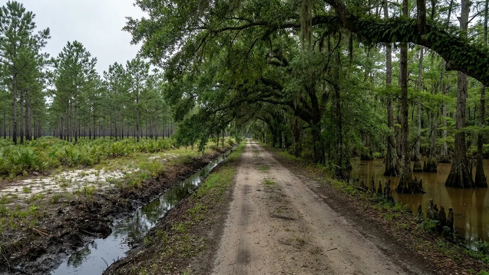
Flat South Carolina pine flatwoods with a loblolly plantation in straight rows, a blackwater cypress swamp margin, a water-filled roadside ditch and a shallow Carolina bay depression.
Horry County One statewide code, county design maps

Barndominium Builders in Conway, SC

Conway is Horry County's seat, thirty-odd minutes inland on the Waccamaw, and it is the practical answer to a Grand Strand land search. The city holds 30,627 people across 27.995 square miles - about 1,094 to the square mile, roughly half the density of Summerville and well under Myrtle Beach's - and unlike the beach municipalities it kept genuine land districts on its own map: Residential Agricultural and Forest Agriculture both set a 40,000 square foot minimum lot with 200 feet of width, a 40-foot height limit and 50-foot front and rear yards, and single-family is a permitted use in each. Two design facts are worth having straight before anything is drawn. The Building Codes Council's Horry County sheet puts its 150 MPH contour offshore in the Atlantic where it never crosses land, and its 140 MPH contour through the western county past Aynor - so Conway sits between the two lines and there is no Conway number to look up, only a reading the authority having jurisdiction makes, and inside the city that authority is Conway rather than the county. And the seismic labels on that same sheet read B here, which means the residential code's seismic chapter never reaches a detached dwelling at all - the exact opposite of the Charleston-triangle towns an hour and a half down the coast. The engineering case in Conway is made on wind, on the water table and on what the city asks for at submittal. The city's own accessory-structure rules are the thing to read before buying, because they are stricter than unincorporated Horry's in both size and material.

Conway at a glance

County
Horry County
Population
30,627

Building conditions in Conway

The building code is the same in every South Carolina county: S.C. Code § 6-9-10(A) requires each municipality and county to enforce the Building Codes Council's codes and to enforce only those, and SC Regulation 8-236(C) bars a local jurisdiction from writing one of its own. The design numbers are not local either, but they are not one number for the state — Regulations 8-1202 and 8-1203 send wind and seismic to the Council's own map for this county, and those maps are drawn as contours, so the figure is read at your address rather than off a county name. What is genuinely local is who issues the permit and inspects the work, what that office charges, the permit procedure it adopted by ordinance, whether your parcel is zoned at all, and the rest of Table R301.2 — frost depth, termite probability and flood — which the jurisdiction fills in for itself.

Build conditions for Conway , Horry County, South Carolina : design wind speed The Building Codes Council's Horry County sheet carries a blue contour boxed and labelled 140 MPH running roughly north-south through the western county past Aynor, and a second boxed contour labelled 150 MPH lying offshore in the Atlantic parallel to the Grand Strand, where it does not cross land anywhere in the county. Conway sits between the two lines rather than on either. The seismic labels hand-lettered on the same sheet are B and C, with the C on the south-western side toward Georgetown County, so Conway reads B. BUILD CONDITIONS CONWAY, SCHorry CountyONE STATEWIDE CODEDESIGN WIND SPEEDThe Building Codes…Reg 8-1202 and 8-1203 (modifications IRC 2021-04 and IRC 2021-05) replace the IRC's own wind andseismic figures with the Council's previously published county maps. Horry is one of the 35…ZONING · RA (RESIDENTIAL AGRICULTURAL) AND FA…40,000 sq ft for a single-family det…Section 3.2.1 states the RA district's intent as "large residentialestates and agriculture" with "Single lots are two (2) acres or…IMPACT AND PERMIT FEESResidential building permitConway levies no impact fee on the published Construction Servicesschedule. The residential building permit is worked from a valuatio…WHO ISSUES THE PERMITCity of Conway Building Department a…196 Laurel Street, PO Box 1075, Conway, SC 29528; (843) 488-9888,building@cityofconway.com, with the Planning Department on the same…
Build conditions for Conway, drawn from the sourced facts on this page. Every figure above is cited in the quick-facts panel below, with its source and vintage.
The Council's Horry County map puts the 150 MPH contour offshore - it never crosses land
This is the first thing to unlearn about building anywhere on the Grand Strand, Conway included, because almost everyone assumes the beach number and the assumption does not survive the map. Regulations 8-1202 and 8-1203 replace IRC R301.2.1 and R301.2.2.1 with "the previously published maps by the South Carolina Building Codes Council," so the governing instrument here is the Council's own county sheet rather than a national map or an insurance table. The Horry sheet is an image-only scan of a marked-up highway map with an empty text layer, which is why it is so rarely quoted; extracted and read at native resolution it carries two boxed blue contours. One is labelled 140 MPH and runs roughly north to south through the western part of the county, passing just east of Aynor near Cool Spring and Dog Bluff. The other is labelled 150 MPH and lies out in the Atlantic, parallel to the beach and several miles offshore - it does not touch land anywhere in the county. Conway therefore sits between the two lines, not on either. The map's own note governs what that means: a wind speed "applies at all points along the length of its corresponding (blue) line," and "Interpolation between wind speed lines is determined by the AHJ as permitted by Figure R301.2(4)(A) of the 2015 International Residential Code." Modification IRC 2021-04 adds that the local building official may delineate the wind design category within the jurisdiction so long as it does not surpass the Applied Technology Council's figures, and sets a floor below the map's lowest speed. So there is no Conway wind speed to look up. There is a determination made for your address by the authority having jurisdiction - and inside the corporate limits that is the City of Conway's Building Department, not Horry County Code Enforcement. Get it in writing before a steel package or a truss order is placed.

SC Building Codes Council, Wind/Seismic Maps, https://llr.sc.gov/bcc/maps.aspx and the Horry County sheet at https://llr.sc.gov/bcc/PDFfiles/WSMaps/Horry%20County.pdf (10,372,422-byte one-page PDF whose single embedded 10,166 x 10,867-pixel raster was extracted and read at native resolution; transcription recorded in research/statewide/design-criteria-and-climate.md section 3c); Regulations 8-1202 and 8-1203, 2021 Code Modifications, S.C. State Register Vol. 46 Issue 5, 27 May 2022, https://llr.sc.gov/bcc/PDFfiles/2021-Code-Modifications.pdf ; SCBCC 2021 Modification Index, modifications IRC 2021-04 and IRC 2021-05, https://llr.sc.gov/bcc/PDFfiles/2021-Modification-index.pdf ; City of Conway Building Department, https://www.conwaysc.gov/departments/building/index.php

Seismic B in Conway - so the engineering argument here is wind, not earthquakes
This is the single sharpest regulatory difference between building in Conway and building in the Charleston triangle, and it runs the opposite way to what most people expect from a coastal town. The seismic labels on the Council's Horry County sheet are hand-lettered B and C either side of a hand-drawn boundary, near Galivants Ferry on the Marion County side and Bucksport Landing on the Waccamaw at the Georgetown line; in both pairs the C sits on the south-western side and the B on the north-eastern, so Conway reads B. SC Residential Code R301.2.2 applies the code's seismic provisions to a detached one- and two-family dwelling only in Seismic Design Categories D0, D1 and D2 - that is item 2 of the section, and townhouses pick them up one category earlier at C. At B a detached house never picks the chapter up at all. Everything that makes this building type difficult around Summerville therefore does not fire here: R403.1.2's requirement that exterior walls sit on continuous solid or fully grouted masonry or concrete footings, R403.1.3's footing and stem-wall reinforcement, R403.1.6.1's plate washers along every required braced wall line, and above all R301.2.2.6's eight irregularity conditions, which a wide clear shop bay next to a two-storey living end trips several of by design. For scale: the Council's sheets put Dorchester at D0 through D2, Berkeley at D1 and D2 and Charleston at C through D2, so the same plan really is a different building a hundred miles down the coast. That is genuinely good news, and it also removes the argument most people expect to be making. The case for an engineered building in Conway rests on wind uplift and a continuous load path, on the water table and the pad, and on what the permitting jurisdiction demands at submittal - not on seismic.

Seismic and wind labels from the SCBCC Horry County sheet, https://llr.sc.gov/bcc/PDFfiles/WSMaps/Horry%20County.pdf (raster extracted and read at native resolution); comparison counties from the Council's Dorchester, Berkeley and Charleston sheets linked at https://llr.sc.gov/bcc/maps.aspx ; 2021 South Carolina Residential Code sections R301.2.2, R301.2.2.6, R403.1.2, R403.1.3 and R403.1.6.1, read at https://up.codes/viewer/south_carolina/irc-2021/chapter/3/building-planning and https://up.codes/viewer/south_carolina/irc-2021/chapter/4/foundations — a third-party rendering of the adopted South Carolina code

Inside the city a detached shop is capped at half the house - and at half the rear yard
The City of Conway's Unified Development Ordinance is more prescriptive about accessory buildings than the county ordinance next door, and Section 5.2.1(A) is the provision to read before buying a lot inside the corporate limits. It applies to single-family detached, single-family semi-detached and two-family dwelling uses, and lists what may be built accessory to them - "detached private garages, storage sheds, children's playhouses, private kennels, non-commercial greenhouses, bath houses, cabanas, garden structures (gazebos, arbors, pergolas), book exchange boxes and structures designed and used for purposes of shelter in the event of a man-made or natural catastrophe." Then it constrains them on five axes at once. Location: "Shall be located in the rear yard only. Detached garages and garden structures may also be located in the side yard." Setbacks: a minimum of five feet from all property lines, and five feet from other accessory structures and from the principal structure. Height: "Shall not exceed fifteen (15) feet in height unless it is located entirely in the buildable area of the lot," and where it does exceed fifteen feet it takes the district's maximum height and "shall not be higher than the principal structure." Number: "Shall be limited to three (3)." And size, which is the binding one: "The total square footage of all accessory structures on a lot shall not exceed fifty (50%) percent of the rear yard. The square footage of one (1) accessory structure shall not exceed 50% of the area of the primary structure on the same lot." Two ceilings, both live at once. However large the lot, a single detached shop inside Conway can never exceed half the area of the house it serves, and every accessory structure together can never occupy more than half the rear yard. The design that sidesteps both is the obvious one: where the shop bay and the living space are one continuous building, it is not an accessory structure at all - it is the dwelling, and single-family is a permitted use in every residential district in the city plus Forest Agriculture.

City of Conway Unified Development Ordinance section 5.2.1(A) (Accessory Structures) and Article 4 Use Tables, adopted 12 December 2011, last amended 20 July 2026, city-published PDF at https://www.conwaysc.gov/Current%20UDO%20(7.20.26).pdf (11,450,157-byte PDF downloaded 6 Sep 2026, text extracted and read in both layout and reading order), linked from https://www.conwaysc.gov/departments/planning___development/p_dfrequently_referenced_documents.php

Four hundred square feet and up: no corrugated metal, no sheet metal, no exposed metal
This is the provision that most changes what a barndominium looks like inside the Conway city limits, and it is easy to miss because it sits under the heading Design rather than under Size. Section 5.2.1(A)(6) sets material standards for accessory structures at single-family, single-family semi-detached and two-family dwellings, banded by floor area. Under 200 square feet, a structure over ten feet tall "shall not be constructed with any corrugated metal, sheet metal, and/or exposed metal & shall be required to use stucco, tabby, wood siding, brick, fiber cement siding, or other material with similar texture." Between 200 and 399 square feet the same material list applies regardless of height. And at "Four hundred (400) square feet & greater," the structure "Shall not be constructed with any corrugated metal, sheet metal, and/or exposed metal & shall architecturally complement the primary structure in exterior finish & roof pitch." A 30-by-40 shop is 1,200 square feet, so any real workshop is in the top band. Note two things about how far that reaches. Paragraph (A), the residential paragraph, carries no district exemption - the parallel non-residential paragraph (B) exempts parcels zoned CP, FA, LI and HI from its own material rule, and paragraph (A) has no equivalent. And it is a rule about accessory structures, not about houses: the city's residential facade list at Section 6.2.3, which permits "Brick, fiber-cement, hardi-plank, stone, vinyl, or equivalent quality material," applies by its own applicability clause only to "any residential development considered to be a 'major' subdivision or development, as defined in Section 10.2.2," and expressly excepts minor developments, neo-traditional developments and accessory dwelling units - and Section 10.2.2 defines a major development as one involving five or more lots or units, new street segments, required Planning Commission review, or dedication of land. So the metal question inside Conway lands squarely on the detached shop. Where the shop and the house are one continuous principal building, Section 5.2.1 does not reach it. Anything in a Historic Design Review District needs Community Appearance Board approval on top.

City of Conway Unified Development Ordinance sections 5.2.1(A)(6), 5.2.1(A)(7), 5.2.1(B)(6), 6.2.3(C) and (D) and 10.2.2, https://www.conwaysc.gov/Current%20UDO%20(7.20.26).pdf , linked from https://www.conwaysc.gov/departments/planning___development/p_dfrequently_referenced_documents.php

Conway kept two land districts on its own map: RA and FA, at 40,000 sq ft and 200 feet wide
This is what separates Conway from the beach municipalities, and it is the reason a land search on the Grand Strand ends here rather than there. Section 3.2.1 of the Unified Development Ordinance describes the Residential Agricultural district: "The intent of the RA District is to provide areas for large residential estates and agriculture. Single lots are two (2) acres or larger." Section 3.2.16 keeps a second one, Forest Agriculture: "The intent of the FA District is to establish and preserve areas designated for agriculture uses and passive recreational activities." Table 6.1 then sets the dimensions, and RA and FA carry identical figures - the largest in the city: a minimum lot of 40,000 square feet for a single-family detached dwelling, 200 feet of minimum lot width, 200 feet of minimum lot depth, a maximum building height of 40 feet, and setbacks of 50 feet front, 50 feet rear and 20 feet side, with a 30-foot corner front on a local street and 50 feet on an arterial or collector. Footnote 3 records that Table 6.1 applies to FA property proposed for single-family residential development. Article 4's use table shows Single-Family as a permitted use in R, RA, RR, R-1, R-2, R-3, R-4, P and FA. For comparison, the next district down - Rural Residential - is 20,000 square feet at 100 feet of width, and R-1 is 7,500 at 75. Two frontage rules travel with the big districts: Section 6.1.10 requires RR, RA and FA lots fronting a curved street to carry at least 75 feet of frontage and those on a cul-de-sac at least 70. The 40-foot height limit is worth noting on its own, because it is generous for a residential district and leaves room for a tall clear-span bay under one roof with the living end.

City of Conway Unified Development Ordinance sections 3.2.1, 3.2.2, 3.2.3, 3.2.16, 6.1.10 and 6.2, Table 6.1 (Dimensional Requirements for Residential Zoning Districts, read in both layout and reading-order extractions and reconciled), and Article 4 Use Tables, https://www.conwaysc.gov/Current%20UDO%20(7.20.26).pdf , linked from https://www.conwaysc.gov/departments/planning___development/p_dfrequently_referenced_documents.php

Cross the city line and the shop rules invert: no cap at all in unincorporated Horry
The two ordinances that meet at the Conway city limit answer the shop question in opposite directions, and knowing which side of the line a parcel is on is worth more here than almost any other piece of local research. Inside the city, Section 5.2.1(A)(5) caps one accessory structure at 50 percent of the area of the primary structure and all of them together at 50 percent of the rear yard, holds them to the rear yard, limits them to three and to fifteen feet in height unless entirely within the buildable area, and bars corrugated, sheet or exposed metal at 400 square feet and up. Outside it, in unincorporated Horry County, the county's zoning ordinance treats the same building completely differently. Section 402, governing accessory buildings once a principal dwelling exists on the parcel, contains no size limit of any kind - no square-footage ceiling, no percentage of the dwelling - only the district setbacks, the district height limit and a rule that an accessory use may not sit forward of the principal structure. What the county does cap is the other case: a building on land with no dwelling on it is a "non-commercial personal use building," and Section 919 provides that "The building does not exceed four thousand five hundred (4,500) square feet in size," with parcels under three acres limited to one of them. So the county's ceiling depends on whether a house is there first, and the city's ceiling depends on how big the house is. Permitting follows the same line: inside the corporate limits the City of Conway Building Department at 196 Laurel Street issues the permit and the city's Planning Department issues the certificate of zoning compliance; outside it, Horry County Code Enforcement, also in Conway, on a different fee schedule and a different submittal list - the county will not take a residential plan set without wind design summary sheets and an original South Carolina engineer's or architect's seal. The code itself does not change either way: S.C. Code section 6-9-10(A) requires every municipality and county to enforce the Building Codes Council's codes and to "enforce only" those.

City of Conway Unified Development Ordinance section 5.2.1(A), https://www.conwaysc.gov/Current%20UDO%20(7.20.26).pdf ; Horry County Zoning Ordinance (Appendix B to the Code of Ordinances) sections 402 and 919 and Table 2-1, county-published edition at https://www.horrycountysc.gov/media/i0pfcm2o/appendix-b-zoning-ordinance-upated-912026.pdf ; Horry County Code Enforcement, "What you need for a Building Permit," https://www.horrycountysc.gov/departments/code-enforcement/permits/building-permit/what-you-need-for-a-building-permit/ ; City of Conway Building Department, https://www.conwaysc.gov/departments/building/index.php ; S.C. Code section 6-9-10, https://www.scstatehouse.gov/code/t06c009.php

Also worth knowing before you build in Conway

Two feet above the base flood elevation, and three elevation certificates before you are done
Conway sits on the Waccamaw River, and the city's floodplain rules are the practical consequence. The city's own floodplain page states the standard plainly: "The minimum elevation of a structure within the Special Flood Hazard Area is 2 feet above the Base Flood Elevation." That is a foot less freeboard than Myrtle Beach requires on the coast, and it is still a fill, drainage and driveway-grade decision on a wide slab-on-grade building rather than a detail - the flood determination belongs before the pad is designed, not after. The paperwork is the part people underestimate: "Elevation Certificates (ECERTs) will be required for new construction in the Special Flood Hazard Area. Each project will have to provide 3 Elevation Certificates; Construction Drawings, Under Construction and a Finished Construction Elevation Certificate." Three certificates means a surveyor on the job three times, at design, during construction and at completion. The Unified Development Ordinance reinforces the same two-foot standard from the land-development side: Section 10.5's lot design rules require that a lot's building area "shall lie at or be elevated to at least two (2) feet above the one hundred (100) year flood elevation as provided for in the Flood Damage Prevention Ordinance (Title 5, Chapter 2 of the City of Conway Code of Ordinances)," and that lots be designed to provide positive drainage away from building sites. Outside the Special Flood Hazard Area the city notes B, C and X zones, where the certificates are not required.

City of Conway, Flood Plain Information, https://www.conwaysc.gov/departments/building/flood_plain_information1.php (read 6 Sep 2026); City of Conway Unified Development Ordinance section 10.5 (Lot Building Areas), https://www.conwaysc.gov/Current%20UDO%20(7.20.26).pdf ; City of Conway Code of Ordinances, Title 5 Chapter 2 (Flood Damage Prevention), https://library.municode.com/sc/conway/codes/code_of_ordinances?nodeId=TIT5PLDE_CH2FLDAPR

The city's fee is worked from a fixed valuation, and a garage is valued at a sixth of a house
Conway prices a residential permit off a valuation the city sets rather than off your contract, and the schedule is unusually explicit about it. The Construction Services Permit Fee Schedule for 2026-2027 sets residential building, for new construction and additions only, at "$200.00 per square foot valuation," and private garages at "$33.00 per square foot valuation" - so the same square foot is valued roughly six times higher as house than as garage, and the fee follows. Storage buildings are charged differently again, at "$0.30 x total square foot for permit cost," and porches and decks at $0.25 per square foot. The valuation then runs through the Permit Fee Chart: $30.00 up to $2,000; $30.00 for the first $2,000 plus $6.00 per additional thousand to $50,000; $324.00 for the first $50,000 plus $5.00 per thousand to $100,000; $574.00 for the first $100,000 plus $4.00 per thousand to $500,000; and $2,174.00 for the first $500,000 plus $3.00 per thousand above. Plan checking is one-half the permit fee. Zoning compliance is $25.00 and a contractor change is $150.00. Sanitation plan review is "$340 per unit for single-family & multi-family units." Re-inspection is $100.00 after two failed inspections, and $100 where an inspection is requested but the work is not ready. A permit renewal is half the permit fee, or $150.00 if the project has reached final inspection or certificate of occupancy. And the schedule keeps the usual penalty with unusual emphasis: where work requiring a permit "is started or in progress prior to obtaining said permit, the fees herein specified shall be DOUBLED." Trade permits - electrical, plumbing, mechanical and gas - are charged separately on their own bases.

City of Conway, Construction Services Permit Fee Schedule 2026-2027, https://www.conwaysc.gov/Const%20Services%20Permit%20Fee%20Schedule%202026-2027..pdf (PDF downloaded and read 6 Sep 2026 in both layout and reading-order modes; the residential and commercial tables are quoted from the reading-order render, which pairs each label with its own value), linked from the City of Conway Building Department, https://www.conwaysc.gov/departments/building/index.php

An accessory dwelling unit is capped at half the house or 1,000 square feet, whichever is less
If the plan is a shop with living quarters over or beside it, the city has a specific instrument for that and a specific ceiling on it. Section 6.2.2(G) of the Unified Development Ordinance governs accessory dwelling units. Location: ADUs "shall be located in the rear yard as defined by Article 2 with the exception of being part of an attached or detached garage, which may be located in a side yard," and where in a side yard may not sit forward of the front facade of the principal structure. Height: subject to the district maximum, and "the ADU shall not exceed the height of the principal structure on the property." Number: "No more than one (1) ADU shall be permitted on a single deeded lot in conjunction with a permitted single-family detached dwelling." Size: "The size of an ADU shall not exceed 50 percent of the gross floor area of the principal dwelling or one thousand (1,000) square feet, whichever is less." It requires one additional off-street parking space, must "architecturally complement the primary structure in exterior finish and roof pitch," permits no retail sales, may be attached or detached, and the property may not be converted to a horizontal property regime. So a thousand square feet is the hard ceiling on habitable accessory space inside the city, and on a house under 2,000 square feet the ceiling is lower still. That is the honest reason the one-building design - shop bay and living space under a continuous roof, permitted and inspected as a dwelling - is the right answer more often inside Conway than the two-building one.

City of Conway Unified Development Ordinance sections 5.2.2 and 6.2.2(G) (Accessory Dwelling Units), https://www.conwaysc.gov/Current%20UDO%20(7.20.26).pdf

27.995 square miles, 1,094 people to it - and 151,691 acres of farmland outside
Conway is the largest municipality by land area on the Grand Strand and the least crowded, and the numbers explain why a land search that starts at the beach ends here. The Census Bureau's 2025 Gazetteer records the city at 72,507,826 square metres of land - 27.995 square miles, about 17,917 acres - which is more territory than the City of Myrtle Beach holds at 23.441 square miles. The Vintage 2025 estimates put 30,627 people on it, roughly 1,094 to the square mile against Myrtle Beach's 1,746 and Summerville's 2,353. Then the county around it: USDA's 2022 Census of Agriculture records 629 farms working 151,691 acres in Horry County - 20.9 percent of a 725,217-acre county - of which 92,254 acres is cropland, 48,253 woodland and 5,579 pasture, at an average holding of 241 acres. The size distribution is the part that matters to a buyer: 248 of those operations run 10 to 49 acres and 178 run 50 to 179, so about two thirds sit under 180 acres. That farm belt is the county's western and northern half - Aynor, Galivants Ferry, Green Sea, Loris - and Conway is the town it drains into. Meanwhile the Census Bureau recorded 14,222 net domestic migrants into Horry County in the year to 1 July 2025, the largest single-county figure in South Carolina. Demand on the beach, land inland, and twenty to forty minutes of road between them.

U.S. Census Bureau, 2025 Gazetteer Files, Places, South Carolina, https://www2.census.gov/geo/docs/maps-data/data/gazetteer/2025_Gazetteer/2025_gaz_place_45.txt (Conway city ALAND 72,507,826 sq m, 27.995 sq mi; Myrtle Beach city 23.441 sq mi; Summerville town 22.601 sq mi); U.S. Census Bureau, Vintage 2025 subcounty estimates, https://www2.census.gov/programs-surveys/popest/datasets/2020-2025/cities/totals/sub-est2025_45.csv (Conway city 30,627 on 1 July 2025 against a 2020 estimates base of 25,057); U.S. Census Bureau Vintage 2025 county estimates, https://www2.census.gov/programs-surveys/popest/datasets/2020-2025/counties/totals/co-est2025-alldata.csv ; USDA National Agricultural Statistics Service, 2022 Census of Agriculture County Profile, Horry County, South Carolina, https://www.nass.usda.gov/Publications/AgCensus/2022/Online_Resources/County_Profiles/South_Carolina/cp45051.pdf

In the city you are on public utilities; outside it, soil decides the parcel
Conway runs its own water and sewer, and inside the corporate limits that removes the single biggest variable on a rural build. Outside the line it comes straight back, and it is the thing most likely to kill a tract that otherwise looks perfect. South Carolina permits onsite wastewater under Regulation 61-56, and the regulation sets suitability from soil morphology - texture, restrictive horizons and depth to the zone of saturation - rather than from a percolation test, determined either by state staff or by a Professional Soil Classifier whose report you file with the application. Section 61-56.200.7 then requires a usable repair area of at least 50 percent of the original system on soil proven suitable, so the parcel has to hold the system, its full setback envelope and a proven reserve, none of it under the drive, the shop or the pool. The odds in this county are worth knowing before you fall in love with a tract: a query of the USDA soil survey for Horry County returns 257,920 acres rated poorly drained and 145,427 very poorly drained out of the 721,803 acres classified - 55.8 percent between them - against just 82,956 acres, 11.5 percent, rated well drained, with Johnston, Woodington, Pocomoke, Ogeechee and the Leon spodosol dominating. On that ground the winter water table sits close to the surface, and the two decisions that follow are how much fill goes under the pad and whether the septic evaluation passes at all. Note one more thing that catches edge-of-Conway buyers: the State will not issue an onsite wastewater permit where public sewer is accessible, which reaches further out from the city than people expect.

S.C. Regulation 61-56, Onsite Wastewater Systems, sections 61-56.102 and 61-56.200.7, https://des.sc.gov/sites/des/files/Library/Regulations/R.61-56.pdf ; SCDES Professional Soil Classifiers, https://des.sc.gov/permits-regulations/septic-tanks/professional-soil-classifiers ; USDA-NRCS Soil Data Access drainage-class aggregation for survey area SC051 (Horry County), compiled in research/statewide/soils-and-geology.md ; City of Conway Public Utilities, https://www.conwaysc.gov/departments/public_utilites_new/index.php

A barndominium is never a farm structure in South Carolina
The FA district's name invites this question and the answer is closed in the statutory definition rather than in a test, so it does not turn on how the building is used. S.C. Code section 6-9-65(A) defines a farm structure as one constructed on a farm "other than a residence or a structure attached to it, for use on the farm including, but not limited to, barns, sheds, and poultry houses." A barndominium is a residence, so it sits outside the exemption from the first day, and the shop half of a shop-house under one continuous roof sits outside it too because it is attached to a residence. There is no square-footage test and no percentage-of-use test to work with. The section closes three more gaps people try: section 6-9-65(C) makes the exemption conditional on the owner filing an affidavit with the local building official before construction, stating the purpose and intended use, so it is never automatic; the definition expressly excludes a structure "originally qualifying as a 'farm structure' but later converted to another use," which is precisely the plan of putting up a pole barn and finishing it into living space later; and section 6-9-65(B) preserves FEMA National Flood Insurance Program standards regardless, which matters on the Waccamaw. Horry County's zoning ordinance draws a parallel line from the land-use side without pretending it is a code exemption - its Section 108 lets genuinely agricultural buildings used in connection with a bona fide agricultural use be shown on a site plan without being drawn to scale, while still meeting the district's exterior setbacks. That is a drafting concession about site plans. It is not permission to live in the building.

S.C. Code section 6-9-65, served text of Title 6 Chapter 9 read at https://www.scstatehouse.gov/code/t06c009.php ; Horry County Zoning Ordinance section 108, https://www.horrycountysc.gov/media/i0pfcm2o/appendix-b-zoning-ordinance-upated-912026.pdf

An excavator grading a compacted building pad on a cleared lot, with orange clay in the cut face, survey stakes and a drainage swale.
Below the slab

The expensive surprises are in the ground, not the building

What moves a South Carolina budget is usually below grade, and more often than not it is the drainfield rather than the foundation. R.61-56 § 200.1 settles whether a parcel can take an onsite system from soil morphology — texture, structure, depth to a restrictive horizon and depth to the zone of saturation — and § 200.2 then rules out two conditions outright: soils exhibiting massive or platy structure, and soils with substantial amounts of expansible layer clay minerals or smectites. That second clause is the one that bites on the mafic Piedmont, where the shrink-swell series sit in quantity under York, Fairfield, Chester, Laurens, Union, Newberry, Greenwood, McCormick, Lancaster, Saluda, Abbeville and Edgefield. A foundation problem has a price and an answer; an unbuildable septic parcel has neither, which is why we look at it first. Bedroom count is the number to settle early, because § 61-56.501 drives design flow from bedrooms, design flow drives trench length, and trench length plus a repair area decides how much good soil the parcel has to have — shop square footage adds nothing to it. Above the Fall Line the evaluation is done in backhoe pits rather than borings alone, so the answer comes from a dug hole and not a form. The site work, the foundation and the drainfield therefore get resolved together rather than one at a time. We price the dirt before we price the building.

What a build looks like

Three stages every Conway project passes through, from a raw parcel to a finished home. Site work first, because that is where the budget is decided.

Aerial view of an undeveloped rural lot with cleared rough grass, planted pine along one boundary, and a red dirt access track cut through orange clay.
Stage one

The parcel

Zoning, setbacks, flood zone and utility access get checked before anything is drawn.

An excavator grading a compacted building pad on a cleared lot, with orange clay in the cut face, survey stakes and a drainage swale.
Stage two

Pad and permit

Clearing, grading and a compacted pad, while the submittal works through whichever office issues the permit where you are building.

A finished barndominium at dusk with warm interior lighting glowing through its large windows.
Stage three

Frame to finish

Shell erected and dried in, then systems, insulation and interior finish through to CO.

Those are the rules where you are building in Conway. Tell us what you want to build and we will draw it to them.

Nearby areas we build in

Others we cover nearby. One may be a county and another a municipality inside one — and a South Carolina municipality can sit in two counties at once — so the office that issues the permit, the fees it charges, whether the land is zoned at all, and which design map covers it can all differ from one card to the next.

Building in Conway: common questions

8 questions we get asked most often about building in Conway. If yours is not on the list, ask it directly.

What design wind speed applies in Conway? I have read 150 mph for this coast.
That figure is very widely repeated and the Council's own map does not support it for anywhere on land in this county. Regulations 8-1202 and 8-1203 replace the residential code's wind and seismic provisions with the maps the South Carolina Building Codes Council publishes for 35 of the 46 counties, so the governing instrument here is the Council's Horry County sheet rather than a national map or an insurance table. That sheet is an image-only scan with an empty text layer, which is why it is so rarely quoted. Read at native resolution it carries two boxed blue contours. One is labelled 140 MPH and runs roughly north to south through the western part of the county, passing just east of Aynor near Cool Spring and Dog Bluff. The other is labelled 150 MPH — and it lies offshore, out in the Atlantic, parallel to the beach and several miles out. It does not cross land anywhere in Horry County. Conway, Loris, Socastee and the whole Grand Strand therefore sit between the two lines rather than on either. The map's own note sets out what that means: a wind speed "applies at all points along the length of its corresponding (blue) line," and "Interpolation between wind speed lines is determined by the AHJ as permitted by Figure R301.2(4)(A) of the 2015 International Residential Code." Modification IRC 2021-04 adds that the local building official may delineate the wind design category within the jurisdiction so long as it does not surpass the figures on the Applied Technology Council's site. So there is no number to look up. There is a determination made by your authority having jurisdiction for your address — and inside the Conway city limits that is the City of Conway Building Department at 196 Laurel Street, not Horry County. Get it in writing before a steel package or a truss order is placed.
Does the Charleston earthquake code apply to me in Conway?
No, and this is one of the real advantages of building here rather than in the Lowcountry. The seismic labels hand-lettered on the Council's Horry County sheet are B and C either side of a hand-drawn boundary, with the C on the south-western side toward Georgetown County — so Conway reads B. SC Residential Code R301.2.2 applies the code's seismic provisions to a detached one- or two-family dwelling only in Seismic Design Categories D0, D1 and D2, which is item 2 of that section. At B a detached house never picks the chapter up at all. Everything that makes this building type difficult around Summerville therefore does not fire here: R403.1.2's requirement that exterior walls sit on continuous solid or fully grouted masonry or concrete footings, R403.1.3's footing and stem-wall reinforcement, R403.1.6.1's plate washers on the anchor bolts along every required braced wall line, and above all R301.2.2.6's eight irregularity conditions, which a wide clear shop bay next to a two-storey living end trips several of by design. The contrast is worth stating exactly, because the two towns are otherwise similar in size and climate: the Council's sheets put Dorchester County at D0 through D2, Berkeley at D1 and D2 and Charleston at C through D2, and the State's own hazard map names the Summerville area as the site of the 1886 earthquake. Around Summerville the seismic chapter reaches every detached dwelling in every one of its three counties, and an irregular plan has to be sealed by a South Carolina licensed architect or engineer as a consequence. In Conway it does not reach the dwelling at all. What that also means is that the case for engineering here has to be made honestly on other grounds — on wind uplift and the continuous load path, on the water table and the pad, and on what the permitting jurisdiction asks for at submittal. Horry County, for its part, will not accept a residential plan set without wind design summary sheets and an original South Carolina engineer's or architect's seal.
Can the shop be bigger than the house inside the Conway city limits?
No — and the cap is set twice over, so there is no lot size that gets you around it. Section 5.2.1(A)(5) of the Unified Development Ordinance reads: "The total square footage of all accessory structures on a lot shall not exceed fifty (50%) percent of the rear yard. The square footage of one (1) accessory structure shall not exceed 50% of the area of the primary structure on the same lot." The second sentence is the one that decides a shop-house. However many acres you have, a detached shop inside the city can never exceed half the area of the house it serves, and if you build several outbuildings they cannot together cover more than half the rear yard. Three other constraints sit alongside. Location: accessory structures are permitted "in the rear yard only," though detached garages and garden structures may also sit in the side yard, and a detached garage in the side yard must meet the district setbacks and not sit forward of the front facade of the primary structure. Height: fifteen feet, "unless it is located entirely in the buildable area of the lot," and even then it takes the district's height limit and may not be higher than the principal structure. Number: three. The design that avoids all of this is the one most people actually want anyway: put the shop bay and the living space under one continuous roof. That is not an accessory structure — it is the dwelling, single-family is a permitted use in RA, FA and every residential district in the city, and the RA and FA height limit is 40 feet. And if what you want really is a very large detached building, the answer is outside the city line, where Horry County's Section 402 imposes no size cap at all on an accessory building once a principal dwelling exists on the parcel.
Can I build a metal shop inside the city?
Not as a detached accessory building, if it is 400 square feet or more. Section 5.2.1(A)(6) of the Unified Development Ordinance sets material standards for accessory structures at single-family, single-family semi-detached and two-family dwellings, and the top band is unambiguous: "Four hundred (400) square feet & greater: Shall not be constructed with any corrugated metal, sheet metal, and/or exposed metal & shall architecturally complement the primary structure in exterior finish & roof pitch." The bands below it are no softer — between 200 and 399 square feet the same materials are barred and the structure must use "stucco, tabby, wood siding, brick, fiber cement siding or other material with similar texture," and under 200 square feet the rule bites once the structure passes ten feet in height. A 30-by-40 shop is 1,200 square feet, so every real workshop is in the top band. Two boundaries on how far the rule reaches, both worth knowing. It is a residential accessory rule, and paragraph (A) carries no district exemption — the parallel non-residential paragraph (B) exempts parcels zoned CP, FA, LI and HI from its own material standard, and there is no equivalent carve-out for paragraph (A). And it does not govern the house itself: the city's residential facade list at Section 6.2.3, which permits brick, fiber-cement, hardi-plank, stone, vinyl or equivalent quality material, applies by its own applicability clause only to residential development that is a "major" subdivision or development as defined in Section 10.2.2 — five or more lots or units, new street segments, required Planning Commission review, or dedication of land — and expressly excepts minor developments and accessory dwelling units. So the practical route inside Conway is a single continuous principal building rather than a detached metal shop, and anything in a Historic Design Review District needs Community Appearance Board approval on top. Outside the city line the county ordinance has no equivalent material rule.
Is there actually land inside Conway, or should I be looking outside the city?
Both answers are real here, which is unusual on this coast. Conway kept two genuine land districts on its own zoning map. Section 3.2.1 describes Residential Agricultural as providing "areas for large residential estates and agriculture," adding that "Single lots are two (2) acres or larger," and Section 3.2.16 keeps Forest Agriculture for agricultural use and passive recreation. Table 6.1 gives both a 40,000 square foot minimum lot for a single-family detached dwelling, 200 feet of lot width and depth, a 40-foot maximum building height and setbacks of 50 feet front, 50 feet rear and 20 feet side — the largest envelope in the city — and Article 4's use table permits single-family in both. The city is also the largest municipality by land area on the Grand Strand: 27.995 square miles by the 2025 Gazetteer, more ground than Myrtle Beach, with 30,627 people on it at roughly 1,094 per square mile. So a buildable RA or FA parcel inside the city is a real thing to look for. What the city line changes is the outbuilding. Inside it, a detached shop is capped at half the area of the house and barred from corrugated, sheet or exposed metal at 400 square feet and up; outside it, in unincorporated Horry County, Section 402 caps an accessory building at nothing once a principal dwelling exists, and there is no material rule. And the land supply outside is large: USDA's 2022 Census of Agriculture counts 629 farms on 151,691 acres in Horry County — 20.9 percent of a 725,217-acre county — with 248 operations of 10 to 49 acres and 178 of 50 to 179, concentrated in the western and northern half around Aynor, Galivants Ferry, Green Sea and Loris. The honest summary: if the design is one continuous building, inside Conway works well and the 40-foot height limit is generous. If the design is a house plus a large separate metal shop, cross the line.
What will the city charge me for the permit?
Conway prices a residential permit from a valuation it sets, not from your contract, and the schedule is explicit about the figures. The Construction Services Permit Fee Schedule for 2026-2027 values residential building — new construction and additions only — at "$200.00 per square foot valuation," and private garages at "$33.00 per square foot valuation." Storage buildings are charged on a different basis again, at "$0.30 x total square foot for permit cost," and porches and decks at $0.25 per square foot. Whichever valuation applies then runs through the Permit Fee Chart: $30.00 up to $2,000; $30.00 for the first $2,000 plus $6.00 for each additional thousand to $50,000; $324.00 for the first $50,000 plus $5.00 per thousand to $100,000; $574.00 for the first $100,000 plus $4.00 per thousand to $500,000; and $2,174.00 for the first $500,000 plus $3.00 per thousand above that. Plan checking is one-half the permit fee. Zoning compliance is $25.00, a contractor change is $150.00, and sanitation plan review is $340 per single-family or multi-family unit. Re-inspection is $100.00 after two failed inspections and $100 where an inspection is requested but the work is not ready; a permit renewal is half the permit fee, or $150.00 if the project has reached final inspection or a certificate of occupancy. Electrical, plumbing, mechanical and gas permits are charged separately on their own bases. And the schedule keeps the usual penalty in capital letters: where work requiring a permit "is started or in progress prior to obtaining said permit, the fees herein specified shall be DOUBLED." No impact fee appears on the city's published Construction Services schedule.
How high will I have to build for flood, and what paperwork does that mean?
Two feet above the base flood elevation, and three separate elevation certificates. The city's floodplain page states the standard directly: "The minimum elevation of a structure within the Special Flood Hazard Area is 2 feet above the Base Flood Elevation." It then sets out the documentation: "Elevation Certificates (ECERTs) will be required for new construction in the Special Flood Hazard Area. Each project will have to provide 3 Elevation Certificates; Construction Drawings, Under Construction and a Finished Construction Elevation Certificate." That is a surveyor on the job three times — at design, mid-construction and at completion — and it is a schedule item, not just a cost. The Unified Development Ordinance reinforces the same standard from the subdivision side: Section 10.5 requires a lot's building area to "lie at or be elevated to at least two (2) feet above the one hundred (100) year flood elevation as provided for in the Flood Damage Prevention Ordinance (Title 5, Chapter 2 of the City of Conway Code of Ordinances)," with lots designed to drain positively away from building sites. For context, the City of Myrtle Beach requires three feet of freeboard on the coast, so Conway is a foot easier — but on a wide slab-on-grade building two feet is still a fill, retaining and driveway-grade problem long before it is a paperwork problem, and it belongs in the design from the beginning rather than after the pad is set. Conway sits on the Waccamaw River, so the flood determination for a specific parcel is worth getting before an offer rather than after. Outside the Special Flood Hazard Area the city notes B, C and X zones, where the elevation certificates are not required.
Can I put a small apartment in the shop and live there while I build the house?
Inside the city that is an accessory dwelling unit, and Section 6.2.2(G) of the Unified Development Ordinance puts a firm ceiling on it: "The size of an ADU shall not exceed 50 percent of the gross floor area of the principal dwelling or one thousand (1,000) square feet, whichever is less." Note the sequencing problem in that sentence — the cap is measured against a principal dwelling, which means the house has to exist first. Only one ADU is permitted on a single deeded lot in conjunction with a permitted single-family detached dwelling; it must sit in the rear yard, except that where it forms part of an attached or detached garage it may sit in a side yard without coming forward of the front facade of the principal structure; it may not exceed the height of the principal structure or the district maximum; it needs one additional off-street parking space; it must "architecturally complement the primary structure in exterior finish and roof pitch"; and the property may not be converted to a horizontal property regime. Separately, Section 5.2.1(A) confines accessory structures to the rear yard, limits them to three and to fifteen feet in height unless entirely in the buildable area, and caps any one of them at half the area of the primary structure. So the shop-first, live-in-it, finish-the-house-later sequence does not work inside Conway. The two honest routes are to design the shop bay and the living space as one continuous principal building, which is a dwelling from the first day and gets its own certificate of occupancy, or to build the dwelling first and add the accessory building afterwards within the caps.

Building in Conway?

Start with the plan. Tell us what you want to build and we will draw it, then confirm which office issues the permit for your parcel, what it will let you put there, and what wind load it has to meet. That conversation costs nothing.