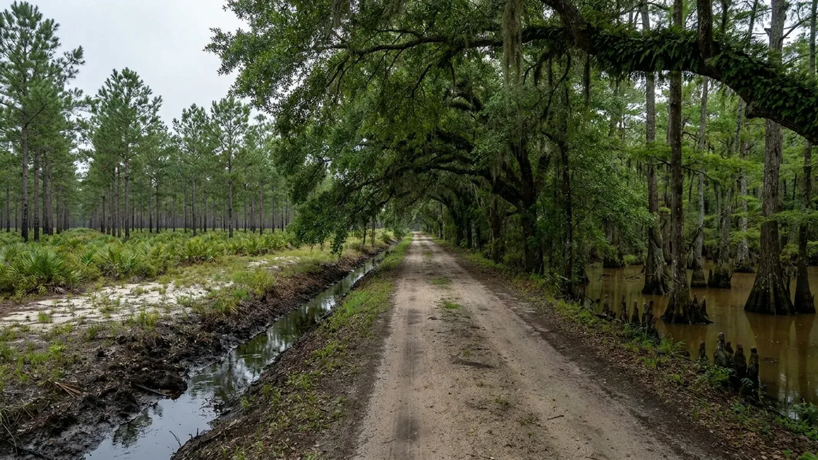
Flat South Carolina pine flatwoods with a loblolly plantation in straight rows, a blackwater cypress swamp margin, a water-filled roadside ditch and a shallow Carolina bay depression.
Horry County One statewide code, county design maps

Barndominium Builders in Horry County, SC

If you are reading this from another state, that is the normal case here. In the year to 1 July 2025 Horry County took in 14,222 net domestic migrants — the largest single-county figure in South Carolina, more than the entire Columbia metro gained — and it is still 20.9 percent farmland, with 151,691 acres in farms across a 725,217-acre county. No other county in the State pairs that much arriving demand with that much remaining land. The land is not on the beach. Myrtle Beach city has essentially no acreage left; the parcels are inland and west, around Conway, Aynor, Galivants Ferry, Green Sea and Loris, and that is where this page is pointed. What you need to know before you buy: the entire county has been zoned since 17 April 2001, so there is a district on every parcel; the county's zoning ordinance caps a stand-alone shop on a vacant parcel at 4,500 square feet but caps nothing once a dwelling is there; the county will not take a residential plan set without an original South Carolina engineer's or architect's seal and wind design summary sheets; and more than half the county's mapped soil is rated poorly or very poorly drained, which makes the septic evaluation, not the slab, the thing that decides a parcel.

Horry County at a glance

County
Horry County
Population
427,551

Building conditions in Horry County

The building code is the same in every South Carolina county: S.C. Code § 6-9-10(A) requires each municipality and county to enforce the Building Codes Council's codes and to enforce only those, and SC Regulation 8-236(C) bars a local jurisdiction from writing one of its own. The design numbers are not local either, but they are not one number for the state — Regulations 8-1202 and 8-1203 send wind and seismic to the Council's own map for this county, and those maps are drawn as contours, so the figure is read at your address rather than off a county name. What is genuinely local is who issues the permit and inspects the work, what that office charges, the permit procedure it adopted by ordinance, whether your parcel is zoned at all, and the rest of Table R301.2 — frost depth, termite probability and flood — which the jurisdiction fills in for itself.

Build conditions for Horry County , South Carolina : design wind speed The Building Codes Council's Horry County sheet carries a blue wind contour labelled 140 MPH running north–south through the western county past Aynor, and a second labelled 150 MPH offshore in the Atlantic parallel to the Grand Strand; the seismic labels hand-lettered on the same sheet are B and C. BUILD CONDITIONS HORRY COUNTY, SCHorry CountyONE STATEWIDE CODEDESIGN WIND SPEEDThe Building Codes…Reg 8-1202 and 8-1203 (modifications IRC 2021-04 and IRC 2021-05) replace the IRC's own wind andseismic figures with the Council's previously published county maps. Horry is one of the 35…ZONING · FA (FOREST AGRICULTURE)1/2 acre (21,780 sq ft) for a single…The entire county has been zoned since 17 April 2001; there is nounzoned remainder. In FA, Table 2-1 sets a single-family dwelling a…RESIDENTIAL BUILDING PERMIT$0.50 per square foot at issue, mini…Horry County's published schedule adds a $0.20 per square foot planreview fee payable when plans are submitted and a $25.00 zoning fee…WHO ISSUES THE PERMITHorry County Code Enforcement / Plan…County offices are at 1301 Second Avenue, Conway. Code Enforcementissues the building permit and runs plan review and inspections;…
Build conditions for Horry County, drawn from the sourced facts on this page. Every figure above is cited in the quick-facts panel below, with its source and vintage.
The Council's Horry County map is a scan — read off it, 140 and 150 MPH and seismic B and C
South Carolina takes wind speed and seismic design category away from the locality and hands them to maps the Building Codes Council publishes itself: Regulations 8-1202 and 8-1203 replace IRC sections R301.2.1 and R301.2.2.1 with "the previously published maps by the South Carolina Building Codes Council." Those maps exist for 35 of the 46 counties, and Horry is one of them — but the Horry sheet is an image-only scan of a marked-up highway map with an empty text layer, so it cannot be searched or quoted from the file. Its single embedded raster was extracted and read at full resolution for this entry. What it shows: a blue wind contour boxed and labelled 140 MPH running roughly north–south through the western part of the county, passing just east of Aynor near Cool Spring and Dog Bluff; a second blue contour boxed and labelled 150 MPH lying offshore in the Atlantic, parallel to the Grand Strand and several miles out. Conway, Loris, Green Sea, Socastee and the whole beachfront therefore sit between the two lines. The seismic labels are hand-lettered in orange boxes either side of a hand-drawn orange boundary: a B and a C near Galivants Ferry on the Marion County side, and a C and a B near Bucksport Landing on the Waccamaw at the Georgetown County line. In both pairs the C sits on the southwestern side of the line and the B on the northeastern side. The map's own note governs how to read it: "Wind speed, shown in miles per hour, applies at all points along the length of its corresponding (blue) line. Interpolation between wind speed lines is determined by the AHJ as permitted by Figure R301.2(4)(A) of the 2015 International Residential Code." So Horry County does not have a wind number. It has two lines and a rule about the space between them, and the value at your parcel is the building official's reading at your parcel.

SC Building Codes Council, Wind/Seismic Maps, https://llr.sc.gov/bcc/maps.aspx (page read 5 Sep 2026), and the Horry County sheet at https://llr.sc.gov/bcc/PDFfiles/WSMaps/Horry%20County.pdf — 10,372,422-byte application/pdf, one page, a single 10,166 × 10,867-pixel DeviceRGB DCTDecode image with no text layer; the image was extracted and read at native resolution 5 Sep 2026. Regulations 8-1202 and 8-1203, 2021 Code Modifications, S.C. State Register Vol. 46 Issue 5, 27 May 2022, https://llr.sc.gov/bcc/PDFfiles/2021-Code-Modifications.pdf ; SCBCC 2021 Modification Index, modifications IRC 2021-04 and IRC 2021-05, https://llr.sc.gov/bcc/PDFfiles/2021-Modification-index.pdf

At B and C the residential code's seismic chapter never switches on for a detached house
This is the single biggest difference between building in Horry County and building an hour and a half down the coast. SC Residential Code R301.2.2 applies the code's seismic provisions to detached one- and two-family dwellings only in Seismic Design Categories D0, D1 and D2; townhouses pick them up one category earlier, at C. The Council's maps put Charleston County at C through D2, Berkeley at D1 and D2 and Dorchester at D0 through D2 — and in that band R403.1.2 forces exterior walls onto continuous solid or fully grouted masonry or concrete footings, R403.1.3 adds footing and stem-wall reinforcement, and R301.2.2.6's eight irregularity conditions push most barndominium plans out of the prescriptive provisions altogether. The Horry map is labelled B and C. A detached dwelling on B or C ground does not pick up that chapter at all, and the wide clear shop bay that trips R301.2.2.6 in the Charleston triangle does not trip it here. What is left in Horry is wind, water and soil — which is why the county's own plan-submittal rule is about wind, and why the septic evaluation matters more here than the seismic category does.

2021 South Carolina Residential Code §§ R301.2.2, R301.2.2.6, R403.1.2, R403.1.3, read at https://up.codes/viewer/south_carolina/irc-2021/chapter/3/building-planning and https://up.codes/viewer/south_carolina/irc-2021/chapter/4/foundations, 5 Sep 2026 — a third-party rendering of the adopted South Carolina code; comparison counties from the Council's own sheets linked at https://llr.sc.gov/bcc/maps.aspx

Horry County will not take a residential plan set without a South Carolina seal
The county's own submittal instructions for a residential one- or two-family building are short and specific, and they are stricter than most South Carolina counties: a completed building permit application, two site plans drawn to scale, and "2 copies of plans drawn to scale with wind, Wind Design Summary Sheets and seismic design per 2021 IRC (with original SC engineer or architect seal)." Note the three parts of that. The plans must carry a seal; the seal must be a South Carolina one; and the submittal must include wind design summary sheets, not just a note on a sheet. Before the permit issues the county also wants verification of sewer service from the health authority or the sewer company, and contractor documentation with a notarised letter of authorisation if anyone other than the licence holder is collecting the permit. If the building sits in a 100-year floodplain the county's floodplain manager adds requirements on top. Residential review is quoted at five to seven days. A manufacturer's stock plan set is a starting point for the engineer who will seal it, not a substitute for one.

Horry County Code Enforcement, "What you need for a Building Permit," https://www.horrycountysc.gov/departments/code-enforcement/permits/building-permit/what-you-need-for-a-building-permit/ (read 5 Sep 2026); the county's adopted-code notice, "2021 South Carolina Code Adoptions," https://www.horrycountysc.gov/media/hwwpypks/2021-south-carolina-code-adoptions.pdf

4,500 square feet: the cap on a shop built before the house, and the absence of one after
Horry County's zoning ordinance treats a workshop on a bare parcel and a workshop beside a house as two entirely different things, and the gap between them is the most useful thing on this page. A building put up on land with no dwelling on it is a "non-commercial personal use building," defined in the ordinance as "an owner-occupied structure permitted on a vacant parcel of land for personal use purposes only. This use may include kitchen facilities." Section 919 then caps it: "The building does not exceed four thousand five hundred (4,500) square feet in size," and "Parcels less than 3 acres in size shall be limited to one (1) non-commercial personal use building." Table 2-1 repeats the 4,500-square-foot ceiling in the Maximum bldg. Sq. Ft. column for that use in both the Forest Agriculture (FA) and Limited Forest Agriculture (LFA) districts. Now put a dwelling on the parcel first. Section 402 governs accessory buildings and it contains no size limit at all — no square-footage cap, no percentage of the dwelling, nothing. Its rules are that an accessory building needs a principal use to attach to, must meet the district's setbacks, and "Accessory uses shall not be located forward of the principal structure," with a narrow exception letting one accessory structure of 200 square feet or less sit five feet off a side or rear line. The district height limit, 35 feet in FA, still applies. And the simplest case of all: where the shop and the living space are one continuous building, it is not an accessory structure — it is the dwelling, and Single Family is a permitted use in FA.

Horry County Zoning Ordinance (Appendix B to the Code of Ordinances) §§ 402, 919 (Ord. No. 123-2024, § 9, 10 Dec 2024) and Table 2-1, with the definition at Article XVII; county-published edition "UPDATED SEPTEMBER 1, 2026," https://www.horrycountysc.gov/media/i0pfcm2o/appendix-b-zoning-ordinance-upated-912026.pdf (15,737,803-byte PDF downloaded, text layer extracted and read 5 Sep 2026), linked from https://www.horrycountysc.gov/departments/planning-and-zoning/

Horry is a coastal-zone county by statute, but the beachfront lines follow the ocean, not the county
S.C. Code § 48-39-10(B) defines the coastal zone and then names it: "These counties are Beaufort, Berkeley, Charleston, Colleton, Dorchester, Horry, Jasper, and Georgetown." That is a closed list of eight and Horry is on it — a statutory fact, not something to read off a map. What the listing does is trigger Coastal Zone Consistency review: SCDES's Bureau of Coastal Management reviews within the eight coastal counties, and SCDES states that a construction stormwater permit covering one to two disturbed acres in one of the eight must be accompanied by a Coastal Zone Consistency determination. On a house pad, a shop pad, a long drive and a septic field, an acre of disturbance arrives sooner than people expect. The Critical Area permit is a different instrument and it follows a feature. § 48-39-10(J) defines the critical area as coastal waters, tidelands, beaches and "beach/dune system which is the area from the mean high-water mark to the setback line as determined in Section 48-39-280." Horry fronts the Atlantic, so that fourth category is live here in a way it is not in Berkeley or Dorchester — § 48-39-280(E)(1) requires the department to "establish monumented and controlled survey points in each county fronting the Atlantic Ocean." But it reaches a strip, not a county. A tract at Aynor or Green Sea is not in the critical area because Horry County is on the statutory list.

S.C. Code § 48-39-10(B) and (J) and § 48-39-280(E), Coastal Tidelands and Wetlands Act, served text read at https://www.scstatehouse.gov/code/t48c039.php 5 Sep 2026; SCDES Coastal Zone Consistency Certification, https://des.sc.gov/programs/bureau-coastal-management/coastal-zone-consistency-certification ; SCDES stormwater, 1 to 2 Acres of Land Disturbance, https://des.sc.gov/programs/bureau-water/stormwater/stormwater-construction-activities/1-2-acres-land-disturbance

14,222 arrivals in one year, and 151,691 acres still in farms
The Census Bureau's vintage 2025 county estimates put Horry County at 427,551 people on 1 July 2025 against a 2020 census base of 351,029 — up 21.8 percent in five years — with net domestic migration of 14,222 in the single year to July 2025. That is the largest figure of any South Carolina county, ahead of Spartanburg's 9,230 and Berkeley's 6,830, and it arrives against a natural decrease of 1,801, so every bit of the growth here is people moving in. What makes the county unusual is that the land did not disappear underneath the growth. USDA's 2022 Census of Agriculture records 629 farms on 151,691 acres — 20.9 percent of a 725,217-acre county — of which 92,254 acres is cropland, 48,253 woodland and 5,579 pasture. This is still working row-crop country: Horry ranks third in the State for tobacco sales and sixth for cotton. The parcel sizes are buyable, too: 248 farms of 10 to 49 acres and 178 of 50 to 179 acres, so two thirds of the county's operations sit under 180 acres. The demand is on the beach and the land is inland, and the drive between them is twenty to forty minutes.

U.S. Census Bureau, Vintage 2025 county population estimates, co-est2025-alldata.csv, https://www2.census.gov/programs-surveys/popest/datasets/2020-2025/counties/totals/co-est2025-alldata.csv ; USDA NASS 2022 Census of Agriculture County Profile, Horry County, South Carolina, https://www.nass.usda.gov/Publications/AgCensus/2022/Online_Resources/County_Profiles/South_Carolina/cp45051.pdf (both fetched and read 5 Sep 2026)

Also worth knowing before you build in Horry County

More than half the county's mapped soil is poorly or very poorly drained
A query run against the USDA soil survey for Horry County (survey area SC051) returns, across the 721,803 acres the survey classifies by drainage, 257,920 acres rated poorly drained (35.7 percent) and 145,427 acres very poorly drained (20.1 percent) — 55.8 percent of the county between them — against 82,956 acres well drained, 11.5 percent. The dominant components tell the same story by name: Johnston 51,125 acres, Woodington 44,411, Pocomoke 38,889, Ogeechee 38,823, and the Leon spodosol at 36,614 acres, whose cemented spodic horizon perches water above it. On this ground the winter water table sits close to the surface, and two decisions follow from that rather than from the house design. The first is pad height: how much fill goes under the slab is the foundation decision on a flatwoods parcel, not a detail. The second is septic. S.C. Regulation 61-56 sets site suitability from soil morphology — texture, restrictive horizons and depth to the zone of saturation — not from a percolation test, and § 61-56.200.7 requires a usable repair area of at least 50 percent of the original system on soil proven suitable. The parcel has to hold the system, its full setback envelope and a proven reserve, all of it above the seasonal water table. Get the evaluation before you close.

USDA-NRCS Soil Data Access, survey area SC051 (Horry County, South Carolina), tabular query posted to https://SDMDataAccess.sc.egov.usda.gov/Tabular/post.rest 5 Sep 2026, aggregating component drainage class and component acreage by map unit; S.C. Regulation 61-56, Onsite Wastewater Systems, §§ 61-56.102, 61-56.200, https://des.sc.gov/sites/des/files/Library/Regulations/R.61-56.pdf ; SCDES Professional Soil Classifiers, https://des.sc.gov/permits-regulations/septic-tanks/professional-soil-classifiers

Zoned countywide since 17 April 2001 — and the FA district is where the acreage is
Horry County's Planning and Zoning department states it flatly: "The entire county has been zoned as of April 17, 2001." There is no unzoned remainder to hope for. The district carrying the inland acreage is Forest Agriculture (FA), intended by the ordinance "for agriculture, forestry, and low-density: residential, commercial, social, cultural, recreational, and religious uses," with Limited Forest Agriculture (LFA) and Commercial Forest Agriculture (CFA) either side of it and Rural Estates (RE) for family farms. In FA, Table 2-1 sets a single-family dwelling at a minimum half acre (21,780 square feet), 40-foot front, 10-foot side, 15-foot rear, 15-foot corner side, 35-foot maximum height and 90 feet of lot width at the building setback line; a non-commercial personal use building takes a 60-foot front instead; an agricultural building for farm animals needs an acre and a half and a 60/25/40 envelope. Two more rules bite on rural parcels. Section 205.B.1, added by Ord. No. 24-2024, forbids any structure within 60 feet of the right-of-way of a named list of roads that covers most of the county's rural spine — Highways 19, 31 (Red Bluff Road), 57, 90, 319, 378, 701, 905, 917, Highway 9 Business, Highway 9 from the Marion County line to Highway 90, Nichols Highway, Hardwick Road off Highway 501 and Pee Dee Highway. And Section 404 requires at least 50 feet of frontage on a street for any newly created lot. A rezoning application runs $250 and the process takes 90 to 120 days.

Horry County Current Planning & Zoning, https://www.horrycountysc.gov/departments/planning-and-zoning/current-planning-zoning/ (read 5 Sep 2026); Horry County Zoning Ordinance §§ 205.B.1 (Ord. No. 24-2024, § 2, 1 Apr 2024), 404, Article II district intents and Table 2-1, https://www.horrycountysc.gov/media/i0pfcm2o/appendix-b-zoning-ordinance-upated-912026.pdf

The permit is priced by the square foot, and it expires in six months
Horry County does not price a residential permit off your contract. Its published schedule charges a plan review fee of twenty cents per square foot when plans are submitted, and, if the plans are approved, fifty cents per square foot when the permit is issued, with a minimum of fifty dollars plus a twenty-five dollar zoning fee. A plan revision is twenty-five dollars. A manufactured home permit is a flat one hundred fifty dollars plus zoning fees. Separately, no permit is valid at all without a certificate of zoning compliance: Section 106 of the zoning ordinance says no building or structure may be erected, moved, added to or structurally altered without one, and no building permit issued for construction in the ordinance's jurisdictional area is valid unless the Zoning Administrator has approved it. Section 109 then puts a clock on it — if the work described in a building permit has not begun within six months of issue, the permit expires and is cancelled. The Planning and Zoning counter is at 1301 Second Avenue, Conway.

Horry County Code Enforcement, "Cost of a Building Permit," https://www.horrycountysc.gov/departments/code-enforcement/permits/building-permit/cost-of-a-building-permit/ (read 5 Sep 2026); Horry County Zoning Ordinance §§ 106, 109, https://www.horrycountysc.gov/media/i0pfcm2o/appendix-b-zoning-ordinance-upated-912026.pdf ; department address from https://www.horrycountysc.gov/departments/planning-and-zoning/current-planning-zoning/

The beachfront baseline and setback line, how they are set, and how often they move
If the parcel you are looking at is on the ocean side of Highway 17, a second regulator sits above the county. S.C. Code § 48-39-280 requires the department to establish a baseline that parallels the shoreline for each standard erosion zone and each inlet erosion zone; for a standard zone the baseline is "established at the location of the crest of the primary oceanfront sand dune in that zone." The setback line is then drawn landward of the baseline "a distance which is forty times the average annual erosion rate or not less than twenty feet from the baseline for each erosion zone." Both lines "must be established anew during establishment cycles that are not less than every seven years, but not more than every ten years following a previous establishment cycle," and until new lines are established for an area the existing ones apply. Two consequences a buyer feels directly. Under § 48-39-290(A) no new construction is allowed seaward of the baseline at all, bar a short list of walkways, small decks, piers and dune work. Between the baseline and the setback line, § 48-39-290(B)(1)(a)(i) allows a new habitable structure only if it "is no larger than five thousand square feet of heated space" and is "located as far landward on the property as practicable." And § 48-39-330 requires a contract of sale for property seaward of the setback line to carry a disclosure statement naming the lines and the local erosion rate. SCDES is currently running a phased re-establishment: a schedule was released 30 January 2024 for a review running between 2024 and 2028, with the first group of lines — Daufuskie, Hilton Head, Bay Point, St. Phillips, Little Capers, Pritchards, Fripp, Hunting and Harbor islands, all in Beaufort County — established and in effect as of 24 July 2026, and the greater Charleston and greater Edisto areas following in Phase II.

S.C. Code §§ 48-39-280, 48-39-290 and 48-39-330, served text read at https://www.scstatehouse.gov/code/t48c039.php 5 Sep 2026; SCDES Bureau of Coastal Management, State Beachfront Jurisdictional Lines, https://des.sc.gov/programs/bureau-coastal-management/beachfront-management/state-beachfront-jurisdictional-lines (page HTML fetched and the review-schedule section read 5 Sep 2026)

South Carolina's karst is small, Coastal Plain, and one of its named pockets is in this county
Sinkholes are a Blue Ridge and Valley-and-Ridge worry in most states; in South Carolina they are not, because the Upstate is crystalline rock that does not dissolve. What karst the State has is a limestone phenomenon of the middle and lower Coastal Plain, mapped in a handful of discrete places on SCDNR's Geologic Hazards of the South Carolina Coastal Plain — and one of them is here. The map's reference list cites Hockensmith, B.L., and Pelletier, A.M., 1987, "Investigation of sinkhole occurrences at Goretown, near Loris, South Carolina," South Carolina Water Resources Commission Open-File Report 11, 31 p. Goretown is a Horry County place, a few miles from Loris, in exactly the part of the county where the inland acreage is. The hazard sheet's legend carries the categories Potential for Collapse, Potential for Sinkholes, Known Sinkhole Occurrences and Limestone Cave, and it prints a photograph captioned as a cover-collapse sinkhole in Horry County. Read the map's own limits before anyone quotes it at you: SCDNR states the information "should not be used for land-use zoning, building-code requirements, or defining insurance rate zones," and that hazard potential "should be evaluated through site-specific geotechnical investigation by qualified practitioners." It screens a parcel around Loris and Green Sea; it does not decide one. What decides one is a walk for closed depressions and, if anything flags, a geotechnical investigation before the slab is designed.

SCDNR Geological Survey, Geologic Hazards page and its reference list naming Hockensmith and Pelletier (1987), https://www.dnr.sc.gov/geology/geologic-hazards.html (read 5 Sep 2026 — the linked Open-File Report 11 PDF at hydrology.dnr.sc.gov returns 404); SCDNR Geological Survey and SC Emergency Management Division, General Geologic Map Series 5, Geologic Hazards of the South Carolina Coastal Plain, 2012, 1:600,000, https://www.dnr.sc.gov/geology/pdfs/GGMS5.pdf

A barndominium is never a farm structure in South Carolina — and the ordinance keeps the two apart
S.C. Code § 6-9-65(A) defines a farm structure as one constructed on a farm "other than a residence or a structure attached to it," and adds that the term "does not include a structure originally qualifying as a 'farm structure' but later converted to another use." A barndominium is a residence, so it is outside the exemption from day one; the shop half of a shouse is outside it too, because it is attached to a residence; and putting up a pole barn under the exemption and finishing it into living space later pulls the whole building back under the code. § 6-9-65(C) also makes the exemption conditional on filing an affidavit with the local building official before construction, stating the purpose and intended use — it is not automatic. Horry County's zoning ordinance draws the same line from the land-use side without pretending it is a code exemption: Section 108 lets genuinely agricultural accessory structures — greenhouses, open sheds, tobacco and bulk barns, packhouses, electric water pump sheds "used in connection with a bona fide agriculture use" in the LFA, FA, CFA and AG districts — be shown on a plan without being drawn to scale, while still requiring them to meet the district's exterior setbacks. That is a drafting concession about site plans, in a zoning ordinance. It is not permission to live in the building.

S.C. Code § 6-9-65, served in full at https://www.scstatehouse.gov/code/t06c009.php (read 5 Sep 2026); Horry County Zoning Ordinance § 108, https://www.horrycountysc.gov/media/i0pfcm2o/appendix-b-zoning-ordinance-upated-912026.pdf

An excavator grading a compacted building pad on a cleared lot, with orange clay in the cut face, survey stakes and a drainage swale.
Below the slab

The expensive surprises are in the ground, not the building

What moves a South Carolina budget is usually below grade, and more often than not it is the drainfield rather than the foundation. R.61-56 § 200.1 settles whether a parcel can take an onsite system from soil morphology — texture, structure, depth to a restrictive horizon and depth to the zone of saturation — and § 200.2 then rules out two conditions outright: soils exhibiting massive or platy structure, and soils with substantial amounts of expansible layer clay minerals or smectites. That second clause is the one that bites on the mafic Piedmont, where the shrink-swell series sit in quantity under York, Fairfield, Chester, Laurens, Union, Newberry, Greenwood, McCormick, Lancaster, Saluda, Abbeville and Edgefield. A foundation problem has a price and an answer; an unbuildable septic parcel has neither, which is why we look at it first. Bedroom count is the number to settle early, because § 61-56.501 drives design flow from bedrooms, design flow drives trench length, and trench length plus a repair area decides how much good soil the parcel has to have — shop square footage adds nothing to it. Above the Fall Line the evaluation is done in backhoe pits rather than borings alone, so the answer comes from a dug hole and not a form. The site work, the foundation and the drainfield therefore get resolved together rather than one at a time. We price the dirt before we price the building.

What a build looks like

Three stages every Horry County project passes through, from a raw parcel to a finished home. Site work first, because that is where the budget is decided.

Aerial view of an undeveloped rural lot with cleared rough grass, planted pine along one boundary, and a red dirt access track cut through orange clay.
Stage one

The parcel

Zoning, setbacks, flood zone and utility access get checked before anything is drawn.

An excavator grading a compacted building pad on a cleared lot, with orange clay in the cut face, survey stakes and a drainage swale.
Stage two

Pad and permit

Clearing, grading and a compacted pad, while the submittal works through whichever office issues the permit where you are building.

A finished barndominium at dusk with warm interior lighting glowing through its large windows.
Stage three

Frame to finish

Shell erected and dried in, then systems, insulation and interior finish through to CO.

Those are the rules where you are building in Horry County. Tell us what you want to build and we will draw it to them.

Nearby areas we build in

Others we cover nearby. One may be a county and another a municipality inside one — and a South Carolina municipality can sit in two counties at once — so the office that issues the permit, the fees it charges, whether the land is zoned at all, and which design map covers it can all differ from one card to the next.

Building in Horry County: common questions

10 questions we get asked most often about building in Horry County. If yours is not on the list, ask it directly.

I'm moving to Myrtle Beach from out of state. Where do I actually buy the land?
Inland, and west. Myrtle Beach city and the strip either side of it are effectively built out, and what acreage remains along the beach is priced as beachfront and regulated as beachfront. The land is in the western and northern half of the county: Conway, which is the county seat and the practical centre of gravity; Aynor and Galivants Ferry out toward the Marion County line; Green Sea and Loris up toward the North Carolina border; and the Socastee and Bucksport edges toward Georgetown County. The numbers behind that advice are not close. USDA's 2022 Census of Agriculture counts 629 farms on 151,691 acres in Horry County — 20.9 percent of a 725,217-acre county — with 248 of those operations between 10 and 49 acres and 178 between 50 and 179 acres, which is the size range most people are actually shopping in. Meanwhile the Census Bureau recorded 14,222 net domestic migrants into the county in the year to 1 July 2025, the highest of any county in the State. That combination of arriving demand and remaining land does not exist anywhere else in South Carolina, and the commute from Conway or Aynor to the beach is twenty to forty minutes.
What design wind speed applies to my parcel in Horry County?
There is a published map, and it is a pair of lines rather than a number. Regulations 8-1202 and 8-1203 replace the residential code's own wind provisions with the maps the South Carolina Building Codes Council publishes for 35 of the 46 counties, and Horry has one. The Horry sheet is an image-only scan of a marked-up highway map, which is why you will rarely see it quoted; read at full resolution it carries a blue contour boxed and labelled 140 MPH running north–south through the western county, just east of Aynor around Cool Spring and Dog Bluff, and a second contour labelled 150 MPH offshore in the Atlantic running parallel to the beach. Conway, Loris, Socastee and the whole Grand Strand lie between those two lines. The map's own note tells you what that means: the wind speed "applies at all points along the length of its corresponding (blue) line," and "Interpolation between wind speed lines is determined by the AHJ as permitted by Figure R301.2(4)(A) of the 2015 International Residential Code." So the number for your build is the Horry County building official's reading at your parcel, and it is worth having in writing before a steel package or a truss order is placed. One thing that travels with the engineering either way: truss design drawings have to be shipped with the trusses and handed to the building official at inspection, listing the controlling wind and earthquake loads and every reaction force.
Does the Charleston earthquake code apply to me here?
No, and this is one of the real advantages of building on the Grand Strand rather than the Lowcountry. The residential code applies its seismic provisions to a detached one- or two-family dwelling only in Seismic Design Categories D0, D1 and D2 — that is R301.2.2, item 2. The Council's maps put Charleston County at C through D2, Berkeley at D1 and D2, and Dorchester at D0 through D2, and in that band the code stops being a matter of paperwork: R403.1.2 requires exterior walls to sit on continuous solid or fully grouted masonry or concrete footings, R403.1.3 adds reinforcement to footings and stem walls, and R301.2.2.6 lists eight irregularity conditions that push a structure out of the prescriptive provisions entirely — a wide clear shop bay beside a two-storey living end tends to trip several of them. The hand-lettered seismic labels on the Horry County map are B and C, with the C on the southwestern side of the boundary toward Georgetown County and B over Conway, Aynor and the beach. A detached dwelling at B or C never picks that chapter up. Design attention in Horry County belongs on wind uplift, on the pad and on the water table instead.
Can the shop be bigger than the house? And can I put the shop up first?
Those are two different questions in Horry County and they have opposite answers. Once there is a principal dwelling on the parcel, the shop is an accessory building under Section 402 of the zoning ordinance — and Section 402 contains no size cap of any kind. No square-footage ceiling, no percentage of the dwelling's floor area. What it does require is that the accessory building have a principal use to be accessory to, that it meet the district's setbacks, and that it not sit forward of the principal structure; the FA district's 35-foot height limit still applies. If instead you want to build the shop on bare land and live in it or add the house later, you are asking for a "non-commercial personal use building," which the ordinance defines as "an owner-occupied structure permitted on a vacant parcel of land for personal use purposes only," adding that it "may include kitchen facilities." Section 919 caps that building at 4,500 square feet, and limits a parcel under three acres to one of them. So the sequence changes the ceiling. And note the cleanest case of all: if the shop and the living space are one continuous building, it is not an accessory structure at all — it is the dwelling, Single Family is a permitted use in FA, and the whole thing is designed, permitted and inspected as a house.
Horry is listed as a coastal county. Do I need an OCRM permit for a build near Conway?
Almost certainly not a Critical Area permit, but the coastal-county listing is real and it does show up. S.C. Code § 48-39-10(B) names the eight counties in the coastal zone and Horry is one of them, so this is settled by statute rather than by looking at a map. What the listing triggers is Coastal Zone Consistency review: SCDES's Bureau of Coastal Management reviews within the eight coastal counties, and SCDES states that a construction stormwater permit covering one to two disturbed acres in one of the eight must be accompanied by a Coastal Zone Consistency submittal. Between a house pad, a shop pad, a turnaround, a drive and a septic field, an acre of disturbance arrives sooner than people expect on a rural build. The Critical Area permit is the other instrument and it follows a feature rather than a county line: § 48-39-10(J) defines the critical area as coastal waters, tidelands, beaches, and the beach/dune system, which it measures "from the mean high-water mark to the setback line as determined in Section 48-39-280." Horry County fronts the Atlantic, so that last category is genuinely live here — the statute requires monumented survey points in each county fronting the ocean — but it reaches a strip along the shore, not the whole county. A tidal creek on your tract can put part of it in the critical area. Farmland at Aynor or Green Sea is not in the critical area because the county is on the list.
I'm looking at oceanfront or second-row land. What do the baseline and the setback line actually do?
They are drawn by SCDES under S.C. Code § 48-39-280, and they move. The baseline for a standard erosion zone is set "at the location of the crest of the primary oceanfront sand dune in that zone." The setback line is then placed landward of it "a distance which is forty times the average annual erosion rate or not less than twenty feet" — so on a fast-eroding stretch it can be a long way inland and on a stable one it is close in. Both lines are re-established "anew during establishment cycles that are not less than every seven years, but not more than every ten years," and until new lines are adopted for your area the existing ones govern. What they do: § 48-39-290(A) bars new construction seaward of the baseline altogether apart from a short list — walkways up to six feet wide, decks up to 144 square feet, public fishing piers, dune work and landscaping. Between the baseline and the setback line, § 48-39-290(B)(1)(a)(i) permits a new habitable structure only where the owner certifies that it "is no larger than five thousand square feet of heated space" and is placed "as far landward on the property as practicable," with no part of it on the primary oceanfront sand dune. And § 48-39-330 requires the contract of sale to disclose the lines and the local erosion rate. SCDES released a schedule on 30 January 2024 for a phased review running 2024 to 2028; the first group of lines, all in Beaufort County, takes effect 24 July 2026, with the greater Charleston and greater Edisto areas in Phase II. Check the current lines against the specific parcel before you sign anything.
Will my land take a septic system? What decides it?
Soil morphology decides it, and in Horry County the odds are worth knowing before you fall in love with a tract. A query of the USDA soil survey for the county returns 257,920 acres rated poorly drained and 145,427 very poorly drained out of the 721,803 acres classified — 55.8 percent between them — against just 82,956 acres, 11.5 percent, rated well drained. The names that dominate are Johnston, Woodington, Pocomoke, Ogeechee and the Leon spodosol, whose cemented horizon perches water above it; on that ground the winter water table sits close to the surface. South Carolina reads soil rather than running a percolation test: R.61-56 sets suitability from texture, restrictive horizons and depth to the zone of saturation, determined either by SCDES staff or by a licensed Professional Soil Classifier you hire and whose report you file with the application. Two constraints eat land. § 61-56.200.7 requires a usable repair area of at least 50 percent of the original system, on soil proven suitable — so the parcel must hold the system, its full setback envelope and a proven reserve, none of it under the drive, the shop or the pool. And SCDES will not issue an onsite wastewater permit where public sewer is accessible, which catches more edge-of-Conway and Socastee acreage than people expect. The same wet ground drives the other big number on a flatwoods build: how much fill goes under the pad. Settle the evaluation and the pad height before the slab is designed, not after.
Someone mentioned sinkholes near Loris. Is that a real thing in South Carolina?
It is real, it is small, and it is in the wrong half of the state from where people expect. South Carolina has no Blue Ridge or Piedmont karst at all — those provinces are crystalline rock, which does not dissolve — so a sinkhole worry carried over from the Appalachian limestone belts does not transfer. What karst the State has is a limestone phenomenon of the middle and lower Coastal Plain, mapped by SCDNR in a handful of discrete places: around Beaufort, east of Lake Moultrie along the Santee River, near Georgetown, along the Santee Limestone belt near Lake Marion — and north of Myrtle Beach. The reference behind that last one is Hockensmith and Pelletier's 1987 "Investigation of sinkhole occurrences at Goretown, near Loris, South Carolina," published by the South Carolina Water Resources Commission, and SCDNR's hazard sheet prints a photograph captioned as a cover-collapse sinkhole in Horry County. Goretown is a few miles from Loris, in exactly the part of the county where the inland acreage sits. What to do with that: use the map to screen, not to decide. SCDNR itself states the information "should not be used for land-use zoning, building-code requirements, or defining insurance rate zones" and that hazard potential "should be evaluated through site-specific geotechnical investigation by qualified practitioners." Walk the tract for closed depressions, and if the screening or the walk flags anything, get a geotechnical investigation before the slab is designed — a barndominium is a wide rigid slab and that is the geometry a collapse feature punishes.
What does the county need from me, and what does the permit cost?
Horry County runs two counters and you need both. Planning and Zoning issues the certificate of zoning compliance, and under Section 106 of the zoning ordinance no building permit is valid without it. Code Enforcement then issues the building permit. For a residential one- or two-family building the county asks for a completed application, two site plans drawn to scale, and "2 copies of plans drawn to scale with wind, Wind Design Summary Sheets and seismic design per 2021 IRC (with original SC engineer or architect seal)." That South Carolina seal requirement is the part that catches out-of-state buyers who arrive with a manufacturer's stock plan set. Before the permit issues you also need verification of sewer service from the health authority or the sewer company, and contractor documentation with a notarised authorisation letter if someone other than the licence holder is collecting it. Review is quoted at five to seven days. On price, the county's published schedule charges twenty cents per square foot for plan review at submittal and fifty cents per square foot at issue, minimum fifty dollars, plus a twenty-five dollar zoning fee; a plan revision is twenty-five dollars. And watch the clock: Section 109 expires a permit if the work has not begun within six months of issue.
Can I build it as a farm building and skip the residential code?
No, and South Carolina closes this one in the definition rather than leaving room to argue. S.C. Code § 6-9-65(A) defines a farm structure as one built on a farm "other than a residence or a structure attached to it." A barndominium is a residence, so it is outside the exemption from the first day, and the shop half of a shouse is outside it too because it is attached to a residence. There is no square-footage test and no percentage-of-use test to work with. The section adds two things people miss: § 6-9-65(C) makes the exemption conditional on the owner filing an affidavit with the local building official before construction, stating the purpose and intended use, so it is not automatic; and the definition expressly excludes a structure that originally qualified "but later converted to another use," so finishing a pole barn into living space later pulls the whole building back under the code as the residence it has become. Horry County's zoning ordinance does give genuine farm buildings a small break — Section 108 lets greenhouses, open sheds, tobacco and bulk barns, packhouses and pump sheds used in connection with a bona fide agricultural use in the LFA, FA, CFA and AG districts be shown on a site plan without being drawn to scale, while still meeting the district's exterior setbacks. That is a site-plan concession in a zoning ordinance. It is not a building-code exemption and it is not permission to live in the building.

Building in Horry County?

Start with the plan. Tell us what you want to build and we will draw it, then confirm which office issues the permit for your parcel, what it will let you put there, and what wind load it has to meet. That conversation costs nothing.