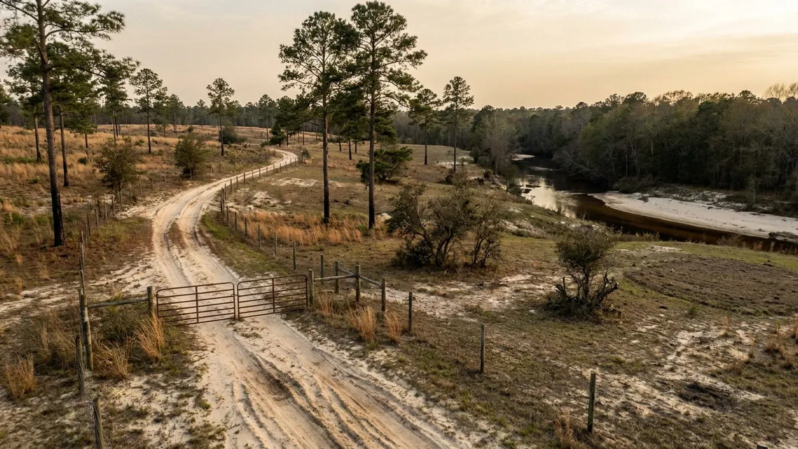
Barndominium Builders in Lexington County, SC
Lexington County went from a 2020 estimates base of 293,919 to 317,588 people on 1 July 2025, and unlike most of the Midlands it still has land to put them on: 79,450 acres in farms across 822 operations, at an average of only 97 acres. That average is the story. Four hundred and seventy-six of those 822 farms are under fifty acres. This is not consolidated plantation ground being held in one piece - it is a county already subdividing into the ten- and twenty-acre parcels a barndominium actually gets built on, from Gilbert and Pelion and Swansea out through Batesburg-Leesville. Two things about building here are unlike the neighbouring county. The zoning ordinance regulates activities rather than buildings, so it sets no maximum square footage for a detached shop and no flat height cap - height comes off a control slope measured back from the property line, and a detached dwelling that keeps five feet of clearance is exempt from it outright. And the county prices its zoning and landscape permits by the acre rather than by the building. One warning about geography: the City of Columbia's limits reach into this county, and the Town of Lexington is its own permitting authority inside its own line, so the mailing address on a listing settles nothing.
Building conditions in Lexington County
The building code is the same in every South Carolina county: S.C. Code § 6-9-10(A) requires each municipality and county to enforce the Building Codes Council's codes and to enforce only those, and SC Regulation 8-236(C) bars a local jurisdiction from writing one of its own. The design numbers are not local either, but they are not one number for the state — Regulations 8-1202 and 8-1203 send wind and seismic to the Council's own map for this county, and those maps are drawn as contours, so the figure is read at your address rather than off a county name. What is genuinely local is who issues the permit and inspects the work, what that office charges, the permit procedure it adopted by ordinance, whether your parcel is zoned at all, and the rest of Table R301.2 — frost depth, termite probability and flood — which the jurisdiction fills in for itself.
SC Building Codes Council, Wind/Seismic Maps, https://llr.sc.gov/bcc/maps.aspx, and the Council's Lexington County sheet Lexington 15.pdf, https://llr.sc.gov/bcc/PDFfiles/WSMaps/Lexington%2015.pdf (application/pdf, 8,082,301 bytes, downloaded 6 Sep 2026; text layer extracted and read). SCBCC 2021 Modification Index, modifications IRC 2021-04 and IRC 2021-05, https://llr.sc.gov/bcc/PDFfiles/2021-Modification-index.pdf
Lexington County Zoning Ordinance, 24 June 2025 edition, Sections 12.10 (Definitions), 21.20 (Accessory Activities) and 23.30 (Setbacks), county-published PDF at https://www.lex-co.sc.gov/sites/lexco/files/Documents/Lexington%20County/Departments/Zoning/Zoning%20Ordinance/Zoning%20Ordinance%206.24.25.pdf (application/pdf, 2,550,111 bytes, downloaded and read as extracted text 6 Sep 2026)
Lexington County Zoning Ordinance, 24 June 2025 edition, Section 23.10 (Height Regulations) and the Section 23.60 Chart of Maximum Buffering Restrictions, Residential Detached row, https://www.lex-co.sc.gov/sites/lexco/files/Documents/Lexington%20County/Departments/Zoning/Zoning%20Ordinance/Zoning%20Ordinance%206.24.25.pdf (read 6 Sep 2026)
Lexington County Zoning Ordinance, 24 June 2025 edition, Sections 11.20 (Jurisdiction), 12.00(g) and 11.50 (Incorporation of Maps), https://www.lex-co.sc.gov/sites/lexco/files/Documents/Lexington%20County/Departments/Zoning/Zoning%20Ordinance/Zoning%20Ordinance%206.24.25.pdf; County of Lexington, Community Development department page (Development Services Division and Building Inspections and Safety Division; Land Development Division), https://lex-co.sc.gov/departments/community-development; county address from the Municode client record for Lexington County, South Carolina (client 6600, 212 South Lake Drive, Lexington SC 29072), verified against the county's own site 6 Sep 2026
County of Lexington, "DEVELOPMENT REVIEW and PERMIT FEES - EFFECTIVE 7/1/2025", https://lex-co.sc.gov/sites/lexco/files/Documents/Lexington%20County/Departments/Community%20Dev/DEVELOPMENT%20REVIEW%20and%20PERMIT%20FEES%20-%202025-26.pdf (application/pdf, 124,797 bytes, read as extracted text 6 Sep 2026); Lexington County Code of Ordinances Secs. 14-331, 14-332, 14-333 and 14-337 (Ord. No. 20-01, Art. 8, 28 July 2020), https://library.municode.com/sc/lexington_county/codes/code_of_ordinances — read via api.municode.com client 6600, product 11162, job 480068 (Supp. No. 20, codified through Ord. No. 25-04, enacted 24 June 2025)
USDA-NRCS Soil Data Access component acreage by county, compiled in research/statewide/soils-and-geology.md (Lakeland: Lexington 126,469 ac; Aiken County Area 90,638; Kershaw County Area 82,459; Fuquay: Lexington 25,587) — series descriptions at https://soilseries.sc.egov.usda.gov/OSD_Docs/L/LAKELAND.html and https://soilseries.sc.egov.usda.gov/OSD_Docs/F/FUQUAY.html; S.C. Regulation 61-56, Onsite Wastewater Systems, §§ 200.5 and 200.7, SCDES copy at https://des.sc.gov/sites/des/files/Library/Regulations/R.61-56.pdf
Also worth knowing before you build in Lexington County
- The county's building code adoption follows the State automatically, chapter 1 and all
- Most South Carolina counties name an edition in their ordinance. Lexington County deliberately does not. County Code Sec. 14-172 adopts "the provisions of the International Building Codes (including chapter 1), including state adopted appendices, in the version most recently adopted by the State of South Carolina Department of Labor, Licensing, and Regulation (SCLLR)," with the exception that detached one- and two-family dwellings, townhouses of not more than three storeys "and their accessory structures shall comply with the International Residential Code (including chapter 1) in the version most recently adopted" by the same body. Read that exception carefully: it puts the shop under the residential code alongside the house. The same section adds that appendix provisions "shall not apply unless specifically adopted through this article or through the state adoption process," and that where the codes are updated the previous version stays in force for pending rights and actions. Taking chapter 1 matters because S.C. Code § 6-9-50(A) withholds the administration chapters from the statewide adoption unless a local governing body takes them, so the construction standard here is the State's and identical in all 46 counties, while the paperwork it runs on is Lexington County's own.
- 180 days to start and 90 days to stall - a tighter clock than the neighbours keep
- Owner-paced builds are common on rural acreage and this is the provision that catches them. County Code Sec. 14-265 reads: "Every permit issued shall become invalid unless the work on the site authorized by such permit is commenced within 180 days after its issuance, or if the work authorized on the site by such permit is suspended or abandoned for a period of 90 days after the time the work is commenced. The building official is authorized to grant, in writing, one or more extensions of time, for periods not more than 90 days each. The extension shall be requested in writing and justifiable cause demonstrated." Ninety days of no work is a short window when a shell is waiting on a steel delivery or on the money for the interior. The extensions are real and repeatable but they are discretionary, they are in writing, and they need a stated cause. Sec. 14-267 also requires the permit card kept in a conspicuous place on the front of the premises, weather-protected, from before work starts until the certificate of occupancy issues, and Sec. 14-266 lets the building official revoke a permit issued on incorrect or incomplete information.
- The county asks for the braced wall lines on the drawings
- County Code Sec. 14-291 requires construction documents in two or more sets with each permit application, "prepared by a registered design professional where required by state and local statute," and lets the building official require more where special conditions exist. Sub-item (3) is the one that lands on this building type: "Information on braced wall design. For buildings and structures utilizing braced wall design, and where required by the building official, braced wall lines shall be identified on the construction documents. Pertinent information, including, but not limited to, bracing methods, location, and length of braced wall panels and foundation requirements of braced wall panels at top and bottom shall be provided." A barndominium is mostly large openings in long walls, which is exactly where prescriptive bracing runs short, so this is a submittal item to have answered by the designer rather than discovered at plan review. Sub-item (4) separately requires a site plan showing the size and location of the new construction, existing structures, and distances to the property lines - the drawing that proves the five-foot accessory setback and the height control slope at the same time.
- Two dwellings to the acre in the agricultural district, and a 9,000 sq ft floor on any new lot
- Section 22.30 of the Zoning Ordinance sets a countywide ceiling first: "All Residential Detached, excluding Limited, and Mobile Home, and Tiny Home land use activities shall have a maximum residential density of four (4) dwelling units per exact acre, unless the zoning district or street classification density allowance is more restrictive." The district table then cuts that to 2 dwelling units per exact acre in R1, D and RA - RA being Recreational/Agricultural, the district that carries the county's rural acreage - against 3 in R2 and 4 in R3. A second table does the same job by street classification, from 4 on an arterial down to 1 on a Residential Local One, and the ordinance applies whichever of the two is more restrictive. Section 22.40 then puts a hard floor under any newly created parcel: 9,000 square feet for Residential Detached, a mobile home or a tiny home. Section 23.60's Residential Detached row sets a 10-foot setback from adjoining property and a 20-foot right-of-way setback, with a footnote raising the right-of-way setback to 30 feet for attached garages, carports and other covered parking - and requiring the whole structure to sit 30 feet back where the residence has no attached garage or carport. Section 22.30 also warns that nothing in it circumvents the state health regulations' own lot-area requirements for individual wells and septic tanks.
- Build next to a working farm and the ordinance imposes a 75-foot buffer
- This one catches people buying exactly the kind of parcel this county is subdividing. Section 23.62, special rule 7 of the Zoning Ordinance: "There shall be a minimum buffer width of 75 feet, unless greater as required under Section 23.60 of this Ordinance, for all new or expanding developments that adjoin existing Agricultural Operations, which have been in continuous operation for a period of seven (7) years prior to development. Existing Agricultural Operations which have discontinued active operation within this seven (7) year timeframe will not be afforded this extra protection." The exemptions listed are for land uses that are themselves actively engaged as an agricultural operation. Seventy-five feet off a boundary is real land on a narrow tract, and it is measured against a neighbour's history of use rather than against anything visible on a plat, so it is a question for the Zoning Administrator before the site plan is drawn. The same chapter also gives a 50 percent reduction in buffer and setback requirements to activities that provide total screening using existing natural vegetation, or provide it with vegetation when it is not required - which on a wooded Sandhills tract is a reason not to clear more than you need.
- The State's landslide-screening threshold was calibrated on a Lexington County slope
- The South Carolina Geological Survey's General Geologic Map Series 5, Geologic Hazards of the South Carolina Coastal Plain, delineates areas of potential landsliding from a slope-stability model, and it explains where its threshold came from: "Areas with landslide potential were recognized using a known landslide occurrence in Lexington County as the type example (Howard, 2010). The landslide occurred on a 12 percent slope surface. Using this information, it was determined that a slope surface of 10 percent or greater was appropriate for representing areas sensitive to potential landslide hazard." It names two settings: "oversteepened banks of major rivers, such as the bluffs of the Congaree and Wateree Rivers, and some of their minor stream tributaries," and "areas adjacent to Fall zone, which is that area of the Coastal Plain immediately southeast of the Piedmont and exhibits high relief particularly in incised stream valleys." Lexington County has both. Read the map's own limits before quoting it anywhere: the Survey states the information "should not be used for land-use zoning, building-code requirements, or defining insurance rate zones," that its zones "are not intended to replace site-specific evaluations," and that hazard potential "should be evaluated through site-specific geotechnical investigation by qualified practitioners." It screens a bluff-edge parcel. It does not decide one.
- 822 farms, 79,450 acres, and a 97-acre average that is falling
- USDA's 2022 Census of Agriculture counts 822 farms in Lexington County on 79,450 acres - 17.8 percent of the county's 447,071 acres - at an average of 97 acres. All three measures moved since 2017, and they moved the same way: the number of farms fell 28 percent, land in farms fell 23 percent, and the average holding edged up only 7 percent. That is farmland leaving agriculture rather than being split within it — which is what a county that added more than 23,000 people looks like in the agricultural statistics, and it is the reason buy-and-build demand here is live rather than theoretical. The size distribution says the same thing: 102 farms are 1 to 9 acres and 374 are 10 to 49 acres, so 476 of the 822 operations - 58 percent - are under fifty acres. Land use inside those farms runs 37,161 acres cropland, 26,279 woodland, 8,429 pastureland and 7,581 other, with 11,500 acres irrigated. Fifty percent of the operations sell less than $2,500 of product a year, which is the statistical signature of small rural holdings rather than commercial agriculture - and of the parcels most likely to come to market whole.
- Three approvals have to exist before the building permit does
- Lexington County's building code ordinance stacks the sequence explicitly rather than leaving it to be discovered. Sec. 14-271: anyone intending to construct or alter a building for which a building permit is required "shall first provide a valid zoning permit, landscape permit, and/or land disturbance permit, as applicable, from the delegated authority of the jurisdiction where the construction or alteration is to be located." Sec. 14-272 lets the building official require "a certificate issued by the appropriate authority granting approval for water and sewer facilities" as part of the application - on unsewered acreage that means the state onsite wastewater permit, which comes from the South Carolina Department of Environmental Services under Regulation 61-56 and not from the county at all. Sec. 14-270 puts the floodplain manager for the Department of Community Development in the chain for anything in a flood hazard area: documented approval before construction, and no final inspection and no certificate of occupancy until that office has concluded the Lexington County Flood Damage Prevention Ordinance has been met. Sec. 14-262 exempts one-storey detached accessory structures of 200 square feet or less from needing a building permit at all - a number a barndominium shop clears many times over.
Lexington County Code of Ordinances Secs. 14-171, 14-172 and 14-174 (Ord. No. 20-01, Art. 1, 28 July 2020), https://library.municode.com/sc/lexington_county/codes/code_of_ordinances — read via api.municode.com product 11162, job 480068, 6 Sep 2026; S.C. Code § 6-9-50(A), https://www.scstatehouse.gov/code/t06c009.php
Lexington County Code of Ordinances Secs. 14-265, 14-266 and 14-267 (Ord. No. 20-01, Art. 5, §§ 5.5—5.7, 28 July 2020), https://library.municode.com/sc/lexington_county/codes/code_of_ordinances — read via api.municode.com product 11162, job 480068, 6 Sep 2026
Lexington County Code of Ordinances Sec. 14-291 (Ord. No. 20-01, Art. 6, § 6.1, 28 July 2020), https://library.municode.com/sc/lexington_county/codes/code_of_ordinances — read via api.municode.com product 11162, job 480068, 6 Sep 2026; SCBCC 2021 Modification Index, modification IRC 2021-01, adding to IRC R202 the definition of "accepted engineering practice" as design "made with accepted design standards by a South Carolina licensed Architect or Engineer as permitted by existing state law," https://llr.sc.gov/bcc/PDFfiles/2021-Modification-index.pdf
Lexington County Zoning Ordinance, 24 June 2025 edition, Sections 22.30 (Density), 22.40 (Minimum Residential Lot Size), 23.30 (Setbacks) and the 23.60 chart, https://www.lex-co.sc.gov/sites/lexco/files/Documents/Lexington%20County/Departments/Zoning/Zoning%20Ordinance/Zoning%20Ordinance%206.24.25.pdf (read 6 Sep 2026)
Lexington County Zoning Ordinance, 24 June 2025 edition, Section 23.62 special rules 6 and 7, https://www.lex-co.sc.gov/sites/lexco/files/Documents/Lexington%20County/Departments/Zoning/Zoning%20Ordinance/Zoning%20Ordinance%206.24.25.pdf (read 6 Sep 2026)
SCDNR Geological Survey and SC Emergency Management Division, General Geologic Map Series 5, Geologic Hazards of the South Carolina Coastal Plain, 2012, 1:600,000, https://www.dnr.sc.gov/geology/pdfs/GGMS5.pdf (32,578,931-byte PDF, text extracted and read); landing page https://www.dnr.sc.gov/geology/geologic-hazards.html
USDA National Agricultural Statistics Service, 2022 Census of Agriculture County Profile, Lexington County, South Carolina, https://www.nass.usda.gov/Publications/AgCensus/2022/Online_Resources/County_Profiles/South_Carolina/cp45063.pdf (application/pdf, 879,685 bytes, read 6 Sep 2026); county acreage from research/statewide/geography-and-population.md; population 317,588 on 1 July 2025 against a 2020 estimates base of 293,919 from U.S. Census Bureau Vintage 2025 county estimates, co-est2025-alldata.csv, https://www2.census.gov/programs-surveys/popest/datasets/2020-2025/counties/totals/co-est2025-alldata.csv
Lexington County Code of Ordinances Secs. 14-262, 14-270, 14-271 and 14-272 (Ord. No. 20-01, Art. 5, §§ 5.2, 5.10—5.12, 28 July 2020), https://library.municode.com/sc/lexington_county/codes/code_of_ordinances — read via api.municode.com product 11162, job 480068, 6 Sep 2026; S.C. Regulation 61-56, https://des.sc.gov/sites/des/files/Library/Regulations/R.61-56.pdf

The expensive surprises are in the ground, not the building
What moves a South Carolina budget is usually below grade, and more often than not it is the drainfield rather than the foundation. R.61-56 § 200.1 settles whether a parcel can take an onsite system from soil morphology — texture, structure, depth to a restrictive horizon and depth to the zone of saturation — and § 200.2 then rules out two conditions outright: soils exhibiting massive or platy structure, and soils with substantial amounts of expansible layer clay minerals or smectites. That second clause is the one that bites on the mafic Piedmont, where the shrink-swell series sit in quantity under York, Fairfield, Chester, Laurens, Union, Newberry, Greenwood, McCormick, Lancaster, Saluda, Abbeville and Edgefield. A foundation problem has a price and an answer; an unbuildable septic parcel has neither, which is why we look at it first. Bedroom count is the number to settle early, because § 61-56.501 drives design flow from bedrooms, design flow drives trench length, and trench length plus a repair area decides how much good soil the parcel has to have — shop square footage adds nothing to it. Above the Fall Line the evaluation is done in backhoe pits rather than borings alone, so the answer comes from a dug hole and not a form. The site work, the foundation and the drainfield therefore get resolved together rather than one at a time. We price the dirt before we price the building.
What we build in Lexington County
All nine services are available in Lexington County. What a build costs depends far more on the parcel than on square footage, so we price against your land rather than publishing a rate card.
Custom Plans
Barndominium plans drawn for your parcel and sealed at the point where South Carolina’s engineering exemption stops applying.
Barndominium Kits
Engineered shell packages for South Carolina land — open construction under the state’s own definition, and therefore not a modular building.
Turnkey Builds
Barndominium construction from raw land through to occupancy: one contract, one schedule, one party answering the building official.
What a build looks like
Three stages every Lexington County project passes through, from a raw parcel to a finished home. Site work first, because that is where the budget is decided.

The parcel
Zoning, setbacks, flood zone and utility access get checked before anything is drawn.
Pad and permit
Clearing, grading and a compacted pad, while the submittal works through whichever office issues the permit where you are building.

Frame to finish
Shell erected and dried in, then systems, insulation and interior finish through to CO.
Those are the rules where you are building in Lexington County. Tell us what you want to build and we will draw it to them.
Keep reading
The questions that usually come next once you know what Lexington County allows.
Nearby areas we build in
Others we cover nearby. One may be a county and another a municipality inside one — and a South Carolina municipality can sit in two counties at once — so the office that issues the permit, the fees it charges, whether the land is zoned at all, and which design map covers it can all differ from one card to the next.
Building in Lexington County: common questions
7 questions we get asked most often about building in Lexington County. If yours is not on the list, ask it directly.
Can the shop be bigger than the house here?
How tall can I actually build it?
My land has a Columbia or a Lexington address. Who actually permits it?
Can I put it up as a farm building and skip the residential code?
What wind speed and seismic category apply to my parcel?
Septic on Sandhills sand - what should I check before I buy?
What is this going to cost me in county fees?
Building in Lexington County?
Start with the plan. Tell us what you want to build and we will draw it, then confirm which office issues the permit for your parcel, what it will let you put there, and what wind load it has to meet. That conversation costs nothing.