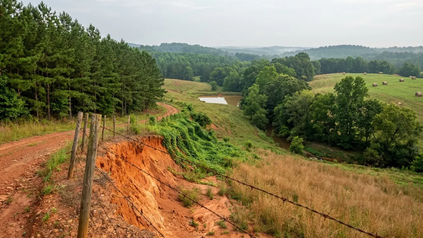
Barndominium Builders in Anderson County, SC
Anderson County has a zoning ordinance and a great deal of land that ordinance does not reach. Article 2 of the county's zoning chapter is one sentence long and it settles the question: the regulations apply within the area shown on the official zoning map, and "the provisions of this chapter do not regulate areas designated as 'UNZONED.'" S.C. Code Section 6-29-330(A) permits exactly that — a county may plan and zone "the total unincorporated area or specific parts of the unincorporated area" — and Anderson has done the second, adding zoned ground one voting precinct at a time by petition and referendum. So the question to ask about a tract here is not whether the county is zoned. It is whether this parcel is. What governs either way is Chapter 24, the Land Use and Development Standards Ordinance, which applies to every unincorporated acre and sets the setbacks, the impervious-surface limit and the height rule that a barndominium actually has to meet. With 174,494 acres in farms across 1,552 operations — 38.2 percent of the county and the largest farmland base in the Upstate — plus Hartwell Lake on the western edge and Greenville twenty-five minutes up I-85, this is where the west-Upstate land market actually is.
Building conditions in Anderson County
The building code is the same in every South Carolina county: S.C. Code § 6-9-10(A) requires each municipality and county to enforce the Building Codes Council's codes and to enforce only those, and SC Regulation 8-236(C) bars a local jurisdiction from writing one of its own. The design numbers are not local either, but they are not one number for the state — Regulations 8-1202 and 8-1203 send wind and seismic to the Council's own map for this county, and those maps are drawn as contours, so the figure is read at your address rather than off a county name. What is genuinely local is who issues the permit and inspects the work, what that office charges, the permit procedure it adopted by ordinance, whether your parcel is zoned at all, and the rest of Table R301.2 — frost depth, termite probability and flood — which the jurisdiction fills in for itself.
Anderson County Code of Ordinances Ch. 48 (Zoning), Art. 2 (Jurisdiction), as adopted by Ord. No. 99-004 art. 2 (20 July 1999) and amended by Ord. No. 2016-006 art. 2 (19 April 2016) — read in the current codification at https://library.municode.com/sc/anderson_county/codes/code_of_ordinances (Municode client 12052, verified as Anderson County, South Carolina, 101 South Main Street, Anderson SC 29621, website andersoncountysc.org) and in the county's own posted ordinance PDF at https://www.andersoncountysc.org/wp-content/uploads/2021/02/Chapter-70-Update-_7-10-18.pdf (HTTP 200, application/pdf, 757,490 bytes; extracted with pdftotext -layout and read 5 Sep 2026). Both loaded 5 Sep 2026
Anderson County Code of Ordinances Ch. 24 (Land Use), Art. II, Divisions 1 and 4 — §§ 24-26, 24-30, 24-116, 24-117, 24-118 (Code 2000 §§ 38-39, 38-43, 38-119, 38-120, 38-121; Ord. No. 03-007 § 1, 15 April 2003), read in the current codification at https://library.municode.com/sc/anderson_county/codes/code_of_ordinances ; scope confirmed on the county's own page at https://www.andersoncountysc.org/work-live/for-businesses/development-standards/ (both read 5 Sep 2026)
Anderson County Planning and Community Development, "How Do I Apply For Zoning In My Precinct? — Process For Initiating Zoning in Anderson County" (2022 update), https://www.andersoncountysc.org/wp-content/uploads/2022/07/Zoning-Brochure-2022-Update.pdf (HTTP 200, application/pdf, 260,817 bytes; extracted and read 5 Sep 2026); petition form at https://www.andersoncountysc.org/wp-content/uploads/2021/02/Zoning-Petition-Legal.pdf
S.C. Building Codes Council, "Wind/Seismic Maps", https://llr.sc.gov/bcc/maps.aspx (served HTML retrieved and enumerated 5 Sep 2026 — 35 county rows, Anderson absent, Chester present); modification text at IRC 2021-04 and IRC 2021-05, https://llr.sc.gov/bcc/PDFfiles/2021-Code-Modifications.pdf (HTTP 200, application/pdf, 509,626 bytes; extracted and read 5 Sep 2026)
S.C. Building Codes Council, "2024 Combined Continued Modifications with Index", staff comment on the 2024 IRC R301.2.2.1 item, https://llr.sc.gov/bcc/Forms/2024%20Combined%20Continued%20Modifications%20with%20Index.pdf (HTTP 200, application/pdf, 2,084,628 bytes; extracted with pdftotext -layout and read 5 Sep 2026); delineation language at IRC 2021-04 and IRC 2021-05, https://llr.sc.gov/bcc/PDFfiles/2021-Code-Modifications.pdf
USDA NASS, 2022 Census of Agriculture County Profile — Anderson County, South Carolina (cp45007), https://www.nass.usda.gov/Publications/AgCensus/2022/Online_Resources/County_Profiles/South_Carolina/cp45007.pdf (HTTP 200, application/pdf, 879,708 bytes; extracted and read 5 Sep 2026); farmland share computed against the county land area recorded in research/statewide/geography-and-population.md
Also worth knowing before you build in Anderson County
- So ask whether the PARCEL is zoned, not whether the county is
- S.C. Code Section 6-29-330(A) lets a county exercise its planning powers "in the total unincorporated area or specific parts of the unincorporated area", and Anderson uses the second half of that sentence. The county's own Rezoning Process sheet states the consequence plainly: "The rezoning process does not apply to unzoned properties in the County." Rezoning is for land already inside the zoning jurisdiction; unzoned land is brought in by a different route entirely. Practically that means two neighbouring tracts a mile apart can sit under completely different rules, and neither the county name nor a general search will tell you which is which. Look the tax map number up on the county's property viewer or ask Planning and Community Development at 401 East River Street, and get the answer in writing before you make an offer if a large shop is central to the plan.
- The county names five soils, by name, as severe limitations to development
- Section 24-91(b) is unusually specific for a county ordinance. It states that "the following soils are identified in a soil survey prepared for the county by the USDA Soil Conservation Service, as presenting severe limitations to development: Cartecay, Gwinette, Madison (where slopes exceed 15 percent), Pacolet and Toccoa", and requires that where such soils are identified on a site, a soils analysis report be submitted with the preliminary plat or site plan describing the extent of the soil and how its limitations are to be overcome — approved by planning staff before a building permit issues. A query against the USDA soil survey for Anderson County returns real acreage behind each name: Madison 75,114 acres in total but 16,642 acres in the 15-to-25-percent slope map unit that actually triggers the clause, Pacolet 24,617, Cartecay 13,484, Gwinnett 4,826 and Toccoa 3,344. Cartecay, Toccoa and Chewacla are floodplain soils; Pacolet, Madison and Gwinnett are the steep, thin, eroded shoulders. This is the county telling you in advance which ground it will ask questions about.
- And the shrink-swell clay that plagues the Catawba counties is essentially absent here
- This is a useful clean negative. The high-shrink-swell soils that weather off the Piedmont's mafic intrusions — Iredell, Winnsboro, Armenia, Enon, Wynott, Brewback — are a real and expensive problem in York, Chester, Fairfield and Lancaster. A Soil Data Access query against the Anderson County survey area returns none of them. The only component from that group present at all is Helena, at about 1,467 acres in a 457,000-acre county. What Anderson has instead is Cecil, 206,544 acres of it as a major component, plus Madison at 75,114 and Hiwassee at 46,887 — the well-drained red Piedmont clays that build without drama. The constraints here are grade, floodplain and the Section 24-91 list, not expansive clay. And there is no karst either: South Carolina's karst is a middle- and lower-Coastal-Plain limestone phenomenon, and the Piedmont is crystalline rock that does not dissolve.
- Zoned R-A: one acre, 50-foot side and rear yards, and no height limit at all
- If your parcel does sit inside the zoning jurisdiction, R-A Residential Agricultural is the district a rural tract most often lands in, and its schedule is short. Minimum lot area one acre. Minimum lot width 100 feet at the building line. Front yard 30 feet on a residential service street, 40 on a collector, 50 on an arterial — measured from the centreline plus 25 feet where no right-of-way is established. Side yard 50 feet, except 20 feet where the side abuts a street. Rear yard 50 feet. Barns and farm-product structures over 3,000 square feet keep 300 feet from an abutting church, park or school. What the district does not contain is a height limitation and it does not contain any cap on an accessory building's floor area or any ratio measuring it against the dwelling. Section 6:3 allows one principal building and its accessory buildings per lot. Section 6:11 is the one that catches people: a home business in R-A running light manufacturing, wholesaling or a service trade must sit in a completely enclosed building not exceeding 2,000 square feet of floor area or 15 feet in height.
- A new single-family dwelling is exempt from the land-use certificate — but not from anything else
- Section 24-52(a) requires a preliminary certificate of compliance before any building, structure or land is used or converted, and then lists what is exempt. Item (4) is "Single-family detached dwellings." Item (1) exempts land used solely for agricultural, farming, dairying or stock-raising purposes. So a new house on acreage in Anderson County does not need the land-use permit that a commercial or institutional use does. That is a genuine simplification and it is also frequently misread. The building permit is separate and is required; Section 24-117's setbacks still apply and Section 24-52(a)(5) says so expressly for the reuse case, adding that where setbacks cannot be met a variance from the Board of Zoning Appeals is needed first; flood, wetland and soils provisions in Divisions 3 and 4 still apply; and Section 24-53(b)(1) still expects a certificate of approval from the state for water and sewage disposal. The exemption removes a form, not a rule.
- Permit fees are computed from a square-foot table, and the shop half is priced differently
- Anderson County prices a residential building permit off construction value — $110 up to $10,000, then $110 plus $2.80 per additional $1,000 — and adds a plan review fee of one half the building permit fee, collected at the time of plan review submittal. The part worth reading before you design is on the second page: "Residential Permit Valuation for new Construction will be based on: Minimum Heated sf = $150.00/sf; Garage/Storage Buildings = $60.00/sf; Un-Finished Basement = $40/sf; Decks = $20/sf." That is a barndominium fee schedule whether or not it was written as one — the heated living end is valued at $150 a square foot and the unheated shop bay at $60, regardless of what either actually costs to build. Electrical, mechanical and plumbing are separately priced, re-inspections are $65 and permit renewals $75 each. The county's own guide confirms a new single-family dwelling pulls building, electrical, mechanical and plumbing permits, and that a barn with electrical pulls a building permit too.
- Two feet of freeboard in the flood zone, and no basements
- Anderson County's flood damage prevention article is stricter than the national minimum and it is one of the rules that applies on unzoned ground as much as zoned. Section 24-663(1) requires new construction and substantial improvement of any residential structure in zones A, AE, AH, AO, A1-30, V and VE where base flood elevation data has been provided to have "the lowest floor elevated no lower than two feet above the base flood elevation", and adds flatly, "No basements are permitted." Non-residential construction takes the same two feet, with floodproofing available in A zones as an alternative. A lowest-floor elevation certification prepared by or under the direct supervision of a registered land surveyor or professional engineer is required as soon as possible after the lowest floor is completed and before further vertical construction. On a wide slab-on-grade building, two feet of freeboard is a fill, retaining and driveway-grade problem long before it is a paperwork problem.
- The county enforces the state's codes, and publishes no farm-structure affidavit of its own
- The Building and Codes Department at 401 East River Street lists what it enforces from 1 January 2023: the 2021 International Building, Residential, Mechanical, Plumbing, Fire, Fuel Gas and Swimming Pool and Spa Codes with South Carolina modifications, the 2020 National Electrical Code with modifications, the 2009 International Energy Conservation Code, the 2021 International Property Maintenance and Existing Building Codes and ANSI A117.1-2017. That is the same set as every other South Carolina county, because S.C. Code Section 6-9-10(A) requires each county to enforce the Building Codes Council's codes and to enforce only those. On the farm-structure question, a search of the department's published forms found no affidavit — unlike Chester and Oconee counties, which publish one. That does not create an exemption. Section 6-9-65(C) still requires the affidavit to be filed with the building official before construction, and Section 6-9-65(A) still defines a farm structure as one built on a farm "other than a residence or a structure attached to it", which puts a barndominium outside it in every case.
Anderson County Planning and Community Development, "Rezoning Process" (19 April 2021), https://www.andersoncountysc.org/wp-content/uploads/2021/04/Rezoning-Process-4.19.21.pdf (HTTP 200, application/pdf, 83,130 bytes; read 5 Sep 2026); county property viewer at https://propertyviewer.andersoncountysc.org/mapsjs/ ; statute at S.C. Code § 6-29-330(A)
Anderson County Code of Ordinances § 24-91 (Soils analysis) (Code 2000 § 38-94; Ord. No. 03-007 § 1, 15 April 2003), https://library.municode.com/sc/anderson_county/codes/code_of_ordinances (read 5 Sep 2026); acreages from USDA-NRCS Soil Data Access, survey area SC007 (Anderson County, South Carolina), tabular query posted to https://SDMDataAccess.sc.egov.usda.gov/Tabular/post.rest on 5 Sep 2026
USDA-NRCS Soil Data Access, survey area SC007, major-component acreage and a targeted query for Iredell, Enon, Helena, Wilkes, Armenia, Winnsboro, Mecklenburg, Wynott and Brewback, posted to https://SDMDataAccess.sc.egov.usda.gov/Tabular/post.rest on 5 Sep 2026; series descriptions at https://soilseries.sc.egov.usda.gov/OSD_Docs/I/IREDELL.html ; karst extent from SCDNR General Geologic Map Series 5, https://www.dnr.sc.gov/geology/pdfs/GGMS5.pdf , as recorded in research/statewide/soils-and-geology.md
Anderson County Code of Ordinances Ch. 48 §§ 5:2.3—5:2.11 (R-A, as amended by Ord. No. 2016-006 § 5:2, 19 April 2016 and Ord. No. 2020-031 exh. A(5:2), 15 December 2020), 6:3, 6:7 and 6:11, https://library.municode.com/sc/anderson_county/codes/code_of_ordinances (read 5 Sep 2026). ⚠️ The R-A side and rear yards were amended to 50 feet after the ordinance PDF the county posts on its own site was compiled; the codified text is the current one
Anderson County Code of Ordinances §§ 24-52, 24-53 (Code 2000 §§ 38-69, 38-71; Ord. No. 03-007 § 1, 15 April 2003; Ord. No. 2018-022 § 1, 19 June 2018), https://library.municode.com/sc/anderson_county/codes/code_of_ordinances (read 5 Sep 2026)
Anderson County Building and Codes Department, "Building Permit Fee Schedule, Effective 7-1-2026", https://www.andersoncountysc.org/wp-content/uploads/2026/06/New-Permit-Fee-Schedule-7-1-2026.pdf (HTTP 200, application/pdf, 219,038 bytes; extracted and read 5 Sep 2026); permit types at "New Permitting Portal — What permits do I need", https://www.andersoncountysc.org/wp-content/uploads/2025/03/What-permits-do-I-need.pdf (read 5 Sep 2026)
Anderson County Code of Ordinances Ch. 24 Art. IV (Flood Damage Prevention), § 24-663 (Ord. No. 2011-024, 6 Sept 2011; Ord. No. 2017-038 exh. B, 21 Nov 2017), https://library.municode.com/sc/anderson_county/codes/code_of_ordinances ; same text in the county's posted standards at https://www.andersoncountysc.org/wp-content/uploads/2022/03/FLOOD_DAMAGE_PREVENTION_Standards_AndersonSC.pdf (HTTP 200, application/pdf, 246,215 bytes; extracted and read 5 Sep 2026)
Anderson County Building and Codes Department, "Adopted Codes and Ordinances" (revised 18 March 2024), https://www.andersoncountysc.org/wp-content/uploads/2024/03/Adopted-Codes-Ordinances-Revised-3-18-2024.pdf (HTTP 200, application/pdf, 104,450 bytes; extracted and read 5 Sep 2026); department page and full form list at https://www.andersoncountysc.org/work-live/for-businesses/building-codes/ (served HTML enumerated 5 Sep 2026; no farm-structure affidavit among the linked documents); statute at S.C. Code § 6-9-65, https://www.scstatehouse.gov/code/t06c009.php

The expensive surprises are in the ground, not the building
What moves a South Carolina budget is usually below grade, and more often than not it is the drainfield rather than the foundation. R.61-56 § 200.1 settles whether a parcel can take an onsite system from soil morphology — texture, structure, depth to a restrictive horizon and depth to the zone of saturation — and § 200.2 then rules out two conditions outright: soils exhibiting massive or platy structure, and soils with substantial amounts of expansible layer clay minerals or smectites. That second clause is the one that bites on the mafic Piedmont, where the shrink-swell series sit in quantity under York, Fairfield, Chester, Laurens, Union, Newberry, Greenwood, McCormick, Lancaster, Saluda, Abbeville and Edgefield. A foundation problem has a price and an answer; an unbuildable septic parcel has neither, which is why we look at it first. Bedroom count is the number to settle early, because § 61-56.501 drives design flow from bedrooms, design flow drives trench length, and trench length plus a repair area decides how much good soil the parcel has to have — shop square footage adds nothing to it. Above the Fall Line the evaluation is done in backhoe pits rather than borings alone, so the answer comes from a dug hole and not a form. The site work, the foundation and the drainfield therefore get resolved together rather than one at a time. We price the dirt before we price the building.
What we build in Anderson County
All nine services are available in Anderson County. What a build costs depends far more on the parcel than on square footage, so we price against your land rather than publishing a rate card.
Custom Plans
Barndominium plans drawn for your parcel and sealed at the point where South Carolina’s engineering exemption stops applying.
Barndominium Kits
Engineered shell packages for South Carolina land — open construction under the state’s own definition, and therefore not a modular building.
Turnkey Builds
Barndominium construction from raw land through to occupancy: one contract, one schedule, one party answering the building official.
What a build looks like
Three stages every Anderson County project passes through, from a raw parcel to a finished home. Site work first, because that is where the budget is decided.

The parcel
Zoning, setbacks, flood zone and utility access get checked before anything is drawn.
Pad and permit
Clearing, grading and a compacted pad, while the submittal works through whichever office issues the permit where you are building.

Frame to finish
Shell erected and dried in, then systems, insulation and interior finish through to CO.
Those are the rules where you are building in Anderson County. Tell us what you want to build and we will draw it to them.
Keep reading
The questions that usually come next once you know what Anderson County allows.
Nearby areas we build in
Others we cover nearby. One may be a county and another a municipality inside one — and a South Carolina municipality can sit in two counties at once — so the office that issues the permit, the fees it charges, whether the land is zoned at all, and which design map covers it can all differ from one card to the next.
Building in Anderson County: common questions
9 questions we get asked most often about building in Anderson County. If yours is not on the list, ask it directly.
Is Anderson County zoned or not?
If my land is unzoned, what actually controls where I put the building?
Can the shop be bigger and taller than the house?
What wind speed and seismic category should my engineer design to?
Could my unzoned land end up zoned after I buy it?
Can I build it as a farm building and finish it out later?
What is the ground like, and what does the county already know about it?
Who permits the septic system, and what is different in the Upstate?
What will the county charge me, and how is the figure worked out?
Building in Anderson County?
Start with the plan. Tell us what you want to build and we will draw it, then confirm which office issues the permit for your parcel, what it will let you put there, and what wind load it has to meet. That conversation costs nothing.