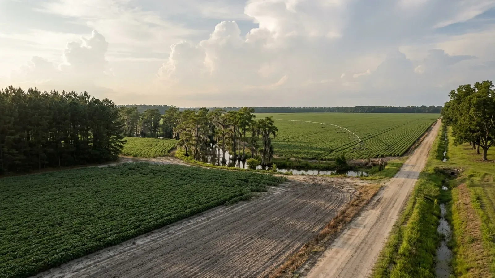
A very large flat South Carolina row-crop field with centre-pivot irrigation tracks, a sharp-edged pine plantation block, a cypress swamp along the creek and a straight dirt road.
Clarendon County One statewide code, county design maps

Barndominium Builders in Clarendon County, SC

Clarendon County is 156,415 acres of farmland wrapped around the top of Lake Marion, with I-95 through the middle of it and Manning as the county seat. It is the one county in this group where the land in farms went up rather than down — plus 14 percent since 2017, against a falling farm count — and where more than seven acres in ten of that farmland is cleared cropland rather than timber. Three things about building here are specific to this county. The Building Codes Council's approved sheet carries a 130 MPH wind contour and three seismic design categories, C, D0 and D1, lettered in red on both sides of two boundaries — so this is a county where the residential code's seismic provisions can switch on for a detached house, and where a single number for the whole county is simply not a true statement. The county's Unified Development Code gives two different minimum lot sizes for its Rural Estate district in two different tables, which is worth knowing before an offer rather than after. And Lake Marion is not just water with a shore: on Santee Cooper leased land a second authority permits the building, with a hard line barring covered structures within 75 feet of the high water mark.

Clarendon County at a glance

County
Clarendon County
Population
31,043

Building conditions in Clarendon County

The building code is the same in every South Carolina county: S.C. Code § 6-9-10(A) requires each municipality and county to enforce the Building Codes Council's codes and to enforce only those, and SC Regulation 8-236(C) bars a local jurisdiction from writing one of its own. The design numbers are not local either, but they are not one number for the state — Regulations 8-1202 and 8-1203 send wind and seismic to the Council's own map for this county, and those maps are drawn as contours, so the figure is read at your address rather than off a county name. What is genuinely local is who issues the permit and inspects the work, what that office charges, the permit procedure it adopted by ordinance, whether your parcel is zoned at all, and the rest of Table R301.2 — frost depth, termite probability and flood — which the jurisdiction fills in for itself.

Build conditions for Clarendon County , South Carolina : design wind speed The Building Codes Council's approved Clarendon County sheet, Clarendon 15(Mays).pdf, carries a single blue wind contour labelled 130 MPH at both ends and three seismic design categories lettered in red — C, D0 and D1 — printed as matched pairs at both ends of two boundaries. BUILD CONDITIONS CLARENDON COUNTY…Clarendon CountyONE STATEWIDE CODEDESIGN WIND SPEEDThe Building Codes…Regs 8-1202 and 8-1203 replace IRC R301.2.1 and R301.2.2.1 with the South Carolina Building CodesCouncil's own county maps, and Clarendon is one of the 33 counties with an approved sheet. It is…ZONING · AGR I AND AGR II (AGRICULTURE), RE (…AGR I and II are described as having…Zoning is countywide, administered through the Unified DevelopmentCode with an official zoning map, a zoning official, a Planning and…ONE AND TWO FAMILY RESIDENTIAL BUILDING PERMIT$460 for the first $100,000 of estim…That is the third of four bands on Table IX-3 of the UnifiedDevelopment Code. The others: a $50 minimum permit fee; $1,001 to…WHO ISSUES THE PERMITClarendon County Building and Planni…411 Sunset Drive, Manning SC 29102; Director Tabitha Hanna803-435-8672. One department covers building permits, plan review,…
Build conditions for Clarendon County, drawn from the sourced facts on this page. Every figure above is cited in the quick-facts panel below, with its source and vintage.
The Council's Clarendon sheet carries a 130 MPH contour and three seismic categories — C, D0 and D1
South Carolina does not use the national maps for houses. Modification IRC 2021-04 rewrites Section R301.2.1 so the ultimate design wind speed comes from "the previously published maps by the South Carolina Building Codes Council" instead of Figure R301.2(2), and IRC 2021-05 does the same for the seismic design category at R301.2.2.1. Clarendon is one of the 33 counties with an approved sheet, and its sheet is one of the more informative in the state. Read three ways — text layer extracted in reading order, extracted again in layout mode, and the page content stream decompressed and enumerated — it returns a single blue wind contour labelled 130 MPH at each of its two ends, and eight seismic letters drawn in red: two matched pairs at the ends of one boundary reading C and D0, and two more at the ends of a second boundary reading D0 and D1. So the county carries three seismic design categories, not one, and the wind figure is a contour rather than a fill. The sheet's own note says so: "Wind speed, shown in miles per hour, applies at all points along the length of its corresponding (blue) line. Interpolation between wind speed lines is determined by the AHJ as permitted by Figure R301.2(4)(A) of the 2015 International Residential Code." Why the seismic half matters more than usual here. Under IRC Section R301.2.2 a detached one- or two-family dwelling does not pick up the residential code's seismic provisions until Seismic Design Category D0 — and two of Clarendon's three categories are at or above that line. Cross it and R403.1.2 requires exterior walls to sit on continuous solid or fully grouted masonry or concrete footings, which takes isolated pier pads under the exterior wall line out of the prescriptive method and is the provision that bites a post-frame building hardest; R403.1.3 requires footings and stem walls to be reinforced; and R301.2.2.6's eight irregularity conditions catch a long clear-span shop bay with a tall door wall more often than not. Which of the three categories applies to your parcel is read at the parcel and confirmed by the building official, and it should be in writing before the frame is quoted.

SC Building Codes Council, "Wind/Seismic Maps", https://llr.sc.gov/bcc/maps.aspx ; the Council's Clarendon County sheet, https://llr.sc.gov/bcc/PDFfiles/WSMaps/Clarendon%2015(Mays).pdf (HTTP 200, application/pdf, 8,518,120 bytes, downloaded 8 September 2026 and read as extracted text in both pdftotext -raw and pdftotext -layout, and independently by inflating the page content stream, which shows 28 red strokes and 8 red fills consistent with two lettered boundaries); modifications IRC 2021-04 and IRC 2021-05, SCBCC 2021 Modification Index, https://llr.sc.gov/bcc/PDFfiles/2021-Modification-index.pdf (HTTP 200, application/pdf, 2,546,668 bytes, downloaded and read 8 September 2026); Regs 8-1202 and 8-1203, https://llr.sc.gov/bcc/PDFfiles/2021-Code-Modifications.pdf ; 2021 South Carolina Residential Code §§ R301.2.2, R301.2.2.6, R403.1.2 and R403.1.3

The Unified Development Code gives two different minimum lot sizes for the Rural Estate district
This one is worth settling before an offer rather than after, because the two answers are four acres apart and the district's lot coverage cap makes the difference expensive. Clarendon County's Unified Development Code describes its zoning districts in Table III-2 of Article III and sets their dimensional standards in Table V-1 of Article V. Table III-2 lists "Residential Estate RE" with "1 acre min. parcel size" and the purpose "Designate lands for residential estates and limited low intensity agricultural activities - subdivisions are permitted." Table V-1 gives RE a minimum lot area of 5 acres, with a 100-foot minimum lot width, a 20-foot side yard and a 50-foot rear yard, and the companion half of the same table gives RE a maximum residential density of 1.0 dwelling unit per acre and a maximum lot coverage of 10 percent — the tightest coverage figure of any district in the code. Both figures are published, both are in the adopted code, and they do not agree. The consequence is concrete rather than academic. Ten percent lot coverage counts structures, pavements and other impervious surfaces together. On five acres that is 21,780 square feet, which is comfortable for a house, a shop and a drive. On one acre it is 4,356 square feet in total — a 40 by 80 building is 3,200 of that before the driveway — and a barndominium programme that assumes the larger figure will not fit. Section 1:8-style tie-breakers do not settle it here, so do not settle it yourself. Take both tables to the Clarendon County Building and Planning Department, ask the zoning official in writing which minimum lot area and which coverage figure apply to the tax map number you are looking at, and get the answer before you are committed. The department is also the body that can tell you whether the parcel is RE at all rather than AGR, and the two districts behave very differently.

Clarendon County Unified Development Code, Article III (Permitted, Conditional and Accessory Uses), Table III-2 Zoning District Descriptions and Purpose, https://media-002-us.cdn.govstack.com/clarendoncountygov-us/media/wflfnw5i/articleiii-permittedconditionalandaccessoryuses-1.pdf (HTTP 200, application/pdf, 761,776 bytes, downloaded and read 8 September 2026); Article V (Site Development Criteria), Sec. 50.02 and Table V-1 Minimum Parcel Dimensions, https://media-002-us.cdn.govstack.com/clarendoncountygov-us/media/eshf3h3o/articlev-sitedevelopmentcriteria.pdf (HTTP 200, application/pdf, 334,834 bytes, downloaded and read 8 September 2026; Table V-1 was extracted in both pdftotext -raw and pdftotext -layout — the layout render offsets every row label by one and was discarded, and the reading-order alignment was independently confirmed by matching five districts against the minimum parcel sizes printed in Table III-2); both linked from https://www.clarendoncountysc.gov/business-and-development/planning-and-zoning/

In the agricultural districts there is no minimum parcel size, no lot coverage cap, and two residences are allowed on one parcel
Clarendon splits its agricultural zoning in two, and the split tells you something about the county. Table III-2 of the Unified Development Code describes both AGR I and AGR II with the same purpose — "Protect agricultural lands, provide for rural residential uses and reserve land until the marketplace determines a more intense land use is justified - maximum two residences per parcel one family business permitted on same parcel" — and the same headline entry, "no minimum parcel size." What separates them is animals: AGR I is the district for "Non-Regulated Animal Facilities" and AGR II for "Regulated Animal Facilities or Intensive Animal Production Facilities." That is not a formality in a county running 2,345,044 broilers and 26,174 hogs. Table V-1 fills in the dimensions for AGR I and II together: front setbacks of 30 feet on a local road, 40 on a collector and 50 on an arterial; a 100-foot minimum lot width, reduced to 75 feet on a curve; a 10-foot side yard and a 25-foot rear yard; and — the entries that matter most for a wide building — no maximum residential density, no maximum floor area ratio and no maximum percent lot coverage at all. Where a single-family detached residence is proposed, the table's own note (b) sets the minimum lot: 10,000 square feet with public water and sewer, 20,000 square feet with public water and a private septic system or public sewer and a well, and 30,000 square feet for a private septic system and well. Note (e) allows accessory buildings to sit "no less than five (5) feet from the rear and/or side lot lines." Read together, an AGR parcel in Clarendon is one of the more permissive rural canvases in the Midlands: modest setbacks, no coverage ratio to design against, five feet of clearance for a detached shop at the rear line, and room for a second dwelling and a family business on the same land without subdividing. Confirm the district and the specific figures with the county before relying on any of it.

Clarendon County Unified Development Code, Article III, Table III-2 (Zoning District Descriptions and Purpose), https://media-002-us.cdn.govstack.com/clarendoncountygov-us/media/wflfnw5i/articleiii-permittedconditionalandaccessoryuses-1.pdf ; Article V, Sec. 50.02 and Table V-1 with notes (a), (b), (d), (e) and (h), https://media-002-us.cdn.govstack.com/clarendoncountygov-us/media/eshf3h3o/articlev-sitedevelopmentcriteria.pdf (both downloaded and read 8 September 2026; Table V-1 read in pdftotext -raw after the pdftotext -layout render was found to offset the row labels by one, with the reading-order alignment confirmed against Table III-2); livestock inventory from USDA NASS, 2022 Census of Agriculture County Profile, Clarendon County, https://www.nass.usda.gov/Publications/AgCensus/2022/Online_Resources/County_Profiles/South_Carolina/cp45027.pdf

Clarendon computes your permit fee from its own published cost-per-square-foot factors, not from the ICC table
Most South Carolina counties that publish a valuation basis point at the International Code Council's Building Valuation Data. Clarendon publishes its own, and because the figures are printed in the adopted code you can work out the permit fee before you apply. Table IX-3 of Article IX sets the building permit fee schedule for one- and two-family residential work: a $50 minimum permit fee; $15 for the first $1,000 plus $5 per thousand from $1,001 to $50,000; $260 for the first $50,000 plus $4 per thousand to $100,000; $460 for the first $100,000 plus $3 per thousand to $500,000; and $1,660 for the first $500,000 plus $2 per thousand above that. Then, at the foot of the table, the "Factors To Estimate Construction Cost" the county uses to arrive at the estimated construction cost the bands are applied to: Agriculture $34 per square foot; Residential 1st floor and finished basement $125 per square foot; Residential detached accessory buildings $34 per square foot; Residential attached garage $30; Residential open porch, detached garage or attached carport $30; Residential roof or pole shed $10; Residential open deck $22; Residential brick veneer $22; Residential vinyl siding $17; Residential foundation $5; Remodeling $60; and commercial and industrial work per contract. Two cautions, and they matter. These are the county's fee-estimating factors — the numbers a permit technician multiplies by your square footage to compute what you owe the county — and they are not a construction price, not a quote and not an estimate of what anything costs to build. And the same schedule appears twice in the code, in Table IX-3 and again as Table XIII-1 in the buildings and building regulations article, with a couple of line items differing between the two printings, so confirm the current figures with the permit technician before budgeting. Also on the schedule: "Agriculture Buildings Same as Residential, 50 min", a building moving fee of $150, demolition $50, residential electrical, plumbing and HVAC permits at $50 each plus $3 per thousand, manufactured home installation $175 and reinspection $40. The application fee schedule in Table IX-2 is separate: a zoning certification fee of $10, a use permit $50, a subdivision exemption $25, a minor subdivision review $200, a conditional use permit $250, a flood hazard area permit $300, a conventional variance $350, a zoning map amendment $350, and staff site plan review $100.

Clarendon County Unified Development Code, Article IX (Application Procedures and Fees), Secs. 90.04 and 90.05, Table IX-2 Application Fee Schedule, Table IX-3 Building Permit Fee Schedule and the Factors To Estimate Construction Cost, https://media-002-us.cdn.govstack.com/clarendoncountygov-us/media/xv3lckdj/articleix-applicationproceduresandfees.pdf (HTTP 200, application/pdf, 260,030 bytes, downloaded 8 September 2026 and read in both pdftotext -raw and pdftotext -layout; the two renders agree on Table IX-3 and on the cost factors, while Table IX-2 is offset in the layout render and was taken from the reading-order one); the same schedule as reprinted at Table XIII-1, Article XIII (Buildings and Building Regulations Ordinance), Sec. 130.05, https://media-002-us.cdn.govstack.com/clarendoncountygov-us/media/ldyhnonp/articlexiii-buildingandbuildingregulationsordinance.pdf

On Santee Cooper land at Lake Marion a second authority permits the building, and no covered structure may sit within 75 feet of the high water mark
Lake Marion defines this county, and it is not simply water with a shoreline. It is part of the Santee Cooper Hydro-Electric Project, and Santee Cooper's Property Management division states that its leasing and permitting programs "exist to keep the Santee Cooper Hydro-Electric Project in compliance with requirements of the Federal Energy Regulatory Commission ("FERC") license under which we operate and the U.S. Army Corps of Engineers." Its permit applications name a closed list of five counties — Berkeley, Calhoun, Clarendon, Orangeburg and Sumter — and Clarendon is on it, with more named Santee Cooper residential subdivisions than any other county on the form: Clark, Church Branch, Frierson, Taw Caw II, West Wyboo, White Oak III, Wyboo, Rowland, Prince and Moultrie I among them. On Santee Cooper leased land the Application for Santee Cooper Land Based Permit sets its own conditions alongside the county's: a $325.00 residential or $500.00 commercial fee, a 30-foot setback to the adjoining road right-of-way, a 75-foot setback to the high water mark of the lake where waterfront, and in capitals on the face of the form, "NO COVERED STRUCTURES ARE ALLOWED WITHIN 75' OF HIGH WATER MARK OF LAKE." It adds that "Marginal leases do not allow dwellings or any part of dwellings," that "No temporary structures such as sheds, garages, or other, will be allowed as temporary or permanent living space," and that grandfathered structures "cannot be replaced, rebuilt, altered in size or its intended use changed." Each request is inspected before construction and again after completion, the proposed location must be staked before the agent's inspection, and a first offence of construction without a permit carries a $425.00 residential fee on Santee Cooper's own published schedule. The form is explicit that its permit does not displace the county's — it directs applicants to "See local and county setback requirements for other building and easement setbacks" — and water-based work has its own application at the same fee, with a note that S.C. Code 40-11-410 section 4D requires any water construction over $5,000.00 to be done by a licensed marine contractor. The question to settle before an offer on any Clarendon lakefront parcel is therefore what you are buying: fee simple upland, or Santee Cooper leased land. The second answer adds an authority and a hard 75-foot line.

Santee Cooper, Lake Property Management, https://www.santeecooper.com/community/lakes/property-management/ (page read 8 September 2026); "Application for Santee Cooper Land Based Permit" (2025), https://www.santeecooper.com/Community/Lakes/Property-Management/_pdfs/Land-Based-Permit-Application-2025.pdf (HTTP 200, application/pdf, 180,608 bytes, downloaded and read 8 September 2026); "Application for Santee Cooper Water Based Permit" (2025), https://www.santeecooper.com/Community/Lakes/Property-Management/_pdfs/Water-Based-Permit-Application-2025.pdf (HTTP 200, application/pdf, 457,114 bytes); Property Management Fee Schedule effective 1 January 2025, https://www.santeecooper.com/Community/Lakes/Property-Management/_pdfs/2025-Fee-Schedule.pdf

156,415 acres in farms — and unusually, the acreage went up 14 percent while the farm count fell
The 2022 Census of Agriculture counts 341 farms in Clarendon County working 156,415 acres at an average of 459 acres each, 40.2 percent of a 388,613-acre county. The direction of travel is the unusual part and it separates Clarendon from every neighbour on this side of the state: since 2017 the number of farms fell 10 percent while the land in farms rose 14 percent, so the average operation grew 28 percent. Land coming into agriculture, not out of it — which is the opposite of the supply-side story that makes rural homesites cheap in the counties around it, and it is worth knowing before assuming this market behaves like Bamberg or Calhoun. What the land is doing matters too. The 156,415 acres break down as 111,991 acres of cropland, 5,309 of pastureland, 30,656 of woodland and 8,459 of other, four figures that sum exactly to the total. Seventy-two percent of the farmland is cleared cropland, the highest proportion of the three counties in this corner of the Midlands, so a tract here is more often open field than planted pine. Irrigation covers 13,612 acres, 9 percent of the land in farms. Clarendon ranks first in South Carolina for grains, oilseeds, dry beans and dry peas at $69,834,000 of sales, second in the state for crops overall at $86,214,000, and second for hogs and pigs — with 39,515 acres of corn for grain, 33,951 of soybeans and 15,162 of wheat as its top three crops by area, and 2,345,044 broilers and 26,174 hogs on hand at the end of 2022. That concentration is the reason the county's zoning splits agriculture into a non-regulated and a regulated animal-facility district. On the size distribution: 20 farms are 1 to 9 acres, 74 are 10 to 49 and 110 are 50 to 179, so 204 of the 341 operations are under 180 acres. County population was 31,043 in 2025, down 101 since the 2020 census.

USDA National Agricultural Statistics Service, 2022 Census of Agriculture County Profile, Clarendon County, South Carolina, https://www.nass.usda.gov/Publications/AgCensus/2022/Online_Resources/County_Profiles/South_Carolina/cp45027.pdf (HTTP 200, application/pdf, 878,781 bytes, downloaded 8 September 2026 and read with pdftotext -raw; the percentage-change column was checked against the pdftotext -layout render, which pairs it with the wrong row labels, and the -raw pairing was confirmed by recomputing the average-size change from the farm-count and acreage changes); county land area and population from Census Bureau Vintage 2025 estimates and the 2025 Gazetteer county file

Also worth knowing before you build in Clarendon County

The accessory-building rules: no size cap, no living in it, and no power on a vacant lot
Section 34 of Article III is the whole of what the Unified Development Code says about accessory uses and structures, and it is short enough to read in full before designing. Section 34.01 describes the intent — accessory uses and structures "subordinate to the principal land use or buildings use", a term that "shall include, but not be limited to, such uses as gazebos, sheds, workshops, greenhouses, storage buildings and similar uses." Section 34.02's general requirements then set out what actually binds: accessory uses, buildings and structures must be on the same lot as the principal use; "No accessory use shall exceed the height limits established for the zoning district in Article V"; accessory buildings may not be rented to someone other than the owner or resident of the parcel; "Accessory building shall not be used or otherwise occupied as a dwelling unit"; "Only accessory use structures requiring taxation by South Carolina Law shall require a building permit from the Department and shall conform to the setback requirements in Article V"; and no accessory building may sit in a required parking area, landscape area, stormwater facility area or front yard in the NC, GC, IND or INS districts. Four observations for a barndominium project. There is no floor-area cap and no percentage-of-the-dwelling test in the general requirements — the subordinate language sits in the intent section rather than in a number — so ask the zoning official how the department applies it rather than assuming either way. The height limit referred to in Article V is not a numeric ceiling in the rural districts: Section 50.05 requires only that non-residential and multifamily structures 30 feet or more in height set back an additional foot for every foot above 30, and that all building heights and areas comply with the adopted fire and building codes. Living in the shop while the house is built is closed by 34.02(d). And two clauses decide whether power can be run: 34.02(g) allows an existing accessory structure on a lot without a principal use to have electrical service, mounted to the structure itself, while 34.02(h) states flatly that "No electrical service may be established on a vacant parcel." One related route the code does provide is an accessory dwelling unit under Section 33.27, allowed in single-family residential districts, capped at less than the primary dwelling's square footage and at 25 feet or the height of the primary residence, occupiable only by an immediate family member of the occupants or an official caregiver, and not to be rented or leased.

Clarendon County Unified Development Code, Article III, Secs. 33.27 (Accessory Dwelling Units), 34.01 and 34.02, https://media-002-us.cdn.govstack.com/clarendoncountygov-us/media/wflfnw5i/articleiii-permittedconditionalandaccessoryuses-1.pdf (read 8 September 2026); Article V, Sec. 50.05 (Building Height and Area Standards), https://media-002-us.cdn.govstack.com/clarendoncountygov-us/media/eshf3h3o/articlev-sitedevelopmentcriteria.pdf

Who permits, who inspects, and the code the county adopted
Clarendon County runs building and planning from one department at 411 Sunset Drive in Manning. Tabitha Hanna is Director on 803-435-8672, with Abony Parker as Deputy Director, Alvin Chambers as Building Official, Cleve Morris as Building Inspector, Wendy Housel as Planning and Zoning Coordinator, Laverne Houston as Permit Technician and Erik House in Code Enforcement; the county's main number is 803-435-0135. Article XIII of the Unified Development Code is the buildings and building regulations ordinance. It establishes the office of Planning Director, charges that office with enforcing the adopted building codes, and provides that the building inspector reports to the Planning Director. Its adoption clause lists the International Building, Fire, Fuel Gas, Mechanical, Plumbing, Residential, Energy Conservation and Pool and Spa Codes with South Carolina modifications, and records for each of them that "January 1, 2023 is hereby adopted the 2021" edition — which is the statewide implementation date rather than a local choice. Section 130.03 preserves a homeowner's right to build, repair or improve on their own residence or other real estate held for personal or rental purposes as opposed to speculative purposes, while stating that this does not exempt the owner from obtaining a permit, having the work inspected or paying the fees. Section 130.04 makes a permit null and void if the authorised work is not commenced within six months, or if it is suspended or abandoned for six months at any time after starting. Section 130.06 forbids a licensed contractor from allowing the use of their name or licence by anyone not regularly employed by them, and Section 130.07 lets the Planning Director refuse future permits to a contractor who repeatedly fails to comply after written notice. Under Section 130.05, work started before a permit is obtained carries double the fees. Site plan review under Article V Section 55.02 does not apply to single family or duplex residential structures, a family business, or on-site agricultural products processing, which is why a rural house and shop normally go straight to the building permit rather than through a site plan.

Clarendon County Planning and Zoning department page and staff directory, https://www.clarendoncountysc.gov/business-and-development/planning-and-zoning/ (served page read 8 September 2026); Unified Development Code Article XIII (Buildings and Building Regulations Ordinance), Secs. 130.01 to 130.08 and 131.01, https://media-002-us.cdn.govstack.com/clarendoncountygov-us/media/ldyhnonp/articlexiii-buildingandbuildingregulationsordinance.pdf (HTTP 200, application/pdf, 165,404 bytes, downloaded and read 8 September 2026); Article V Sec. 55.02 (Site Plan Review, Applicability), https://media-002-us.cdn.govstack.com/clarendoncountygov-us/media/eshf3h3o/articlev-sitedevelopmentcriteria.pdf

Clarendon has more Fuquay sand and more Lynchburg wetland soil than almost any county in the state
Two soils dominate the building question here and they pull in opposite directions, which is why the answer is parcel-specific rather than countywide. On the sandy side, an NRCS Soil Data Access query of component acreage across South Carolina survey areas returns 50,612 acres of Fuquay in Clarendon County, second in the state only to the Aiken County survey area. Fuquay is a sandy-surfaced soil over a plinthic subsoil — its Official Series Description classes it Loamy, kaolinitic, thermic Arenic Plinthic Kandiudults, well drained, with low shrink-swell potential and moderately low saturated hydraulic conductivity, so it digs easily and drains near the surface while the plinthite horizon beneath perches water rather than letting it through. On the wet side, the same query returns 53,092 acres of Lynchburg in Clarendon, second in the state only to Florence County. Lynchburg's own series description is the more useful document here: Fine-loamy, siliceous, semiactive, thermic Aeric Paleaquults, agricultural drainage class somewhat poorly drained, and "Depth to Seasonal High Water Table: 15 to 46 centimeters (6 to 18 inches), November to April." Six to eighteen inches below grade for half the year is not a footnote. On a wide building that is the foundation decision. Pad height, fill volume and driveway grade are set by how high the water comes in February, not by what the ground looks like in August, and an embedded post sitting in saturated soil for half the year is a materially different proposition from the same post in dry sand. Three practical steps. Pull the Web Soil Survey report for the actual building footprint rather than the parcel, and read the depth-to-water-table table as carefully as the engineering properties. Visit in the wet season if the timing allows. And treat the septic evaluation and the foundation investigation as one exercise, because on Coastal Plain ground they are asking the same question about the same restrictive horizon. Because Clarendon sits below the Fall Line, the mandatory backhoe-pit soil evaluation that S.C. Regulation 61-56 § 104.1(5) imposes above it does not apply here.

NRCS Soil Data Access tabular service, component acreage by South Carolina survey area (queries run for this build and recorded in research/statewide/soils-and-geology.md), https://SDMDataAccess.sc.egov.usda.gov/Tabular/post.rest ; Fuquay and Lynchburg Official Series Descriptions, https://soilseries.sc.egov.usda.gov/OSD_Docs/F/FUQUAY.html and https://soilseries.sc.egov.usda.gov/OSD_Docs/L/LYNCHBURG.html ; NRCS Web Soil Survey, https://websoilsurvey.nrcs.usda.gov/ ; S.C. Regulation 61-56 § 104.1(5), https://des.sc.gov/sites/des/files/Library/Regulations/R.61-56.pdf

Clarendon is not in the coastal zone, and Lake Marion does not put it there
A parcel on Lake Marion feels like waterfront in the fullest sense, and buyers regularly arrive expecting a state coastal permit. Clarendon County is not in the coastal zone, and the answer comes from a definition clause rather than from a map. S.C. Code Section 48-39-10(B) of the Coastal Tidelands and Wetlands Act defines the coastal zone as "all coastal waters and submerged lands seaward to the state's jurisdictional limits and all lands and waters in the counties of the State which contain any one or more of the critical areas. These counties are Beaufort, Berkeley, Charleston, Colleton, Dorchester, Horry, Jasper, and Georgetown." That is a closed list of eight named counties, Clarendon is not among them, and a large freshwater impoundment is not a critical area. So there is no Critical Area permit and no coastal zone consistency certification for a Clarendon build. What genuinely applies on the water here comes from three other places and it pays to keep them distinct: Santee Cooper's own permitting on Santee Cooper leased land under its federal licence; the U.S. Army Corps of Engineers where wetlands or navigable waters are involved; and the county's own Flood Damage Prevention Ordinance at Article XVII of the Unified Development Code, together with the flood hazard area permit that carries a $300 fee on the county's published application fee schedule and the $10 flood zone certificate alongside it. Onsite wastewater is a state permit under S.C. Regulation 61-56 rather than a county one.

S.C. Code § 48-39-10(B), Coastal Tidelands and Wetlands Act, https://www.scstatehouse.gov/code/t48c039.php ; Clarendon County Unified Development Code, Table IX-2 Application Fee Schedule (Flood Hazard Area Permits, Flood Zone Certificate), https://media-002-us.cdn.govstack.com/clarendoncountygov-us/media/xv3lckdj/articleix-applicationproceduresandfees.pdf ; Article XVII Flood Damage Prevention Ordinance as listed at https://www.clarendoncountysc.gov/business-and-development/planning-and-zoning/ ; S.C. Regulation 61-56, https://des.sc.gov/sites/des/files/Library/Regulations/R.61-56.pdf ; Santee Cooper Lake Property Management, https://www.santeecooper.com/community/lakes/property-management/

One code statewide, no local modification here, and a barndominium is never a farm structure
The construction standard in Clarendon County is the State's. S.C. Code Section 6-9-10(A) requires every municipality and county in the State to enforce the Building Codes Council's codes and to "enforce only" them, and SC Regulation 8-236(C) adds that "Local jurisdictions are prohibited from writing or publishing any other building codes in part or in whole." In force now are the 2021 International codes with South Carolina modifications, implemented 1 January 2023 — the date Clarendon's own Article XIII records against each code it adopts — together with the 2020 National Electrical Code and, by statute rather than by the Council, the 2009 International Energy Conservation Code. The 2024 codes take effect 1 January 2027, and Section 6-9-130(A) fixes the edition that governs a project at the date the original building permit was issued. Under the 2021 codes the Council has granted exactly one local residential modification anywhere in South Carolina and it belongs to Greenville County; Clarendon has none. Which brings up the question every buyer on 156,415 acres of farmland asks. S.C. Code Section 6-9-65(A) defines a farm structure as one built on a farm "other than a residence or a structure attached to it," and excludes any structure "originally qualifying as a 'farm structure' but later converted to another use." A barndominium is a residence, so it is outside the exemption; the shop half of a shouse under one continuous roof is attached to a residence, so it is outside too; and finishing out a barn later is removed from the exemption by the definition's own words. Section 6-9-65(C) makes the exemption conditional on an affidavit filed with the building official before construction, Section 6-9-65(B) preserves the National Flood Insurance Program standards regardless, and Section 6-9-65(D) leaves the county free to require a permit anyway. Note also that the county's own fee schedule prices "Agriculture Buildings Same as Residential, 50 min" and applies a $34 per square foot cost factor to agricultural work, so a genuine barn is a permitted building here rather than an unregulated one.

S.C. Code §§ 6-9-10(A), 6-9-65 and 6-9-130(A), https://www.scstatehouse.gov/code/t06c009.php ; SC Reg 8-236, https://www.scstatehouse.gov/coderegs/Chapter%208.pdf ; SC Building Codes Council, Building Code Adoption, https://llr.sc.gov/bcc/BCAdoption.aspx ; Clarendon County Unified Development Code Article XIII Sec. 131.01 and Table XIII-1, https://media-002-us.cdn.govstack.com/clarendoncountygov-us/media/ldyhnonp/articlexiii-buildingandbuildingregulationsordinance.pdf

An excavator grading a compacted building pad on a cleared lot, with orange clay in the cut face, survey stakes and a drainage swale.
Below the slab

The expensive surprises are in the ground, not the building

What moves a South Carolina budget is usually below grade, and more often than not it is the drainfield rather than the foundation. R.61-56 § 200.1 settles whether a parcel can take an onsite system from soil morphology — texture, structure, depth to a restrictive horizon and depth to the zone of saturation — and § 200.2 then rules out two conditions outright: soils exhibiting massive or platy structure, and soils with substantial amounts of expansible layer clay minerals or smectites. That second clause is the one that bites on the mafic Piedmont, where the shrink-swell series sit in quantity under York, Fairfield, Chester, Laurens, Union, Newberry, Greenwood, McCormick, Lancaster, Saluda, Abbeville and Edgefield. A foundation problem has a price and an answer; an unbuildable septic parcel has neither, which is why we look at it first. Bedroom count is the number to settle early, because § 61-56.501 drives design flow from bedrooms, design flow drives trench length, and trench length plus a repair area decides how much good soil the parcel has to have — shop square footage adds nothing to it. Above the Fall Line the evaluation is done in backhoe pits rather than borings alone, so the answer comes from a dug hole and not a form. The site work, the foundation and the drainfield therefore get resolved together rather than one at a time. We price the dirt before we price the building.

What a build looks like

Three stages every Clarendon County project passes through, from a raw parcel to a finished home. Site work first, because that is where the budget is decided.

Aerial view of an undeveloped rural lot with cleared rough grass, planted pine along one boundary, and a red dirt access track cut through orange clay.
Stage one

The parcel

Zoning, setbacks, flood zone and utility access get checked before anything is drawn.

An excavator grading a compacted building pad on a cleared lot, with orange clay in the cut face, survey stakes and a drainage swale.
Stage two

Pad and permit

Clearing, grading and a compacted pad, while the submittal works through whichever office issues the permit where you are building.

A finished barndominium at dusk with warm interior lighting glowing through its large windows.
Stage three

Frame to finish

Shell erected and dried in, then systems, insulation and interior finish through to CO.

Those are the rules where you are building in Clarendon County. Tell us what you want to build and we will draw it to them.

Nearby areas we build in

Others we cover nearby. One may be a county and another a municipality inside one — and a South Carolina municipality can sit in two counties at once — so the office that issues the permit, the fees it charges, whether the land is zoned at all, and which design map covers it can all differ from one card to the next.

Building in Clarendon County: common questions

8 questions we get asked most often about building in Clarendon County. If yours is not on the list, ask it directly.

What wind speed and seismic design category apply to my Clarendon County parcel?
The figures come off a state map rather than a county chart, and the seismic answer is three answers rather than one. Regulation 8-1202 replaced IRC Section R301.2.1 with "the previously published maps by the South Carolina Building Codes Council" and Regulation 8-1203 did the same for R301.2.2.1. The Council's approved sheet for Clarendon County carries a single blue wind contour labelled 130 MPH at each of its ends, and eight seismic letters drawn in red: a matched C and D0 pair at the two ends of one boundary, and a matched D0 and D1 pair at the two ends of a second. So the county spans Seismic Design Categories C, D0 and D1, and anybody who quotes you one letter for the whole of Clarendon has not looked at the sheet. The wind figure is a contour too — the sheet states on its own face that the speed "applies at all points along the length of its corresponding (blue) line" and that "Interpolation between wind speed lines is determined by the AHJ as permitted by Figure R301.2(4)(A) of the 2015 International Residential Code." The seismic half deserves more attention here than in the counties immediately west, where the Council sheet publishes no category at all. Under IRC Section R301.2.2 a detached one- or two-family dwelling picks up the residential code's seismic provisions at Seismic Design Category D0, and two of Clarendon's three categories are at or above that. Cross the line and R403.1.2 requires exterior walls to bear on continuous solid or fully grouted masonry or concrete footings — which takes isolated pier pads under the exterior wall line out of the prescriptive method and is the single most expensive consequence for a post-frame building — while R403.1.3 requires reinforced footings and stem walls, R403.1.6.1 tightens sill anchorage, and R301.2.2.6 lists eight irregularity conditions that a wide clear-span shop bay with a tall door wall will often meet. Get the category for your tax map number in writing from the Clarendon County building official before the frame is ordered.
How much land do I need in Clarendon County?
It depends on the district, and in one district the code gives two answers. In AGR I and AGR II, the county's agricultural districts, Table III-2 of the Unified Development Code states "no minimum parcel size," and where a single-family detached residence is proposed, Table V-1's note (b) sets the minimum lot at 10,000 square feet with public water and sewer, 20,000 square feet with public water and a private septic system or public sewer and a well, and 30,000 square feet — roughly seven tenths of an acre — for a private septic system and well. Those districts also carry no maximum residential density, no floor area ratio and no maximum lot coverage, which is unusually permissive and means a wide building is not fighting a percentage as well as a setback. In RE, Residential Estate, the code is inconsistent: Table III-2 says the minimum parcel size is 1 acre, while Table V-1 says 5 acres and also sets a maximum density of 1.0 dwelling unit per acre and a maximum lot coverage of 10 percent. Both are published in the adopted code and they do not agree, so this is a question for the Building and Planning Department rather than for a website. The 10 percent coverage figure is what makes the discrepancy expensive: it counts structures, pavements and other impervious surfaces together, so on five acres it allows 21,780 square feet in total and on one acre only 4,356 — and a 40 by 80 building is 3,200 of that before the driveway. Ask the zoning official in writing which minimum lot area and which coverage figure apply to the specific parcel, and do it before you are committed. Two other numbers to size against regardless of district: the septic layout, where S.C. Regulation 61-56 § 200.7(1) requires a usable repair area of at least half the size of the original system, and the front setback, which is 30 feet on a local road, 40 on a collector and 50 on an arterial.
Can the shop be bigger than the house, and can I live in it while I build?
On size, the general requirements in the ordinance do not set a cap, and that is a genuine difference from the county to the west. Section 34.02 of Article III is the operative list for accessory uses and structures in Clarendon, and it contains no floor-area limit, no percentage-of-the-dwelling test and no rear-yard coverage rule. The word subordinate does appear, but in Section 34.01, which describes the intent of the section rather than imposing a number. So the honest answer is that there is no published cap and that how the department applies the intent language is a question for the zoning official — ask, and get the answer in writing, rather than assuming it either way. What Section 34.02 does say is that no accessory use may exceed the height limits established for the district in Article V, and Article V Section 50.05 sets no numeric height ceiling for a rural residential district: it requires only that non-residential and multifamily structures of 30 feet or more set back an extra foot for every foot above 30, and that all building heights and areas comply with the adopted fire and building codes. In the AGR districts there is no lot coverage cap either, and accessory buildings may sit as close as five feet to the rear or side lot line. On living in it, the answer is no, and it is explicit: Section 34.02(d) states that an "Accessory building shall not be used or otherwise occupied as a dwelling unit." Two further clauses catch people who plan to put the shop up first. Section 34.02(h) says flatly that "No electrical service may be established on a vacant parcel," and Section 34.02(g) allows an existing accessory structure on a lot without a principal use to have electrical service only where the service is mounted to the accessory structure itself. And a note on permitting: Section 34.02(e) provides that "Only accessory use structures requiring taxation by South Carolina Law shall require a building permit from the Department" — which does not mean an unpermitted shop is unregulated, and it does mean the threshold question is worth asking at the counter. The cleanest route for most people is a shouse: one structure, one permit, shop and living space under a continuous roof, which is the principal dwelling and not an accessory building at all.
What will the county charge for the permit?
Clarendon publishes both the fee bands and the cost factors it uses to compute the valuation those bands are applied to, which is unusual and means you can work the number out in advance. Table IX-3 sets one- and two-family residential permits at a $50 minimum, then $15 for the first $1,000 plus $5 per thousand from $1,001 to $50,000; $260 for the first $50,000 plus $4 per thousand to $100,000; $460 for the first $100,000 plus $3 per thousand to $500,000; and $1,660 for the first $500,000 plus $2 per thousand above. Residential electrical, plumbing and HVAC permits are $50 each plus $3 per thousand. Demolition is $50, a building move $150, manufactured home installation $175 and a reinspection $40. Agriculture buildings are charged the same as residential with a $50 minimum. The estimated construction cost the bands run against comes from the county's own "Factors To Estimate Construction Cost", printed at the foot of the same table: Residential 1st floor and finished basement $125 per square foot; Residential detached accessory buildings $34 per square foot; Agriculture $34; Residential attached garage $30; Residential open porch, detached garage or attached carport $30; Residential roof or pole shed $10; Residential open deck $22; brick veneer $22; vinyl siding $17; foundation $5; remodeling $60; and commercial and industrial per contract. Be clear about what those numbers are and are not. They are the county's fee-computation factors — what a permit technician multiplies by your square footage to work out what you owe Clarendon County — and they are not a construction price, a quote, or an indication of what anything costs to build. The same schedule is reprinted as Table XIII-1 in the buildings and building regulations article with a couple of line items differing between the two printings, so confirm the current figures with the permit technician before budgeting. Separate application fees apply for zoning and land-use matters: $10 for a zoning certification, $50 for a use permit, $25 for a subdivision exemption, $200 for a minor subdivision review, $250 for a conditional use permit, $300 for a flood hazard area permit, $350 for a variance and $350 for a zoning map amendment. Starting work before the permit doubles the fee.
My land is on Lake Marion. Who has to approve the building?
Possibly two authorities rather than one, and the answer depends on what you are buying. Lake Marion is part of the Santee Cooper Hydro-Electric Project, and Santee Cooper's Property Management division says its leasing and permitting programs "exist to keep the Santee Cooper Hydro-Electric Project in compliance with requirements of the Federal Energy Regulatory Commission ("FERC") license under which we operate and the U.S. Army Corps of Engineers." Its permit applications name five counties — Berkeley, Calhoun, Clarendon, Orangeburg and Sumter — and list more Santee Cooper residential subdivisions in Clarendon than in any other, including Wyboo, West Wyboo, White Oak III, Taw Caw II, Church Branch, Clark, Frierson, Rowland, Prince and Moultrie I. On Santee Cooper leased land the Application for Santee Cooper Land Based Permit sets its own terms alongside the county's: a $325.00 residential fee, a 30-foot setback to the adjoining road right-of-way, a 75-foot setback to the high water mark of the lake where waterfront, and in capitals on the form itself, "NO COVERED STRUCTURES ARE ALLOWED WITHIN 75' OF HIGH WATER MARK OF LAKE." It states that "Marginal leases do not allow dwellings or any part of dwellings," that no temporary structure such as a shed or garage may be used as temporary or permanent living space, and that grandfathered structures cannot be replaced, rebuilt or altered in size. Each request is inspected before construction and after completion, the proposed location must be staked before the agent's inspection, and a first offence of building without a Santee Cooper permit is $425.00 residential on the published schedule. Santee Cooper's form is explicit that its permit sits alongside rather than instead of the county's — it directs applicants to "See local and county setback requirements for other building and easement setbacks." So the question to answer before an offer is whether the parcel is fee simple upland or Santee Cooper leased land, because the second answer adds an approval and a hard 75-foot line that no amount of design will move. A separate point people expect to hear: being on a big lake does not put Clarendon in the state coastal zone. S.C. Code Section 48-39-10(B) names the eight coastal-zone counties and Clarendon is not one.
Is Clarendon a good place to buy land for this?
It has real acreage and good access, and it behaves differently from its neighbours in a way worth understanding before you shop. The 2022 Census of Agriculture counts 341 farms working 156,415 acres at an average of 459 acres, and 111,991 of those acres are cropland rather than timber — seventy-two percent, the highest proportion in this corner of the Midlands, so a tract here is more often open field than planted pine, and open field is cheaper to build on. The county sits on I-95 with Manning at the interchange, and it borders Sumter, Calhoun, Orangeburg, Berkeley, Williamsburg and Florence, which puts Columbia, Florence and the Charleston side all within reach. The part that differs from the counties to the west: since 2017 Clarendon's land in farms rose 14 percent while the number of farms fell 10 percent. That is land coming into agriculture rather than leaving it, which is the opposite of the supply-side story that keeps rural homesites cheap in Bamberg and Calhoun. Farmland here has a productive bid behind it — the county ranks first in South Carolina for grains, oilseeds, dry beans and dry peas at $69,834,000 of sales and second in the state for crops overall — so do not assume the pricing behaves like a declining farm county. Small tracts do exist: 20 farms are 1 to 9 acres, 74 are 10 to 49 and 110 are 50 to 179, so 204 of the 341 operations are under 180 acres. The county's population was 31,043 in 2025, down 101 since the 2020 census. Two things to check on any specific parcel before an offer. Which zoning district it is in, because AGR and RE behave very differently and the code gives two minimum lot sizes for RE. And what the soil report says about the water table, because Clarendon carries 53,092 acres of Lynchburg — second most in the state — and on that ground the pad height is the foundation decision.
Will the ground take a slab and a septic system?
It usually will, and the variable to check is water rather than rock. Clarendon is Coastal Plain, so the sediments are hundreds of feet thick and there is nothing to hit; what controls is the restrictive horizon in the top metre or two. Two soils dominate here and they behave differently. An NRCS Soil Data Access query of component acreage across South Carolina survey areas returns 50,612 acres of Fuquay in Clarendon, second in the state only to the Aiken County survey area — classed in its Official Series Description as well drained with low shrink-swell, easy to dig, with a plinthite horizon beneath that perches water rather than letting it through. The same query returns 53,092 acres of Lynchburg, again second in the state, this time behind Florence — somewhat poorly drained, and its series description puts the "Depth to Seasonal High Water Table: 15 to 46 centimeters (6 to 18 inches), November to April." On a wide slab-on-grade building that second one sets the whole foundation approach: pad height, fill volume and driveway grade are decided by how high the water comes in February, and an embedded post standing in saturated soil for half the year is a materially different structural proposition from the same post in dry sand. Three practical steps. Pull the Web Soil Survey report for the actual building footprint rather than for the parcel as a whole, and read the depth-to-water-table figures as closely as the engineering properties. If the calendar allows, walk the site in the wet season. And run the septic evaluation and the foundation investigation together, because on this ground they are asking the same question about the same horizon. On septic itself, the permit is a state one under S.C. Regulation 61-56 rather than a county one, and because Clarendon is below the Fall Line the mandatory backhoe-pit evaluation that § 104.1(5) imposes in the Piedmont does not apply. Section 200.7(1) does require a usable repair area equal to at least half the original system, kept clear, so site the drainfield and its replacement before the pad.
Can I build it as a farm building and finish it out later?
No. S.C. Code Section 6-9-65(A) defines a farm structure as one built on a farm "other than a residence or a structure attached to it," and excludes any structure "originally qualifying as a 'farm structure' but later converted to another use." A barndominium is a residence, so it is outside the exemption in every case; the shop half of a shouse under one continuous roof is attached to a residence, so it is outside too; and the conversion clause closes the finish-it-later plan by its own terms, after the footings are buried, the frame is closed in and nothing has been inspected. Section 6-9-65(C) makes the exemption conditional on an affidavit filed with the local building official before construction, Section 6-9-65(B) preserves the National Flood Insurance Program standards regardless — which in Clarendon means the county's flood damage prevention ordinance still applies in the mapped hazard area — and Section 6-9-65(D) leaves the county free to require a building permit anyway. In Clarendon that last point is not theoretical: the county's own fee schedule prices "Agriculture Buildings Same as Residential, 50 min" and applies a $34 per square foot cost factor to agricultural work, so a genuine barn here is a permitted, inspected building rather than an exempt one. Two county rules point the same way for anyone thinking about sequencing. Article III Section 34.02(d) provides that an accessory building "shall not be used or otherwise occupied as a dwelling unit," and Section 34.02(h) that "No electrical service may be established on a vacant parcel." A genuinely detached barn or equipment shed on the same land can qualify for the state exemption. The building you intend to sleep in cannot, and the practical answer for most people is to permit the whole thing as one dwelling from the start.

Building in Clarendon County?

Start with the plan. Tell us what you want to build and we will draw it, then confirm which office issues the permit for your parcel, what it will let you put there, and what wind load it has to meet. That conversation costs nothing.