Barndominium Builders in Sumter County, SC
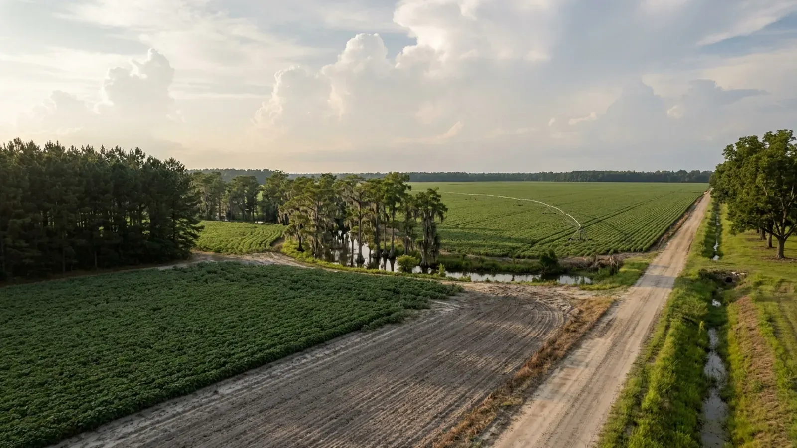
Sumter County is 38.4 percent farmland — 163,578 acres, of which 96,118 is cropland rather than timber — with its own metropolitan statistical area and Shaw Air Force Base in the middle of it. Two things make this page unlike the other county pages here. The first is an absence. Sumter is one of only eleven South Carolina counties for which the Building Codes Council has approved no wind or seismic map at all, and it is the odd one out among those eleven: the other ten sit in the Upstate corner of the state. That absence is the local fact, and what the adopted code text points to instead has its own problem, which this page sets out. The second is an overlay. The county's zoning ordinance carries Airfield Compatibility Districts around Shaw and Range Compatibility Districts around the Poinsett Electronic Combat Range, and inside them a single-family dwelling is prohibited outright in the two Accident Potential Zones and has to be built to a measured noise level reduction in the day-night noise zones. Zoning runs countywide in the unincorporated area, which here is the majority of the county — 60,921 of 105,067 residents. And the compensating fact is generous: in the Agricultural Conservation district a parcel over five acres is exempt from the ordinance's maximum accessory-building footprint altogether.
Building conditions in Sumter County
The building code is the same in every South Carolina county: S.C. Code § 6-9-10(A) requires each municipality and county to enforce the Building Codes Council's codes and to enforce only those, and SC Regulation 8-236(C) bars a local jurisdiction from writing one of its own. The design numbers are not local either, but they are not one number for the state — Regulations 8-1202 and 8-1203 send wind and seismic to the Council's own map for this county, and those maps are drawn as contours, so the figure is read at your address rather than off a county name. What is genuinely local is who issues the permit and inspects the work, what that office charges, the permit procedure it adopted by ordinance, whether your parcel is zoned at all, and the rest of Table R301.2 — frost depth, termite probability and flood — which the jurisdiction fills in for itself.
SC Building Codes Council, Wind/Seismic Maps, https://llr.sc.gov/bcc/maps.aspx (page loaded and its full map list read 6 Sep 2026 — 33 county PDFs plus whole-county lines for Abbeville and York, and no Sumter County entry of either kind); 2021 Code Modifications, Regulations 8-1202 and 8-1203, https://llr.sc.gov/bcc/PDFfiles/2021-Code-Modifications.pdf; SCBCC 2021 Modification Index, modifications IRC 2021-04 and IRC 2021-05, https://llr.sc.gov/bcc/PDFfiles/2021-Modification-index.pdf; research/statewide/design-criteria-and-climate.md §1c and §3
SC Building Codes Council, 2024 Combined Continued Modifications with Index, the R301.2.2.1 entry and its staff comment, https://llr.sc.gov/bcc/Forms/2024%20Combined%20Continued%20Modifications%20with%20Index.pdf (PDF loaded and text layer extracted 6 Sep 2026); 2021 Code Modifications, Regulations 8-1202 and 8-1203, https://llr.sc.gov/bcc/PDFfiles/2021-Code-Modifications.pdf; S.C. Code § 6-9-130(A), https://www.scstatehouse.gov/code/t06c009.php; SC Building Codes Council Building Code Adoption page, https://llr.sc.gov/bcc/BCAdoption.aspx
Sumter County Zoning and Development Standards Ordinance, Article One §1.a.3.f (revised October 2025), https://www.sumtercountysc.gov/Departments/Planning%20Department/Oct%2024%202025%20ARTICLE%201_County.pdf, and Article Three §§3.r, 3.s and 3.t with Exhibits 6 and 7 (revised January 2026), https://www.sumtercountysc.gov/Departments/Planning%20Department/Jan%2028%202026%20%20ARTICLE%203_County.pdf (both PDFs downloaded and text layers extracted 6 Sep 2026); ordinance index page, https://www.sumtercountysc.gov/departments/j_-_r/planning/county_zoning_and_development_standards_ordinance.php
Sumter County Zoning and Development Standards Ordinance, Article Four §4.g.2 and Exhibit 8A with its notes 1 to 4 (revised October 2025), https://www.sumtercountysc.gov/Departments/Planning%20Department/Oct%2024%202025%20ARTICLE%204_County.pdf (PDF downloaded and text layer extracted 6 Sep 2026); Article Three §3.n.5 for the AC district's 80 percent impervious surface ratio and 60-foot minimum lot width, https://www.sumtercountysc.gov/Departments/Planning%20Department/Jan%2028%202026%20%20ARTICLE%203_County.pdf
Sumter County Zoning and Development Standards Ordinance, Article Four §§4.g.2.a.2, 4.g.4 and Exhibit 8A note 4 (revised October 2025), https://www.sumtercountysc.gov/Departments/Planning%20Department/Oct%2024%202025%20ARTICLE%204_County.pdf; Article Three §3.n.5, AC district development standards (revised January 2026), https://www.sumtercountysc.gov/Departments/Planning%20Department/Jan%2028%202026%20%20ARTICLE%203_County.pdf (both read 6 Sep 2026)
Sumter City/County Farm Structure Building Permit Affidavit, published by the joint Sumter City-County Building Department at 12 W. Liberty Street, https://www.sumtersc.gov/sites/default/files/uploads/Departments/Building/Forms_Applications/farm_structure_affidavit.pdf (PDF loaded and text layer extracted 6 Sep 2026; the form reproduces S.C. Code §§ 6-9-65, 40-11-360, 40-22-280 and 40-3-290 in full as attachments); S.C. Code § 6-9-65, https://www.scstatehouse.gov/code/t06c009.php; Sumter County Building Inspections, https://www.sumtercountysc.gov/departments/a_-_d/building_inspections/index.php
Also worth knowing before you build in Sumter County
- 163,578 acres in farms, and most of it is cleared field rather than timber
- The land story here is different in kind from the Lowcountry counties, and the difference shows up in one table. The 2022 Census of Agriculture records Sumter County with 445 farms on 163,578 acres at an average of 368 acres — 38.4 percent of the county's 425,650 acres of land, seventh-highest farmland share among South Carolina's 46 counties. Now the land-use split, which is the part that matters when you are buying a building site: cropland 96,118 acres, woodland 51,647, pastureland 5,147 and other 10,666. Cropland is nearly three-fifths of the farmland. That is open, level, already-cleared, already-drained ground with field access — as against a Lowcountry county where the same headline acreage is mostly woodland, and where clearing, stumping and a wet-season access road are line items before the slab is poured. Sumter also irrigates 18,459 acres, 11 percent of its farmland, which tells you something about how the water table behaves in the growing season. The trade is demand. The Census Bureau's Vintage 2025 estimates put the county at 105,067 people, down from a 2020 base of 105,556, with 1,300 births against 1,291 deaths in the year to 1 July 2025 and net domestic migration of 221. This is not a growth market; it is a supply market with a stable population and a large military employer, and the two things it offers a builder are cheap, workable acreage and very little competition for it.
- Zoning covers the whole unincorporated county, and that is where most of the county lives
- Two facts sit together here and they invert what a lot of counties look like. First, coverage: Article One §1.b.1 of the Sumter County Zoning and Development Standards Ordinance provides that "the provisions in this ordinance shall be applicable within the unincorporated portions of the County of Sumter, South Carolina", with no carved-out unzoned remainder, and the ordinance is adopted under the authority S.C. Code § 6-29-710 delegates to cities and counties. Second, reach: the Census Bureau's Vintage 2025 sub-county estimates show Sumter County holds only three municipalities — the City of Sumter at 43,094, Mayesville at 554 and Pinewood at 498 — against a "Balance of Sumter County" of 60,921. Fifty-eight percent of the county's people live outside any municipality, so the county's own ordinance is the one that governs most of the residents and almost all of the acreage. The administrative arrangement behind it is the thing to get right, because it is easy to describe wrongly: the County and the City of Sumter share a nine-member Sumter City-County Planning Commission and a joint planning department at 12 W. Liberty Street, but each adopts its own Zoning and Development Standards Ordinance. One office, two ordinances, and the one that applies to your parcel depends on which side of the city line it sits on. The department's own note on its published ordinance says the posted articles are current but change periodically, and directs anyone who needs the current copy to the office on 803-774-1660.
- Sumter has more Norfolk soil than any other county in South Carolina — and a wet counterpart underneath it
- The septic answer and the slab answer both come out of the soil map, and Sumter's is unusually well documented because it is farmed. Measured across the state's soil survey, Sumter County carries 42,684 acres of the Norfolk series — the largest acreage of Norfolk of any South Carolina county, ahead of Florence's 40,762. Norfolk is the good news: the official series description records it as well drained, very deep, with a seasonal high water table at 40 to 72 inches from January to March, and plinthite content of 0 to 4 percent above 60 inches. That is ground a conventional septic system and a slab both like. The counterpart is Lynchburg, of which the county carries 31,382 acres, and its description is the warning: somewhat poorly drained, with a seasonal high water table at 15 to 46 centimetres — 6 to 18 inches — from November to April. On a Lynchburg site the water is within a foot and a half of the surface for six months of the year, which is a septic problem, a footing-drainage problem and a construction-access problem at once, and none of it will be visible in August. Two parcels a mile apart in this county can therefore be entirely different projects. South Carolina reads septic suitability from soil morphology rather than from a percolation test — texture, restrictive horizons and depth to the zone of saturation, determined by SCDES staff or by a licensed soil classifier engaged privately — and the regulation requires a usable repair area of at least 50 percent of the original system in addition to the system itself. Book the soil evaluation before the offer expires, and if you can, walk the site in February.
- Ground-mounted solar within five nautical miles of the base needs the commander notified
- A detail that catches people who plan the shop roof and the solar array in the same conversation. Article Five §5.b.1.m applies to accessory photovoltaic solar energy systems "located within 5.0 nautical miles of the center point of the runway for Shaw Air Force Base and Sumter County Airport, as well as the center point of Poinsett Electronic Combat Range (ECR)." Inside that radius, ground-mounted collectors take a minimum 50-foot setback from all property lines or the district's own yard setbacks, whichever is greater, and are capped at 25 feet above ground when tilted to maximum; on-site electrical interconnections and power lines go underground wherever reasonably practical; the applicant carries the burden of proving glare will not significantly adversely affect aviation, road traffic or neighbouring property; and the applicant "shall provide documented proof of having notified the Shaw Air Force Base/Poinsett ECR Military Garrison Commander, or the commander's representative, and the Sumter County Airport Director", allowing 14 days for written comments which must then be submitted with the conditional use application. A decommissioning plan under Appendix D has to be recorded with the Sumter County Register of Deeds. For a primary rather than accessory system the ordinance goes further again — a glare assessment by a qualified professional, 21 days for comments, and a 50-foot landscape buffer. Roof-mounted panels on the dwelling are a different question, but if the plan involves an array on the ground, find out how far the parcel is from those three centre points before it is designed.
- The permit comes from the Zoning Administrator first, and clearing more than two acres is its own approval
- The sequence in Sumter County is worth knowing before the machinery arrives. Article One §1.p.1 provides that "no building, sign, parking lot or other structure shall be erected, moved, added to, or structurally altered without a permit issued by the Zoning Administrator", and adds a clearing rule that applies to exactly the kind of site work a rural build starts with: large-scale land clearance or grading, meaning more than 2.0 acres, requires a tree protection and landscape plan submitted to and approved by the Sumter City-County Planning Commission before the Zoning Administrator may issue a grading or land-clearance permit; under 2 acres goes straight to the Zoning Administrator. Farming operations regulated elsewhere in the ordinance are not prohibited by that section. The permit has to be posted on the property in full view from each abutting street. §1.q.1 requires the building permit application to be accompanied by a site plan in duplicate, drawn to scale, showing the lot's actual dimensions and shape, the exact size and location of any existing buildings and the location and dimensions of what is proposed, and §1.q.2 has the County Engineer attest by signature and seal to the correctness and adequacy of the infrastructure improvements shown. §1.r.1 issues the certificate of zoning compliance when the building permit is approved, and §1.s.2 withholds occupancy until both the Zoning Administrator and the Building Official have certified compliance. On the building side, inspections are requested only on 803-774-1634 and only by the contractor of record or an authorised representative of that company, who must be present at the site at the time of the inspection; requests received after 3 p.m. are treated as emergency requests at the building official's discretion.
- One code statewide, and no local modification belongs to this county
- The adopted edition is not a local fact in South Carolina, and on a page whose headline fact is a missing map it is worth saying so clearly, because the two are easy to confuse. S.C. Code § 6-9-10(A) requires every municipality and county to enforce the Building Codes Council's codes and to "enforce only" them; Regulation 8-236(C) provides that local jurisdictions are prohibited from writing or publishing any other building codes in part or in whole; and § 6-9-30(A) names unincorporated county land as territory that must sit under a building official. A locality may petition the Council for a variation under § 6-9-105, but only on grounds of local physical or climatological conditions, only with its own governing body's approval first, and only on a two-thirds vote of the Council — and under the 2021 codes exactly one local residential modification has been granted anywhere in the state, to Greenville County, for a radon appendix. There is none for Sumter County. So the 2021 South Carolina codes have applied here since 1 January 2023 on the same terms as everywhere else, and the 2024 editions take effect statewide on 1 January 2027. What is genuinely local is everything the code does not cover: the zoning ordinance, the airfield and range overlays, the flood and stormwater ordinances the county publishes separately, the permit procedure — that last because § 6-9-50(A) leaves the codes' administrative chapter out of the statewide adoption unless the local governing body adopts it by ordinance — and, on this county's page, the fact that the Council never drew the map the code points to.
- What the AC district actually allows, in numbers
- Agricultural Conservation is the district that carries Sumter County's acreage, and its stated purpose is "to protect and preserve areas of the county which are presently rural or agricultural in character and use, and are uniquely suited to agricultural use", with strict quality standards where urban development is permitted within it. The numbers, from Article 3 §3.n.5: minimum lot area 1.0 acre and minimum lot width 60 feet, with no depth minimum; front yard 35 feet from local and collector streets and 45 feet from all other street types; side yard 12 feet for residential uses and 50 feet for non-residential; rear yard 50 feet whether the abutting district is residential or not; maximum building height 35 feet; maximum impervious surface ratio 80 percent; residential density 0.5 on gross acreage; and a non-residential floor area ratio of 0.15. §3.n.5 also sends the reader to Article 3.r for the supplementary standards that apply where the parcel falls inside the Density Dispersion Zone of the Shaw overlay, which raises the minimum lot width to 220 feet and the side and rear setbacks to 50 feet. Section X adds the farming rules that overlay all districts: 3.0 acres minimum for a commercial farming operation, no acreage minimum for personal or private farming in connection with a residential use, all accessory and principal buildings to meet the district's yard and setback requirements, and barns, stables, pens or other animal shelters kept at least 100 feet from the nearest residential property line. Swine and hog farms are AC-only and then only by special exception.
USDA NASS, 2022 Census of Agriculture County Profile, Sumter County, South Carolina, https://www.nass.usda.gov/Publications/AgCensus/2022/Online_Resources/County_Profiles/South_Carolina/cp45085.pdf (PDF loaded and read 6 Sep 2026; the four Land in Farms by Use figures sum exactly to the 163,578-acre total); U.S. Census Bureau Population Estimates, Vintage 2025, co-est2025-alldata.csv, https://www2.census.gov/programs-surveys/popest/datasets/2020-2025/counties/totals/co-est2025-alldata.csv (downloaded and parsed 6 Sep 2026); county land area from research/statewide/geography-and-population.md §5.1
Sumter County Zoning and Development Standards Ordinance, Article One §§1.a.1 and 1.b.1 (revised October 2025), https://www.sumtercountysc.gov/Departments/Planning%20Department/Oct%2024%202025%20ARTICLE%201_County.pdf; ordinance index page and its currency note, https://www.sumtercountysc.gov/departments/j_-_r/planning/county_zoning_and_development_standards_ordinance.php (both read 6 Sep 2026); U.S. Census Bureau Population Estimates, Vintage 2025, sub-est2025_45.csv, SUMLEV 157 records for county FIPS 085 including "Balance of Sumter County", https://www2.census.gov/programs-surveys/popest/datasets/2020-2025/cities/totals/sub-est2025_45.csv; research/statewide/county-zoning-survey.md
Soil component acreages measured from USDA-NRCS Soil Data Access as recorded in research/statewide/soils-and-geology.md §1.4; Official Series Descriptions, NORFOLK, https://soilseries.sc.egov.usda.gov/OSD_Docs/N/NORFOLK.html, and LYNCHBURG, https://soilseries.sc.egov.usda.gov/OSD_Docs/L/LYNCHBURG.html (both loaded and read 6 Sep 2026); SCDES Onsite Wastewater, Septic Tanks regulations and forms, https://des.sc.gov/permits-regulations/septic-tanks/septic-tanks-regulation-forms-fact-sheets, and Professional Soil Classifiers, https://des.sc.gov/permits-regulations/septic-tanks/professional-soil-classifiers
Sumter County Zoning and Development Standards Ordinance, Article Five §§5.b.1.m and the primary photovoltaic solar energy system provisions (revised January 2026), https://www.sumtercountysc.gov/Departments/Planning%20Department/Jan%2028%202026%20ARTICLE%205_County.pdf (PDF downloaded and text layer extracted 6 Sep 2026)
Sumter County Zoning and Development Standards Ordinance, Article One §§1.p.1, 1.q.1, 1.q.2, 1.r.1 and 1.s.2 (revised October 2025), https://www.sumtercountysc.gov/Departments/Planning%20Department/Oct%2024%202025%20ARTICLE%201_County.pdf; Sumter County Building Inspections, inspection request policy, https://www.sumtercountysc.gov/departments/a_-_d/building_inspections/index.php (both read 6 Sep 2026)
S.C. Code §§ 6-9-10(A), 6-9-30(A), 6-9-50(A), 6-9-105 and 6-9-130(A), https://www.scstatehouse.gov/code/t06c009.php (served HTML of Title 6 Chapter 9, read 6 Sep 2026); SC Building Codes Council Building Code Adoption page, https://llr.sc.gov/bcc/BCAdoption.aspx; SCBCC 2021 Modification Index, https://llr.sc.gov/bcc/PDFfiles/2021-Modification-index.pdf; research/statewide/code-regime.md §1 and §2
Sumter County Zoning and Development Standards Ordinance, Article Three §§3.n.1 to 3.n.5 (Agricultural Conservation District) and §3.x.1 (Farming), revised January 2026, https://www.sumtercountysc.gov/Departments/Planning%20Department/Jan%2028%202026%20%20ARTICLE%203_County.pdf (PDF downloaded and text layer extracted 6 Sep 2026); ordinance index, https://www.sumtercountysc.gov/departments/j_-_r/planning/county_zoning_and_development_standards_ordinance.php

The expensive surprises are in the ground, not the building
What moves a South Carolina budget is usually below grade, and more often than not it is the drainfield rather than the foundation. R.61-56 § 200.1 settles whether a parcel can take an onsite system from soil morphology — texture, structure, depth to a restrictive horizon and depth to the zone of saturation — and § 200.2 then rules out two conditions outright: soils exhibiting massive or platy structure, and soils with substantial amounts of expansible layer clay minerals or smectites. That second clause is the one that bites on the mafic Piedmont, where the shrink-swell series sit in quantity under York, Fairfield, Chester, Laurens, Union, Newberry, Greenwood, McCormick, Lancaster, Saluda, Abbeville and Edgefield. A foundation problem has a price and an answer; an unbuildable septic parcel has neither, which is why we look at it first. Bedroom count is the number to settle early, because § 61-56.501 drives design flow from bedrooms, design flow drives trench length, and trench length plus a repair area decides how much good soil the parcel has to have — shop square footage adds nothing to it. Above the Fall Line the evaluation is done in backhoe pits rather than borings alone, so the answer comes from a dug hole and not a form. The site work, the foundation and the drainfield therefore get resolved together rather than one at a time. We price the dirt before we price the building.
What we build in Sumter County
All nine services are available in Sumter County. What a build costs depends far more on the parcel than on square footage, so we price against your land rather than publishing a rate card.
Custom Plans
Barndominium plans drawn for your parcel and sealed at the point where South Carolina’s engineering exemption stops applying.
Barndominium Kits
Engineered shell packages for South Carolina land — open construction under the state’s own definition, and therefore not a modular building.
Turnkey Builds
Barndominium construction from raw land through to occupancy: one contract, one schedule, one party answering the building official.
What a build looks like
Three stages every Sumter County project passes through, from a raw parcel to a finished home. Site work first, because that is where the budget is decided.

The parcel
Zoning, setbacks, flood zone and utility access get checked before anything is drawn.
Pad and permit
Clearing, grading and a compacted pad, while the submittal works through whichever office issues the permit where you are building.

Frame to finish
Shell erected and dried in, then systems, insulation and interior finish through to CO.
Those are the rules where you are building in Sumter County. Tell us what you want to build and we will draw it to them.
Keep reading
The questions that usually come next once you know what Sumter County allows.
Nearby areas we build in
Others we cover nearby. One may be a county and another a municipality inside one — and a South Carolina municipality can sit in two counties at once — so the office that issues the permit, the fees it charges, whether the land is zoned at all, and which design map covers it can all differ from one card to the next.
Building in Sumter County: common questions
8 questions we get asked most often about building in Sumter County. If yours is not on the list, ask it directly.
What design wind speed and seismic category apply in Sumter County?
Can the shop be bigger than the house?
How does Shaw Air Force Base affect what I can build?
Can I put the shop up first and build the house later?
Who issues the permit — the county or the City of Sumter?
Will the ground take a slab and a septic system?
Do I need an engineer for a metal or post-frame building here?
Is Sumter County a good place to buy land for this?
Building in Sumter County?
Start with the plan. Tell us what you want to build and we will draw it, then confirm which office issues the permit for your parcel, what it will let you put there, and what wind load it has to meet. That conversation costs nothing.