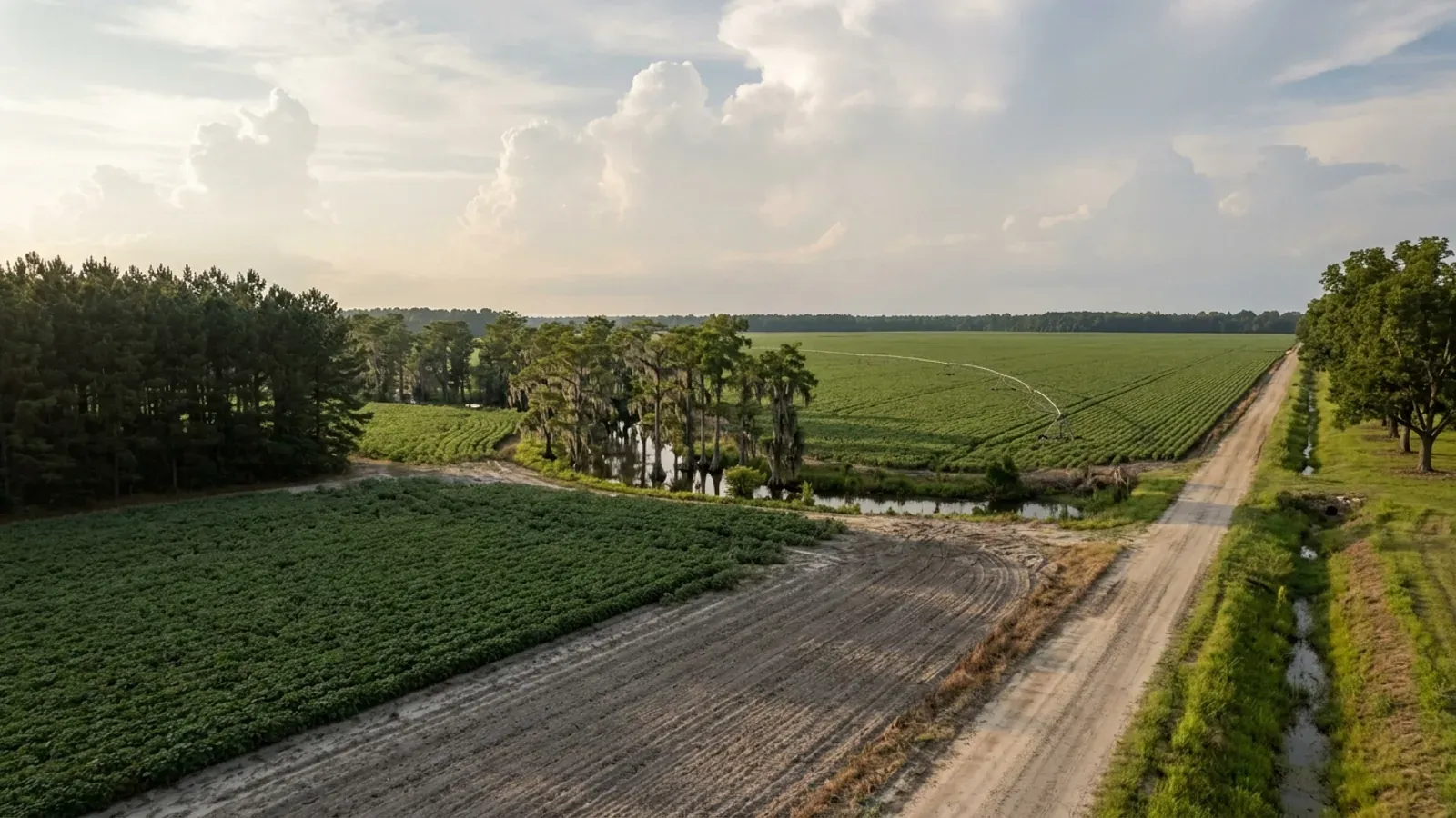
A very large flat South Carolina row-crop field with centre-pivot irrigation tracks, a sharp-edged pine plantation block, a cypress swamp along the creek and a straight dirt road.
Dillon County One statewide code, county design maps

Barndominium Builders in Dillon County, SC

Dillon County is the most commercially farmed ground in the Pee Dee and one of the few counties in South Carolina where land is moving into agriculture rather than out of it. The 2022 Census of Agriculture counts 200 farms on 111,091 acres at an average of 555 acres, and between 2017 and 2022 the number of farms rose 10 percent, land in farms rose 22 percent and the average holding rose 11 percent. Total agricultural sales were $226,004,000, fifth of the forty-six counties in the state, on a market value per farm of $1,130,022 that doubled in five years. Nearly four fifths of the farmland is cropland, only 15,860 acres are woods, and 6,447 acres are irrigated. That shapes what a tract here looks like: open, flat, farmed, usually on a state or county road, and often part of a working operation rather than a hunting tract. Three things about building here are specific to this county and worth reading before you draw. The county is zoned, countywide, but the zoning ordinance is a separate uncodified volume the county does not publish online, so the district on your parcel is a question you have to ask rather than a document you can read. The Building Codes Council's Dillon sheet carries a single 130 mph wind contour and, unusually, no seismic line at all. And Dillon's floodplain ordinance requires a lowest floor two feet above the base flood elevation and permits no basements, working from a flood insurance study dated 24 May 2011 — a much older map than several of its neighbours use.

Dillon County at a glance

County
Dillon County
Population
27,458

Building conditions in Dillon County

The building code is the same in every South Carolina county: S.C. Code § 6-9-10(A) requires each municipality and county to enforce the Building Codes Council's codes and to enforce only those, and SC Regulation 8-236(C) bars a local jurisdiction from writing one of its own. The design numbers are not local either, but they are not one number for the state — Regulations 8-1202 and 8-1203 send wind and seismic to the Council's own map for this county, and those maps are drawn as contours, so the figure is read at your address rather than off a county name. What is genuinely local is who issues the permit and inspects the work, what that office charges, the permit procedure it adopted by ordinance, whether your parcel is zoned at all, and the rest of Table R301.2 — frost depth, termite probability and flood — which the jurisdiction fills in for itself.

Build conditions for Dillon County , South Carolina : design wind speed The Building Codes Council's Dillon County sheet carries exactly one wind contour — a single line boxed and labelled 130 MPH at each of its two ends, the only wind speed printed anywhere on the sheet. The same sheet carries no seismic content at all: no seismic boundary and no Seismic Design category letter appears in its text layer or among the annotations drawn over its scanned base map. BUILD CONDITIONS DILLON COUNTY, SCDillon CountyONE STATEWIDE CODEDESIGN WIND SPEEDThe Building Codes…Regulations 8-1202 and 8-1203 replace IRC R301.2.1 and R301.2.2.1 with the Council's ownpreviously published county maps, and Dillon is one of the 35 counties mapped. The sheet's boxed…ZONING · RU RURAL IS THE DISTRICT THAT BLANKE…Dillon County has countywide zoning of the unincorporated area, butthe ordinance itself is not published online. County Code § 44-2…WHO ISSUES THE PERMITDillon County Building Code Enforcem…401 W. Main St., Suite 201, PO Box 256, Dillon SC 29536;843-841-3874, fax 843-841-3875, dilloncode17@dilloncountysc.org.…
Build conditions for Dillon County, drawn from the sourced facts on this page. Every figure above is cited in the quick-facts panel below, with its source and vintage.
One 130 mph contour, and a Council sheet with no seismic line on it at all
South Carolina takes wind speed and seismic design category away from the locality: Regulation 8-1202 replaces IRC Section R301.2.1 and Regulation 8-1203 replaces R301.2.2.1 with "the previously published maps by the South Carolina Building Codes Council", and Dillon is one of the thirty-five counties for which such a sheet exists. What the sheet carries is worth knowing precisely, because it is not what the neighbouring sheets carry. There is exactly one wind contour on it. A single blue line, boxed and labelled 130 MPH at each of its two ends, is the only wind speed printed anywhere on the sheet. And there is no seismic content at all — no seismic boundary, no Seismic Design B and no Seismic Design C — neither in the sheet's machine-readable text layer nor among the annotations drawn over the scanned base map, which is where the wind contour itself and, on the Darlington and Chesterfield sheets, the seismic letters live. The sheet's own note box reads: "NOTE! Wind speed, shown in miles per hour, applies at all points along the length of its corresponding (blue) line. Interpolation between wind speed lines is determined by the AHJ as permitted by Figure R301.2(4)(A) of the 2015 International Residential Code." With one line and nothing to interpolate between, the wind figure at a given parcel is a determination for the county building official rather than something to read off a table, and the Council's 2021 modification IRC 2021-04 lets the official delineate the wind design category so long as it does not surpass the values on the Applied Technology Council website, with a floor at the lowest wind speed in the code's prescriptive provisions. On seismic the Council's maps page is the thing to read: it says the ATC website "is not meant to supersede the maps approved by the Council, but is intended to provide further clarification as needed to determine the boundary on an approved map, or to determine the wind and seismic zones if a map has not been approved for that particular county." One practical wrinkle to raise at plan review: the Council's own 2024 staff comment records that the ATC hazard site "ceased operation on December 31, 2024", with users directed to the ASCE hazard tool instead, while the adopted code text still points at the site that closed. Get the wind figure and the seismic category into the plan-review correspondence in writing before a frame is priced.

SC Building Codes Council, "Wind/Seismic Maps", https://llr.sc.gov/bcc/maps.aspx ; the Dillon County sheet itself at https://llr.sc.gov/bcc/PDFfiles/WSMaps/Dillon%2015%28Mays%29.pdf (application/pdf, 3,854,669 bytes, downloaded 8 September 2026; the text layer was extracted in both reading-order and layout modes and both renders agree, and every compressed object stream in the file was then inflated and every annotation dictionary parsed for subtype, rectangle, colour and contents — the two 130 MPH labels and the blue polyline chain between them are the only wind content and there is no red-coloured annotation of any kind on the sheet); Regulations 8-1202 and 8-1203 and modification IRC 2021-04 from SC Building Codes Council, 2021 Code Modifications, https://llr.sc.gov/bcc/PDFfiles/2021-Code-Modifications.pdf ; the ATC closure note from SC Building Codes Council, 2024 Combined Continued Modifications, https://llr.sc.gov/bcc/Forms/2024%20Combined%20Continued%20Modifications%20with%20Index.pdf

The county is zoned everywhere — but the zoning ordinance is not published anywhere
Dillon County has countywide zoning and an unusual publication problem, and knowing that before you make an offer saves a week. Section 44-2 of the county code says the whole of it: "This section incorporates by reference the provisions of the zoning ordinance of February 28, 2007, which is published in a separate volume, and all amendments thereto." That separate volume is not on the county's website, and the county's codified ordinances on Municode carry no zoning text — so unlike Darlington next door, where there is no zoning ordinance to read, here there is one and you cannot read it. Section 10-87 sets the planning commission's area of jurisdiction as "the entire unincorporated area contained within the boundaries of the county", and the county's own Building Code Enforcement, Planning and Zoning page describes the department as enforcing the County Zoning Ordinance adopted by County Council and holding hearings for rezoning, special exceptions, variances and text amendments. What you can see for yourself is the map. The county's public GIS carries a County Zoning layer that renders a continuous coverage with no unzoned gaps and no unzoned legend category: RU Rural blankets the rural county, with GC, HC, ID-1, ID-2, RS-1, RS-2 and RS-3 inside it and the municipal limits shown separately. An identify on a rural interior parcel returns the county together with County Zoning: RU Rural. Two more things worth holding. The county's online code is codified only through Ordinance No. 15-07, adopted 22 April 2015, so a change made since then will not appear there. And Chapter 50, Subdivisions, is printed in the code as reserved — there is no codified county subdivision article to read either. The practical consequence for a barndominium is simple and it is not a reason to walk away: call the Building Code Enforcement, Planning and Zoning office at 401 W. Main Street with a tax map number before you buy, ask for the district and for the district's setbacks, height limit and any rule sizing an accessory building against the dwelling, and get the answer in writing.

Dillon County Code of Ordinances § 44-2 (Adoption of zoning provisions), https://library.municode.com/sc/dillon_county/codes/code_of_ordinances?nodeId=COOR_CH44PLDE_ARTIINGE_S44-2ADZOPR and the reserved subdivision chapter at Chapter 50, https://library.municode.com/sc/dillon_county/codes/code_of_ordinances?nodeId=COOR_CH50SU (the code's own banner records it as "CODE OF ORDINANCES DILLON COUNTY SOUTH CAROLINA — Codified through Ordinance No. 15-07, adopted April 22, 2015", and the publisher's client record for this code gives the address as PO Box 449, Dillon SC 29536, which is the county's); the department's own description of what it enforces at Dillon County Building Code Enforcement, Planning and Zoning, https://www.dilloncountysc.org/departments/services/building_code_enforcement_planning_zoning.php ; the zoning layer at the county's public GIS, https://dillonsc.wthgis.com/ (all read 8 September 2026)

42.9 percent farmland, a 555-acre average, and acreage moving INTO agriculture
Dillon County farms 111,091 acres across 200 operations at an average of 555 acres — 42.9 percent of the county's 259,249 land acres, the fourth-highest farmland share in South Carolina after Lee, Darlington and Calhoun. The direction of travel is what separates it from almost every county around it. Between 2017 and 2022 the number of farms rose 10 percent, land in farms rose 22 percent and the average size rose 11 percent. Farmland is not leaving agriculture here; there is more of it than there was, in bigger blocks. The money moved the same way, and hard: total agricultural sales of $226,004,000 rank fifth among the forty-six counties, up 100 percent in five years, on a market value per farm of $1,130,022 that is up 82 percent, with net cash farm income up 142 percent. Grains, oilseeds, dry beans and dry peas alone sold $45,546,000, third in the state; poultry and eggs $124,979,000, eighth; cotton and cottonseed $6,816,000, twelfth of the thirty counties producing it; and the county ranks sixth of the twelve counties that still grow tobacco. Inside the farmland base the land use splits into 87,357 acres of cropland, 15,860 of woodland, 3,972 of pastureland and 3,902 of other uses, and those four figures sum exactly to the 111,091-acre total — so 79 percent of the farmland is cropland and only 14 percent is woods. This is not a timber county and it is not a hobby-farm county: 80 of the 200 operations sell $100,000 or more, 36 of them exceed 1,000 acres, 6,447 acres are irrigated, and 70 percent of farms use no-till or reduced till. What that means for a buyer is that the tracts coming loose here are open and farmable rather than timbered, which is far easier ground to build on, but that they are also worth real money to the operator farming them. Population, meanwhile, is drifting down — 27,458 estimated for 2025 against 28,292 at the 2020 census, a fall of 2.9 percent — which is the combination that keeps land priced for farming rather than for houses.

USDA National Agricultural Statistics Service, 2022 Census of Agriculture County Profile — Dillon County, South Carolina, https://www.nass.usda.gov/Publications/AgCensus/2022/Online_Resources/County_Profiles/South_Carolina/cp45033.pdf (application/pdf, 879,073 bytes, downloaded 8 September 2026 and read in both reading-order and layout extraction modes; the three percentage-change figures are quoted from the reading-order render, where label, value and percent print on a single line, and the layout render was confirmed to shift that column by one row on this file as it does on the other South Carolina profiles; the four land-use figures were checked to sum exactly to the total); county land area and the statewide farmland-share ranking from research/statewide/geography-and-population.md, built on the same census joined to the 2025 Census Gazetteer county file, https://www2.census.gov/geo/docs/maps-data/data/gazetteer/2025_Gazetteer/2025_gaz_counties_45.txt ; population from U.S. Census Bureau Vintage 2025 county population estimates, https://www2.census.gov/programs-surveys/popest/datasets/2020-2025/counties/totals/co-est2025-alldata.csv

Two feet of freeboard, no basements, and a flood study dated 2011
Dillon County's floodplain rules are specific, they are stricter than the federal minimum, and they run off an older map than several neighbouring counties use — all three of which matter on Pee Dee bottomland. Section 16-22 provides that the flood article applies to all areas of special flood hazard within the county's jurisdiction "as identified by the Federal Emergency Management Agency (FEMA) in its Flood Insurance Study, dated May 24, 2011, with accompanying maps and other supporting data", adopted by reference. Section 16-23 is one sentence and it is absolute: "A development permit shall be required in conformance with the provisions of this article prior to the commencement of any development activities." Section 16-24 adds that no structure or land "shall hereafter be located, extended, converted, or structurally altered without full compliance". Then Section 16-79(1), the specific standard for residential construction in Zones A, AE, AH, AO, A1-30, V and VE where base flood elevation data exists, sets the number: "New construction or substantial improvement of any residential structure (including manufactured homes) shall have the lowest floor elevated no lower than two feet above the base flood elevation. No basements are permitted." Where solid perimeter foundation walls are used to elevate the structure, flood openings sufficient to automatically equalise hydrostatic forces must be provided. For a barndominium that arithmetic lands on the slab. A wide, single-storey building whose whole appeal is that you drive into it at grade does not tolerate two feet of fill gracefully — the ramp into the shop bay has to come from somewhere, and on a big footprint the fill volume and the compaction testing are a real line in the budget rather than an afterthought. So the flood question in Dillon County is not "am I in the zone" but "how much of this pad is in the zone", and it is a question for the survey rather than for the listing. Note also that the county's flood ordinance is Ordinance No. 11-04, adopted 11 May 2011, and that a fourteen-year-old study is old enough that a parcel a neighbour built on may not sit where it did — check the current effective map rather than a memory.

Dillon County Code of Ordinances, Chapter 16, Article II (Flood Damage Prevention), §§ 16-22, 16-23 and 16-24 and the specific standards at § 16-79(1) (Ord. No. 11-04, 5-11-2011), https://library.municode.com/sc/dillon_county/codes/code_of_ordinances?nodeId=COOR_CH16DRFLCOLADIAC (read 8 September 2026; the chapter text was retrieved from the publisher's own content service for this code and the quoted sentences are taken from that text)

Carolina bays, a sand rim, and the layer under them that decides your septic
Dillon County has the geology that makes a barndominium pad either easy or expensive, and unlike most of the state it has a public example you can walk. Little Pee Dee State Park, 835 acres in rural Dillon County around 54-acre Lake Norton, contains "1 Carolina Bay and the sand rim where the ancient coastline once existed". Carolina bays are the feature to understand here because they are common across this part of the Coastal Plain and they are almost invisible from the road. The SC Department of Natural Resources describes them as shallow elliptical depressions in the unconsolidated Coastal Plain sediments, elongated north-west to south-east with their long axes perpendicular to the old shoreline, often carrying sand rims along their south-eastern and north-eastern edges built by wind and wave action, the rims made of fine to medium sand with water-laid muddy sand and sandy mud. Around 5,000 of them have been mapped geologically in South Carolina. The part that reaches your budget is what sits at the bottom: sand cemented with humate forms an impermeable layer at the base of a bay, which is what allows water to rest above the regional water table. That is a perched water table under a surface that looks like dry sand, and it is exactly the condition that fails an onsite wastewater design and softens a slab subgrade after a storm on a site that was walked in August. The wider county is Inner Coastal Plain with a Sandhills influence — a Soil Data Access query of the SSURGO database returns 13,470 acres of Fuquay and between 11,092 and 15,650 acres of Lakeland in the Dillon survey area, the first plinthic and the second deep sand, and neither is a soil to guess at. There is no rock anywhere in the county: Coastal Plain sediments here are hundreds of feet thick, so depth to bedrock is not the question. The controlling feature is the restrictive horizon or the seasonal high water table, typically within the top one to two metres. Onsite wastewater is permitted by the South Carolina Department of Environmental Services under Regulation 61-56, not by the county, and § 200.5 disqualifies a site outright where a restrictive horizon sits within twelve inches of the deepest point of effluent application. Section 200.6 keeps no part of the system within five feet of a building or property line, 75 feet of a private well, 100 feet of a public well or 25 feet of a drainage ditch, and § 200.7(1) requires a usable repair area of at least half the size of the original system. On a wide barndominium footprint that repair-area arithmetic, and not any county rule, is usually what fixes where the pad goes. Get a Professional Soil Classifier onto the tract before you close, not after.

SC Department of Natural Resources, Geological Survey, "Carolina Bays", https://www.dnr.sc.gov/geology/carolina-bays.html ; South Carolina State Parks, Little Pee Dee, https://southcarolinaparks.com/little-pee-dee ; S.C. Regulation 61-56, Onsite Wastewater Systems, §§ 200.5, 200.6 and 200.7(1), https://des.sc.gov/sites/des/files/Library/Regulations/R.61-56.pdf ; SC Department of Environmental Services, Professional Soil Classifiers, https://des.sc.gov/permits-regulations/septic-tanks/professional-soil-classifiers ; the Fuquay and Lakeland acreages and the Coastal Plain failure modes from research/statewide/soils-and-geology.md, built on USDA-NRCS Soil Data Access component-acreage queries by survey area, with series descriptions at https://soilseries.sc.egov.usda.gov/OSD_Docs/F/FUQUAY.html and https://soilseries.sc.egov.usda.gov/OSD_Docs/L/LAKELAND.html

Where you permit, who the building official is, and why the fee schedule is a phone call
Building permits for unincorporated Dillon County come from the county's Building Code Enforcement, Planning and Zoning Department at 401 W. Main Street, Suite 201, Dillon, telephone 843-841-3874, and it is a small office: Amy Hilburn is both the Building Official and Inspector and the staff secretary and permit clerk, and the managing director's post is listed as vacant. The department issues building permits and carries out follow-up inspections for construction and remodelling, including electrical, plumbing and mechanical work, and it is also the zoning office, so the same counter answers both the district question and the permit question. E911 addressing is a separate number, 843-774-1458. The codes it enforces are the State's rather than the county's — S.C. Code § 6-9-10(A) requires every county to enforce the Building Codes Council's codes and to "enforce only" them, and Regulation 8-236(C) prohibits a local jurisdiction from writing or publishing any other building code — so there is no local edition to check and no local amendment to hunt for. On fees, the county code is unusually candid: § 12-1 provides that "the building permit and inspection fees as set forth in the schedule of building permit and inspection fees, which is on file and available in the county offices, shall be applied by the county building inspector." That schedule is not published on the county's website, so unlike Darlington, which codifies its fee ladder, and Chesterfield, which posts a per-square-foot valuation sheet, the Dillon number is something you ask for. Two published county figures do exist and both concern manufactured homes rather than site-built construction: § 34-19 sets a $100.00 fee for a doublewide and $75.00 for a singlewide at the time a retirement-of-title inspection request is issued, with a $50.00 de-titling fee for each additional inspection required if the home does not pass, all non-refundable. Section 34-20 requires all wheels, axles and towing hitches to be removed and not stored on the property. Note finally that Chapter 12's own state law reference note points the reader at S.C. Code § 6-9-65(B) — the provision on farm structures — which is the right place to look and, as the answer below explains, not a door a barndominium can go through.

Dillon County Building Code Enforcement, Planning and Zoning, https://www.dilloncountysc.org/departments/services/building_code_enforcement_planning_zoning.php (read 8 September 2026); the fee provision at Dillon County Code § 12-1 and the chapter's state law reference note, https://library.municode.com/sc/dillon_county/codes/code_of_ordinances?nodeId=COOR_CH12BUBURE ; manufactured home fees and installation standards at §§ 34-19 and 34-20 (Ord. No. 06-02, 3-22-2006), https://library.municode.com/sc/dillon_county/codes/code_of_ordinances?nodeId=COOR_CH34MAHO ; S.C. Code §§ 6-9-10 and 6-9-65, https://www.scstatehouse.gov/code/t06c009.php

Also worth knowing before you build in Dillon County

A barndominium is never a farm structure, and in this county the temptation is real
In a county where four fifths of the farmland is cropland and the average operation runs 555 acres, the idea of permitting a big metal building as a farm building and finishing the living end later comes up constantly. S.C. Code § 6-9-65 closes it, and the county's own building chapter points you straight at the section. Subsection (B) prevents a local government enforcing a nationally recognised building code against a farm structure, which is what makes the idea attractive. Subsection (A) defines a farm structure as one built on a farm "other than a residence or a structure attached to it". A barndominium is a residence, so it sits outside the exemption from the first day, and the shop half of a shouse sits outside it too because it is attached to a residence. There is no square-footage test and no percentage-of-use test to argue with. Subsection (C) makes the exemption conditional on an affidavit filed with the local building official before construction begins, and the definition expressly excludes a structure that originally qualified "but later converted to another use", which is exactly what a later finish-out would be. The licensing side says the same thing from the other direction. Under Chapter 11 the "Wood Frame Structures" subclassification at § 40-11-410(4)(l) reaches framing, roofing, siding or flooring for wood-framed structures over five thousand square feet used for housing livestock, storage or processing "when such structures are not used for habitation or office facilities" — so the moment a post-frame building is a dwelling it leaves that subclassification entirely. Pre-engineered Metal Buildings is likewise a shell subclassification, reaching a building "consisting of no more than a concrete floor slab, metal frame, metal roof, metal sidewalls, foundations, and building insulation". A finished dwelling is more than that list. The destination is the same by either route: permit the building as a dwelling from the start, with the shop bay in the drawings, and have the design criteria agreed in writing before the frame is ordered.

S.C. Code § 6-9-65, https://www.scstatehouse.gov/code/t06c009.php ; the county's own state law reference to § 6-9-65(B) in Dillon County Code Chapter 12, https://library.municode.com/sc/dillon_county/codes/code_of_ordinances?nodeId=COOR_CH12BUBURE ; the contractor subclassification definitions at S.C. Code § 40-11-410(4)(l) and § 40-11-410, https://www.scstatehouse.gov/code/t40c011.php ; the residential builder definition and threshold at § 40-59-20(6), https://www.scstatehouse.gov/code/t40c059.php

Forty-eight miles of state-designated scenic river, and what that does and does not mean
The Little Pee Dee River through Dillon County is a State Scenic River, designated in 2005 under the Scenic Rivers Act, and the designated reach is long: 48 river miles through Dillon County, from the Marlboro County line above Parish Mill Bridge on State Road 363 down to the confluence with Buck Swamp at the Marion County line. For someone buying river-adjacent acreage that is a genuinely useful thing to know, and it is worth understanding correctly rather than nervously. The designation is a state programme administered by the SC Department of Natural Resources; it is not a zoning overlay, it does not create a county setback, and it is not the reason a river tract is hard to build on. What actually constrains a river tract in Dillon County is the same short list that constrains any of them: the mapped special flood hazard area and the county's own two-foot freeboard rule, the wetlands question, the septic evaluation, and access. The scenic designation matters to a buyer for a different reason — it is a reasonable proxy for the river's condition and its recreational traffic, and DNR's own guidance to river users is to respect private property and use only the public right-of-way adjacent to roads and bridges where allowed. The practical planning point for a barndominium is that a long, wide, single-storey building wants a big flat pad, and the flat ground near a Coastal Plain river is usually the ground that floods. The buildable pad on a river tract here is generally back on the terrace, not down on the bottom, and that decision is worth making with the surveyor before it is made with the excavator.

SC Department of Natural Resources, Scenic Rivers Program — Little Pee Dee River of Dillon County, https://www.dnr.sc.gov/water/river/scenic/lilpddillon.html (read 8 September 2026); the county freeboard and development-permit provisions at Dillon County Code §§ 16-22, 16-23 and 16-79(1), https://library.municode.com/sc/dillon_county/codes/code_of_ordinances?nodeId=COOR_CH16DRFLCOLADIAC

The tracts that come loose here, and the questions to ask about them
Dillon County's land market has a shape that follows straight from the agricultural census, and it is worth reading the numbers as a buyer rather than as a statistician. The size distribution of the county's 200 operations is 7 farms of 1 to 9 acres, 45 of 10 to 49, 44 of 50 to 179, 44 of 180 to 499, 24 of 500 to 999 and 36 of 1,000 acres or more. Eighteen percent of the farms in this county are section-scale operations, and 40 percent of all of them sell $100,000 or more a year. That is a professional farming county, and it has two consequences. The first is that a five- or ten-acre homesite here is usually a piece cut off the corner of something bigger rather than a lot in a recorded subdivision, which means the recorded plat, the access easement and the utility runs are the documents that decide whether it is buildable — and the county's codified subdivision chapter is printed as reserved, so those questions go to the planning side of the Building Code Enforcement, Planning and Zoning office rather than to a published article. The second is that irrigation matters: 6,447 acres, six percent of the county's farmland, are irrigated, and centre-pivot ground carries infrastructure and easements that a residential buyer will not expect. Ask specifically what crosses the tract. Beyond that the checklist is short and it is the same one every time here. Get the zoning district and its dimensional standards from the county in writing, because the ordinance is not published. Get the flood determination from the survey rather than the listing, because two feet of freeboard on a wide building is a fill problem. Get a soil evaluation before you close rather than after, because a Carolina bay or a plinthic horizon is invisible in a dry month. And confirm which side of a municipal line the parcel sits on: the City of Dillon, Latta, Lake View and Sellers are separate jurisdictions with their own arrangements, and the county's answer is a county answer.

USDA National Agricultural Statistics Service, 2022 Census of Agriculture County Profile — Dillon County, South Carolina, farms-by-size and irrigated-acres tables, https://www.nass.usda.gov/Publications/AgCensus/2022/Online_Resources/County_Profiles/South_Carolina/cp45033.pdf (read in both extraction modes 8 September 2026); the reserved subdivision chapter at Dillon County Code Chapter 50, https://library.municode.com/sc/dillon_county/codes/code_of_ordinances?nodeId=COOR_CH50SU ; the department that answers both the zoning and permit questions at https://www.dilloncountysc.org/departments/services/building_code_enforcement_planning_zoning.php ; the county zoning layer at https://dillonsc.wthgis.com/

An excavator grading a compacted building pad on a cleared lot, with orange clay in the cut face, survey stakes and a drainage swale.
Below the slab

The expensive surprises are in the ground, not the building

What moves a South Carolina budget is usually below grade, and more often than not it is the drainfield rather than the foundation. R.61-56 § 200.1 settles whether a parcel can take an onsite system from soil morphology — texture, structure, depth to a restrictive horizon and depth to the zone of saturation — and § 200.2 then rules out two conditions outright: soils exhibiting massive or platy structure, and soils with substantial amounts of expansible layer clay minerals or smectites. That second clause is the one that bites on the mafic Piedmont, where the shrink-swell series sit in quantity under York, Fairfield, Chester, Laurens, Union, Newberry, Greenwood, McCormick, Lancaster, Saluda, Abbeville and Edgefield. A foundation problem has a price and an answer; an unbuildable septic parcel has neither, which is why we look at it first. Bedroom count is the number to settle early, because § 61-56.501 drives design flow from bedrooms, design flow drives trench length, and trench length plus a repair area decides how much good soil the parcel has to have — shop square footage adds nothing to it. Above the Fall Line the evaluation is done in backhoe pits rather than borings alone, so the answer comes from a dug hole and not a form. The site work, the foundation and the drainfield therefore get resolved together rather than one at a time. We price the dirt before we price the building.

What a build looks like

Three stages every Dillon County project passes through, from a raw parcel to a finished home. Site work first, because that is where the budget is decided.

Aerial view of an undeveloped rural lot with cleared rough grass, planted pine along one boundary, and a red dirt access track cut through orange clay.
Stage one

The parcel

Zoning, setbacks, flood zone and utility access get checked before anything is drawn.

An excavator grading a compacted building pad on a cleared lot, with orange clay in the cut face, survey stakes and a drainage swale.
Stage two

Pad and permit

Clearing, grading and a compacted pad, while the submittal works through whichever office issues the permit where you are building.

A finished barndominium at dusk with warm interior lighting glowing through its large windows.
Stage three

Frame to finish

Shell erected and dried in, then systems, insulation and interior finish through to CO.

Those are the rules where you are building in Dillon County. Tell us what you want to build and we will draw it to them.

Nearby areas we build in

Others we cover nearby. One may be a county and another a municipality inside one — and a South Carolina municipality can sit in two counties at once — so the office that issues the permit, the fees it charges, whether the land is zoned at all, and which design map covers it can all differ from one card to the next.

Building in Dillon County: common questions

7 questions we get asked most often about building in Dillon County. If yours is not on the list, ask it directly.

What design wind speed and seismic category should my engineer use in Dillon County?
Start from the fact that South Carolina does not use the residential code's national maps for houses. Regulation 8-1202 replaces IRC R301.2.1 and Regulation 8-1203 replaces R301.2.2.1 with "the previously published maps by the South Carolina Building Codes Council", and Dillon is one of the thirty-five counties with such a sheet. Here is exactly what that sheet shows. There is one wind contour on it: a single line, boxed and labelled 130 MPH at each of its two ends, and that is the only wind speed printed anywhere on the sheet. And there is no seismic content on it at all — no boundary line, no Seismic Design B and no Seismic Design C — neither in the sheet's text layer nor among the annotations drawn over the scanned base map, which is where the wind contour itself lives and where the Darlington and Chesterfield sheets carry their seismic letters. That is unusual, and it is the answer rather than a gap in the research. The sheet's own note says a wind speed "applies at all points along the length of its corresponding (blue) line" and that interpolation between wind speed lines is determined by the authority having jurisdiction; with one line there is nothing to interpolate between, which is precisely why the figure for your parcel is a conversation with the county building official rather than a lookup. The Council's 2021 modification IRC 2021-04 also lets the official delineate the wind design category provided it does not surpass the Applied Technology Council website's values, and sets a floor at the lowest wind speed in the code's prescriptive provisions. On seismic, the Council's maps page says the ATC site is "intended to provide further clarification as needed to determine the boundary on an approved map, or to determine the wind and seismic zones if a map has not been approved for that particular county" — and the Council's own 2024 staff comment records that the ATC hazard site "ceased operation on December 31, 2024", with users directed to the ASCE hazard tool. Raise both at plan review, get the answers in writing, and have the engineer state the source and the value on the drawings before a frame is ordered.
Can the shop be bigger and taller than the house in Dillon County?
Honestly: nobody can tell you from a published document, and that is the single most important thing to know about building here. Dillon County has countywide zoning of its unincorporated area, but County Code § 44-2 incorporates by reference "the provisions of the zoning ordinance of February 28, 2007, which is published in a separate volume", and that volume is not on the county's website and is not in the county's codified ordinances. So unlike Darlington next door, where there is no zoning ordinance and therefore no district table capping an accessory building against the dwelling, here there is an ordinance and the accessory-building rule in it — if there is one — cannot be read online. What you can see is the map: the county's public GIS carries a County Zoning layer with continuous coverage and no unzoned category, RU Rural blanketing the rural county, so your tract has a district whatever it is. The right move is a five-minute phone call before you make an offer. Take the tax map number to the Building Code Enforcement, Planning and Zoning office at 401 W. Main Street, on 843-841-3874, and ask four things: what district is this parcel, what are the front, side and rear setbacks, what is the maximum building height, and is there any rule limiting the size or height of a detached accessory building against the dwelling. Ask for the answer in writing or by email. One planning note that sidesteps the argument entirely: if the shop and the living space share one continuous roof, there is no accessory building in the picture at all — the whole thing is simply the dwelling, and the only dimensional rules that touch it are the ones that apply to a house.
The flood map — how bad is it, and what does two feet of freeboard actually cost me?
Dillon County requires more than the federal minimum and it is a real design constraint on a wide building. Section 16-79(1) of the county code provides that new construction or substantial improvement of any residential structure, manufactured homes included, "shall have the lowest floor elevated no lower than two feet above the base flood elevation. No basements are permitted." Section 16-23 requires a development permit before the commencement of any development activities, and § 16-24 says no structure or land may be located, extended, converted or structurally altered without full compliance. The mapped areas are those identified in the FEMA Flood Insurance Study dated 24 May 2011, adopted by reference at § 16-22. Two things follow for a barndominium specifically. First, the whole appeal of the building type is that you drive into it at grade, and two feet of freeboard on a footprint sixty or eighty feet wide is a substantial volume of engineered fill plus the compaction testing that goes with it, plus a ramp into every shop bay. That is a line in the budget, not a detail. Second, and much more usefully: the fix is almost always to move the pad rather than to raise it. The flat, easy-looking ground on a Pee Dee tract is frequently the ground in the zone, and the buildable pad is back on the terrace. Get the flood determination from a survey against the current effective map rather than from the listing or from what a neighbour remembers — the county's study is fourteen years old, and a parcel that was out when the last house went up may read differently now. If any part of the tract is in the mapped area, the development permit comes first, before anything else happens on the site.
What is a Carolina bay, and why does everyone here tell me to get the soil tested first?
A Carolina bay is a shallow elliptical depression in the Coastal Plain sediments, elongated north-west to south-east, often with a sand rim along its south-eastern and north-eastern edges. The SC Department of Natural Resources has mapped around 5,000 of them in South Carolina, and Dillon County has a public example you can walk: Little Pee Dee State Park, 835 acres around 54-acre Lake Norton, contains "1 Carolina Bay and the sand rim where the ancient coastline once existed." The reason it matters to your budget is what sits underneath. DNR's own description is that sand cemented with humate forms the impermeable layer at the base of a bay, which is what allows water to rest above the water table. Translated: a perched water table under ground whose surface looks like dry sand. That is precisely the condition that fails an onsite wastewater design and softens a slab subgrade after a storm, on a site a buyer walked in August and judged sandy and well drained. Elsewhere in the county the equivalent trap is a plinthic horizon — a Soil Data Access query returns 13,470 acres of Fuquay in the Dillon survey area — or the seasonal high water table, typically within the top one to two metres and invisible from the surface. There is no rock to hit anywhere here; Coastal Plain sediments run hundreds of feet deep, so depth to bedrock is never the question. Onsite wastewater is permitted by the South Carolina Department of Environmental Services under Regulation 61-56, not by the county, and § 200.5 disqualifies a site outright where a restrictive horizon sits within twelve inches of the deepest point of effluent application. Get a Professional Soil Classifier onto the tract before you close. It is the cheapest de-risking available on a rural purchase here and it is the one people skip.
What will the county charge me for a permit?
The county does not publish the number, and that is worth saying plainly rather than dressing up. Dillon County Code § 12-1 provides that "the building permit and inspection fees as set forth in the schedule of building permit and inspection fees, which is on file and available in the county offices, shall be applied by the county building inspector." The schedule is not on the county's website and it is not in the codified ordinances, so the fee for a given construction valuation is something you ask the Building Code Enforcement, Planning and Zoning office for on 843-841-3874. Two county figures are published, and both are manufactured-home figures rather than site-built ones: § 34-19 sets $100.00 for a doublewide and $75.00 for a singlewide at the time a retirement-of-title inspection request is issued, with a $50.00 de-titling fee for each additional inspection required if the home does not pass, all non-refundable. Note also what is not a county charge at all. The septic permit is a separate state permit issued by the South Carolina Department of Environmental Services under Regulation 61-56 and is not part of the county fee. And South Carolina's mandatory statewide code means there is no local edition, no local amendment and no local product-approval scheme adding cost here: § 6-9-10(A) requires every county to enforce the Building Codes Council's codes and to enforce only those. When you call for the fee, ask in the same conversation what the plan-review requirement is and whether sealed drawings are needed at your building's size, because that is usually the larger number.
Can I build the shell as a farm building and finish the living space later?
No, and in Dillon County the temptation is stronger than most places because this is a genuinely commercial farming county — 200 operations, an average of 555 acres, and 79 percent of the farmland in cropland. S.C. Code § 6-9-65 settles it, and the county's own building chapter points you at the section in its state law reference note. Subsection (B) is the part that makes the idea attractive: a local government may not enforce a nationally recognised building code against a farm structure. Subsection (A) is the part that closes it: a farm structure is one built on a farm "other than a residence or a structure attached to it." A barndominium is a residence, so it falls outside the exemption from day one, and the shop half of a shouse falls outside it too because it is attached to a residence. There is no square-footage test and no percentage-of-use test to work with. Subsection (C) makes the exemption conditional on an affidavit filed with the building official before construction begins, and the definition expressly excludes a structure that originally qualified "but later converted to another use", which is exactly what a later finish-out is. The licensing side reaches the same place from the other direction: the Wood Frame Structures subclassification at § 40-11-410(4)(l) covers large wood-framed structures for livestock, storage or processing "when such structures are not used for habitation or office facilities", and Pre-engineered Metal Buildings covers a building "consisting of no more than a concrete floor slab, metal frame, metal roof, metal sidewalls, foundations, and building insulation". A finished dwelling is more than that. Permit it as a dwelling from the start, with the shop bay drawn in.
The farmland here is going up, not down. What am I actually buying?
You are buying into the fourth most agricultural county in South Carolina by share of land area, and one of very few where the acreage is growing. The 2022 Census of Agriculture counts 200 farms on 111,091 acres at an average of 555 acres — 42.9 percent of the county's 259,249 land acres. Between 2017 and 2022 the farm count rose 10 percent, land in farms rose 22 percent and average size rose 11 percent. Sales tell the same story louder: $226,004,000 in 2022, fifth of the forty-six counties, up 100 percent in five years, at $1,130,022 per farm. Grains and oilseeds alone sold $45,546,000, third in the state; poultry and eggs $124,979,000, eighth. Inside the farmland base, 87,357 acres are cropland against only 15,860 of woodland, 3,972 of pasture and 3,902 of other uses — four figures that sum exactly to the total. So this is open, farmed, irrigated-in-places, flat ground, not timber, and 6,447 acres of it are under irrigation. What that means practically is good and bad in equal measure. Good: an open tract is far cheaper to prepare than a timbered one, the road frontage is usually already there, and the soils are mapped in detail because somebody has been farming them for a century. Bad: this ground earns money as farmland, which puts a floor under the price, and a small homesite is generally a piece cut off a larger operation rather than a lot in a subdivision — so the recorded plat, the access easement, the utility runs and any irrigation infrastructure crossing the tract are the documents that decide whether it is buildable. Meanwhile the population is drifting down, 27,458 estimated for 2025 against 28,292 in 2020, which is why the land is still priced for farming. Ask what crosses the tract, get the zoning district in writing, get the flood determination surveyed, and get the soil evaluated before you close.

Building in Dillon County?

Start with the plan. Tell us what you want to build and we will draw it, then confirm which office issues the permit for your parcel, what it will let you put there, and what wind load it has to meet. That conversation costs nothing.