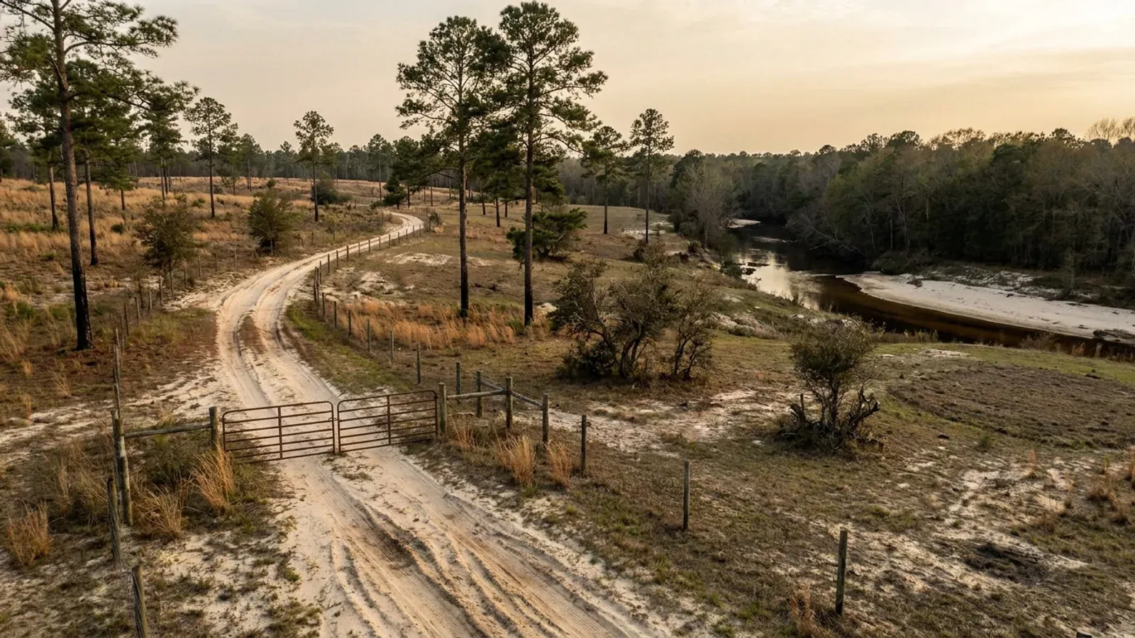
Open longleaf pine woodland on deep white sand, with wiregrass and turkey oak understorey, fire-blackened trunk bases and a sandy two-track road.
Darlington County One statewide code, county design maps

Barndominium Builders in Darlington County, SC

Darlington County is 45.3 percent farmland, the second-highest share in South Carolina after Lee, and its farms average 518 acres. That is a very unusual thing to find within twenty minutes of a real employment town, and Hartsville is one — Sonoco's headquarters, Coker University, and a downtown that has been invested in. The county also has no zoning ordinance. What it has instead is the Development Standards Ordinance, Ordinance No. 130 of 1985, and the difference matters enormously in practice. The DSO regulates development rather than use: it establishes only two kinds of district, airport and flood hazard, plus a jetport height and safety overlay and a stormwater overlay, and there is no zoning map, no permitted-use table, no rezoning procedure and no board of zoning appeals anywhere in the county code. So on an ordinary rural tract nobody assigns your land a district or caps your shop against your house. What you do owe the county is a site plan, a development permit or a summary approval, a building permit, and — if the tract is in the mapped floodplain, which the county's flood ordinance now works from a FEMA study dated 25 March 2025 — a development permit before anything else happens. Two things are genuinely specific to this county and worth reading before you draw. The Building Codes Council's Darlington sheet carries exactly one wind contour and a seismic boundary that runs east to west across the county's southern third, so where your parcel sits relative to those two lines changes the engineering. And the jetport safety zones near the Darlington County Jetport are the one place in the county where land use really is restricted.

Darlington County at a glance

County
Darlington County
Population
62,888

Building conditions in Darlington County

The building code is the same in every South Carolina county: S.C. Code § 6-9-10(A) requires each municipality and county to enforce the Building Codes Council's codes and to enforce only those, and SC Regulation 8-236(C) bars a local jurisdiction from writing one of its own. The design numbers are not local either, but they are not one number for the state — Regulations 8-1202 and 8-1203 send wind and seismic to the Council's own map for this county, and those maps are drawn as contours, so the figure is read at your address rather than off a county name. What is genuinely local is who issues the permit and inspects the work, what that office charges, the permit procedure it adopted by ordinance, whether your parcel is zoned at all, and the rest of Table R301.2 — frost depth, termite probability and flood — which the jurisdiction fills in for itself.

Build conditions for Darlington County , South Carolina : design wind speed The Building Codes Council's Darlington County sheet carries a single blue wind contour, boxed and labelled 120 MPH at both of its ends, entering at the northern county boundary just below Society Hill and running south-south-west past the Darlington County Jetport and through Lydia to the Lee County line on the road to Bishopville. It is the only wind speed printed anywhere on the map. Seismic is a separate red boundary running roughly east to west across the county's southern third, from the Florence County line near Pine Acres and Wilson Crossroads west to the Lee County line near Vaughns Crossroads, passing a short distance north of Lamar, with B lettered on the northern side at both ends and C on the southern side. BUILD CONDITIONS DARLINGTON COUNTY…Darlington CountyONE STATEWIDE CODEDESIGN WIND SPEEDThe Building Codes…Regs 8-1202 and 8-1203 replace IRC R301.2.1 and R301.2.2.1 with the Council's own previouslypublished county maps, and Darlington is one of the 35 counties mapped. The sheet is titled…ZONING · UNDEFINEDThere is no county zoning ordinance. Darlington County's land-usedocument is the Development Standards Ordinance — Appendix A to the…RESIDENTIAL BUILDING PERMIT$1,027 for the first $100,000 of val…That is the sixth band of the schedule codified at Chapter 8,Appendix A of the county code, which covers building, construction,…WHO ISSUES THE PERMITDarlington County Codes Enforcement…1 Public Square, Room 303, Darlington SC 29532; 843-398-4011, fax843-398-4072. Issues building, electrical, plumbing, gas and…
Build conditions for Darlington County, drawn from the sourced facts on this page. Every figure above is cited in the quick-facts panel below, with its source and vintage.
No zoning — the Development Standards Ordinance regulates development, not use
Darlington County has no zoning ordinance, and the shape of what it has instead is worth understanding because it is not the same as having nothing. The county's land-use document is the Development Standards Ordinance, printed as Appendix A to the county code and described in the code's own editor's note as "the Development Standards Ordinance of Darlington County, being Ordinance No. 130, as adopted by the county council on April 15, 1985, and effective the same date." Section 2 gives it jurisdiction over "all land development within the established special districts of the county" and makes it "effective in all unincorporated areas of the county." But read Article Three, the article headed how development districts are established: the only districts the ordinance creates are airport districts and flood hazard districts. There is no residential district, no agricultural district, no permitted-use table, no minimum lot size, no setback schedule, no building height limit, no rezoning procedure, no special exception and no board of zoning appeals — the appeal route for a plat or plan decision runs from staff to the Planning Commission and then to the circuit court under S.C. Code § 6-29-1150. The word districts in this ordinance means the two hazard overlays plus the jetport height and safety zones in Article Eleven and the MS4 stormwater protection overlay in Article Seventeen, and nothing more. The practical consequence for a barndominium is clean and unusual: no county document caps a detached accessory building against the size or the height of the dwelling, because no county document creates that kind of rule. Note the contrast inside the county line, though. The City of Hartsville does have a zoning ordinance and its own Planning and Zoning Administrator, and so do the county's other municipalities — the county's silence is a county silence.

Darlington County Code of Ordinances, Appendix A — Development Standards Ordinance, editor's note and Art. Two § 2 (Jurisdiction) and § 2.4 (Plat or plan submission appeal, Ord. No. 15-15, § 4, 6-1-15), https://library.municode.com/sc/darlington_county/codes/code_of_ordinances?nodeId=APXADESTOR ; the district structure at Art. Three §§ 3, 3.0.1 and 3.0.2, https://library.municode.com/sc/darlington_county/codes/code_of_ordinances?nodeId=APXADESTOR_ARTTHREEHODEDIARESGOIRDIFLHADI (the full appendix table of contents, all nineteen articles, was read 6 September 2026 and contains no use-district article); the county's own link to the ordinance from Darlington County Planning, https://www.darcosc.com/departments/planning/index.php ; the municipal contrast at City of Hartsville Code of Ordinances, Appendix A — Zoning, https://library.municode.com/sc/hartsville/codes/code_of_ordinances?nodeId=APXAZO and City of Hartsville Planning and Zoning, https://www.hartsvillesc.gov/residents/planning-and-zoning

One wind contour, and a seismic line that runs east to west across the county's southern third
South Carolina takes wind speed and seismic design category away from the locality — Regulation 8-1202 replaces IRC Section R301.2.1 and Regulation 8-1203 replaces R301.2.2.1 with "the previously published maps by the South Carolina Building Codes Council" — and Darlington is one of the thirty-five counties for which such a sheet exists. The sheet is titled DARLINGTON COUNTY 16 and is drawn on the SCDOT general highway map, with the map rotated so that north points to the left of the page. It carries a boxed blue note: "NOTE! Wind speed, shown in miles per hour, applies at all points along the length of its corresponding (blue) line. Interpolation between wind speed lines is determined by the AHJ as permitted by Figure R301.2(4) of the International Residential Code." And it carries exactly one wind contour. A single blue line, boxed and labelled 120 MPH at both of its ends, enters at the northern county boundary just below Society Hill, runs south-south-west past the Darlington County Jetport and on through Lydia, and leaves the county at the Lee County line on the road to Bishopville. Every blue pixel on the sheet was scanned: that one line and the note box are the only blue ink on it, so 120 MPH is the only wind speed printed anywhere on the map. The line divides the county — Hartsville and the western county lie inland of it, Darlington and Lamar seaward of it — and with only one line present there is nothing on this sheet to interpolate between, which is precisely why the value at your parcel is a question for the building official rather than something to read off a table. Seismic is drawn separately, in red, and it is a different geometry entirely: one boundary running roughly east to west across the county's southern third, from the Florence County line near Pine Acres and Wilson Crossroads west to the Lee County line near Vaughns Crossroads, passing a short distance north of Lamar. The letters are set on the sheet on both sides at both ends — B on the northern side, C on the southern. So Society Hill, Hartsville and the City of Darlington read B; the Lamar area and the county's southern edge read C. That distinction is not academic: at Seismic Design Category B or C the residential code's seismic provisions do not reach a detached one- or two-family dwelling at all under R301.2.2, so on a Darlington County house the engineering argument is a wind argument.

SC Building Codes Council, "Wind/Seismic Maps", https://llr.sc.gov/bcc/maps.aspx ; the Darlington County sheet itself at https://llr.sc.gov/bcc/PDFfiles/WSMaps/Darlington%20County.pdf (application/pdf, 14,576,290 bytes, downloaded 6 September 2026; the sheet has no wind value in its text layer, so its single embedded 10,800 x 14,516-pixel raster was extracted and read at native resolution, the whole image was scanned pixel by pixel for blue and red ink to confirm one wind contour and one seismic boundary, and the B and C letters — which are drawn as PDF annotations over the scan rather than in it — were located from the file's own annotation coordinates against the red line); Regs 8-1202 and 8-1203 quoted from SC Building Codes Council, 2021 Code Modifications, https://llr.sc.gov/bcc/PDFfiles/2021-Code-Modifications.pdf

45.3 percent farmland, a 518-acre average operation, and the state's number one cotton county
Darlington County operates 162,716 acres of farmland across 314 farms at an average of 518 acres — 45.3 percent of the county's 358,803 land acres, a share beaten only by Lee County's 51.1 percent, and an average holding beaten only by Dillon and a handful of others. The five-year movement is the part that separates this county from most of the Pee Dee. Between 2017 and 2022 the number of farms fell 2 percent while land in farms rose 13 percent and the average size rose 16 percent: consolidation, not abandonment. Land is not leaving agriculture in Darlington County; it is being gathered into larger operations, which is exactly the market condition in which good parcels come loose from bigger tracts. Inside the farmland base the land use splits into 107,607 acres of cropland, 44,292 of woodland, 6,604 of other uses and 4,213 of pastureland, and those four figures sum exactly to the 162,716-acre total — this is a cropland county, not a timber county, with only 27 percent of its farmland in woods. The size distribution still leaves plenty of workable ground: 31 farms of 1 to 9 acres, 77 of 10 to 49, 98 of 50 to 179 and 47 of 180 to 499, so 253 of the county's 314 operations are under 500 acres even though 51 of them exceed 1,000. And the county has a genuine claim to make about what it grows: at $30,686,000 of cotton and cottonseed sold in 2022 Darlington ranks first in South Carolina among the thirty counties producing it, with cotton on 36,678 acres, soybeans on 28,147, corn for grain on 20,672, wheat on 5,444 and peanuts on 5,163. Poultry is the other half of the economy at $66,610,000, thirteenth in the state. Total agricultural sales were $143,765,000, up 63 percent since 2017, with net cash farm income up 100 percent. Population, meanwhile, is flat rather than falling: 62,888 estimated for 2025 against 62,905 at the 2020 census, a change of minus 17 people.

USDA National Agricultural Statistics Service, 2022 Census of Agriculture County Profile — Darlington County, South Carolina, https://www.nass.usda.gov/Publications/AgCensus/2022/Online_Resources/County_Profiles/South_Carolina/cp45031.pdf (application/pdf, 879,065 bytes, downloaded 6 September 2026 and read in both reading-order and layout extraction modes; the three percentage-change figures are quoted from the reading-order render, where label, value and percent print on one line, and the four land-use figures were checked to sum exactly to the total); the statewide farmland-share comparison from research/statewide/geography-and-population.md, built on the same census joined to the 2025 Census Gazetteer county file, https://www2.census.gov/geo/docs/maps-data/data/gazetteer/2025_Gazetteer/2025_gaz_counties_45.txt ; population from U.S. Census Bureau Vintage 2025 county population estimates, https://www2.census.gov/programs-surveys/popest/datasets/2020-2025/counties/totals/co-est2025-alldata.csv

The permit fee schedule is codified, and it checks out arithmetically
Darlington County puts its building permit fees in the code rather than on a loose sheet, as Appendix A to Chapter 8, which makes them easy to verify — and they do verify: each band's opening figure is exactly the previous band's ceiling, so the table has not been transcribed wrong. A $20.00 administrative fee is added to every permit. Then, on total valuation, covering building, construction, mechanical, plumbing, gas, electrical and miscellaneous work: $80.00 up to $2,000; $104.00 from $2,001 to $5,000; $157.00 from $5,001 to $10,000; $157.00 for the first $10,000 plus $11.00 per additional thousand or fraction to $40,000; $487.00 for the first $40,000 plus $9.00 per thousand to $100,000; $1,027.00 for the first $100,000 plus $7.00 per thousand to $500,000; $3,827.00 for the first $500,000 plus $5.00 per thousand to $1,000,000; and on upward from there. Plan review is 50 percent of the total permit fee, which is the line people forget when they budget. Re-inspections escalate — $25.00 for the first, $50.00 for the second, $100.00 for the third and beyond. A moving fee is $100.00, a demolition inspection $100.00, a mobile home inspection $100.00 and an electrical reconnect $25.00. An application to the construction board of appeals is $300.00. The planning side is charged separately and is much smaller: under DSO § 6.3(G) a residential plan review of one lot is $25.00, a plat review of one or two lots $25.00, a floodplain review $250.00, and countywide stormwater on a land disturbance of one acre or more $125.00. No impact fee appears in either schedule. Septic is not in any of this — it is a separate state permit.

Darlington County Code of Ordinances, Chapter 8 (Buildings and Building Regulations), Appendix A — Permit Fees, https://library.municode.com/sc/darlington_county/codes/code_of_ordinances?nodeId=COOR_CH8BUBURE_APA (read 6 September 2026; the fee table was extracted cell by cell from the code's own table markup rather than from flowed text, and every band's opening figure reconciles with the previous band's arithmetic); the development fee table at Development Standards Ordinance § 6.3(G), https://library.municode.com/sc/darlington_county/codes/code_of_ordinances?nodeId=APXADESTOR_ARTSIXHODEPEARREAP ; the county's own link to both from Darlington County Codes Enforcement, https://www.darcosc.com/departments/codes_enforcement/index.php

A house on five acres gets summary approval — but everything still needs a site plan
Darlington County's permitting route for a rural dwelling is unusually well defined for an unzoned county, and knowing which of the three gates you pass through saves weeks. DSO § 6 requires a permit for all development unless expressly exempted, issued by the Director of Planning as the county's Development Official. Section 6.1 then creates a summary review, and its first line is the one that matters here: the Development Official may issue summary approval for "any single-family residential structure on a tract of five acres or more on a public road, unless the tract is located within a special district as delineated in article three" — the airport and flood hazard districts. Its second line covers "all farm and farm-related structures, unless regulated by Chapter 3 (Agriculture)." Its third covers development of up to five contiguous lots on an existing state or accepted county road shown on a surveyed plat, with a two-year cooling-off period before the same developer can add contiguous lots to a three-to-five-lot subdivision. Subdivisions and communication towers must go to the Planning Commission itself under § 6.2. What nobody escapes is § 2.5: "All residential, commercial, and industrial developments shall be represented by a site/plot plan," with the only exceptions being additions and accessory structures no more than 400 square feet. Three copies at 11 by 17 inches or larger go to the county planning department, hand-drawn is acceptable, and the required contents are specific — property boundaries with dimensions, adjacent owners and land uses, accurate road layout, north arrow and vicinity map, existing and proposed structures with dimensions, tax map number and scale, bodies of water, flood hazard areas, wetlands, adjacent ditches and easements, and proposed surface covers with the area of land disturbance. Land disturbance of one acre or more triggers an engineered stormwater pollution prevention plan. And the building permit counter has its own list: a deed plat approved by the Planning Department, a septic or sewer permit, an E911 address inquiry, two sets of drawings and the plan review fee. One requirement in that list catches large barndominiums specifically — the county requires drawings sealed and signed by a South Carolina licensed architect and engineer for assembly, educational, institutional and hazardous occupancies of any size "and any other construction 5000 square feet or 3 stories or more."

Darlington County Development Standards Ordinance §§ 2.5 (Ord. No. 15-15, § 4, 6-1-15; Ord. No. 17-06, § 2, 7-10-17), 6, 6.1 (Ord. No. 07-15, 10-15-07; Ord. No. 15-01, § I, 4-6-15) and 6.2, https://library.municode.com/sc/darlington_county/codes/code_of_ordinances?nodeId=APXADESTOR_ARTSIXHODEPEARREAP and https://library.municode.com/sc/darlington_county/codes/code_of_ordinances?nodeId=APXADESTOR_ARTTWOACGOOR ; Darlington County, "Darlington County Building Permits — Required Information", https://www.darcosc.com/Documents/Services/Documents%20%26%20forms/Codes%20Enforcement/Building_Permits_Required_Information.pdf (application/pdf, 16,622 bytes, downloaded 6 September 2026 and read in both layout and reading-order extraction modes)

Near the Jetport there really is a land-use rule, and it caps your building plot
There is exactly one part of Darlington County where a county ordinance tells you what you may build on your land, and it is worth locating on a map before you buy anything in the county's north — the safety and height zones around the Darlington County Jetport. Article Eleven of the Development Standards Ordinance is headed Jetport Safety and Height Zoning Regulations, and § 11.2 converts the FAR Part 77 airspace surfaces — approach, transitional, horizontal and conical — into zones shown on "Darlington County Jetport Zoning Maps consisting of two sheets, and dated January 1995," attached to Ordinance No. 97-8. Where an area falls in more than one zone, the more restrictive height limitation governs. The use limitations in § 11.5 are the part that bites. Safety Zone A "shall contain no buildings or temporary structures, and shall be restricted to those uses which will not create, attract, or bring together an assembly of persons thereon," with permitted uses that "may include agriculture and essential air-navigation equipment" — so a dwelling is out entirely. Safety Zone B is more subtle and is the one that changes a barndominium plan: each use must sit on a site of not less than ten acres; each site may have "no more than one building plot upon which any number of structures may be erected"; and that building plot must be a single, uniform, uncomplicated shape whose area does not exceed a published cap — 72,500 square feet for a site of 10 to under 20 acres, and 145,000 square feet for a site of 20 acres and up — with site population capped at 60 persons per acre in the first band and 120 in the second. Section 11.7 requires a permit before any material change in the use of land, any structure being erected, or even a tree being planted in any zone the article creates, and § 11.9 gives the article its own board of adjustment. The county's own summary approval route for a house on five acres expressly does not apply inside a special district, so a tract near the Jetport goes the long way round. If you are looking at land north of the City of Darlington, ask the planning department for the 1995 jetport zoning sheets before you make an offer.

Darlington County Development Standards Ordinance, Article Eleven — Jetport Safety and Height Zoning Regulations, §§ 11.2, 11.5, 11.7 and 11.9 (Ord. No. 97-8), https://library.municode.com/sc/darlington_county/codes/code_of_ordinances?nodeId=APXADESTOR_ARTELEVENJESAHEZORE (read 6 September 2026; the Safety Zone B site-area, building-plot and site-population figures were extracted from the ordinance's own table markup); the special-district carve-out from summary approval at § 6.1(A)(1), https://library.municode.com/sc/darlington_county/codes/code_of_ordinances?nodeId=APXADESTOR_ARTSIXHODEPEARREAP

Also worth knowing before you build in Darlington County

In the flood hazard district the development permit comes first, and the study is brand new
The flood hazard district is one of only two districts the Development Standards Ordinance creates, and Darlington County's floodplain rules were rebuilt on a very recent map. Section 3.4.1(D) provides that section 3.4 "shall apply to all areas of special flood hazard within the unincorporated areas of the county as identified by the Federal Emergency Management Agency in its flood insurance study, dated March 25, 2025, for the county with accompanying maps and other supporting data," adopted by reference. Section 3.4.1(E) is short and absolute: "A development permit shall be required in conformance with the provisions of section 3.4 prior to the commencement of any development activities." Section 3.4.1(F) adds that no structure or land "shall hereafter be located, extended, converted, or structurally altered without full compliance." The county charges $250.00 for a floodplain review on its development fee schedule, and § 6.2 puts floodplain development among the permits the Development Official may issue without going to the Planning Commission. Two practical points. First, a 25 March 2025 study means the maps may well have moved since the last time a neighbour built, so a parcel that was out may now be in and vice versa — check the current effective map, not a memory. Second, the DSO's summary approval for a single-family dwelling on five acres or more is expressly unavailable inside a special district, so a floodplain tract is reviewed rather than waved through. The county's ordinance also sets out how a base flood elevation is to be established where none is published, referring to FEMA's manual for managing floodplain development in approximate Zone A areas — which is the situation on a good deal of Pee Dee bottomland.

Darlington County Development Standards Ordinance § 3.4.1(D), (E) and (F) and § 3.4.4, https://library.municode.com/sc/darlington_county/codes/code_of_ordinances?nodeId=APXADESTOR_ARTTHREEHODEDIARESGOIRDIFLHADI (read 6 September 2026); the floodplain review fee at § 6.3(G) and the permit route at § 6.2, https://library.municode.com/sc/darlington_county/codes/code_of_ordinances?nodeId=APXADESTOR_ARTSIXHODEPEARREAP

Frontage, easements and flag lots — the county's real limits on how a rural lot is shaped
With no zoning there is no minimum lot size in Darlington County, but there are hard rules about access, and on a back tract they are the ones that decide whether a parcel can be built on at all. DSO § 5.8 requires that all development involving the division of land into lots or parcels "shall include, as a minimum, 20 feet of frontage on a publicly maintained road," with the access to that frontage permitted to take the form of an easement for up to six lots where the easement is shown on a recorded plat and labelled, in exactly these words, "Easement for Access and Utilities, only: Not A Public Road." Such easements may not exceed 200 feet in length unless the Planning Commission formally waives it, and sales beyond six lots may not take place along one. Section 2.3 repeats the six-lot cap and adds that all such roads "shall be privately maintained and is the sole responsibility of the affected property owners." Flag lots are the other constraint, and Darlington is stricter than most: they are "prohibited except in cases where no other feasible alternative exists," allowed only once from a single parcel, and then only with a minimum 25-foot access width and a minimum 50 feet of public road frontage, an entrance not exceeding 750 feet in total length serving a single lot, private ownership and maintenance of the access, one single-family residence per lot, a driveway connection approved by the state or the county, and no further subdivision. Section 2.3 also requires every plat to certify whether any part of the property is inside the FEMA flood zone, referencing the current flood insurance rate map and its effective date. And it is worth knowing what does not count as development at all under § 2.1.2: growing crops or trees, a transfer of title that does not divide land, the division of land into parcels of five acres or more where no new street is involved, and the division of land into lots for sale or transfer to members of one's own immediate family where no new street is involved. If your tract already exists and you are not dividing it, most of this never touches you — but read the recorded plat and the easement language before you buy, because in an unzoned county they carry the weight.

Darlington County Development Standards Ordinance §§ 2.1.2, 2.3 (Ord. No. 15-15, § 4, 6-1-15; Ord. No. 17-06, § I, 7-10-17; Ord. No. 17-09, § I, 10-2-17) and 5.8 (Ord. No. 92-15, § 8, 10-5-92; Ord. No. 96-12, § 17, 5-20-96; Ord. No. 17-09, § 2, 10-2-17), https://library.municode.com/sc/darlington_county/codes/code_of_ordinances?nodeId=APXADESTOR_ARTTWOACGOOR and https://library.municode.com/sc/darlington_county/codes/code_of_ordinances?nodeId=APXADESTOR_ARTFIVEDEDEST_S5.8LOPADERE

The one protection an unzoned county still gives a rural neighbour: Chapter 3
People buying land in a county with no zoning usually ask the same question in the same order — if there is no zoning, what stops a hog operation appearing next door? In Darlington County the answer is Chapter 3 of the county code, Agriculture, and it is unusually specific. Article II covers stockyards, slaughter houses, commercial and confined poultry houses, commercial meat production centres and commercial and confined swine operations, and its stated purpose is "to provide locations for the aforementioned uses that are remote enough to minimize disturbing effects to adjacent property owners." For confined swine operations § 3-53 sets a minimum separation of five miles between swine operations, including facilities in adjacent counties, and then a table of separations from other uses: half a mile from residential use, one mile from religious institutions, two miles from public or private schools and education facilities, one mile from public parks and recreational facilities, one mile from commercial and industrial uses, two miles from incorporated municipal limits within the county, two miles from county industrial parks and one mile from public water sources and surface water intakes. Animal waste lagoons must sit at least 1,500 feet from the property line, from any public or private water supply, stream or watercourse, and from the centreline of any public road. This is also the reason the Development Standards Ordinance's summary approval for farm and farm-related structures at § 6.1(A)(2) is expressly qualified "unless regulated by Chapter 3" — the county does not wave those buildings through. It is the closest thing Darlington County has to a use rule, and it works in a rural buyer's favour.

Darlington County Code of Ordinances, Chapter 3 — Agriculture, Art. II §§ 3-51, 3-52 and 3-53 (Ord. No. 02-2, 4-1-02), https://library.municode.com/sc/darlington_county/codes/code_of_ordinances?nodeId=COOR_CH3AG (read 6 September 2026; the separation table was extracted from the code's own table markup); the cross-reference at Development Standards Ordinance § 6.1(A)(2), https://library.municode.com/sc/darlington_county/codes/code_of_ordinances?nodeId=APXADESTOR_ARTSIXHODEPEARREAP

A barndominium is never a farm structure, whatever an unzoned county seems to allow
S.C. Code § 6-9-65(B) prevents a local government enforcing a nationally recognised building code against a farm structure, and in a county with no zoning and a summary-approval line covering "all farm and farm-related structures" the temptation to run a barndominium through that door is obvious. Subsection (A) closes it. A farm structure is one built on a farm "other than a residence or a structure attached to it." A barndominium is a residence, so it sits outside the exemption from the first day, and the shop half of a shouse sits outside it too because it is attached to a residence. There is no square-footage test and no percentage-of-use test to argue with; subsection (C) makes the exemption conditional on an affidavit filed with the local building official before construction begins; and the definition expressly excludes a structure that originally qualified "but later converted to another use" — which is exactly what a later finish-out would be. Several South Carolina counties publish that affidavit as a downloadable form; Williamsburg, Oconee, Colleton, Sumter and Spartanburg do. No agricultural or farm-structure affidavit appears among Darlington County's published Codes Enforcement or Planning forms, and the Development Standards Ordinance's own § 4.1, which the code's editor's note records as having "pertained to affidavits required for building permit," was repealed by Ordinance No. 02-15 in October 2002. So in Darlington County the practical answer is to ask Codes Enforcement directly what they require rather than to assume a form exists. What is not in doubt is the destination: permit the building as a dwelling from the start, with the shop bay in the drawings. Two county requirements reinforce that. Every permit needs a septic or sewer permit and an E911 address inquiry before it issues, and an owner acting as their own builder must file notice with the Clerk of Court in the courthouse.

S.C. Code § 6-9-65, https://www.scstatehouse.gov/code/t06c009.php ; the summary-approval line at Darlington County Development Standards Ordinance § 6.1(A)(2) and the repeal note at § 4.1 (Ord. No. 02-15, § 2, 10-7-02), https://library.municode.com/sc/darlington_county/codes/code_of_ordinances?nodeId=APXADESTOR_ARTFOURBUCOPE ; the permit prerequisites and the owner-builder notice at Darlington County, "Darlington County Building Permits — Required Information", https://www.darcosc.com/Documents/Services/Documents%20%26%20forms/Codes%20Enforcement/Building_Permits_Required_Information.pdf ; the published forms lists at Darlington County Codes Enforcement, https://www.darcosc.com/departments/codes_enforcement/index.php and Darlington County Planning forms, https://www.darcosc.com/departments/planning/forms.php (both read 6 September 2026)

Sandhills sand in the north, Coastal Plain wetness in the south — and the septic rule that follows
Darlington County straddles a soil boundary, and the two halves fail in opposite ways, which is why a septic evaluation here is worth more than a general impression of the county. The northern part sits in the Sandhills and Fall Line belt, where Lakeland and Fuquay sands dominate and the classic problem is either sand so coarse that effluent moves through it faster than it can be treated, or a fragipan or plinthite layer sitting within twelve inches of the trench bottom, which S.C. Regulation 61-56 § 200.5 disqualifies outright. The southern and eastern part sits in the Inner Coastal Plain, where the measured picture is Norfolk and Goldsboro: a Soil Data Access query of the SSURGO database returns 32,643 acres of Norfolk in the Darlington survey area, third-most of any county in the state, and 31,466 acres of Goldsboro, sixth. There is no rock to hit anywhere in the county — Coastal Plain sediments are hundreds of feet thick — so depth to bedrock is not the question. The controlling feature is the restrictive horizon: plinthite, a clay-increase Bt, or the seasonal high water table, typically within the top one to two metres and invisible from the surface in a dry month. Onsite wastewater is permitted by the South Carolina Department of Environmental Services under Regulation 61-56, not by the county, and below the Fall Line the site evaluation is done with hand borings. Section 200.6 keeps no part of the system within five feet of a building or a property line, 75 feet of a private well, 100 feet of a public well or 25 feet of a drainage ditch, and § 200.7(1) requires a usable repair area of at least half the size of the original system — on a wide barndominium footprint that arithmetic, and not any county rule, is usually what fixes where the pad goes. The county reinforces it at the counter: a septic or sewer permit is on the list of things required before any building permit issues.

S.C. Regulation 61-56, Onsite Wastewater Systems, §§ 200.5, 200.6 and 200.7(1), https://des.sc.gov/sites/des/files/Library/Regulations/R.61-56.pdf ; SC Department of Environmental Services, Professional Soil Classifiers, https://des.sc.gov/permits-regulations/septic-tanks/professional-soil-classifiers ; the Norfolk and Goldsboro acreages and the Sandhills failure modes from research/statewide/soils-and-geology.md, built on USDA-NRCS Soil Data Access component-acreage queries by survey area, with series descriptions at https://soilseries.sc.egov.usda.gov/OSD_Docs/N/NORFOLK.html and https://soilseries.sc.egov.usda.gov/OSD_Docs/G/GOLDSBORO.html ; the permit prerequisite at Darlington County, "Building Permits — Required Information", https://www.darcosc.com/Documents/Services/Documents%20%26%20forms/Codes%20Enforcement/Building_Permits_Required_Information.pdf

Where you permit, and which codes the county is actually enforcing
Building permits for unincorporated Darlington County come from the Darlington County Codes Enforcement Department at 1 Public Square, Room 303, Darlington, on 843-398-4011, and the department handles building permits, plan review and mobile home inspections. Planning — the deed plat approval, the site plan and the E911 address inquiry — is in the courthouse at Room 405, and the county also runs online permitting. Chapter 8 of the county code establishes the Building Inspection/Code Enforcement Department at § 8-71 and requires the building codes enforcement officer to hold at least ten years' experience as an architect, engineer, inspector, contractor or superintendent of construction, five of them in responsible charge, and to be registered with the South Carolina Building Codes Council. On which codes apply, do not be misled by the codified adoption sections: §§ 8-31 to 8-38 still name the 2000 editions of the International Building, Fire, Plumbing, Mechanical, Fuel Gas, Energy Conservation and Residential Codes and the 2002 National Electrical Code, but § 8-39 resolves it — "Codes will be automatically updated on a three year cycle with the latest editions … for enforcement as modified and mandated by the South Carolina building codes council in accordance with chapter 9 of title 6 of the South Carolina code of laws." That is the same answer S.C. Code § 6-9-10(A) compels of every county in the state. Section 8-40 applies the codes to all unincorporated areas of the county, excluding parcels owned by the State or the federal government. Appeals under any adopted code go to the county Construction Board of Adjustments and Appeals rather than to a code-specific board, at $300.00 an application. One more provision worth knowing if you are building just outside a town: § 8-1 lets the county enter agreements with municipalities under S.C. Code § 6-9-20 to issue permits and enforce the codes inside those municipalities — so ask which office is yours rather than assuming.

Darlington County Code of Ordinances, Chapter 8 §§ 8-1, 8-2, 8-31 to 8-41 and 8-71 to 8-72 (Ord. No. 99-1, 6-7-99; Ord. No. 01-4, 5-7-01; Ord. No. 04-13, 10-4-04), https://library.municode.com/sc/darlington_county/codes/code_of_ordinances?nodeId=COOR_CH8BUBURE (read 6 September 2026); the appeals fee at Chapter 8 Appendix A, https://library.municode.com/sc/darlington_county/codes/code_of_ordinances?nodeId=COOR_CH8BUBURE_APA ; department location and services at Darlington County Codes Enforcement, https://www.darcosc.com/departments/codes_enforcement/index.php and the permit checklist at https://www.darcosc.com/Documents/Services/Documents%20%26%20forms/Codes%20Enforcement/Building_Permits_Required_Information.pdf ; S.C. Code §§ 6-9-10 and 6-9-20, https://www.scstatehouse.gov/code/t06c009.php

An excavator grading a compacted building pad on a cleared lot, with orange clay in the cut face, survey stakes and a drainage swale.
Below the slab

The expensive surprises are in the ground, not the building

What moves a South Carolina budget is usually below grade, and more often than not it is the drainfield rather than the foundation. R.61-56 § 200.1 settles whether a parcel can take an onsite system from soil morphology — texture, structure, depth to a restrictive horizon and depth to the zone of saturation — and § 200.2 then rules out two conditions outright: soils exhibiting massive or platy structure, and soils with substantial amounts of expansible layer clay minerals or smectites. That second clause is the one that bites on the mafic Piedmont, where the shrink-swell series sit in quantity under York, Fairfield, Chester, Laurens, Union, Newberry, Greenwood, McCormick, Lancaster, Saluda, Abbeville and Edgefield. A foundation problem has a price and an answer; an unbuildable septic parcel has neither, which is why we look at it first. Bedroom count is the number to settle early, because § 61-56.501 drives design flow from bedrooms, design flow drives trench length, and trench length plus a repair area decides how much good soil the parcel has to have — shop square footage adds nothing to it. Above the Fall Line the evaluation is done in backhoe pits rather than borings alone, so the answer comes from a dug hole and not a form. The site work, the foundation and the drainfield therefore get resolved together rather than one at a time. We price the dirt before we price the building.

What a build looks like

Three stages every Darlington County project passes through, from a raw parcel to a finished home. Site work first, because that is where the budget is decided.

Aerial view of an undeveloped rural lot with cleared rough grass, planted pine along one boundary, and a red dirt access track cut through orange clay.
Stage one

The parcel

Zoning, setbacks, flood zone and utility access get checked before anything is drawn.

An excavator grading a compacted building pad on a cleared lot, with orange clay in the cut face, survey stakes and a drainage swale.
Stage two

Pad and permit

Clearing, grading and a compacted pad, while the submittal works through whichever office issues the permit where you are building.

A finished barndominium at dusk with warm interior lighting glowing through its large windows.
Stage three

Frame to finish

Shell erected and dried in, then systems, insulation and interior finish through to CO.

Those are the rules where you are building in Darlington County. Tell us what you want to build and we will draw it to them.

Nearby areas we build in

Others we cover nearby. One may be a county and another a municipality inside one — and a South Carolina municipality can sit in two counties at once — so the office that issues the permit, the fees it charges, whether the land is zoned at all, and which design map covers it can all differ from one card to the next.

Building in Darlington County: common questions

8 questions we get asked most often about building in Darlington County. If yours is not on the list, ask it directly.

Darlington County really has no zoning? Then what is the Development Standards Ordinance?
It is a development ordinance, not a zoning ordinance, and the difference is the whole point. The Development Standards Ordinance is Ordinance No. 130, adopted by county council on 15 April 1985 and printed as Appendix A to the county code. It is effective in all unincorporated areas of the county, and it has nineteen articles covering streets, drainage, plats, permits, communication towers, mobile homes, signs, stormwater, campers and renewable energy. What it does not have is districts in the sense you are thinking of. Article Three, the article that establishes districts, creates exactly two kinds: airport districts and flood hazard districts. Article Eleven adds height and safety zones around the Darlington County Jetport and Article Seventeen adds an MS4 stormwater overlay. There is no residential district, no agricultural district, no permitted-use table, no minimum lot size, no setback schedule, no height limit, no rezoning procedure and no board of zoning appeals anywhere in the county code. So nobody assigns your rural tract a district, and nobody caps your shop against your house. What the county does regulate is the act of developing: you need a site plan, a development permit or a summary approval, and a building permit, and if the tract is in a mapped flood area or near the jetport you go the long way round. One thing to hold in mind: this is a county silence, not a Pee Dee silence. The City of Hartsville has its own zoning ordinance and its own Planning and Zoning Administrator, and the City of Darlington and the Town of Lamar are separate jurisdictions too. Confirm which side of a municipal line your parcel is on before you rely on any of this.
So how far from the property line does my building have to sit?
No county-adopted document answers that in unincorporated Darlington County, and it is worth saying plainly rather than dressing up. There is no county setback ordinance, no minimum lot size and no building height limit outside the jetport zones. What will actually position your building is a short list. The septic system, because S.C. Regulation 61-56 § 200.6 keeps no part of it within five feet of a building or a property line, 75 feet of a private well or 25 feet of a drainage ditch, and § 200.7(1) requires a usable repair area equal to at least half the original system — on a wide barndominium footprint that arithmetic, not a setback line, is what decides where the pad goes. The flood map, if any part of the tract is inside the special flood hazard area identified in the FEMA study dated 25 March 2025. Your access, under § 5.8's 20-foot minimum frontage on a publicly maintained road and the six-lot cap on access-and-utility easements. The jetport safety and height zones, if you are anywhere near the Darlington County Jetport. And your deed — covenants, building lines shown on the recorded plat, and utility or access easements are enforceable against you whether or not the county has an ordinance. The county still makes you draw it: DSO § 2.5 requires a site or plot plan for all residential development, three copies at 11 by 17 inches or larger, showing property boundaries with dimensions, adjacent owners and land uses, road layout, existing and proposed structures with dimensions, water bodies, flood hazard areas, wetlands, ditches and easements. Only additions and accessory structures of 400 square feet or less are exempt.
Can the shop be bigger and taller than the house?
On an ordinary rural tract in unincorporated Darlington County, yes. In a zoned county this question is decided by a district table capping a detached accessory building at some fraction of the dwelling's floor area and at a fixed height. There is no such table here, because there is no zoning ordinance and the Development Standards Ordinance creates no use districts. Three caveats, and they are real ones. First, the jetport. Inside Safety Zone A around the Darlington County Jetport no buildings at all are permitted; inside Safety Zone B a use must sit on at least ten acres, there may be no more than one building plot on the site, and that plot's area is capped at 72,500 square feet on a site of 10 to under 20 acres or 145,000 square feet on 20 acres and up. If your land is north of the City of Darlington, get the 1995 jetport zoning sheets from the planning department before you buy. Second, size triggers a design requirement rather than a limit: the county requires drawings sealed and signed by a South Carolina licensed architect and engineer for any construction of 5,000 square feet or three storeys or more, so a big shop-plus-house under one roof will be an engineered set. Third, the design criteria are the live question rather than the dimensions — the Council's Darlington sheet carries a single 120 mph contour and no more, so the value that applies at your parcel is something to agree in writing with Codes Enforcement before a frame is priced. One planning note that avoids the whole argument: if the shop and the living space share one continuous roof there is no accessory building in the picture at all — the whole thing is simply the dwelling.
What design wind speed and seismic category should my engineer use in Darlington County?
Start from the fact that South Carolina does not use the residential code's national maps for houses. Regulation 8-1202 replaces IRC R301.2.1 and Regulation 8-1203 replaces R301.2.2.1 with "the previously published maps by the South Carolina Building Codes Council," and Darlington is one of the thirty-five counties with such a sheet. Here is what the sheet actually shows. Titled DARLINGTON COUNTY 16, drawn on the SCDOT highway map with north to the left of the page, it carries a single blue wind contour, boxed and labelled 120 MPH at both ends, entering at the northern county line just below Society Hill and running south-south-west past the Darlington County Jetport and through Lydia to the Lee County line on the road to Bishopville. That is the only wind speed printed anywhere on it — the whole image was scanned for blue ink to be sure. Hartsville and the western county lie inland of that line; Darlington and Lamar lie seaward of it. The sheet's own note says a wind speed "applies at all points along the length of its corresponding (blue) line" and that interpolation between wind speed lines is determined by the authority having jurisdiction — and with only one line on the sheet there is nothing to interpolate between, which is exactly why the number for your parcel is a conversation with the county building official rather than a lookup. The Council's 2021 modification also lets the official delineate the wind design category provided it does not surpass the Applied Technology Council website's values, and sets a floor at the lowest wind speed in the code's prescriptive provisions. Seismic is easier. The sheet carries one red boundary running roughly east to west across the county's southern third, from the Florence County line near Pine Acres and Wilson Crossroads west to the Lee County line near Vaughns Crossroads, passing a short way north of Lamar, with B lettered on the northern side and C on the southern. Society Hill, Hartsville and the City of Darlington read B; the Lamar area and the county's southern edge read C. At Seismic Design Category B or C the residential code's seismic provisions never reach a detached one- or two-family dwelling under R301.2.2 at all — so unlike Berkeley or Charleston, the engineering argument on a Darlington County house is entirely a wind argument. Get the wind figure into the plan-review correspondence in writing and have the engineer state the source and the value on the drawings before ordering a frame.
What will the county charge me?
Darlington codifies its building fees rather than posting a loose sheet, at Chapter 8 Appendix A, and the table is internally consistent — each band opens exactly where the previous one's arithmetic ends. A $20.00 administrative fee is added to every permit. On total valuation, covering building, construction, mechanical, plumbing, gas, electrical and miscellaneous work: $80.00 up to $2,000; $104.00 from $2,001 to $5,000; $157.00 from $5,001 to $10,000; $157.00 for the first $10,000 plus $11.00 per additional thousand to $40,000; $487.00 for the first $40,000 plus $9.00 per thousand to $100,000; $1,027.00 for the first $100,000 plus $7.00 per thousand to $500,000; and $3,827.00 for the first $500,000 plus $5.00 per thousand to a million. Plan review is 50 percent of the total permit fee, which is the line most budgets miss. Re-inspections escalate: $25.00 for the first, $50.00 for the second, $100.00 for the third and beyond — a real incentive to have the work ready when the inspector comes. A construction board of appeals application is $300.00. Separately, the planning side charges under DSO § 6.3(G): $25.00 for a residential plan review of one lot, $25.00 for a plat review of one or two lots, $250.00 for a floodplain review, and $125.00 countywide stormwater where land disturbance reaches one acre. No impact fee appears in either schedule. Septic is a separate state permit under Regulation 61-56 and is not part of any of this — but note that the county will not issue a building permit without the septic or sewer permit, the approved deed plat and the E911 address inquiry in hand.
Can I build the shell as a farm building and finish the living space later?
No, and the temptation is stronger in Darlington than in most counties because the Development Standards Ordinance's summary approval route expressly covers "all farm and farm-related structures." S.C. Code § 6-9-65(A) settles it anyway: a farm structure is one built on a farm "other than a residence or a structure attached to it." A barndominium is a residence, so it is outside the exemption from the first day, and the shop half of a shouse is outside it too because it is attached to a residence. There is no square-footage test and no percentage-of-use test to work with, subsection (C) makes the exemption conditional on an affidavit filed with the local building official before construction begins, and the definition expressly excludes a structure that originally qualified "but later converted to another use" — which is precisely what a later finish-out is. Note also that Darlington's own summary-approval line for farm structures is qualified "unless regulated by Chapter 3 (Agriculture)," the chapter that sets separation distances for poultry houses, stockyards and swine operations, so the county does not simply wave agricultural buildings through. Unlike Williamsburg, Oconee, Colleton, Sumter and Spartanburg, no farm-structure affidavit appears among Darlington County's published forms, and the DSO's own § 4.1 on affidavits required for a building permit was repealed in October 2002 — so ask Codes Enforcement directly what they require rather than assuming a form exists. The destination is the same either way: permit the building as a dwelling from the start, with the shop bay in the drawings. The county's own checklist reinforces it, since every permit needs a septic or sewer permit and an E911 address before it issues, and an owner acting as their own builder must file notice with the Clerk of Court.
There's no zoning — what stops a hog farm or a poultry house appearing next door?
Chapter 3 of the county code does, and it is more specific than most zoned counties manage. Article II covers stockyards, slaughter houses, commercial and confined poultry houses, commercial meat production centres and commercial and confined swine operations, with the stated purpose of providing locations "remote enough to minimize disturbing effects to adjacent property owners." For confined swine operations, § 3-53 requires a minimum of five miles between swine operations, counting facilities in adjacent counties, and then sets separations from other uses: half a mile from residential use, one mile from religious institutions, two miles from public or private schools and education facilities, one mile from public parks and recreational facilities, one mile from commercial and industrial uses, two miles from incorporated municipal limits within the county, two miles from county industrial parks and one mile from public water sources and surface water intakes. Animal waste lagoons must be at least 1,500 feet from the property line on which they sit, from any public or private water supply, stream or watercourse, and from the centreline of any public road. That is why the Development Standards Ordinance's summary approval for farm structures is qualified "unless regulated by Chapter 3" — those buildings get reviewed. It is not a complete answer to every neighbour question in an unzoned county, and nothing in the county code stops an ordinary agricultural or residential use next door. But on the specific use that worries rural land buyers most, Darlington County has written the setback down.
The land is cheap here and the farms are big. What am I actually buying?
You are buying into the second most agricultural county in South Carolina by share of land area, next door to a working job market. The 2022 Census of Agriculture counts 314 farms on 162,716 acres at an average of 518 acres — 45.3 percent of the county's land, behind only Lee County's 51.1 percent. Between 2017 and 2022 the farm count fell 2 percent while land in farms rose 13 percent and average size rose 16 percent, which is consolidation rather than decline: land is being gathered into bigger operations, and that is the market in which good pieces come loose from larger tracts. This is cropland country, not timber country — 107,607 acres of cropland against 44,292 of woodland, 6,604 of other uses and 4,213 of pasture, four figures that sum exactly to the total — and it is the state's number one cotton county, selling $30,686,000 of cotton and cottonseed in 2022 with 36,678 acres in the crop, alongside 28,147 acres of soybeans and 20,672 of corn. Poultry adds another $66,610,000. Total sales rose 63 percent in five years. Meanwhile the population is essentially unchanged — 62,888 estimated for 2025 against 62,905 in 2020 — so this is not a county emptying out. Hartsville is the reason: Sonoco's headquarters, Coker University and a downtown that has had money spent on it, with the City of Darlington and the raceway on the other side of the county and Florence twenty minutes east. Practically, that means a Darlington County tract is usually open, farmed, flat and served by a state or county road — much easier ground to build on than a timbered Lowcountry parcel — and the questions to ask are about the soil rather than the trees. Get the septic evaluation before you close, check the March 2025 flood mapping, and if you are looking north of the City of Darlington, ask the planning department about the jetport safety zones.

Building in Darlington County?

Start with the plan. Tell us what you want to build and we will draw it, then confirm which office issues the permit for your parcel, what it will let you put there, and what wind load it has to meet. That conversation costs nothing.