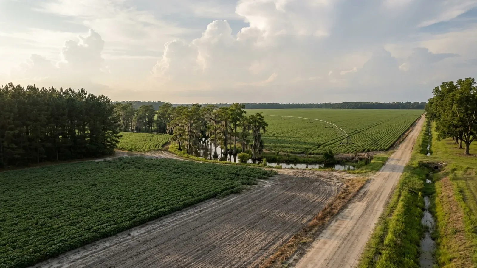
Barndominium Builders in Florence County, SC
Florence County is where I-95 crosses I-20, and that crossroads is the whole point of the place: it is the Pee Dee's job centre, its hospital centre and its freight centre, with 22.7 percent of the county still in farms. For a barndominium the county has an unusually favourable pairing of design conditions, and it took reading a map nobody had read to establish it. The Building Codes Council's Florence County sheet is an image-only scan with an empty text layer, which is why every published summary of South Carolina's wind and seismic maps has left the Florence row blank. Extracted and read at native resolution it turns out to carry exactly one wind contour, boxed and labelled 130 MPH at both ends, clipping the south-eastern corner of the county past Bostick and east of Lake City; and a printed note in an orange box putting the entire county in a single seismic category. What follows from that is a building that is not fighting the code the way a Lowcountry one is. The thing that actually decides a parcel here is not the frame. It is whether the parcel is zoned at all — Florence County zoned part of its unincorporated area and left the rest unzoned, so the first question on any tract is not which district it is in but whether it is in one.
Building conditions in Florence County
The building code is the same in every South Carolina county: S.C. Code § 6-9-10(A) requires each municipality and county to enforce the Building Codes Council's codes and to enforce only those, and SC Regulation 8-236(C) bars a local jurisdiction from writing one of its own. The design numbers are not local either, but they are not one number for the state — Regulations 8-1202 and 8-1203 send wind and seismic to the Council's own map for this county, and those maps are drawn as contours, so the figure is read at your address rather than off a county name. What is genuinely local is who issues the permit and inspects the work, what that office charges, the permit procedure it adopted by ordinance, whether your parcel is zoned at all, and the rest of Table R301.2 — frost depth, termite probability and flood — which the jurisdiction fills in for itself.
SC Building Codes Council, Wind/Seismic Maps, https://llr.sc.gov/bcc/maps.aspx (page read 6 Sep 2026), and the Florence County sheet at https://llr.sc.gov/bcc/PDFfiles/WSMaps/Florence%20County.pdf — 3,375,128-byte application/pdf, one page, a single 5,394 x 7,251-pixel DeviceRGB JPXDecode image with no text layer; the image was extracted and read at native resolution 6 Sep 2026. Regulations 8-1202 and 8-1203, 2021 Code Modifications, S.C. State Register Vol. 46 Issue 5, 27 May 2022, https://llr.sc.gov/bcc/PDFfiles/2021-Code-Modifications.pdf ; SCBCC 2021 Modification Index, modifications IRC 2021-04 and IRC 2021-05, https://llr.sc.gov/bcc/PDFfiles/2021-Modification-index.pdf
Florence County, SC Code of Ordinances, Ch. 30 Zoning Ordinance, Sec. 30-9 (Unzoned areas), via Municode Library: https://library.municode.com/sc/florence_county/codes/code_of_ordinances?nodeId=COOR_CH30ZOOR_ARTIESPURUINZODIZOANPR_S30-9UNAR
Florence County, SC Code of Ordinances, Ch. 30, Art. III, Sec. 30-111 (Development standards for unzoned areas): https://library.municode.com/sc/florence_county/codes/code_of_ordinances?nodeId=COOR_CH30ZOOR_ARTIIICOUSRE_S30-111DESTUNAR
Florence County, SC Code of Ordinances, Ch. 30, Art. VII, Sec. 30-246(2)b: https://library.municode.com/sc/florence_county/codes/code_of_ordinances?nodeId=COOR_CH30ZOOR_ARTVIIGEANRE_S30-246ACBUUS — read with Sec. 30-30 Table III: https://library.municode.com/sc/florence_county/codes/code_of_ordinances?nodeId=COOR_CH30ZOOR_ARTIIZODIRE
USDA NASS, 2022 Census of Agriculture, County Profile — Florence County, South Carolina, https://www.nass.usda.gov/Publications/AgCensus/2022/Online_Resources/County_Profiles/South_Carolina/cp45041.pdf (extracted in both pdftotext -layout and -raw mode; raw mode adopted after layout mode showed the known one-row column shift). Land area from U.S. Census Bureau, 2025 Gazetteer Files, county file, https://www2.census.gov/geo/docs/maps-data/data/gazetteer/2025_Gazetteer/2025_Gaz_counties_national.zip (GEOID 45041, ALAND_SQMI 800.454).
USDA-NRCS Soil Data Access, Tabular POST REST service, https://SDMDataAccess.sc.egov.usda.gov/Tabular/post.rest — SQL joins of legend/mapunit/component for areasymbol 'SC041' (returned areaname 'Florence County, South Carolina', 515,100 total mapped acres), aggregating muacres weighted by comppct_r across drainagecl, hydricrating, and major components. Underlying survey documented at USDA Web Soil Survey, https://websoilsurvey.nrcs.usda.gov/
Also worth knowing before you build in Florence County
- One line on the map, and two rules that decide what happens off it
- A map with a single contour raises an obvious question: what governs the large part of Florence County that the 130 MPH line does not touch? The modification that put the map into the code answers it, and the answer is worth reading closely because it is not interpolation. Modification IRC 2021-04 rewrites R301.2.1 to draw the ultimate design wind speed from "the previously published maps by the South Carolina Building Codes Council" in place of the IRC's own figure, and then adds two limbs. The first: "The local building official may delineate the wind design category within their jurisdiction, as long as, it does not surpass those provided on the Applied Technology Council (ATC) website." So the official may set a value for a parcel, with the ATC figures as the ceiling — and the Council's own maps page says the same thing from the other direction, that the ATC site "is not meant to supersede the maps approved by the Council, but is intended to provide further clarification as needed to determine the boundary on an approved map." The second limb is a floor: "Where ultimate design wind speeds in Figure R301.2(2) are less than the lowest wind speed indicated in the prescriptive provisions of this code, the lowest wind speed indicated in the prescriptive provisions of this code shall be used." A Florence parcel well inland of the line does not therefore fall to nothing; it falls to the lowest speed the code's own prescriptive tables are written for. Between that floor and the 130 MPH line is the whole range this county contains. The direction of travel is visible on the neighbouring sheets: Williamsburg County, one county toward the ocean, carries both a 130 MPH and a 140 MPH line, while Clarendon to the south-west and Dillon to the north-east each carry 130 and nothing higher.
- Seismic C: the code's earthquake chapter never reaches a detached house here — but it does reach a townhouse
- The Florence map's orange note places the entire county in seismic design category C, and that single letter decides more about how a barndominium is engineered here than any other figure on the sheet. SC Residential Code R301.2.2 applies the code's seismic provisions to detached one- and two-family dwellings only in categories D0, D1 and D2 — that is item 2 of the section. Item 1 catches townhouses one category earlier, at C. So the line falls precisely between the two building types in Florence County. A detached barndominium here never picks up the seismic chapter at all, which means R403.1.2's requirement that exterior walls sit on continuous solid or fully grouted masonry or concrete footings does not reach it, R403.1.3's footing and stem-wall reinforcement does not reach it, and — most usefully — the eight irregularity conditions of R301.2.2.6 that push a wide clear shop bay beside a two-storey living end out of the prescriptive provisions never switch on. Build the same plan in the Charleston, Berkeley and Dorchester D1 and D2 band and every one of those applies. Attach the units into townhouses in Florence County, though, and category C brings all of it back. One caution against over-reading this: nothing in the seismic answer makes a long clear span prescriptive on its own terms, and plan review will still want to see how the frame stands up. What category C removes is a code trigger, not the engineering.
- The Florence sheet has an expiry date: on 1 January 2027 the Council's maps stop being the instrument
- Everything on this page that comes off the Council's county map is dated, and the date is published. The 2021 South Carolina codes have applied statewide since 1 January 2023, and the 2024 editions take effect on 1 January 2027. In the 2024 modification index the two provisions that created the county-map regime are continued but rewritten: modification IRC 2024 04, the successor to IRC 2021-04, now reads that buildings shall be constructed using the ultimate design wind speed "as determined from Figure R301.2(2) American Society of Civil Engineers (ASCE) Hazard Tool", and IRC 2024 06 assigns the seismic design category "in accordance with the American Society of Civil Engineers (ASCE) Hazard Tool." In both, the building official's power to delineate within the jurisdiction survives, but the ceiling moves from the ATC website to the ASCE Hazard Tool. So the transcription on this page describes the instrument in force now, and a project permitted after the changeover will be worked from a source that returns a site-specific value from coordinates rather than a line on a scanned highway map. The Council's own maps page already points the official to the ATC site "to determine the wind and seismic zones if a map has not been approved for that particular county" — the 2024 cycle simply makes a tool the primary source for every county. One thing that does not move: S.C. Code § 6-9-130(A) inspects a building under the codes in effect on the date the original permit was issued, so a permit pulled before the changeover stays on the 2021 code and on this map.
- A barndominium is never a farm structure in South Carolina, and 22.7 percent farmland does not change that
- On a county where nearly a quarter of the land is in farms this is the question that comes up first, and South Carolina closes it in the definition rather than leaving room to argue. S.C. Code § 6-9-65(A) defines a farm structure as one constructed on a farm "other than a residence or a structure attached to it, for use on the farm including, but not limited to, barns, sheds, and poultry houses." A barndominium is a residence, so it is outside the exemption from the first day; the shop half of a shouse under one continuous roof is outside it too, because it is attached to a residence. There is no square-footage test and no percentage-of-use test to work with. Three further limbs close the gaps people try. The exemption is not automatic — § 6-9-65(C) requires the owner to file an affidavit with the local building official before construction stating the structure is being built as a farm structure. It evaporates on conversion, because the definition expressly excludes a structure "originally qualifying as a 'farm structure' but later converted to another use", which is exactly the plan of putting up a pole barn now and finishing it into living space later. And § 6-9-65(B) preserves FEMA National Flood Insurance Program standards regardless, so the exemption never reaches flood — which matters on the Great Pee Dee and Lynches floodplains. A detached shop on a genuine working farm can qualify. The house cannot, and neither can anything attached to it.
- "Unzoned district" is a named intent in the code — but it is not one of the districts Sec. 30-1 establishes
- Sec. 30-2 (Purpose of districts) describes an unzoned category in its own words: "Unzoned district: The intent of this district is to sustain and support the rural community environment. This district is commonly referred to as unzoned areas throughout the Florence County Zoning Ordinance. While identified as unzoned, developments standards do exist and apply to this district as outlined in the Florence County Land Development and Zoning Ordinances. This district supports a multitude of uses such as, but limited to, residential, commercial, industrial, agrarian, and horticultural in nature." (The phrase "but limited to" is the code's own wording.) The distinction matters: Sec. 30-1, which is the section that actually establishes districts, lists Residential (R-1 through R-5A, TH), Business (B-1 through B-6), Rural (RU-1, RU-1A, RU-2), Special Purpose (PD, FH, AC, CO) and Mixed-Use (MR, MMF, FO/LI, MU, CMU) — and does not include an unzoned district. The word "unzoned" appears nowhere in Article II (Zoning District Regulations). So "unzoned" is the absence of a mapped district, described in the purposes section for narrative reasons, not a district you can be rezoned into.
- Accessory buildings in RESIDENTIAL districts: a hard square-footage table, a 30-foot height cap, and a house-size rule that bites only under one acre
- Sec. 30-246(2)a governs residential districts. It sets: "The height of accessory buildings shall not exceed 30 feet"; the number of structures per Table II; and combined gross floor area per Table I. Table I (Maximum Floor Area) reads: 1 acre or less — 2,000 sf†; more than 1 to under 2 acres — 3,000 sf*; 2 to under 4 acres — 4,000 sf*; 4 or more acres — 6,000 sf*. The dagger note applies to the first row only: "No structure or combination of structures shall be larger than the square footage of the existing primary structure." The asterisk rows instead trigger "bufferyard E requirements (section 30-121)." Table II (Maximum Number of Structures): under 1 acre — 2; more than 1 to under 4 acres — 3; 4 or more acres — "4 or unlimited with bufferyard requirements." So in a residential district the shop-bigger-than-the-house prohibition is real, but only on lots of an acre or less; above an acre the cap is a flat square-footage number and the house's size stops mattering. Accessory structures may sit within three feet of a side or rear line, except when larger than 2,000 sf, which triggers bufferyard E.
- Accessory buildings on an UNZONED parcel: the code sets a setback and stops
- Sec. 30-9 expressly carries Sec. 30-246 into unzoned areas, so accessory-building rules do apply. But the only sentence in Sec. 30-246 aimed at unzoned land is in subsection (3) Location: "Unzoned areas of Florence County shall observe the setbacks for all other uses as established in section 30-111 of this chapter." That points to the 25' front / 5' rear / 5' side row. Subsection (3)h adds that accessory uses (not buildings) may sit in the front yard of "business and rural zoning districts and unzoned areas" under stated footprint thresholds. What the section does not do is extend either dimensional cap to unzoned land: Table I and Table II are scoped by their own text to "Residential districts," and the 30-percent lot-coverage rule is scoped to "All other zoned districts" — and an unzoned parcel is neither. The honest statement for a landowner is that Chapter 30 sets no square-footage cap, no count limit and no height cap on accessory buildings in an unzoned area, only the 25/5/5 setback; how the zoning administrator applies the tables at the counter is a question to put to the Planning Department directly before designing.
- The rural districts that allow a dwelling on acreage: RU-1, RU-1A and RU-2 dimensional standards
- Sec. 30-30 (Table III: Zoning setbacks) gives the numbers. RU-1 and RU-1A (rural community): minimum lot area 15,000 sf residential and 15,000 sf non-residential, lot width 100 ft, front yard 35 ft, side yard 10 ft, rear yard 30 ft, maximum height 38 ft, maximum impervious surface 40 percent, non-residential floor area ratio 0.25. RU-2 (rural resource): minimum lot area 87,120 sf residential — two acres — and 43,560 sf non-residential, lot width 200 ft, front yard 35 ft, side yard 15 ft residential / 50 ft non-residential, rear yard 30 ft residential / 60 ft non-residential, maximum height 38 ft, maximum impervious surface 20 percent, FAR 0.15. Table III notes that lot area is in square feet, front setbacks are measured from the front property line, and height is measured "from average elevation of finished grade of the front of the structure." Sec. 30-2 gives the intent: RU-1/RU-1A "to sustain and support rural community centers," and RU-2 "to conserve and protect from urban encroachment rural characteristics and resources, particularly agricultural." Sec. 30-29 Table II permits general farms, livestock, forestry and agricultural services in all three.
- How to find out whether a specific Florence County parcel is zoned
- There is no self-service answer published on the county website, and the county treats its zoning map as a product rather than a web layer: the Planning Department's fee page lists "Zoning Maps $15.00" and "City/County Maps $2.00" alongside "Consolidated Zoning Ordinances $10.00" and "Land Development Regulations $6.00." The practical route is the Planning Department at (843) 676-8600. The determination is also made formally on the county's Application for Certificate of Zoning Compliance, which carries a "[For Zoning Staff Use Only]" block with the fields "Tax Map Number" and "Zoning District" — staff fill in the district, or establish that the parcel is unzoned, from the tax map number. That application costs $25.00 and the form warns: "This application for a Certificate of Zoning Compliance must be accompanied by an application for a permit from the Building Inspection Department in order to receive a Certificate of Occupancy," and "If any work described on this form has not begun within one year from the date of issuance, this certificate shall expire." Bring a tax map number and a site plan showing every existing and proposed structure — the form asks for both counts.
- Published fees: a percentage-of-cost building permit, a half-price plan review, and codified electrical and mobile home schedules
- Florence County publishes fees in two places. The Planning fee page lists, verbatim: Zoning Maps $15.00; City/County Maps $2.00; Consolidated Zoning Ordinances $10.00; Land Development Regulations $6.00; Comprehensive Plan – Document Copy $20.00; Comprehensive Plan Map Amendment $100.00; Zoning/Rezoning App. Fee $100.00; Variance Request Fee $100.00; Subdivision Review Fee (County) Plus $25.00 per lot or acre $100.00; Engineering Reimbursement Plan Fee $45.00; Certificate of Zoning Compliance $25.00. For the building permit itself the county states only the method: "The building permit fee is based on total cost and is paid prior to the issuance of the building permit," and "The plan review fee is one-half the cost of the permit fee." The dollar brackets live in a scanned Permit Fees Schedule PDF linked from that page. Separately, Chapter 7 of the Code codifies fixed figures: electrical permit issuance $10.00, permanent service 0–400 amps $10.00, over 400 amps $20.00, subfeeders $5.00, each motor $5.00, each generator $15.00, reinspection $25.00; and for mobile home installation, mobile home permit $40.00 with plumbing, electrical and mechanical permits $20.00 each. Sec. 7-23: work started without a permit means "fees shall be doubled."
- Which municipalities the County permits, and which run their own
- Florence County's Planning and Building Inspection Department provides zoning and permitting for six of the county's towns as well as the unincorporated county. Every county zoning-compliance form carries the same jurisdictional line verbatim: "(Florence County, Johnsonville, Olanta, Pamplico, Quinby, Scranton, Timmonsville)." So a project in Johnsonville, Olanta, Pamplico, Quinby, Scranton or Timmonsville goes to the county office at 518 S. Irby Street, not to a town hall. Two jurisdictions are conspicuously absent from that list and run their own programs. The City of Florence administers its own Unified Development Ordinance and its own Building Department. Lake City operates a Building and Codes Enforcement office and a separate Zoning Board, reachable at (843) 374-5421. Coward does not appear on the county's list and its arrangement was not established from a published source — confirm before assuming. Note also Code Sec. 7-1(a): "Every municipality in the county, requiring permits for the construction, repair or improvement of buildings upon real estate situate within the municipality, shall furnish to the county tax assessor copies of all permits issued by the municipality."
- What the farmland actually is: 75,104 acres cropland, 34,124 acres woodland, and a land-use table that sums exactly
- Florence County's 116,428 farm acres break into 75,104 acres of cropland, 34,124 acres of woodland, 2,967 acres of pastureland and 4,233 acres of other land. This is the strongest self-check in the whole profile: those four figures sum to 116,428 exactly, matching the reported land-in-farms total to the acre. It is also the table where layout-mode extraction failed most visibly, printing 'Woodland' with a blank value and stranding 4,233 below 'Other' — raw mode resolves it, and the exact sum confirms the assignment. Practically, this is a cropped county, not a grazed one: 64.5% of farmland is cropland, 29.3% is woodland, and pasture is a rounding error at 2.5%. Only 1,808 acres are irrigated, 2% of land in farms, so this is dryland row-crop country. Tillage practice reinforces it — 33% of farms report intensive till, against 15% no-till, 13% reduced till and 8% cover cropping. For a buyer, the woodland share is the useful number: roughly 34,000 acres inside farm boundaries are timbered, and wooded farm edges and cut-over blocks are where rural building lots in this county tend to come from.
- Population and migration: Florence gains, but barely, and the gain is decelerating hard
- The Census Bureau's Vintage 2025 estimates put Florence County at 138,504 residents on 1 July 2025, against an April 2020 census base of 137,067 — a gain of 1,437 people, or 1.05%, across five years. That growth is entirely migration-driven, because natural change is negative: the county recorded 225 more deaths than births in the 2025 period alone. Domestic migration has been positive in every year since 2020, at +33, +726, +575, +522 and +178 for 2021 through 2025, a cumulative +2,034 — but the trend is clearly decaying, with the 2025 figure less than a quarter of the 2022 peak. Honest framing matters here. Florence is a genuine net domestic-migration gainer, which sets it apart from most of the Pee Dee, but it is not a boom county. Across the neighbour set, cumulative 2021–2025 domestic migration runs: Horry +75,073, Florence +2,034, Darlington +1,070, Marion −52, Williamsburg −294, Dillon −369 and Sumter −744. On total population, only Horry (+21.8%) and Florence (+1.05%) grew at all; Darlington was flat and Sumter, Dillon, Marion and Williamsburg all shrank. Florence is the region's stable anchor rather than its growth engine — the county people move to from the shrinking counties around it.
- Six in ten Florence County residents live outside any town limits
- The Vintage 2025 sub-county estimates split Florence County's 138,504 residents cleanly. The city of Florence holds 41,231 — up from 39,979 in 2020, a 3.1% gain that outpaces the county as a whole. Every other municipality is small and mostly static or shrinking: Lake City 5,940 (down from 6,033), Timmonsville 2,117, Johnsonville 1,348, Pamplico 1,062, Quinby 883, Coward 729, Scranton 653 and Olanta 550. The balance of Florence County — the unincorporated remainder, outside every municipal boundary — holds 83,991 people, or 60.6% of the county. That single figure frames the whole build. Roughly five people in eight in Florence County live on land where there is no town water main, no municipal sewer, and no town building department; the county's Planning and Building Department is the sole permitting authority, and water and wastewater are the owner's problem to solve. It also explains the direction of growth: the city gained 1,252 people since 2020 while the unincorporated balance gained only 282, so the county's modest net growth is concentrated inside the Florence city limits rather than dispersed across the rural townships.
- Septic in South Carolina is decided by soil morphology, not a percolation test — and you must set aside a 50% repair area
- Onsite wastewater systems in Florence County are permitted by the S.C. Department of Environmental Services under Regulation 61-56, not by the county. The single most important fact about that regulation is what it does not contain: a full-text search of R.61-56 returns zero occurrences of the word 'percolation'. South Carolina abandoned the perc test. Section 200.1 instead requires that 'Soil texture, depth of soil to restrictive horizons, and depth to the zone of saturation shall meet minimum standards approved by the Department', determined 'using accepted methodologies in the field of soil science' — that is, a soil scientist reads the profile for texture, structure and redoximorphic features. Section 200.2 disqualifies outright any soil with massive or platy structure or substantial expansible-clay or smectite content. Section 200.3 requires at least six inches of vertical separation between the deepest point of effluent application and the zone of saturation, and Section 200.5 requires more than twelve inches to rock or other restrictive horizon. Section 200.7(1) is the site-planning constraint: every new site must have 'a usable repair or replacement area equivalent to at least fifty (50) percent of the size of the original system', which under 200.7(2) must have suitable soil and be free of buildings, impervious surfaces, setbacks and easements. Evaluations may be done by SCDES staff or by a licensed Professional Soil Classifier under S.C. Code § 40-65-40(7), including one privately hired. The site evaluation fee is $150.
- Flood: 172 square miles of mapped hazard area and a brand-new FIRM effective March 2025
- Florence County's Planning Department states that the county 'has approximately 172 square miles located in a flood hazard area as mapped by the Federal Emergency Management Agency'. Against the Gazetteer land area of 800.454 square miles, that is 21.5% of the county — a consequence of the Great Pee Dee and Lynches river corridors and their swamps. The FIRM is current, not legacy: FEMA's Community Information System shows a current effective map date of 25 March 2025 for both Florence County (CID 450076) and the City of Florence (CID 450078), meaning anyone working from older panels is working from superseded maps. The county entered the NFIP regular program on 2 September 1982, its initial FHBM having been identified 28 April 1978. Both communities participate in the Community Rating System: the county entered CRS on 1 May 2010 and holds Class 9 (5% premium discount), while the city entered in 1991 and holds Class 6 (20%). Notably, Florence County does not appear to run a standalone flood damage prevention ordinance — the county's own page states that its floodplain provisions live inside the zoning ordinance and the building codes. All development in the regulatory floodplain requires an Elevation Certificate before, during and after construction, and the 50% substantial-improvement rule applies. A Certified Floodplain Manager is on staff at 518 South Irby Street.
- Florence is not a coastal-zone county — no OCRM critical area, no coastal zone consistency review
- South Carolina's Coastal Tidelands and Wetlands Act draws a hard statutory boundary, and Florence County sits outside it. S.C. Code § 48-39-10(B) defines the coastal zone as all coastal waters and submerged lands seaward to the state's jurisdictional limits, together with all lands and waters in the counties containing critical areas, and then names those counties exhaustively: Beaufort, Berkeley, Charleston, Colleton, Dorchester, Horry, Jasper and Georgetown. Eight counties, and Florence is not among them — notable because Horry and Georgetown, both on the list, are immediate Pee Dee neighbours. The practical consequences for a Florence County build are entirely favourable. There is no OCRM critical area to delineate, because 'critical area' under § 48-39-10(J) means coastal waters, tidelands, beaches and the beach/dune system, none of which occur here. There is no coastal zone consistency certification step layered onto state and federal permits, and no beachfront setback line, no Critical Area permit, and no dock master plan regime. A rural homesite in Florence County that touches water touches a river, creek or swamp governed by ordinary wetlands and stormwater rules — U.S. Army Corps of Engineers permitting under Section 404 of the Clean Water Act where wetlands are present, which R.61-56 § 200.6(3) expressly contemplates for septic siting — but never by the coastal division. That removes an entire permitting agency from the critical path compared with a build one county east in Horry or Georgetown.
- Geology: no SCDNR-mapped geologic hazard identified for Florence County
- This is an absence finding, and the absence is the useful part. SCDNR's geologic hazards program maps five things statewide — liquefaction areas, collapse potential, landslide potential, faults, and recent seismicity — and consolidates them on Geologic Map Series GGMS-5, the Generalized Geologic Hazard Map of the South Carolina Coastal Plain. Florence County is not named anywhere in SCDNR's geologic hazards overview page. The collapse-potential mapping, which is South Carolina's karst story, is explicitly located elsewhere: GGMS-5's explanatory text states that the larger collapse area is drawn from the USGS map of potentially karstic rocks in the southeastern United States, that it 'lies inland of the zone of liquefaction and consists almost entirely of the middle Coastal Plain', and that the discrete known-sinkhole polygons are two areas north of Myrtle Beach, a large area around Beaufort, an area east of Lake Moultrie along the Santee River, and recent activity in Georgetown. None of those named locations is in Florence County. South Carolina's karst is a limestone phenomenon of the middle and lower Coastal Plain and of the Santee and Beaufort limestone belts, not of the Pee Dee interior. For a Florence County build the practical reading is that foundation risk here is a drainage and shrink-swell question, governed by the soil profile, rather than a subsidence or bedrock question.
- Water and sewer: seven public systems, all municipal, and 84,000 people outside all of them
- Florence County has no county-wide water or sewer authority. The Florence County Economic Development Partnership states that the county 'is served by seven public water/wastewater entities, with the City of Florence being the primary provider' — the others being the City of Johnsonville, the City of Lake City, and the towns of Coward, Olanta, Pamplico and Scranton. Every one of those is a municipal system built around a town, and the largest of the towns after Florence has under 6,000 residents. Set that against the census split: 83,991 people, 60.6% of the county, live in the unincorporated balance outside all municipal boundaries. Public sewer in Florence County essentially reaches the City of Florence and its immediate fringe, the Lake City and Johnsonville areas, and the small town centres along the US 378 and SC 51 corridors; it does not reach the rural townships between them. For a rural homesite the working assumption should be a private well plus an onsite wastewater system permitted by SCDES under R.61-56, with the $150 site evaluation and the 50% repair area reserved on the plat. Wells are permitted by SCDES rather than the county, which runs a private well ePermitting programme. Rural electric service is cooperative — Santee Electric Cooperative and Pee Dee Electric (now MPD Corporation after its 2020 merger with Marlboro Electric) — with Duke Energy Progress and Dominion Energy natural gas in the served corridors.
SCBCC 2021 Modification Index, modification IRC 2021-04, R301.2.1 Wind design criteria, https://llr.sc.gov/bcc/PDFfiles/2021-Modification-index.pdf (PDF loaded and text extracted 6 Sep 2026); SC Building Codes Council Wind/Seismic Maps page, https://llr.sc.gov/bcc/maps.aspx ; neighbouring county sheets read for comparison the same day — Williamsburg https://llr.sc.gov/bcc/PDFfiles/WSMaps/Williamsburg%2015(Mays).pdf (130 MPH and 140 MPH in its text layer), Clarendon https://llr.sc.gov/bcc/PDFfiles/WSMaps/Clarendon%2015(Mays).pdf and Dillon https://llr.sc.gov/bcc/PDFfiles/WSMaps/Dillon%2015(Mays).pdf (130 MPH each)
2021 South Carolina Residential Code §§ R301.2.2 items 1 and 2, R301.2.2.6, R403.1.2 and R403.1.3, as recorded in research/statewide/design-criteria-and-climate.md §4a-§4c; seismic category from the SCBCC Florence County sheet's printed note, https://llr.sc.gov/bcc/PDFfiles/WSMaps/Florence%20County.pdf (raster extracted and read at native resolution 6 Sep 2026); modification IRC 2021-05, which also provides that "The local building official may delineate the seismic design category within the jurisdiction, as long as, it does not surpass those provided on the Applied Technology Council (ATC) website", https://llr.sc.gov/bcc/PDFfiles/2021-Modification-index.pdf
SCBCC 2024 Building Code Modification Index (11/3/2025 V.1), modifications IRC 2024 04 and IRC 2024 06, https://llr.sc.gov/bcc/PDFfiles/2024%20Final%20Modification%20Index%20with%20Hyperlinks.pdf (PDF loaded and text extracted 6 Sep 2026); SC Building Codes Council Building Code Adoption page, https://llr.sc.gov/bcc/BCAdoption.aspx ; S.C. Code § 6-9-130(A), https://www.scstatehouse.gov/code/t06c009.php
S.C. Code § 6-9-65, served text of Title 6 Chapter 9 read at https://www.scstatehouse.gov/code/t06c009.php 6 Sep 2026
Florence County, SC Code of Ordinances, Ch. 30, Sec. 30-1 (Establishment of districts) and Sec. 30-2 (Purpose of districts): https://library.municode.com/sc/florence_county/codes/code_of_ordinances?nodeId=COOR_CH30ZOOR_ARTIESPURUINZODIZOANPR_S30-1ESDI — and Article II (Zoning District Regulations): https://library.municode.com/sc/florence_county/codes/code_of_ordinances?nodeId=COOR_CH30ZOOR_ARTIIZODIRE
Florence County, SC Code of Ordinances, Ch. 30, Art. VII, Sec. 30-246 (Accessory buildings and uses), subsection (2)a and Tables I and II: https://library.municode.com/sc/florence_county/codes/code_of_ordinances?nodeId=COOR_CH30ZOOR_ARTVIIGEANRE_S30-246ACBUUS
Florence County, SC Code of Ordinances, Ch. 30, Sec. 30-246(3) and Sec. 30-9: https://library.municode.com/sc/florence_county/codes/code_of_ordinances?nodeId=COOR_CH30ZOOR_ARTVIIGEANRE_S30-246ACBUUS and https://library.municode.com/sc/florence_county/codes/code_of_ordinances?nodeId=COOR_CH30ZOOR_ARTIESPURUINZODIZOANPR_S30-9UNAR
Florence County, SC Code of Ordinances, Ch. 30, Art. II, Sec. 30-30 (Table III: Zoning setbacks), Sec. 30-29 (Table II) and Sec. 30-2: https://library.municode.com/sc/florence_county/codes/code_of_ordinances?nodeId=COOR_CH30ZOOR_ARTIIZODIRE
Florence County Planning fee schedule: https://www.florencecountysc.gov/planning/fees/ — and Florence County Application for Certificate of Zoning Compliance (PDF): https://s3.amazonaws.com/files.florenceco.org/public/Planning/Forms/Zoning_Compliance%20Form.pdf and https://s3.amazonaws.com/files.florenceco.org/public/Planning/ZoningComplianceAccessory%20Building.pdf
Florence County Planning fees page: https://www.florencecountysc.gov/planning/fees/ ; Florence County Inspections page: https://www.florencecountysc.gov/planning/inspections/ ; linked Permit Fees Schedule PDF: https://s3.us-east-1.amazonaws.com/files.florenceco.org/public/Planning/permit_fees_schedule.pdf ; Code of Ordinances Ch. 7, Secs. 7-21 through 7-24: https://library.municode.com/sc/florence_county/codes/code_of_ordinances?nodeId=COOR_CH7BURE
Florence County zoning compliance forms (PDF): https://s3.amazonaws.com/files.florenceco.org/public/Planning/Forms/Zoning_Compliance%20Form.pdf and https://s3.us-east-1.amazonaws.com/files.florenceco.org/public/Planning/special_use_certificate_of_zoning_compliance.pdf ; City of Florence Unified Development Ordinance: https://online.encodeplus.com/regs/florence-sc/doc-view.aspx?print=1 ; Lake City Building & Codes Enforcement: http://lakecitysc.gov/164/Building-Codes-Enforcement ; Florence County Code Sec. 7-1: https://library.municode.com/sc/florence_county/codes/code_of_ordinances?nodeId=COOR_CH7BURE
USDA NASS, 2022 Census of Agriculture, County Profile — Florence County, South Carolina, https://www.nass.usda.gov/Publications/AgCensus/2022/Online_Resources/County_Profiles/South_Carolina/cp45041.pdf ('Land in Farms by Use (acres)' and 'Land Use Practices' panels, raw-mode extraction; the four land-use values sum to the reported 116,428-acre total exactly).
U.S. Census Bureau, Vintage 2025 County Population Estimates, https://www2.census.gov/programs-surveys/popest/datasets/2020-2025/counties/totals/co-est2025-alldata.csv (rows STATE=45 with COUNTY=041 Florence, 051 Horry, 031 Darlington, 067 Marion, 089 Williamsburg, 085 Sumter, 033 Dillon; fields ESTIMATESBASE2020, POPESTIMATE2025, NATURALCHG2025, DOMESTICMIG2021–2025).
U.S. Census Bureau, Vintage 2025 Sub-County Population Estimates for South Carolina, https://www2.census.gov/programs-surveys/popest/datasets/2020-2025/cities/totals/sub-est2025_45.csv (SUMLEV 157 records under STATE=45, COUNTY=041, including 'Balance of Florence County' 83,991 and 'Florence city (pt.)' 41,231; county total from SUMLEV 050 record, 138,504).
S.C. Department of Environmental Services, Regulation 61-56, Onsite Wastewater Systems (Sections 102.1 site evaluations, 102.2 fees, 200.1–200.7 minimum site conditions, and the definition of 'Professional Soil Classifier'), obtained from the SCDES septic tanks page, https://des.sc.gov/permits-regulations/septic-tanks (page verified as live content, title 'Septic Tanks | South Carolina Department of Environmental Services'; links to Regulation 61-56 and to a 'Find a Soil Classifier' directory at https://des.sc.gov/permits-regulations/septic-tanks/professional-soil-classifiers ).
Florence County Planning Department, 'Flood Plains', https://www.florencecountysc.gov/planning/flood-plains/ (page verified as genuine content, not a soft 404: HTTP 200 with title 'Florence County SC - Flood Plains', zero 'not found' strings, and full substantive body text including the 172-square-mile figure, the Elevation Certificate requirement and the 50% substantial-improvement rule). FIRM dates, NFIP entry and CRS class from FEMA Community Information System, South Carolina community status report, https://www.fema.gov/cis/SC.html (rows 450076C FLORENCE COUNTY and 450078C FLORENCE, CITY OF; column order Init FHBM / Init FIRM / Curr Eff Map Date / Tribal / Reg-Emer / CRS Entry / Curr Eff / Curr Class / % Disc). Land area from https://www2.census.gov/geo/docs/maps-data/data/gazetteer/2025_Gazetteer/2025_Gaz_counties_national.zip
South Carolina Code of Laws, Title 48, Chapter 39 (Coastal Tidelands and Wetlands), § 48-39-10(B) and (J), https://www.scstatehouse.gov/code/t48c039.php (the eight named counties are Beaufort, Berkeley, Charleston, Colleton, Dorchester, Horry, Jasper and Georgetown; Florence is absent). Wetlands cross-reference from S.C. Regulation 61-56 § 200.6(3), https://des.sc.gov/permits-regulations/septic-tanks
S.C. Department of Natural Resources, Geological Survey, 'Geologic Hazards', https://www.dnr.sc.gov/geology/geologic-hazards.html (hazard categories mapped: liquefaction areas, collapse potential, landslide potential, faults, recent seismicity; Florence County not mentioned). SCDNR GGMS-5, Generalized Geologic Hazard Map of the South Carolina Coastal Plain, https://www.dnr.sc.gov/geology/pdfs/GGMS5.pdf (explanatory text on the derivation and location of collapse-potential areas). Note: GGMS-5 is a map sheet; its text layer carries the narrative and place labels but not polygon geometry, so this finding reports the narrative's stated locations rather than a polygon test.
Florence County Economic Development Partnership, 'Utilities', https://www.fcedp.com/doing-business/utilities (seven public water/wastewater entities named; electric and gas providers). Unincorporated population from U.S. Census Bureau Vintage 2025 sub-county estimates, https://www2.census.gov/programs-surveys/popest/datasets/2020-2025/cities/totals/sub-est2025_45.csv ('Balance of Florence County' 83,991 of 138,504). Well and septic permitting authority from S.C. Department of Environmental Services, https://des.sc.gov/permits-regulations/septic-tanks

The expensive surprises are in the ground, not the building
What moves a South Carolina budget is usually below grade, and more often than not it is the drainfield rather than the foundation. R.61-56 § 200.1 settles whether a parcel can take an onsite system from soil morphology — texture, structure, depth to a restrictive horizon and depth to the zone of saturation — and § 200.2 then rules out two conditions outright: soils exhibiting massive or platy structure, and soils with substantial amounts of expansible layer clay minerals or smectites. That second clause is the one that bites on the mafic Piedmont, where the shrink-swell series sit in quantity under York, Fairfield, Chester, Laurens, Union, Newberry, Greenwood, McCormick, Lancaster, Saluda, Abbeville and Edgefield. A foundation problem has a price and an answer; an unbuildable septic parcel has neither, which is why we look at it first. Bedroom count is the number to settle early, because § 61-56.501 drives design flow from bedrooms, design flow drives trench length, and trench length plus a repair area decides how much good soil the parcel has to have — shop square footage adds nothing to it. Above the Fall Line the evaluation is done in backhoe pits rather than borings alone, so the answer comes from a dug hole and not a form. The site work, the foundation and the drainfield therefore get resolved together rather than one at a time. We price the dirt before we price the building.
What we build in Florence County
All nine services are available in Florence County. What a build costs depends far more on the parcel than on square footage, so we price against your land rather than publishing a rate card.
Custom Plans
Barndominium plans drawn for your parcel and sealed at the point where South Carolina’s engineering exemption stops applying.
Barndominium Kits
Engineered shell packages for South Carolina land — open construction under the state’s own definition, and therefore not a modular building.
Turnkey Builds
Barndominium construction from raw land through to occupancy: one contract, one schedule, one party answering the building official.
What a build looks like
Three stages every Florence County project passes through, from a raw parcel to a finished home. Site work first, because that is where the budget is decided.

The parcel
Zoning, setbacks, flood zone and utility access get checked before anything is drawn.
Pad and permit
Clearing, grading and a compacted pad, while the submittal works through whichever office issues the permit where you are building.

Frame to finish
Shell erected and dried in, then systems, insulation and interior finish through to CO.
Those are the rules where you are building in Florence County. Tell us what you want to build and we will draw it to them.
Keep reading
The questions that usually come next once you know what Florence County allows.
Nearby areas we build in
Others we cover nearby. One may be a county and another a municipality inside one — and a South Carolina municipality can sit in two counties at once — so the office that issues the permit, the fees it charges, whether the land is zoned at all, and which design map covers it can all differ from one card to the next.
Building in Florence County: common questions
9 questions we get asked most often about building in Florence County. If yours is not on the list, ask it directly.
Is my Florence County land actually zoned? How do I find out?
My parcel is unzoned. What actually governs it, then?
Can the shop be bigger than the house in Florence County?
What design wind speed applies to my parcel in Florence County?
Does the Charleston earthquake code apply to me in Florence County?
Will my land take a septic system? What decides it?
How much of Florence County is in a flood zone, and what does that change?
Can I build it as a farm building and skip the residential code?
Who permits the work, and what does it cost?
Building in Florence County?
Start with the plan. Tell us what you want to build and we will draw it, then confirm which office issues the permit for your parcel, what it will let you put there, and what wind load it has to meet. That conversation costs nothing.