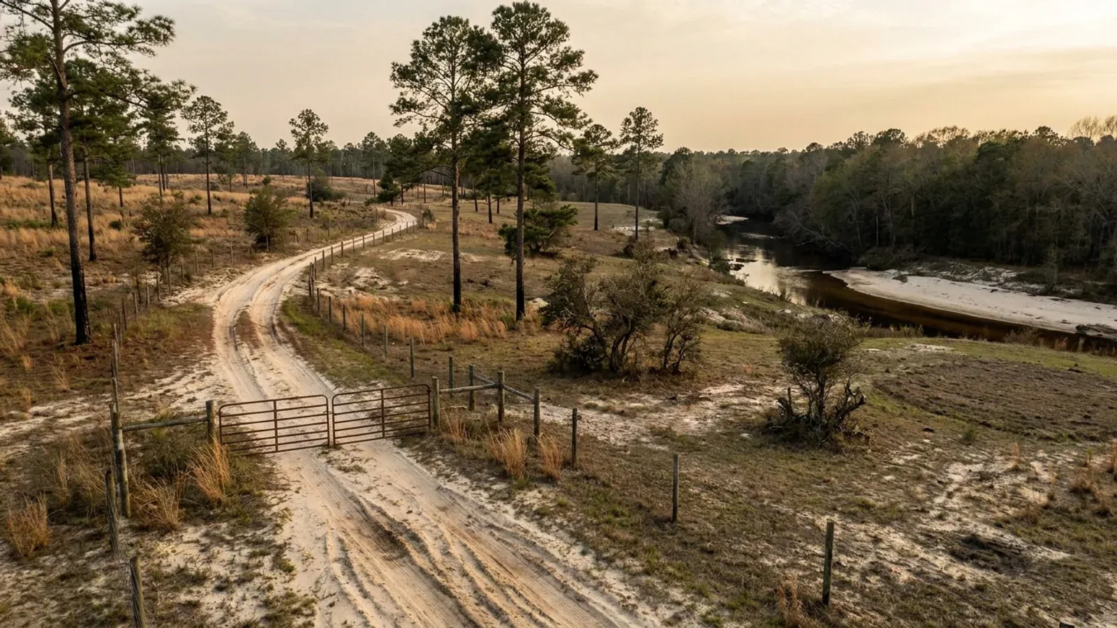
Open longleaf pine woodland on deep white sand, with wiregrass and turkey oak understorey, fire-blackened trunk bases and a sandy two-track road.
Marlboro County One statewide code, county design maps

Barndominium Builders in Marlboro County, SC

Marlboro County is row-crop country with an unusually readable rulebook. Its farms average 505 acres, the second-largest average operation in the Pee Dee, and two thirds of its farmland is cropland rather than woods — this is cotton and grain ground on the Sandhills-to-Inner-Coastal-Plain seam, and the county sold $9,300,000 of cotton and cottonseed in 2022, eighth of the thirty South Carolina counties that still grow it. Unlike Darlington to the south, which has no zoning at all, Marlboro is zoned countywide under Ordinance 545, adopted in 2002 as the Zoning Ordinance of Marlboro County, and unlike Dillon to the east, that ordinance is published in full on the county's own site. That matters more than it sounds, because it means the questions a barndominium buyer actually asks have written answers here. Five districts cover the unincorporated county — GD General Development, IND Industrial Development, RC Residential Conservation, RM Residential Multi-Use and RR Rural Resource — and the GD district works backwards from every other zoning ordinance you have read: within GD a building or premise may be used for any purpose except four expressly prohibited ones. The dimensional standards are equally plain. A detached accessory building takes a 5-foot side and 5-foot rear setback. There is no maximum building height in the ordinance; instead, anything over 30 feet steps back one additional horizontal foot for every additional vertical foot. And the one number that will surprise a buyer with livestock plans is footnote 6 to the setback table, which puts accessory farm buildings housing livestock, swine or fowl no closer than 1,000 feet to the nearest residential property line.

Marlboro County at a glance

County
Marlboro County
Population
25,488

Building conditions in Marlboro County

The building code is the same in every South Carolina county: S.C. Code § 6-9-10(A) requires each municipality and county to enforce the Building Codes Council's codes and to enforce only those, and SC Regulation 8-236(C) bars a local jurisdiction from writing one of its own. The design numbers are not local either, but they are not one number for the state — Regulations 8-1202 and 8-1203 send wind and seismic to the Council's own map for this county, and those maps are drawn as contours, so the figure is read at your address rather than off a county name. What is genuinely local is who issues the permit and inspects the work, what that office charges, the permit procedure it adopted by ordinance, whether your parcel is zoned at all, and the rest of Table R301.2 — frost depth, termite probability and flood — which the jurisdiction fills in for itself.

Build conditions for Marlboro County , South Carolina : design wind speed The Building Codes Council's Marlboro County sheet carries exactly one wind contour — a single line boxed and labelled 120 MPH at each of its two ends, the only wind speed printed anywhere on the sheet. Seismic is a separate red boundary drawn across the county, carrying one stacked label block reading Seismic Design B and Seismic Design C set at one end of the line, so the county is split between two seismic design categories. BUILD CONDITIONS MARLBORO COUNTY…Marlboro CountyONE STATEWIDE CODEDESIGN WIND SPEEDThe Building Codes…Regulations 8-1202 and 8-1203 replace IRC R301.2.1 and R301.2.2.1 with the Council's ownpreviously published county maps, and Marlboro is one of the 35 counties mapped. The sheet's boxe…ZONING · GD (GENERAL DEVELOPMENT), IND (INDUS…10,000 square feet for a single-fami…Ordinance 545, the Zoning Ordinance of Marlboro County (2002),applies to all unincorporated portions of the county under Art. I §…WHO ISSUES THE PERMITMarlboro County Building, Planning a…County Courthouse, 105 Main Street, Bennettsville SC 29512; mailingaddress PO Box 419, Bennettsville SC 29512; 843-479-5602 option 1,…
Build conditions for Marlboro County, drawn from the sourced facts on this page. Every figure above is cited in the quick-facts panel below, with its source and vintage.
Five districts, and a General Development district that permits anything except four things
Marlboro County zones the whole of its unincorporated area under Ordinance 545, the Zoning Ordinance of Marlboro County, adopted in 2002 and posted in full on the county's own ordinances page. Article I § 1-3 gives it jurisdiction over all unincorporated portions of the county, and § 2-2 divides that territory among five districts on a single Official Zoning Map: GD General Development, IND Industrial Development, RC Residential Conservation, RM Residential Multi-Use and RR Rural Resource. There is no unzoned remainder. What makes this ordinance genuinely different from most is the structure of the GD district. Section 3-1.2 reads that within GD "a building or premise may be used for any purpose, except the following expressly prohibited uses", and lists exactly four: sanitary landfills, incinerators and infectious waste facilities; hazardous and nuclear waste transfer, storage, treatment and disposal facilities; stockyards, slaughter houses, commercial poultry operations with more than six houses, and swine facilities; and sexually-oriented businesses. Everything else is permitted. Compare that with the rest of the ordinance, where § 8-2 provides that "uses not specifically referenced by type or functional classification are prohibited" — so GD is permissive and the other four districts are exclusive lists. The RR Rural Resource district, the one intended to "protect and preserve areas of the County which are presently rural or agricultural in character", lists among its permitted uses agricultural uses including general farming operations, keeping and raising animals and livestock and structures for housing and processing products raised on the premises; dwelling, single-family detached; equestrian uses including stables, tracks, clubs, fields and caretaker's facilities; cabins, cottages, inns and campgrounds; a roadside stand for the sale of agricultural products; flea markets and auction barns; and a retail store provided its gross floor area does not exceed 5,000 square feet. Notice one contrast worth carrying: the RM district's agricultural clause expressly excludes "the keeping of pigs, feed lots, and commercial kennels and poultry houses", and RR's does not. Which district your parcel sits in decides which of those lists governs, and the Official Zoning Map is the document that answers it.

Ordinance 545, Zoning Ordinance of Marlboro County (2002), Art. I § 1-3 (Jurisdiction), Art. II § 2-2 (Establishment of the Official Zoning District Map), § 3-1.2 (GD permitted and prohibited uses), § 3-4 (RM permitted uses), § 3-5 (RR Rural Resource District, purpose and permitted uses) and Art. VIII § 8-2 (Uses Not Permitted Are Prohibited), https://cms2.revize.com/revize/marlborocosc/Ordinances/Ordinance%20545%20Zoning.pdf (application/pdf, 12,835,229 bytes, downloaded 8 September 2026; the file is a 72-page scan with no text layer, so each page image was extracted at native resolution and read directly, and the table of contents, article headings and section numbers quoted here were read from those page images); the county's own link to it at Marlboro County Ordinances, https://marlborocounty.sc.gov/government_/ordinance.php

The accessory building takes a 5-foot setback — and a livestock barn takes 1,000 feet
Marlboro County's minimum setback table sits at Ordinance 545 § 4-5, and for a barndominium it is one of the friendliest in the Pee Dee with one very large exception. Front yards are set by the class of road the lot abuts rather than by district: 30 feet on local roads, 40 feet on collector roads, 50 feet on arterial roads, and that applies to every use in the table. A single-family dwelling then takes a 10-foot side yard and a 25-foot rear yard. An accessory building takes the same 30, 40 and 50-foot front yards but only a 5-foot side yard and a 5-foot rear yard. Nothing in the table caps an accessory building's floor area against the dwelling's, and nothing in it caps the accessory building's height. Section 4-5.3 requires all buildings and structures, including expansions of existing ones, to meet or exceed those minimums, and fences and walls are expressly allowed along the property line unless a buffer requirement says otherwise. Then read footnote 6, because it is the one that will change a plan: "Accessory farm buildings or structures housing livestock, swine or fowl, regardless of the type of enclosure, shall be located no closer than 1,000 feet to the nearest residential property line; a 5-foot setback shall be required in all other instances." One thousand feet is a fifth of a mile. On a twenty-acre square tract you physically cannot satisfy it against a neighbouring residential parcel, so if the plan includes a stall barn, a chicken house or any covered pen, the tract has to be large enough or the neighbouring land has to be something other than residential. This is the same drafted table Chesterfield County next door publishes, with the same columns and the same footnotes — but Chesterfield's copy shows the 1,000 struck through and 50 feet written in, and Marlboro's does not. Two adjacent counties, one table, and a twenty-fold difference in the number that matters most to anyone who wants animals. Confirm your parcel's figure with the county before you site anything.

Ordinance 545, Zoning Ordinance of Marlboro County, § 4-5 (Building Setbacks and Required Yards), § 4-5.3 (Standards) and the Minimum Setback Requirements table with footnotes 1 to 6 at pages 16 and 17 of the ordinance, https://cms2.revize.com/revize/marlborocosc/Ordinances/Ordinance%20545%20Zoning.pdf (page images read at native resolution 8 September 2026; the residential rows, the accessory row and footnote 6 were each read twice, once in the full-page view and once enlarged); the neighbouring county's amended copy of the same table at Chesterfield County Building Codes, "Minimum Setback Requirements", https://www.chesterfieldcountysc.com/_files/ugd/1d4971_918647ba8bb746f18b89729af0a2abb7.pdf

No height limit — but every foot above 30 buys a foot of setback
Marlboro County's zoning ordinance sets no maximum building height, which is unusual and very useful if the plan involves an RV bay, a lift, or a tall gable over an open shop. What it sets instead is a stepback, at § 4-6.2: "Where a building or structure of 30 feet or more is proposed, said building or structure shall be set back from the building line one additional foot in horizontal distance for each one foot in additional vertical distance (building height) over 30 feet. Initially a 30-foot rise is permitted at and perpendicular to the building line. As the building or structure increases in height, it must distance itself from the building or setback line at the same rate of increase (1 to 1)." So a 38-foot ridge on an accessory building whose base side setback is 5 feet needs 13 feet from the side line, not 5. That is worth knowing before the truss order rather than after, and it is the sort of provision that quietly decides where a building sits on a narrow lot. Two other dimensional rules bear on a big footprint. Section 4-4.2 limits residential use to 55 percent of total lot or site area in impervious surface — house, shop, drive, apron and pad together — which on a small lot is the binding constraint rather than the setbacks, and which the ordinance introduces with the blunt statement that lot-line-to-lot-line "black topping" is "declared by this Ordinance to be an unacceptable practice". And § 4-10.2 sets the minimum area: "All new buildings and structures on a public sewerage system shall meet or exceed the following minimum area or lot requirements. All new buildings and structures not on such a system shall meet the minimum area requirements of the South Carolina Department of Health and Environmental Control (DHEC), but in no case shall the requirements be less than the following" — 10,000 square feet for a single-family detached dwelling and 10,000 square feet for a mobile home on an individual lot. Read that carefully: off public sewer, the state's onsite wastewater requirement governs and the 10,000 square feet is only a floor. The 2002 ordinance still names the state agency by its former title; onsite wastewater is now permitted by the South Carolina Department of Environmental Services under Regulation 61-56. One more provision for a two-building plan: § 8-5 says that where more than one principal building is placed on a lot, the required yards are maintained around the group and "individual buildings shall be separated by a horizontal distance that is at least equal to the height of the highest adjacent building."

Ordinance 545, Zoning Ordinance of Marlboro County, § 4-4.2 (Impervious Surface Standards), § 4-6.1 and § 4-6.2 (Building Height Standards), § 4-10.1 and § 4-10.2 (Minimum Lot or Parcel Area Requirements) and § 8-5 (Yard Regulations for Two or More Buildings on a Lot), https://cms2.revize.com/revize/marlborocosc/Ordinances/Ordinance%20545%20Zoning.pdf (pages 15, 18, 22 and 41 of the ordinance, read as page images at native resolution 8 September 2026); onsite wastewater under S.C. Regulation 61-56, https://des.sc.gov/sites/des/files/Library/Regulations/R.61-56.pdf

Getting a buildable lot off a bigger tract: private easements and rural community driveways
Most Marlboro County homesites are cut off a larger farm, and the rules that decide whether the piece is buildable are in a separate document from the zoning — Ordinance 575, the Land Development Ordinance of Marlboro County, adopted under the 1994 Local Government Comprehensive Planning Enabling Act at §§ 6-29-310 through 6-29-1200. Section 103 provides that no plat of the subdivision of any land within the county's subdivision jurisdiction may be filed with or recorded by the Clerk of Court until it has been submitted to and approved by the Planning Commission or Planning Department staff. Section 107 gives that teeth: selling, agreeing to sell, negotiating or even advertising land by reference to an unapproved plat is a misdemeanour, fined $25.00 to $100.00 or ten to thirty days per lot, with each day a separate offence. Two provisions then answer the question everyone actually has, which is how a back tract gets legal access. Section 401.11 allows private easements "as a one-time exception" where four conditions are met: an access easement used to provide a driveway for a landlocked parcel may only be designated over one parcel; the easement must be at least thirty feet wide along its entire length; its location must be shown on all plats and designated, in these words, "Private Easement, Not County-Maintained"; and no further subdivision of property along the access easement is permitted unless the Planning Commission approves it. Section 401.12 covers the larger case, rural community driveways, which the Planning Commission may permit where the driveway serves no more than five lots, provided the lots meet the state health agency's minimum standard, the development is not expanded beyond five lots out of the parent tract for ten years, the driveway is not less than sixty-six feet wide with not less than sixty-six feet of frontage on a public street, and the sub-divider places a sign reading "Private Driveway" near the entrance. Section 401 also prohibits reserve strips controlling access to streets created by the sub-divider. Read alongside the zoning ordinance's § 8-7.1 — every building erected, constructed, moved or relocated "shall be adjacent and/or have access to a publicly dedicated, publicly accepted or maintained street" — that is the whole access picture, and it is why the recorded plat is the first document to read on a rural Marlboro County tract.

Ordinance 575, Land Development Ordinance of Marlboro County, South Carolina, §§ 100 to 107 (Article I, General Provisions, including authority under S.C. Code §§ 6-29-310 to 6-29-1200) and §§ 401.11 and 401.12 (private easements and rural community driveways), https://cms2.revize.com/revize/marlborocosc/Ordinances/Ordinance%20575%20-Governing%20the%20Development%20%26%20Subdivision%20of%20Land.pdf (application/pdf, 1,553,917 bytes, downloaded 8 September 2026; the file is a 22-page scan with no text layer, so the pages were decoded from the embedded images and read at native resolution); the access requirement at Ordinance 545 § 8-7.1, https://cms2.revize.com/revize/marlborocosc/Ordinances/Ordinance%20545%20Zoning.pdf ; the county's own list of both ordinances at https://marlborocounty.sc.gov/government_/ordinance.php

One 120 mph contour, seismic B and C, and a note that omits two words its neighbours print
South Carolina takes wind speed and seismic design category away from the locality — Regulation 8-1202 replaces IRC Section R301.2.1 and Regulation 8-1203 replaces R301.2.2.1 with "the previously published maps by the South Carolina Building Codes Council" — and Marlboro is one of the thirty-five counties for which such a sheet exists. What the Marlboro sheet carries is a single wind contour, boxed and labelled 120 MPH at each of its two ends, drawn as one continuous chain across the county; that is the only wind speed printed anywhere on it. Seismic is drawn separately in red as a single boundary running across the county, with one stacked label block reading Seismic Design B and Seismic Design C set at one end of that line. So the county is split between two seismic design categories, and which side of the red line your parcel falls on is a determination for the building official. The practical consequence is worth stating, because it points the engineering conversation in the right direction: at Seismic Design Category B or C the residential code's seismic provisions do not reach a detached one- or two-family dwelling at all under R301.2.2, so on a Marlboro County house the engineering argument is a wind argument, not a seismic one. That is the opposite of the situation in the Charleston-area counties and it is why a design imported from the coast is over-specified here in one direction and possibly under-specified in another. One small detail that is genuinely particular to this sheet: its note box reads "NOTE! Wind speed, shown in miles per hour, applies at all points along the length of its corresponding (blue) line. Interpolation between wind speed lines is determined by the AHJ as permitted by Figure R301.2(4) of the International Residential Code" — omitting both the "(A)" and the "2015" that the Dillon and Chesterfield sheets carry, and matching the shorter form printed on the Darlington sheet. With a single wind contour there is nothing on the sheet to interpolate between, so the figure for a given parcel is a question for the county building official; the Council's 2021 modification IRC 2021-04 also lets the official delineate the wind design category so long as it does not surpass the values on the Applied Technology Council website, and sets a floor at the lowest wind speed in the code's prescriptive provisions.

SC Building Codes Council, "Wind/Seismic Maps", https://llr.sc.gov/bcc/maps.aspx ; the Marlboro County sheet itself at https://llr.sc.gov/bcc/PDFfiles/WSMaps/Marlboro%2015.pdf (application/pdf, 3,875,213 bytes, downloaded 8 September 2026; the text layer was extracted in both reading-order and layout modes and both renders agree, and every compressed object stream in the file was then inflated and every annotation dictionary parsed for subtype, rectangle, colour and contents — two 120 MPH labels on one blue polyline chain, and one red polyline chain of nine segments carrying a single stacked Seismic Design B / Seismic Design C label at one end); Regulations 8-1202 and 8-1203 and modification IRC 2021-04 from SC Building Codes Council, 2021 Code Modifications, https://llr.sc.gov/bcc/PDFfiles/2021-Code-Modifications.pdf

505-acre farms, eighth in the state for cotton, and a county consolidating hard
Marlboro County farms 78,300 acres across 155 operations at an average of 505 acres — 25.5 percent of the county's 307,119 land acres, and one of the largest average holdings in South Carolina. The five-year direction is consolidation of an unusually sharp kind: between 2017 and 2022 the number of farms fell 23 percent while land in farms fell 13 percent and the average size rose 13 percent. Fewer farms, less farmland, bigger farms. That is a different story from Dillon next door, where all three rose, and it is the market condition in which pieces come loose from operations that are being wound down rather than assembled. This is a crop county rather than a livestock county: crops make up 47 percent of sales, the highest crop share of the three counties along this stretch of the state line. Cotton and cottonseed sold $9,300,000 in 2022, eighth of the thirty South Carolina counties producing it; other crops and hay $5,267,000, ninth; grains, oilseeds, dry beans and dry peas $21,481,000, tenth; nursery, greenhouse, floriculture and sod $3,315,000, nineteenth; and the county ranks seventh of the twelve counties still growing tobacco. Poultry and eggs add $43,267,000. Inside the farmland base the land use splits into 52,509 acres of cropland, 19,244 of woodland, 4,006 of pastureland and 2,541 of other uses, and those four figures sum exactly to the 78,300-acre total — so two thirds of the county's farmland is cropland and under a quarter is woods. Fourteen percent of operations exceed 1,000 acres, 4,138 acres are irrigated, and 51 of the 155 farms fall in the 50 to 179-acre band, which is the band a homesite buyer is realistically shopping in. Population is falling faster than in either neighbour — 25,488 estimated for 2025 against 26,667 at the 2020 census, down 4.4 percent — and Bennettsville is the seat and the county's only real town. That combination, large tracts and a shrinking population, is why Marlboro is one of the cheapest places in the Pee Dee to buy real acreage, and why the questions worth asking are about access and soils rather than about competition.

USDA National Agricultural Statistics Service, 2022 Census of Agriculture County Profile — Marlboro County, South Carolina, https://www.nass.usda.gov/Publications/AgCensus/2022/Online_Resources/County_Profiles/South_Carolina/cp45069.pdf (application/pdf, 878,798 bytes, downloaded 8 September 2026 and read in both reading-order and layout extraction modes; the three percentage-change figures are quoted from the reading-order render, where label, value and percent print on a single line, and the layout render was confirmed to shift that column by one row on this file as it does on the other South Carolina profiles; the four land-use figures were checked to sum exactly to the total); county land area and the statewide comparison from research/statewide/geography-and-population.md, built on the same census joined to the 2025 Census Gazetteer county file, https://www2.census.gov/geo/docs/maps-data/data/gazetteer/2025_Gazetteer/2025_gaz_counties_45.txt ; population from U.S. Census Bureau Vintage 2025 county population estimates, https://www2.census.gov/programs-surveys/popest/datasets/2020-2025/counties/totals/co-est2025-alldata.csv

Also worth knowing before you build in Marlboro County

Permits over $2,000, two sealed plans, and a fee schedule whose link does not open
Marlboro County's permit threshold is low and its documentation requirements are specific, so it is worth knowing both before you start. The county's building permits page states that "a building permit is required for ANY type of construction, addition or renovation greater than $2,000 in valuation, or that requires an inspection", listing roof replacement, door and window replacement, decks, guardrails, structural repairs, moving a wall and new construction among the examples; the departments directory puts the same threshold as work exceeding "$2000 and/or 200 sq. ft." What the county asks you to bring is a completed residential or commercial application, the property address and tax map number, a plot plan with the construction site marked, the septic tank permit, and — for additions and new construction — two sealed plans from a registered design professional. It also asks for the power company premise number. Permitting is run from the Building, Planning and Zoning office in the County Courthouse at 105 Main Street, Bennettsville, with a mailing address of PO Box 419, Bennettsville SC 29512, on 843-479-5602 option 1; Janilla Williams is the permit clerk and the office sits inside Public Services. Property addressing is a separate extension. Note two boundaries. Work inside the Bennettsville city limits is permitted through City Administration rather than the county, and a business in the Town of Clio needs a town business licence. On money, the county's permit page says fees are based on valuation and links a fee schedule it dates to June 2017 — but that link redirects to a document store that returns nothing, so no Marlboro County fee figure is quoted here. Ask the permit clerk for the current schedule rather than working from a number found elsewhere. What is not a county charge in any case: the septic permit is a separate state permit issued by the South Carolina Department of Environmental Services under Regulation 61-56.

Marlboro County Building Permits, https://marlborocounty.sc.gov/services/building_permits.php and the county directory entry for Building, Planning and Zoning within Public Services, https://www.marlborocounty.sc.gov/government_/departments_.php (both read 8 September 2026; the fee schedule link published on the permits page redirects to the county's document store and returns no document, so no fee figure is quoted); S.C. Regulation 61-56, https://des.sc.gov/sites/des/files/Library/Regulations/R.61-56.pdf

The soils clause in the zoning ordinance, the wetlands clause next to it, and the septic rule behind both
Marlboro County's zoning ordinance does something most do not: it puts site conditions in the development standards rather than leaving them to the state. Section 4-2.2 requires a natural features analysis identifying "soils with severe limitations to development and wetlands" as part of the required site analysis. Section 4-2.3 then names the source: "Certain soils are identified as presenting severe limitations to development in the Soil Survey of Marlboro County, South Carolina, 1995, prepared by the Natural Resources Conservation Service of the United States Department of Agriculture. Where such soils are identified on a site proposed for multi-family or non-residential buildings with more than 5,000 square feet of gross floor area, a soils analysis report shall be submitted together with the preliminary plat or site plan. The report shall describe the extent of the soil(s) and how the limitations are to be overcome. The proposed method of dealing with the soils shall be approved by the Code Enforcement Official prior to the issuance of a building permit." The trigger there is multi-family or non-residential floor area, so a single-family dwelling on its own does not pull it — but a large detached shop is exactly the kind of building where the classification is worth settling with the county at the counter rather than assuming. The ordinance is candid about why: "Soils may and often do pose significant constraints to development. However, these constraints often may be overcome by sound engineering solutions… removal of these soils from construction areas, use of additional fill dirt, use of extra thick sub-base, pilings, elevated first floor, or other such measures." Section 4-2.4 handles the other half: where wetlands are identified by the analysis, the applicant must contact the U.S. Army Corps of Engineers to determine whether they are jurisdictional and, if so, secure the necessary permits or clearance before a building permit is issued by the county. Underneath all of it sits the septic rule, which is state rather than county. Onsite wastewater is permitted by the South Carolina Department of Environmental Services under Regulation 61-56; § 200.5 disqualifies a site where a restrictive horizon sits within twelve inches of the deepest point of effluent application, § 200.6 keeps no part of the system within five feet of a building or property line, 75 feet of a private well, 100 feet of a public well or 25 feet of a drainage ditch, and § 200.7(1) requires a usable repair area of at least half the size of the original system. On a wide barndominium footprint that repair-area arithmetic is usually what fixes where the pad goes. Marlboro sits on the seam between the Sandhills belt in its north and the Inner Coastal Plain to the south, and the two halves fail in opposite ways — sand too fast to treat effluent on one side, a restrictive clay-increase or plinthic horizon on the other — so a soil evaluation before closing is worth more here than a general impression of the county.

Ordinance 545, Zoning Ordinance of Marlboro County, §§ 4-2.2 (Natural Features Analysis), 4-2.3 (Soils Analysis) and 4-2.4 (Wetlands Requirements), https://cms2.revize.com/revize/marlborocosc/Ordinances/Ordinance%20545%20Zoning.pdf (page 11 of the ordinance, read as a page image at native resolution 8 September 2026); S.C. Regulation 61-56, Onsite Wastewater Systems, §§ 200.5, 200.6 and 200.7(1), https://des.sc.gov/sites/des/files/Library/Regulations/R.61-56.pdf ; SC Department of Environmental Services, Professional Soil Classifiers, https://des.sc.gov/permits-regulations/septic-tanks/professional-soil-classifiers ; the county's position on the Sandhills / Inner Coastal Plain seam and the measured Norfolk acreage in the Marlboro survey area from research/statewide/soils-and-geology.md, built on USDA-NRCS Soil Data Access component-acreage queries

A barndominium is never a farm structure, and the shop is not a farm building either
In a county where the average operation runs 505 acres and two thirds of the farmland is cropland, the idea of permitting the building as a farm structure and finishing the living end later comes up in almost every conversation. S.C. Code § 6-9-65 closes it. Subsection (B) prevents a local government enforcing a nationally recognised building code against a farm structure, which is what makes the idea attractive. Subsection (A) defines a farm structure as one built on a farm "other than a residence or a structure attached to it". A barndominium is a residence, so it sits outside the exemption from the first day, and the shop half of a shouse sits outside it too because it is attached to a residence. There is no square-footage test and no percentage-of-use test to argue with; subsection (C) makes the exemption conditional on an affidavit filed with the local building official before construction begins; and the definition expressly excludes a structure that originally qualified "but later converted to another use", which is exactly what a later finish-out would be. The licensing side reaches the same place from the other direction, and in a post-frame county it is the more useful framing. The "Wood Frame Structures" subclassification at § 40-11-410(4)(l) covers framing, roofing, siding or flooring for wood-framed structures over five thousand square feet used for housing livestock, storage or processing "when such structures are not used for habitation or office facilities" — so the moment a post-frame building is a dwelling it leaves that subclassification entirely. The "Pre-engineered Metal Buildings" subclassification covers a building "consisting of no more than a concrete floor slab, metal frame, metal roof, metal sidewalls, foundations, and building insulation", and a finished dwelling is more than that list. The zoning ordinance points the same way from a third direction: the RR district permits "structures for housing and processing products raised on the premises" as an agricultural use and separately permits "Dwelling, single-family detached" as its own listed use, and § 8-2 provides that a use not specifically referenced is prohibited. Permit it as a dwelling from the start, with the shop bay in the drawings.

S.C. Code § 6-9-65, https://www.scstatehouse.gov/code/t06c009.php ; the contractor subclassification definitions at S.C. Code § 40-11-410, https://www.scstatehouse.gov/code/t40c011.php ; the residential builder definition and $5,000 threshold at § 40-59-20(6), https://www.scstatehouse.gov/code/t40c059.php ; the RR permitted-use list and the exclusive-list rule at Ordinance 545 §§ 3-5.2 and 8-2, https://cms2.revize.com/revize/marlborocosc/Ordinances/Ordinance%20545%20Zoning.pdf

Two provisions that quietly favour a shop building, and one that does not
Three small clauses in Ordinance 545 change what a rural Marlboro County property can look like day to day, and none of them is where a buyer would think to look. The first is § 8-9, which applies in the RC Residential Conservation district and is unusually direct: "Automobiles, trucks or trailers of any kind or type without current license plates shall not be parked, and construction equipment shall not be stored on any residentially occupied lot of less than 10 acres, other than in completely enclosed buildings." Read that as written — the restriction is on open storage, and a completely enclosed building is the express exception. If the plan is a shop that swallows the project truck, the trailer and the tractor, this district's rule is an argument for it rather than against it. Section 8-9 also prohibits the parking or storage of tractor trailer rigs and cabs outright, and permits not more than one travel or camping trailer per family living on the premises, which may not be occupied permanently while parked or stored. The second is § 8-6, which allows manufactured units, portable offices and modular structures as temporary uses in any district during construction, provided a permit is first issued by the Code Enforcement Official, the unit is not used as living quarters, and it is removed within fifteen days of completion. Anyone planning to live on site in a camper while the house goes up should read those two sections together before assuming it is allowed. The third is § 4-5.5 and the projections it permits into a required setback: eaves, chimneys, cornices, gutters and other minor architectural features projecting less than 24 inches from the main building; unenclosed steps not extending above the first floor level and not closer than five feet to a property line; fences and walls of any necessary height but not closer than eighteen inches to a street line; and a protective hood or awning over a doorway extending not more than five feet into the required minimum setback area. A 24-inch eave on a metal building is common and it is inside that allowance; a three-foot overhang is not. Administration of all of it runs through the Code Enforcement Official under § 9-1, who "shall accept and examine all applications for construction, use or reuse of land, and shall issue building and use permits where such applications are in accord with the provisions of this Ordinance and applicable building codes."

Ordinance 545, Zoning Ordinance of Marlboro County, §§ 4-5.5 (Projections Into Setback), 4-5.6 (Setbacks at Street and Driveway Intersections), 8-6 (Temporary Uses), 8-9 (Parking, Storage and Use of Certain Vehicles in the RC District) and 9-1 (Administration Officer and Responsibilities), https://cms2.revize.com/revize/marlborocosc/Ordinances/Ordinance%20545%20Zoning.pdf (pages 17, 18, 41 and 42 of the ordinance, read as page images at native resolution 8 September 2026)

An excavator grading a compacted building pad on a cleared lot, with orange clay in the cut face, survey stakes and a drainage swale.
Below the slab

The expensive surprises are in the ground, not the building

What moves a South Carolina budget is usually below grade, and more often than not it is the drainfield rather than the foundation. R.61-56 § 200.1 settles whether a parcel can take an onsite system from soil morphology — texture, structure, depth to a restrictive horizon and depth to the zone of saturation — and § 200.2 then rules out two conditions outright: soils exhibiting massive or platy structure, and soils with substantial amounts of expansible layer clay minerals or smectites. That second clause is the one that bites on the mafic Piedmont, where the shrink-swell series sit in quantity under York, Fairfield, Chester, Laurens, Union, Newberry, Greenwood, McCormick, Lancaster, Saluda, Abbeville and Edgefield. A foundation problem has a price and an answer; an unbuildable septic parcel has neither, which is why we look at it first. Bedroom count is the number to settle early, because § 61-56.501 drives design flow from bedrooms, design flow drives trench length, and trench length plus a repair area decides how much good soil the parcel has to have — shop square footage adds nothing to it. Above the Fall Line the evaluation is done in backhoe pits rather than borings alone, so the answer comes from a dug hole and not a form. The site work, the foundation and the drainfield therefore get resolved together rather than one at a time. We price the dirt before we price the building.

What a build looks like

Three stages every Marlboro County project passes through, from a raw parcel to a finished home. Site work first, because that is where the budget is decided.

Aerial view of an undeveloped rural lot with cleared rough grass, planted pine along one boundary, and a red dirt access track cut through orange clay.
Stage one

The parcel

Zoning, setbacks, flood zone and utility access get checked before anything is drawn.

An excavator grading a compacted building pad on a cleared lot, with orange clay in the cut face, survey stakes and a drainage swale.
Stage two

Pad and permit

Clearing, grading and a compacted pad, while the submittal works through whichever office issues the permit where you are building.

A finished barndominium at dusk with warm interior lighting glowing through its large windows.
Stage three

Frame to finish

Shell erected and dried in, then systems, insulation and interior finish through to CO.

Those are the rules where you are building in Marlboro County. Tell us what you want to build and we will draw it to them.

Nearby areas we build in

Others we cover nearby. One may be a county and another a municipality inside one — and a South Carolina municipality can sit in two counties at once — so the office that issues the permit, the fees it charges, whether the land is zoned at all, and which design map covers it can all differ from one card to the next.

Building in Marlboro County: common questions

7 questions we get asked most often about building in Marlboro County. If yours is not on the list, ask it directly.

Can the shop be bigger and taller than the house in Marlboro County?
Yes, and the ordinance is unusually clear about it. Ordinance 545's minimum setback table gives an accessory building the same front yards as everything else — 30 feet on a local road, 40 on a collector, 50 on an arterial — and then only a 5-foot side yard and a 5-foot rear yard. Nothing in the table caps an accessory building's floor area against the dwelling's, and nothing in the ordinance sets a maximum building height at all. What it sets instead is a stepback at § 4-6.2: where a building of 30 feet or more is proposed, it must be set back from the building line one additional horizontal foot for each additional vertical foot over 30 feet, at a one-to-one rate. So a 38-foot ridge sits 13 feet off the side line rather than 5. Two other limits are worth checking before the shop grows. Section 4-4.2 caps residential impervious surface at 55 percent of total lot or site area, which on a small lot binds long before the setbacks do — house, shop, drive, apron and pad all count. And § 8-5 provides that where more than one principal building goes on a lot, the buildings must be separated by a horizontal distance at least equal to the height of the highest adjacent one. One planning note that sidesteps the whole question: if the shop and the living space share a single continuous roof there is no accessory building in the picture at all — the whole thing is the dwelling, and the dwelling's 10-foot side and 25-foot rear yards are what apply. And one warning that catches people out: if any part of the plan is a barn, stall or pen housing livestock, swine or fowl, footnote 6 to the setback table puts it 1,000 feet from the nearest residential property line, not 5.
A thousand feet for a barn? Is that real?
It is what the published table says, and it is the single most consequential number in Marlboro County's zoning ordinance for anyone who wants animals. Footnote 6 to the Minimum Setback Requirements table at § 4-5 reads: "Accessory farm buildings or structures housing livestock, swine or fowl, regardless of the type of enclosure, shall be located no closer than 1,000 feet to the nearest residential property line; a 5-foot setback shall be required in all other instances." Note the two halves. The 5-foot figure is the ordinary accessory-building setback and it covers a shop, a garage, a workshop, an equipment barn, a hay barn — anything not housing livestock, swine or fowl. The 1,000 feet applies only where animals are housed, and it is measured to the nearest residential property line rather than to the nearest house. A fifth of a mile is a serious constraint: on a square twenty-acre tract the distance from centre to boundary is only about 470 feet, so a compliant stall barn generally needs either a much larger tract or neighbouring land that is not residential. Two things to do about it rather than around it. First, establish what the neighbouring parcels actually are before you buy, not after — the county's Building, Planning and Zoning office and the assessor's records will tell you. Second, take the question to the county in writing, because the same drafted table is published by Chesterfield County next door with the 1,000 struck through and 50 feet written in, which tells you this is a figure counties in this region have actively revisited. Marlboro's published copy has not been amended in that way. Ask; do not assume either number.
What design wind speed and seismic category should my engineer use in Marlboro County?
South Carolina does not use the residential code's national maps for houses. Regulation 8-1202 replaces IRC R301.2.1 and Regulation 8-1203 replaces R301.2.2.1 with "the previously published maps by the South Carolina Building Codes Council", and Marlboro is one of the thirty-five counties with such a sheet. The sheet carries exactly one wind contour: a single line, boxed and labelled 120 MPH at each of its two ends, and that is the only wind speed printed anywhere on it. Seismic is drawn separately in red as one boundary running across the county, with a single stacked label reading Seismic Design B and Seismic Design C at one end of that line — so the county is split between two categories and which side your parcel falls on is a determination for the building official. That distinction is less consequential than it sounds, and it is worth knowing why: at Seismic Design Category B or C the residential code's seismic provisions never reach a detached one- or two-family dwelling at all under R301.2.2. So on a Marlboro County house the engineering argument is a wind argument. The sheet's own note says a wind speed "applies at all points along the length of its corresponding (blue) line" and that interpolation between wind speed lines is determined by the authority having jurisdiction — and with one line on the sheet there is nothing to interpolate between, which is exactly why the number for your parcel is a conversation with the county rather than a lookup. The Council's 2021 modification IRC 2021-04 also lets the official delineate the wind design category provided it does not surpass the Applied Technology Council website's values, and sets a floor at the lowest wind speed in the code's prescriptive provisions. Get the figure into the plan-review correspondence in writing and have the engineer state the source and the value on the drawings before ordering a frame.
I want to buy a piece off a bigger farm. What makes it a buildable lot here?
Access, first and last. Ordinance 545 § 8-7.1 requires every building erected, constructed, moved or relocated to be adjacent to or have access to "a publicly dedicated, publicly accepted or maintained street", so the recorded plat is the document that decides whether a back tract can be built on at all. Ordinance 575, the county's Land Development Ordinance, then sets out the two ways of getting there. Section 401.11 permits a private easement "as a one-time exception" where four conditions are met: an access easement used to provide a driveway for a landlocked parcel may only be designated over one parcel; it must be at least thirty feet wide along its entire length; its location must be shown on all plats and labelled, in these exact words, "Private Easement, Not County-Maintained"; and no further subdivision along it is permitted unless the Planning Commission approves. Section 401.12 covers the case of several lots: rural community driveways may be permitted where they serve no more than five lots, the lots meet the state health agency's minimum standard, the development is not expanded beyond five lots out of the parent tract for ten years, the driveway is not less than sixty-six feet wide with not less than sixty-six feet of frontage on a public street, and a sign reading "Private Driveway" is placed near the entrance. Reserve strips controlling access to streets are prohibited. And nothing gets recorded without approval: § 103 bars the Clerk of Court from recording any subdivision plat until the Planning Commission or Planning Department staff has approved it, and § 107 makes selling, negotiating or even advertising land by reference to an unapproved plat a misdemeanour at $25.00 to $100.00 or ten to thirty days per lot, each day a separate offence. Read the plat, read the easement language, and confirm with the Planning Department before you make an offer on anything that does not front a maintained road.
What will the county charge me for a permit?
The threshold is published and the schedule currently is not, so this answer is honest rather than tidy. Marlboro County requires a building permit for any type of construction, addition or renovation greater than $2,000 in valuation, or that requires an inspection; the county directory puts the same trigger as work exceeding $2,000 and/or 200 square feet. Fees are stated to be based on the valuation of the project, under a schedule the county dates to June 2017 and links from its building permits page — but that link resolves to nothing at present, so no figure is quoted here rather than a figure being guessed. Ask the permit clerk on 843-479-5602 option 1 for the current schedule. What you will need to bring is published and is worth assembling before you go: a completed residential or commercial application, the property address and tax map number, a plot plan with the construction site marked, the septic tank permit, the power company premise number, and — for an addition or new construction — two sealed plans from a registered design professional. That last requirement is the one that shapes a barndominium budget, because it means an engineered or architect-sealed set from the outset rather than a manufacturer's generic drawings. Two things that are not county charges: the septic permit is a separate state permit under Regulation 61-56 issued by the South Carolina Department of Environmental Services, and there is no local code edition or local product-approval scheme adding cost, because § 6-9-10(A) requires every county to enforce the Building Codes Council's codes and to enforce only those. Finally, check which side of the line you are on — work inside the Bennettsville city limits is permitted by City Administration, not by the county.
Can I live in a camper on the land while the house goes up?
Read two sections of the zoning ordinance together before assuming so, because they point in different directions and neither is where you would look. Section 8-6 allows manufactured units, portable offices and modular structures as temporary uses in any district during the construction of buildings or projects — but only if a permit for such use is first issued by the Code Enforcement Official, only if the unit "is not used as living quarters", and only if it is removed within fifteen days after completion of the project. That provision is about site offices, not about living on site. Separately, § 8-9, which applies in the RC Residential Conservation district, permits "not more than one (1) travel or camping trailer per family living on the premises" to be parked on a lot, and expressly adds that "the trailer shall not be occupied permanently while it is parked or stored." Neither section grants a general right to occupy a camper on a rural tract during construction, and the answer to what is actually allowed in your district is a question for the Code Enforcement Official rather than for a website. Ask it early, because the answer changes the sequencing of a build: if temporary occupancy is not available, the electrical service, the septic system and the certificate of occupancy schedule all move up the critical path. While you are asking, § 8-9 is worth reading for a related reason — in RC it bars parking unlicensed vehicles or storing construction equipment on a residentially occupied lot of under ten acres "other than in completely enclosed buildings", which is one of the more direct arguments for building the shop first that any South Carolina ordinance offers.
The farms here are huge and the population is falling. What am I actually buying?
You are buying into a consolidating crop county with some of the largest average holdings in South Carolina and very little competition for a homesite. The 2022 Census of Agriculture counts 155 farms on 78,300 acres at an average of 505 acres — 25.5 percent of the county's 307,119 land acres. Between 2017 and 2022 the number of farms fell 23 percent, land in farms fell 13 percent and the average size rose 13 percent: fewer, larger operations working slightly less ground. That is a different pattern from Dillon next door, where farms, acreage and average size all rose, and it is the condition in which pieces come loose from operations being wound down. Crops make up 47 percent of sales here, the highest crop share along this stretch. Cotton and cottonseed sold $9,300,000 in 2022, eighth of the thirty counties in the state producing it; grains and oilseeds $21,481,000, tenth; other crops and hay $5,267,000, ninth; nursery, greenhouse and sod $3,315,000, nineteenth; and poultry and eggs add $43,267,000. The land use inside the farmland base is 52,509 acres of cropland, 19,244 of woodland, 4,006 of pastureland and 2,541 of other uses, four figures that sum exactly to the total — so this is open, worked ground rather than timber, which is far cheaper to prepare for a building pad. Fifty-one of the 155 operations sit in the 50 to 179-acre band, which is the band a homesite buyer is realistically shopping. Population is 25,488 estimated for 2025 against 26,667 at the 2020 census, down 4.4 percent, with Bennettsville the seat and the county's only substantial town. Practically: get the zoning district and the Official Zoning Map reading from the county, check footnote 6 against your animal plans, read the recorded plat for access, and get a soil evaluation before you close — the county straddles the Sandhills belt in its north and the Inner Coastal Plain to the south, and the two halves fail in opposite ways.

Building in Marlboro County?

Start with the plan. Tell us what you want to build and we will draw it, then confirm which office issues the permit for your parcel, what it will let you put there, and what wind load it has to meet. That conversation costs nothing.