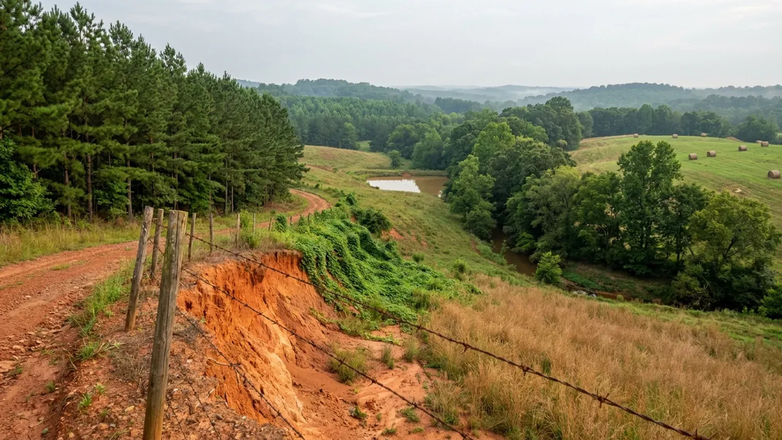
Rolling South Carolina Upstate pasture with a red dirt track cut through orange clay, planted pine rows on one edge, hardwood along a creek bottom, and round hay bales in the field.
Lancaster County One statewide code, county design maps

Barndominium Builders in Lancaster County, SC

Lancaster County is two markets wearing one name. The northern panhandle — Indian Land, Van Wyck, the Highway 521 corridor running up to the North Carolina line — is Charlotte's southern edge, and it is where the county's impact fees, its Highway Corridor Overlay and its growth pressure all live. The land is south of that: down past Lancaster city toward Heath Springs and the town of Kershaw, where the county's own impact fee study says the fees stop and where 510 farms still hold 60,781 acres. The county added 18,284 people between 2020 and 2025, a 19.0 percent gain and the fourth-largest percentage increase in the state, with 2,405 of the most recent year's arrivals coming from elsewhere in the country rather than from births. What makes it a good place to build a shop-and-house is one line in the Unified Development Ordinance: above two acres there is no cap on how big an accessory building may be, and no limit on how many of them you may have. Below two acres there is — 1,500 square feet per structure and 75 percent of the principal house. Two things to know before you shop. The town of Kershaw is in this county, not in Kershaw County, which is a real source of confusion for out-of-state buyers reading listings. And the Building Codes Council's map for this county draws a seismic line across it, so the design category has to be read at the parcel rather than taken from a neighbour.

Lancaster County at a glance

County
Lancaster County
Population
114,296

Building conditions in Lancaster County

The building code is the same in every South Carolina county: S.C. Code § 6-9-10(A) requires each municipality and county to enforce the Building Codes Council's codes and to enforce only those, and SC Regulation 8-236(C) bars a local jurisdiction from writing one of its own. The design numbers are not local either, but they are not one number for the state — Regulations 8-1202 and 8-1203 send wind and seismic to the Council's own map for this county, and those maps are drawn as contours, so the figure is read at your address rather than off a county name. What is genuinely local is who issues the permit and inspects the work, what that office charges, the permit procedure it adopted by ordinance, whether your parcel is zoned at all, and the rest of Table R301.2 — frost depth, termite probability and flood — which the jurisdiction fills in for itself.

Build conditions for Lancaster County , South Carolina : design wind speed The Building Codes Council's Lancaster County sheet carries two wind contour labels and both read "115 MPH", with the Council's standard caution that a wind speed "applies at all points along the length of its corresponding (blue) line" and that "[i]nterpolation between wind speed lines is determined by the AHJ as permitted by Figure R301.2(4)A of the 2015 International Residential Code." No second wind value appears anywhere in the sheet's text layer, and the Council does not state this county as a single whole-county line the way it does for two others. The seismic side of the same sheet is a contour rather than one value: it carries both "Seismic Design B" and "Seismic Design C" with a boundary drawn across the county.. BUILD CONDITIONS LANCASTER COUNTY…Lancaster CountyONE STATEWIDE CODEDESIGN WIND SPEEDThe Building Codes…These are contour maps and a county can carry more than one value — the seismic category hereplainly does. Exposure category stays a site-specific determination under R301.2.1.4. Ground snow…ZONING · AR (AGRICULTURAL RESIDENTIAL), RR (R…1.0 acre in AR, RR and RN, at a maxi…The Unified Development Ordinance regulates land use inunincorporated Lancaster County and does not apply inside the…DEVELOPMENT IMPACT FEES, NEW SINGLE-FAMILY DE…$908 parks and recreation, $141 sher…Adopted by County Council on 19 July 2021 under Ordinances 2021-1722(fire), 2021-1723 (EMS), 2021-1724 (sheriff) and 2021-1725 (parks…WHO ISSUES THE PERMITLancaster County Building Services…101 N Main Street, PO Box 1809, Lancaster SC 29720; 803-285-1969,with the Planning Department on 803-285-6005 and Zoning on…
Build conditions for Lancaster County, drawn from the sourced facts on this page. Every figure above is cited in the quick-facts panel below, with its source and vintage.
Two acres is the line that decides whether the shop can be bigger than the house
Section 1.4.7(B) of the Unified Development Ordinance sets accessory structure limits in three columns, and the third one is why rural acreage here suits this building type. On a single-family or two-family lot of less than half an acre: side or rear yard only, two accessory structures maximum, 750 square feet per structure, aggregate area no greater than 75 percent of the principal structure. On a single-family or two-family lot of half an acre to two acres: the same locational rule, still two structures maximum, 1,500 square feet per structure, aggregate still capped at 75 percent of the principal structure. On "All Other Uses and Lots Larger than 2 Acres": permitted in all yards, may not be closer than 30 feet to a right-of-way, "No maximum" number permitted, "No maximum" building footprint. Over two acres, nothing in the ordinance ties the workshop's floor area to the house's. Under two, a 40-by-60 shop is already over the cap. There is a second limit that does not move: Section 1.4.7(A)(2) provides that accessory structures "shall not be used for dwelling purposes except as approved Accessory Dwelling Units", so the shop is not a place to live while the house gets built.

Lancaster County Unified Development Ordinance § 1.4.7 (Accessory Uses and Structures), adopted 28 November 2016, combined text amended 14 March 2022, https://www.lancastercountysc.gov/DocumentCenter/View/387/UDO--Combined-2022-03-14-PDF (HTTP 200, application/pdf, 22,538,688 bytes; extracted with pdftotext in both -layout and -raw mode and the table reconciled between them, 6 Sep 2026)

The county's map states one wind figure twice and two seismic categories
This is one of the 35 counties for which the Building Codes Council publishes an approved wind and seismic sheet, and the sheet has to be read rather than summarised. Its note block reads: "Wind speed, shown in miles per hour, applies at all points along the length of its corresponding (blue) line. Interpolation between wind speed lines is determined by the AHJ as permitted by Figure R301.2(4)A of the 2015 International Residential Code." Two wind labels appear in the sheet's text layer and both read "115 MPH" — there is no second wind value on the map, and no whole-county wind statement of the kind the Council prints for a couple of counties. The seismic side is different: the sheet carries both "Seismic Design B" and "Seismic Design C", labelled twice on either side of a boundary drawn across the county. So the seismic design category is a read-at-the-parcel question here, and the wind number is not something to take from a neighbouring county's sheet. Regulations 8-1202 and 8-1203 are what give these maps their force: they delete the residential code's national wind and seismic sources and substitute the Council's previously published maps.

S.C. Building Codes Council, "Lancaster 15.pdf", linked from "Wind/Seismic Maps" at https://llr.sc.gov/bcc/maps.aspx — sheet at https://llr.sc.gov/bcc/PDFfiles/WSMaps/Lancaster%2015.pdf (HTTP 200, application/pdf, 3,992,993 bytes; text layer extracted with pdftotext -layout and -raw and read in full, 6 Sep 2026). Substitution mechanism at Regs. 8-1202 and 8-1203, https://llr.sc.gov/bcc/PDFfiles/2021-Code-Modifications.pdf

The impact fees stop at the panhandle — and south of it there are none
County Council adopted four development impact fees in July 2021, effective 1 October 2021, and a school fee that followed on 1 January 2022. Where they apply is the part worth knowing before making an offer. The county's own impact fee guidance says the fees are "applicable in the highest growth area which is defined as the greater panhandle of the County", which "includes the six most northern fire districts: Pleasant Valley, Indian Land, Van Wyck, Riverside, Shiloh Zion, and Camp Creek"; that "[o]nly the Parks and Recreation Fee applies to the entire area"; and that "[t]he three remaining public safety fees for Sheriff, Fire and EMS are limited to projects in the northern three fire districts of Indian Land, Van Wyck and Pleasant Valley." In the Riverside, Shiloh Zion and Camp Creek districts the sheriff, fire and EMS lines are all $0. Outside the greater panhandle altogether, none of them apply. On the adopted fee schedule for fiscal 2027 a new single-family detached housing unit carries $908 for parks and recreation, $141 for the sheriff, $130 for EMS and a fire fee of $1,072 in the Greater Panhandle service area or $880 in the Pleasant Valley Fire District. The school fee is a separate ordinance and a bigger number — $9,507 per single-family housing unit — and the county's guidance says it "is only applicable within the Panhandle Service Area." All of these are collected when the building permit issues.

Lancaster County, "Development Impact Fees — Frequently Asked Questions" (updated 1 July 2024), https://www.lancastercountysc.gov/DocumentCenter/View/288/Impact-Fee-FAQ-July-2024-PDF (HTTP 200, application/pdf, 736,694 bytes; extracted and read 6 Sep 2026); amounts from the Fiscal Year 2027 Adopted Fee Schedule, https://www.lancastercountysc.gov/DocumentCenter/View/4419 (HTTP 200, application/pdf, 762,280 bytes; impact fee tables read in both -layout and -raw mode and reconciled by row count, 6 Sep 2026); programme page at https://www.lancastercountysc.gov/229/Impact-Fee-Information

The town of Kershaw is in this county — and the county zoning office runs its ordinance
This trips up almost everyone who has not lived here. Kershaw is a town in Lancaster County; Kershaw County is a different county thirty-odd miles west whose seat is Camden. It is the one place name in the state that sits inside a differently named county of the same name, and any rule that derives a county from a town's name gets it wrong. The county says so itself in its ordinance guidance, answering the question of what geographic area the development ordinance covers: "The UDO regulates land use and development in unincorporated Lancaster County. It does not apply in incorporated cities and towns like Lancaster, Van Wyck, Heath Springs, or Kershaw." But zoning inside two of those towns is still administered from the county building: the Zoning Office "is responsible for administering the Unified Development Ordinance (UDO) as adopted by Lancaster County Council, Town of Heath Springs Ordinance, and Town of Kershaw Ordinance", and publishes the Town of Kershaw ordinance and the Town of Kershaw map on its own page. Shannon Catoe is the Zoning Director. So a parcel just outside Kershaw town limits is under the county ordinance; a parcel inside them is under the town's ordinance but administered by the same staff at 101 N Main Street in Lancaster.

Lancaster County Planning, "2026 Unified Development Ordinance Frequently Asked Questions", question 4, https://www.lancastercountysc.gov/799/2026-Unified-Development-Ordinance-Frequ (served HTML retrieved and read 6 Sep 2026); Lancaster County Zoning Department, https://www.lancastercountysc.gov/427/Zoning (read 6 Sep 2026)

The highest shrink-swell reading measured anywhere in the state is in this county
A query against the USDA soil survey for this county returns an Iredell Bt horizon at 23 to 74 centimetres — roughly 9 to 29 inches below grade — with a linear extensibility of 17 percent and 50 percent clay. That is the "very high" class, and 17 is the highest per-horizon figure the survey returns for any major soil component in the state. Keep the acreage in proportion: Iredell is only 1,232 acres here. The larger expansive bodies are Helena at 17,175 acres and Enon at 5,341, both rated high at 7.5 percent, with Mecklenburg at 2,307. Together that is something like 26,000 acres out of 351,470 — patchy, unmarked, and directly under where a slab and its footings sit. The foundation side of that is an engineering problem with a price attached. The wastewater side may not be. Regulation 61-56 § 200.2 provides that "[s]oils exhibiting massive or platy structure, and soils which have been identified as having substantial amounts of expansible layer clay minerals or smectites, are unsuitable for onsite wastewater systems." Be precise about what that settles: Iredell's family class is "Fine, mixed, active, thermic Oxyaquic Vertic Hapludalfs" — mixed, not smectitic — so the regulation does not disqualify it automatically. What it does record is the field evidence the regulation looks for, describing its Btss horizons at 7 to 20 inches as "clay ... very firm, very sticky, very plastic ... common slickensides and pressure faces", with very slow permeability. Whether any of it rules out a particular parcel is a determination for a licensed Professional Soil Classifier standing on the ground, under Title 40, Chapter 65. Get that done before closing, not after.

Acreages, horizon depths, linear extensibility and clay percentages from USDA-NRCS Soil Data Access, survey area SC057 (Lancaster County, South Carolina), tabular queries posted to https://SDMDataAccess.sc.egov.usda.gov/Tabular/post.rest on 6 Sep 2026; series morphology and taxonomic class at USDA-NRCS Official Series Descriptions, https://soilseries.sc.egov.usda.gov/OSD_Docs/I/IREDELL.html and https://soilseries.sc.egov.usda.gov/OSD_Docs/H/HELENA.html ; S.C. Regs. 61-56 § 200.2, https://des.sc.gov/sites/des/files/Library/Regulations/R.61-56.pdf ; soil classifier licensing under S.C. Code Title 40, Chapter 65, https://www.scstatehouse.gov/code/t40c065.php

The county prices the no-inspection farm building — and it cannot be your house
The adopted fee schedule carries a line most counties do not publish at all: "No Inspection Exception for AG", priced at "[t]hree fourths of one percent (0.0075) of estimated value", with valuation "determined by $10 per sq. ft. for Agricultural structures by land/use classification which require or not subsequent electrical, gas, mechanical, plumbing, or structural inspection", and the closing sentence "Zoning permits are required for all structures." That is a real, cheap, real-world route for a genuine barn — and it is closed to a barndominium in every case. S.C. Code § 6-9-65(A) defines a farm structure as one built on a farm "other than a residence or a structure attached to it", and expressly excludes any structure "originally qualifying as a 'farm structure' but later converted to another use." A dwelling is outside the exemption by definition, and so is the shop half of a shouse, because that half is attached to the residence. Even for a genuinely detached agricultural building the relief is conditional: § 6-9-65(C) requires an affidavit filed with the building official before construction stating the intended use, and § 6-9-65(D) leaves the county free to require a permit anyway. The practical warning is in the fee line itself. A shell put up with no structural, electrical, mechanical, plumbing or gas inspection is a shell that has to be opened up and proved after the fact if it ever becomes living space.

Lancaster County Fiscal Year 2027 Adopted Fee Schedule, Building Fees, https://www.lancastercountysc.gov/DocumentCenter/View/4419 (extracted with pdftotext -layout and -raw and reconciled between them, 6 Sep 2026); statute at S.C. Code of Laws Title 6, Chapter 9, § 6-9-65, served in full at https://www.scstatehouse.gov/code/t06c009.php (HTTP 200, 60,174 bytes, read 6 Sep 2026)

Also worth knowing before you build in Lancaster County

The rural districts: one acre, 130 feet of frontage, 35 feet to the top
Section 2.4 gives Agricultural Residential (AR), Rural Residential (RR), Rural Neighborhood (RN), Rural Business (RUB) and Manufactured Housing (MH) a single shared schedule. Maximum density 1 unit per acre; minimum lot area 1.0 acre; minimum lot width at the front setback 130 linear feet; minimum pervious surface 65 percent in AR and 50 percent in the others. Principal building: 40 ft front setback, 20 ft street side on a corner, 20 ft side from an adjacent lot, 25 ft rear. Accessory structure: 5 ft side and 5 ft rear — but footnote 1 removes that concession for anything substantial, providing that "[a]ccessory structures over 600 sf must comply with principal setback requirement." A shop of any real size therefore takes the 40/20/25 principal setbacks, not the 5-foot ones. Maximum height is 35 feet for the principal building and 35 feet for an accessory structure alike, measured under Section 1.4.6(B) "from the highest ground level at the structure foundation to the highest point of the structure, excluding chimneys and antennas." A single-family dwelling is permitted by right in AR, RR and RN on the Section 2.5.3 use table, and agriculture and crop production, agritourism, forestry and commercial stables are permitted by right in all three as well.

Lancaster County Unified Development Ordinance §§ 1.4.6(B), 2.4 (District Development Standards) and 2.5.3 (Use Table), https://www.lancastercountysc.gov/DocumentCenter/View/387/UDO--Combined-2022-03-14-PDF (read 6 Sep 2026; the § 2.4 table's row labels are offset by one row in -layout extraction and were reconciled against the -raw reading-order render before any figure here was quoted)

One creek basin in the panhandle has its own endangered-species rulebook
Section 4.2.2 establishes the Carolina Heelsplitter Overlay District, and it is unlike any other overlay in the region. The Carolina Heelsplitter is a federally endangered freshwater mussel, and the overlay covers the Six Mile Creek drainage basin as designated by the U.S. Geological Survey, hydrographic unit 03050103030010, in the northern panhandle. The trigger is impervious surface. Under 8,000 square feet of new impervious surface — or a project at 10 percent or less impervious — with existing riparian buffers undisturbed, development proceeds as of right. At or above 8,000 square feet, or above 10 percent, or if the buffers are disturbed, the project must additionally buy credits from the Carolina Heelsplitter Conservation Bank, purchased when the grading permit issues, with proof supplied to the county before any building permit is released and a 20 percent per year penalty if they were not bought on time. Either way a native forested buffer stands 200 feet from the edge-of-bank of a perennial stream and 100 feet from any intermittent stream. Note the arithmetic: a house, a large detached shop, a driveway and a parking apron can reach 8,000 square feet of impervious surface without anyone intending it — rooftops, driveways, patios, sheds and compacted roadways all count. The overlay follows the watershed boundary rather than parcel lines, so part of a parcel can be in and part out.

Lancaster County Unified Development Ordinance § 4.2.2 (Carolina Heelsplitter Overlay District), https://www.lancastercountysc.gov/DocumentCenter/View/387/UDO--Combined-2022-03-14-PDF (read 6 Sep 2026)

Who issues the permit, what it costs, and how the county scores
Building Services, at 101 N Main Street in Lancaster on 803-285-1969, issues residential and commercial building permits, runs plan review before issuing them, and inspects through construction. Darin Robinson is the Building Director. The department's own page states the position plainly: "Building Codes are mandated by the state of South Carolina General Assembly ... No local modification is allowed", and lists what it enforces — the 2021 International Building, Residential, Mechanical, Fuel Gas, Plumbing, Fire, Existing Buildings, Property Maintenance and Swimming Pool and Spa Codes, the 2009 International Energy Conservation Code, 2017 ICC A117.1 and the 2020 National Electrical Code with state modifications. The building permit itself is priced at three quarters of one percent of estimated value, with valuation set from the National Building Valuation Data and Modifiers rather than from the contract, at a $25 minimum; plan review and any resubmittal review are each one tenth of the building permit fee; re-inspections run $50, then $100, then $250 with $250 added per inspection after the third. Fees double if work starts before the permit issues. Zoning is a separate ticket and a separate office: a residential zoning permit is $50 and covers "a new home, mobile home, modular, storage building, swimming pool, adding to existing structure, signs, and detached structures". The county also reports its Insurance Services Office grading — three for commercial construction and four for residential, on a scale where one is perfect and nine means no code enforcement — an improvement from a six on both at the previous grading.

Lancaster County Building Services, https://www.lancastercountysc.gov/200/Building (served HTML retrieved and read 6 Sep 2026); building fee lines from the Fiscal Year 2027 Adopted Fee Schedule, https://www.lancastercountysc.gov/DocumentCenter/View/4419 ; zoning fees from Lancaster County Zoning, "Fees", https://www.lancastercountysc.gov/431/Fees (read 6 Sep 2026)

510 farms, 60,781 acres, and four in five of them under 180 acres
The 2022 Census of Agriculture counts 510 farms in this county holding 60,781 acres — 17.3 percent of the county's 351,470 acres of land, at an average of 119 acres. Both the farm count and the acreage are down 4 percent since 2017 while the average size is up 1 percent, which is what a growth county looks like from the agricultural side. The land-use split sums exactly to the total: 21,708 acres of cropland, 17,878 of pastureland, 18,494 of woodland and 2,701 of other. The size distribution is the number to shop against — 30 farms of 1 to 9 acres, 227 of 10 to 49 acres, 182 of 50 to 179, 46 of 180 to 499, 15 of 500 to 999 and 10 above 1,000. Four in five operations here are under 180 acres, which is a landscape already cut into pieces a household can buy. Livestock, poultry and products account for 91 percent of the county's $76.4 million in agricultural sales, so most of the working ground is pasture and woodland rather than row crop.

USDA NASS, 2022 Census of Agriculture County Profile — Lancaster County, South Carolina (cp45057), https://www.nass.usda.gov/Publications/AgCensus/2022/Online_Resources/County_Profiles/South_Carolina/cp45057.pdf (HTTP 200, application/pdf, 878,943 bytes; read in both -layout and -raw mode, 6 Sep 2026 — the percent-change column is offset by one row in the -layout render and the -raw reading was used); county land area from research/statewide/geography-and-population.md

18,284 more people in five years, and almost all of them moved here
The Census Bureau's Vintage 2025 estimates put the county at 114,296 as of 1 July 2025 against a 2020 estimates base of 96,012 — a gain of 18,284, or 19.0 percent, in five years. Only three counties in the state grew faster in percentage terms. The components of change for the year to July 2025 explain the shape of it: 1,518 births against 1,180 deaths for a natural change of just +338, international migration of +267, and net domestic migration of +2,405. Nearly the whole of the growth is people arriving, and the great majority of them are arriving in the panhandle, within commuting distance of Charlotte, Fort Mill and Rock Hill. That is also why the county is in the middle of rewriting its development ordinance: the current ordinance dates to 2016, a replacement has been in drafting since 2021, and the county's own guidance says the draft is scheduled for adoption "at about the same time the moratorium expires in November 2026." Anyone buying land here in the meantime should check the county's zoning map with the moratorium layer turned on, which is what the county's own instructions say to do.

U.S. Census Bureau, Vintage 2025 County Population Totals and Components of Change, co-est2025-alldata.csv, SUMLEV 050, STATE 45 / COUNTY 057, https://www2.census.gov/programs-surveys/popest/datasets/2020-2025/counties/totals/co-est2025-alldata.csv (fetched and parsed 6 Sep 2026); ordinance timetable and moratorium at https://www.lancastercountysc.gov/799/2026-Unified-Development-Ordinance-Frequ and https://www.lancastercountysc.gov/747/MORATORIUM-INFORMATION (both read 6 Sep 2026)

Two opposite soil problems, sometimes a few miles apart
The county straddles a geological change, and the soil survey shows it. North and west the major components are the ordinary Piedmont and Carolina Slate Belt clays that build without drama — Herndon at 44,170 acres, Cecil at 42,303, Georgeville at 34,598, Pacolet at 19,548, Tarrus at 15,643 — plus the mafic clays described above. Toward the south-east the survey returns Blanton at 19,318 acres and Wagram at 5,536, deep Coastal Plain sands formed "in sandy and loamy marine or eolian deposits", somewhat excessively to moderately well drained. Those two halves fail in opposite directions. Heavy clay drains too slowly for a drainfield and heaves under a slab; deep sand drains too fast to treat effluent and ravels out of a trench cut for a turned-down slab edge. The onsite wastewater route also differs across that boundary: R.61-56 § 104.1(5) requires backhoe pits — a machine on the parcel, not a hand auger — "above the Fall Line that separates the Piedmont area from the Coastal Plain as defined by the South Carolina Geological Survey." Whichever side a parcel is on, § 104.1(6) requires the site to be ready before anyone comes out: boundary lines cleared and marked, a marker at the front centre of the lot, stakes at the corners of the proposed building, the stub-out, tank and drainfield areas marked, the well location identified and a site sketch with the application.

Soil component acreages from USDA-NRCS Soil Data Access, survey area SC057, queries posted to https://SDMDataAccess.sc.egov.usda.gov/Tabular/post.rest on 6 Sep 2026; Blanton geographic setting and drainage at https://soilseries.sc.egov.usda.gov/OSD_Docs/B/BLANTON.html ; S.C. Regs. 61-56 §§ 104.1(5) and 104.1(6), https://des.sc.gov/sites/des/files/Library/Regulations/R.61-56.pdf (read 6 Sep 2026)

Seismic B or C, and neither one switches the code's seismic chapter on
The Council's sheet carries both categories across this county, and for a detached one- or two-family dwelling neither triggers the residential code's seismic provisions. Section R301.2.2 applies them to detached one- and two-family dwellings only in seismic design categories D0, D1 and D2, and to townhouses from category C. So a detached barndominium here never picks up R403.1.2's continuous solid or fully grouted footings under exterior walls by seismic operation, never picks up the enhanced sill anchorage of R403.1.6.1, and never has to run the eight irregularity conditions in R301.2.2.6 that push a design out of the prescriptive path. That last one matters for this shape of building: a wide open shop bay beside a two-storey living end trips the diaphragm-opening and offset-shear-line conditions readily, and in the parts of the state carrying a D rating that alone forces an engineered design. A townhouse is a different answer on the C side of the county's line. None of this removes the engineer from a post-frame or rigid-frame building — a foundation system the code has no prescriptive table for is a design departing from the prescriptive method, which the state's own definition of accepted engineering practice requires be made by a South Carolina licensed architect or engineer.

2021 South Carolina Residential Code §§ R301.2.2, R301.2.2.6, R403.1.2 and R403.1.6.1, with the wind and seismic sources replaced and the R202 definition modified by the state's 2021 code modifications, https://llr.sc.gov/bcc/PDFfiles/2021-Code-Modifications.pdf (read 6 Sep 2026); county categories from https://llr.sc.gov/bcc/PDFfiles/WSMaps/Lancaster%2015.pdf

No slope threshold in the ordinance, and an airport overlay most people never check
The development ordinance was searched in full for a slope provision governing where a house may be built, and there is none — no hillside overlay, no percentage above which a dwelling needs extra review, no county figure a builder can be held to. Slope appears only as a design detail: berms take a maximum 3:1 side slope up to four feet and 4:1 above that, planting-yard grading is limited to 3:1 or flatter, fill slopes may be no steeper than two horizontal to one vertical, and § 4.4.1(F) lists "[a]reas containing slopes in excess of 25 percent" among the features that must be included where practicable in the open space a cluster subdivision sets aside. Any slope number quoted as a statewide standard should be traced back to the jurisdiction that published it. What does exist and is easy to miss is the McWhirter Field Aviation Overlay, which draws Airport Land Use Zones A, B1, B2, C1, C2, D, E and F over land around the county airport, caps structure height by aerial contour, and makes single-family residential a conditional rather than a permitted land use in Zones B1, B2, C2 and D. Zone F is a six-mile boundary that bars new municipal solid waste landfills. Check the overlay before buying near the field.

Lancaster County Unified Development Ordinance §§ 4.2.1 (McWhirter Field Aviation Overlay, land use compatibility table) and 4.4.1(F) (Cluster Subdivision Overlay open space), with the full combined text searched for slope provisions, https://www.lancastercountysc.gov/DocumentCenter/View/387/UDO--Combined-2022-03-14-PDF (extracted and searched 6 Sep 2026)

An excavator grading a compacted building pad on a cleared lot, with orange clay in the cut face, survey stakes and a drainage swale.
Below the slab

The expensive surprises are in the ground, not the building

What moves a South Carolina budget is usually below grade, and more often than not it is the drainfield rather than the foundation. R.61-56 § 200.1 settles whether a parcel can take an onsite system from soil morphology — texture, structure, depth to a restrictive horizon and depth to the zone of saturation — and § 200.2 then rules out two conditions outright: soils exhibiting massive or platy structure, and soils with substantial amounts of expansible layer clay minerals or smectites. That second clause is the one that bites on the mafic Piedmont, where the shrink-swell series sit in quantity under York, Fairfield, Chester, Laurens, Union, Newberry, Greenwood, McCormick, Lancaster, Saluda, Abbeville and Edgefield. A foundation problem has a price and an answer; an unbuildable septic parcel has neither, which is why we look at it first. Bedroom count is the number to settle early, because § 61-56.501 drives design flow from bedrooms, design flow drives trench length, and trench length plus a repair area decides how much good soil the parcel has to have — shop square footage adds nothing to it. Above the Fall Line the evaluation is done in backhoe pits rather than borings alone, so the answer comes from a dug hole and not a form. The site work, the foundation and the drainfield therefore get resolved together rather than one at a time. We price the dirt before we price the building.

What a build looks like

Three stages every Lancaster County project passes through, from a raw parcel to a finished home. Site work first, because that is where the budget is decided.

Aerial view of an undeveloped rural lot with cleared rough grass, planted pine along one boundary, and a red dirt access track cut through orange clay.
Stage one

The parcel

Zoning, setbacks, flood zone and utility access get checked before anything is drawn.

An excavator grading a compacted building pad on a cleared lot, with orange clay in the cut face, survey stakes and a drainage swale.
Stage two

Pad and permit

Clearing, grading and a compacted pad, while the submittal works through whichever office issues the permit where you are building.

A finished barndominium at dusk with warm interior lighting glowing through its large windows.
Stage three

Frame to finish

Shell erected and dried in, then systems, insulation and interior finish through to CO.

Those are the rules where you are building in Lancaster County. Tell us what you want to build and we will draw it to them.

Nearby areas we build in

Others we cover nearby. One may be a county and another a municipality inside one — and a South Carolina municipality can sit in two counties at once — so the office that issues the permit, the fees it charges, whether the land is zoned at all, and which design map covers it can all differ from one card to the next.

Building in Lancaster County: common questions

8 questions we get asked most often about building in Lancaster County. If yours is not on the list, ask it directly.

Can the shop be bigger than the house here?
On more than two acres, yes, and the ordinance says so in a table rather than leaving it to interpretation. Section 1.4.7(B) of the Unified Development Ordinance splits accessory structures three ways. Under half an acre: side or rear yard only, two structures maximum, 750 square feet each, aggregate no greater than 75 percent of the principal structure. Half an acre to two acres: same location rule, two structures maximum, 1,500 square feet each, aggregate still 75 percent of the principal structure. Over two acres, and for all other uses: permitted in all yards provided nothing sits closer than 30 feet to a right-of-way, "No maximum" number, "No maximum" building footprint. So the two-acre line is the one to shop against — below it a 40-by-60 shop is already over the per-structure cap, and above it nothing ties the shop's floor area to the house's at all. Three things still bind. Height is 35 feet for an accessory structure just as it is for the principal building, measured from the highest ground level at the foundation to the highest point of the structure. Any accessory structure over 600 square feet loses the 5-foot accessory setbacks and takes the principal setbacks instead — 40 feet front, 20 side, 25 rear in the rural districts. And Section 1.4.7(A)(2) provides that accessory structures "shall not be used for dwelling purposes except as approved Accessory Dwelling Units", so the shop is not somewhere to live while the house is being finished. One structural note that changes the analysis entirely: if the shop and the living space share one continuous roof, it is not an accessory structure at all. It is the dwelling, and only the dwelling's rules apply.
What design wind speed and seismic category should my engineer use?
The state does not use the national maps for houses. Its 2021 code modifications rewrite the residential code's wind and seismic sections to take both figures from the previously published maps of the South Carolina Building Codes Council, and this county has one of the 35 approved sheets. Read it rather than take a number secondhand, because the two halves behave differently. Two wind labels appear on the sheet and both read 115 MPH, alongside the Council's standard caution that a wind speed applies at all points along the length of its corresponding line and that interpolation between lines is determined by the authority having jurisdiction as permitted by Figure R301.2(4)A. The seismic side is a genuine contour: the sheet carries both Seismic Design B and Seismic Design C, labelled on either side of a boundary drawn across the county, so the category has to be read at the parcel. Two more cells nobody publishes for this county. Exposure category stays site-specific under Section R301.2.1.4 — that is the one that goes wrong when a set drawn to a sheltered exposure is dropped onto open pasture. And ground snow load and frost line depth are cells of Table R301.2 the code leaves to the jurisdiction to fill in; no completed table for this county was found published, unlike the one York County maintains next door. Settle all of them in writing with the building official before the frame is ordered.
Are the impact fees going to hit me?
Only if the land is in the northern part of the county, and the boundary is drawn on fire districts rather than on anything you would guess from a map. The county's own guidance says the fees are applicable in "the greater panhandle of the County", which "includes the six most northern fire districts: Pleasant Valley, Indian Land, Van Wyck, Riverside, Shiloh Zion, and Camp Creek", and that only the parks and recreation fee applies across that whole area; the sheriff, fire and EMS fees are "limited to projects in the northern three fire districts of Indian Land, Van Wyck and Pleasant Valley." In Riverside, Shiloh Zion and Camp Creek those three read $0. Outside the greater panhandle — which is most of the county, including everything south of Lancaster city toward Heath Springs and the town of Kershaw — none of them apply. On the fiscal 2027 adopted schedule a new single-family detached unit inside the fee area carries $908 parks and recreation, $141 sheriff, $130 EMS, and fire at $1,072 in the Greater Panhandle service area or $880 in the Pleasant Valley Fire District. The school fee is separate and much larger, $9,507 per single-family housing unit, and the county says it "is only applicable within the Panhandle Service Area", covering detached homes, attached homes and mobile homes. All of it is collected when the building permit issues, and the amounts adjust annually against the Construction Cost Index. Two otherwise identical parcels on either side of a fire district line can differ by more than ten thousand dollars on these lines alone.
Is the town of Kershaw in Kershaw County?
No — and this is worth getting straight before you start reading listings, because it is the one place in the state where a town sits inside a differently named county of the same name. The town of Kershaw is in Lancaster County. Kershaw County is a separate county to the west whose seat is Camden. Any listing, tax record or search tool that derives a county from a town's name gets this one wrong. What follows from it practically is a jurisdiction question. The county's development ordinance "regulates land use and development in unincorporated Lancaster County" and, in the county's own words, "does not apply in incorporated cities and towns like Lancaster, Van Wyck, Heath Springs, or Kershaw." But the county Zoning Office administers the Town of Kershaw Ordinance and the Town of Heath Springs Ordinance as well as the county's own, and publishes the Kershaw town ordinance and town map itself. So the office you talk to is the same either side of the town line; the rulebook it applies to your parcel is not. Check which side of the municipal boundary the land falls on before you assume the county's two-acre accessory rule applies to it.
Everyone warns about the red clay out here. Is it real?
Some of it is, and this county holds the most extreme measurement anywhere in the state. The soil survey returns an Iredell Bt horizon here at 23 to 74 centimetres — about 9 to 29 inches below grade — with a linear extensibility of 17 percent and 50 percent clay. Seventeen percent is the "very high" class and it is the highest per-horizon figure the survey returns for any major component statewide. Keep the acreage in proportion, though: Iredell covers only 1,232 acres here. The larger bodies are Helena at 17,175 acres and Enon at 5,341, both rated high at 7.5 percent, with Mecklenburg at 2,307 — roughly 26,000 acres of it against 351,470 acres of county. Most of the rest is ordinary and builds without drama: Herndon at 44,170 acres, Cecil at 42,303, Georgeville at 34,598, Pacolet at 19,548. The bad ground is patchy and unmarked, which is the worst possible pattern for buying on assumption. On the foundation side that is an engineering problem with a price attached. On the wastewater side it may not be a problem with a price at all. Regulation 61-56 § 200.2 makes soils "identified as having substantial amounts of expansible layer clay minerals or smectites" unsuitable for onsite wastewater systems outright. Be precise about what that does and does not settle: Iredell's family mineralogy class is mixed, not smectitic, so the regulation does not disqualify it automatically. What its official description does record is exactly the field evidence the regulation looks for — clay that is "very firm, very sticky, very plastic" with "common slickensides and pressure faces" at 7 to 20 inches, and very slow permeability. Whether that bites on your parcel is a determination for a licensed Professional Soil Classifier standing on it, under Title 40, Chapter 65. Get the evaluation before you close, not after. And note the opposite problem exists in the same county: toward the south-east the survey returns 19,318 acres of Blanton and 5,536 of Wagram, deep Coastal Plain sands that drain too fast to treat effluent and ravel out of a trench.
Can I put it up as a farm building and skip the inspections?
No, and this county is unusually explicit about both halves of that answer. On the fee side it publishes a line called "No Inspection Exception for AG" — three quarters of one percent of estimated value, with valuation set at $10 per square foot for agricultural structures by land use classification "which require or not subsequent electrical, gas, mechanical, plumbing, or structural inspection", and the note that "[z]oning permits are required for all structures." That is a real route for a genuine barn. It is closed to a barndominium in every case. S.C. Code § 6-9-65(A) defines a farm structure as one constructed on a farm "other than a residence or a structure attached to it", and expressly excludes anything "originally qualifying as a 'farm structure' but later converted to another use." A barndominium is a residence, so it falls outside the exemption; the shop half of a shouse falls outside it too, because that half is attached to the residence. There is no square-footage test and no percentage-of-use test to work with. Even for a genuinely detached agricultural building the relief is conditional: § 6-9-65(C) requires the owner to file an affidavit with the building official before construction stating the intended use, and § 6-9-65(D) leaves the county free to require a building permit anyway. The zoning side is unaffected regardless — the county still requires a zoning permit for the structure. And the practical warning is written into the fee line itself: a shell built with no structural, footing, electrical, mechanical, plumbing or gas inspection is a shell that has to be opened up and proved after the fact if it ever becomes living space. It is the most expensive way to save money on a permit that exists.
Where should I actually be looking for land in this county?
South of the panhandle, for three separate reasons that all point the same way. First, supply: the panhandle around Indian Land and Van Wyck is largely built out or spoken for, and what remains there prices against Charlotte and Fort Mill rather than against this county. The 2022 agricultural census counts 510 farms holding 60,781 acres across the county, at an average of 119 acres, with 227 operations of 10 to 49 acres and 182 of 50 to 179 — a landscape already cut into pieces a household can buy, and most of it is south and east of Lancaster city toward Heath Springs and the town of Kershaw. Second, cost: the county's impact fees stop at the greater panhandle's six northern fire districts, and the $9,507 school fee stops at the Panhandle Service Area, so a parcel south of that line avoids the whole set. Third, the regulatory line that matters most for this building type: over two acres there is no cap on the size or number of accessory structures, and rural acreage south of the city is where two-acre-plus tracts actually are. Three cautions against hurrying. The county is mid-way through replacing a development ordinance adopted in 2016, with the draft scheduled for adoption around the time the current moratorium expires in November 2026, and the county publishes a moratorium layer on its zoning map you should check against any parcel before making an offer. Anything in the Six Mile Creek basin in the panhandle carries the Carolina Heelsplitter Overlay, where 8,000 square feet of new impervious surface triggers a conservation-bank credit purchase and a 200-foot forested buffer stands off every perennial stream regardless. And on any parcel, the soil evaluation matters more here than almost anywhere — this county holds both the highest shrink-swell reading in the state and thousands of acres of deep Coastal Plain sand, and they fail in opposite directions.
Who do I file with, and what does the county charge?
Two offices in the same building at 101 N Main Street in Lancaster, and you need both. Building Services, on 803-285-1969, issues the building permit, runs plan review beforehand and inspects through construction; Darin Robinson is the Building Director. The Zoning Office, on 803-416-9777 under Zoning Director Shannon Catoe, issues the zoning permit and administers the development ordinance. A residential zoning permit is $50 and expressly covers a new home, a modular, an addition to an existing structure and detached structures. The building permit is three quarters of one percent — 0.0075 — of estimated value, with the valuation taken from the National Building Valuation Data and Modifiers rather than from your contract, at a $25 minimum; plan review is one tenth of the building permit fee and a resubmittal review is another tenth; re-inspections run $50, then $100, then $250, with $250 added for each inspection after the third. Fees double if work starts before the permit issues. The code being enforced is the statewide set and the department says so plainly — the codes are mandated by the General Assembly and no local modification is allowed — which in practice means the 2021 International Residential Code with state modifications, the 2009 International Energy Conservation Code and the 2020 National Electrical Code with state modifications. If the land is inside the city of Lancaster or the towns of Van Wyck, Heath Springs or Kershaw, the county ordinance does not reach it, though the county zoning staff administer the Heath Springs and Kershaw town ordinances themselves. Onsite wastewater is a separate track with the state environmental agency, and that approval has to be in hand for the building permit packet.

Building in Lancaster County?

Start with the plan. Tell us what you want to build and we will draw it, then confirm which office issues the permit for your parcel, what it will let you put there, and what wind load it has to meet. That conversation costs nothing.