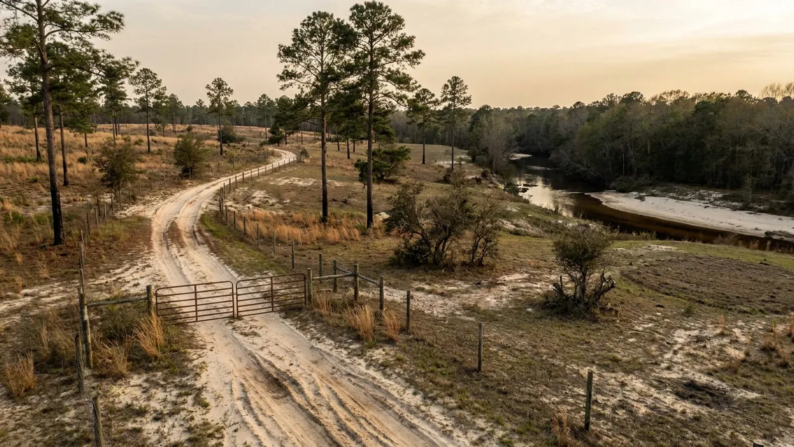
Open longleaf pine woodland on deep white sand, with wiregrass and turkey oak understorey, fire-blackened trunk bases and a sandy two-track road.
Richland County One statewide code, county design maps

Barndominium Builders in Richland County, SC

Richland County is where this office is, and the first thing to be clear about is that a Columbia mailing address does not tell you who permits your build. Columbia's city limits reach into three counties - Richland, Lexington and Kershaw - and Richland County's own building ordinance says at Sec. 6-3 that it applies to the unincorporated areas and to municipalities that contract with the county, so inside a city line you are dealing with that city. The land is all on the county side: Lower Richland toward Eastover, Hopkins and Gadsden, and the north-east toward Blythewood. 76,011 acres are in farms, 15.7 percent of the county. Two things here are unlike anywhere else in the Midlands. The Fall Line crosses the county, and the state septic regulation changes the soil-evaluation method at that exact line. And a large part of the southern acreage sits under a military installation overlay tied to Fort Jackson, McCrady Training Center and McEntire Joint National Guard Base, where a dwelling has to be designed and built to a stated noise-reduction figure.

Richland County at a glance

County
Richland County
Population
434,956

Building conditions in Richland County

The building code is the same in every South Carolina county: S.C. Code § 6-9-10(A) requires each municipality and county to enforce the Building Codes Council's codes and to enforce only those, and SC Regulation 8-236(C) bars a local jurisdiction from writing one of its own. The design numbers are not local either, but they are not one number for the state — Regulations 8-1202 and 8-1203 send wind and seismic to the Council's own map for this county, and those maps are drawn as contours, so the figure is read at your address rather than off a county name. What is genuinely local is who issues the permit and inspects the work, what that office charges, the permit procedure it adopted by ordinance, whether your parcel is zoned at all, and the rest of Table R301.2 — frost depth, termite probability and flood — which the jurisdiction fills in for itself.

Build conditions for Richland County , South Carolina : design wind speed The Building Codes Council's approved Richland County map carries 115 MPH and 120 MPH wind contour lines. BUILD CONDITIONS RICHLAND COUNTY…Richland CountyONE STATEWIDE CODEDESIGN WIND SPEEDThe Building Codes…Reg 8-1202 replaces IRC R301.2.1 with the Council's own county maps. This is a contour map, not asingle value: the map's note says the speed "applies at all points along the length of its…ZONING · AG (AGRICULTURAL), HM (HOMESTEAD), R…98,000 sq ft in AG, 50,000 sq ft in…Land Development Code as amended 14 Nov 2023, effective 1 Mar 2024,applies to the unincorporated portion of the county (Sec.…IMPACT AND PERMIT FEESBuilding permit feeRichland County levies no impact fee. County Code Sec. 6-50(b)provides that permit, appeal and amendment fees "shall be determine…WHO ISSUES THE PERMITRichland County Building Permitting…2020 Hampton Street, Columbia, SC 29204; permitting through thecounty's eTrakit portal at etrakit.rcgov.us. Zoning and the Land…
Build conditions for Richland County, drawn from the sourced facts on this page. Every figure above is cited in the quick-facts panel below, with its source and vintage.
The Council's Richland County map carries 115 and 120 mph contours, and no seismic label in its text
South Carolina takes the ultimate design wind speed away from the IRC's national figure and hands it to the Building Codes Council's own county maps: Reg 8-1202 replaces IRC R301.2.1 with "the previously published maps by the South Carolina Building Codes Council," and Reg 8-1203 does the same for seismic design category at R301.2.2.1. The Council's approved map for Richland County carries 115 MPH and 120 MPH wind contour lines and prints this note on its face: "Wind speed, shown in miles per hour, applies at all points along the length of its corresponding (blue) line. Interpolation between wind speed lines is determined by the AHJ as permitted by Figure R301.2(4A) of the 2015 International Residential Code." So the figure is read off the map at the parcel, and between two lines the building official interpolates. The map's machine-readable text layer carries no seismic design category label at all, and the map is a raster drawing that could not be rendered here, so no seismic category is stated for Richland County on this page. Ask the county building official to read the category off the Council map for your parcel and put it in writing.

SC Building Codes Council, "Wind/Seismic Maps", https://llr.sc.gov/bcc/maps.aspx, and the Council's Richland County map, https://llr.sc.gov/bcc/PDFfiles/WSMaps/Richland%2015.pdf (HTTP 200, application/pdf, 9,124,278 bytes, downloaded 5 Sep 2026; text layer extracted with pdftotext -layout and read). Reg 8-1202 and 8-1203, 2021 Code Modifications, SC State Register Vol. 46 Issue 5, https://llr.sc.gov/bcc/PDFfiles/2021-Code-Modifications.pdf

Lower Richland sits under a military noise overlay that puts a dBA number on the dwelling
The Land Development Code's Military Installation Overlay (Sec. 26-3.7(g)) divides land around McEntire Joint National Guard Base, Fort Jackson and McCrady Training Center into nine sub-zones. Zones 1 and 2 are the McEntire Clear Zone and Accident Potential Zone 1. Zones 4 to 7 are the McEntire noise bands, from "in excess of 80 dB DNL" down to "between 65-69 dB DNL." Zone 8 is different and it is the one that covers rural Richland: "MI-O Zone 8 includes lands located south of Fort Jackson and McCrady Training Center that have been identified by the military as likely to experience noise impacts averaging between 115 and 130 dB." In those zones the code's own note [2] conditions development "on design and construction providing for an average minimum Noise Level Reduction (NLR) of average minimum 25 dBA throughout the facility or dwelling," and note [3] raises it to 30 dBA. Sec. 26-3.7(g)(5) says the application is not approved unless a qualified acoustical consultant, architect or engineer licensed in South Carolina certifies by testing that the structure achieves it, or an engineer licensed in South Carolina submits a signed and sealed judgment that a structure built to the submitted plans will meet it, worked against Appendix D of the "Guidelines for Sound Insulation of Residences Exposed to Aircraft Operations" prepared for the Department of the Navy by Wyle Research and Consulting, April 2005. A bare metal shell is a poor acoustic performer, so on Lower Richland acreage this is a design decision made before the shell is ordered, not after.

Richland County Land Development Code, Sec. 26-3.7(g)(3), (g)(4) notes [1]-[4], and (g)(5), and Sec. 26-3.214(g)(6) (MI-O Zone 9), as amended 14 Nov 2023, effective 1 Mar 2024. County-published PDF at https://www.richlandcountysc.gov/files/assets/county/v/1/planning-development/documents/121223-ldc-adopted-2023.pdf, linked from the county's Zoning page; read 5 Sep 2026 from the Internet Archive's byte-identical capture of that county file (14,390,008 bytes, application/pdf) because the live host refuses automated requests, and extracted with pdftotext -layout

A detached shop is capped at half the house, or 2,500 sq ft on two rural acres
This is the rule that decides whether a barndominium works as one building or two here. Land Development Code Sec. 26-4.3(b) provides that "the total gross floor area of all accessory structures on any lot in a Residential district shall not exceed 50 percent of the gross floor area of the principal building on the lot or 1,200 square feet, whichever is greater. Accessory structures shall not cover more than 30 percent of the rear yard." It then makes one specific allowance for the rural residential district: "The total gross floor area of all accessory structures on any lot in the RT District that is at least two acres shall not exceed a maximum total area of 50 percent of the gross floor area of the principal building or 2,500 square feet." And one exemption: "There are no size restrictions for accessory structures that are associated with agricultural uses in the RT District, provided that the lot size is greater than two acres and that a 100-foot setback is maintained from all property lines." Accessory structures also may not sit forward of the principal building line, may not come within five feet of a property line in a rear yard, and "shall not exceed the height limitations that apply to principal buildings in the district." The practical consequence: a shouse where the shop and the living space are under one continuous roof is a single principal dwelling and none of this applies to it. Put the shop in a separate building and the cap does apply.

Richland County Land Development Code, Sec. 26-4.3(b), General Standards for All Accessory Uses and Structures, as amended 14 Nov 2023, effective 1 Mar 2024, https://www.richlandcountysc.gov/files/assets/county/v/1/planning-development/documents/121223-ldc-adopted-2023.pdf (read 5 Sep 2026 via the Internet Archive capture of the county file, extracted with pdftotext -layout)

The county permits the unincorporated area only, and Columbia spans three counties
Richland County Code Sec. 6-3, Area of applicability, says it plainly: "This chapter shall apply to the unincorporated areas of the county and those municipalities that make an agreement with the council to be regulated by the terms of this chapter." The zoning side matches - Land Development Code Sec. 26-1.5(a) applies its standards "to any use or development of land within the unincorporated portion of Richland County, South Carolina," and Sec. 26-1.8 puts that land on a map titled "Zoning Map of Unincorporated Richland County, South Carolina," which "shall be the final authority as to the status of the zoning district classification of land in the County." This matters more in Richland than anywhere else in the state because the City of Columbia's limits cross two county lines beyond this one, reaching into Lexington and Kershaw counties as well. A Columbia postcode settles nothing. The county's Planning and Development Services counter is at 2020 Hampton Street, Columbia, and Building Permitting and Inspections works from the same address.

Richland County Code of Ordinances Sec. 6-3 (Code 1976, § 7-1001(c); Ord. No. 012-09HR, § I, 3 Mar 2009), American Legal Publishing, Richland County Code Chapter 6 (Buildings and Building Regulations), https://codelibrary.amlegal.com/codes/richlandcounty/latest/richco_sc/0-0-0-40726 (read 8 September 2026); Land Development Code Secs. 26-1.5(a) and 26-1.8, https://www.richlandcountysc.gov/files/assets/county/v/1/planning-development/documents/121223-ldc-adopted-2023.pdf; county contact and address from https://www.richlandcountysc.gov/Property-Business/Comprehensive-Planning/Zoning

Above the Fall Line the septic soil evaluation has to be dug with a backhoe
Richland County straddles the Fall Line, and South Carolina's onsite wastewater regulation changes method at that exact boundary. R.61-56 § 104.1(5) reads, in full: "Backhoe pits shall be required above the Fall Line that separates the Piedmont area from the Coastal Plain as defined by the South Carolina Geological Survey." So two parcels a few miles apart in this county can get materially different evaluations. The rest of the sequence is the same everywhere: § 102.2 sets a site evaluation fee of "one hundred and fifty dollars ($150.00)," payable when the application to construct is filed; § 104.1(6) requires the applicant, before the evaluation, to clear and mark the boundary lines and corners, post an identification marker at the front centre of the lot, stake the corners of the proposed building, mark the stub-out, tank and drainfield area, and locate the well. § 200.6 keeps the system five feet off a building and off any property line, 75 feet from a private well and 25 feet from a drainage ditch, and § 200.7(1) requires a usable repair area "equivalent to at least fifty (50) percent of the size of the original system." A 60-foot-wide building with a wide apron eats that room quickly, so the drainfield and its replacement area get located before the pad is sited, not after.

S.C. Regulation 61-56, Onsite Wastewater Systems, §§ 102.1, 102.2, 104.1(5), 104.1(6), 200.6 and 200.7, SCDES copy at https://des.sc.gov/sites/des/files/Library/Regulations/R.61-56.pdf (HTTP 200, application/pdf, 4,282,530 bytes, 110 pages, downloaded 5 Sep 2026 and read as text extracted with pdftotext -layout); statutory authority 1976 Code §§ 44-55-610 et seq., 48-1-10 et seq. and 2023 Act No. 60

Six months to start, a year to stall, and the county can call the shell debris
Owner-paced builds are common on rural acreage, and Richland County's ordinance has an unusually hard edge on them. Sec. 6-46(c): "Any permit issued shall become invalid unless the work authorized by it was commenced within six (6) months after its issuance, or if the work authorized by such permit is suspended or abandoned for a period of one (1) year after the time the work is commenced," with extensions of up to ninety days each available in writing from the building official for cause. Then the sentence that follows: "Any structure that has not been completed and has no permitted/approved/inspected work for a period of one (1) year and has allowed the structure to get in a state of disrepair due to neglect and abandonment, shall be declared debris and abated by demolition. A lien shall be placed on the property." And Sec. 6-50(f): "Where any construction requiring a permit begun before a permit is obtained, the permit fee will be doubled." The plain reading is that a shell left open with no inspections for a year is exposed, and that clearing the pad before the permit issues costs double.

Richland County Code of Ordinances Secs. 6-46(c) and 6-50(f) (Code 1976, §§ 7-1007(a), 7-1008; Ord. No. 012-09HR, § I, 3 Mar 2009; Ord. No. 0004-12HR, § VI, 7 Feb 2012), American Legal Publishing, Richland County Code Chapter 6 (Buildings and Building Regulations), https://codelibrary.amlegal.com/codes/richlandcounty/latest/richco_sc/0-0-0-40726 (read 8 September 2026)

Also worth knowing before you build in Richland County

Richland adopted the code's administrative chapter, which the state adoption leaves out
S.C. Code § 6-9-50(A) puts the technical provisions of the residential code in force statewide automatically, but expressly withholds the provisions "which concern the qualification, removal, dismissal, duties, responsibilities of, and administrative procedures for all building officials" unless a local governing body adopts them. Reg 8-236(E) says the same thing and adds that in the absence of Council adoption a local jurisdiction "may adopt any or all sections of the administration chapters" or set its own procedure by ordinance. Richland County adopted them. Sec. 6-82(a): "There is hereby adopted by the county council the 2021 South Carolina Residential Code, including Chapter 1 (Administration), and all amendments thereto," applying to "every detached one- and two-family dwelling structure, townhomes (not more than three stories) and accessory structures." Sec. 6-82(b) does the same for the 2021 South Carolina Building Code for everything that is not a one- or two-family dwelling, and Sec. 6-192 adopts the 2009 International Energy Conservation Code including its administration chapter. The current adoption ordinance is Ord. No. 004-24HR, 13 February 2024. The construction standard is the state's and is identical in all 46 counties; what Richland decided locally is the paperwork the standard runs on.

Richland County Code of Ordinances Secs. 6-82 and 6-192 (Ord. No. 004-24HR, § I, 13 Feb 2024; Ord. No. 011-13HR, § I, 5 Mar 2013), American Legal Publishing, Richland County Code Chapter 6 (Buildings and Building Regulations), https://codelibrary.amlegal.com/codes/richlandcounty/latest/richco_sc/0-0-0-40726 (read 8 September 2026); S.C. Code § 6-9-50(A) at https://www.scstatehouse.gov/code/t06c009.php; SC Reg 8-236 at https://www.scstatehouse.gov/coderegs/Chapter%208.pdf

Over 5,000 square feet, the drawings need a seal - unless it is the dwelling
Richland County Code Sec. 6-44(c) draws a line that lands squarely on barndominium shop bays: "In case of buildings or structures of Groups A, E, I, and H occupancy, and all buildings or structures exceeding two (2) stories in height or five thousand (5,000) square feet in area, except one- and two-family dwellings, such designer shall be an architect or engineer legally registered under the laws of this state regulating the practice of architecture or engineering and shall affix his/her official seal to such drawings, specifications, and accompanying data." One- and two-family dwellings are carved out by name, so a 6,000 sq ft house is not caught by this section. A 6,000 sq ft detached shop is not a dwelling, and is. Sec. 6-44(b) separately lets the building official require "details, computations, diagrams, and other data" bearing the signature of the person responsible for the design - which is how a post-frame or steel package normally arrives here anyway, since South Carolina's own definition of "accepted engineering practice" at IRC R202, added by modification IRC 2021-01, requires any design departing from the code's prescriptive methods to be made "by a South Carolina licensed Architect or Engineer."

Richland County Code of Ordinances Sec. 6-44 (Code 1976, § 7-1004(c); Ord. No. 1821-88, § I, 13 Dec 1988; Ord. No. 012-09HR, § I, 3 Mar 2009), American Legal Publishing, Richland County Code Chapter 6 (Buildings and Building Regulations), https://codelibrary.amlegal.com/codes/richlandcounty/latest/richco_sc/0-0-0-40726 (read 8 September 2026); SCBCC 2021 Modification Index, modification IRC 2021-01, https://llr.sc.gov/bcc/PDFfiles/2021-Modification-index.pdf

The rural districts are AG, HM and RT, and all three cap height at 45 feet
The Land Development Code rewrite replaced the old district names on 1 March 2024; the former RU: Rural district is gone, and Table 26-1.9(e) maps the old districts onto the new ones. The three that carry rural acreage now are AG: Agricultural, HM: Homestead and RT: Residential Transition. AG is "intended for active working lands on large tracts," at a maximum density of 0.33 dwelling units per acre, a minimum lot of 98,000 sq ft, 240 feet of lot width, setbacks of 50 feet front, 20 feet side and 50 feet rear, and a 45-foot height cap that "does not apply to silos, barns, windmills, or other similar structures used for agricultural purpose"; land rezoned to AG must total 35 contiguous acres with any adjoining AG or HM land. HM runs at 0.66 du/acre on a 50,000 sq ft minimum lot with 150 feet of width and the same 50/20/50 setbacks and 45-foot cap. RT, the low-intensity residential district "outside urban and suburban settings," runs at 1.0 du/acre on a 32,670 sq ft minimum lot with 120 feet of width, a 40-foot front setback, 20-foot sides, a 50-foot rear and the same 45-foot height cap. All three describe single-family detached dwellings and manufactured homes as the residential development they contemplate.

Richland County Land Development Code, Table 26-3.1(c), Secs. 26-3.2(d) (AG), 26-3.2(e) (HM) and 26-3.3(c) (RT), and Table 26-1.9(e) Zoning District Equivalencies, as amended 14 Nov 2023, effective 1 Mar 2024, https://www.richlandcountysc.gov/files/assets/county/v/1/planning-development/documents/121223-ldc-adopted-2023.pdf (read 5 Sep 2026 via the Internet Archive capture of the county file, extracted with pdftotext -layout)

In a flood zone the finished floor goes two feet above base flood elevation
The county's own Flood Zone Verification form, issued by the Department of Public Works Engineering Division at 2020 Hampton Street, states the requirement directly: "To build a structure on property that is within an SFHA you or your client will need to submit a plat prepared by a South Carolina licensed surveyor showing the SFHA boundary line as well as an Elevation Certificate for the Structure (depending on location.) You will need to show that the finished floor of structure is 2' above the Base Flood Elevation." The same form adds that "Flow Accumulation, Wetlands, and Streams are also regulated areas within the county." Richland County has taken part in the National Flood Insurance Program since 1979 and its Community Rating System standing gives residents an automatic 10 percent discount on flood insurance premiums. Two feet of freeboard is a slab-height decision, and on a wide slab-on-grade building it is a fill and drainage decision as well, so the flood determination comes before the pad design.

Richland County Flood Zone Verification form, https://www.richlandcountysc.gov/files/assets/county/v/1/planning-development/documents/fzv_request.pdf (application/pdf, 146.7 KB, retrieved and read as extracted text 5 Sep 2026); Richland County Flooding page, https://www.richlandcountysc.gov/Property-Business/Comprehensive-Planning/Flooding

76,011 acres in farms, and more than half of the farms are under fifty acres
The 2022 Census of Agriculture counts 340 farms in Richland County on 76,011 acres, an average of 224 acres. Against the county's 484,682 acres of land that is 15.7 percent in farms - a modest share for the Midlands, and it is concentrated rather than spread: Lower Richland toward Eastover, Hopkins and Gadsden, and the north-east toward Blythewood. The size distribution is the part that matters to somebody buying a homesite: 55 farms are 1 to 9 acres and 129 are 10 to 49 acres, so 184 of the 340 operations are under fifty acres. Farms fell 23 percent since 2017 while land in farms rose 45 percent, which is consolidation at the top and subdivision at the bottom at the same time. Land use inside those farms runs 40,270 acres cropland, 24,730 woodland, 7,464 other and 3,547 pasture.

USDA National Agricultural Statistics Service, 2022 Census of Agriculture County Profile, Richland County, South Carolina, https://www.nass.usda.gov/Publications/AgCensus/2022/Online_Resources/County_Profiles/South_Carolina/cp45079.pdf (HTTP 200, application/pdf, 879,789 bytes, read 5 Sep 2026); land area from the Census Bureau TIGER county record for Richland County (GEOID 45079, AREALAND 1,961,420,490 m2) returned by https://geocoding.geo.census.gov/geocoder/geographies/address; population 434,956 from Census Bureau Vintage 2025 co-est2025-alldata.csv, POPESTIMATE2025, www2.census.gov

Three working days' notice, and the county owes you an inspection in three
Richland County Code Sec. 6-53 puts a clock on both sides. The permit holder gives "three (3) working days' advance notice to the building official when work is ready for inspections or testing" and has to make sure the work will actually pass before giving it. In return, "it shall be the duty of the building official to ensure that, provided the proper advance notice is given, the first and second inspections are performed within three (3) working days of the date for which the inspection was requested," and the final inspection "within five (5) working days." Permit fees themselves are not printed in the code - Sec. 6-50(b) says fees "shall be determined by the county council and set forth in the county's annual budget ordinance for the current fiscal year," so the current schedule comes from the county's own fee list rather than from the ordinance text. Appeals from a building official's decision go to the seven-member Building Codes Board of Appeals under Sec. 6-75, in writing within thirty days (Sec. 6-33(b)).

Richland County Code of Ordinances Secs. 6-33(b), 6-50(b), 6-53 and 6-75, American Legal Publishing, Richland County Code Chapter 6 (Buildings and Building Regulations), https://codelibrary.amlegal.com/codes/richlandcounty/latest/richco_sc/0-0-0-40726 (read 8 September 2026); Building Permitting and Inspections department page, https://www.richlandcountysc.gov/Government/Organization/Departments/Building-Permitting-and-Inspections

An excavator grading a compacted building pad on a cleared lot, with orange clay in the cut face, survey stakes and a drainage swale.
Below the slab

The expensive surprises are in the ground, not the building

What moves a South Carolina budget is usually below grade, and more often than not it is the drainfield rather than the foundation. R.61-56 § 200.1 settles whether a parcel can take an onsite system from soil morphology — texture, structure, depth to a restrictive horizon and depth to the zone of saturation — and § 200.2 then rules out two conditions outright: soils exhibiting massive or platy structure, and soils with substantial amounts of expansible layer clay minerals or smectites. That second clause is the one that bites on the mafic Piedmont, where the shrink-swell series sit in quantity under York, Fairfield, Chester, Laurens, Union, Newberry, Greenwood, McCormick, Lancaster, Saluda, Abbeville and Edgefield. A foundation problem has a price and an answer; an unbuildable septic parcel has neither, which is why we look at it first. Bedroom count is the number to settle early, because § 61-56.501 drives design flow from bedrooms, design flow drives trench length, and trench length plus a repair area decides how much good soil the parcel has to have — shop square footage adds nothing to it. Above the Fall Line the evaluation is done in backhoe pits rather than borings alone, so the answer comes from a dug hole and not a form. The site work, the foundation and the drainfield therefore get resolved together rather than one at a time. We price the dirt before we price the building.

What a build looks like

Three stages every Richland County project passes through, from a raw parcel to a finished home. Site work first, because that is where the budget is decided.

Aerial view of an undeveloped rural lot with cleared rough grass, planted pine along one boundary, and a red dirt access track cut through orange clay.
Stage one

The parcel

Zoning, setbacks, flood zone and utility access get checked before anything is drawn.

An excavator grading a compacted building pad on a cleared lot, with orange clay in the cut face, survey stakes and a drainage swale.
Stage two

Pad and permit

Clearing, grading and a compacted pad, while the submittal works through whichever office issues the permit where you are building.

A finished barndominium at dusk with warm interior lighting glowing through its large windows.
Stage three

Frame to finish

Shell erected and dried in, then systems, insulation and interior finish through to CO.

Those are the rules where you are building in Richland County. Tell us what you want to build and we will draw it to them.

Nearby areas we build in

Others we cover nearby. One may be a county and another a municipality inside one — and a South Carolina municipality can sit in two counties at once — so the office that issues the permit, the fees it charges, whether the land is zoned at all, and which design map covers it can all differ from one card to the next.

Building in Richland County: common questions

7 questions we get asked most often about building in Richland County. If yours is not on the list, ask it directly.

My land has a Columbia address. Do I deal with the city or the county?
Check the jurisdiction before you check anything else, because Columbia is a harder case than most. The city's limits cross into Lexington and Kershaw counties as well as Richland, so a Columbia mailing address tells you nothing about who permits. Richland County Code Sec. 6-3 says the county's building chapter "shall apply to the unincorporated areas of the county and those municipalities that make an agreement with the council to be regulated by the terms of this chapter," and the Land Development Code applies at Sec. 26-1.5(a) only "within the unincorporated portion of Richland County, South Carolina," with its map titled the Zoning Map of Unincorporated Richland County. So inside a municipal boundary that municipality permits and zones, and outside it the county does. The county's own Planning and Development Services counter at 2020 Hampton Street will tell you which side of the line a tax map number falls on, and it is worth asking before you put money on a parcel. Almost all of the buildable acreage in this county - Lower Richland toward Eastover, Hopkins and Gadsden, and the north-east toward Blythewood - is unincorporated and answers to the county.
Can the shop be bigger than the house?
Yes, if it is the same building. No, if it is a separate one. Land Development Code Sec. 26-4.3(b) caps "the total gross floor area of all accessory structures on any lot in a Residential district" at "50 percent of the gross floor area of the principal building on the lot or 1,200 square feet, whichever is greater," and adds that accessory structures "shall not cover more than 30 percent of the rear yard." On a lot of at least two acres in the RT district that ceiling becomes "50 percent of the gross floor area of the principal building or 2,500 square feet." A barndominium where the shop bay and the living end share one continuous roof is not an accessory structure at all - it is the principal dwelling, and the cap does not touch it. The moment you detach the shop, it becomes accessory and the cap applies. There is one further route: the code says "there are no size restrictions for accessory structures that are associated with agricultural uses in the RT District, provided that the lot size is greater than two acres and that a 100-foot setback is maintained from all property lines." That is a genuine allowance, but read the two conditions - it turns on the structure being associated with an agricultural use, and it costs you a hundred feet of clearance on every boundary. Height is capped the same way either way: accessory structures "shall not exceed the height limitations that apply to principal buildings in the district," which is 45 feet in AG, HM and RT.
Can I build it as a farm building and skip the code?
No, and South Carolina closes this one cleanly in the statute rather than leaving it to argument. S.C. Code § 6-9-65(A) defines a farm structure as one built on a farm "other than a residence or a structure attached to it." A barndominium is a residence, so it is outside the exemption in every case, and the attached shop half of a shouse is outside it too because the definition excludes a structure attached to the residence. There is no square-footage test and no percentage-of-use test to work with. Three further points from the same section: § 6-9-65(C) says the exemption "do[es] not apply unless" the owner files an affidavit with the local building official before construction stating the structure is being built as a farm structure; the definition excludes any structure "originally qualifying as a farm structure but later converted to another use," so putting up a pole barn under the exemption and finishing it into a dwelling later takes it back out; and § 6-9-65(B) preserves the FEMA National Flood Insurance Program standards regardless, so the exemption never reaches flood. A genuinely detached barn or equipment shed on the same land can qualify. The building anyone sleeps in cannot.
What wind speed and seismic category apply to my parcel?
The wind speed comes off a state map, not a county chart. Reg 8-1202 replaced IRC section R301.2.1 with "the previously published maps by the South Carolina Building Codes Council," and the Council's approved map for Richland County carries 115 MPH and 120 MPH contour lines. Note that word - contour. The map says on its face that a wind speed "applies at all points along the length of its corresponding (blue) line" and that "interpolation between wind speed lines is determined by the AHJ." So there is no single Richland County number; there is a map, and a value read at your parcel, and a building official who interpolates between lines. Be wary of anyone who quotes you one figure for the whole county. Seismic works the same way under Reg 8-1203, but the Richland map's machine-readable text carries no seismic design category label, so no category is stated on this page and you should get the building official to read it off the Council map for your parcel in writing. For context on why it matters: the IRC's seismic provisions do not reach a detached one- or two-family dwelling until category D0, and South Carolina's D2 band sits in the Charleston, Berkeley and Dorchester triangle, well away from the Midlands.
How does septic work out here, and what is different about the Fall Line?
Septic is a state permit, not a county one. The South Carolina Department of Environmental Services permits onsite wastewater systems under Regulation 61-56, and the sequence starts with a site evaluation you pay for when you apply - § 102.2 fixes that fee at "one hundred and fifty dollars ($150.00)." Before the evaluator comes out, § 104.1(6) makes you clear and mark the property lines and corners, post a marker at the front centre of the lot, stake the corners of the proposed building, mark the stub-out, the tank and the drainfield area, and locate the well. The Fall Line is the local wrinkle, and it runs right through this county: § 104.1(5) provides that "backhoe pits shall be required above the Fall Line that separates the Piedmont area from the Coastal Plain as defined by the South Carolina Geological Survey." Two parcels in the same county can therefore get evaluated by different methods. Space is the other thing to plan for. § 200.6 keeps no part of the system within five feet of a building or a property line, 75 feet of a private well, or 25 feet of a drainage ditch or detention pond, and § 200.7(1) requires a usable repair area equal to at least half the size of the original system, free of buildings and improvements. A wide slab with a turning apron consumes that room fast, so site the drainfield and its replacement first and the pad second.
Can I live in the shop while the house is being finished?
Not in Richland County, unless a disaster put you there. The Land Development Code has exactly one provision for using an accessory structure as a dwelling, and it is narrow: an existing accessory structure to an existing principal dwelling "that has been damaged or destroyed by a fire, hurricane, or other physical catastrophe may be temporarily used as the principal dwelling on the lot while the damaged or destroyed principal dwelling is being repaired or reconstructed," provided the inhabited part meets all applicable building and health regulations, and it "shall be removed or converted to an authorized accessory use within 30 days after issuance of the certificate of zoning compliance for the permanent principal dwelling," with a four-year outside limit. That is a rebuild-after-catastrophe rule, not a build-in-stages rule. There is a separate reason not to plan around a long staged build here: county Code Sec. 6-46(c) invalidates a permit if work has not started within six months or is suspended for a year, and provides that a structure with no permitted, approved or inspected work for a year that has fallen into disrepair "shall be declared debris and abated by demolition," with a lien on the property. If your plan is to occupy while you finish, the honest answer is to design the building so the dwelling half can take a certificate of occupancy on its own, and to keep inspections moving.
I am looking at land in Lower Richland. Is there anything unusual about it?
Yes, and it is the thing most people find out late. A large part of southern Richland County sits inside the Land Development Code's Military Installation Overlay, which is drawn around McEntire Joint National Guard Base and around Fort Jackson and McCrady Training Center. The sub-zone that reaches furthest into farmland is MI-O Zone 8, which the code describes as "lands located south of Fort Jackson and McCrady Training Center that have been identified by the military as likely to experience noise impacts averaging between 115 and 130 dB." In the noise sub-zones the code conditions development on the building achieving an average minimum Noise Level Reduction - 25 dBA under its note [2] and 30 dBA under note [3] - "throughout the facility or dwelling," and Sec. 26-3.7(g)(5) will not approve it unless a qualified acoustical consultant, architect or engineer licensed in South Carolina certifies by testing that the structure achieves the figure, or an engineer licensed in South Carolina signs and seals a judgment that a building constructed to the submitted plans will meet it, worked against the Department of the Navy sound-insulation guidelines the section names. Nearer McEntire the overlay is stricter still: Zones 1 and 2 are the runway Clear Zone and Accident Potential Zone 1. None of this makes Lower Richland a bad place to build - it is where the county's acreage is - but a steel or post-frame shell needs its wall and roof assemblies designed for that number from the start, and the overlay is the first thing to check on a tax map number down there, right after the flood zone.

Building in Richland County?

Start with the plan. Tell us what you want to build and we will draw it, then confirm which office issues the permit for your parcel, what it will let you put there, and what wind load it has to meet. That conversation costs nothing.