Barndominium Builders in Rock Hill, SC
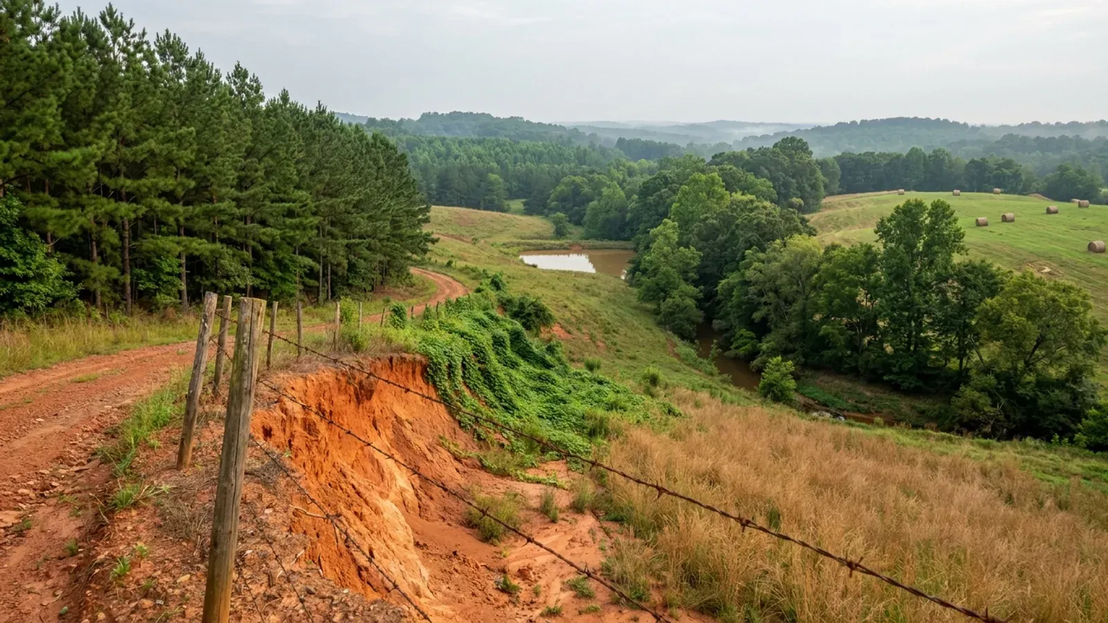
Rock Hill permits its own land. The county ordinance that governs the rest of York County stops at the city limits, and inside them the Zoning Ordinance does two things that decide whether a shop-and-house works. It caps the combined floor area of all detached accessory structures at the greater of 30 percent of the principal house or 600 square feet — 800 or 1,000 if the house has only a one-car garage or none — and it bars corrugated metal on a residential accessory building over 200 square feet unless the building is screened from the road. There is exactly one way out of both, and it is written in the same ordinance: a lot of five acres or more, zoned Rural Residential or Rural Commercial, with the residence at least 100 feet off the road. Then there is no size limit at all. The trouble is how little land that describes. In its June 2026 amendments the city eliminated the old Rural zoning district and listed by parcel number and street address the eleven properties it moved into Rural Residential and Rural Commercial. The growth figures tell the same story: the city added 1,566 people between 2020 and 2025 while York County as a whole added 24,980, most of it on the Fort Mill and Indian Land side where the Charlotte metro spills across the state line. If your plan is a large detached metal shop on acreage, the honest answer is that it belongs outside the city line — in unincorporated York County, or in Chester or Lancaster County — and this page says where and why. If the plan is a shop and living space under one continuous roof, the answer is different, because an attached garage is limited only by the setbacks and impervious surface that apply to the house itself.
Building conditions in Rock Hill
The building code is the same in every South Carolina county: S.C. Code § 6-9-10(A) requires each municipality and county to enforce the Building Codes Council's codes and to enforce only those, and SC Regulation 8-236(C) bars a local jurisdiction from writing one of its own. The design numbers are not local either, but they are not one number for the state — Regulations 8-1202 and 8-1203 send wind and seismic to the Council's own map for this county, and those maps are drawn as contours, so the figure is read at your address rather than off a county name. What is genuinely local is who issues the permit and inspects the work, what that office charges, the permit procedure it adopted by ordinance, whether your parcel is zoned at all, and the rest of Table R301.2 — frost depth, termite probability and flood — which the jurisdiction fills in for itself.
City of Rock Hill Zoning Ordinance § 5.3.5.1(E), adopted December 2005, effective 1 March 2006, last update 22 June 2026, https://www.cityofrockhill.com/home/showpublisheddocument/2065/639238489642270000 (HTTP 200, application/pdf, 14,476,489 bytes; extracted with pdftotext in both -layout and -raw mode and the table reconciled between them, 6 Sep 2026); summarised by the city at https://www.cityofrockhill.com/departments/planning-and-development/permits-inspections/residential-building-permits/accessory-structures
City of Rock Hill Zoning Ordinance §§ 9.7.1 and 9.7.2 (Accessory Structures Design Standards), https://www.cityofrockhill.com/home/showpublisheddocument/2065/639238489642270000 (read 6 Sep 2026)
City of Rock Hill Zoning Ordinance § 5.3.5.1(E)(1), attachment rules and illustrations, https://www.cityofrockhill.com/home/showpublisheddocument/2065/639238489642270000 (read 6 Sep 2026)
City of Rock Hill Zoning Ordinance §§ 1.7(C) (Transition for Eliminated Zoning Districts) and 3.3.1(A) (Rural Residential), https://www.cityofrockhill.com/home/showpublisheddocument/2065/639238489642270000 (read 6 Sep 2026); zoning map linked from https://www.cityofrockhill.com/departments/planning-and-development/development-plan-review/development-regulations
Rock Hill Code of Ordinances ch. 10 (Buildings and Building Regulations) §§ 10-74, 10-123, 10-125, 10-191 and 10-192, codified through Ordinance No. 2026-38 adopted 22 June 2026 (Supp. No. 94), https://library.municode.com/sc/rock_hill/codes/code_of_ordinances?nodeId=MUCO_CH10BUBURE (read 6 Sep 2026); department address and process at https://www.cityofrockhill.com/departments/planning-and-development/permits-inspections
City of Rock Hill Zoning Ordinance Appendix 3-E(D) and § 4.3.3.3.05(E), with the Table of Primary Uses at § 4.3.2 and the conditional-use definition at § 4.3.1, https://www.cityofrockhill.com/home/showpublisheddocument/2065/639238489642270000 (read 6 Sep 2026)
Also worth knowing before you build in Rock Hill
- 115 mph and seismic B — and this is one of only two counties the Council states as a whole-county line
- The state does not use the national wind and seismic maps for houses. Regulations 8-1202 and 8-1203 substitute the previously published maps of the South Carolina Building Codes Council, and for 33 counties those are contour sheets that can carry more than one value across a single county. This is not one of them. On the Council's own Wind/Seismic Maps page there is no map PDF for this county at all; instead the page carries a single printed line: "York County — Entire County is Seismic Category: B; Wind Category: 115mph." Only one other county in the state is stated that way. So a single figure is legitimate here in a way it would not be one county over, and the publisher is the Council rather than the city. York County independently publishes a completed Table R301.2(1) for the county that records the same 115 mph and category B, with topographic effects, special wind region and wind-borne debris all entered "No", 10 psf ground snow, a 12-inch frost line and termite Heavy. That table is the county's document, not the city's, but the design figures it records come from the same Council statement. Exposure category is the cell that stays site-specific under Section R301.2.1.4 wherever the parcel is.
- Rural Residential dimensions: one acre, and up to 350 feet of frontage
- The Table of Dimensional Standards for Residential Districts gives Rural Residential a minimum lot area of 43,560 square feet for a single-family detached dwelling, a minimum lot width of 350 feet if the lot fronts an arterial or major collector road and 200 feet otherwise, maximum lot coverage of 50 percent and a maximum primary structure height of 50 feet — fifteen feet taller than the 35 feet allowed in the SF-2 through SF-5 districts. Setbacks are 10 feet to each side line and 25 feet to the rear, with the front setback 50 feet on an arterial or major collector and 25 feet otherwise. Note what the frontage number does to a plan: 200 to 350 feet of lot width is a genuine rural dimension and it is why the district is not a way to squeeze a rural building onto a suburban lot. Height on the accessory side is tied to the house rather than to the district — Section 5.3.5.1(F) provides that "[a]ccessory structures cannot exceed the lesser of two stories or the height of primary structure", with one story defined as a floor-to-ceiling height of 12 feet or less. A tall clear-span shop door beside a single-storey house runs into that sentence before it runs into anything else.
- On five rural acres you may keep your well and septic — and you owe your neighbours a right-to-farm easement
- Appendix 3-E carries three provisions that exist nowhere else in this ordinance. On water and sewer: "properties that are at least five acres and are zoned with the Rural Residential or the Rural Commercial zoning district shall not be required to connect to City water and/or sewer utilities unless both of the following are true: (a) the services are available immediately adjacent to the subject use, and (b) the cost to connect is within 10% of the cost for the property owner to install well and/or septic instead", subject to state law on fire suppression, and an owner may request connection at any time with City Council deciding. On farming: "All new residences built after June 22nd, 2026, within one mile of an existing farm, measured from the residence to the property line of the farm, must grant a right-to-farm easement to the property owners of any farmland to allow operations using generally acceptable agricultural management practices on adjacent parcels to generate noise, odors, dust, light, and other impacts." One mile is a long way, and that easement travels with the deed. And on family land: more than one residence per lot is allowed in RR and RC if the owner lives on the property, the occupants are related by blood, marriage or adoption, the total is limited to one unit per two acres up to a maximum of seven, the land is not conveyed outside the family within five years and is not subdivided within fifteen.
- The city added 1,566 people while the county added 24,980
- The Census Bureau's Vintage 2025 estimates put the city at 75,911 as of 1 July 2025 against a 2020 estimates base of 74,345 — a gain of 1,566 people, or 2.1 percent, over five years. It remains the fourth-largest municipality in the state. Over the same five years York County went from a base of 281,907 to 306,887, a gain of 24,980 and 8.9 percent. Ninety-four percent of the county's growth happened outside this city's limits. That single comparison is the practical case for looking at land beyond the city line rather than inside it: the households arriving in this market are largely buying in unincorporated York County, on the Fort Mill and Indian Land side, and in Chester and Lancaster counties, where lot sizes are larger and the accessory-structure rules are written for rural acreage rather than for a platted neighbourhood.
- Two floodplains, one of which FEMA has never mapped
- Section 7.2.2 applies to "Special Flood Hazard Areas designated by the most current FEMA FIRM and locally-designated flood-prone areas as defined by the City's Stormwater Master Plan; Dam or Reservoir Inundation Zones; and any site-specific areas vulnerable to flooding hazards." The local designation is the one to watch, and the ordinance is candid about the difference: "Structures within FEMA designated floodplains are typically subjected to federal flood insurance requirements, where structures in locally-designated flood-prone areas are not." Development in the FEMA floodplain follows Chapter 10, Article 7 of the city code; development in the local one follows the Stormwater Master Plan and the Local Flood Hazard Risk Policy Guide, and neither may fill or net-reduce 100-year floodplain storage without an analysis showing no rise in floodstage upstream, downstream or on adjacent property. Riparian buffers are separate again and are measured landward from the water. The published widths: Lake Wylie, 100 feet undisturbed plus a 10-foot transition area, measured from the full pond elevation contour defined by the Federal Energy Regulatory Commission; the Catawba River, 100 feet plus 25, from the mean high-water line; perennial streams, 50 feet plus 25 from the top of bank; intermittent streams, 40 feet plus 10; wetlands and ponds, 40 feet plus 10 from the edge of the wetland.
- A slope figure the city does publish, and what it actually governs
- Worth stating precisely, because slope thresholds are the most commonly misquoted numbers in residential land work. This ordinance publishes no percentage above which a house needs extra review, no hillside overlay and no cap on building on a grade. What it does publish is a buffer rule: "Lands adjacent to or within 25 feet of a riparian buffer that have natural slopes of 33% must be included in the riparian buffer", and a note that the maximum buffer widths in the buffer table "applies only when the buffer falls within a natural, consistent slope area of 33% or greater." Slope otherwise appears only as a construction detail — berms not steeper than three to one where they are to be mowed, and the airport approach surfaces. So the 33 percent figure is a stream-buffer trigger, not a building-siting threshold, and quoting it as the latter would be wrong. What genuinely constrains a build on a grade comes from the residential code's own limit on how steeply the top surface of a footing may slope, which forces stepped footings across a grade change.
- No county school impact fee applies here — but check the district line, not the city line
- York County adopted Ordinance 7218 on 16 July 2018 to collect impact fees on new development, and states on its own page that "the only impact fees adopted by County Council are for local school districts." There are two: the Fort Mill School District fee, adopted 7 April 2025 at $29,640 for a single-family dwelling and $20,796 per multi-family unit, and the Clover School District fee, modified 15 December 2025 with effect from 16 December, at $8,000 per single-family residential unit, $5,236 per mobile home and $3,952 per unit in a multi-family development. The county collects each of them when the residential building permit issues, including on land inside the towns of Fort Mill, Tega Cay and Clover. Neither district is the one that serves this city, so a house here does not carry a school impact fee — but the fee follows the school district boundary rather than a municipal boundary, so confirm which district a parcel sits in before making an offer rather than reasoning from the city line. The Zoning Ordinance itself imposes no impact fee of any kind.
- A barn is not a way around any of this
- S.C. Code § 6-9-65(A) defines a farm structure as one built on a farm "other than a residence or a structure attached to it", and expressly excludes a structure "originally qualifying as a 'farm structure' but later converted to another use." A barndominium is a residence, so the building-code exemption in § 6-9-65(B) is unavailable to it in every case, and unavailable to the shop half of a shouse because that half is attached to the residence. Even for a genuinely detached agricultural building the relief is conditional — § 6-9-65(C) requires an affidavit filed with the building official before construction stating the intended use, and § 6-9-65(D) preserves the jurisdiction's power to require a permit anyway. Inside this city there is a second layer on top of that: the exemption is from the building code, not from zoning, and the accessory-structure size, location, setback, height and materials standards apply to an agricultural outbuilding exactly as they do to a garage. The city's permit checklist adds its own conditions that catch people out — a scaled drawing showing the proposed materials, a homeowners' association approval letter where covenants are enforced, a Certificate of Appropriateness if the property is in a Historic Overlay District, and business licences for every design professional, contractor and subcontractor before a building permit can issue.
S.C. Building Codes Council, "Wind/Seismic Maps", https://llr.sc.gov/bcc/maps.aspx (served HTML retrieved and the York County line read verbatim, 6 Sep 2026); substitution mechanism at Regs. 8-1202 and 8-1203, https://llr.sc.gov/bcc/PDFfiles/2021-Code-Modifications.pdf ; county design-criteria table at https://www.yorkcountysc.gov/DocumentCenter/View/6147/Table-R30121-03_2024
City of Rock Hill Zoning Ordinance § 6.6 (Tables of Dimensional Standards, Residential Districts) and § 5.3.5.1(C) and (F), https://www.cityofrockhill.com/home/showpublisheddocument/2065/639238489642270000 (read 6 Sep 2026; the dimensional table was read in both -layout and -raw mode and the RR row reconciled between them before quoting)
City of Rock Hill Zoning Ordinance Appendix 3-E(A), (B) and (C) (Standards for the Rural Residential and Rural Commercial Zoning Districts), https://www.cityofrockhill.com/home/showpublisheddocument/2065/639238489642270000 (read 6 Sep 2026)
U.S. Census Bureau, Vintage 2025 Subcounty Population Totals, sub-est2025_45.csv, SUMLEV 157, STATE 45 / COUNTY 091 / PLACE 61405, https://www2.census.gov/programs-surveys/popest/datasets/2020-2025/cities/totals/sub-est2025_45.csv (HTTP 200, text/csv, fetched and parsed 6 Sep 2026); county figures from co-est2025-alldata.csv, https://www2.census.gov/programs-surveys/popest/datasets/2020-2025/counties/totals/co-est2025-alldata.csv
City of Rock Hill Zoning Ordinance §§ 7.2.2 (Flood Hazard Risk Areas) and 8.4.1 (riparian buffer widths), https://www.cityofrockhill.com/home/showpublisheddocument/2065/639238489642270000 (read 6 Sep 2026; the buffer table was read in both -layout and -raw mode — the -layout render offsets the water-resource labels by one row against the widths, and the -raw reading-order render was used)
City of Rock Hill Zoning Ordinance § 8.4.1(C) and the riparian buffer table notes, with the full ordinance text searched for slope provisions, https://www.cityofrockhill.com/home/showpublisheddocument/2065/639238489642270000 (extracted and searched 6 Sep 2026)
York County Planning & Development Services, "Impact Fees", https://www.yorkcountysc.gov/833/Impact-Fee (served HTML retrieved and read 6 Sep 2026); the City of Rock Hill Zoning Ordinance was searched in full for impact fee provisions and contains none, https://www.cityofrockhill.com/home/showpublisheddocument/2065/639238489642270000
S.C. Code of Laws Title 6, Chapter 9, § 6-9-65, served in full at https://www.scstatehouse.gov/code/t06c009.php (HTTP 200, 60,174 bytes, read 6 Sep 2026); city submittal conditions at City of Rock Hill, "Accessory Structures of 200 SF or Less", https://www.cityofrockhill.com/departments/planning-and-development/permits-inspections/residential-building-permits/accessory-structures (read 6 Sep 2026)

The expensive surprises are in the ground, not the building
What moves a South Carolina budget is usually below grade, and more often than not it is the drainfield rather than the foundation. R.61-56 § 200.1 settles whether a parcel can take an onsite system from soil morphology — texture, structure, depth to a restrictive horizon and depth to the zone of saturation — and § 200.2 then rules out two conditions outright: soils exhibiting massive or platy structure, and soils with substantial amounts of expansible layer clay minerals or smectites. That second clause is the one that bites on the mafic Piedmont, where the shrink-swell series sit in quantity under York, Fairfield, Chester, Laurens, Union, Newberry, Greenwood, McCormick, Lancaster, Saluda, Abbeville and Edgefield. A foundation problem has a price and an answer; an unbuildable septic parcel has neither, which is why we look at it first. Bedroom count is the number to settle early, because § 61-56.501 drives design flow from bedrooms, design flow drives trench length, and trench length plus a repair area decides how much good soil the parcel has to have — shop square footage adds nothing to it. Above the Fall Line the evaluation is done in backhoe pits rather than borings alone, so the answer comes from a dug hole and not a form. The site work, the foundation and the drainfield therefore get resolved together rather than one at a time. We price the dirt before we price the building.
What we build in Rock Hill
All nine services are available in Rock Hill. What a build costs depends far more on the parcel than on square footage, so we price against your land rather than publishing a rate card.
Custom Plans
Barndominium plans drawn for your parcel and sealed at the point where South Carolina’s engineering exemption stops applying.
Barndominium Kits
Engineered shell packages for South Carolina land — open construction under the state’s own definition, and therefore not a modular building.
Turnkey Builds
Barndominium construction from raw land through to occupancy: one contract, one schedule, one party answering the building official.
What a build looks like
Three stages every Rock Hill project passes through, from a raw parcel to a finished home. Site work first, because that is where the budget is decided.

The parcel
Zoning, setbacks, flood zone and utility access get checked before anything is drawn.
Pad and permit
Clearing, grading and a compacted pad, while the submittal works through whichever office issues the permit where you are building.

Frame to finish
Shell erected and dried in, then systems, insulation and interior finish through to CO.
Those are the rules where you are building in Rock Hill. Tell us what you want to build and we will draw it to them.
Keep reading
The questions that usually come next once you know what Rock Hill allows.
Nearby areas we build in
Others we cover nearby. One may be a county and another a municipality inside one — and a South Carolina municipality can sit in two counties at once — so the office that issues the permit, the fees it charges, whether the land is zoned at all, and which design map covers it can all differ from one card to the next.
Building in Rock Hill: common questions
7 questions we get asked most often about building in Rock Hill. If yours is not on the list, ask it directly.
Can I build a big detached metal shop on my property inside the city?
Then where should I actually be buying?
What if the shop and the house are one building under one roof?
What design wind speed and seismic category apply here?
The zoning ordinance mentions barndominiums by name. What does that provision actually do?
Do I have to hook up to city water and sewer?
Who issues the permit, what does it cost, and what do I need in the packet?
Building in Rock Hill?
Start with the plan. Tell us what you want to build and we will draw it, then confirm which office issues the permit for your parcel, what it will let you put there, and what wind load it has to meet. That conversation costs nothing.