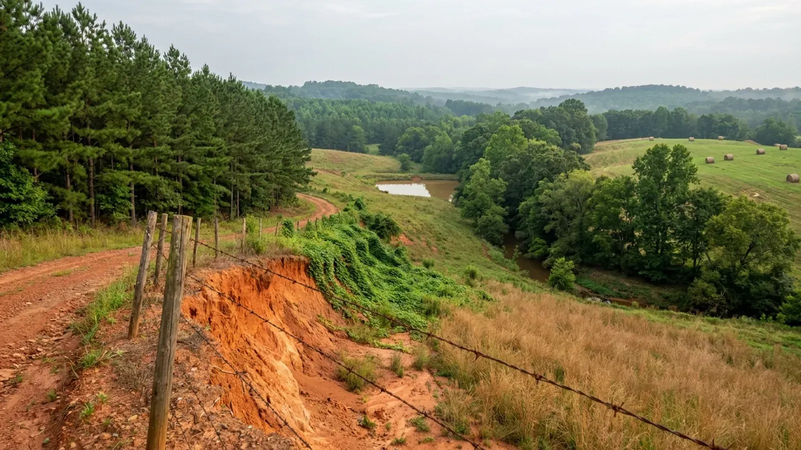
Rolling South Carolina Upstate pasture with a red dirt track cut through orange clay, planted pine rows on one edge, hardwood along a creek bottom, and round hay bales in the field.
Union County One statewide code, county design maps

Barndominium Builders in Union County, SC

Union County is the cheapest acreage within an hour of both Spartanburg and Rock Hill, and it is the least regulated place to build in the Upstate — not by a little. There is no county zoning ordinance. There is no planning or zoning department. Chapter 25 of the county code is headed PLANNING AND LAND DEVELOPMENT and contains exactly one section, which says the county belongs to a regional council of governments. No county-adopted document sets a setback, a minimum lot size or a building height for a single-family lot in unincorporated Union County. What does apply is Chapter 7, the building and technical codes, enforced by the county Department of Building Safety; Chapter 9, the flood damage prevention ordinance; the county Road Ordinance, which decides whether anyone will ever maintain the road to your land; and the state septic regulation. A draft set of Land Development Regulations has been circulating since 2022 and was reposted, still stamped DRAFT, in 2025 — worth reading, but not law. The agricultural picture is the part that surprises people. Between 2017 and 2022 Union County added 30 percent more farms working 26 percent more land, the largest gain on both measures of any of the ten Upstate counties, in a county whose population fell 1.6 percent since the 2020 census. Land is coming back into agriculture here while people are not coming back, and 52 percent of the county's parcels are undeveloped.

Union County at a glance

County
Union County
Population
26,799

Building conditions in Union County

The building code is the same in every South Carolina county: S.C. Code § 6-9-10(A) requires each municipality and county to enforce the Building Codes Council's codes and to enforce only those, and SC Regulation 8-236(C) bars a local jurisdiction from writing one of its own. The design numbers are not local either, but they are not one number for the state — Regulations 8-1202 and 8-1203 send wind and seismic to the Council's own map for this county, and those maps are drawn as contours, so the figure is read at your address rather than off a county name. What is genuinely local is who issues the permit and inspects the work, what that office charges, the permit procedure it adopted by ordinance, whether your parcel is zoned at all, and the rest of Table R301.2 — frost depth, termite probability and flood — which the jurisdiction fills in for itself.

Build conditions for Union County , South Carolina . BUILD CONDITIONS UNION COUNTY, SCUnion CountyONE STATEWIDE CODEADOPTED RESIDENTIAL CODEONE STATEWIDE CODENo design wind speed is carried on this page. It is read off the Building Codes Council mapcovering the county and settled in writing with the authority over your parcel before the frame i…ZONING · UNDEFINEDThere is no county zoning ordinance and no adopted land developmentordinance. Union is one of six South Carolina counties without…RESIDENTIAL BUILDING PERMIT$450 for the first $100,000 of valua…That is the fourth of five bands in County Code § 7-9, and thepermit is inclusive — one fee covering building, mechanical,…WHO ISSUES THE PERMITUnion County Department of Building…1246 S. Duncan Bypass, Suite B, Union SC 29379; 864-424-2341. Thesame office issues building permits, carries out inspections and…
Build conditions for Union County, drawn from the sourced facts on this page. Every figure above is cited in the quick-facts panel below, with its source and vintage.
The county's entire planning chapter is one sentence about a regional council
Union County is one of six South Carolina counties with no zoning ordinance, and the way its own code says so is remarkable. Chapter 25 of the Union County Code of Ordinances is titled PLANNING AND LAND DEVELOPMENT. Its complete substantive text is Section 25-1: "The county, by virtue of a 1972 agreement, as subsequently amended, is a member of the Catawba Regional Planning Council of Governments." That is the whole chapter. The code's table of contents runs from General Provisions through Water and Sewers and contains no zoning chapter anywhere. The county's own website lists its departments — 911 Communications, Addressing, Airport, Animal Control, Assessor, Building Safety and Floodplain Management, Code Enforcement, Emergency Management, Finance, GIS, Public Works and the rest — and there is no planning department and no zoning department among them. The adopted Comprehensive Plan 2031 treats all of this as work still to be done rather than as a settled position: its Land Use element's first planning objective is to "Adopt and implement land development ordinances in accordance with the Future Land Use Plan," with action strategies to analyse existing ordinances and to "Prepare a land development ordinance and related maps," and its record of community input lists "Need land use and zoning regulation" among the county's weaknesses. So the practical answer for a barndominium is unusually clean: there is no district on your parcel, no permitted-use table, no accessory-structure ratio, no height cap, no rezoning, no special exception and no board of zoning appeals — because no county document creates any of those things.

Union County Code of Ordinances ch. 25 (Planning and Land Development), § 25-1, https://library.municode.com/sc/union_county/codes/code_of_ordinances?nodeId=PTITHCO_CH25PLLADE — the code's own header reads "CODE OF ORDINANCES County of UNION, SOUTH CAROLINA Codified through Ordinance No. 403, enacted May 13, 2025 (Supp. No. 34)", online content updated 7 April 2026, and the full table of contents was read on 6 September 2026 and contains no zoning chapter; department list at Union County, https://gearupunionsc.com/departments/ ; Union County Comprehensive Plan 2031, adopted 12 October 2021, Chapter 4 Land Use goals and strategies and the community-input weaknesses list, https://gearupunionsc.com/wp-content/uploads/2022/06/Union-County-Comprehensive-Plan-2031-ADOPTED-10.12.2021.pdf

No county setback rule exists — the building code, the flood ordinance and the road ordinance are what govern
With no zoning and no adopted land development ordinance, the documents that actually decide a Union County build are four, and it is worth knowing exactly what each one does. Chapter 7, Building, Construction and Technical Codes, is the main one: § 7-2 requires a permit before any building or structure or addition is erected, § 7-6 adopts Chapter 1 of the International Building, Energy Conservation, Fire, Fuel Gas, Mechanical, Plumbing and Residential Codes together with the National Electrical Code, § 7-8 makes the corresponding county official the enforcement official, and § 7-11 closes the back door — "No supplier of water, gas or electric service shall initiate or re-initiate service to a building unless the owner thereof has been issued a building permit or certificate of occupancy for the building." Chapter 9, Article II, is the flood damage prevention ordinance: it applies to the special flood hazard areas identified in FEMA's flood insurance study for the county dated 2 August 2011, § 9-25 requires a development permit before any development activity begins in them, and § 9-51 appoints the building official as local administrator. The Road Ordinance governs access. And the septic system is a state permit under Regulation 61-56. What none of them contains is a front, side or rear setback for a house, a minimum lot size outside a flood area, a lot-frontage requirement, a maximum building height, or any rule sizing an accessory building against a dwelling. That is a real freedom and it comes with a real obligation: the deed restrictions, easements and private covenants on your particular tract may be the only land-use rules that apply to it, so read them before you buy.

Union County Code §§ 7-2, 7-6, 7-8 and 7-11 (Ord. No. 248, 9 Jun 2009, as amended by Ord. No. 298, 26 Oct 2015), https://library.municode.com/sc/union_county/codes/code_of_ordinances?nodeId=PTITHCO_CH7BUCOTECO ; §§ 9-24, 9-25 and 9-51 (Ord. No. 259, 12 Jul 2011), https://library.municode.com/sc/union_county/codes/code_of_ordinances?nodeId=PTITHCO_CH9DRERFLCOOTLASTAC (both chapters read in full 6 September 2026)

The Land Development Regulations are a draft, and the draft says so on every page
Union County has been working on land development regulations for years, and the current version is posted on the county's own Forms and Documents page as "Draft Land Development Regulations Updated 2025." The document header reads "DRAFT as of June 25, 2025 CHAPTER 25 — PLANNING AND LAND DEVELOPMENT," and it is written to be inserted into the same Chapter 25 that today holds one sentence. It is worth reading, because it tells you what the county is contemplating, and it is worth being clear about: it is not in force, and the codified Chapter 25 shows no trace of it. If adopted as drafted, the standards it would introduce are these. Front setback twenty-five feet from the right-of-way on a private or county-maintained road, or fifty feet from the centreline where no right-of-way is defined — but one hundred feet from the right-of-way along state-maintained roads, which is the number most likely to change where a building can sit on a highway frontage tract. Rear setback twenty-five feet, dropping to ten feet for a single-family residential accessory structure not on a permanent foundation. Side setback ten feet. Minimum fifty feet of road frontage on any roadway dedicated to public use. Flag-lot poles at least twenty-five feet wide and spaced at least fifty feet apart, each serving no more than two properties. Minimum lot size of three-quarters of an acre on septic and a quarter acre on public sewer — but only for newly created single-family lots in major subdivisions. And a land development permit before any land development activity, expressly excepting "an individual single-family residence that is not part of a larger common plan, or … a single-family residential accessory use." Note what even the draft does not contain: any maximum building height, and any rule sizing an accessory structure against the dwelling.

Union County, "Draft Land Development Regulations Updated 2025" — Union County LDR DRAFT 2025, headed "DRAFT as of June 25, 2025", §§ 25-2, 25-4, 25-5 and 25-6, https://gearupunionsc.com/wp-content/uploads/2025/08/Union-County-LDR-DRAFT-2025.pdf (application/pdf, 303,323 bytes, downloaded 6 September 2026 and read in both layout and reading-order extraction modes); linked from Union County, Forms & Documents, https://gearupunionsc.com/online-forms-docs/ ; the codified Chapter 25 for comparison at https://library.municode.com/sc/union_county/codes/code_of_ordinances?nodeId=PTITHCO_CH25PLLADE

No Council wind or seismic map — but the county wrote its own design table into its code
South Carolina takes wind speed and seismic design category away from the locality and gives them to maps the Building Codes Council publishes itself. Regulation 8-1202 replaces IRC Section R301.2.1 with the instruction that buildings "shall be constructed in accordance with the previously published maps by the South Carolina Building Codes Council," and Regulation 8-1203 does the same for the seismic design category at R301.2.2.1. Those maps exist for thirty-five of the forty-six counties. Union is one of the eleven with none — the Council's page was retrieved and enumerated on 6 September 2026 and carries thirty-three county map PDFs plus whole-county text lines for Abbeville and York, with no occurrence of "Union" anywhere on it. The absence is the local fact, and it should be stated rather than filled in from a neighbour. What makes Union unusual among those eleven is that the county did not leave the cells blank in its own ordinance. Section 7-6 of the county code, adopting Chapter 1 of the residential code "supplied with local information as required," contains a completed Table R301.2(1) reading: Ground Snow Load 10 psf; Wind Speed 90 mph; Topographic Effects No; Seismic Design Category C; Weathering Moderate; Frost line Depth 12 inches; Termite Very Heavy; Winter Design Temperature 22 degrees F; Ice Barrier Underlayment Required No; Air Freezing Index 0—1500; Mean Annual Temperature 60.5 degrees F. Treat that table as evidence of the county's position rather than as the design criteria. Its own vintage is the problem: it entered the code with Ordinance No. 248 on 9 June 2009 and was re-enacted by Ordinance No. 298 on 26 October 2015, while § 7-6 adopts the "Latest Edition" of the codes — and its flood row still names a FIRM dated 2 December 2004 when the county's own flood ordinance, adopted in 2011, works from a FEMA study dated 2 August 2011. On top of that, § 7-1 provides that "Should any conflict arise between the provisions of this chapter and any South Carolina law, rule or regulation, the provisions of state law shall be controlling," and Regs 8-1202 and 8-1203 are exactly such regulations — they replace the wind and seismic sections outright and let the local building official delineate the category so long as it does not surpass the Applied Technology Council website's values. The Council's own 2024 staff comment records that the ATC Hazards by Location site "ceased operation on December 31, 2024," pointing users to the ASCE Hazard Tool, which the 2024 modifications name in the code text from 1 January 2027. So: raise the county's published table with the building official, agree the numbers in writing before a steel package or a truss order is placed, and have the engineer state on the drawings which source and which values were used.

SC Building Codes Council, "Wind/Seismic Maps", https://llr.sc.gov/bcc/maps.aspx (served HTML retrieved 6 September 2026, 26,165 bytes; 33 county map PDF links plus whole-county text lines for Abbeville and York, and zero occurrences of "Union"); Regs 8-1202 and 8-1203 quoted from the 2021 Code Modifications, https://llr.sc.gov/bcc/PDFfiles/2021-Code-Modifications.pdf ; the county's Table R301.2(1) and § 7-1 at Union County Code §§ 7-1 and 7-6 (Ord. No. 248, art. I, §§ I and VI, 9 Jun 2009; Ord. No. 298, § 2(Exh. A), 26 Oct 2015), https://library.municode.com/sc/union_county/codes/code_of_ordinances?nodeId=PTITHCO_CH7BUCOTECO ; flood study date at Union County Code § 9-24, https://library.municode.com/sc/union_county/codes/code_of_ordinances?nodeId=PTITHCO_CH9DRERFLCOOTLASTAC ; the ATC comment at SC Building Codes Council, 2024 Combined Continued Modifications with Index, https://llr.sc.gov/bcc/Forms/2024%20Combined%20Continued%20Modifications%20with%20Index.pdf

Thirty percent more farms on twenty-six percent more land — the biggest Upstate gain on both
The 2022 Census of Agriculture counts 313 farms in Union County working 55,044 acres at an average of 176 acres — 16.7 percent of the county's 328,706 land acres, the lowest farmland share in the Upstate, because a large part of the county is national forest rather than farm. The direction of travel is the striking part. Between 2017 and 2022 the number of farms rose 30 percent and land in farms rose 26 percent, while the average holding shrank 3 percent. All ten Upstate county profiles were pulled and read: Abbeville is second at plus 18 percent on farms and plus 25 percent on acreage, Greenwood third at plus 2 and plus 9, and the rest are flat or falling — Anderson minus 11 and minus 5, Greenville minus 11 and minus 11, Laurens minus 11 and minus 1, Spartanburg minus 14 and plus 2. No Upstate county gained more on either measure than Union did. Land is coming back into agriculture here in more hands and smaller pieces, which is precisely the pattern a buyer looking for a workable tract wants to find. The distribution supports it: 12 farms of 1 to 9 acres, 105 of 10 to 49 and 108 of 50 to 179, so 225 of the county's 313 operations — 72 percent — are under 180 acres, and only 32 exceed 500. Land use inside those farms splits into 27,636 acres of woodland, 14,977 of pasture, 10,105 of cropland and 2,326 of other uses, which sum exactly to the 55,044-acre total. And all of that is happening in a county that is losing population: 26,799 people on 1 July 2025 against 27,244 at the 2020 census, down 445 or 1.6 percent. The reason is worth knowing, because it is not the one people assume. In the year to July 2025 Union County recorded net domestic in-migration of 158 and net international migration of 53 — more people moved in than moved out. The decline is a natural one, 207 more deaths than births.

USDA National Agricultural Statistics Service, 2022 Census of Agriculture County Profile — Union County, South Carolina, https://www.nass.usda.gov/Publications/AgCensus/2022/Online_Resources/County_Profiles/South_Carolina/cp45087.pdf (HTTP 200, application/pdf, 879,578 bytes, downloaded 6 September 2026 and read in both reading-order and layout extraction modes; the percentage-change figures are quoted from the reading-order render, where label, value and percent print on one line). The Upstate comparison is from the county profiles for Abbeville (cp45001), Anderson (cp45007), Cherokee (cp45021), Greenville (cp45045), Greenwood (cp45047), Laurens (cp45059), Oconee (cp45073), Pickens (cp45077) and Spartanburg (cp45083) in the same series, all read the same way on the same day; land area 513.604 sq mi from the 2025 Census Gazetteer county file, https://www2.census.gov/geo/docs/maps-data/data/gazetteer/2025_Gazetteer/2025_gaz_counties_45.txt ; population and components of change from U.S. Census Bureau Vintage 2025 county estimates, https://www2.census.gov/programs-surveys/popest/datasets/2020-2025/counties/totals/co-est2025-alldata.csv

One inclusive permit, twenty-five dollars a thousand, and no charge to appeal
Union County's building fees are codified rather than posted as a loose schedule, which makes them easy to check. Section 7-9 opens with the structure that matters most on a house: "Residential new construction and additions inclusive permit for building, mechanical, electrical, plumbing and gas" — one permit and one fee covering all five trades, where most counties charge separately for each. The bands are: no fee at $1,000 and under unless an inspection is required, in which case $25.00 per inspection; $25.00 for the first $1,000 plus $5.00 for each additional thousand or fraction thereof up to $50,000; $270.00 for the first $50,000 plus $3.60 per thousand to $100,000; $450.00 for the first $100,000 plus $2.00 per thousand to $500,000; and $1,250.00 for the first $500,000 plus $2.00 per thousand above. Note what is not there: no dollars-per-square-foot valuation floor of the kind Cherokee County applies, and no residential plan-review fee — the 50 percent plan review line in § 7-9 is stated as a commercial plan review fee with a $50.00 minimum. Re-inspections are $25.00 each. A residential demolition permit is $15.00 and is valid for thirty days only. A manufactured home inclusive permit — moving, building, mechanical, electrical and plumbing — is $100.00. The board of appeals fee is listed as "No Charge," which is not something most counties publish. And the penalty line is the usual one and the expensive one: where work requiring a permit is started before the permit is obtained, "the fees herein specified shall be doubled." No impact fee appears anywhere in the county's codified schedule.

Union County Code § 7-9 (Fees), Chapter 7 — Building, Construction and Technical Codes, https://library.municode.com/sc/union_county/codes/code_of_ordinances?nodeId=PTITHCO_CH7BUCOTECO (read 6 September 2026); the department also posts a scanned fee schedule and permit guidance from Union County Building Safety & Floodplain Management, https://gearupunionsc.com/departments/building-maintenance/

Also worth knowing before you build in Union County

The road ordinance is the document that decides whether anyone will maintain your access
On a rural Union County tract the access question outlasts the build, and the county answers it in the Road Ordinance rather than in any planning document. A public road is defined as any road serving two or more separate property owners where the right-of-way has been acquired by the county, or any road connecting two other publicly maintained roads. The county road right-of-way is sixty-six feet, thirty-three either side of the centreline, and a paved county road has a minimum travel way of twenty feet exclusive of side ditches. To get a road added to the county system you must dedicate that sixty-six-foot right-of-way free of charge; the road must have been graded, drained and surfaced with six inches of pit gravel or four inches of topsoil; and there is a population test. A road half a mile or shorter needs at least two separate property owners with a minimum of two occupied year-round residences fronting it or entering directly onto it. A road longer than half a mile needs two residents per tenth of a mile beyond that first half mile. Signed easements, a certified survey of the easement and all the legal work are the applicant's responsibility, and no fewer than four members of county council must physically view the road before it is voted on. One provision works in your favour: the county road department installs one twenty-foot drainage pipe in the ditch and prepares and maintains the driveway apron to the limit of the county right-of-way, including for a new residence on a county road that did not previously have one.

Amendment to Union County Road Ordinance Number 11, FY-77-78, §§ I—IV, https://gearupunionsc.com/wp-content/uploads/2020/02/Amendment-to-Union-County-Road-Ordinance-Number-11.pdf (application/pdf, 26,344 bytes, read 6 September 2026); linked from Union County, Forms & Documents, https://gearupunionsc.com/online-forms-docs/

Sixty-one thousand acres of shallow soil, and twenty-five thousand of the expansive kind
Union County's ground is more variable than its neighbours', and both of the things that bite are worth locating before a foundation is priced. A Soil Data Access query of the SSURGO database for the Union County survey area returns 92,023 acres of Madison, 61,405 of Wilkes, 29,722 of Cecil, 23,829 of Cataula, 23,278 of Pacolet, 21,729 of Enon and 21,105 of Hiwassee. Madison, Cecil, Pacolet and Hiwassee are the well-drained kaolinitic red Piedmont soils that build normally. The other three are the ones to check for. Wilkes is classed in its official series description as shallow, with soft bedrock 10 to 20 inches below the surface and hard bedrock at 40 to more than 60 inches — 61,405 acres, about nineteen percent of the county, on which a footing trench, a septic trench and a utility run all meet rock sooner than the excavator expects. Enon and Iredell are the mafic soils that shrink and swell: 21,729 acres of Enon plus 3,574 of Iredell is more than 25,000 acres of genuinely expansive ground, and S.C. Regulation 61-56 § 200.2 provides that soils with massive or platy structure and soils identified as having substantial amounts of expansible layer clay minerals or smectites are "unsuitable for onsite wastewater systems" — unsuitable outright, not merely expensive. Cataula adds a third pattern on 23,829 acres: its series description puts a dense, partially brittle layer 15 to 40 inches down, which perches water above it. Compare Cherokee County next door, where the entire expansive exposure is 2,061 acres of Iredell and 868 of Helena. In Union the answer is per parcel, and it is worth a boring and a soil evaluation before you close rather than after.

USDA-NRCS Soil Data Access, SSURGO component-acreage query for survey area SC087 (Union County, South Carolina) with SC021 (Cherokee County) for comparison, posted to https://SDMDataAccess.sc.egov.usda.gov/Tabular/post.rest on 6 September 2026; series descriptions at https://soilseries.sc.egov.usda.gov/OSD_Docs/W/WILKES.html , https://soilseries.sc.egov.usda.gov/OSD_Docs/E/ENON.html and https://soilseries.sc.egov.usda.gov/OSD_Docs/C/CATAULA.html ; the unsuitability rule at S.C. Regulation 61-56 § 200.2, https://des.sc.gov/sites/des/files/Library/Regulations/R.61-56.pdf

Above the Fall Line the septic evaluation is dug with a backhoe, and it is a state permit
Onsite wastewater in Union County is permitted by the South Carolina Department of Environmental Services under Regulation 61-56, not by the county, and with no county minimum lot size in force outside the flood ordinance it is the septic evaluation rather than any local rule that decides how small a workable tract can be. The Upstate method is specific: § 104.1(5) requires backhoe pits above the Fall Line separating the Piedmont from the Coastal Plain as defined by the South Carolina Geological Survey, and the whole of Union County is above it, so the evaluation is a machine digging pits on your land rather than a hand auger. Section 104.1(6) requires the site to be ready before the evaluator arrives: property boundary lines and corners cleared and marked, an identification marker at the front centre of the lot, the corners of the proposed building staked, the stub-out, tank and drainfield areas marked, the well location identified and a site sketch filed with the application. Space is the constraint a wide building runs into: § 200.6 keeps no part of the system within five feet of a building or a property line, 75 feet of a private well, 100 feet of a public well or 25 feet of a drainage ditch, and § 200.7(1) requires a usable repair area equal to at least fifty percent of the size of the original system. The evaluation can be done by certified Department staff or by a licensed Professional Soil Classifier you hire directly. On a Union County parcel with Enon or Iredell in the map unit, that report can come back saying no — which is the reason to get it before you close.

S.C. Regulation 61-56, Onsite Wastewater Systems, §§ 104.1(5), 104.1(6), 200.2, 200.6 and 200.7(1), https://des.sc.gov/sites/des/files/Library/Regulations/R.61-56.pdf ; SC Department of Environmental Services, Professional Soil Classifiers, https://des.sc.gov/permits-regulations/septic-tanks/professional-soil-classifiers

A barndominium is never a farm structure, and this county publishes no affidavit for one
S.C. Code § 6-9-65(B) prevents a local government enforcing a nationally recognised building code against a farm structure, which is where the confusion starts. Subsection (A) settles it: a farm structure is one built on a farm "other than a residence or a structure attached to it." A barndominium is a residence, so it is outside the exemption from the first day, and the shop half of a shouse is outside it too because it is attached to a residence. There is no square-footage test and no percentage-of-use test to argue with, subsection (C) makes the exemption conditional on an affidavit filed with the local building official before construction, and the definition expressly excludes any structure that originally qualified "but later converted to another use." Several South Carolina counties publish that affidavit as a downloadable form — Oconee, Colleton and Sumter do, and Spartanburg next door makes the owner swear its version before a notary. Union County publishes no agricultural building statement at all: its Building Safety forms page lists residential, commercial, mechanical, plumbing, electrical, mobile home, fire alarm and fire sprinkler applications, a mobile home information packet, Ordinance No. 248 and the homeowner disclosure, and nothing agricultural. The nearest thing in the county's own law to a definition of an agricultural building is in the flood ordinance, and it is instructive about what the term actually covers: § 9-75 limits an agricultural-structure flood variance to pole frame buildings used exclusively for storing farm machinery and equipment, steel grain bins and corncribs, and general purpose barns open on at least one side for temporarily feeding livestock. A dwelling is not on that list. What Union County does require of an owner-builder is the State License Exemption Homeowners Disclosure Statement, sworn before a notary and filed as a matter of public record with the register of deeds indexed under the owner's name — with the same two-year warning the statute carries, that selling or renting within two years of completion raises a presumption the building was built for sale or rent.

S.C. Code § 6-9-65, https://www.scstatehouse.gov/code/t06c009.php (served in full, 60,174 bytes, read 6 September 2026); Union County Code § 9-75 (Agricultural structures), https://library.municode.com/sc/union_county/codes/code_of_ordinances?nodeId=PTITHCO_CH9DRERFLCOOTLASTAC ; the complete published forms list at Union County Building Safety & Floodplain Management, https://gearupunionsc.com/departments/building-maintenance/ (read 6 September 2026, no agricultural building statement listed); Union County Department of Building Safety, "State License Exemption Homeowners Disclosure Statement", https://gearupunionsc.com/wp-content/uploads/2020/02/Disclosure-Statement.pdf

Fifty-two percent of the county's parcels are undeveloped, and a fifth is national forest
The Comprehensive Plan 2031 describes the land market better than any listing site does. "Union County is a rural county with an abundance of protected open space, natural resources, and undeveloped land. Over half of the parcels in Union County, 52%, are undeveloped, and 21% are protected open space. Most of the protected open space land is located within the proclaimed boundary of the Sumter National Forest and is maintained by the U.S. Forest Service or held in conservation easements. Approximately a quarter of the remaining parcels are categorized as underdeveloped, developed, or agricultural lands." The plan's Future Land Use map puts 58 percent of the county in a Farmland/Rural Residential category intended to preserve agricultural land and protect rural living, and 37 percent in Preserved Open Space, most of it the Sumter National Forest in the southern and south-eastern part of the county. The county is bounded by rivers on three sides — the Pacolet to the north, the Broad to the east, and the Enoree and Tyger to the south, the Enoree being one of the longest free-flowing rivers in the State — and development is concentrated in the City of Union, Jonesville, Lockhart and Carlisle, with smaller pockets at Bonham, Buffalo, Cross Keys, Kelly Kelton, Monarch, Neal Shoals, Philippi, Rose Hill, Santuc, Sardis, Southside and Whitmire. The plan's own summary of density is the line that explains the price: "Except for a portion of the City of Union, all areas of Union County have a population of less than one household per acre." One thing to note before assuming isolation: Union County is one of the two counties in the Spartanburg, SC metropolitan statistical area, so a Spartanburg job and a Union County tract are the same labour market.

Union County Comprehensive Plan 2031, adopted 12 October 2021 — Chapter 4 Land Use planning context and Future Land Use Plan, and the county profile in Chapter 1, https://gearupunionsc.com/wp-content/uploads/2022/06/Union-County-Comprehensive-Plan-2031-ADOPTED-10.12.2021.pdf (application/pdf, downloaded 6 September 2026 and read as text extracted with pdftotext in both layout and reading-order modes); metropolitan statistical area composition recorded in research/statewide/geography-and-population.md

Where you permit, and the inspections the county actually calls for
Building permits for unincorporated Union County come from the county Department of Building Safety and Floodplain Management at 1246 S. Duncan Bypass, Suite B, Union, with permitting and inspections both from 9:00 am to 4:00 pm and applications accepted by email. The City of Union runs its own; the Code Enforcement Division's own description is a useful map of the split, since it enforces property maintenance "on all properties in the County of Union, including the Town of Jonesville, the Town of Lockhart and the Town of Carlisle" — the three smaller towns, but not the city. The county's published Residential Inspection Procedures list fifteen inspections and a few requirements worth building into a schedule: a 24-hour notice for every inspection; the permit posted at the site and protected from weather; the address posted where it can be seen from the street; sanitary facilities available on site. The footing inspection wants ditches at least twelve inches deep with squared bottoms bearing on undisturbed earth, free of loose dirt, mud, water, roots and vegetation, with grade markings and any reinforcing steel in place — and it notes that "poor soil conditions may require soil to be tested by approved soil testing firm," which on a Wilkes or Enon map unit is a live possibility. Proof of termite treatment must be on site at the foundation inspection, which fits the county's own design table classing the termite hazard as Very Heavy. At framing, "if any trusses or engineered beams are used, the engineered plans, drawings, and/or specifications shall be on site" — the point at which the wind and seismic values you agreed with the building official have to appear on paper. The insulation inspection verifies R-30 in the ceiling, R-19 in the floor, R-13 in exterior wood-framed walls, R-8.0 for duct in unconditioned space and a 0.65 U-factor on windows, with a permanent certificate posted on or in the electrical panel. Power and meter release comes only once the structure is weathertight and drywall is installed.

Union County Building Safety & Floodplain Management, https://gearupunionsc.com/departments/building-maintenance/ and "Residential Inspection Procedures", https://gearupunionsc.com/wp-content/uploads/2020/02/InspectionProcedures.pdf (application/pdf, 26,402 bytes, read 6 September 2026); Union County Code Enforcement, https://gearupunionsc.com/departments/code-enforcement/ ; the termite designation from Table R301.2(1) at Union County Code § 7-6, https://library.municode.com/sc/union_county/codes/code_of_ordinances?nodeId=PTITHCO_CH7BUCOTECO

In a special flood hazard area the development permit comes before the building permit
The one part of Union County where a county land-use rule really does bite is the floodplain, and the county's flood ordinance is a full one. Chapter 9, Article II applies to all areas of special flood hazard within the county's jurisdiction as identified in FEMA's flood insurance study dated 2 August 2011, with the accompanying maps adopted by reference. Section 9-25 is short and absolute: "A development permit shall be required in conformance with the provisions of this article prior to the commencement of any development activities." Section 9-51 appoints the building official as local administrator, so the same office handles it. With rivers on three sides of the county — the Pacolet, the Broad, the Enoree and the Tyger — and the bottomland that goes with them, a cheap riverside tract is exactly the kind of parcel where this applies, and a wide slab-on-grade building is exactly the kind that is awkward to elevate afterwards. Check the flood map before you make an offer, not after. The ordinance also carries an appeal board, a variance route with conditions at § 9-79, and a narrow agricultural-structure variance at § 9-75 that a dwelling cannot use.

Union County Code §§ 9-24, 9-25, 9-51, 9-71 and 9-75 (Ord. No. 259, Arts. I—VI, adopted 12 July 2011), Chapter 9 — Drainage; Erosion and Flood Control; and Other Land-Disturbing Activities, https://library.municode.com/sc/union_county/codes/code_of_ordinances?nodeId=PTITHCO_CH9DRERFLCOOTLASTAC (read 6 September 2026)

An excavator grading a compacted building pad on a cleared lot, with orange clay in the cut face, survey stakes and a drainage swale.
Below the slab

The expensive surprises are in the ground, not the building

What moves a South Carolina budget is usually below grade, and more often than not it is the drainfield rather than the foundation. R.61-56 § 200.1 settles whether a parcel can take an onsite system from soil morphology — texture, structure, depth to a restrictive horizon and depth to the zone of saturation — and § 200.2 then rules out two conditions outright: soils exhibiting massive or platy structure, and soils with substantial amounts of expansible layer clay minerals or smectites. That second clause is the one that bites on the mafic Piedmont, where the shrink-swell series sit in quantity under York, Fairfield, Chester, Laurens, Union, Newberry, Greenwood, McCormick, Lancaster, Saluda, Abbeville and Edgefield. A foundation problem has a price and an answer; an unbuildable septic parcel has neither, which is why we look at it first. Bedroom count is the number to settle early, because § 61-56.501 drives design flow from bedrooms, design flow drives trench length, and trench length plus a repair area decides how much good soil the parcel has to have — shop square footage adds nothing to it. Above the Fall Line the evaluation is done in backhoe pits rather than borings alone, so the answer comes from a dug hole and not a form. The site work, the foundation and the drainfield therefore get resolved together rather than one at a time. We price the dirt before we price the building.

What a build looks like

Three stages every Union County project passes through, from a raw parcel to a finished home. Site work first, because that is where the budget is decided.

Aerial view of an undeveloped rural lot with cleared rough grass, planted pine along one boundary, and a red dirt access track cut through orange clay.
Stage one

The parcel

Zoning, setbacks, flood zone and utility access get checked before anything is drawn.

An excavator grading a compacted building pad on a cleared lot, with orange clay in the cut face, survey stakes and a drainage swale.
Stage two

Pad and permit

Clearing, grading and a compacted pad, while the submittal works through whichever office issues the permit where you are building.

A finished barndominium at dusk with warm interior lighting glowing through its large windows.
Stage three

Frame to finish

Shell erected and dried in, then systems, insulation and interior finish through to CO.

Those are the rules where you are building in Union County. Tell us what you want to build and we will draw it to them.

Nearby areas we build in

Others we cover nearby. One may be a county and another a municipality inside one — and a South Carolina municipality can sit in two counties at once — so the office that issues the permit, the fees it charges, whether the land is zoned at all, and which design map covers it can all differ from one card to the next.

Building in Union County: common questions

8 questions we get asked most often about building in Union County. If yours is not on the list, ask it directly.

Union County really has no zoning? What stops my neighbour — or stops me?
It really does, and the code is unusually blunt about it. Chapter 25 of the Union County Code of Ordinances is headed PLANNING AND LAND DEVELOPMENT and contains one section, § 25-1, which records that the county belongs to the Catawba Regional Planning Council of Governments. That is the whole chapter. The code's table of contents has no zoning chapter, and the county's own department list has no planning department and no zoning department. So there is no district on your parcel, no permitted-use table, no accessory-structure ratio, no height cap, no rezoning, no special exception and no board of zoning appeals — and the same is true of the parcel next door. What still applies is the building code, which every South Carolina county must enforce under S.C. Code § 6-9-10(A) and which Union County adopted at County Code § 7-6; the flood damage prevention ordinance in Chapter 9, which requires a development permit before any development activity in a mapped special flood hazard area; the county Road Ordinance; and the state septic regulation. Two practical consequences follow. First, on most tracts the private deed restrictions and recorded covenants are the only land-use rules that apply, so read the title work carefully — in an unzoned county they carry all the weight. Second, this is not permanent. The adopted Comprehensive Plan 2031 sets adopting a land development ordinance as a planning objective, records "Need land use and zoning regulation" among the weaknesses residents identified, and a draft chapter has been circulating since 2022 and was reposted, still marked DRAFT, in 2025. Ask Building Safety what has been adopted before you commit.
So how far from the property line does my building have to sit?
No county-adopted document answers that question in unincorporated Union County, which is genuinely unusual and worth saying plainly rather than dressing up. There is no county setback ordinance, no minimum lot size outside the flood ordinance, no lot-frontage requirement and no height limit. The things that will actually position your building are these. The septic system, because R.61-56 § 200.6 keeps no part of it within five feet of a building or a property line, 75 feet of a private well or 25 feet of a drainage ditch, and § 200.7(1) requires a usable repair area equal to at least half the original system — on a wide barndominium footprint that arithmetic, not a setback line, is what decides where the pad goes. The flood map, if any part of the tract is in a special flood hazard area. Your access, under the Road Ordinance. And your deed: covenants, building lines shown on the recorded plat, and utility or access easements are enforceable against you whether or not the county has an ordinance. It is also worth knowing what the 2025 draft would impose if it were adopted, because it is the county's stated direction of travel: 25 feet from the right-of-way at the front on a private or county road, 50 feet from the centreline where no right-of-way is defined, 100 feet from the right-of-way on a state-maintained road, 25 feet at the rear, 10 feet at the sides, and 50 feet of frontage. The 100-foot state-road figure is the one that would change site plans on highway frontage. None of it is in force today.
Can the shop be bigger and taller than the house?
Yes, and Union County is about as unconstrained on this as any jurisdiction in South Carolina. In a zoned county this question is usually decided by a district table capping a detached accessory building at some fraction of the dwelling's floor area and at a fixed height. There is no such table here, because there is no zoning ordinance — and the 2025 draft that may eventually replace the county's silence contains no height limit and no accessory-structure floor-area cap either. What does bind you is the building code as the county enforces it, and there the design criteria are the live question rather than the dimensions: the Building Codes Council has published no wind or seismic map for Union County, so the values behind a long clear span have to be agreed with the county building official and stated on the engineer's drawings. Beyond that, the constraints are physical rather than regulatory. The septic setbacks and the required repair area, which on a wide building are usually the binding limit. The flood map, if the tract touches one of the county's river bottoms. Your own covenants. And the ground: with 61,405 acres of shallow Wilkes soil and more than 25,000 acres of expansive Enon and Iredell in the county, a boring before the foundation is priced is worth more here than in most Upstate counties. If the shop and the living space share one continuous roof there is no accessory building in the picture at all — the whole thing is simply the dwelling.
What design wind speed and seismic category should my engineer use in Union County?
This one needs care, because there are two answers in circulation and only one of them is authoritative. South Carolina does not use the residential code's national maps for houses: Regulation 8-1202 replaces IRC R301.2.1 and Regulation 8-1203 replaces R301.2.2.1 with "the previously published maps by the South Carolina Building Codes Council." Those maps cover thirty-five of the forty-six counties. Union is one of the eleven with none, along with Anderson, Cherokee, Greenville, Greenwood, Laurens, McCormick, Oconee, Pickens, Spartanburg and Sumter; the Council's page was retrieved and enumerated and contains no occurrence of "Union." So no South Carolina authority publishes a design wind speed or a seismic design category for this county, and that absence is a real answer rather than a gap. The second answer is the county's own. Union did not leave the cells blank: County Code § 7-6 carries a completed Table R301.2(1) giving a ground snow load of 10 psf, a wind speed of 90 mph, Seismic Design Category C, moderate weathering, a 12-inch frost line depth, a Very Heavy termite hazard, a 22-degree winter design temperature, no ice barrier underlayment requirement, an air freezing index of 0 to 1500 and a mean annual temperature of 60.5 degrees. Useful to know, and useful to raise at the counter — but treat it as the county's position rather than as the design criteria, for three reasons. It entered the code with Ordinance No. 248 in 2009 and was re-enacted in 2015 while § 7-6 adopts the codes' "Latest Edition," so the figures and the code edition are not the same vintage; its flood row still names a FIRM dated 2 December 2004 when the county's own flood ordinance works from a 2011 study; and § 7-1 says that where the chapter conflicts with state law, state law controls — which is exactly what Regulations 8-1202 and 8-1203 are. Those regulations also let the local building official delineate the category so long as it does not surpass the Applied Technology Council website's values, and the Council's own 2024 staff comment records that the ATC Hazards by Location site ceased operation on 31 December 2024, with the ASCE Hazard Tool named in the code text from 1 January 2027. Get the numbers into the plan-review correspondence in writing before ordering a frame.
What will the county charge me?
Less than most, and the structure is the good part. Union County's fees are codified at County Code § 7-9, and the first line says the residential permit is inclusive: one permit and one fee covering building, mechanical, electrical, plumbing and gas on new construction and additions, where most counties price each trade separately. The bands run on total valuation: no fee at $1,000 and under unless an inspection is required, in which case $25.00 per inspection; $25.00 for the first $1,000 plus $5.00 for each additional thousand or fraction up to $50,000; $270.00 for the first $50,000 plus $3.60 per thousand to $100,000; $450.00 for the first $100,000 plus $2.00 per thousand to $500,000; and $1,250.00 for the first $500,000 plus $2.00 per thousand above that. Two absences are worth noting. There is no dollars-per-square-foot valuation floor in the schedule, unlike Cherokee County next door, which will not value a new dwelling below $150 a square foot. And the 50 percent plan review line is stated as a commercial plan review fee with a $50.00 minimum; no residential plan review fee is listed. Re-inspections are $25.00 each, a manufactured home inclusive permit is $100.00, a residential demolition permit is $15.00 and lasts thirty days, and the board of appeals fee is "No Charge." No impact fee appears anywhere in the codified schedule. The line that costs real money is the same one every county has: start work before the permit is issued and the fees are doubled. Septic is a separate state permit under Regulation 61-56 and is not part of any of this.
Can I build the shell as a farm building and finish the living space later?
No. S.C. Code § 6-9-65(A) defines a farm structure as one built on a farm "other than a residence or a structure attached to it," so a barndominium is outside the exemption from the first day and the shop half of a shouse is outside it too, because it is attached to a residence. There is no square-footage test and no percentage-of-use test to work with. Subsection (C) makes the exemption conditional on an affidavit filed with the local building official before construction begins, and the definition expressly excludes a structure that originally qualified "but later converted to another use" — which is precisely what a later finish-out is. Union County publishes no agricultural building statement to file: its Building Safety forms page lists residential, commercial, mechanical, plumbing, electrical, mobile home, fire alarm and fire sprinkler applications, the mobile home packet, Ordinance No. 248 and the homeowner disclosure, and nothing agricultural. The nearest definition in the county's own law is in the flood ordinance, and it shows how narrow the category really is: § 9-75 limits an agricultural-structure flood variance to pole frame buildings used exclusively for storing farm machinery and equipment, steel grain bins and corncribs, and general purpose barns open on at least one side for temporarily feeding livestock. A dwelling is not among them. There is also a practical gate at County Code § 7-11: no water, gas or electric supplier may initiate service to a building unless the owner has a building permit or a certificate of occupancy for it, so an unpermitted shell does not get powered. Permit the building as a dwelling from the start, with the shop bay in the drawings.
What is the ground like, and what should I check before I buy?
Union County has good building soil and bad building soil in roughly the same landscape, and the mix is different from its neighbours'. A query of the SSURGO soil database for the Union County survey area returns 92,023 acres of Madison, 29,722 of Cecil, 23,278 of Pacolet and 21,105 of Hiwassee — the well-drained kaolinitic red Piedmont soils that build normally and ordinarily meet or exceed the residential code's presumptive bearing value for clay. Against that, two patterns to locate. First, depth: 61,405 acres of Wilkes, a series whose official description is classed as shallow with soft bedrock 10 to 20 inches below the surface, about nineteen percent of the county. On Wilkes ground the footing trench, the septic trench and the utility run all meet rock sooner than expected, and a wide slab with a long clear span is exactly the shape that suffers when one corner sits on rock and another on residuum. Second, shrink-swell: 21,729 acres of Enon and 3,574 of Iredell, more than 25,000 acres of genuinely expansive mafic soil. That is the number that separates Union from Cherokee County next door, where the whole expansive exposure is 2,061 acres of Iredell and 868 of Helena. It matters for more than the slab, because S.C. Regulation 61-56 § 200.2 makes soils with substantial expansible layer clay minerals or smectites "unsuitable for onsite wastewater systems" outright — a parcel can be ruled out for septic altogether, and with no sewer in reach that ends the project. Cataula adds a third pattern on 23,829 acres, with a dense, partially brittle layer 15 to 40 inches down that perches water above it. So the order of operations on a Union County tract is: check the soil survey, get the septic evaluation before you close rather than after, and budget a boring before the foundation is priced. The county's own inspection procedures anticipate all of this — the footing inspection note says "poor soil conditions may require soil to be tested by approved soil testing firm."
The land is cheap here. What am I actually buying, and how do I reach it?
You are buying into the emptiest county in the Upstate, and the access question is the one that catches people. The Comprehensive Plan 2031 puts it in figures: 52 percent of the county's parcels are undeveloped and 21 percent is protected open space, most of it inside the proclaimed boundary of the Sumter National Forest in the southern and south-eastern part of the county; the Future Land Use map assigns 58 percent of the county to Farmland/Rural Residential and 37 percent to Preserved Open Space; and "except for a portion of the City of Union, all areas of Union County have a population of less than one household per acre." The farmland base is growing rather than shrinking — 313 farms on 55,044 acres in 2022, up 30 percent and 26 percent respectively since 2017, the largest gain on both measures of any of the ten Upstate counties — while the population fell 1.6 percent since the 2020 census, entirely because deaths outran births; net migration was actually positive in the year to July 2025. Union County is also one of the two counties in the Spartanburg metropolitan statistical area, so a Spartanburg job and a Union County tract sit in the same labour market, and Rock Hill is reachable across the Broad River. Now the access. The county Road Ordinance defines a public road as one serving two or more separate property owners where the county has acquired the right-of-way, and to get a road adopted into the county system you must dedicate a 66-foot right-of-way free of charge, have it graded, drained and surfaced with six inches of pit gravel or four inches of topsoil, and meet a population test: a road half a mile or shorter needs two separate owners and at least two occupied year-round residences fronting it, and a longer road needs two residents per tenth of a mile beyond the first half mile. Four members of county council must physically view the road before it is voted on. On a single house at the end of a long private drive, none of that will be met — so establish before you buy who maintains the road, what the recorded easement actually says, and whether it is wide enough to bring a concrete truck and a crane down. One thing the county does provide: the road department installs one 20-foot drainage pipe and maintains the driveway apron to the limit of the county right-of-way, including for a new residence on a county road that did not previously have one.

Building in Union County?

Start with the plan. Tell us what you want to build and we will draw it, then confirm which office issues the permit for your parcel, what it will let you put there, and what wind load it has to meet. That conversation costs nothing.